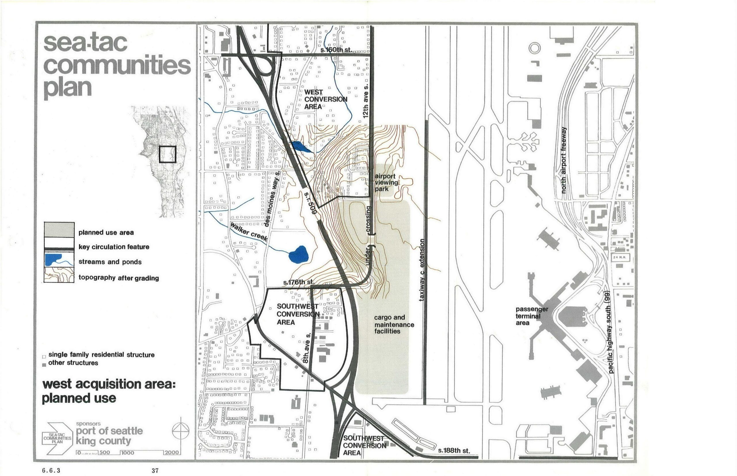
This planning map, sponsored by the Port of Seattle and King County, depicts the West Acquisition Area planned land uses near Seattle-Tacoma International Airport, showing the West Conversion Area, Southwest Conversion Area, cargo and maintenance facilities, airport viewing park, taxiway C extension, and key circulation features including SR-509 and Des Moines Way S. The map is labeled as page 37, section 6.6.3 of the Sea-Tac Communities Plan.Open full document
Notes
This planning map, sponsored by the Port of Seattle and King County, depicts the West Acquisition Area planned land uses near Seattle-Tacoma International Airport, showing the West Conversion Area, Southwest Conversion Area, cargo and maintenance facilities, airport viewing park, taxiway C extension, and key circulation features including SR-509 and Des Moines Way S. The map is labeled as page 37, section 6.6.3 of the Sea-Tac Communities Plan.