TagSea-Tac Communities Plan(215)
-
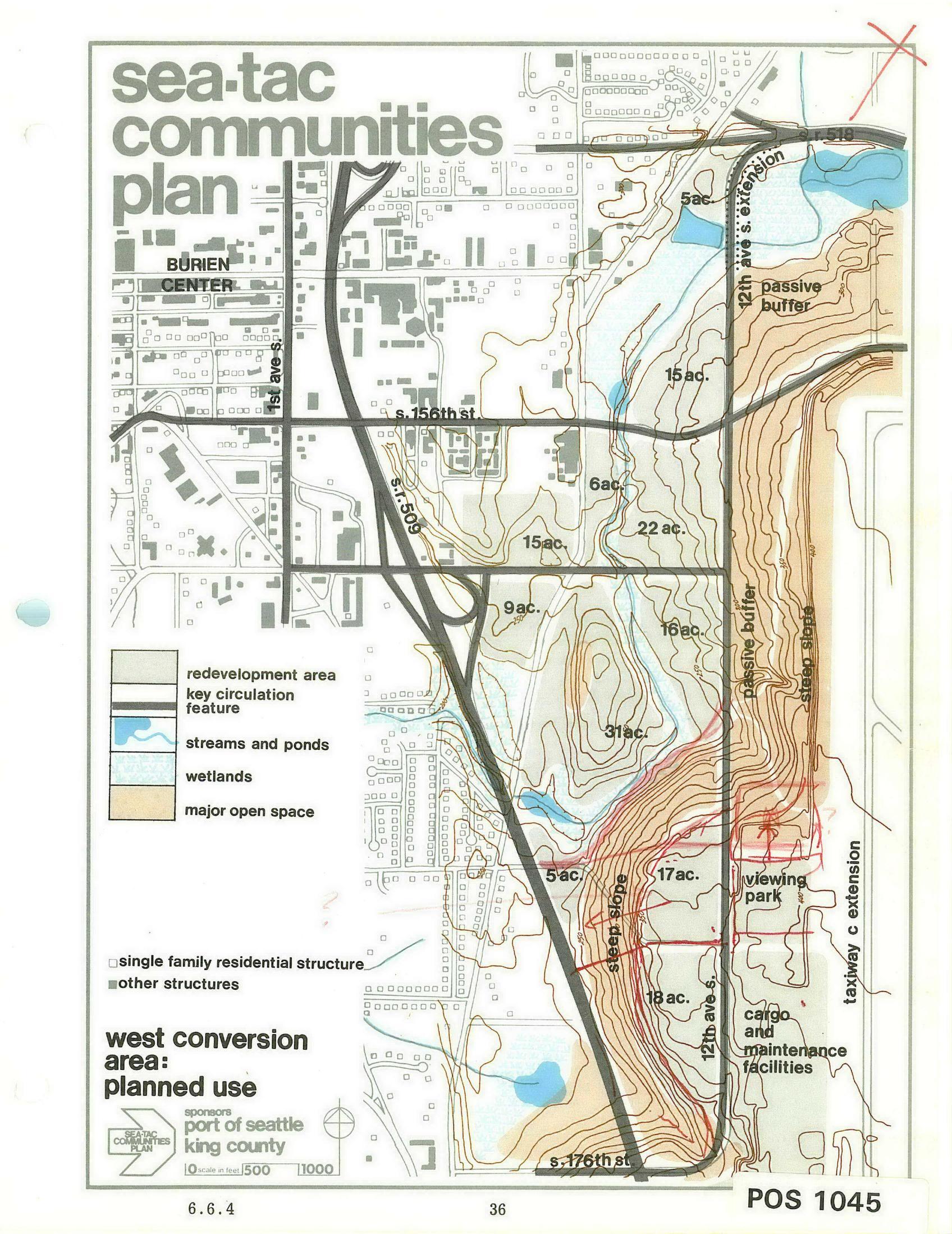
Sea-Tac Communities Plan Page 36 — West Conversion Area: Planned Use
This is page 36 of the Sea-Tac Communities Plan, document reference POS 1045, map section 6.6.4, titled 'West Conversion Area: Planned Use.' Sponsored by the Port of Seattle and King County, the map shows planned land uses adjacent to Seattle-Tacoma International Airport including redevelopment areas, streams and wetlands, major open space, passive buffers, steep slopes, a proposed viewing park, cargo and maintenance facilities, and a taxiway C extension, with acreages labeled throughout the study area near Burien Center and S. 156th–S. 176th Streets. -
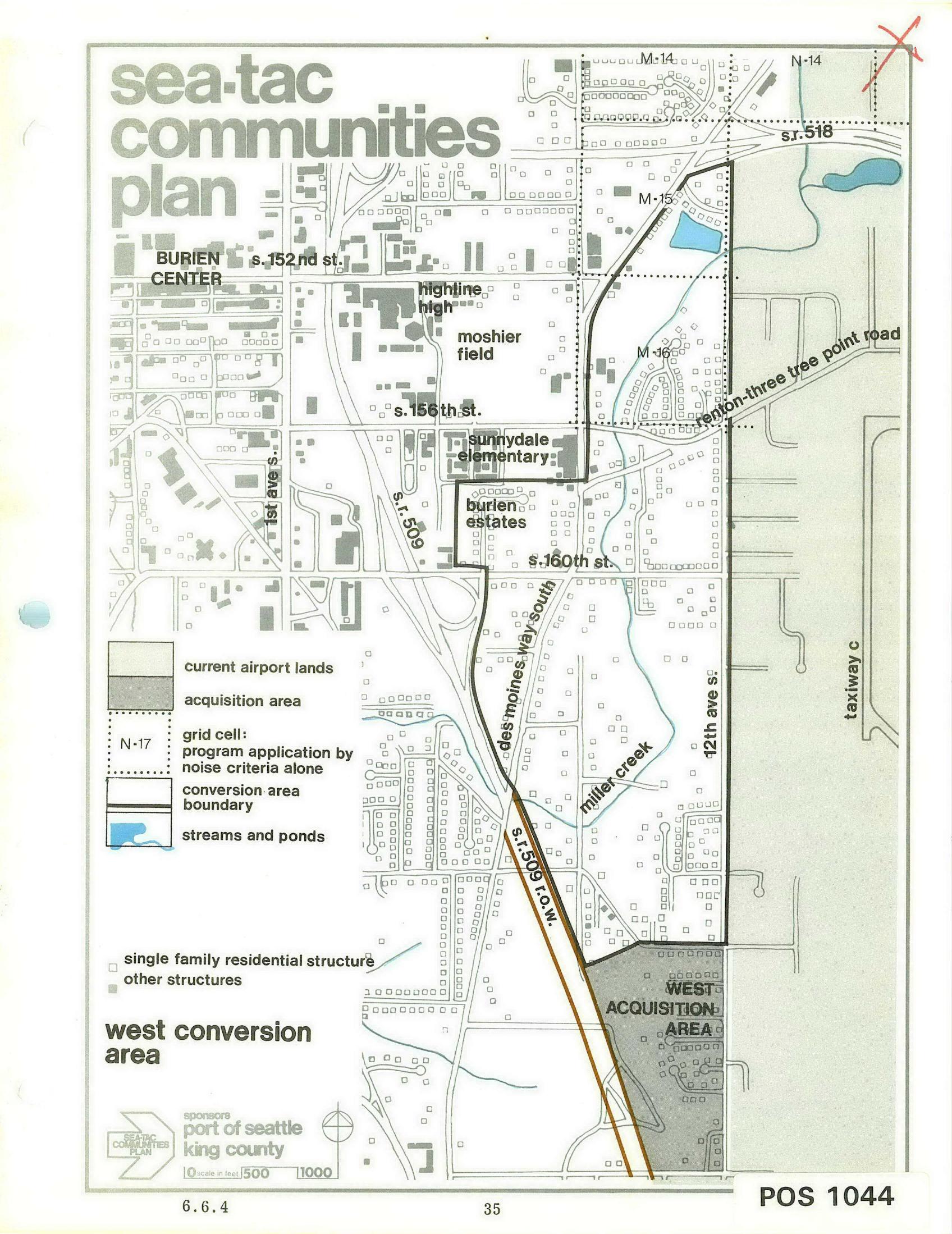
Sea-Tac Communities Plan – West Conversion Area Planning Map
Planning map labeled 'Sea-Tac Communities Plan – West Conversion Area,' sponsored by the Port of Seattle and King County, showing the west conversion area boundary, current airport lands, acquisition areas, grid cells subject to noise criteria, streams and ponds, and named landmarks including Burien Center, Highline High School, Moshier Field, Sunnydale Elementary, and Burien Estates. Document reference number POS 1044 appears at lower right, and the map scale and section number 6.6.4 are noted at bottom. -
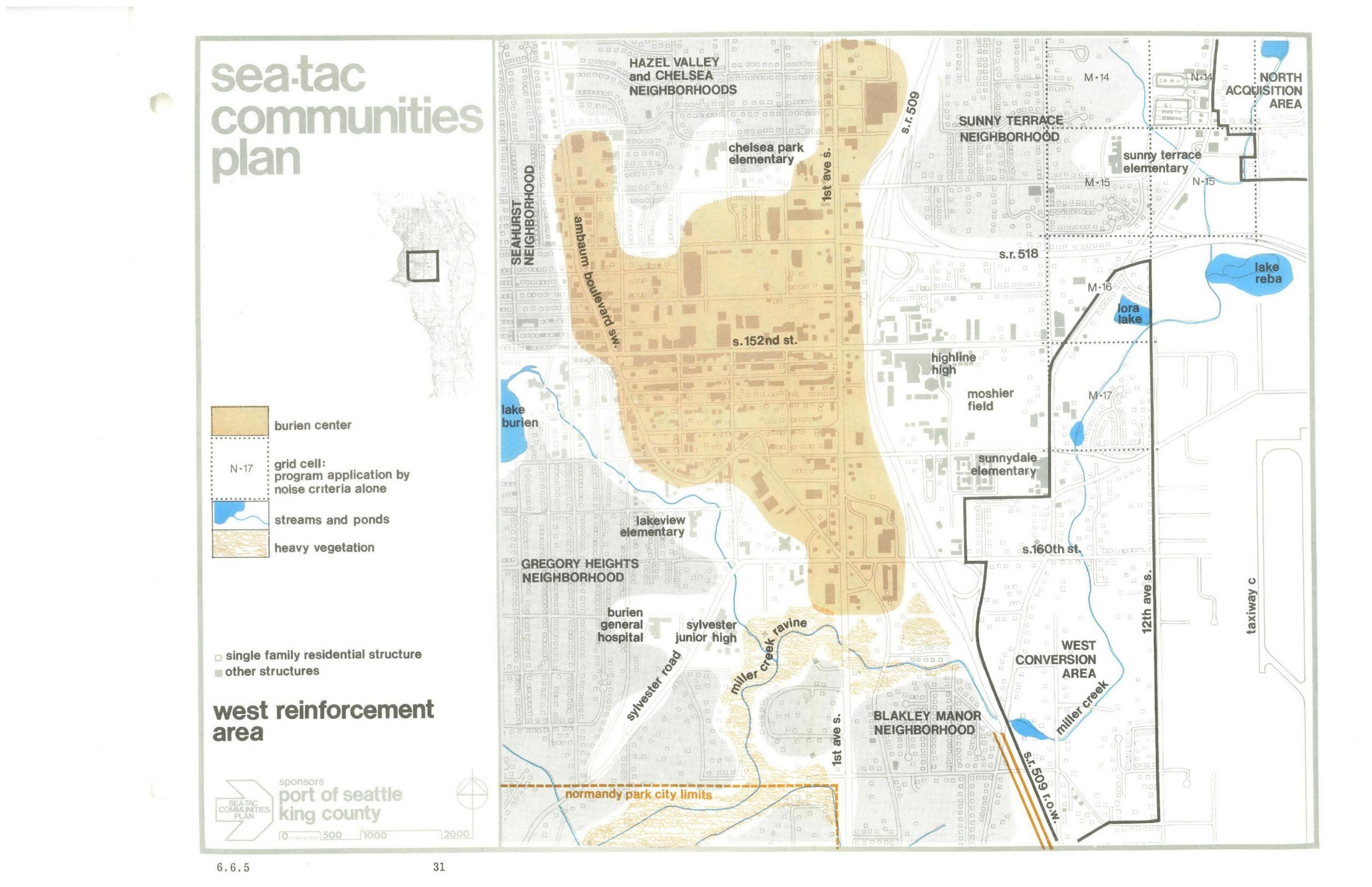
Sea-Tac Communities Plan: West Reinforcement Area Planning Map
A planning map from the Sea-Tac Communities Plan, sponsored by the Port of Seattle and King County, depicting the West Reinforcement Area including the Burien Center, surrounding neighborhoods (Seahurst, Hazel Valley, Chelsea, Gregory Heights, Sunny Terrace, Blakley Manor), schools, waterways, and adjacent land-use zones such as the North Acquisition Area and West Conversion Area. The map uses color coding and grid cells to indicate noise-based program application areas, streams, ponds, and heavy vegetation, with key landmarks including Highline High School, Lake Burien, and S.R. 518. -
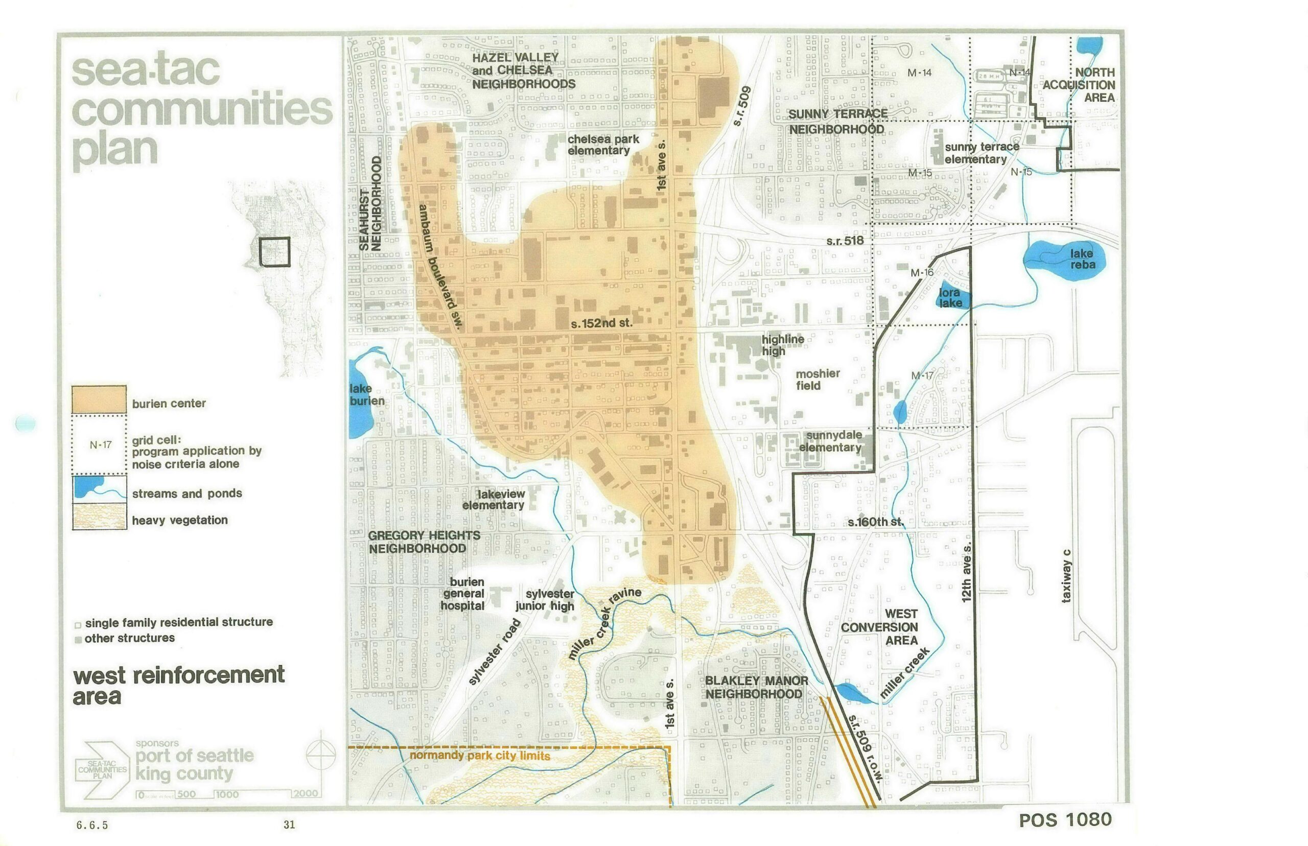
Sea-Tac Communities Plan Map 6.6.5 — West Reinforcement Area: Hazel Valley, Chelsea, and Surrounding Neighborhoods
This is map 6.6.5 (page 31, document reference POS 1080) from the Sea-Tac Communities Plan, sponsored by the Port of Seattle and King County. It depicts the West Reinforcement Area, showing neighborhoods including Hazel Valley and Chelsea, Seahurst, Gregory Heights, Sunny Terrace, and Blakley Manor, with grid cells indicating noise-criteria program application areas, the Burien Center boundary, streams and ponds, and key landmarks such as Highline High School, Burien General Hospital, and Lora Lake. -
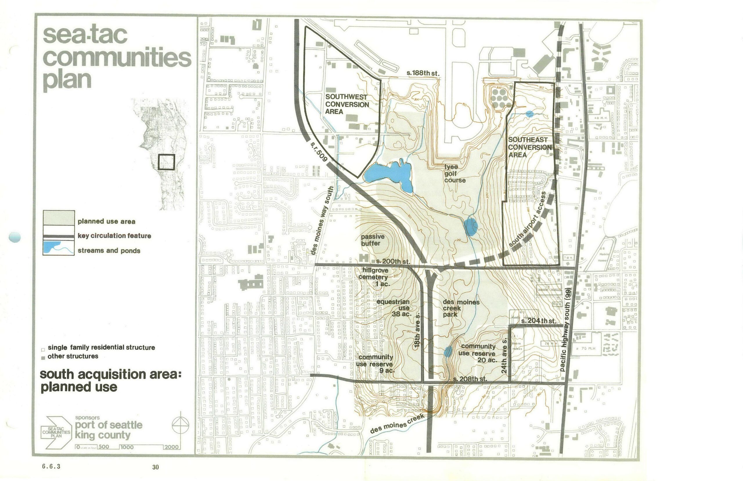
STCP South Acquisition Area Planned Land Use Map
A planning map from the Sea-Tac Communities Plan, sponsored by the Port of Seattle and King County, showing the south acquisition area's planned land uses including the Southwest and Southeast Conversion Areas, Tyee Golf Course, Des Moines Creek Park, equestrian use (38 ac.), community use reserves, Hillgrove Cemetery, and a passive buffer zone. Key circulation features including SR-509, Des Moines Way South, and Pacific Highway South (99) are delineated, with streams and ponds shown in blue. -
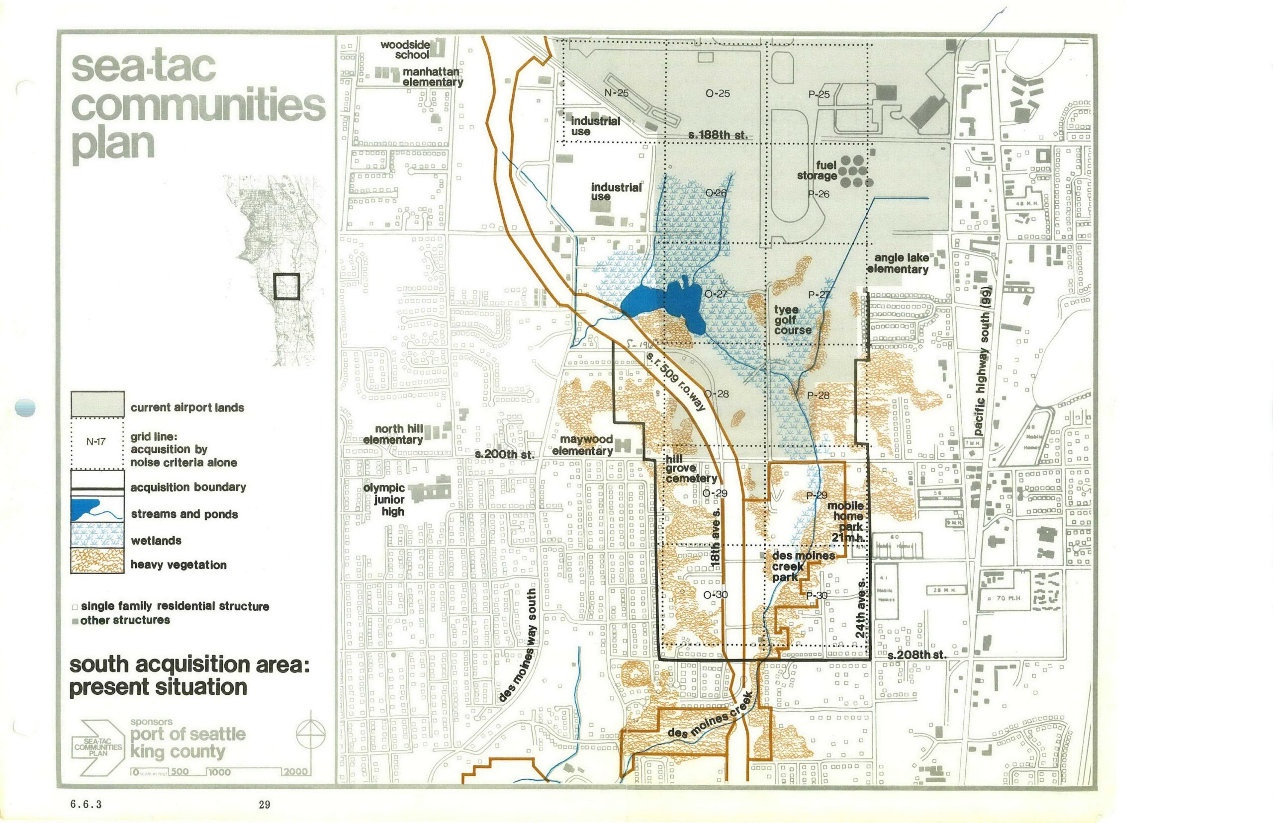
STCP South Acquisition Area Present Situation Map (Page 29)
This planning map, page 29 (figure 6.6.3) of the Sea-Tac Communities Plan sponsored by the Port of Seattle and King County, depicts the south acquisition area around Seattle-Tacoma International Airport, showing current airport lands, acquisition boundaries, grid lines for noise-criteria acquisition, streams, ponds, wetlands, heavy vegetation, and key landmarks including Tyee Golf Course, Hill Grove Cemetery, Des Moines Creek Park, and several schools along Pacific Highway South and Des Moines Way South. -
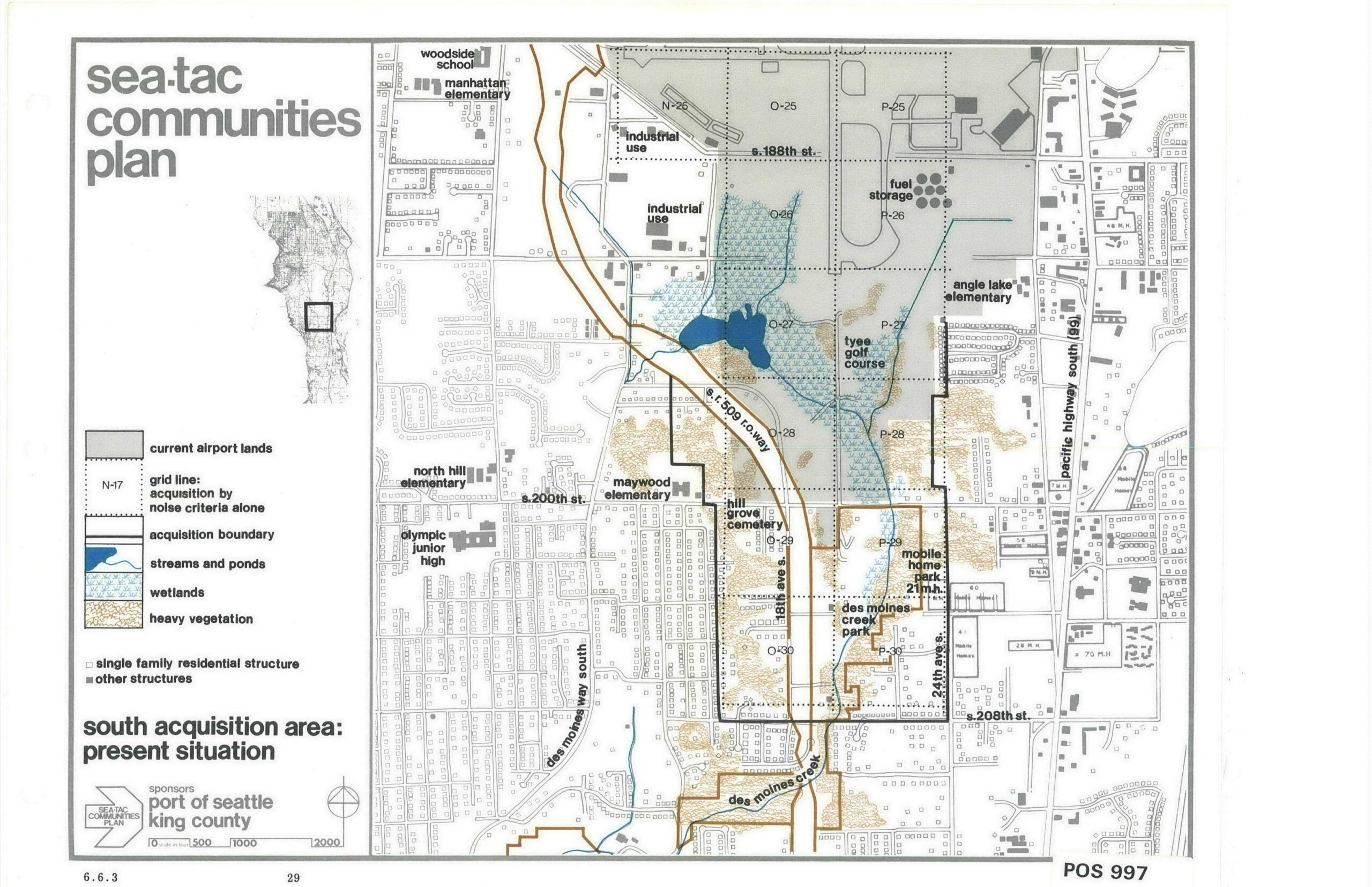
Sea-Tac Communities Plan — South Acquisition Area Present Situation Map (Page 29)
This is page 29, map 6.6.3 from the Sea-Tac Communities Plan (document POS 997), sponsored by the Port of Seattle and King County. The map depicts the south acquisition area around Seattle-Tacoma International Airport, showing current airport lands, acquisition boundaries based on noise criteria, streams, wetlands, heavy vegetation, and named landmarks including Tyee Golf Course, Hill Grove Cemetery, Des Moines Creek Park, and several elementary schools. -
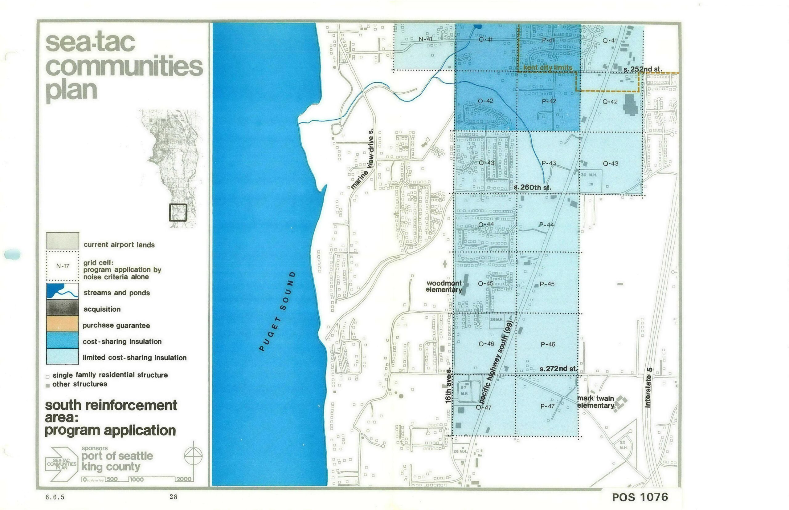
Sea-Tac Communities Plan – South Reinforcement Area Program Application Map (Page 28)
This map, labeled 'Sea-Tac Communities Plan – South Reinforcement Area: Program Application' (document reference POS 1076, page 28, section 6.6.5), was sponsored by the Port of Seattle and King County. It depicts grid cells O-41 through Q-47 in the area west of Interstate 5 and east of Puget Sound, color-coded to show noise-mitigation program designations including cost-sharing insulation, limited cost-sharing insulation, acquisition, and purchase guarantee zones, with landmarks including Woodmont Elementary, Mark Twain Elementary, Pacific Highway South (SR 99), and S. 252nd through S. 272nd Streets. -
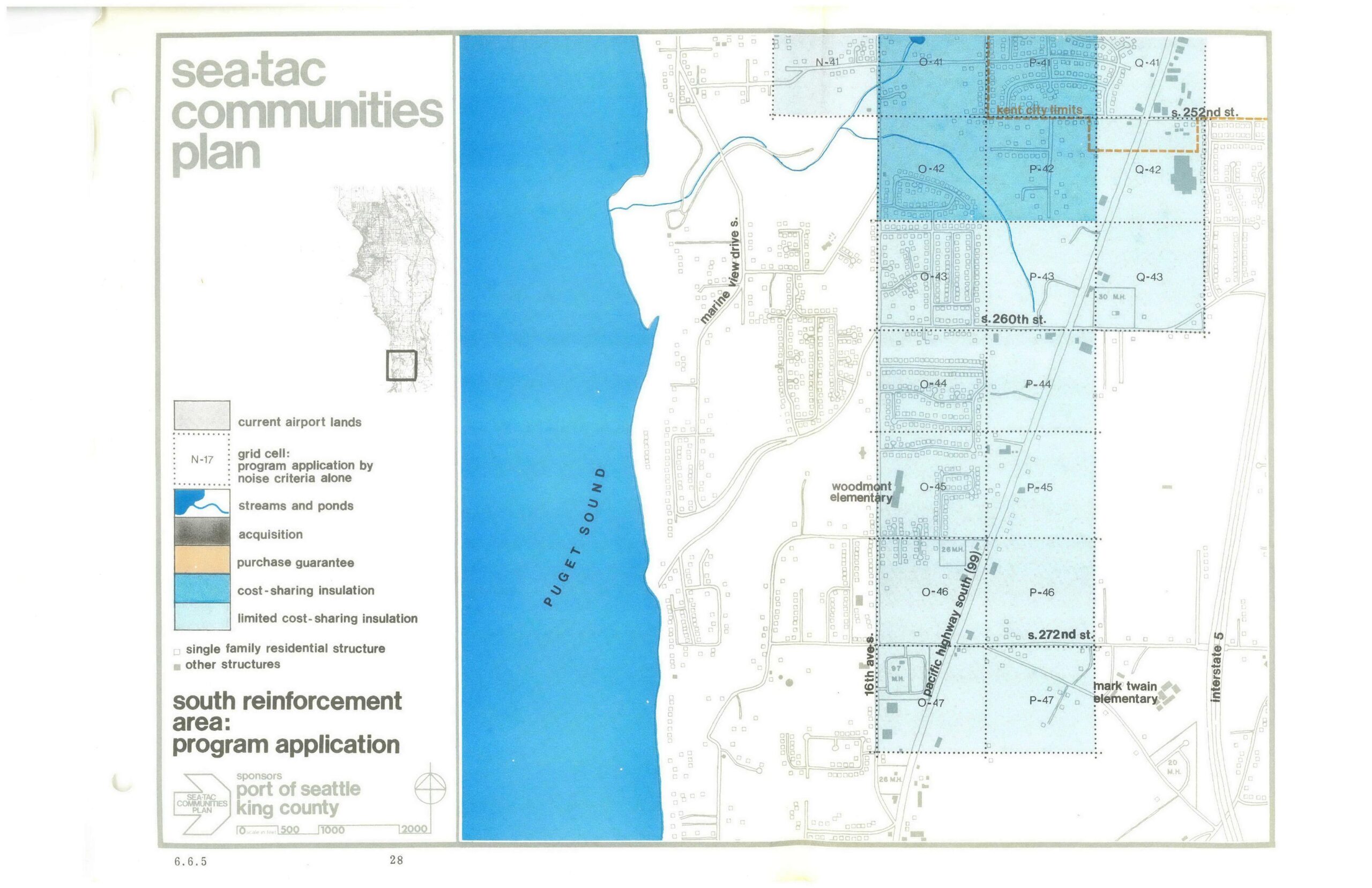
STCP South Reinforcement Area Program Application Map
A planning map from the Sea-Tac Communities Plan, sponsored by the Port of Seattle and King County, showing the South Reinforcement Area's program application for noise mitigation. The map depicts grid cells in the area bounded roughly by S. 252nd St. to S. 272nd St. and Marine View Drive S. to Interstate 5, color-coded to indicate acquisition, purchase guarantee, cost-sharing insulation, and limited cost-sharing insulation zones, with landmarks including Woodmont Elementary, Mark Twain Elementary, and the Kent City Limits noted. -
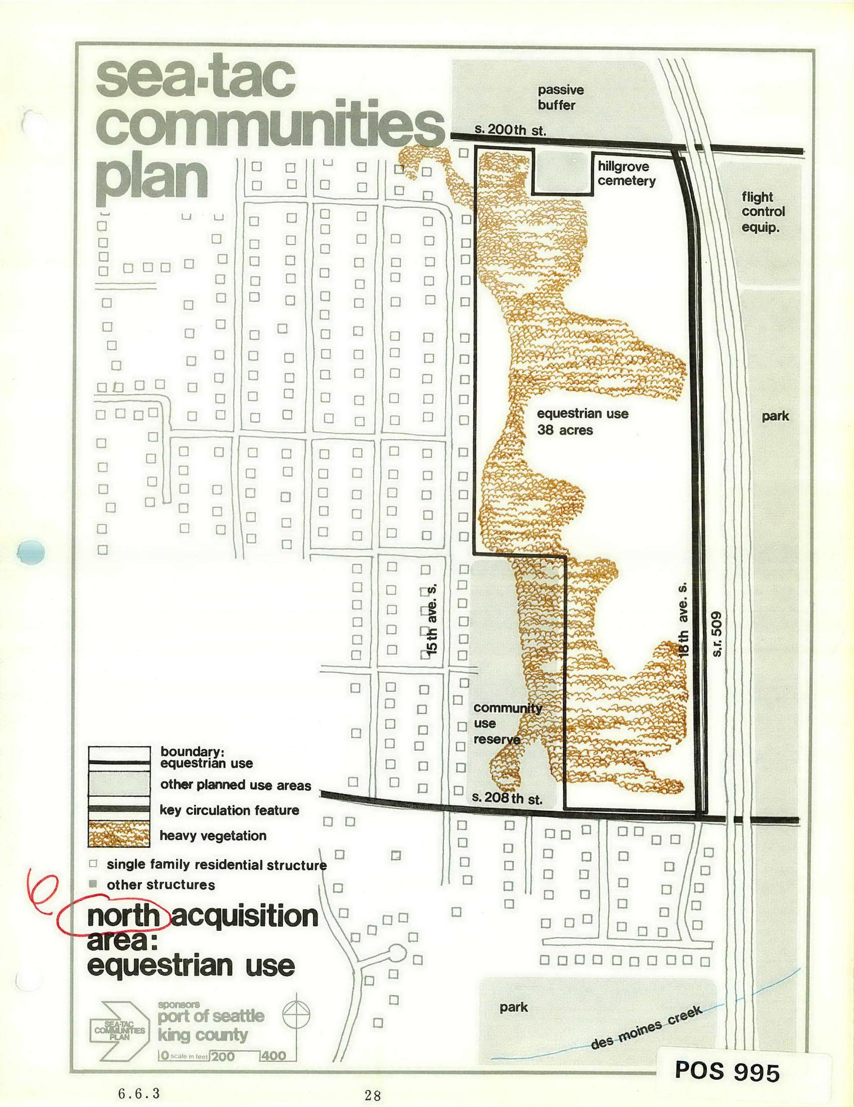
Sea-Tac Communities Plan: North Acquisition Area Equestrian Use Map (POS 995)
A planning map labeled 'POS 995' from the Sea-Tac Communities Plan, sponsored by the Port of Seattle and King County, showing the north acquisition area designated for equestrian use (38 acres) between S. 200th St. and S. 208th St., bounded by 15th Ave. S. and 16th Ave. S./S.R. 509. The map identifies land uses including Hillgrove Cemetery, a passive buffer, flight control equipment area, community use reserve, heavy vegetation, and adjacent parks including one near Des Moines Creek.