TagSea-Tac Airport(1855)
-
 2024-06-12
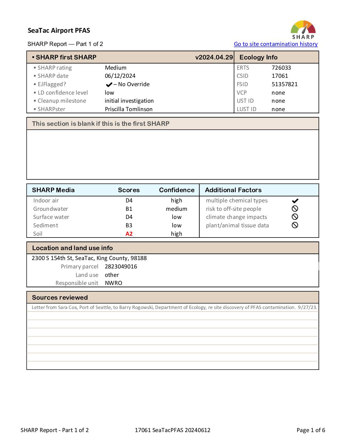
Sea-Tac Airport PFAS SHARP report — part 1 of 2
A SHARP (Site Hazard Assessment Ranking and Prioritization) report for SeaTac Airport covering PFAS contamination identified at four areas: fire station, fuel farm, fire training area, and industrial wastewater system. The report details media scores for groundwater, soil, surface water, sediment, and indoor air, noting concerns about Des Moines Creek and the City of Highline’s -
 2024-06-10
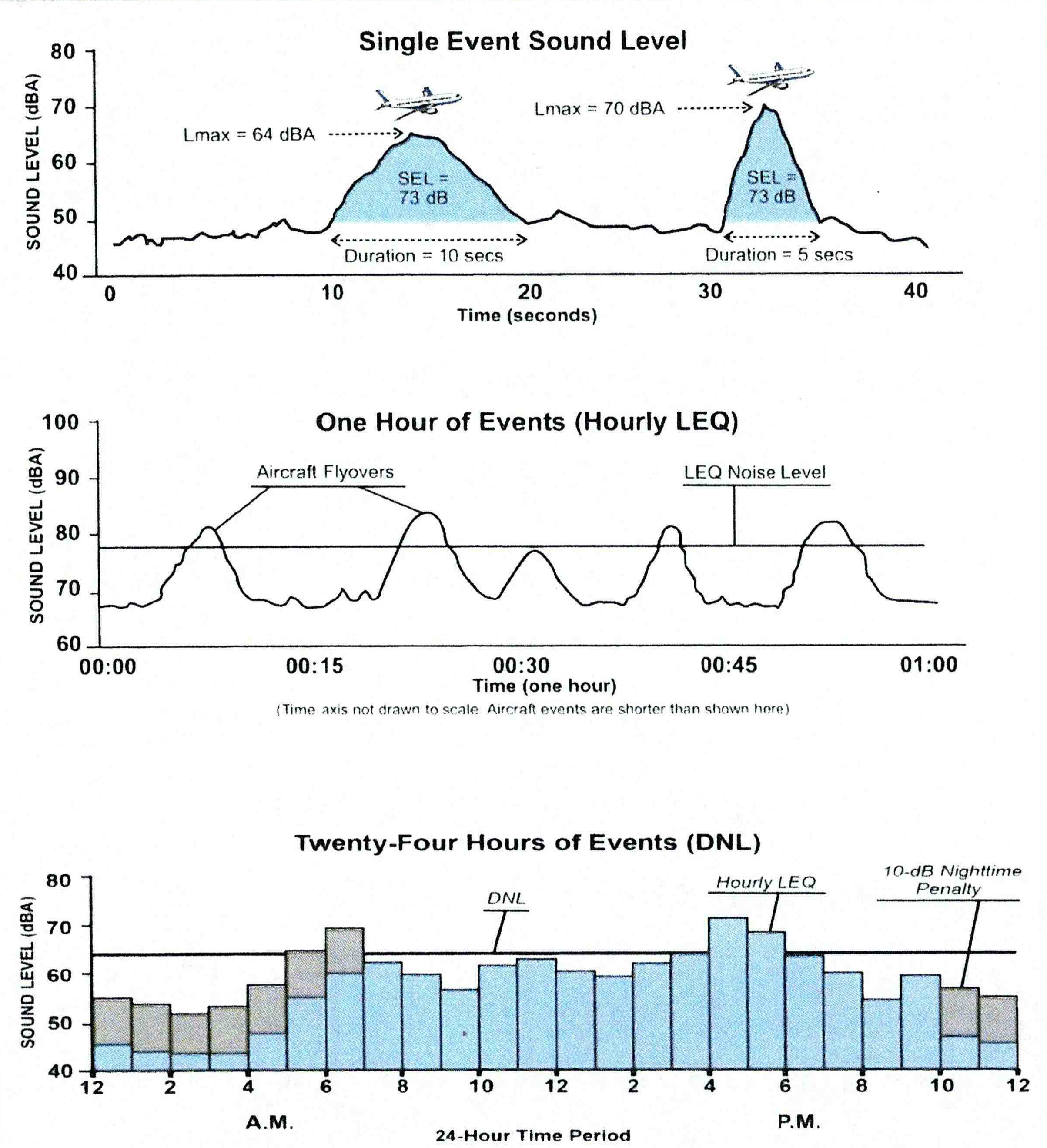
SEL, Hourly LEQ, and DNL Aircraft Noise Measurement Diagram — Part 150 Study Technical Review Committee Meeting #1
Three-panel educational diagram illustrating how aircraft noise is measured and averaged across different time scales: Single Event Sound Level (SEL) showing two aircraft flyovers with Lmax and duration annotations, Hourly LEQ showing cumulative noise over one hour, and Day-Night Level (DNL) showing 24-hour noise distribution with a 10-dB nighttime penalty applied during nighttime hours. No source organization or document identifier is visible. -
 2024-06-05
Appendix F Public Outreach
The Port of Seattle held public workshops in June 2024 to kick off an update to the Seattle-Tacoma International Airport Part 150 Noise Study, gathering community input from residents and other interested parties near the airport. The workshops were promoted through a wide range of online publications, social media, and community outreach channels, with materials available in multiple languages including Spanish, Somali, Vietnamese, and Chinese. A follow-up workshop on Draft Noise Exposure Maps was scheduled for September–October 2025. -
2024-06-05
Appendix F Public Outreach
The Port of Seattle held public workshops in June 2024 to kick off an update to the Seattle-Tacoma International Airport Part 150 Noise Study, gathering community input from residents and other interested parties near the airport. The workshops were promoted through a wide range of online publications, social media, and community outreach channels, with materials available in multiple languages including Spanish, Somali, Vietnamese, and Chinese. A follow-up workshop on Draft Noise Exposure Maps was scheduled for September–October 2025. -
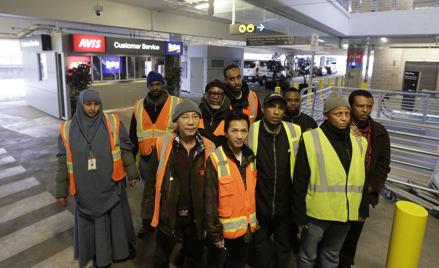
Sea-Tac Airport Workers in High-Visibility Vests at Rental Car Center
A group of approximately ten workers wearing orange and yellow high-visibility safety vests stand together in what appears to be an airport rental car center, with visible Avis and Budget car rental signage and a shuttle bus directional sign overhead. The diverse group includes both men and women, some wearing winter hats and one woman in a hijab with a visible ID badge. -
 2024-06-01
Purpose and Need Technical Report: Sustainable Airport Master Plan – Near-Term Projects
This technical report, prepared by Landrum & Brown for the Port of Seattle in June 2024, outlines the purpose and need for near-term capital projects identified in Sea-Tac Airport's Sustainable Airport Master Plan. It is part of a broader set of supporting documents that also covers alternatives analysis, terminal needs assessment, and air cargo facility requirements. The report provides the foundational justification for proposed airport improvements and infrastructure expansions at Seattle-Tacoma International Airport. -
 2024-06-01
Purpose and Need Technical Report: Sustainable Airport Master Plan – Near-Term Projects
This technical report, prepared by Landrum & Brown for the Port of Seattle in June 2024, outlines the purpose and need for near-term construction and improvement projects identified in Sea-Tac Airport's Sustainable Airport Master Plan. It is part of a broader set of supporting documents that also covers alternatives analysis, terminal needs assessment, and air cargo facility requirements. The report provides the foundational justification for proposed airport development decisions and infrastructure changes. -
 2024-06-01
Appendix B: SAMP – Near-Term Projects: Purpose and Need Technical Report
This technical report, prepared by Landrum & Brown for the Port of Seattle in June 2024, outlines the purpose and need for near-term construction and improvement projects identified in the Sustainable Airport Master Plan for Seattle-Tacoma International Airport. It is part of a broader set of supporting documents that also covers alternatives analysis, terminal needs, and air cargo facility requirements. The report provides the foundational justification for planned airport development decisions. -
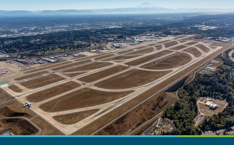
Sea-Tac Airport Aerial View Showing Parallel Runways and Terminal Facilities
Aerial photograph of Seattle-Tacoma International Airport (Sea-Tac) showing its parallel runway configuration, taxiways, terminal facilities, and surrounding communities. Mount Rainier is visible on the horizon to the southeast, confirming the Pacific Northwest location. -
 2024-05-22
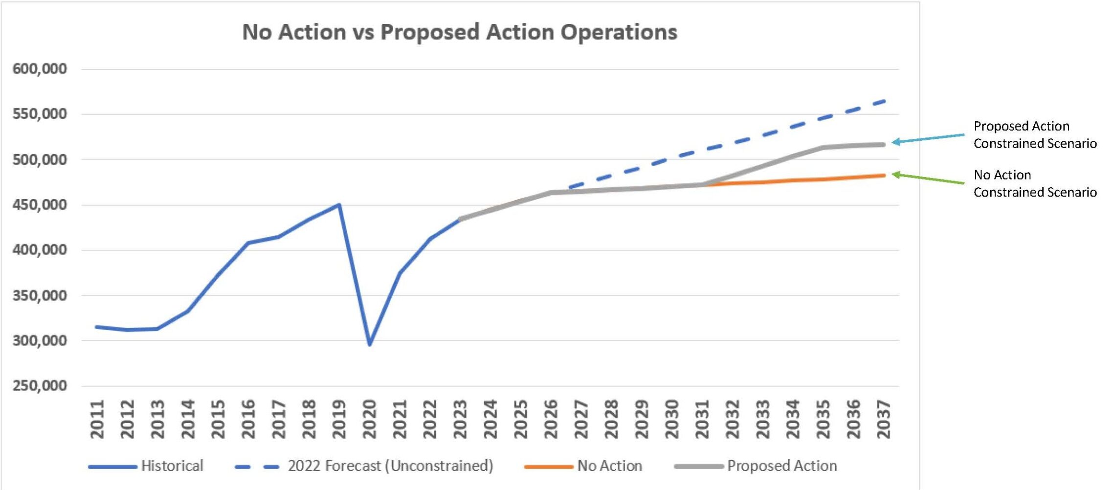
SAMP NTP Environmental Review Overview — Aircraft Operations Forecast Chart (Page 4), May 2024
A line graph comparing historical aircraft operations data (2011–2022) with forecast scenarios through 2037, including an unconstrained 2022 forecast, a No Action constrained scenario, and a Proposed Action constrained scenario. The chart shows operations declining sharply in 2020 (likely due to COVID-19) and recovering, with the Proposed Action scenario reaching approximately 520,000 operations and the No Action scenario capping near 485,000 operations by 2037.