TagPuget Sound(124)
-
 2022-11-29
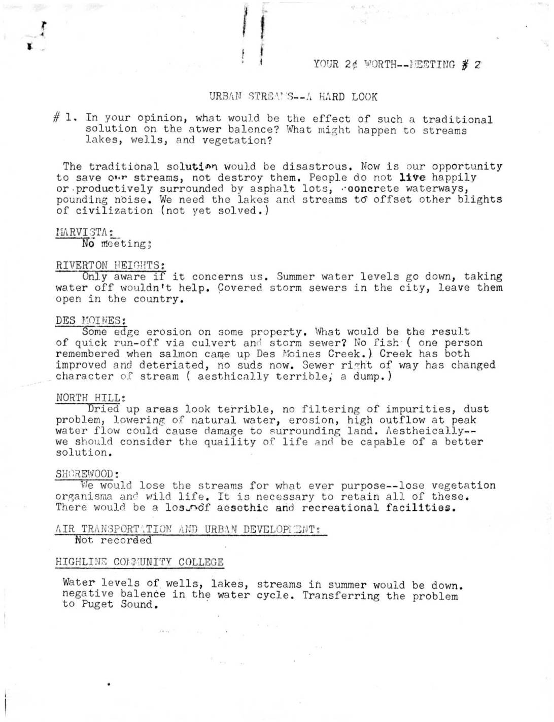
Your 2¢ Worth — Meeting #2: Urban Streams, A Hard Look
Community meeting notes from the Highline area (near Sea-Tac) capture neighborhood group responses to questions about urban streams and stormwater management. Residents from areas including Des Moines, North Hill, Shorewood, and Riverton Heights expressed strong opposition to traditional drainage solutions such as culverts and concrete channels, citing harm to water balance, wildlife, and quality of life. Groups broadly favored preserving natural streams for recreational, aesthetic, and ecological benefits, while debating appropriate levels of public access. -
 2022-11-16
SR 509 Completion Project: Highline Forum presentation
A November 2022 WSDOT presentation by Construction Manager Andrey Chepel outlines progress on the SR 509 Completion Project, part of the broader Puget Sound Gateway Program in King County. The project aims to improve freight and passenger connections to the Port of Seattle and Sea-Tac Airport area by completing a long-planned highway extension. The presentation covers construction stages 1a and 1b, upcoming Stage 2 procurement, and community engagement efforts. -
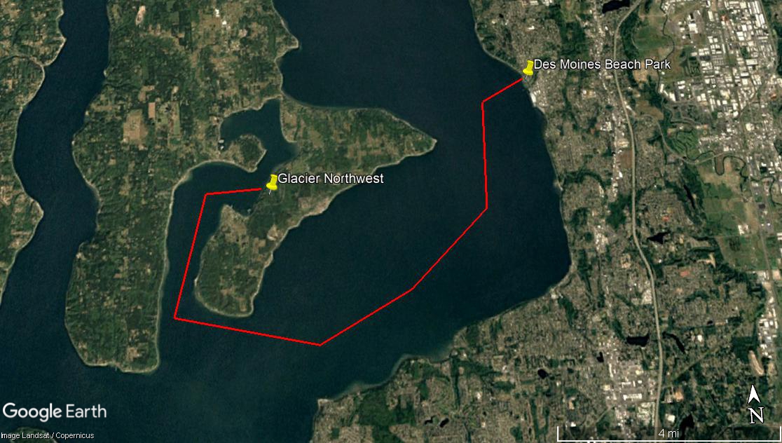
Maury Island Barge Path to Des Moines Beach Park
A Google Earth satellite image (Landsat/Copernicus imagery) showing a red polygon outlining an area of Puget Sound near Vashon Island, with yellow pins marking Glacier Northwest and Des Moines Beach Park. The map covers approximately 4 miles of water between what appears to be a peninsula near Glacier Northwest's facility and the Des Moines, Washington shoreline. -
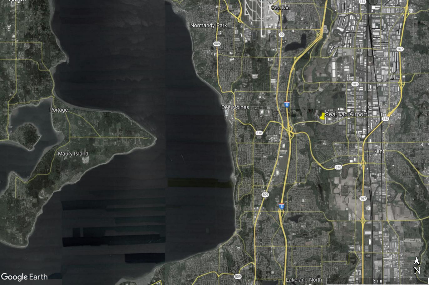
Google Earth Aerial View: Sea-Tac Airport to Maury Island and Des Moines Beach Noise-Impact Study Area
Google Earth aerial/satellite image showing Seattle-Tacoma International Airport (Sea-Tac) and surrounding communities including Des Moines, Normandy Park, Kent, Maury Island, and Portage, with Interstate 5, SR-509, SR-516, and SR-167 visible. The image includes a yellow pin marker at Sea-Tac Airport and covers the broader noise-impact study area west of Puget Sound to east of the airport corridor. -
 2022-09-12
Puget Soundkeeper Alliance’s pre-hearing brief
The Puget Soundkeeper Alliance challenged the 2003 water discharge permit issued to Seattle-Tacoma International Airport, arguing that the Port of Seattle had been releasing harmful pollutants — including aircraft de-icing fluids — into Puget Sound without proper treatment or enforceable limits for nearly a decade. The group contended that Washington State's Department of Ecology improperly extended the airport's compliance deadline beyond the legally allowed 10-year period, pushing it from 2004 to 2007. The case centered on whether the permit violated both Washington State law and the federal Clean Water Act. -
 2022-09-01
Destination 2030: Environmental justice appendix
This appendix from the Destination 2030 Metropolitan Transportation Plan examines environmental justice in the central Puget Sound region, analyzing how transportation costs and benefits are distributed among minority and low-income populations across King, Kitsap, Pierce, and Snohomish counties. Using 1990 Census data and 1997–1998 estimates, it finds that low-income populations are concentrated in Seattle, Tacoma, and Everett, while the region's minority population stands at roughly 15 percent, with the highest concentrations in northern Pierce County and southwestern King County. The analysis was conducted to ensure that burdens and benefits of the regional transportation plan are equitably shared across groups defined by race, income, age, or disability. -
 2022-09-01
Destination 2030: Resources and references
This document is a resources and references section from the Puget Sound Regional Council's 'Destination 2030' metropolitan transportation plan, listing planning publications, environmental impact statements, and transportation policy reports relevant to the Central Puget Sound region. It includes references to the SeaTac Airport Master Plan Update and its Final Supplemental Environmental Impact Statement, alongside broader regional transportation and growth management studies. The document also credits the full Regional Council project team and policy board members involved in developing the plan. -
 2022-09-01
Destination 2030: Executive summary
Destination 2030 is a long-range regional transportation action plan for King, Pierce, Snohomish, and Kitsap counties in the central Puget Sound area of Washington state, designed to address growing traffic congestion as the region prepares for an additional 1.5 million residents and 800,000 new jobs. The plan outlines over 2,200 specific projects—including more than 2,000 miles of new and improved roadways, expanded transit services, and new walkways and bikeways—to improve mobility across the region by 2030. It also emphasizes coordinating land use and transportation planning to support sustainable growth while preserving environmental quality. -
 2022-09-01
King County Communitywide Consumption-Based GHG Emissions Inventory: Puget Sound Regional Emissions Analysis
This 2022 report by EcoDataLab and Stockholm Environment Institute provides a consumption-based greenhouse gas emissions inventory for King County and the broader Puget Sound region, tracking emissions tied to residents' purchases and behaviors across categories such as transportation, food, housing, goods, and services. It analyzes historical emissions trends, neighborhood-level variations, and supply chain stages, then outlines potential strategies for reducing those emissions through policy changes and shifts in household consumption patterns. -
 2022-08-01
King County Communitywide Geographic Greenhouse Gas Emissions: Puget Sound Regional Emissions Analysis
This August 2022 report by Cascadia Consulting Group analyzes greenhouse gas emissions across King County, Washington, examining where emissions come from, what is driving trends over time, and how the county can meet its climate goals. The report covers sectors including transportation, electricity, natural gas, solid waste, and land use, tracking data from multiple inventory years and comparing per-capita emissions across jurisdictions. It also models future emissions scenarios to assess the impact of federal, state, and regional policies on reaching reduction targets through 2050.