TagPort Of Seattle(2342)
-
 2026-07-30
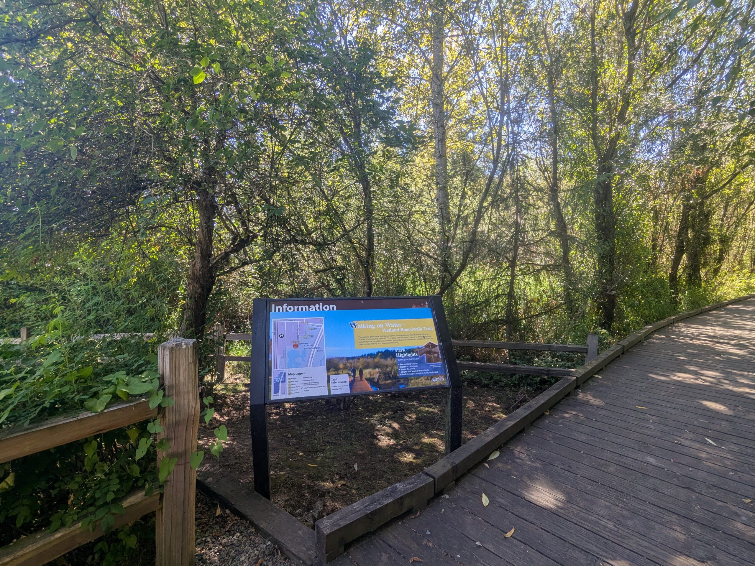
Walking on Water Wetland Boardwalk Trail — Information Kiosk and Trail Map Sign
An information kiosk at the entrance of the 'Walking on Water Wetland Boardwalk Trail' shows a trail map, park highlights, and interpretive content. The wooden boardwalk trail and surrounding wetland forest vegetation are visible behind the sign. -
-
 2026-07-30
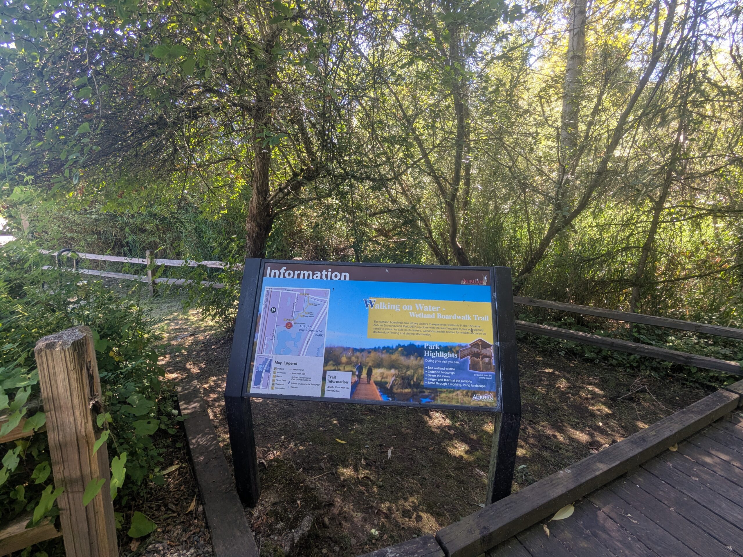
Walking on Water Wetland Boardwalk Trail Sign at Auburn Environmental Park
An information kiosk at Auburn Environmental Park (Auburn, Washington) displays a sign titled 'Walking on Water – Wetland Boardwalk Trail,' including a trail map, map legend, trail information, and park highlights. The sign bears the City of Auburn logo and describes the wetland boardwalk that allows visitors to experience the park's wetland ecosystem. -
 2026-07-28
Port of Seattle Special Commission Meeting July 28, 2026
**8e.** One-year extension of the Duwamish Basin Steward Interlocal Agreement through December 31, 2027 **10b.** Introduction and adoption of Resolution No. 3852 amending Commission Bylaws — Articles IV (Meetings) and VI (Rules of Order) **11a.** 2026 Police Department Update presentation -
 2026-07-28
Port Of Seattle Regular Commission Meeting agenda, July 28, 2026
This document is the agenda for a Port of Seattle Regular Commission Meeting held on July 28, 2026, covering routine administrative and operational matters such as approval of meeting minutes, claims and obligations, lease agreements, and custodial services contracts. The meeting agenda does not contain any items specifically related to Sea-Tac Airport noise policy. Notable items include a $150 million authorization for airport custodial services contracts through 2031 and environmental stewardship agreements for the Duwamish Basin. -
 2026-07-22
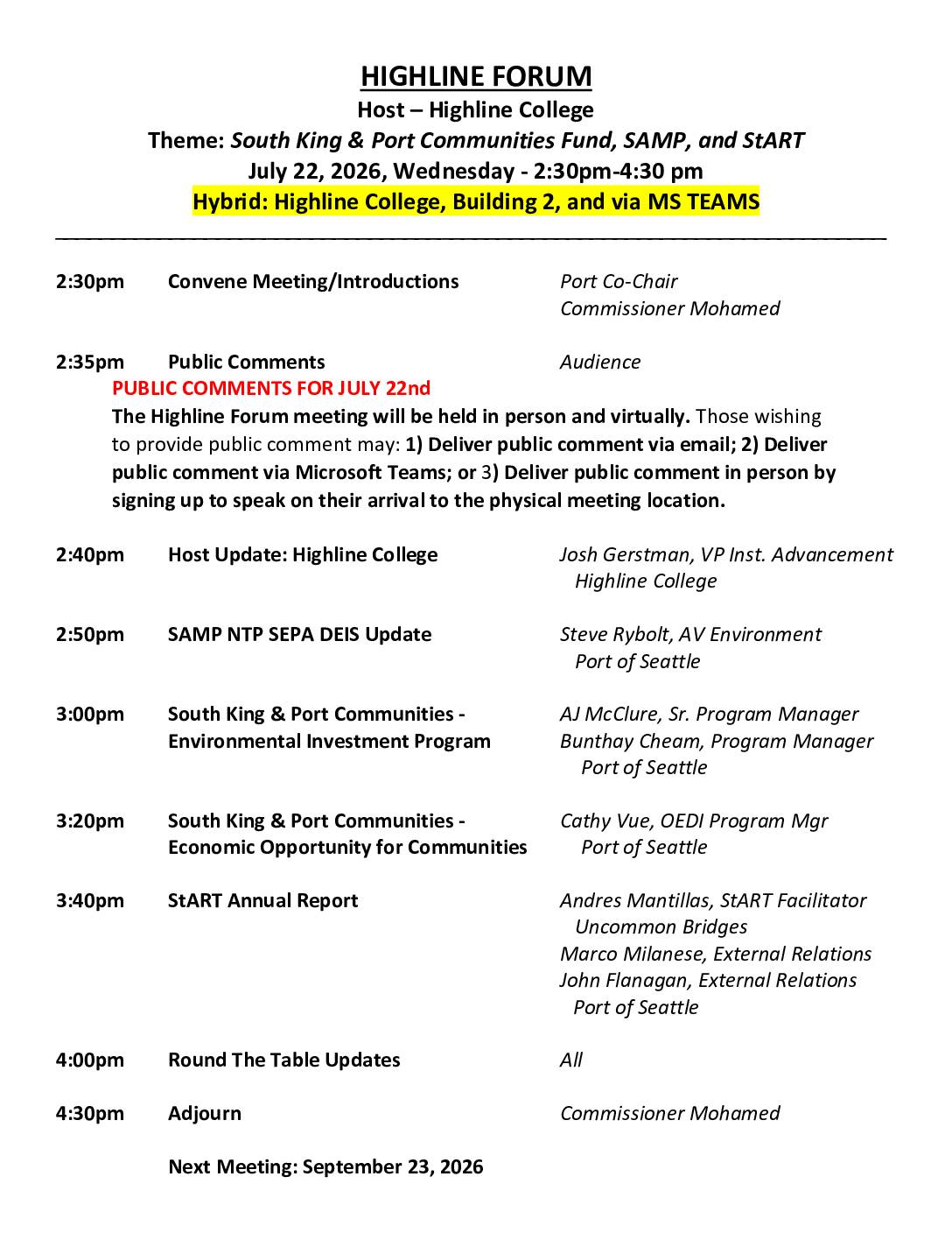
Highline Forum July 22, 2026
## 1. SAMP NTP SEPA DEIS Update - Presented by Steve Rybolt, Port of Seattle ## 2. South King & Port Communities: Environmental Investment Program - Presented by AJ McClure & Bunthay Cheam, Port of Seattle ## 3. South King & Port Communities: Economic Opportunity for Communities - Presented by Cathy Vue, Port of Seattle ## 4. StART Annual Report - Presented by Andres Mantillas, Marco Milanese & John Flanagan **Next Meeting:** September 23, 2026 | City of Des Moines, Police Building Training Room -
 2026-07-22
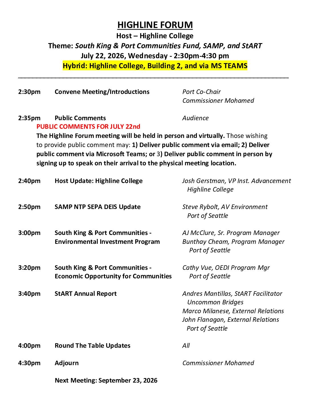
Highline Forum agenda, July 22, 2026
Agenda for the July 22, 2026 Highline Forum meeting hosted by Highline College, covering the South King & Port Communities Fund, SAMP NTP SEPA DEIS update, and StART Annual Report. The hybrid meeting was held in person at Highline College Building 2 and via Microsoft Teams. Also includes the full list of 2026 Highline Forum -
 2026-07-16
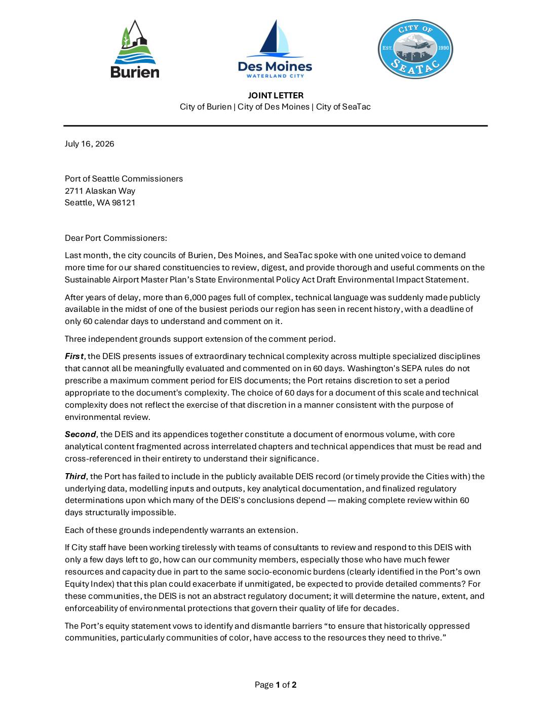
Joint letter from Burien, Des Moines, and SeaTac requesting extension of SAMP SEPA DEIS comment period
In July 2026, the city managers of Burien, Des Moines, and SeaTac jointly wrote to Port of Seattle Commissioners demanding that the public comment period for the Sustainable Airport Master Plan's Draft Environmental Impact Statement be extended from 60 to at least 120 days. The cities argued that the document's enormous size (over 6,000 pages), technical complexity, and missing underlying data made meaningful review within 60 days impossible, particularly for lower-resource community members most affected by airport impacts. The letter also called on the Port to honor its own equity commitments by ensuring historically overburdened communities surrounding the airport have a genuine opportunity to participate in the review process. -
 2026-07-15
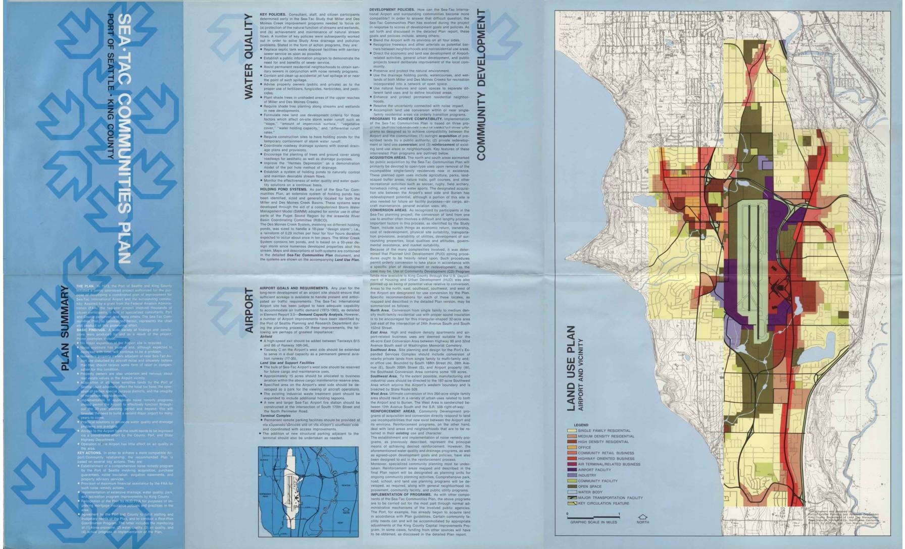
Sea-Tac Communities Plan: Plan Summary Brochure
The Sea-Tac Communities Plan, jointly developed by the Port of Seattle and King County beginning in 1973, outlines strategies to improve compatibility between Sea-Tac International Airport and surrounding neighborhoods, with a focus on aircraft noise remedies, water quality improvements, and land use conversion. The plan identifies specific areas for outright property acquisition, purchase guarantees, and noise insulation programs affecting thousands of homes north and south of the airport. It also establishes policies for drainage management, community development, and long-term airport facility improvements to accommodate projected air traffic growth through 1993. -
 2026-07-15
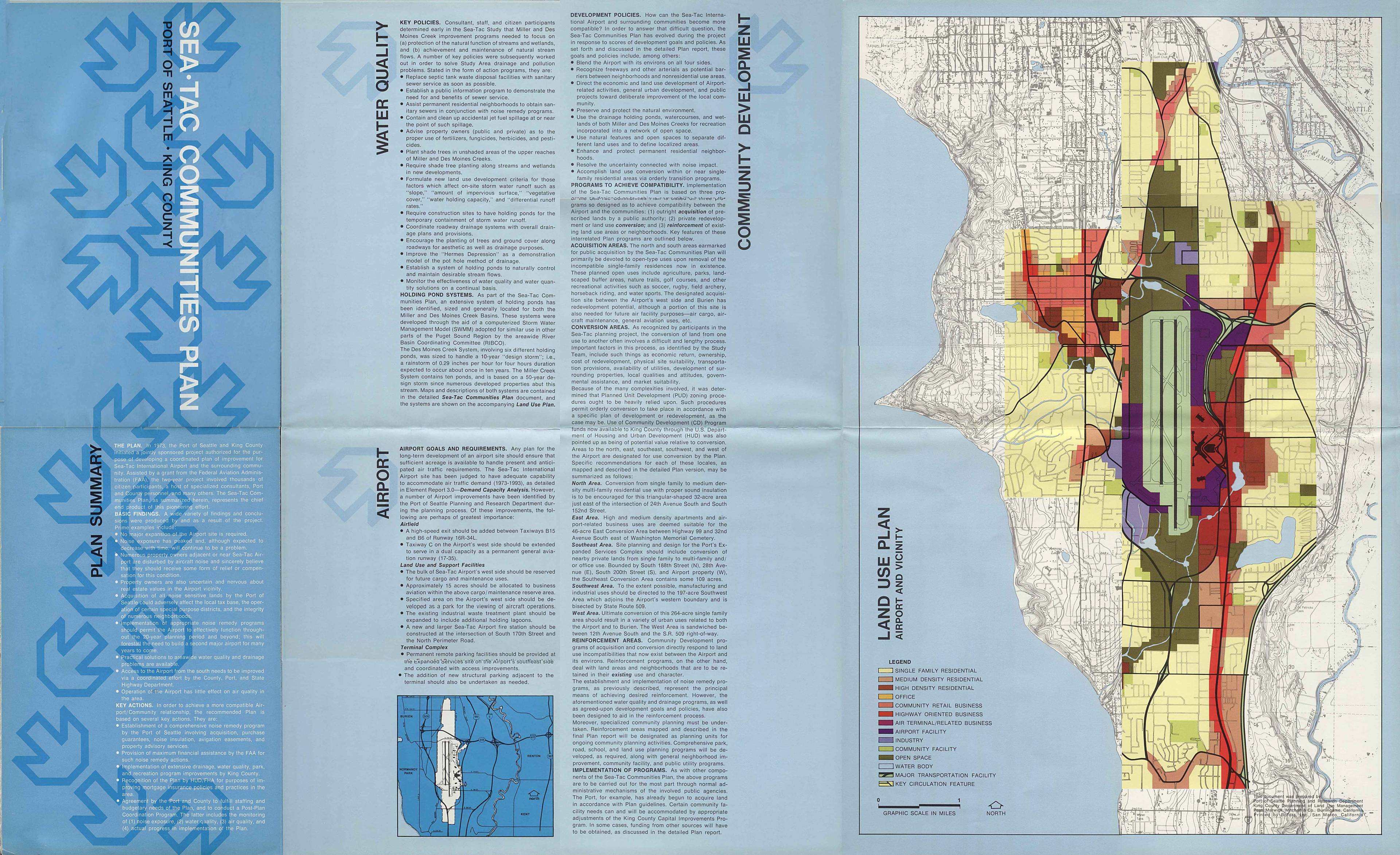
Sea-Tac Communities Plan: Water quality, airport, and community development
The Sea-Tac Communities Plan outlines strategies to improve compatibility between Seattle-Tacoma International Airport and surrounding neighborhoods, focusing on water quality, drainage, and land use. Key programs include public acquisition of noise-impacted residential areas for open space and recreation, conversion of single-family zones to higher-density or commercial uses, and reinforcement of existing neighborhoods through noise remedy and infrastructure improvements. The plan also addresses environmental concerns such as stream protection, holding pond systems for stormwater management, and pollution control near Miller and Des Moines Creeks.