TagPort Of Seattle(2342)
-
 2026-07-15
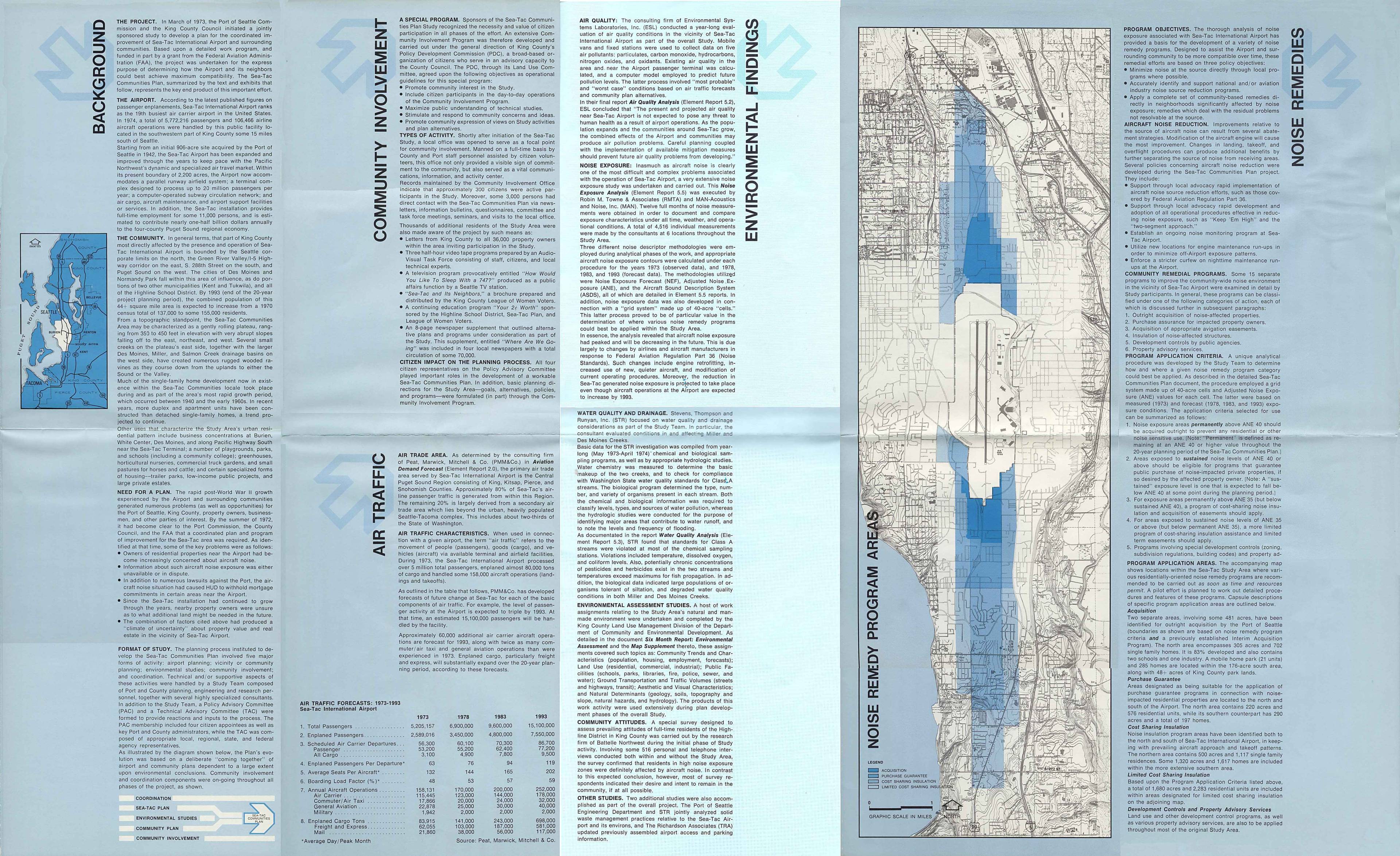
Sea-Tac Communities Plan background and environmental findings
This document summarizes the Sea-Tac Communities Plan, a 1973 joint study by the Port of Seattle and King County to improve compatibility between Sea-Tac International Airport and its surrounding neighborhoods. The plan examined aircraft noise exposure, air and water quality, and community growth, finding that noise levels were expected to decrease over time due to quieter aircraft technology despite rising flight operations. It proposed a range of noise remedy programs—including property acquisition, purchase guarantees, and insulation assistance—affecting thousands of homes in areas north and south of the airport. -
 2026-07-14
Sea-Tac Communities Plan: Map Supplement to Sixth Month Report — Community Trends and Characteristics, Land Use, Ground Transportation and Traffic, Aesthetic and Visual Characteristics, Natural Determinants
This document is a map supplement to the sixth-month element report for the Sea-Tac Communities Plan, a planning study sponsored by the Port of Seattle and King County and partially funded by a federal FAA grant. It covers five key topics—community trends and characteristics, land use, ground transportation and traffic, aesthetic and visual characteristics, and natural determinants—for the communities surrounding Seattle-Tacoma International Airport. The supplement includes 1970 census tract maps of the Sea-Tac area and an errata note correcting a data classification error for Census Tract 272 related to public assistance recipients. -
 2026-07-13
Sea-Tac Communities Plan: Part 1 — Overview of the Plan (Working Draft)
This working draft of the Sea-Tac Communities Plan, produced jointly by the Port of Seattle and King County, outlines a planning framework for communities surrounding Seattle-Tacoma International Airport. The document, reviewed in summary form around 1975, addresses land use and policy considerations for neighborhoods affected by airport operations and noise. It represents an early collaborative effort to balance airport growth with the needs of surrounding residential communities. -
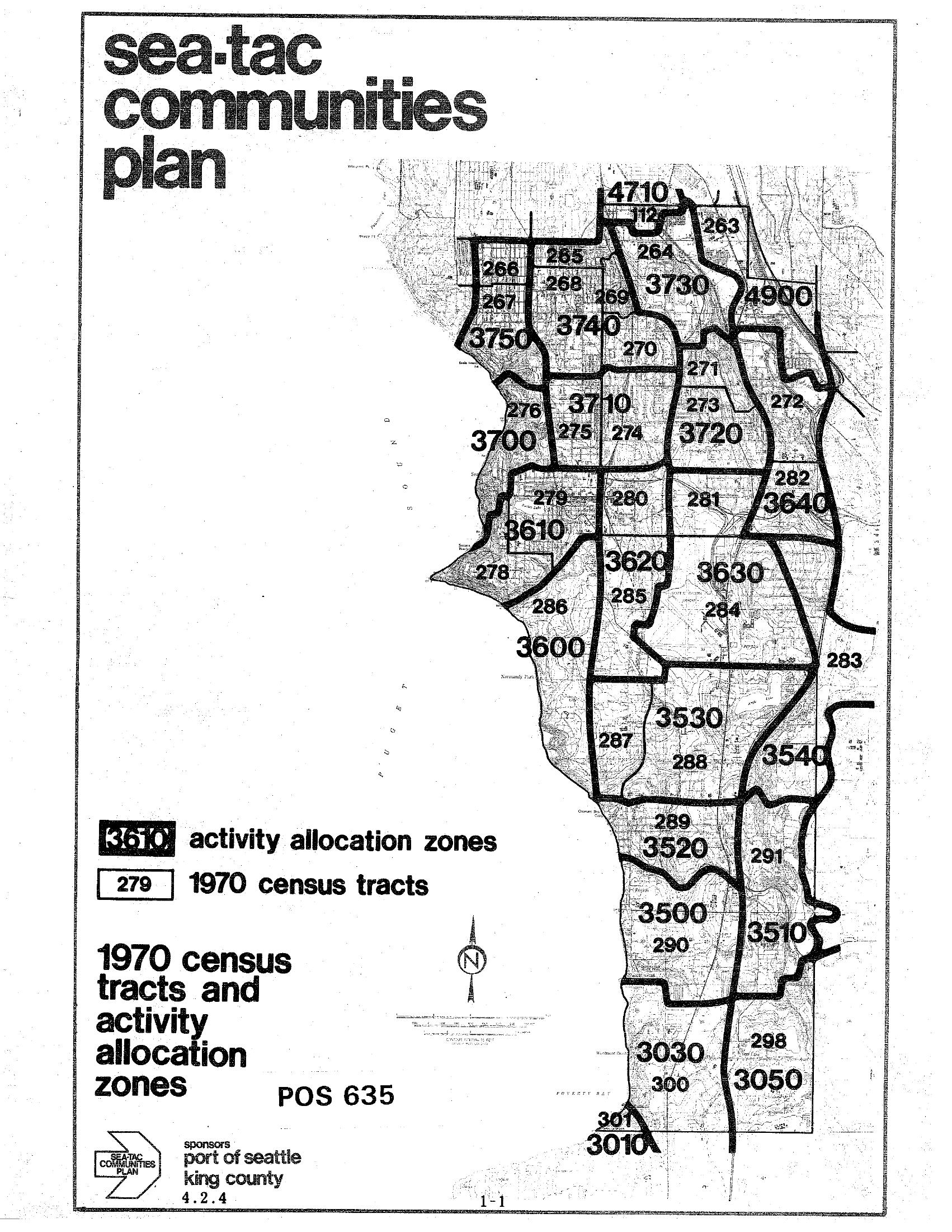
Sea-Tac Communities Plan — 1970 Census Tracts and Activity Allocation Zones Map
A map from the Sea-Tac Communities Plan (document reference POS 635, page 1-1) showing 1970 census tracts and activity allocation zones for the Sea-Tac area. The plan was sponsored by the Port of Seattle and King County, and displays numbered zones (e.g., 3610, 3720, 3740) overlaid on census tract boundaries. -
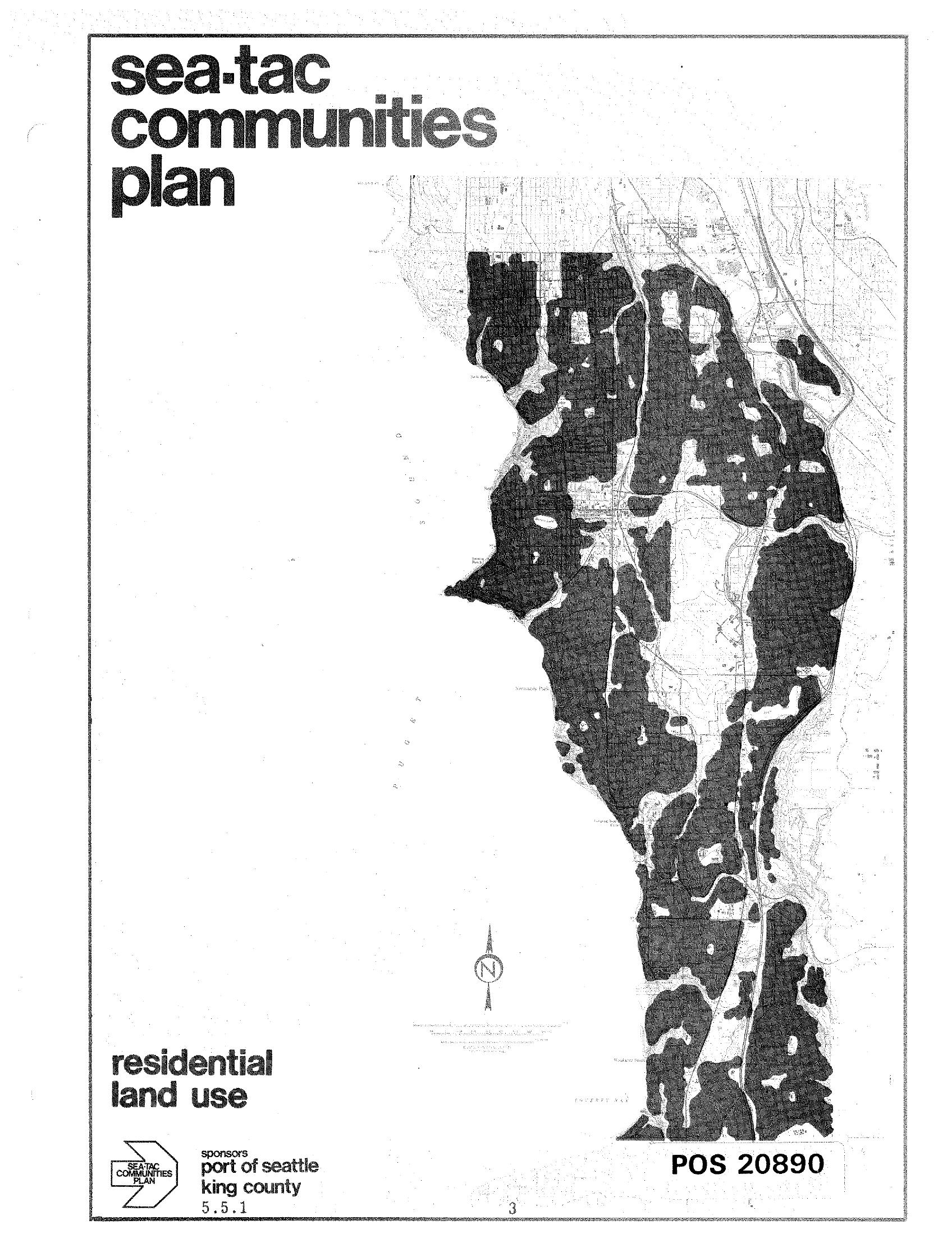
STCP Residential Land Use Chapter Cover Page
Cover page of the Sea-Tac Communities Plan document titled 'Residential Land Use,' bearing document number POS 20890 and version number 5.5.1. The page features a black-and-white map showing residential land use patterns in the Sea-Tac area, sponsored by the Port of Seattle and King County. -

STCP North Reinforcement Area Program Application Map (POS 1054)
This planning map, document number POS 1054 (page 6.6.5, sheet 8), was produced under the Sea-Tac Communities Plan sponsored by the Port of Seattle and King County. It depicts the North Reinforcement Area program application, showing land-use designations including acquisition zones (gray), cost-sharing insulation areas (blue), conversion areas (West and North), streams and ponds, current airport lands, and key landmarks such as Highline High School, Sunny Terrace Elementary, Sunnydale Elementary, and Riverton Heights Elementary, within the grid bounded roughly by S. 144th St. to S. 152nd St. and SR-509/SR-518. -
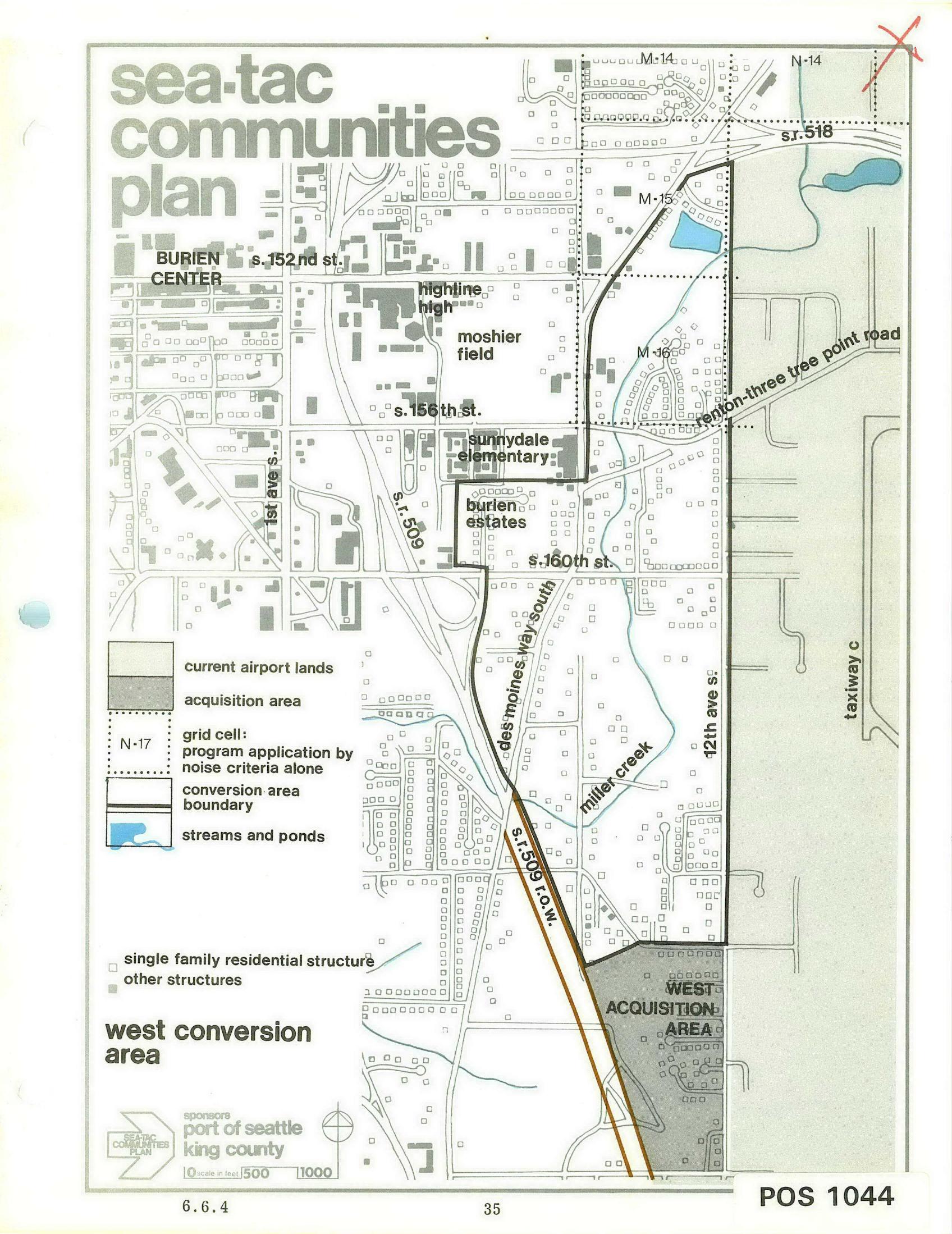
Sea-Tac Communities Plan – West Conversion Area Planning Map
Planning map labeled 'Sea-Tac Communities Plan – West Conversion Area,' sponsored by the Port of Seattle and King County, showing the west conversion area boundary, current airport lands, acquisition areas, grid cells subject to noise criteria, streams and ponds, and named landmarks including Burien Center, Highline High School, Moshier Field, Sunnydale Elementary, and Burien Estates. Document reference number POS 1044 appears at lower right, and the map scale and section number 6.6.4 are noted at bottom. -
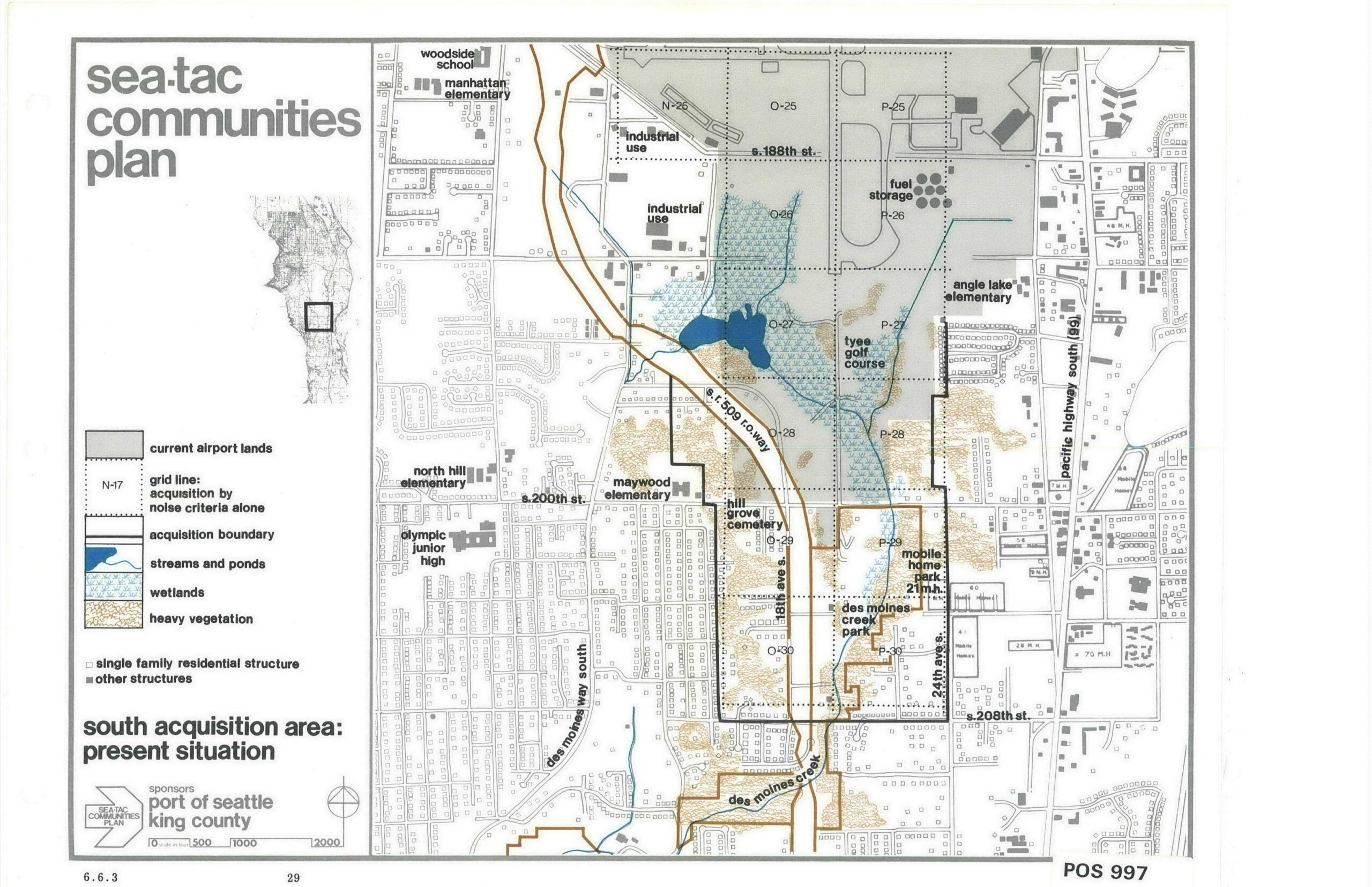
Sea-Tac Communities Plan — South Acquisition Area Present Situation Map (Page 29)
This is page 29, map 6.6.3 from the Sea-Tac Communities Plan (document POS 997), sponsored by the Port of Seattle and King County. The map depicts the south acquisition area around Seattle-Tacoma International Airport, showing current airport lands, acquisition boundaries based on noise criteria, streams, wetlands, heavy vegetation, and named landmarks including Tyee Golf Course, Hill Grove Cemetery, Des Moines Creek Park, and several elementary schools. -
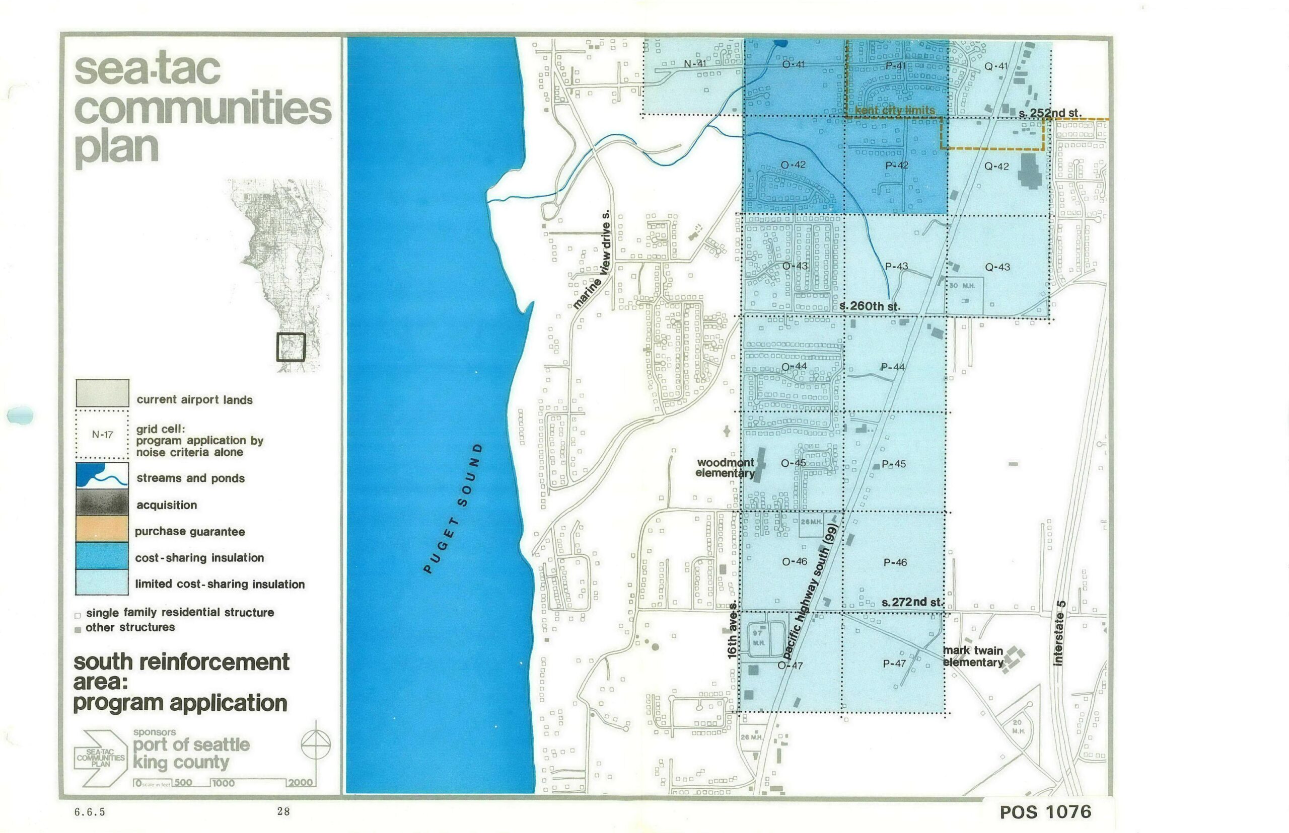
Sea-Tac Communities Plan – South Reinforcement Area Program Application Map (Page 28)
This map, labeled 'Sea-Tac Communities Plan – South Reinforcement Area: Program Application' (document reference POS 1076, page 28, section 6.6.5), was sponsored by the Port of Seattle and King County. It depicts grid cells O-41 through Q-47 in the area west of Interstate 5 and east of Puget Sound, color-coded to show noise-mitigation program designations including cost-sharing insulation, limited cost-sharing insulation, acquisition, and purchase guarantee zones, with landmarks including Woodmont Elementary, Mark Twain Elementary, Pacific Highway South (SR 99), and S. 252nd through S. 272nd Streets. -
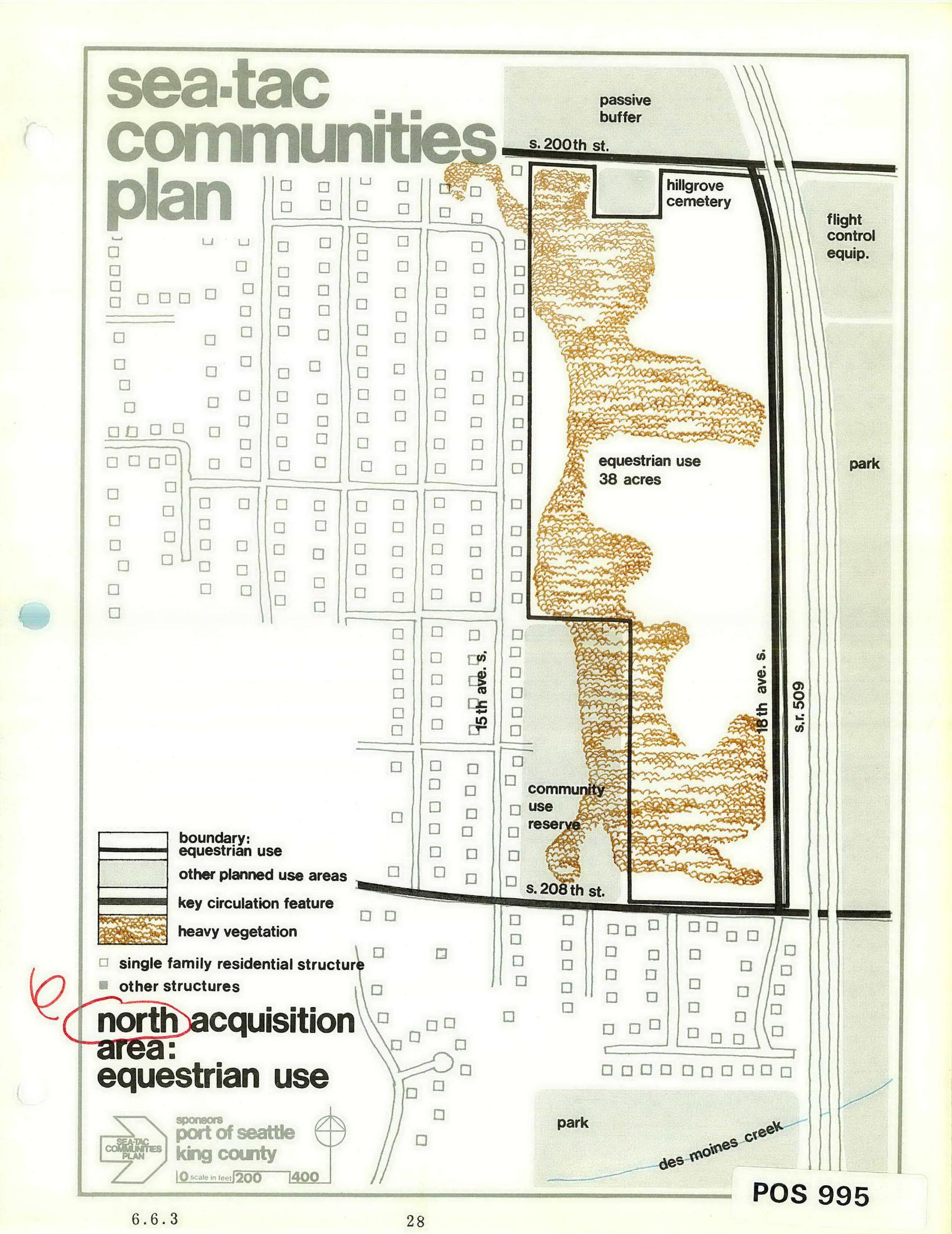
Sea-Tac Communities Plan: North Acquisition Area Equestrian Use Map (POS 995)
A planning map labeled 'POS 995' from the Sea-Tac Communities Plan, sponsored by the Port of Seattle and King County, showing the north acquisition area designated for equestrian use (38 acres) between S. 200th St. and S. 208th St., bounded by 15th Ave. S. and 16th Ave. S./S.R. 509. The map identifies land uses including Hillgrove Cemetery, a passive buffer, flight control equipment area, community use reserve, heavy vegetation, and adjacent parks including one near Des Moines Creek.