TagLand Use(212)
-
 1979-12-21
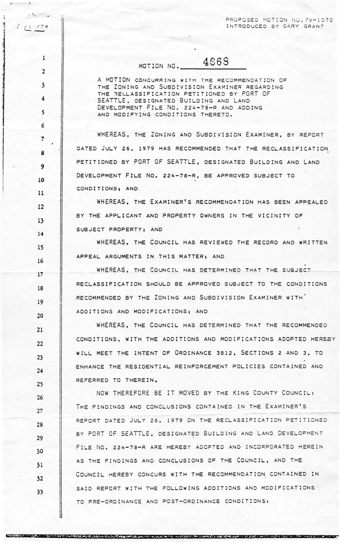
Motion No. 4668: King County Council Motion Concurring with Zoning and Subdivision Examiner Recommendation Regarding Reclassification Petitioned by Port Of Seattle, Building and Land Development File No. 224-78-R
In December 1979, the King County Council passed Motion No. 4668, concurring with the Zoning and Subdivision Examiner's recommendation to approve a land reclassification petitioned by the Port of Seattle (File No. 224-78-R), related to development of a Boeing facility near Sea-Tac Airport. As conditions of approval, the Port of Seattle was required to provide 5 acres for a neighborhood park along 12th Avenue South and to enter into a memorandum of understanding with King County freezing development on a 55-acre Westside Greenbelt buffer zone for ten years. The motion also mandated a separate public hearing in affected communities during the site plan approval process, reflecting efforts to balance airport-related development with residential stability concerns. -
 1979-07-30
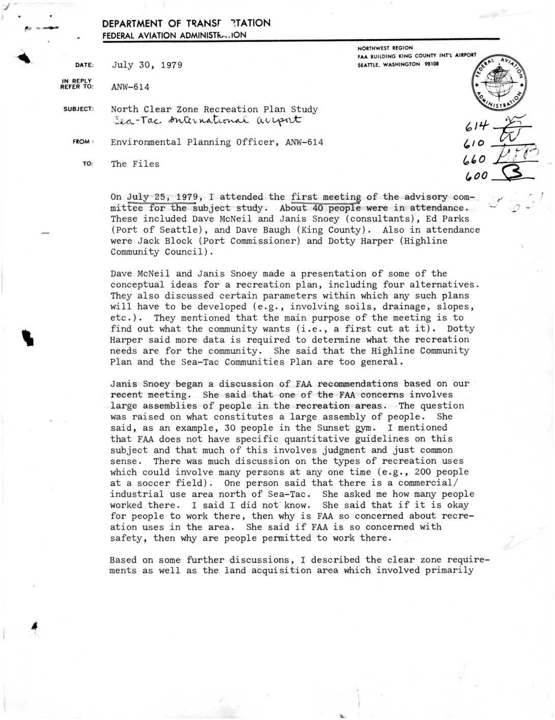
North Clear Zone Recreation Plan Study – Sea-Tac International Airport
A July 1979 FAA memo summarizes the first advisory committee meeting on a proposed recreation plan for the North Clear Zone near Sea-Tac International Airport. The meeting, attended by about 40 community members, consultants, and Port of Seattle representatives, centered on what types of recreational uses—such as soccer fields, golf courses, and bike trails—would be compatible with airport safety guidelines, with the FAA cautioning against intensive uses and large fixed spectator facilities in the clear zone. The group requested more specific, quantitative FAA guidelines on acceptable land use, and a follow-up meeting was scheduled for August 8, with the full study expected to take six months and potentially set precedents for recreational land use near major airports. -
 1979-07-27
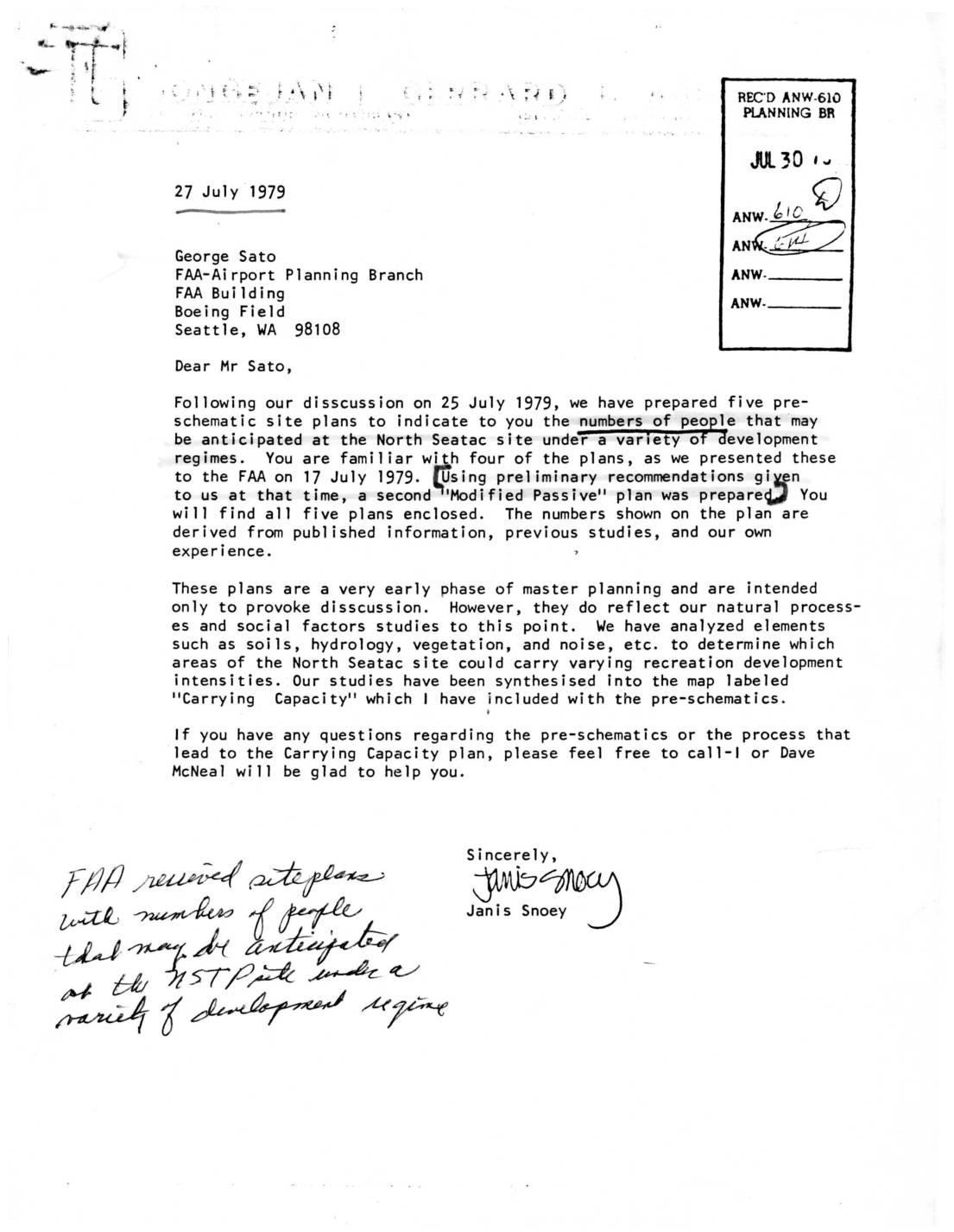
Letter to FAA North Sea-Tac site development plans and carrying capacity analysis
A July 1979 letter from planner Janis Snoey to FAA Airport Planning Branch representative George Sato transmits five pre-schematic site plans for the North Sea-Tac Park, showing projected peak-time visitor numbers under various development scenarios. The plans, prepared following an FAA meeting on July 17, 1979, are accompanied by a 'Carrying Capacity' map that classifies park areas by development suitability—from very high intensity (sports fields, motorcycle trails) to low intensity (foot paths only)—based on analysis of soils, hydrology, vegetation, and noise. The documents were intended solely to provoke discussion during the early master planning phase for the North Sea-Tac site. -
 1979-07-24
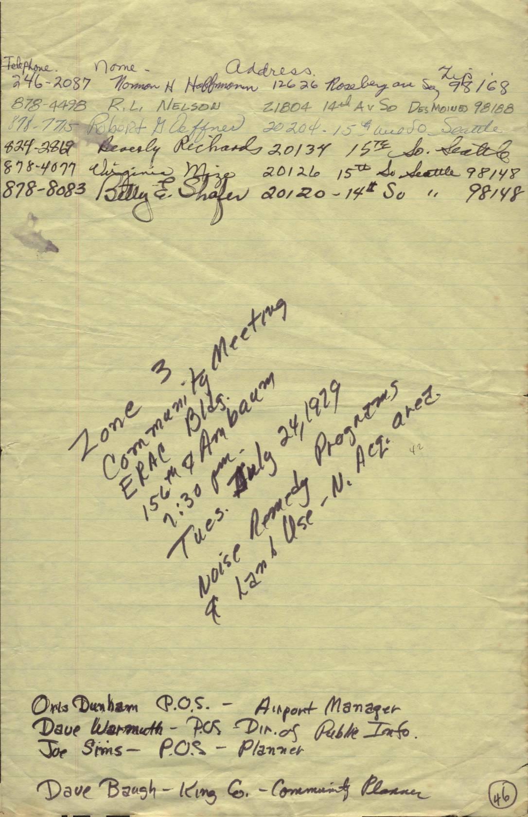
Zone 3 Community Meeting Attendee List, July 24, 1979
This document contains handwritten sign-in sheets and contact lists from a Zone 3 Community Meeting held on Tuesday, July 24, 1979, at the ERAC Building (156th & Ambaum), focused on noise remedy programs and land use in the North Acres area near Sea-Tac Airport. Attendees included Port of Seattle officials such as Airport Manager Otis Dunham, Director of Public Information Dave Warmuth, Planner Joe Sims, and King County Community Planner Dave Baugh, along with numerous local residents. The sheets record names, addresses, and phone numbers of participants, reflecting community engagement with airport noise and land-use concerns in the Seattle/Des Moines area during the late 1970s. -
 1979-07-22
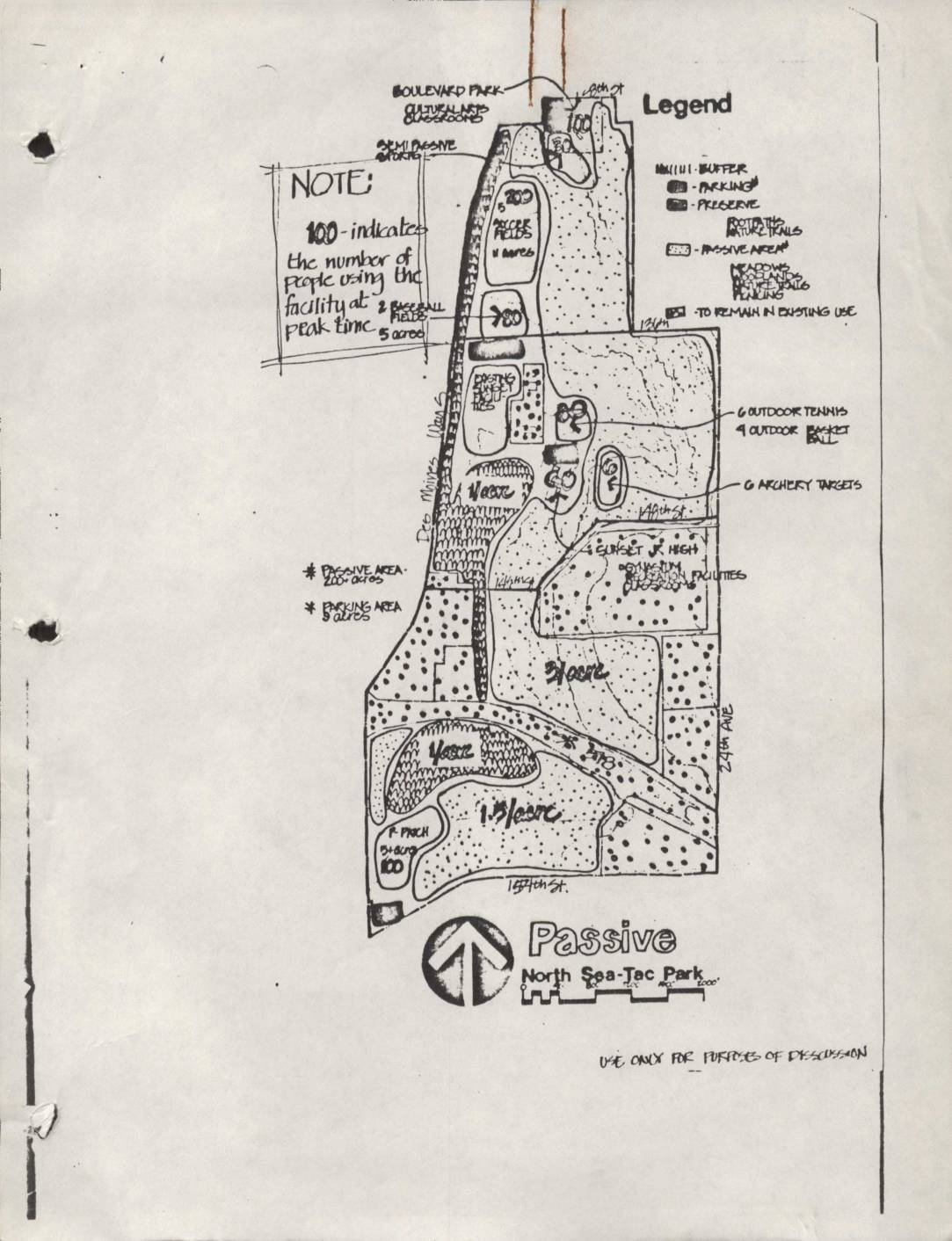
North Sea-Tac Park planning maps: Passive, Modified Passive, and Modified Passive 2 concepts
These three hand-drawn planning maps present alternative development scenarios for North Sea-Tac Park, labeled 'Passive,' 'Modified Passive,' and 'Modified Passive 2.' Each concept proposes different mixes of recreational facilities—such as soccer fields, baseball fields, tennis courts, a golf course, and archery targets—alongside preserved natural areas, nature trails, and passive open space. The maps were intended solely for discussion purposes and show peak-time visitor capacity estimates for each proposed facility zone. -
 1979-03-01
Quiet Communities: Minimizing the Effects of Noise through Land Use Controls
Published in March 1979 by the National Association of Counties Research, Inc., this guide examines how local governments can use land use controls—such as zoning and planning regulations—to reduce the impact of noise on residential communities. It covers noise sources including highway and transportation corridors, offering practical strategies for buffering noise-sensitive land uses from high-noise areas. The document is a foundational reference for planners and policymakers working to protect communities from airport, highway, and industrial noise. -
 1979-02-01
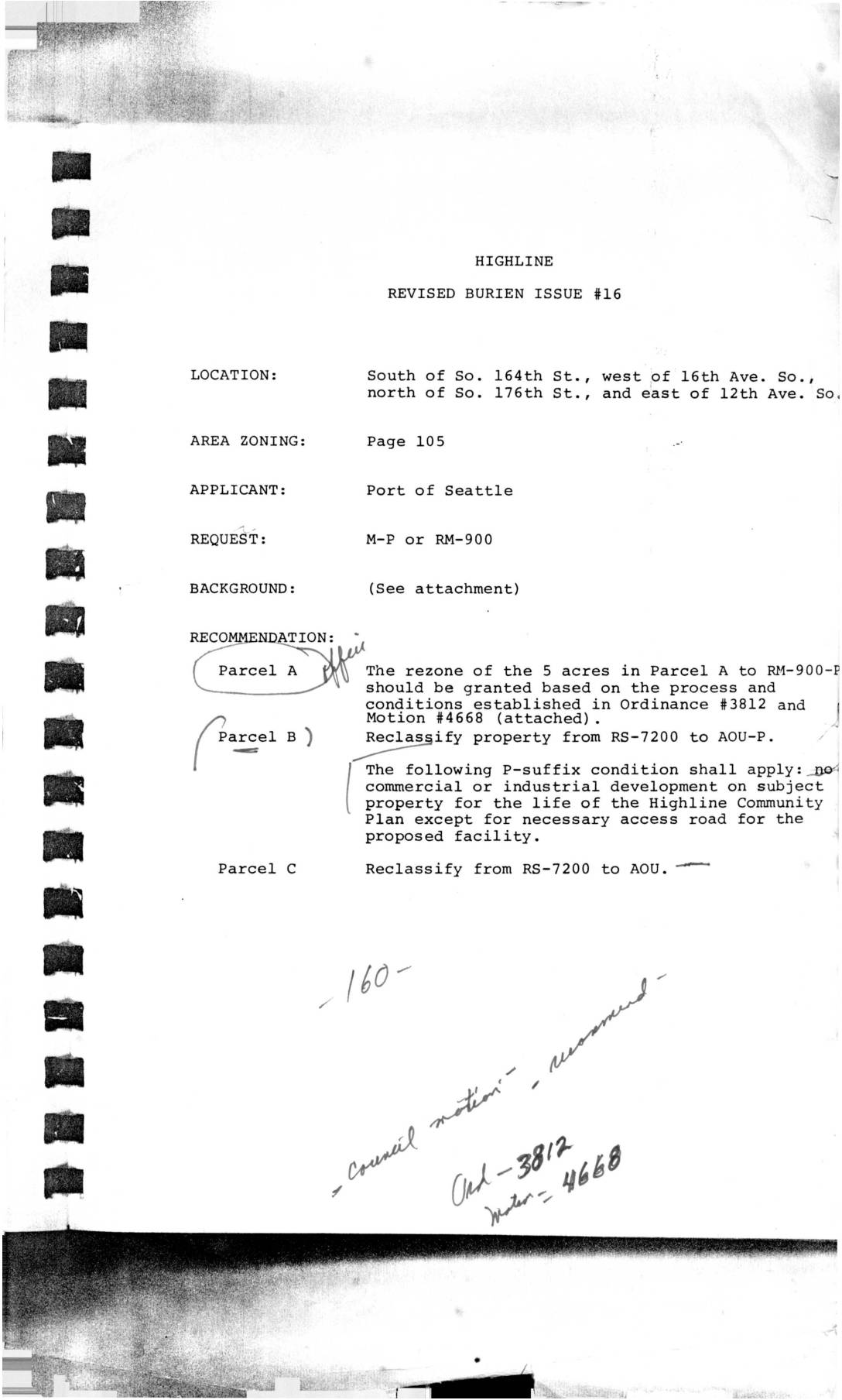
Highline Burien Issue #16 – Port of Seattle Zoning Request
A zoning reclassification request by the Port of Seattle for property south of So. 164th St. in the Highline area. The document shows recommendations for three parcels: Parcel A to be rezoned to RM-900-P, Parcel B to be reclassified from RS-7200 to AOU-P with restrictions on commercial/industrial development, and Parcel C to be reclassified from -
 1979-02-01
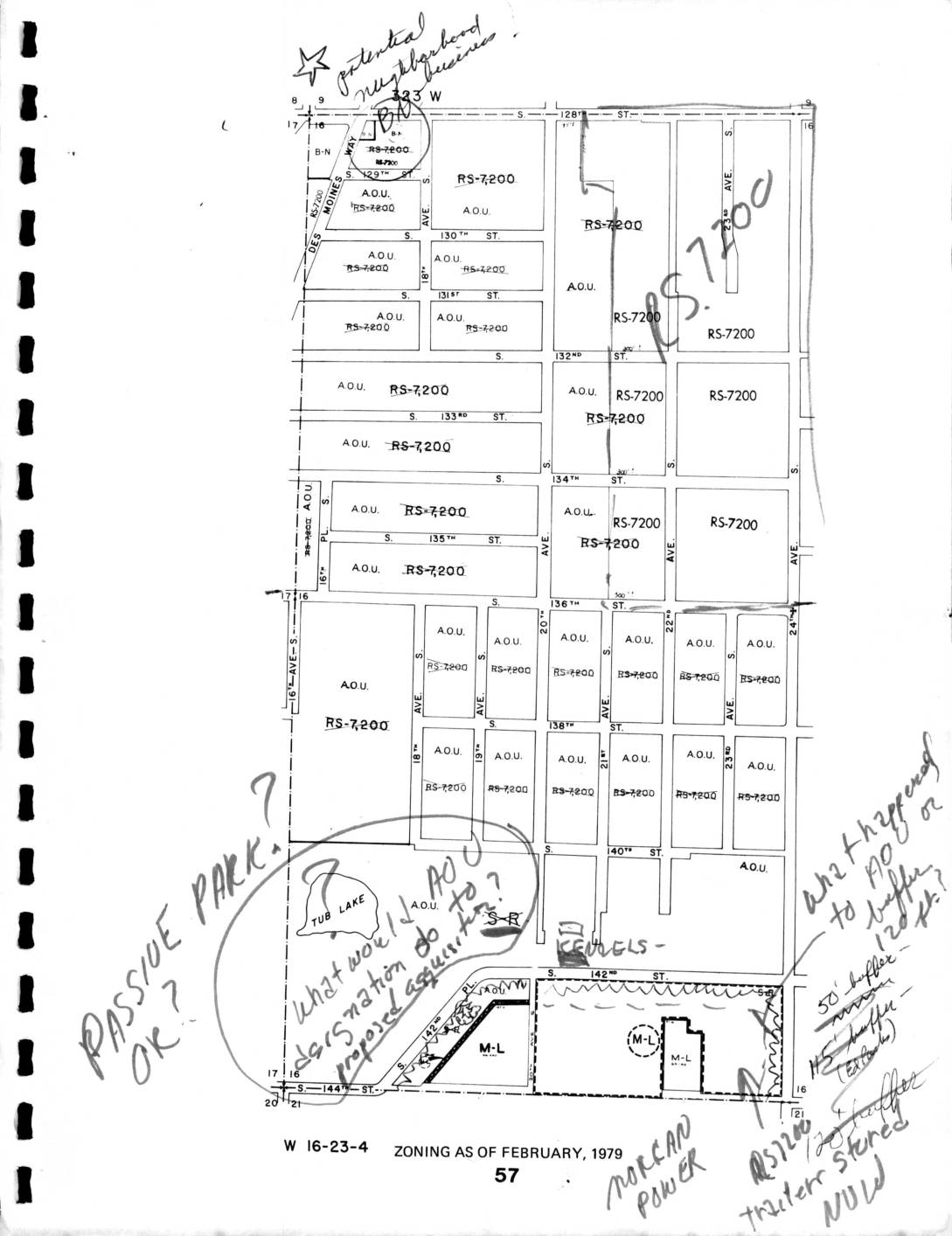
Zoning Map: North Sea-Tac Park Area, February 1979
This is a zoning map dated February 1979 for section W 16-23-4, showing land use designations—primarily RS-7200 (single-family residential) and A.O.U. (Airport Operations Use) zones—in the area south of S. 128th Street near Seattle-Tacoma Airport. Handwritten annotations raise questions about passive park designations, proposed AOC/AOU classifications near Tub Lake, buffer distances (50-foot and 45-foot buffers are noted), and the status of an RS-7200 trailer storage site. The notes suggest an active policy review regarding how airport-related zoning categories and noise buffers should be applied to residential and transitional parcels in this neighborhood. -
 1978-03-15
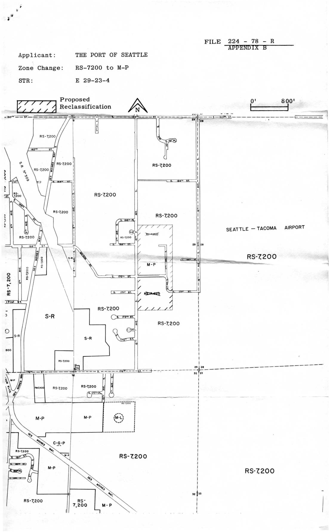
File 224-78-R Appendix B: Port Of Seattle Zone Change Map, RS-7200 to M-P, STR E 29-23-4
This 1978 King County Building & Land Development document relates to a zoning reclassification application (File 224-78-R) filed by the Port of Seattle, proposing to change land near Seattle-Tacoma Airport from residential (RS-7,200) to manufacturing-park (M-P) zoning. The accompanying map shows the affected parcels in section E 29-23-4, located adjacent to Sea-Tac Airport, where multiple residential zones were targeted for conversion. A notice was mailed to area resident Virginia Dana at 2648 South 142nd Street, Seattle, in March 1978. -
 1978-01-01
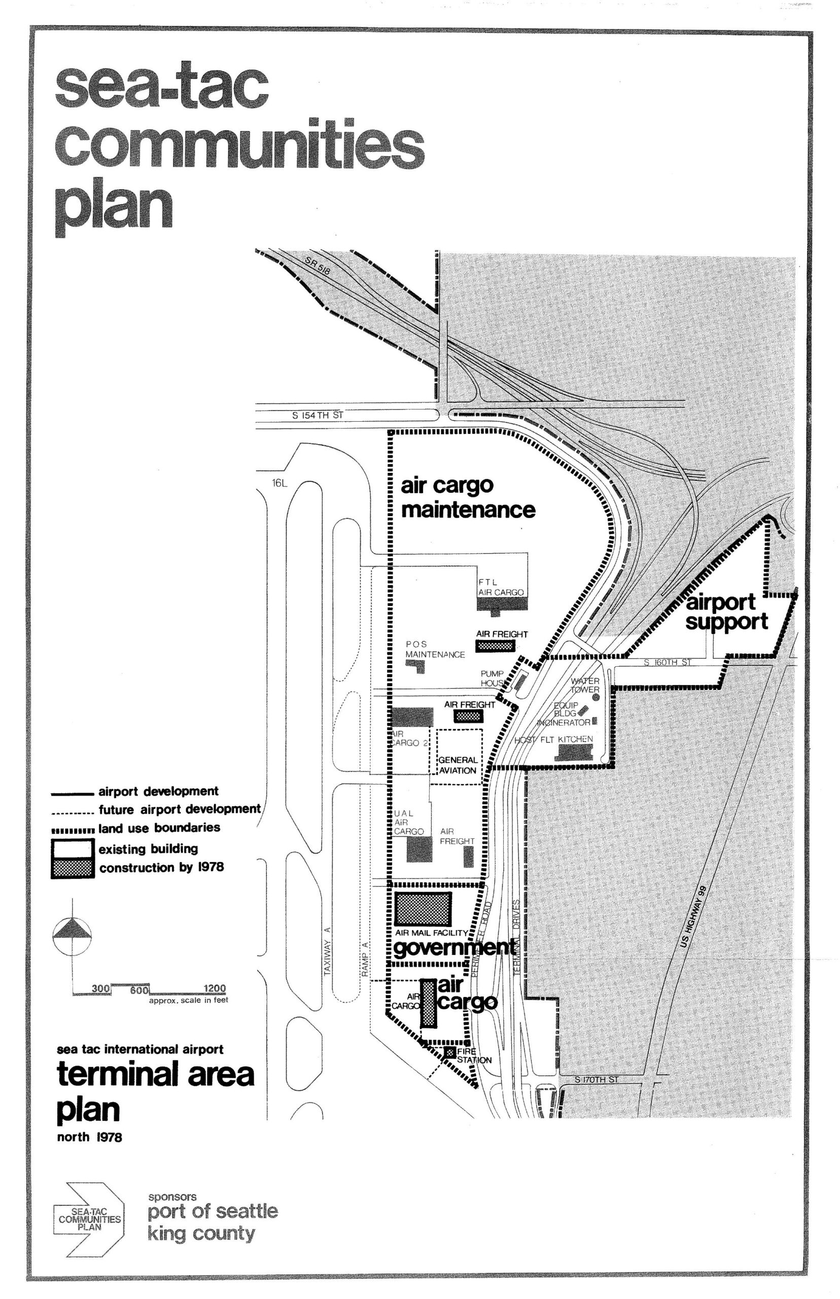
Sea-Tac International Airport North Terminal Area Plan Map, 1978
A land-use planning map from the Sea-Tac Communities Plan showing the north terminal area of Sea-Tac International Airport as of 1978, delineating zones for air cargo maintenance, airport support, government, and general aviation facilities, with existing buildings and planned construction indicated. The plan was sponsored by the Port of Seattle and King County, and shows key roadways including S 154th St, S 160th St, S 170th St, and US Highway 99.