TagKing County(422)
-
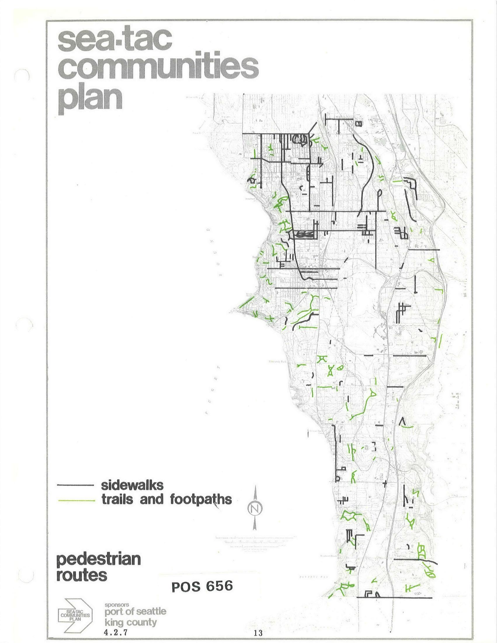
Sea-Tac Communities Plan — Pedestrian Routes Map (Page 13)
A planning map labeled 'Sea-Tac Communities Plan' showing pedestrian routes — sidewalks (black lines) and trails and footpaths (green lines) — within the Sea-Tac area. The document is identified as POS 656, page 13, sponsored by the Port of Seattle and King County, dated 4.2.7. -
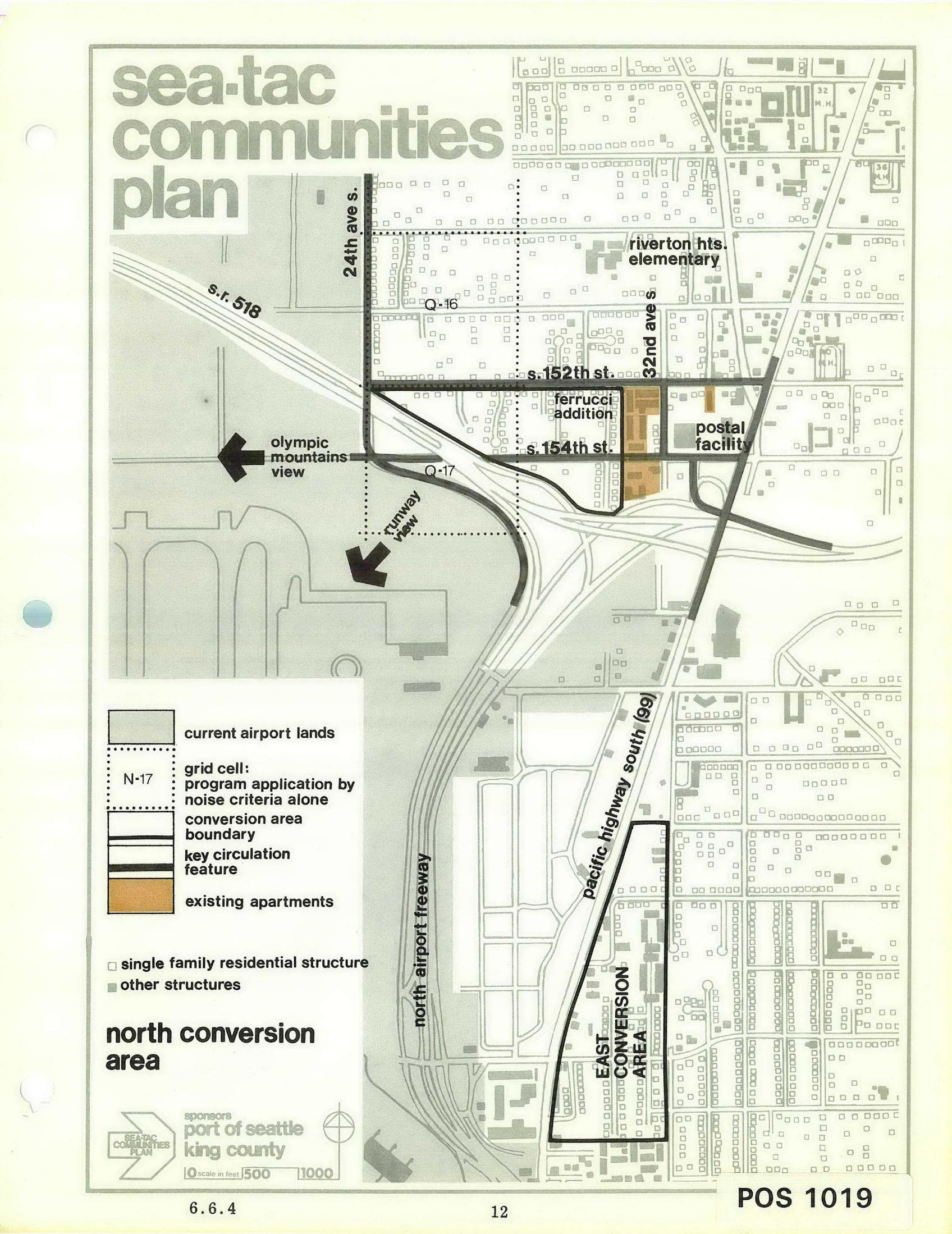
Sea-Tac Communities Plan — North Conversion Area Planning Map
A planning map labeled 'Sea-Tac Communities Plan' showing the North Conversion Area near Seattle-Tacoma Airport, identifying key features including S.R. 518, S. 152nd and S. 154th Streets, 24th and 32nd Avenues S., Riverton Heights Elementary, a postal facility, Ferrucci Addition, grid cells Q-16 and Q-17, Olympic Mountains view corridor, runway view corridor, and the East Conversion Area along Pacific Highway South (99). Sponsored by the Port of Seattle and King County, document reference POS 1019, page 6.6.4. -
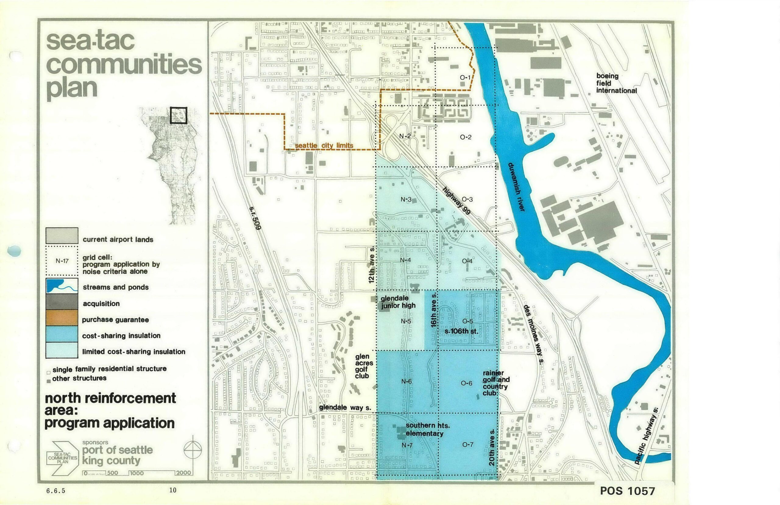
Sea-Tac Communities Plan North Reinforcement Area Program Map (POS 1057, Sheet 6.6.5, Page 10)
This planning map (document number POS 1057, sheet 6.6.5, page 10) from the Sea-Tac Communities Plan depicts the North Reinforcement Area program application, showing grid cells N-1 through N-7 and O-1 through O-7 near Seattle-Tacoma International Airport. Sponsored by the Port of Seattle and King County, the map identifies land-use categories including current airport lands, acquisition zones, purchase guarantee areas, cost-sharing insulation areas, and limited cost-sharing insulation areas, with landmarks such as Boeing Field International, the Duwamish River, Glendale Junior High, Southern Heights Elementary, and Rainier Golf and Country Club. -
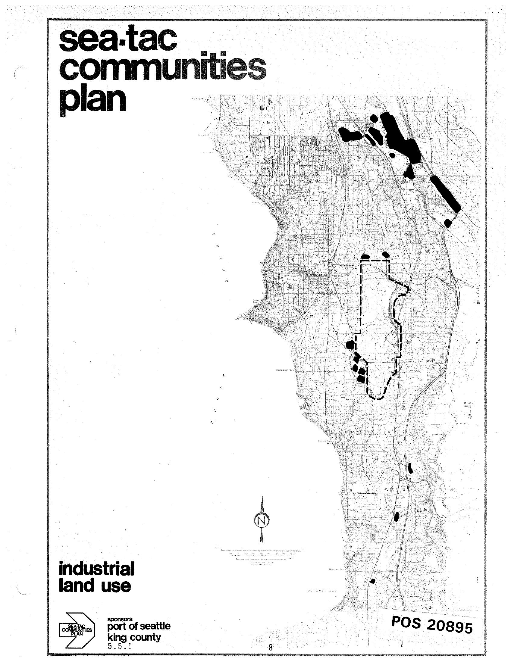
Sea-Tac Communities Plan Industrial Land Use Map
A planning document titled 'Sea-Tac Communities Plan' showing an industrial land use map of the Sea-Tac area, sponsored by the Port of Seattle and King County (document reference 5.5.1). The map highlights industrial land use zones in black, with a dashed boundary indicating a specific study or airport area, and is catalogued as POS 20895. -
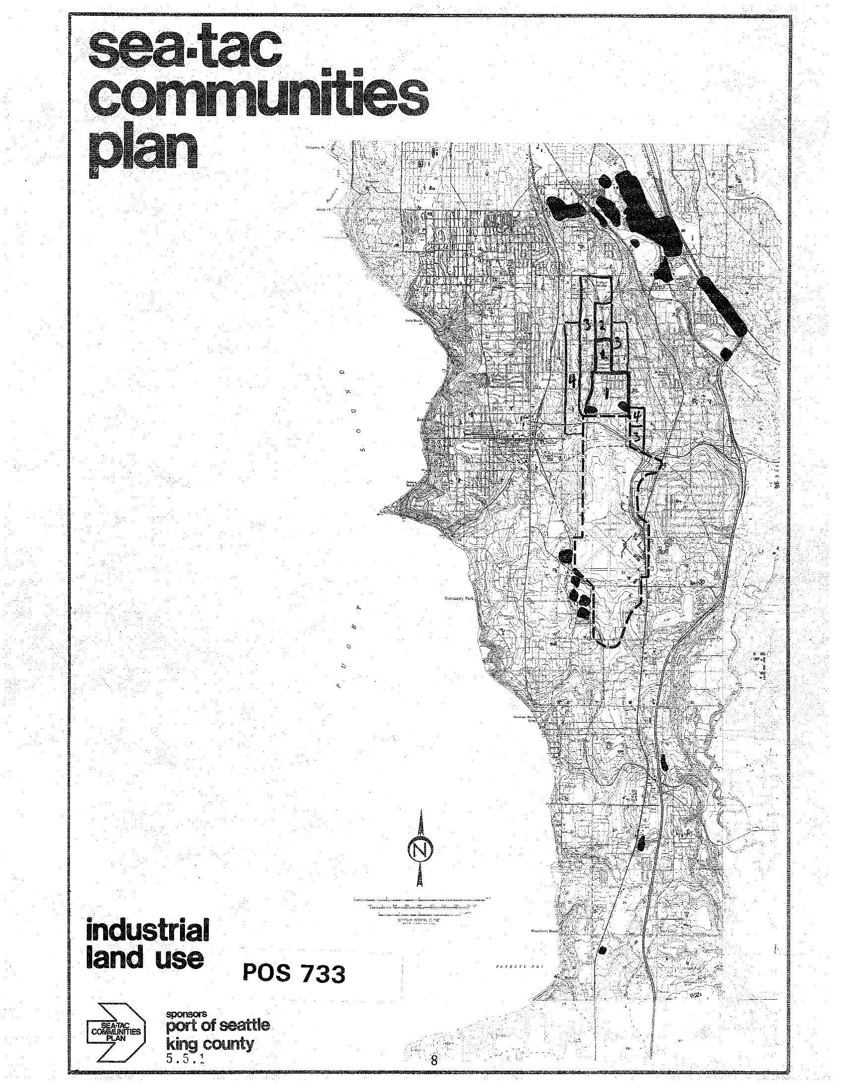
Sea-Tac Communities Plan – Industrial Land Use Map (POS 733)
A land use planning map labeled 'Sea-Tac Communities Plan – Industrial Land Use, POS 733,' sponsored by the Port of Seattle and King County (document reference 5.5.1). The map depicts industrial land use zones in the Sea-Tac area, with numbered zones and shaded areas indicating industrial designations, oriented with a north arrow and scale bar. -
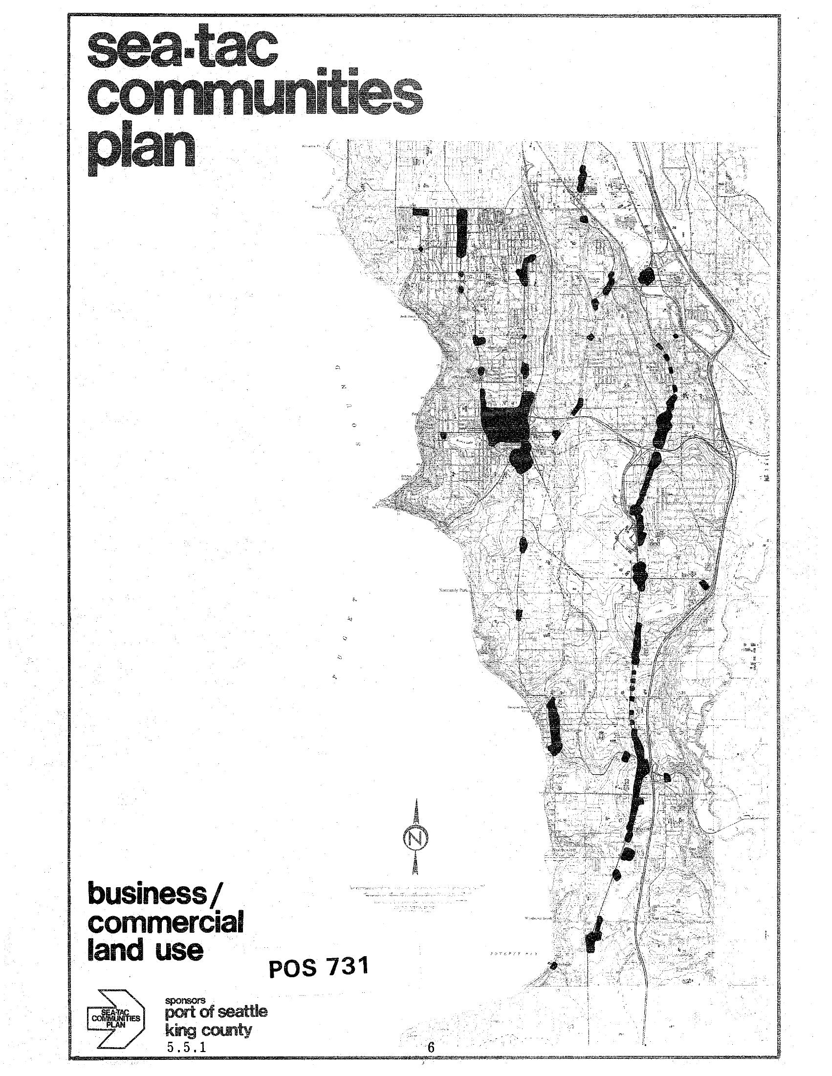
Sea-Tac Communities Plan — Business/Commercial Land Use Map (POS 731, Section 5.5.1)
Cover page of the Sea-Tac Communities Plan document titled 'Business/Commercial Land Use,' reference number POS 731, section 5.5.1. The plan was sponsored by the Port of Seattle and King County, and features a black-and-white map depicting commercial land use zones in the Sea-Tac area. -
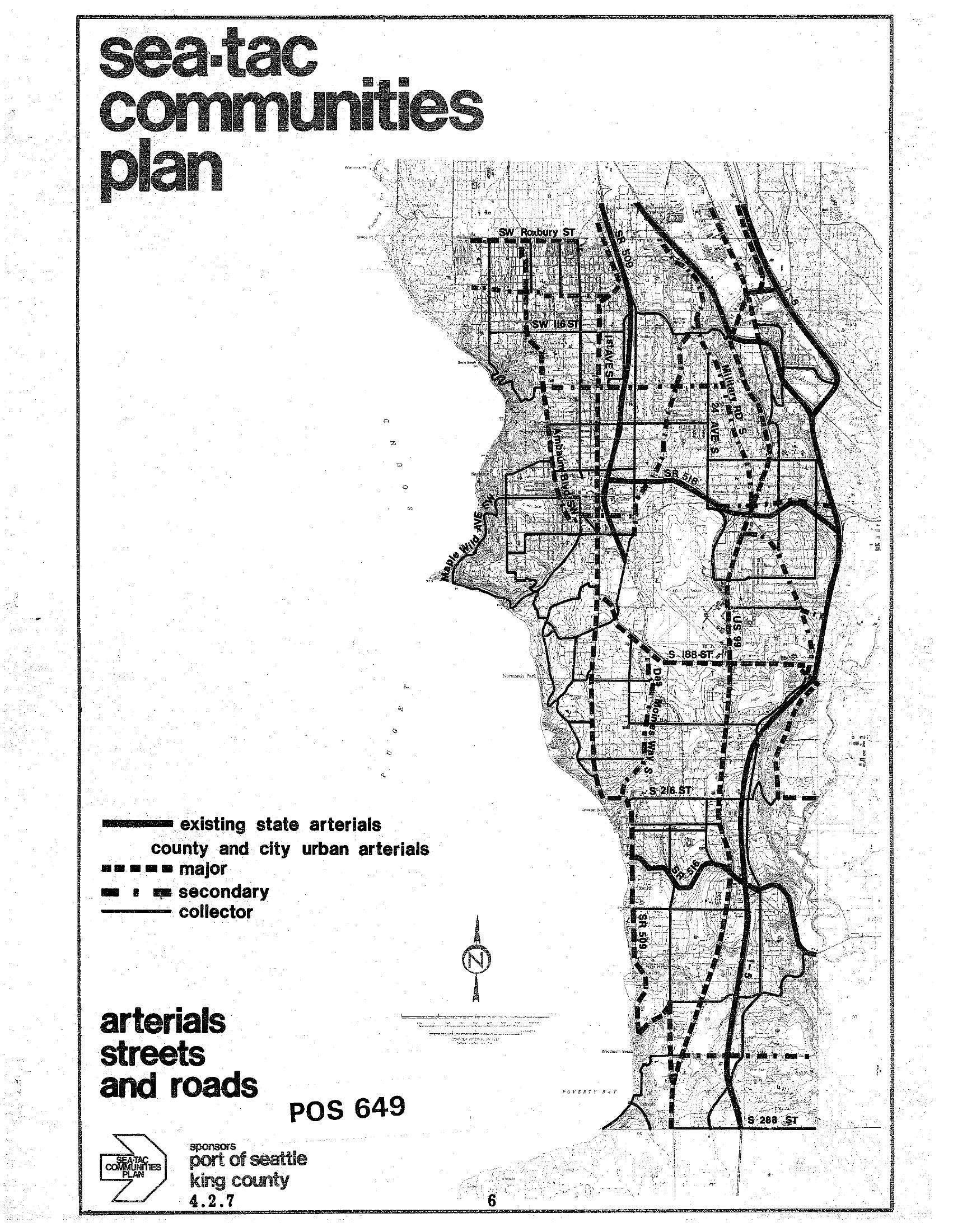
Sea-Tac Communities Plan Map 4.2.7 — Arterials, Streets, and Roads
A planning map labeled 'Sea-Tac Communities Plan' showing arterials, streets, and roads in the Sea-Tac area, document number POS 649, map sheet 4.2.7. The map identifies existing state arterials, county and city urban arterials (major, secondary, and collector), with visible street labels including SW Roxbury St, S 188th St, S 216th St, S 288th St, SR 518, SR 509, and US 99; sponsored by the Port of Seattle and King County. -
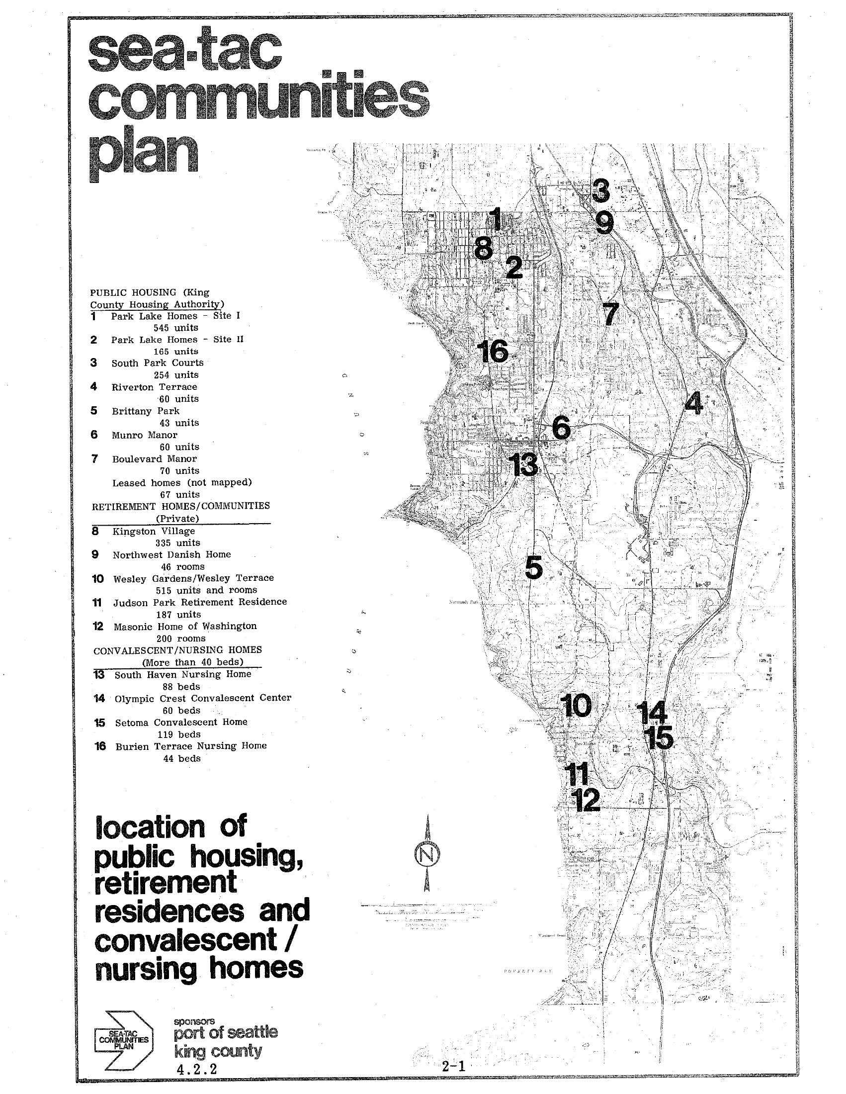
STCP Map: Locations of Public Housing, Retirement Residences, and Convalescent Nursing Homes in the Sea-Tac Area
A map from the Sea-Tac Communities Plan (document reference 4.2.2), sponsored by the Port of Seattle and King County, showing numbered locations of 16 public housing, retirement, and convalescent/nursing home facilities in the Sea-Tac area, including King County Housing Authority properties such as Park Lake Homes (545 and 165 units) and private retirement communities such as Kingston Village (335 units) and Wesley Gardens/Wesley Terrace (515 units and rooms). -
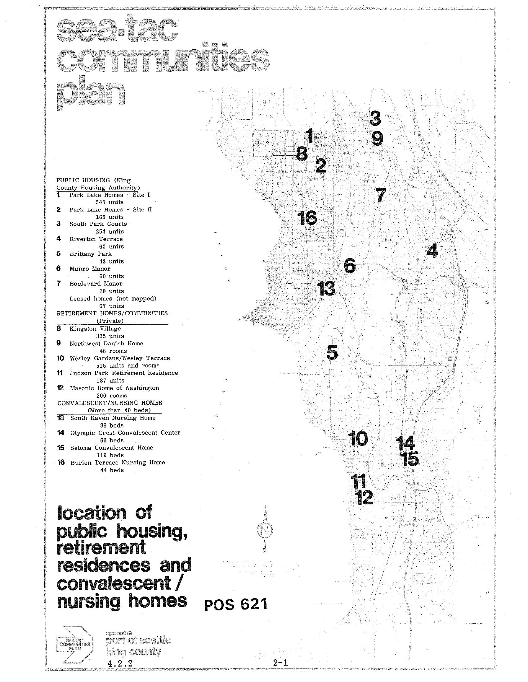
STCP Map: Locations of Public Housing, Retirement Residences, and Convalescent Nursing Homes in the Sea-Tac Area
This map from the Sea-Tac Communities Plan (document reference 4.2.2, page 2-1) plots 16 numbered locations of public housing sites administered by the King County Housing Authority, private retirement homes/communities, and convalescent/nursing homes with more than 40 beds in the Sea-Tac area. Sponsors listed are the Port of Seattle and King County. -
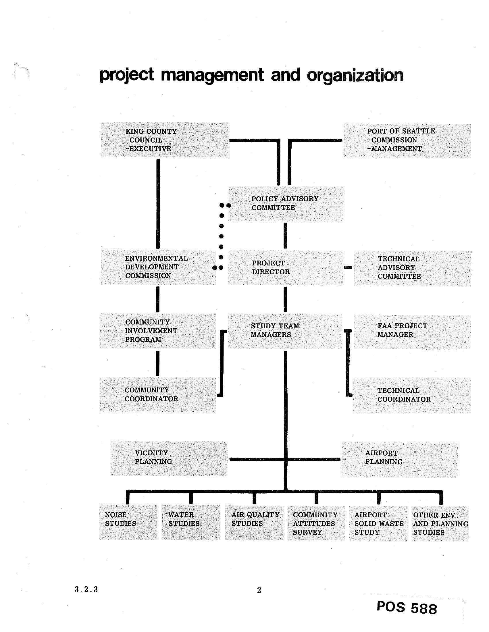
Sea-Tac Airport Environmental Study Project Management and Organization Chart
An organizational chart titled 'project management and organization' showing the hierarchy for a Sea-Tac Airport environmental study, with King County (Council/Executive) and Port of Seattle (Commission/Management) at the top, flowing through a Policy Advisory Committee and Project Director, down to Study Team Managers, and ending with study areas including Noise Studies, Water Studies, Air Quality Studies, Community Attitudes Survey, Airport Solid Waste Study, and Other Environmental and Planning Studies. Document is labeled POS 588, page 3.2.3.