TagDes Moines(255)
-

Luisa Bangs
A formal professional headshot of a woman wearing a blue patterned top with a decorative pin. The image bears a watermark reading 'Photography by Rafid' in the lower right corner. -

Jeanette Burrage
A formal headshot of a middle-aged woman with short brown hair, wearing a dark navy blazer and gold necklace. The image bears a watermark reading 'Photography by Rapel' in the lower right corner; the subject is not identified by any visible caption or text. -
 2024-01-25
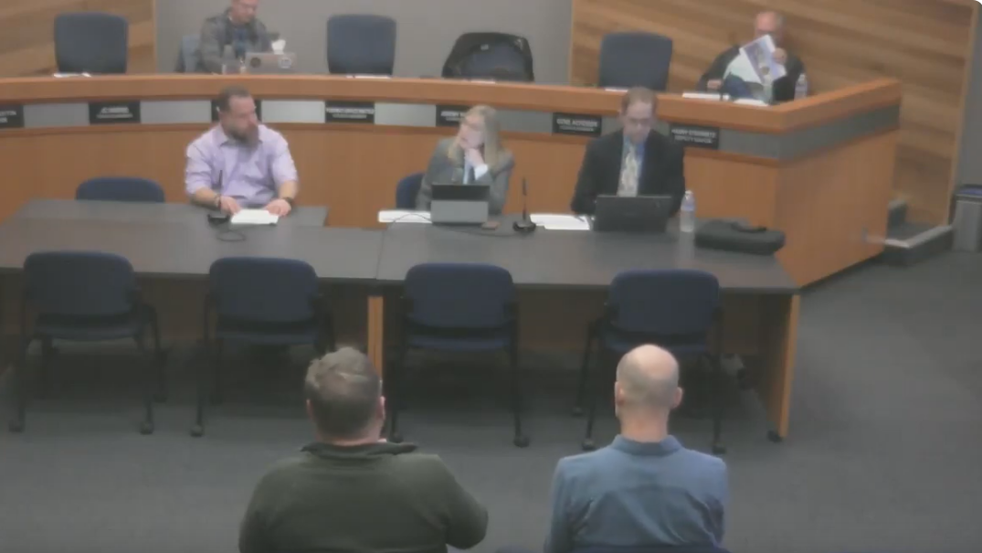
Des Moines Economic Development Committee Meeting, January 25, 2024
A formal government council or commission meeting is in session, with three officials seated at a curved dais and two members of the public seated facing them. Name placards are visible on the dais but are not legible at this resolution. -
 2024-01-01
Areas 26, 29, 61, 62, 88: Residential Revalue for 2024 Assessment Roll
King County Department of Assessments 2024 annual residential revalue report covering Area 26 (Steel Lake/Star Lake), Area 29 (Kentridge), Area 61 (Kent Meridian), Area 62 (Lea Hill), and Area 88 (Des Moines/SeaTac/Kent). Authored by King County Assessor John Wilson. Explains mass appraisal methodology, property inspection cycles under RCW 84.40.025, time-adjusted sales analysis using three years -
 2023-12-07
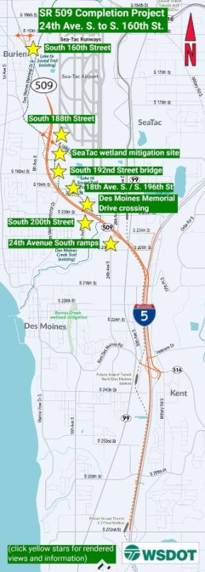
SR 509 Completion Project: 24th Ave. S. to S. 160th St.
The SR 509 Completion Project extends State Route 509 from 24th Avenue South to South 160th Street near Sea-Tac Airport, adding new interchanges, roundabouts, and connections to southbound I-5 and toward Seattle. Key features include a new interchange at South 188th Street with a shared-use path and Lake to Sound Trail access, as well as a South 160th Street interchange with noise walls to protect nearby residents. The project also includes wetland mitigation sites and infrastructure improvements along the Des Moines Memorial Drive corridor. -
 2023-08-28
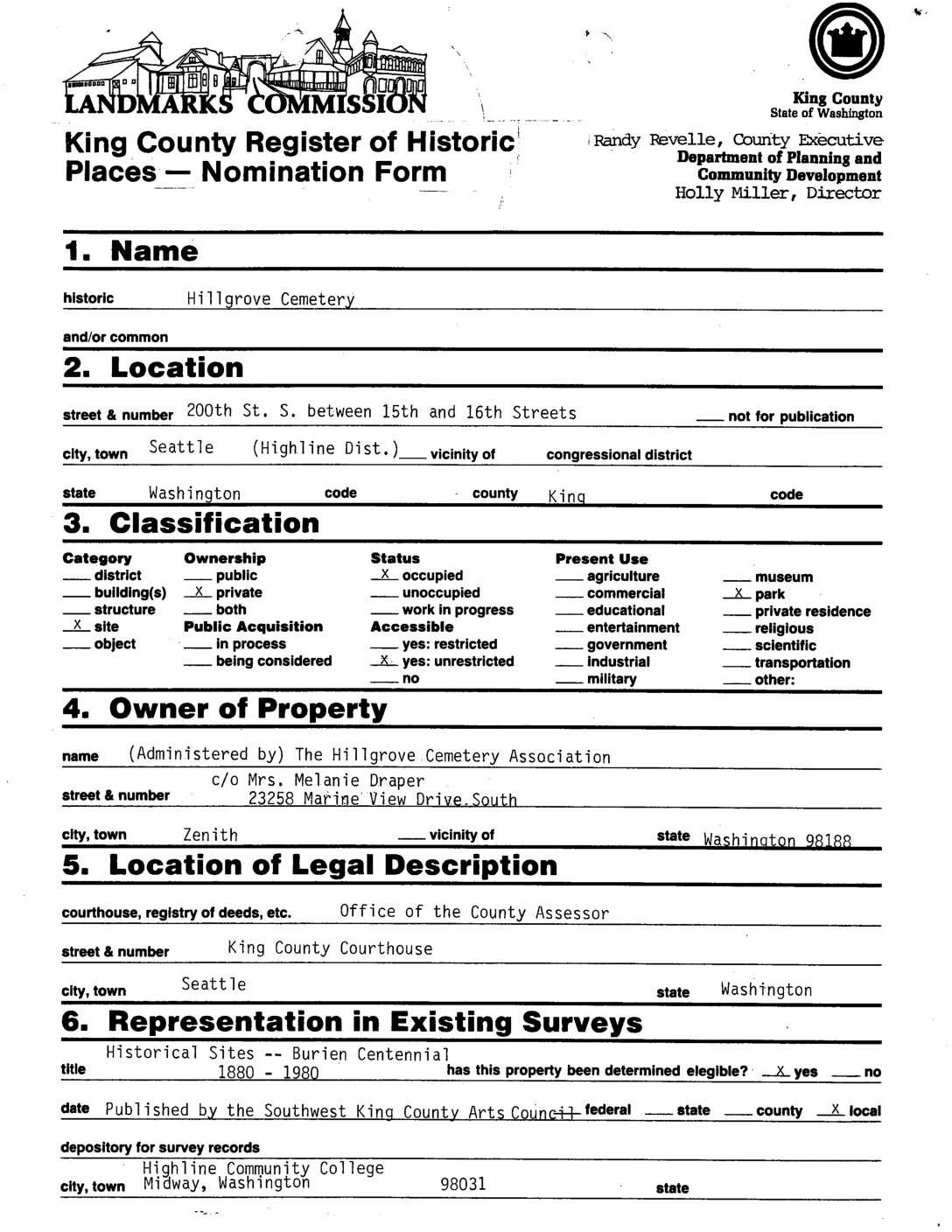
King County Register of Historic Places Nomination Form: Hillgrove Cemetery
Hillgrove Cemetery, located on 200th Street South in the Highline District of Seattle, is a historic private burial site consisting of 57 individually owned plots that serves as a significant link to the ethnic and pioneer heritage of the Highline/Des Moines area of south King County. The cemetery is surrounded on three sides by Port of Seattle land — the agency that operates Sea-Tac Airport — which erected the chain-link fence enclosing the property. Nominated to the King County Register of Historic Places, the site commemorates early settlers whose activities shaped the region's economic and civic development, including road-building, milling, transportation, and farming that contributed to what became Seattle's Pike Place Market. -
 2023-08-28
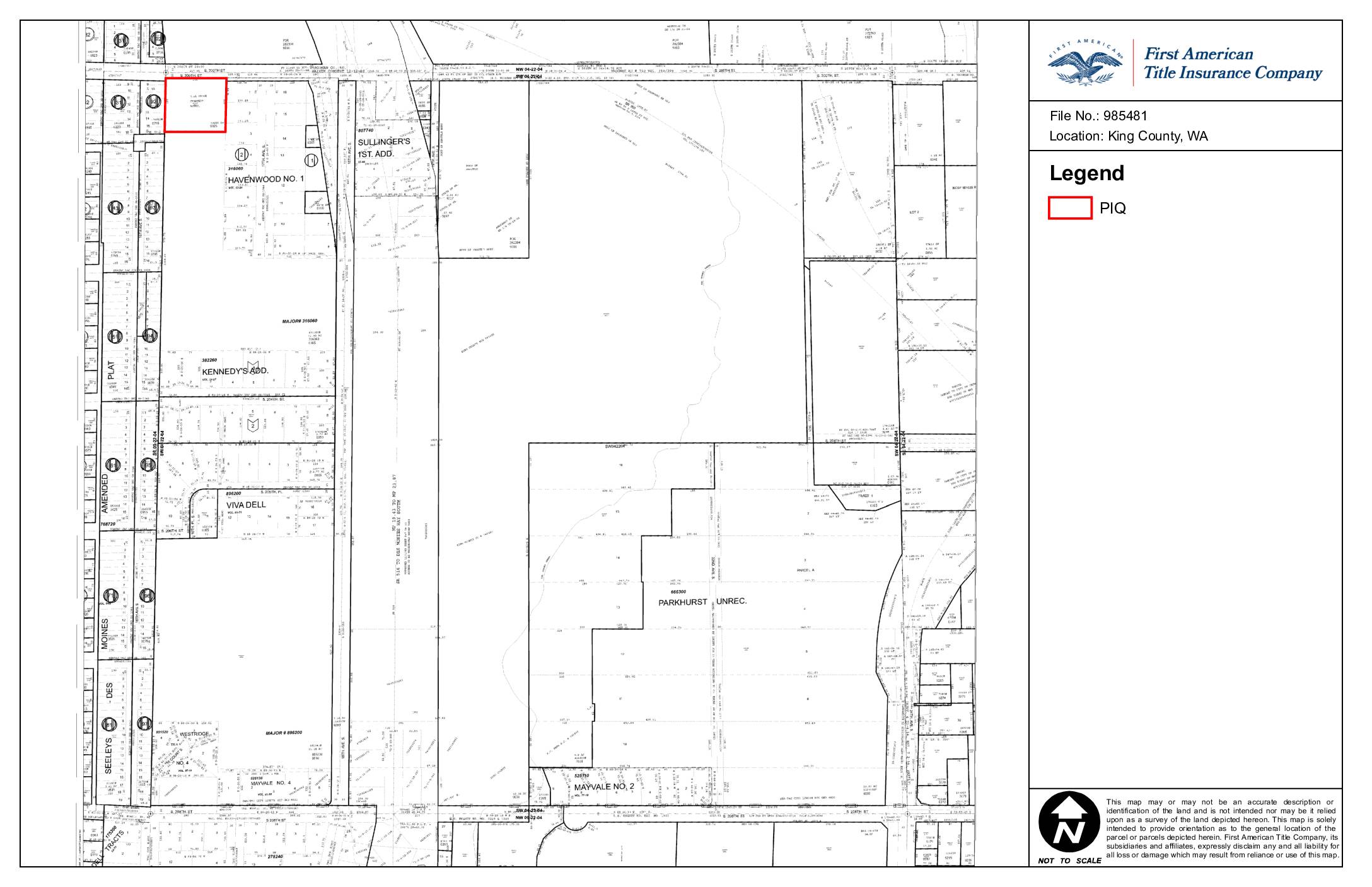
Location Map: King County, WA (File No. 985481)
This is a parcel map prepared by First American Title Insurance Company for File No. 985481, identifying land located in King County, Washington. The map provides a general geographic orientation of one or more parcels in the area, encompassing subdivisions such as Havenwood No. 1, Kennedy's Addition, Viva Dell, and Mayvale No. 2. The document is not intended to serve as a legal survey and carries an express disclaimer of liability for any reliance on its contents. -
 2023-08-27
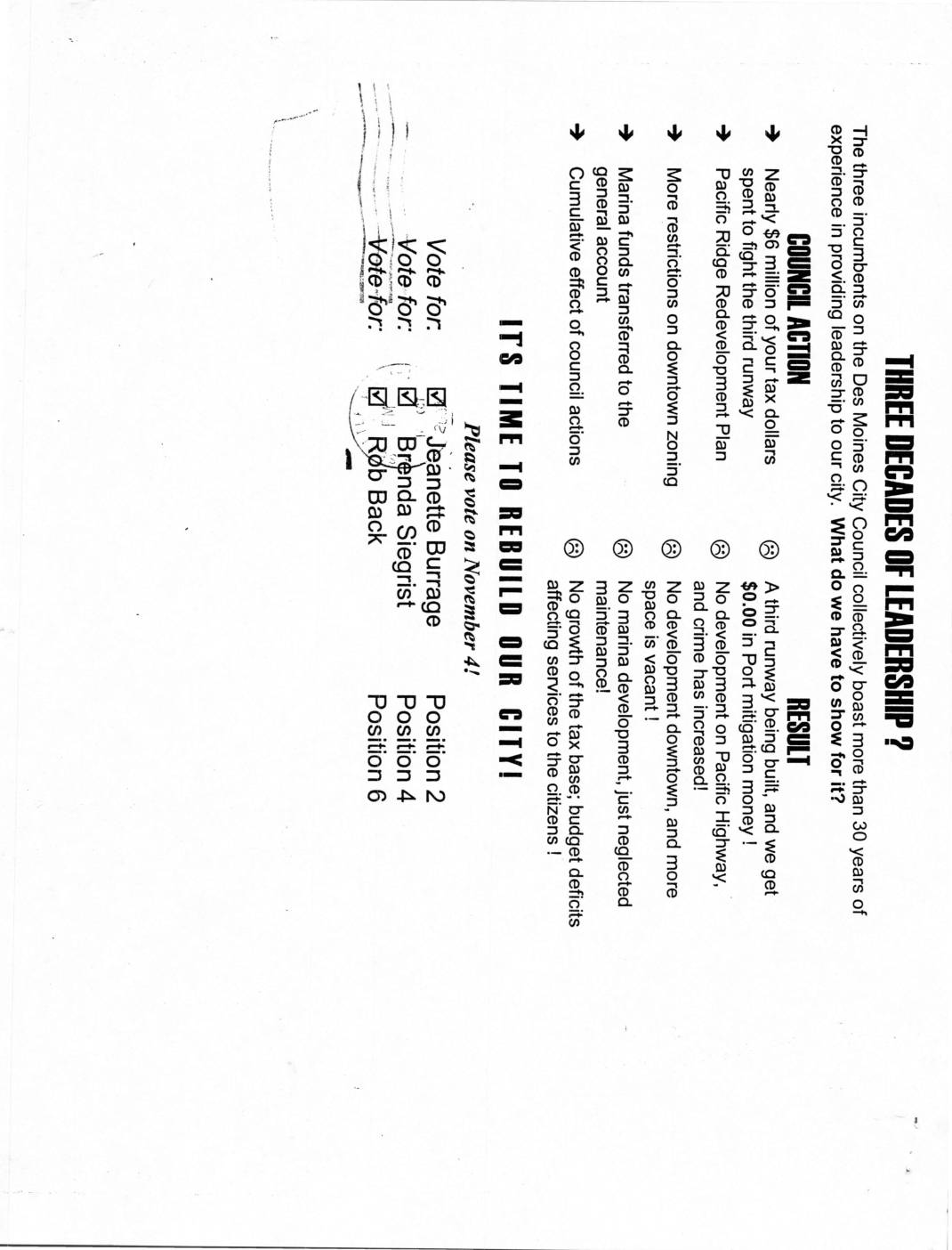
Three decades of leadership? Campaign mailer for Jeanette Burrage, Brenda Siegrist, and Rob Back
A political mailer from the 'Friends of Des Moines Committee' urges residents to vote on November 4th for three City Council candidates — Jeanette Burrage, Brenda Siegrist, and Rob Back — running for Positions 2, 4, and 6 respectively. The flyer criticizes the incumbent council members' three decades of leadership, citing failures such as nearly $6 million in tax dollars spent fighting a third runway at the airport with no mitigation money received, marina funds diverted to the general account, and no downtown development. The candidates campaign under the slogan 'It's Time to Rebuild Our City,' positioning themselves as a change from stagnant growth and budget deficits affecting Des Moines, Washington. -
 2023-08-22
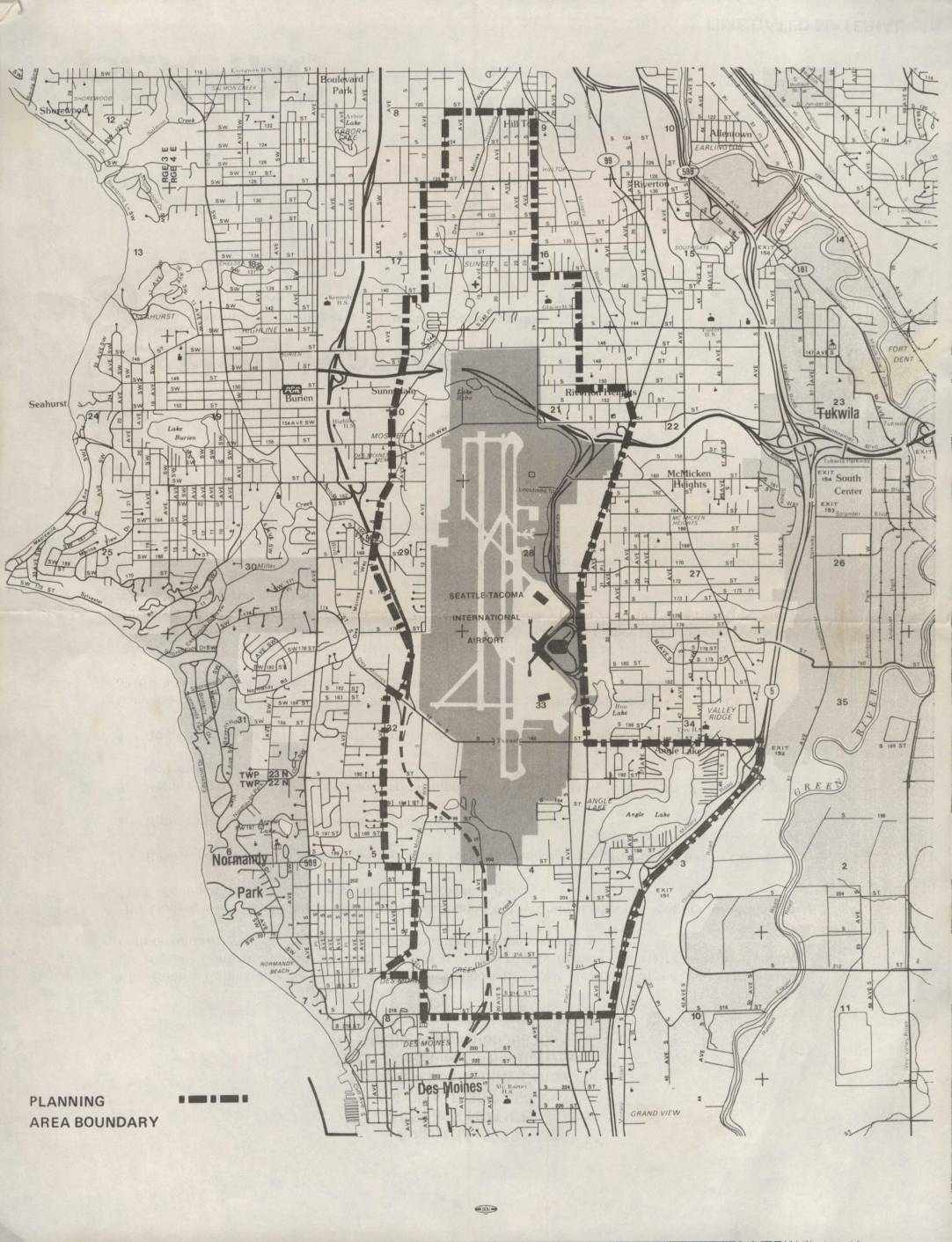
Seattle-Tacoma International Airport Planning Area Boundary Map
This map depicts the planning area boundary surrounding Seattle-Tacoma International Airport and its neighboring communities, including Burien, Normandy Park, Des Moines, Tukwila, and Riverton. The shaded region highlights the airport's footprint and immediate environs, while the dashed boundary line delineates the study area used for airport-related land use and noise planning purposes. The document appears to be part of an environmental or community planning effort assessing the impact of Sea-Tac Airport on surrounding residential and commercial areas. -
 2023-08-20
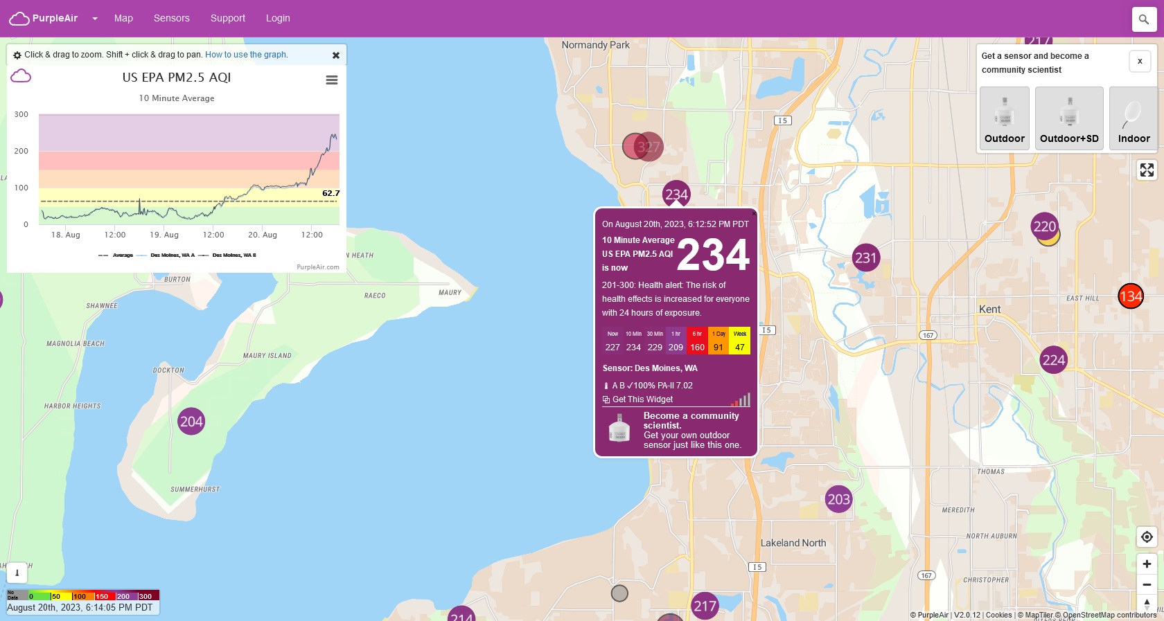
Air Quality Map – Des Moines, WA Area
Screenshot of the PurpleAir air quality monitoring platform taken August 20th, 2023 at 6:14 PM PDT, showing a 10-minute average US EPA PM2.5 AQI of 234 at the Des Moines, WA sensor, classified as a health alert (201-300 range). The graph panel shows AQI rising sharply over the preceding days, with surrounding sensors in the Sea-Tac/Kent/South King County area also showing very high readings (204–327).