TagSR509(120)
-
 2024-08-05
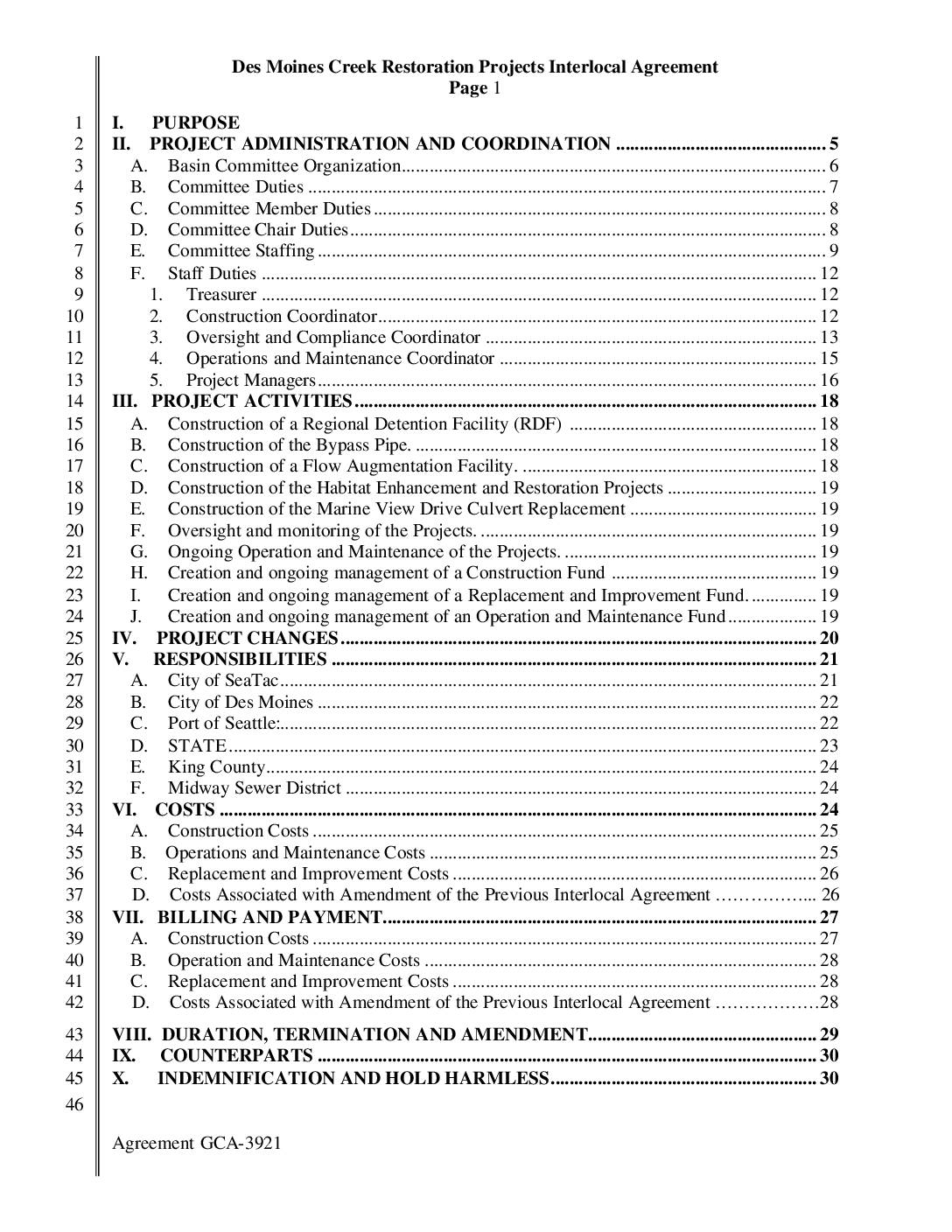
Des Moines Creek Basin Restoration Projects Interlocal Agreement (Agreement GCA-3921)
The Des Moines Creek Basin Restoration Projects Interlocal Agreement (GCA-3921) is a cooperative agreement between the City of Des Moines, City of SeaTac, Port of Seattle, Washington State Department of Transportation, and King County to fund and manage several creek restoration projects. The projects aim to control stream flows, improve water quality and fish habitat, and address drainage and flooding problems in the Des Moines Creek Basin. The agreement also serves as part of the stormwater management strategy for the SR 509 highway extension, with costs and responsibilities shared among the participating agencies. -
 2024-06-25
SR 509 Completion Project: Des Moines Historical Society Presentation
A June 2024 WSDOT presentation to the Des Moines Historical Society outlines the SR 509 Completion Project, part of the broader Puget Sound Gateway Program alongside the SR 167 Completion Project in Pierce County. The project aims to improve freight and passenger connections between the Port of Seattle, Sea-Tac Airport, and key regional distribution centers in King County. The presentation covers the project's history and two construction stages, with WSDOT emphasizing efficiencies gained by managing both highway projects under a single program. -
 2024-02-05
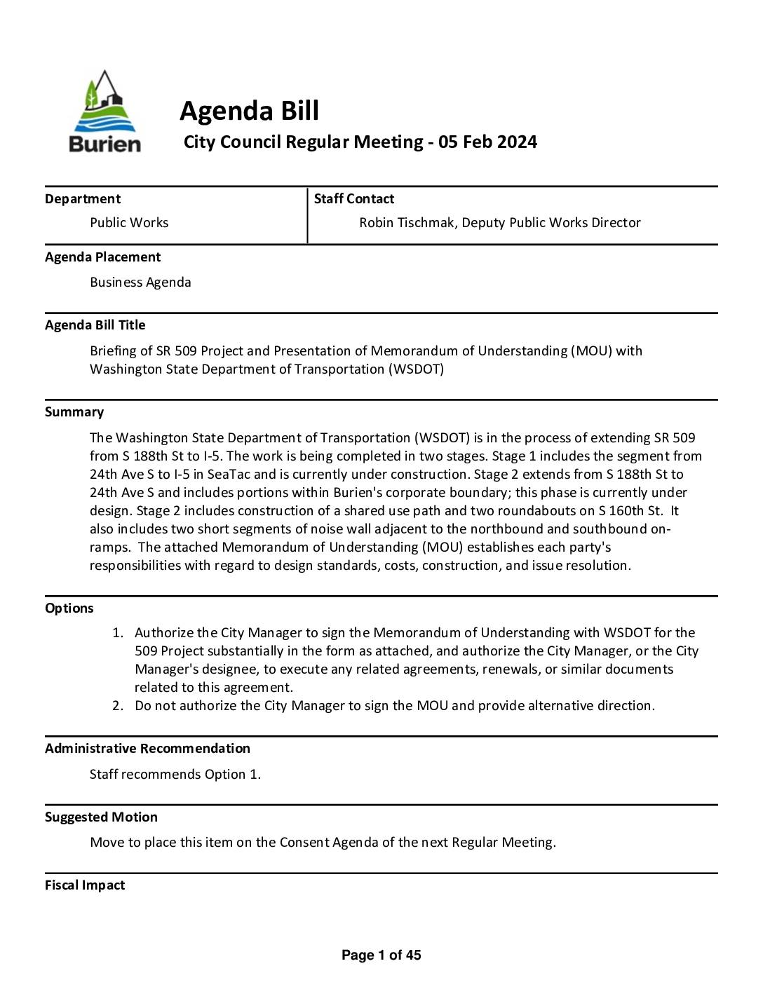
Briefing of SR 509 project and presentation of memorandum of understanding (MOU) with Washington State Department of Transportation (WSDOT)
The City of Burien and the Washington State Department of Transportation (WSDOT) have entered into a Memorandum of Understanding regarding the SR 509 Completion Project Stage 2, which extends the highway from S 188th Street to 24th Avenue South, with portions running through Burien's city limits. The project includes construction of a shared-use path, two roundabouts on S 160th Street, and short noise wall segments adjacent to highway on-ramps. WSDOT is responsible for costs associated with the proposed design and construction, while Burien bears costs for any changes it requests beyond standard design requirements. -
 2023-12-07
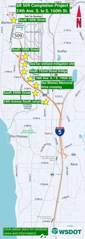
SR 509 Completion Project: 24th Ave. S. to S. 160th St.
The SR 509 Completion Project extends State Route 509 from 24th Avenue South to South 160th Street near Sea-Tac Airport, adding new interchanges, roundabouts, and connections to southbound I-5 and toward Seattle. Key features include a new interchange at South 188th Street with a shared-use path and Lake to Sound Trail access, as well as a South 160th Street interchange with noise walls to protect nearby residents. The project also includes wetland mitigation sites and infrastructure improvements along the Des Moines Memorial Drive corridor. -
 2023-12-05
SR 509 project completion
https://wsdot.wa.gov/construction-planning/search-projects/sr-509-completion-project -
Tribes call for national ban on salmon-killing chemical in car tires
by John Ryan Three Northwest tribes have petitioned the federal government to ban a salmon-killing chemical found in tires and urban streams worldwide. As car and truck tires wear and leave behind skid marks and tire dust, the rubber stabilizer known as 6PPD turns into 6PPD-quinone (also called 6PPD-q), one of the most toxic substances -
 2023-04-24
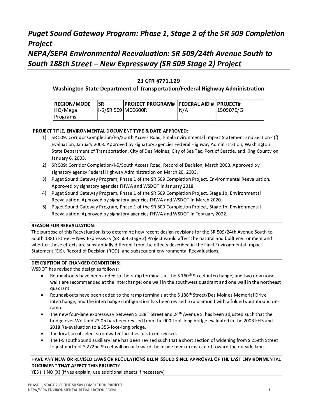
Puget Sound Gateway Program: Phase 1, Stage 2 of the SR 509 Completion Project NEPA/SEPA Environmental Reevaluation form
South Access Road Section 4(f) -
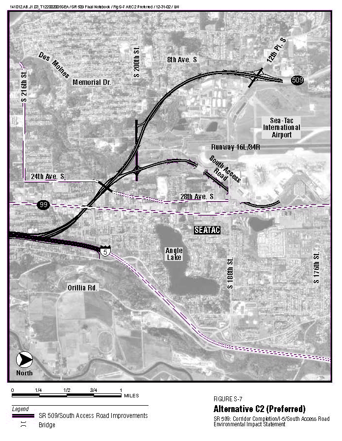
Page 33 from SR-509-FEIS-ocr Alternative C2 (preferred)
This is Figure S-7 from the SR 509 Corridor Completion/I-5/South Access Road Environmental Impact Statement, showing the preferred Alternative C2 alignment. The aerial map depicts proposed SR 509 and South Access Road improvements near Sea-Tac International Airport, connecting to I-5 via Orillia Road, with key landmarks including Angle Lake, Runway 16L/34R, and surrounding streets in SeaTac, Washington, dated December 31, 2002. -
 2022-11-16
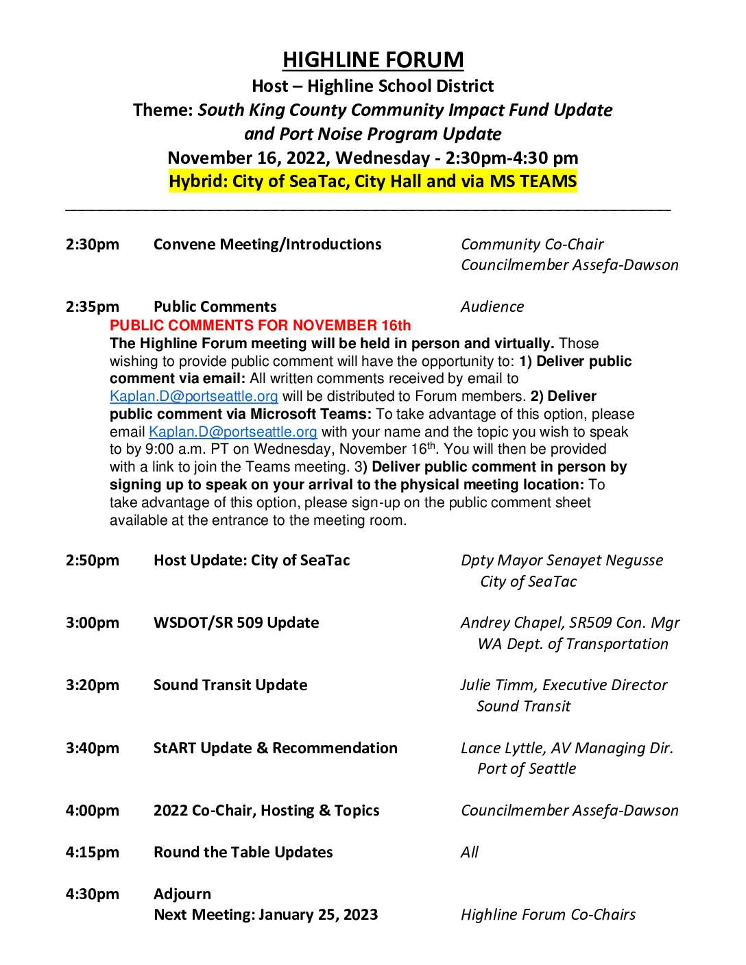
Highline Forum agenda: South King County Community Impact Fund update and Port Noise Program update
The Highline Forum met on November 16, 2022, hosted by the Highline School District at SeaTac City Hall, with a focus on the South King County Community Impact Fund and Port Noise Program updates. The agenda included presentations from the Port of Seattle, Sound Transit, and the Washington Department of Transportation, alongside public comment opportunities offered both in-person and virtually via Microsoft Teams. The document also lists six bimonthly Highline Forum meeting dates scheduled throughout 2023, each running from 2:30pm to 4:30pm. -
 2022-11-16
SR 509 Completion Project: Highline Forum presentation
A November 2022 WSDOT presentation by Construction Manager Andrey Chepel outlines progress on the SR 509 Completion Project, part of the broader Puget Sound Gateway Program in King County. The project aims to improve freight and passenger connections to the Port of Seattle and Sea-Tac Airport area by completing a long-planned highway extension. The presentation covers construction stages 1a and 1b, upcoming Stage 2 procurement, and community engagement efforts.