TagSea-Tac Communities Plan(215)
-
 1978-01-01
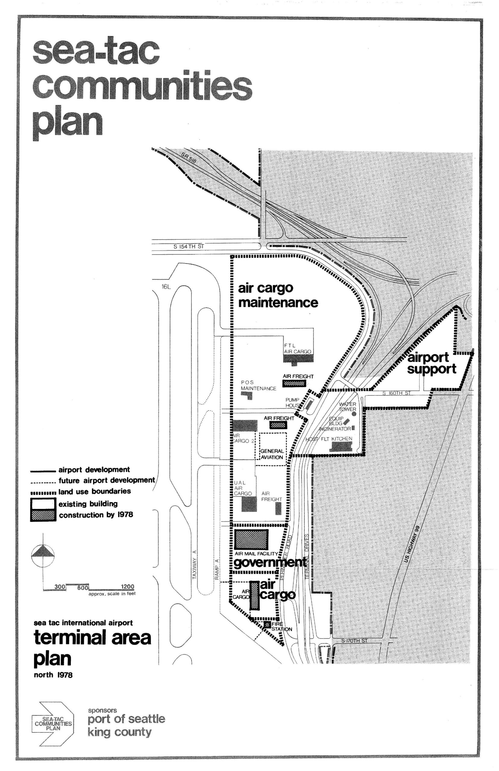
Sea-Tac International Airport North Terminal Area Plan Map, 1978
A land-use planning map from the Sea-Tac Communities Plan showing the north terminal area of Sea-Tac International Airport as of 1978, delineating zones for air cargo maintenance, airport support, government, and general aviation facilities, with existing buildings and planned construction indicated. The plan was sponsored by the Port of Seattle and King County, and shows key roadways including S 154th St, S 160th St, S 170th St, and US Highway 99. -
 1977-09-01
Planning for the airport and its environs: The Sea-Tac success story
In the absence of such guidance, what may be termed a "let them sue" approach was essentially followed by the Port during the period from 1957 to 1972. -
FAA ‘The Sea-Tac Success Story’ 09/1977
A draft cover page for a report titled 'Planning for the Airport and Its Environs: The Sea-Tac Success Story,' prepared for the Federal Aviation Administration Office of Environmental Quality in Washington, D.C. The report was prepared by Peat, Marwick, Mitchell & Co. of San Mateo, California, and dated September 1977. -
 1977-05-26
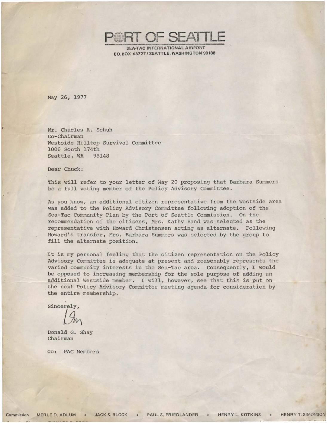
Letter to Charles Schuh regarding Barbara Summers and Policy Advisory Committee membership
In this May 26, 1977 letter, Port of Seattle Chairman Donald G. Shay responds to a request from the Westside Hilltop Survival Committee to make Barbara Summers a full voting member of the Policy Advisory Committee (PAC). Shay explains that Summers currently serves as an alternate representative for the Westside area and expresses his personal opposition to expanding PAC membership solely to add another Westside representative. He agrees, however, to place the matter on the next PAC meeting agenda for consideration by the full membership. -
 1977-05-12
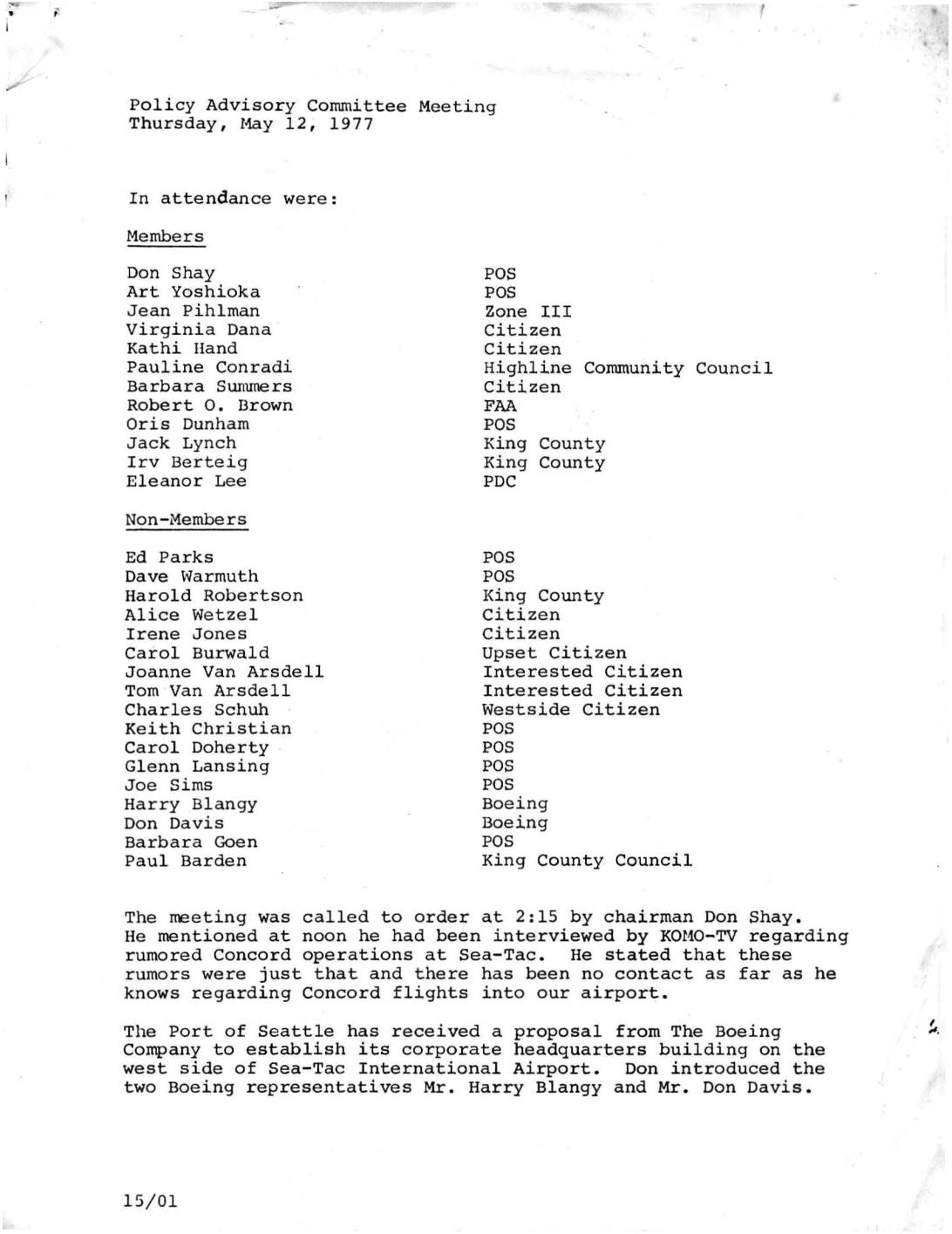
Policy Advisory Committee Meeting Minutes: Boeing Corporate Headquarters Proposal at Sea-Tac Airport
Minutes from a May 12, 1977 Policy Advisory Committee meeting at Sea-Tac International Airport, covering Boeing's preliminary proposal to build its corporate headquarters on approximately 12 acres on the airport's west side. The proposal required an amendment to the Sea-Tac/Communities Plan and raised community concerns about traffic, parking, landscaping, and the potential relocation of a planned viewpoint park. Port of Seattle officials emphasized that any development would need extensive buffering, no westerly road access, and maximum community participation in the decision-making process. -
 1977-03-31
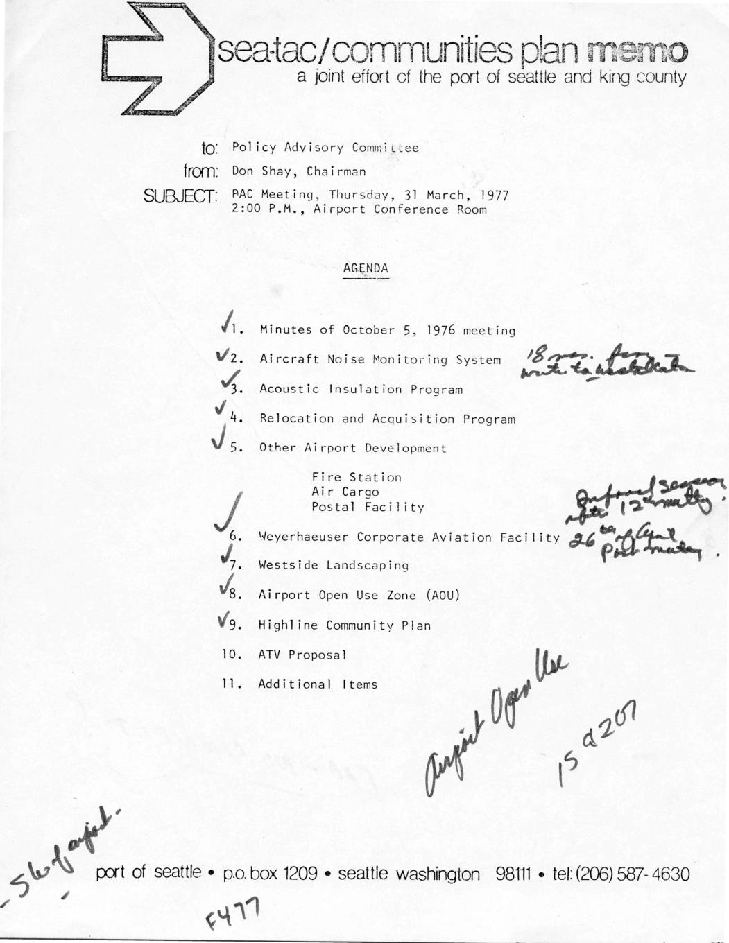
PAC meeting agenda, 31 March 1977
This is a 1977 agenda memo from Don Shay, Chairman, calling a Policy Advisory Committee (PAC) meeting at Sea-Tac Airport on March 31, 1977. The meeting covered key airport development and community impact topics, including an Aircraft Noise Monitoring System, Acoustic Insulation Program, Relocation and Acquisition Program, and various facility developments such as a Fire Station, Air Cargo, and Postal Facility. Additional agenda items included the Weyerhaeuser Corporate Aviation Facility, Westside Landscaping, the Airport Open Use Zone, the Highline Community Plan, and an ATV Proposal, reflecting the joint planning efforts of the Port of Seattle and King County. -
 1977-03-14
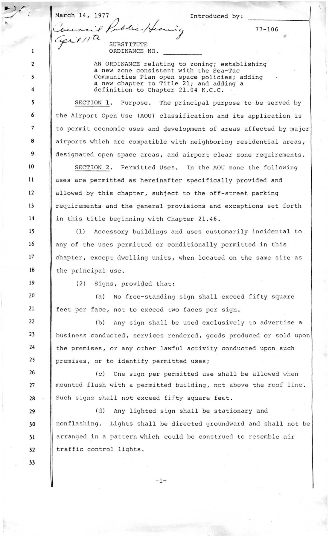
Substitute ordinance establishing Airport Open Use (AOU) zoning classification
Ordinance 77-106, introduced in March 1977, established the Airport Open Use (AOU) zoning classification for areas around major airports like Sea-Tac, allowing compatible economic activities such as agriculture, public parks, commercial recreation, and public utility facilities while protecting neighboring residential areas. The ordinance sets strict conditions on signage, building setbacks, landscaping buffers, and livestock density to minimize conflicts with adjacent residential zones. Uses like golf courses, outdoor storage, and cemeteries require conditional use permits when the property borders residential (R or S) zones. -
 1976-09-20
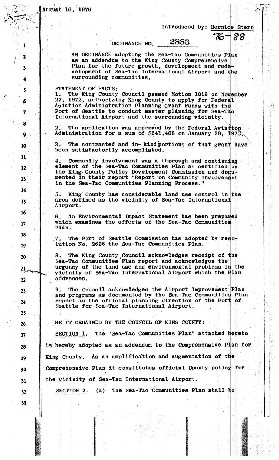
Ordinance No. 2883: An ordinance adopting the Sea-Tac Communities Plan
★ 32King County Ordinance No. 2883, passed in September 1976, officially adopted the Sea-Tac Communities Plan as an addendum to the King County Comprehensive Plan, establishing it as the guiding policy for land use, development, and redevelopment around Sea-Tac International Airport. The plan, developed with Federal Aviation Administration grant funding and extensive community involvement, addresses noise programs, open space acquisition areas, and compatible land use in the airport's vicinity. It required coordination between King County and the Port of Seattle on any future changes, with the Highline Communities Plan designated as the official zoning guideline for implementing its land use concepts. -
 1976-09-01
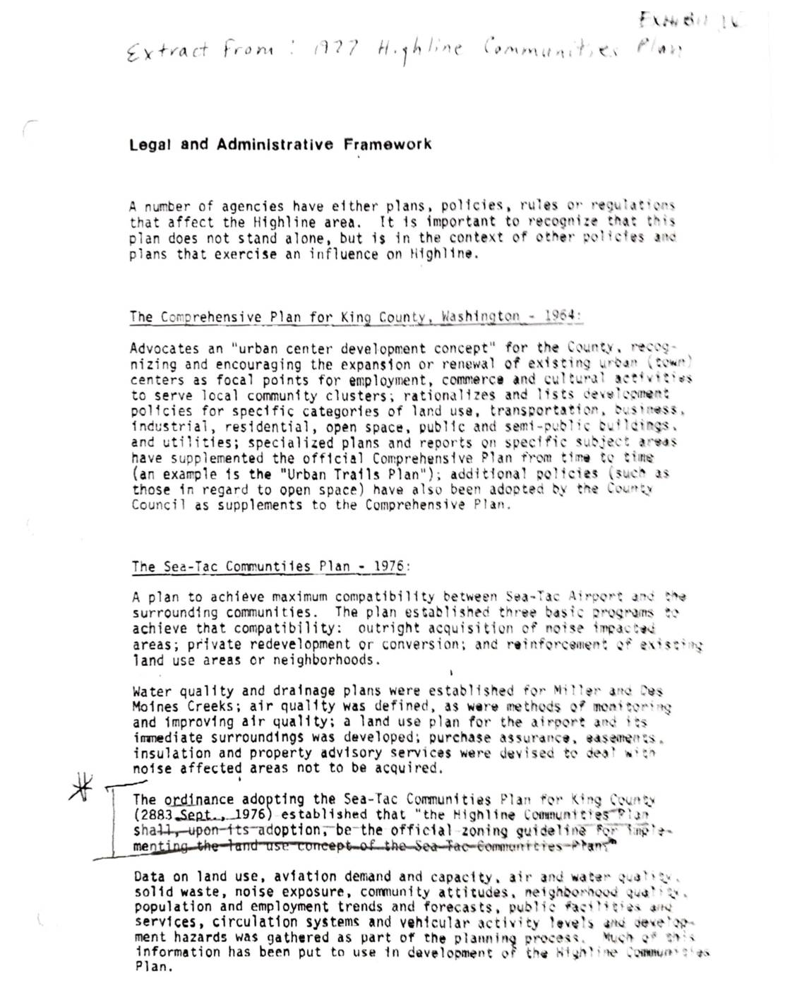
Exhibit 16: Highline Communities Plan — Legal and Administrative Framework, Committee Members, and Forward Thrust Fund Reallocation Request (1976–1977)
This document contains materials from the 1977 Highline Communities Plan, outlining the legal and administrative framework governing the Highline area near Sea-Tac Airport in King County, Washington. It references key planning documents including the 1964 King County Comprehensive Plan and the 1976 Sea-Tac Communities Plan, which sought to balance airport operations with surrounding residential communities through noise mitigation measures such as property acquisition, insulation programs, and land use controls. A 1976 memo from the Highline Communities Plan Committee also requests that Forward Thrust funds not be reallocated until the Highline Communities Plan was formally adopted. -
 1976-08-27
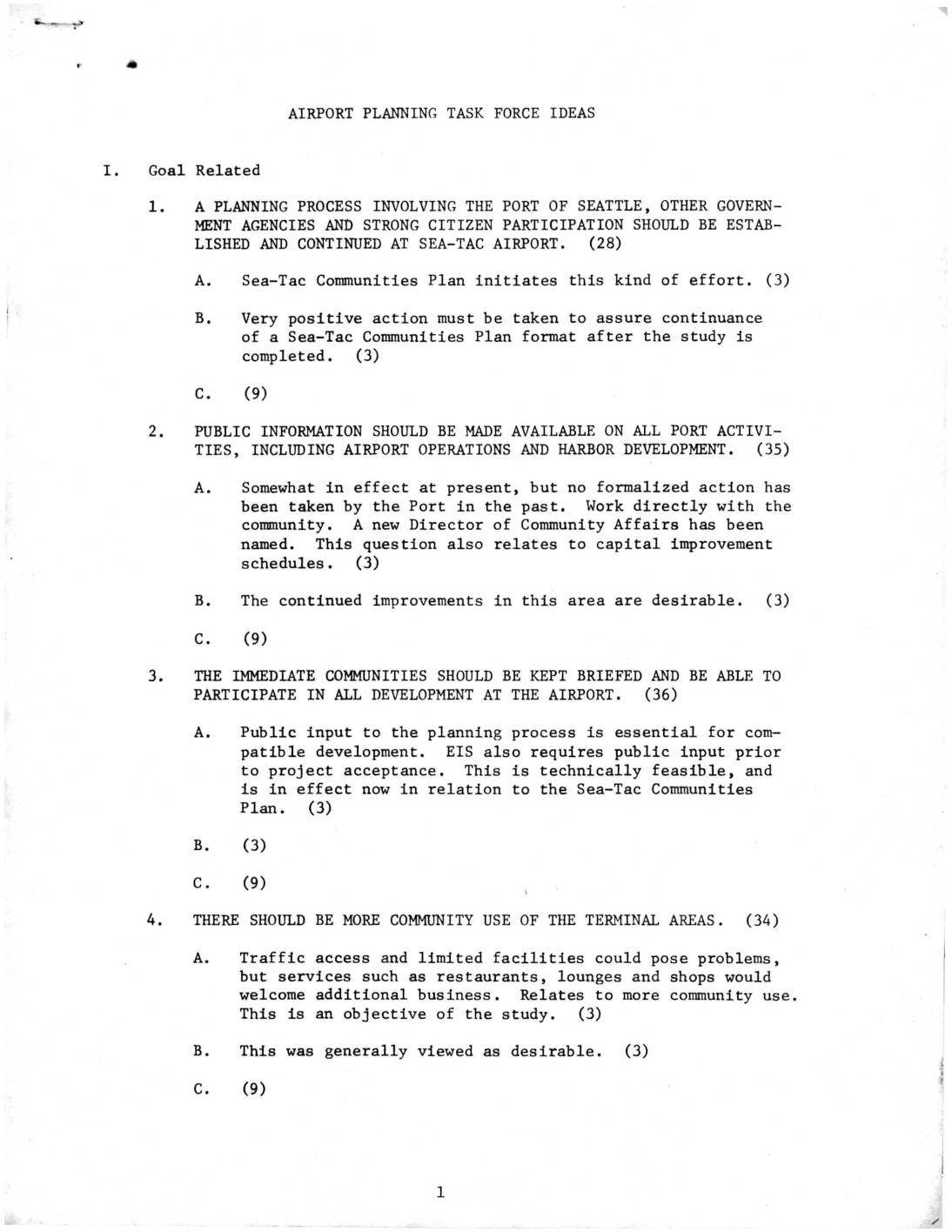
Airport Planning Task Force Ideas
This document outlines planning ideas from an Airport Planning Task Force focused on Sea-Tac Airport, covering goals such as increased citizen participation in airport decision-making, greater public access to Port of Seattle information, and more community use of terminal facilities. It also addresses proposed airport development concepts, including cargo tunnels linking the east and west sides of the airport, pedestrian access improvements, a public aircraft-viewing park, and guidance on where freight and cargo facilities should be located. The task force emphasized collaboration between the Port of Seattle, government agencies, and local communities throughout the planning process.