TagSea-Tac Airport(1855)
-
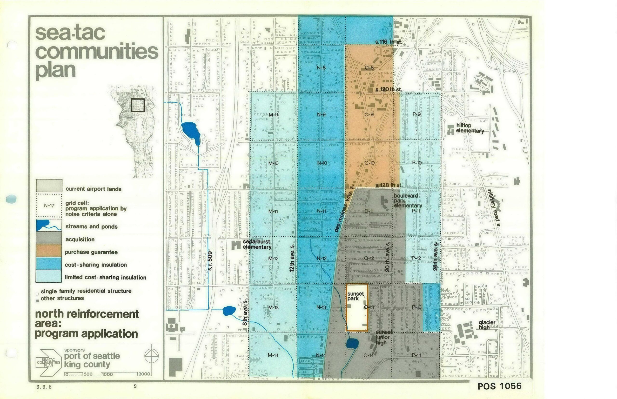
STCP North Reinforcement Area Program Application Map (Page 9)
This planning map, document number POS 1056 (page 9, section 6.6.5), was produced under the Sea-Tac Communities Plan sponsored by the Port of Seattle and King County. It depicts the North Reinforcement Area program application, showing grid cells classified by noise-mitigation programs—including acquisition, purchase guarantee, cost-sharing insulation, and limited cost-sharing insulation—across neighborhoods near Seattle-Tacoma International Airport, with landmarks such as Cedarhurst Elementary, Boulevard Park Elementary, Hilltop Elementary, Glacier High, and Sunset Junior High identified. -
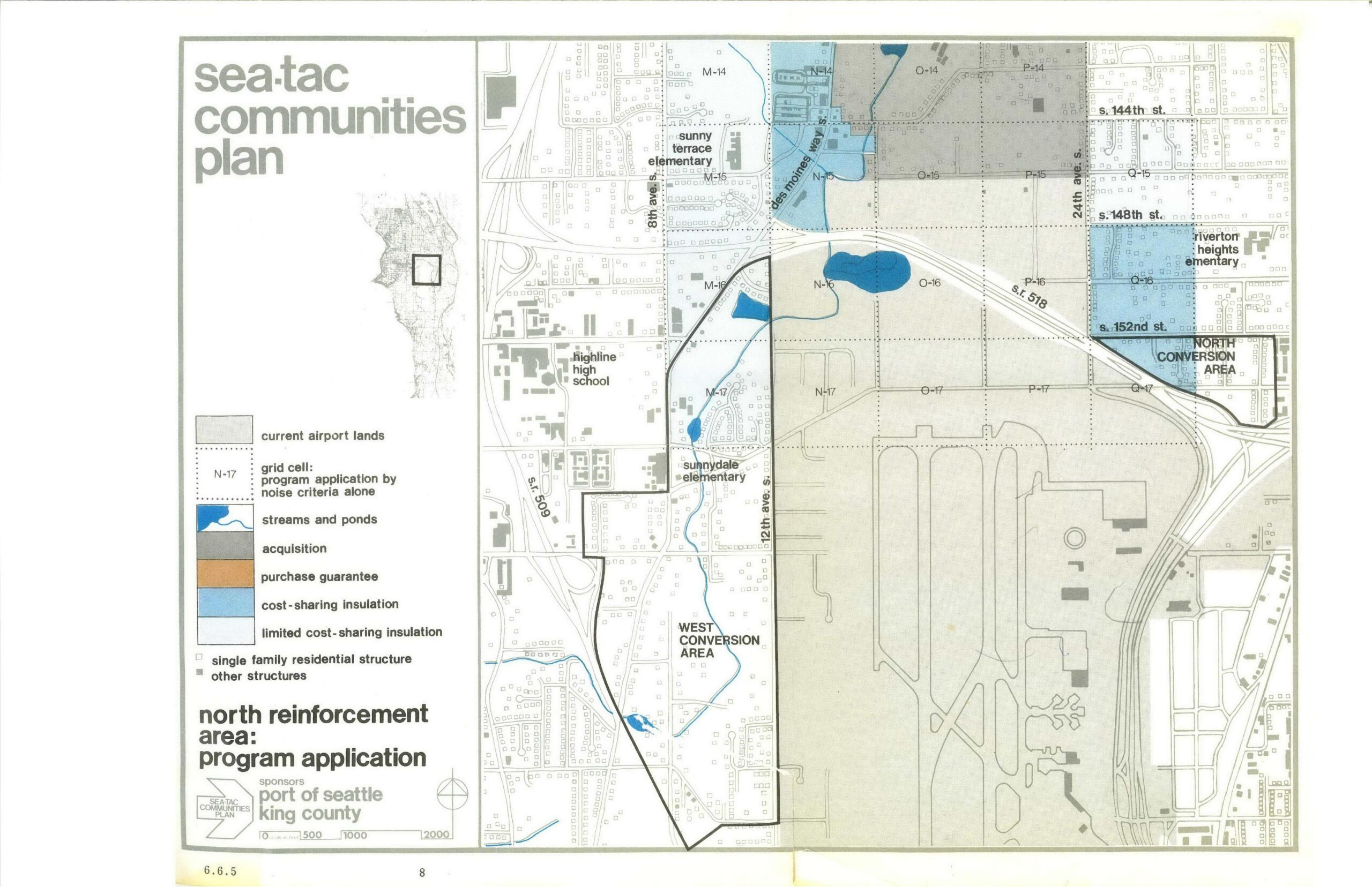
STCP North Reinforcement Area Program Application Map — Sea-Tac Communities Plan
A planning map (page 8, document section 6.6.5) from the Sea-Tac Communities Plan, sponsored by the Port of Seattle and King County, depicting the North Reinforcement Area program application around Seattle-Tacoma International Airport. The map shows land-use categories including current airport lands, acquisition zones, cost-sharing insulation areas, conversion areas (West and North), streams and ponds, and nearby landmarks such as Highline High School, Sunny Terrace Elementary, Sunnydale Elementary, and Riverton Heights Elementary, with a grid cell reference system and scale bar. -
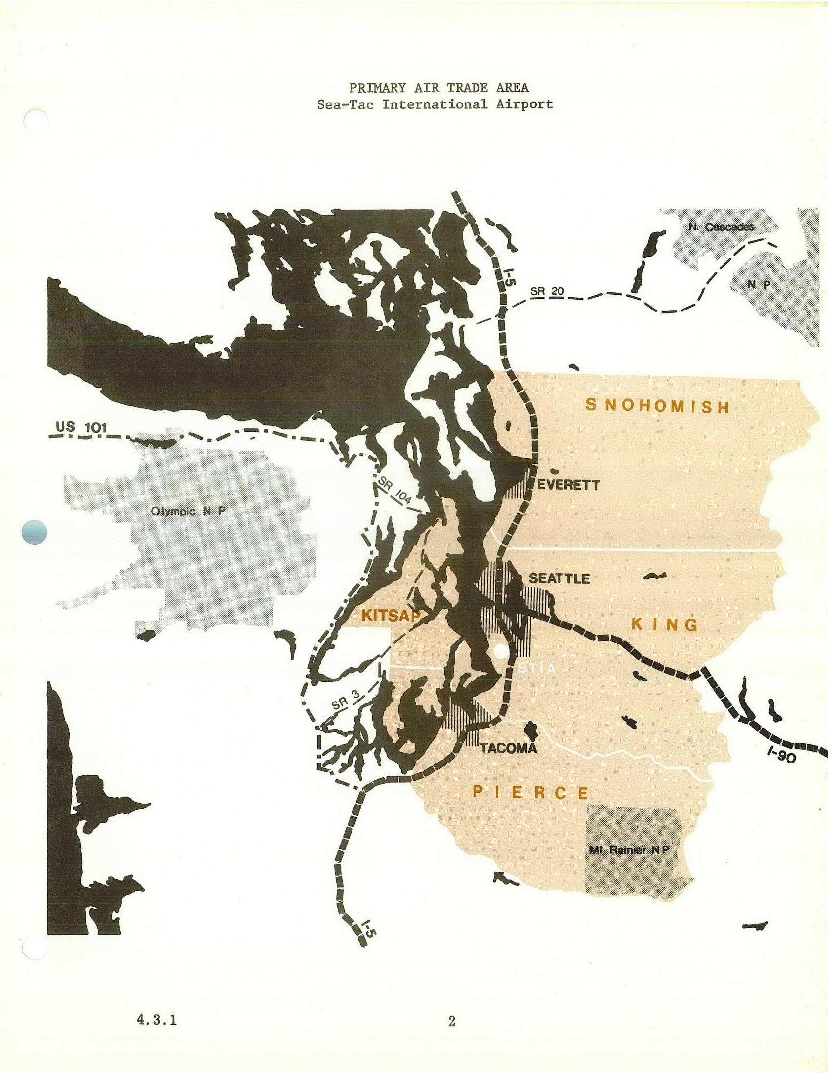
Primary Air Trade Area Planning Map – Sea-Tac Airport
A planning map labeled 'PRIMARY AIR TRADE AREA – Sea-Tac International Airport' (document reference 4.3.1, page 2) delineating the primary air trade catchment zone in tan/orange shading across Snohomish, King, and Pierce counties, with Kitsap County partially included. Major highways (I-5, I-90, US 101, SR 20, SR 104, SR 3) and cities (Seattle, Tacoma, Everett) are marked, along with national parks (Olympic NP, Mt. Rainier NP, N. Cascades NP) shown as excluded areas. -
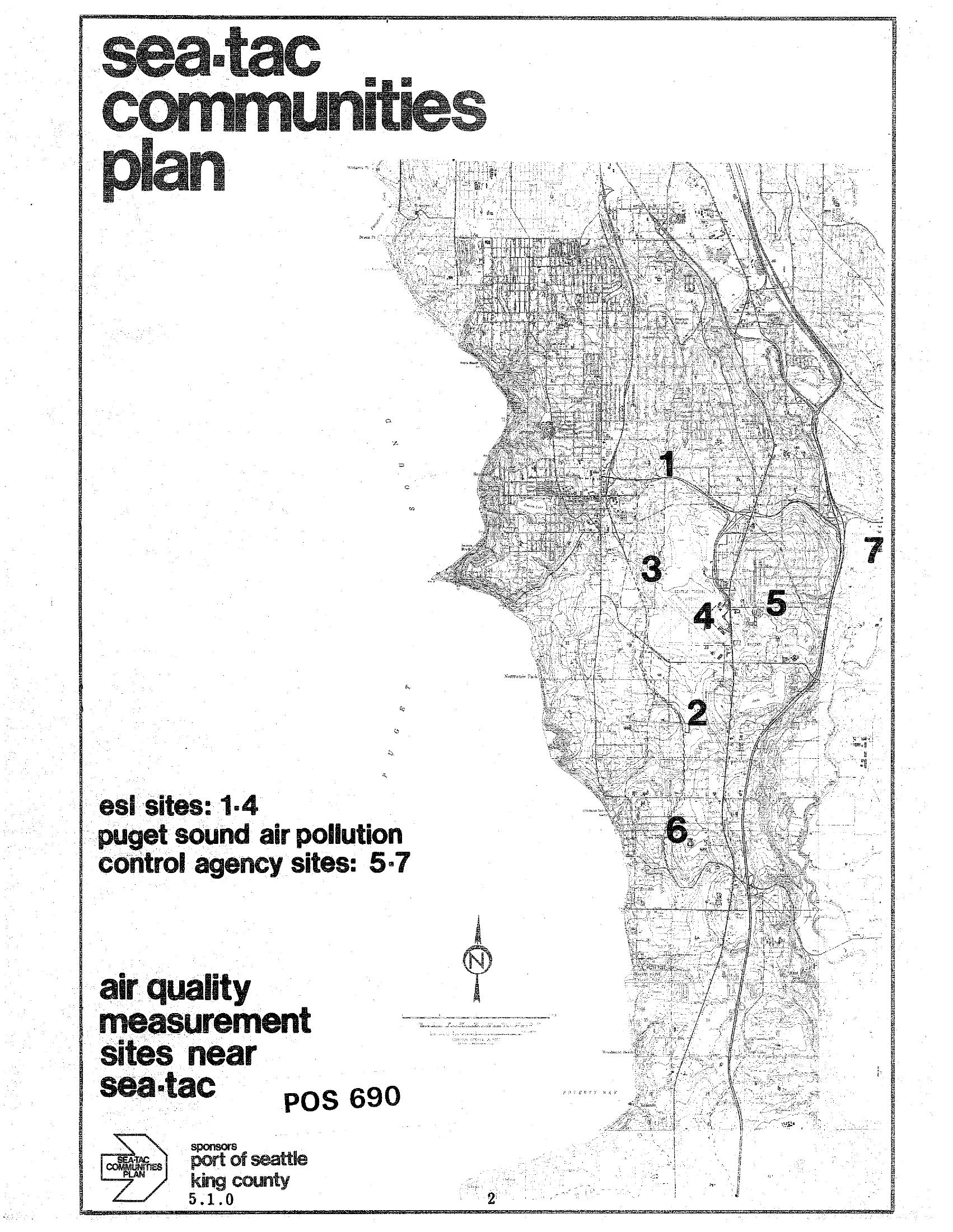
STCP Air Quality Measurement Sites Near Sea-Tac Airport
A map from the Sea-Tac Communities Plan (document reference POS 690, page 5.1.0) showing seven air quality measurement sites near Seattle-Tacoma International Airport. Sites 1–4 are ESL sites and sites 5–7 are Puget Sound Air Pollution Control Agency sites; the plan was sponsored by the Port of Seattle and King County. -
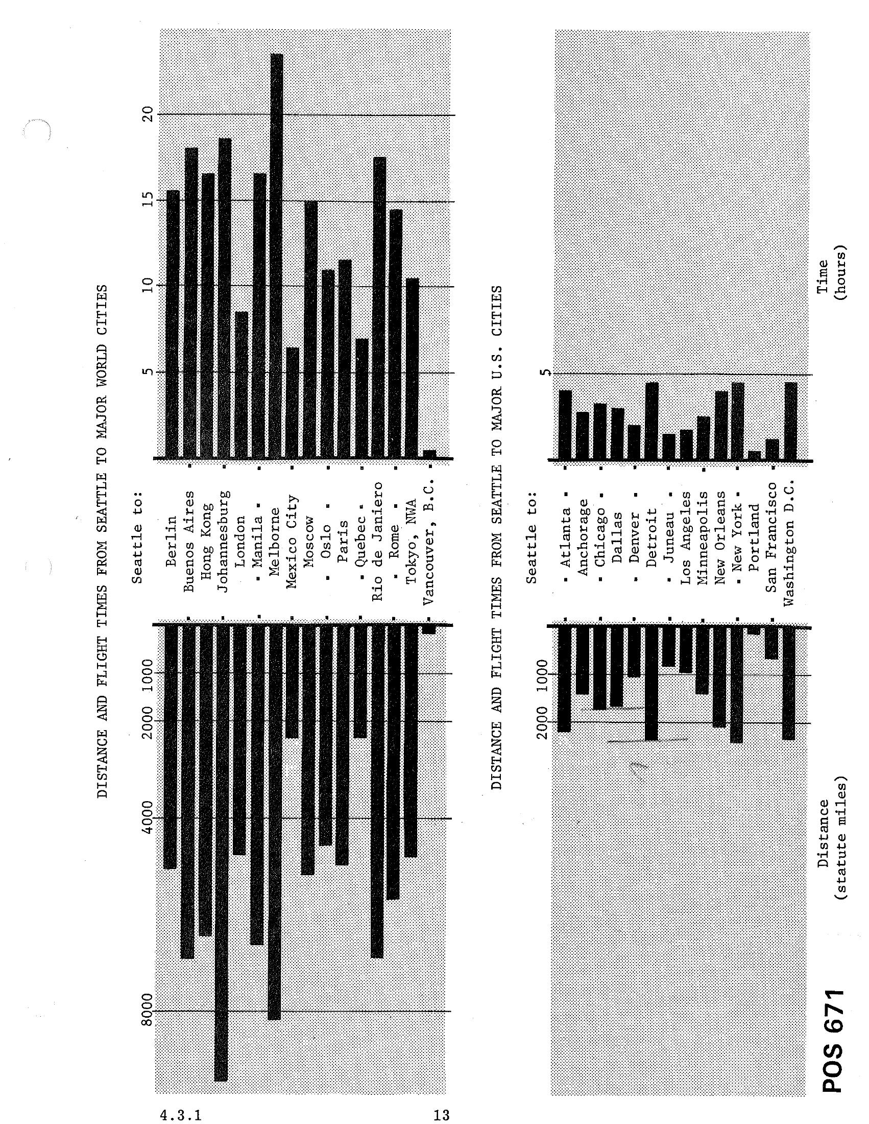
STCP Chapter 4.3.1 — Bar Charts: Distances and Flight Times from Seattle to Major World Cities and Major US Cities
Document POS 671 (page 4.3.1/13) contains two bar charts showing distances in statute miles and flight times in hours from Seattle to major world cities (including Berlin, Buenos Aires, Hong Kong, Johannesburg, London, Manila, Melbourne, Mexico City, Moscow, Oslo, Paris, Quebec, Rio de Janeiro, Rome, Tokyo, and Vancouver B.C.) and major U.S. cities (including Atlanta, Anchorage, Chicago, Dallas, Denver, Detroit, Juneau, Los Angeles, Minneapolis, New Orleans, New York, Portland, San Francisco, and Washington D.C.). -
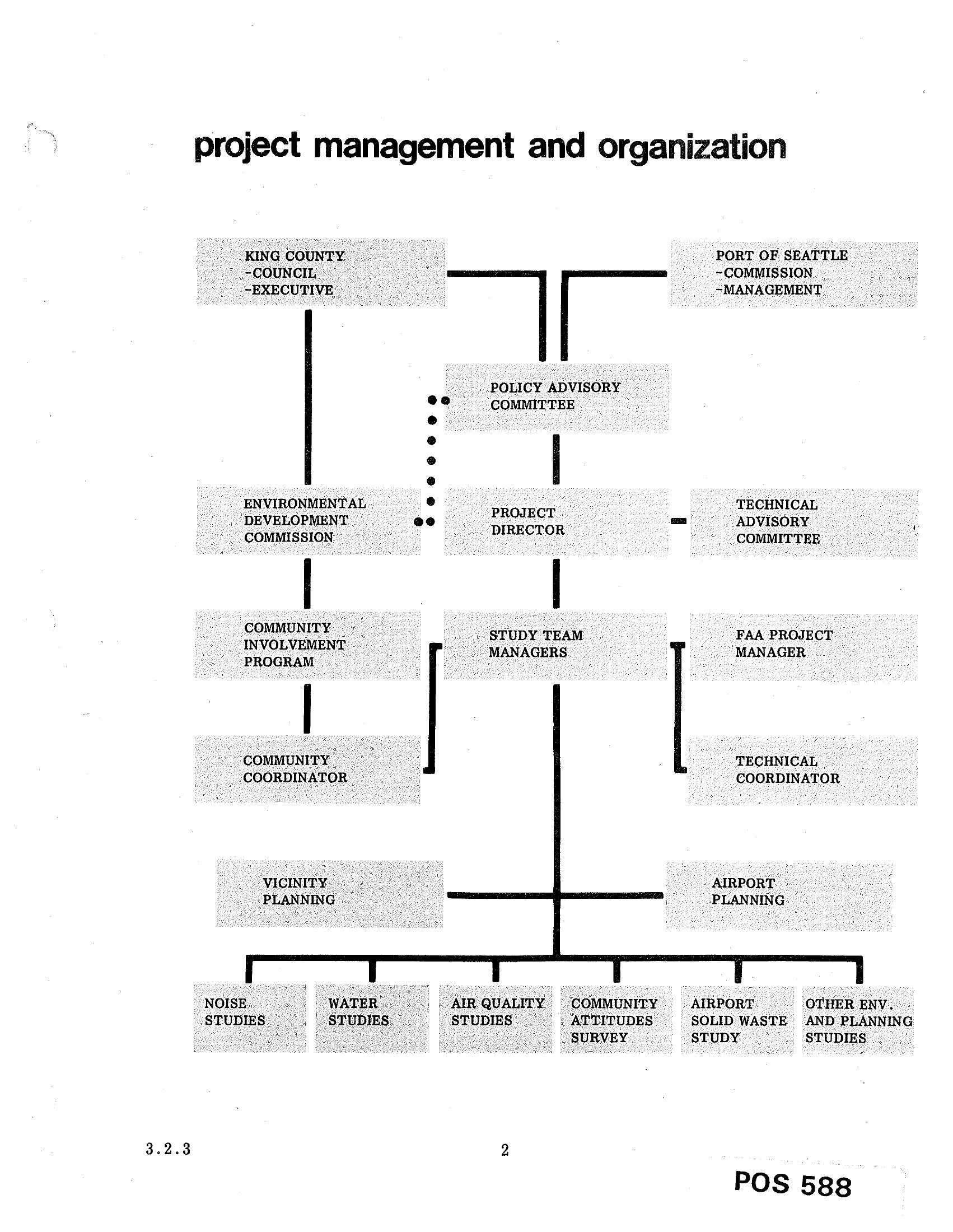
Sea-Tac Airport Environmental Study Project Management and Organization Chart
An organizational chart titled 'project management and organization' showing the hierarchy for a Sea-Tac Airport environmental study, with King County (Council/Executive) and Port of Seattle (Commission/Management) at the top, flowing through a Policy Advisory Committee and Project Director, down to Study Team Managers, and ending with study areas including Noise Studies, Water Studies, Air Quality Studies, Community Attitudes Survey, Airport Solid Waste Study, and Other Environmental and Planning Studies. Document is labeled POS 588, page 3.2.3. -
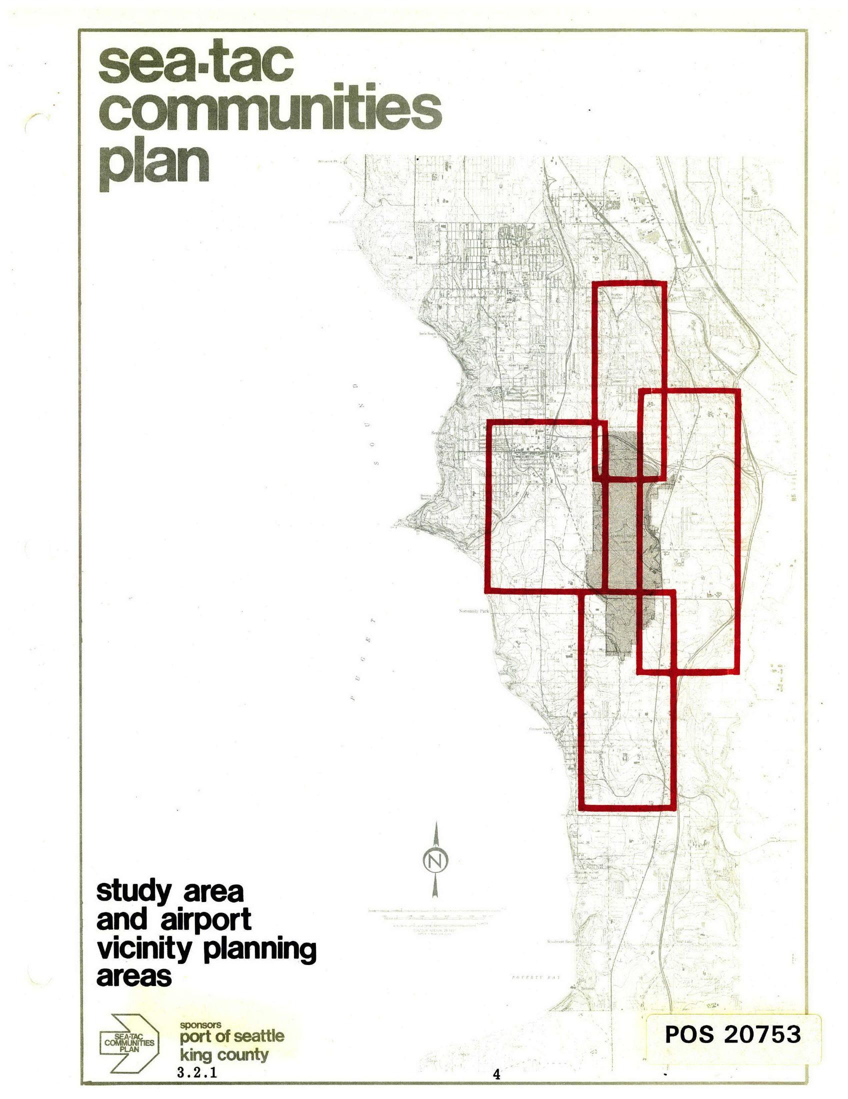
Sea-Tac Communities Plan Study Area and Airport Vicinity Planning Areas Map
Cover page of the Sea-Tac Communities Plan document (map sheet 3.2.1, page 4), jointly sponsored by the Port of Seattle and King County, showing a topographic base map of the Sea-Tac area with red-outlined rectangles delineating the study area and airport vicinity planning zones around Seattle-Tacoma International Airport. The document is catalogued as POS 20753. -
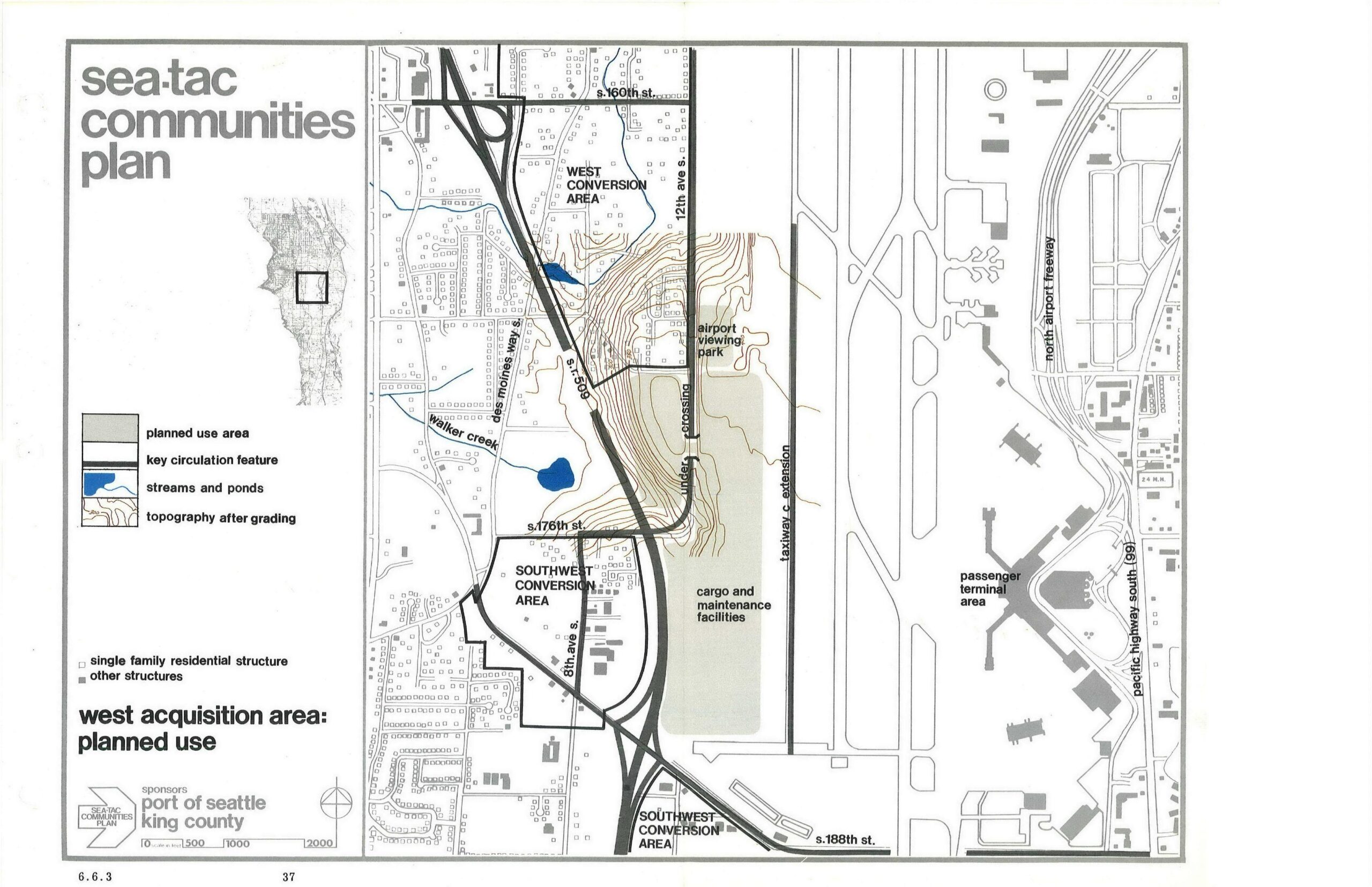
Sea-Tac Communities Plan West Acquisition Area Planned Land Use Map
This planning map, sponsored by the Port of Seattle and King County, depicts the West Acquisition Area planned land uses near Seattle-Tacoma International Airport, showing the West Conversion Area, Southwest Conversion Area, cargo and maintenance facilities, airport viewing park, taxiway C extension, and key circulation features including SR-509 and Des Moines Way S. The map is labeled as page 37, section 6.6.3 of the Sea-Tac Communities Plan. -
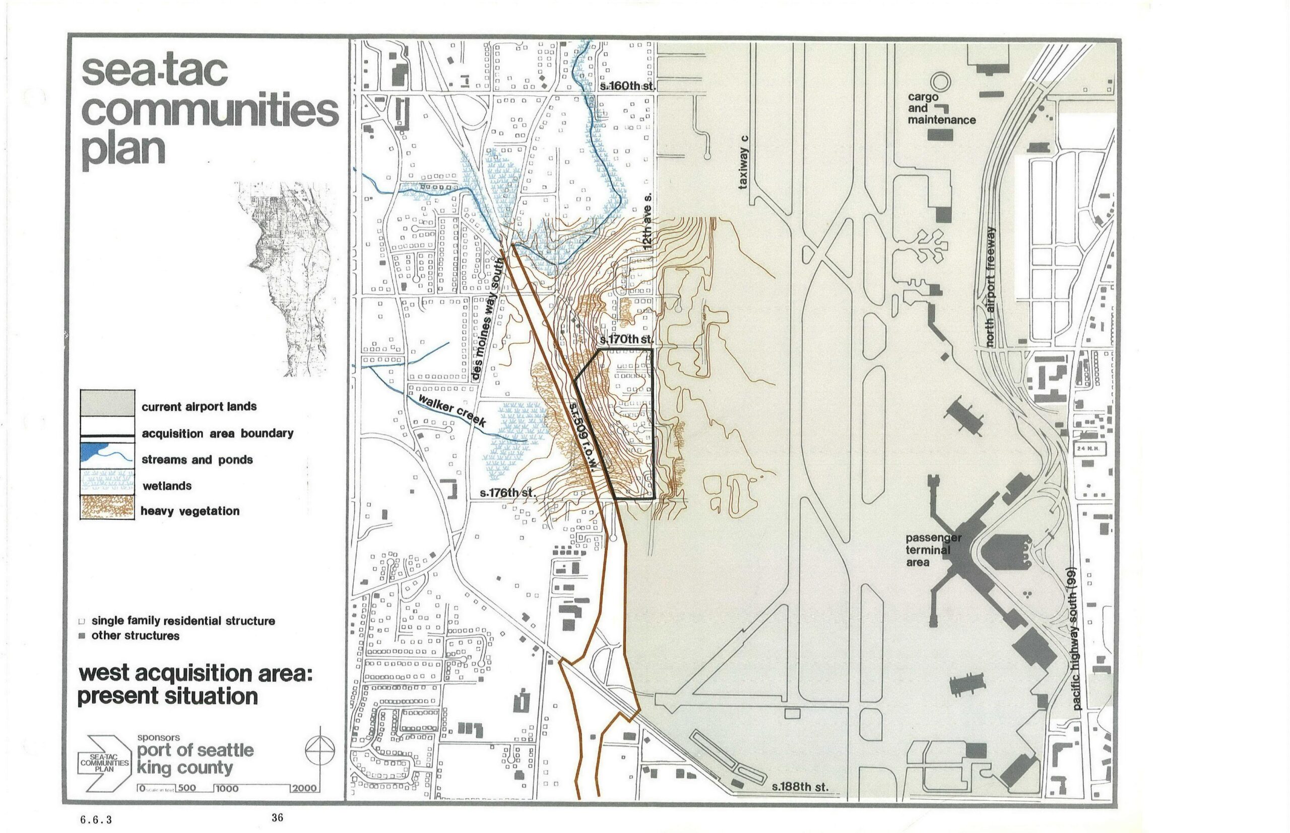
Sea-Tac Airport West Acquisition Area Present Situation Planning Map
This planning map, sponsored by the Port of Seattle and King County, depicts the West Acquisition Area adjacent to Seattle-Tacoma International Airport, showing current airport lands, acquisition area boundaries, streams, wetlands, heavy vegetation, and residential structures. Key features labeled include Walker Creek, Des Moines Way South, 12th Ave S, S. 170th St, S. 176th St, S. 188th St, Taxiway C, the North Airport Freeway, the Passenger Terminal Area, and the Cargo and Maintenance area. -
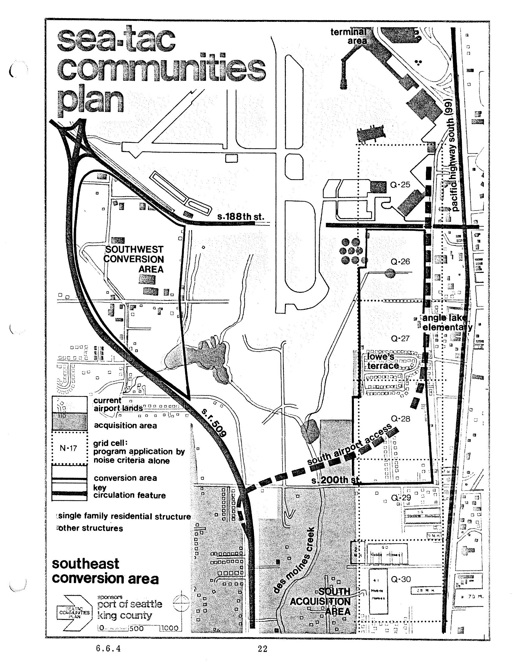
Sea-Tac Communities Plan Chapter 6 Page 22 — Southeast Conversion Area Map
This is page 22 (section 6.6.4) of the Sea-Tac Communities Plan, sponsored by the Port of Seattle and King County. The map depicts the Southeast Conversion Area near Seattle-Tacoma International Airport, showing grid cells, acquisition areas, current airport lands, key circulation features including S.R. 509 and South Airport Access road, and named landmarks such as Angle Lake Elementary, Lowe's Terrace, Des Moines Creek, and street references including S. 188th St. and S. 200th St.