TagSea-Tac Airport(2010)
-
 1975-04-22
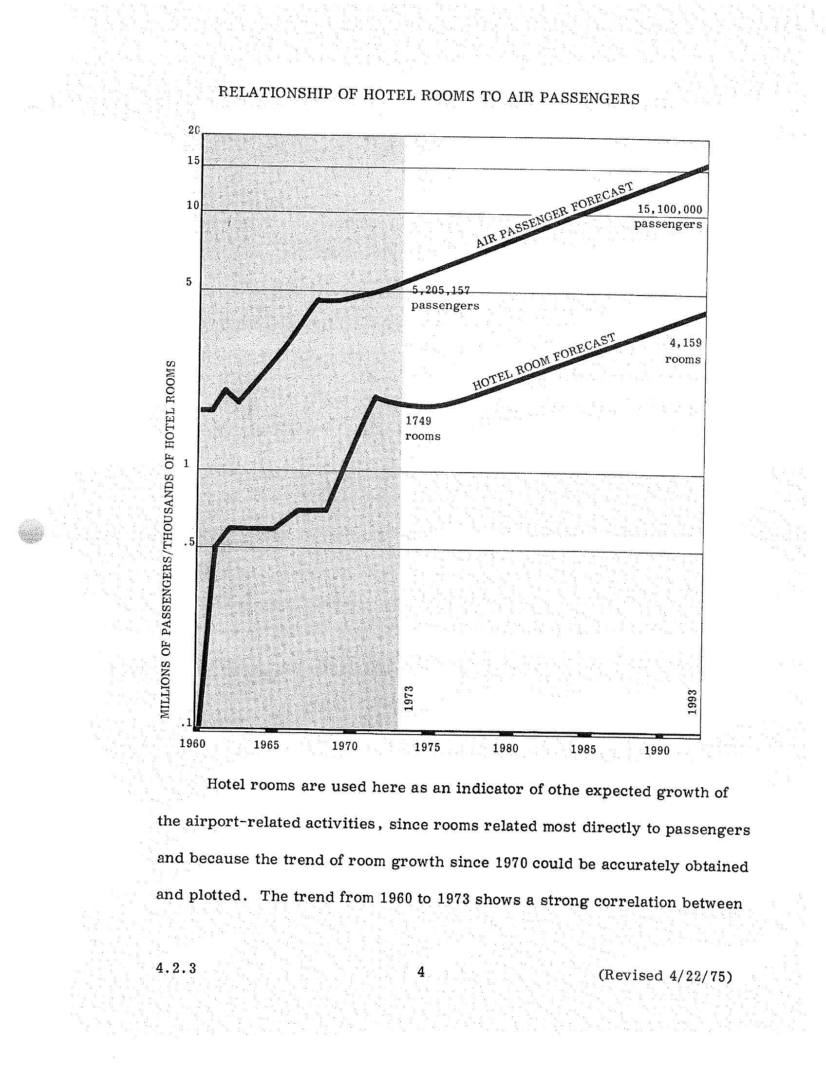
Sea-Tac Airport STCP Section 4.2.3: Air Passengers vs. Hotel Rooms Forecast, 1960–1993
A dual-axis chart from a Sea-Tac Airport planning document (revised April 22, 1975, section 4.2.3) plotting historical and forecast air passenger volumes against hotel room counts from 1960 to 1993. The chart projects growth from 5,205,157 passengers and 1,749 hotel rooms in 1973 to 15,100,000 passengers and 4,159 rooms by 1993, using hotel room growth as an indicator of airport-related activity expansion. -
 1975-04-22
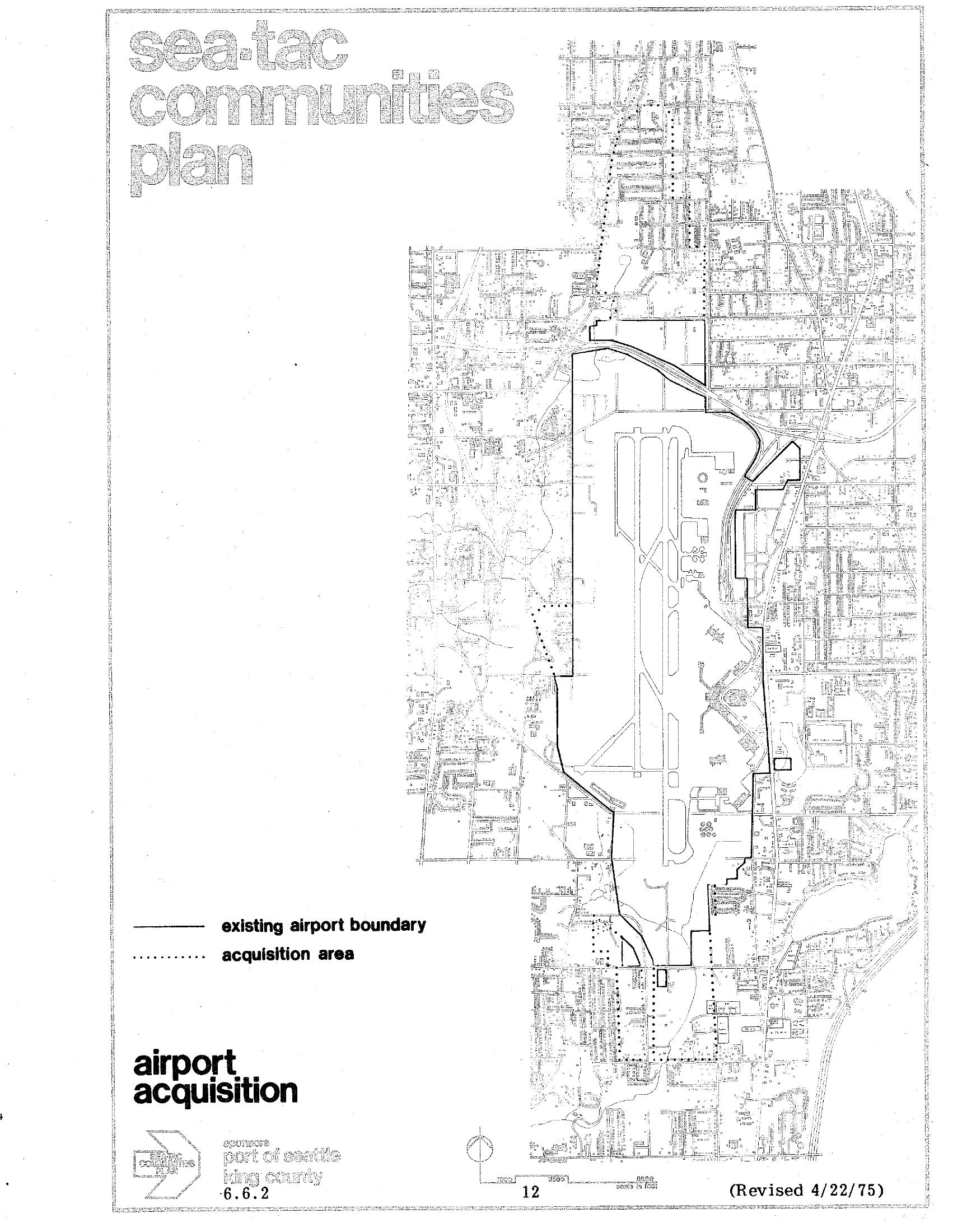
Sea-Tac Communities Plan Airport Acquisition Map (Plate 6.6.2), April 1975
Map plate 6.6.2 from the Sea-Tac Communities Plan, revised April 22, 1975, showing the existing Seattle-Tacoma International Airport boundary (solid line) and the proposed acquisition area (dotted line). The document is sponsored by the Port of Seattle and King County and is labeled 'airport acquisition,' page 12. -
 1975-04-22
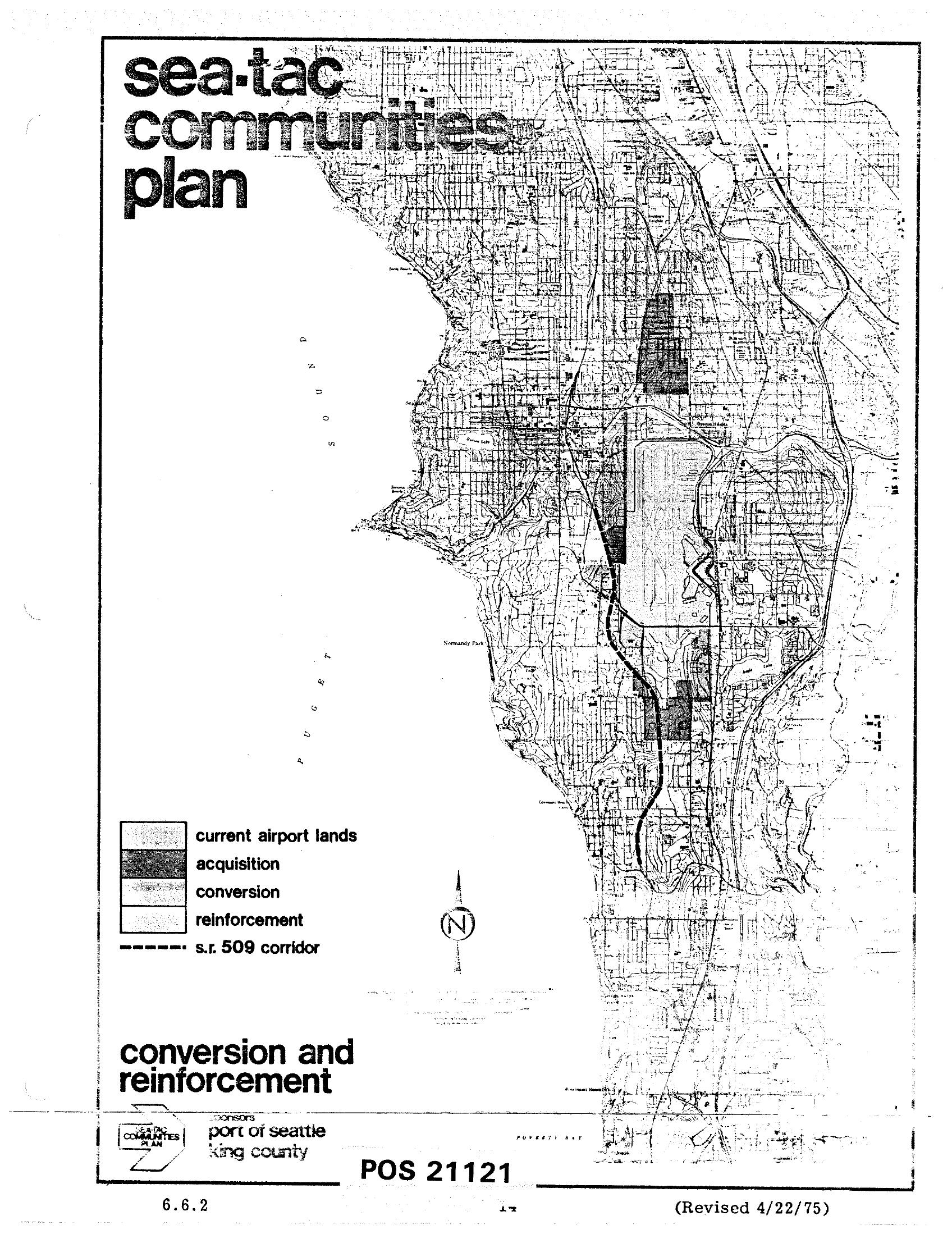
Sea-Tac Communities Plan Map 6.6.2 — Conversion and Reinforcement Areas (April 1975)
This is map sheet 6.6.2 (POS 21121, revised April 22, 1975) from the Sea-Tac Communities Plan, sponsored by the Port of Seattle and King County. It shows the area around Seattle-Tacoma International Airport with land-use designations including current airport lands, acquisition zones, conversion areas, reinforcement areas, and the proposed S.R. 509 corridor, overlaid on a street grid map extending from Puget Sound eastward. -
 1974-07-31
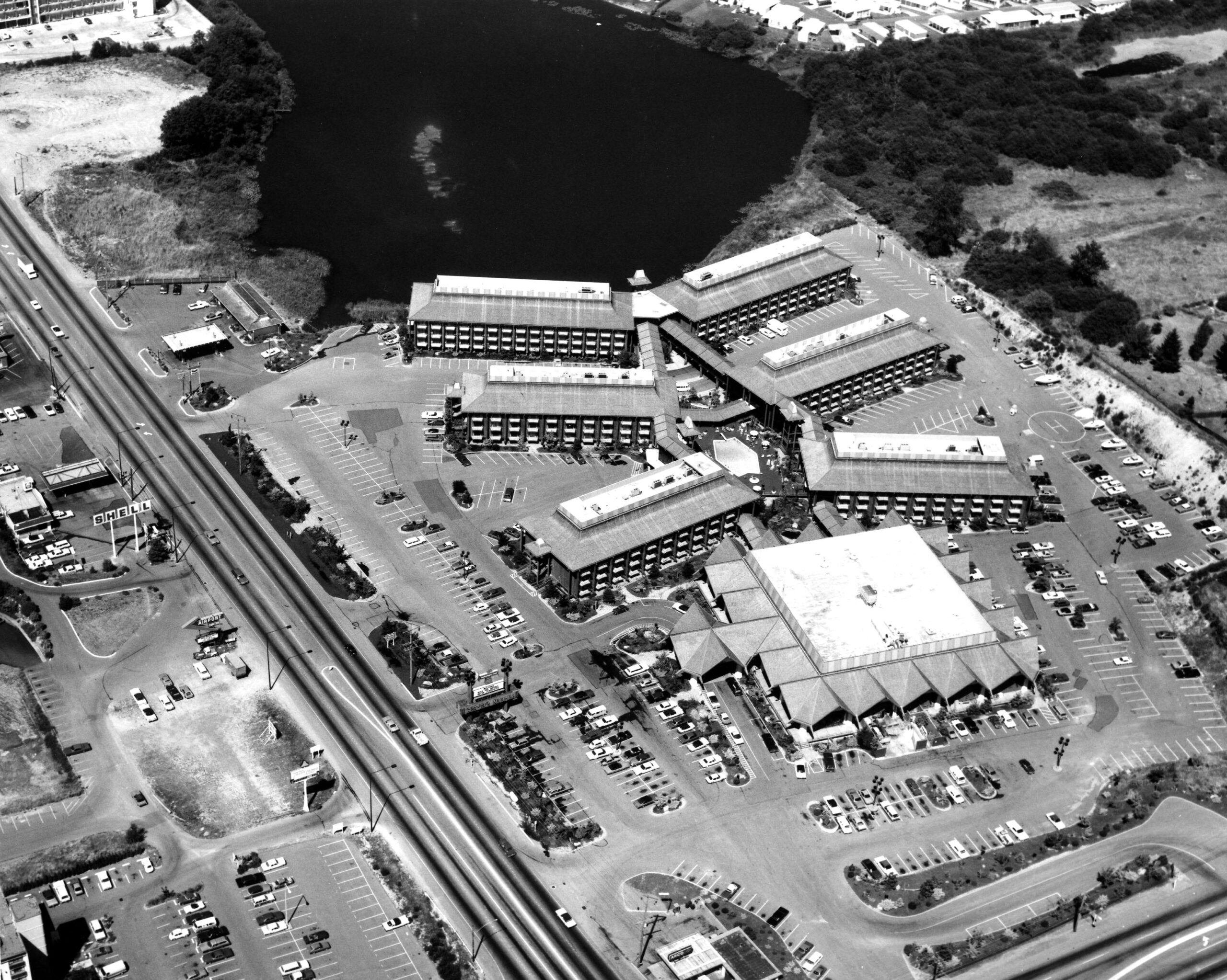
Sea-Tac Motel Aerial
Black-and-white aerial photograph showing a large multi-building hotel or motel complex with extensive parking lots alongside a divided highway. A body of water is visible in the upper portion of the image; a Shell gas station sign is faintly legible on the left side of the road. -
 1974-01-06
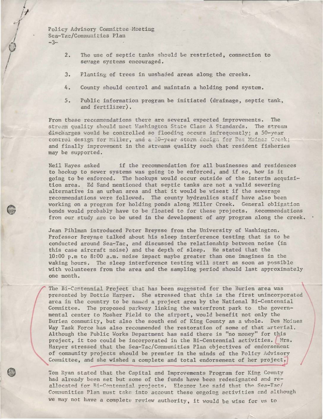
Policy Advisory Committee meeting, Sea-Tac-Communities Plan
This document summarizes a Policy Advisory Committee meeting for the Sea-Tac/Communities Plan, covering recommendations to improve local creek water quality through sewer hookups, tree planting, and holding ponds. It also describes a University of Washington study on how nighttime aircraft noise disrupts sleep for residents near Sea-Tac Airport. Additionally, a proposed Bi-Centennial parkway project linking Burien's waterfront to the airport was presented, with a request for the committee's full endorsement. -
 1974-01-01
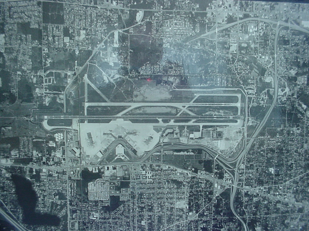
Sea-Tac Airport Aerial Photograph, 1974
Black-and-white aerial or satellite photograph showing a large commercial airport with multiple parallel runways, terminal buildings, taxiways, and surrounding dense urban development. No visible text, labels, or watermarks are present to confirm the specific airport identity or date. -
 1974-01-01
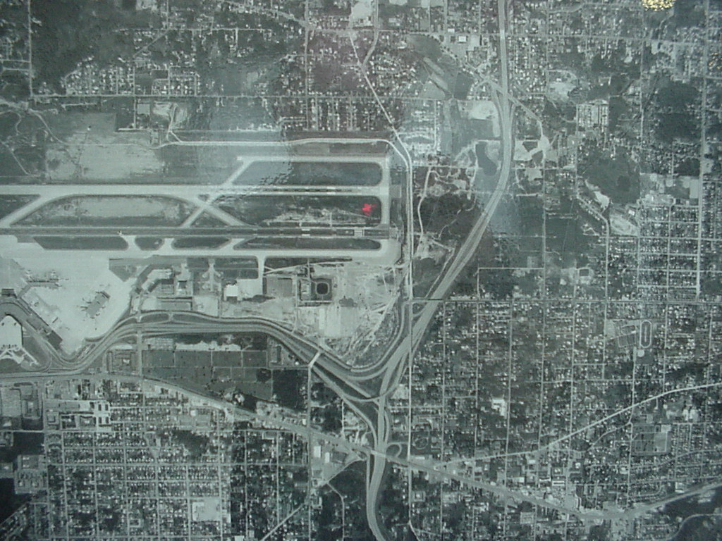
Sea-Tac Airport Aerial View, 1974
Black-and-white aerial photograph showing a commercial airport with multiple parallel runways, terminal area, and access roadways, surrounded by a dense urban street grid. No visible text, date, or identifying labels are present in the image. -
 1974-01-01
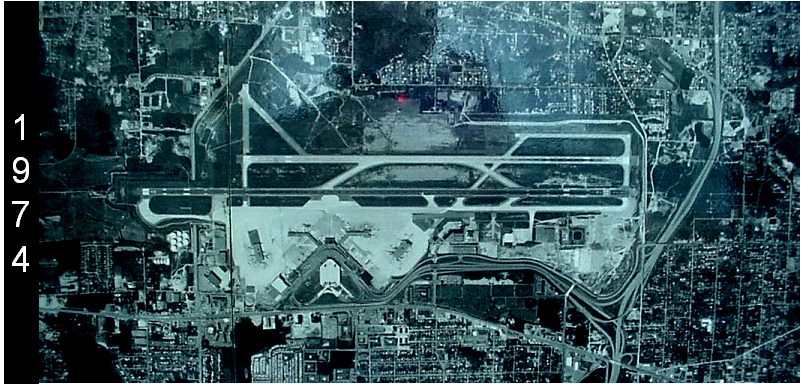
Sea-Tac Airport Aerial Photograph, 1974
Aerial satellite or reconnaissance photograph of Seattle-Tacoma International Airport (Sea-Tac) dated 1974, showing the parallel runway configuration, terminal complex, and surrounding urban development. The image is labeled with the year 1974 on the left side and appears to be a historical planning or archival document. -
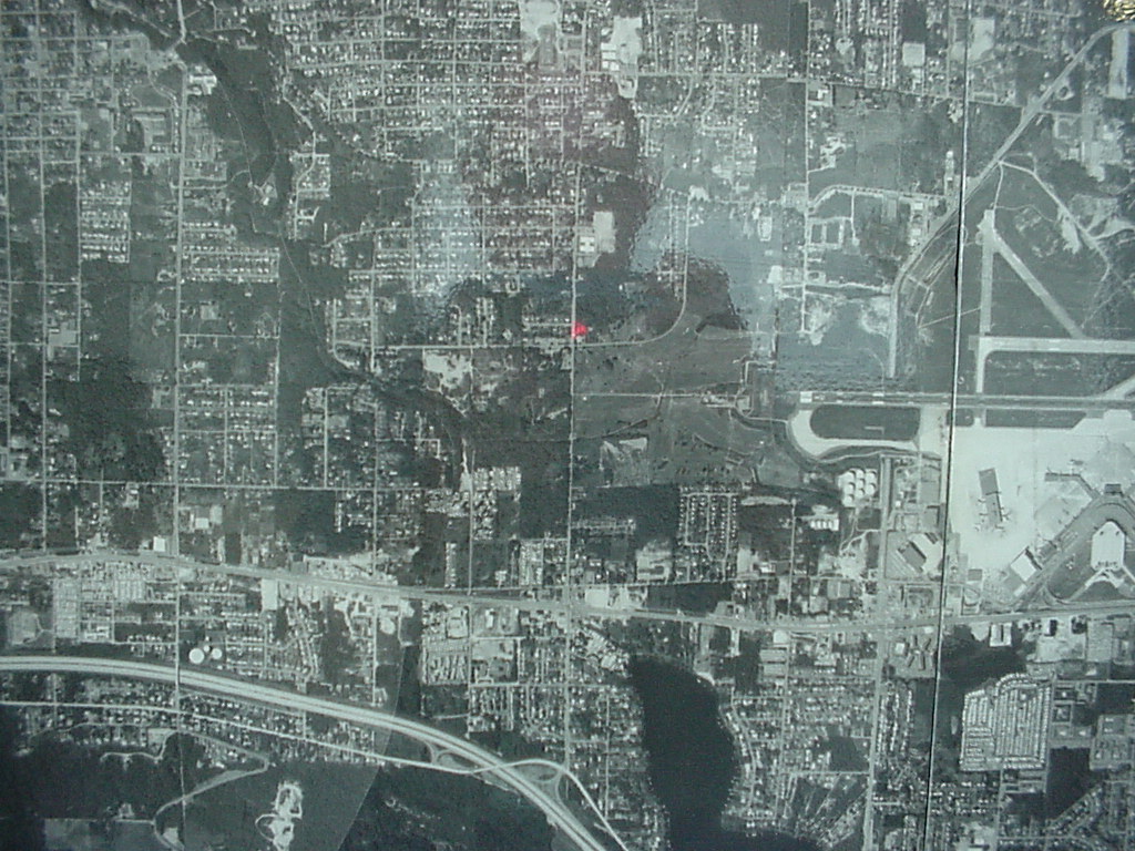 1974-01-01
1974 Aerial Photograph of Sea-Tac Airport and Surrounding Urban Grid
Black-and-white aerial photograph showing a densely developed urban grid with what appears to be an airport facility with runways visible in the upper-right quadrant. A small red marker is visible near the center of the image, possibly indicating a reference point on the map. -
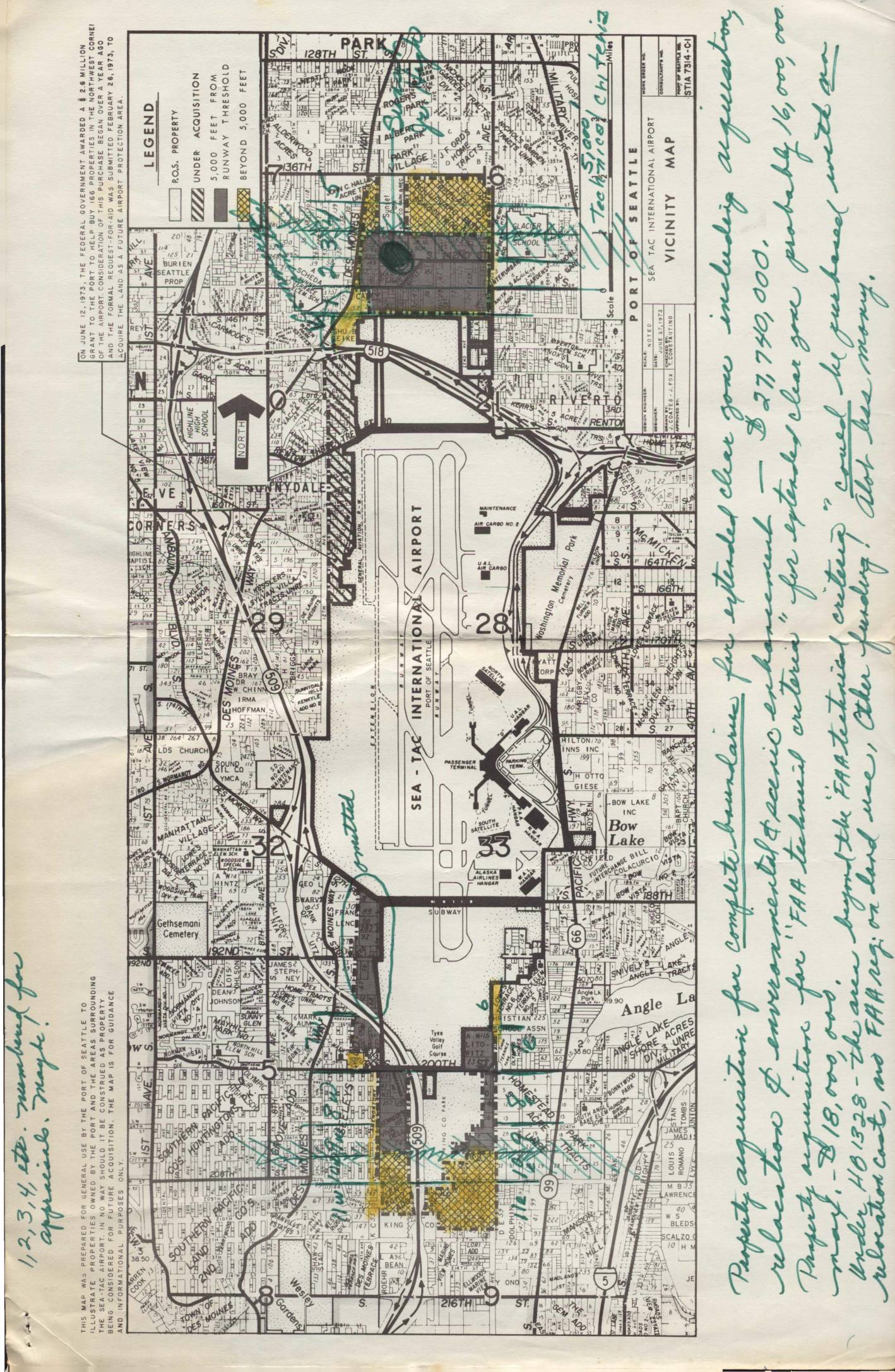 1973-09-07
Land use map, heavily notated with property acquisition notes by Virginia Dana
In September 1973, the Port of Seattle's Director of Aviation recommended an interim land acquisition program around Sea-Tac International Airport, targeting approximately 610 residential parcels and 75 acres of open land in clear zones north and south of the runways. The estimated cost of the acquisitions was $15.46 million, with the FAA expected to contribute over $8 million and the Port of Seattle covering the remaining $8 million from airport revenues between 1974 and 1977. Under the best-case timeline, actual land purchases could not begin until after July 1, 1974, following completion of environmental impact statements, housing relocation plans, and FAA review.