TagPart 150(269)
-
 2013-09-24
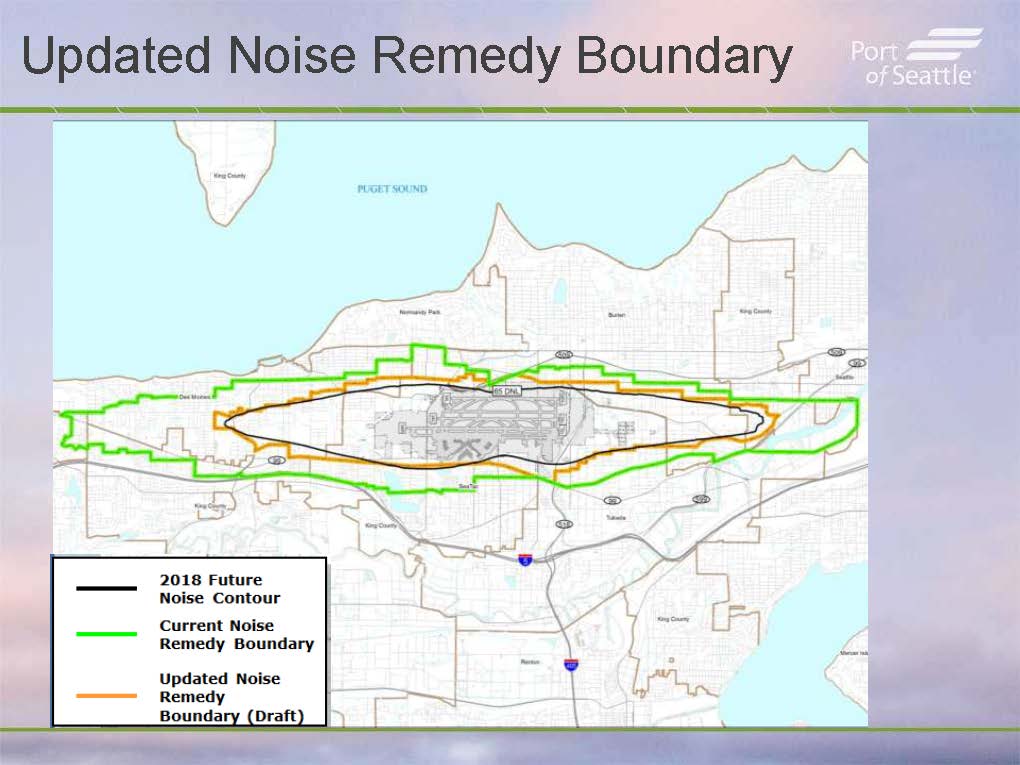
Updated Noise Remedy Boundary Map — Port Of Seattle Commission Presentation (September 24, 2013) — Slide 2
A Port of Seattle presentation slide titled 'Updated Noise Remedy Boundary' showing a map of the Sea-Tac Airport area with three overlaid boundaries: the 2018 Future Noise Contour (black), the Current Noise Remedy Boundary (green), and the draft Updated Noise Remedy Boundary (orange). The map covers surrounding communities including Des Moines, Burien, Normandy Park, and Tukwila along Puget Sound. -
 2013-09-24
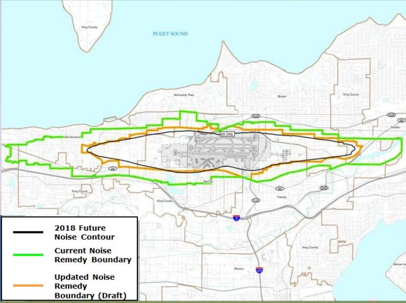
Part 150 Noise Boundary Zones Map — Sea-Tac Airport Commission Presentation
Map showing three overlapping noise boundary zones around Seattle-Tacoma International Airport: the 2018 Future Noise Contour (black), the Current Noise Remedy Boundary (green), and the Updated Noise Remedy Boundary in draft form (orange). The map covers the surrounding communities including Des Moines, Normandy Park, Burien, SeaTac, and Tukwila, adjacent to Puget Sound. -
 2013-09-24
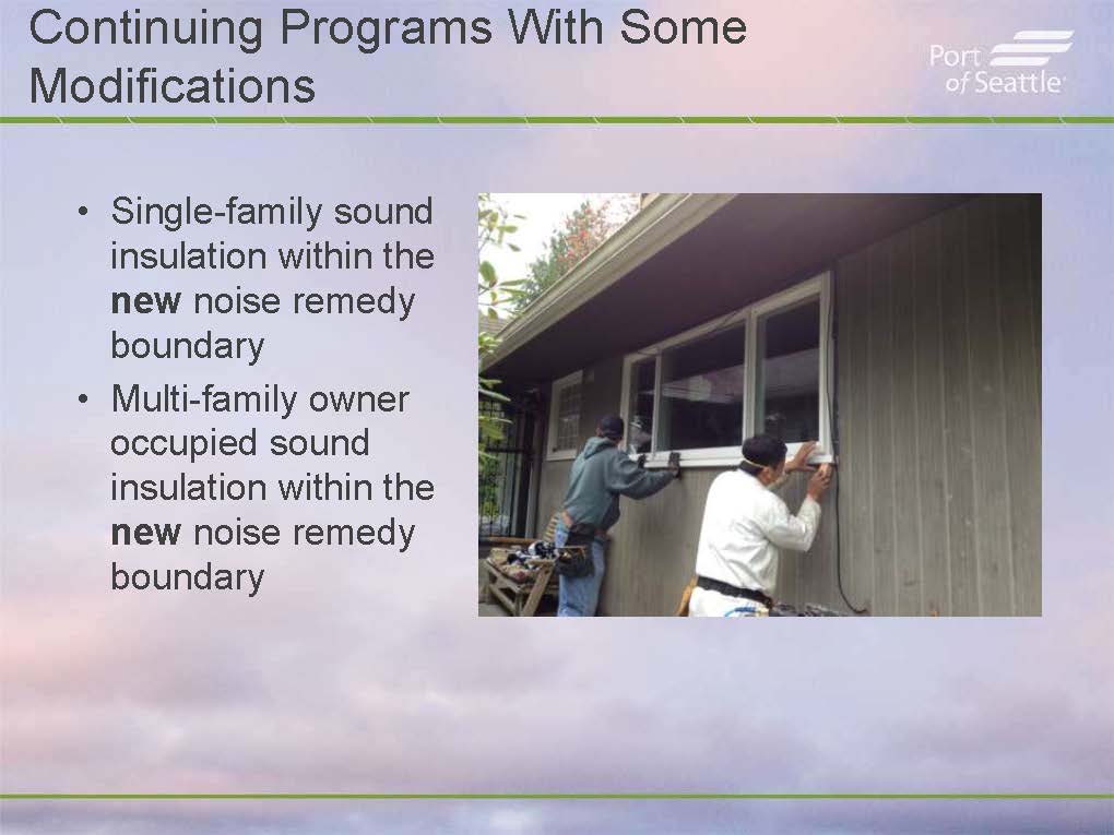
Part 150 Noise Remedy Program — Sound Insulation Presentation to Port Of Seattle Commission (September 24, 2013) — Slide 3
A Port of Seattle presentation slide describing continuing noise-remedy programs with modifications, specifically single-family and multi-family owner-occupied sound insulation within the new noise remedy boundary. The accompanying photo shows two workers installing or sealing windows on the exterior of a residential building, illustrating the sound insulation work being performed. -
 2013-09-24
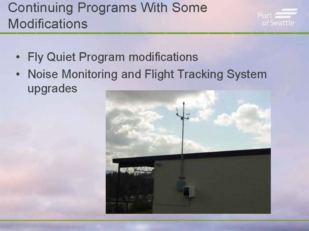
Part 150 Noise Mitigation Programs — Fly Quiet and Noise Monitoring System Upgrade (Page 4, September 24, 2013 Commission Presentation)
A Port of Seattle presentation slide outlining continuing noise-mitigation programs with modifications, specifically the Fly Quiet Program and upgrades to the Noise Monitoring and Flight Tracking System. The slide includes a photograph of a noise monitoring station mounted on a rooftop, with an antenna mast and weather sensors visible against a cloudy sky. -
 2013-09-24
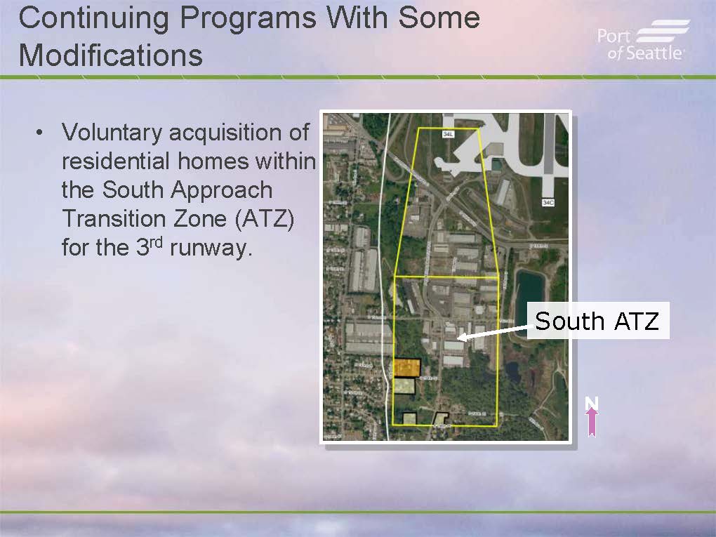
Port Of Seattle Part 150 Commission Presentation — Slide 5: Continuing Programs With Modifications and South ATZ Voluntary Acquisition (September 24, 2013)
A Port of Seattle presentation slide titled 'Continuing Programs With Some Modifications' describes the voluntary acquisition of residential homes within the South Approach Transition Zone (ATZ) for Sea-Tac Airport's 3rd runway. An aerial map highlights the South ATZ boundary in yellow, located south of the airport's runways 34L and 34C. -
 2013-09-24
Part 150 Noise Compatibility Program Update — Commission Presentation, September 24, 2013 (Page 1)
Title slide for a Part 150 noise compatibility program update presentation for Seattle-Tacoma International Airport (Sea-Tac), produced by the Port of Seattle. The slide is labeled '7b' and includes the Port of Seattle logo with its tagline 'Where a sustainable world is headed,' along with imagery of the Seattle skyline, an Alaska Airlines aircraft, cargo containers, and marina boats. -
 2013-05-30
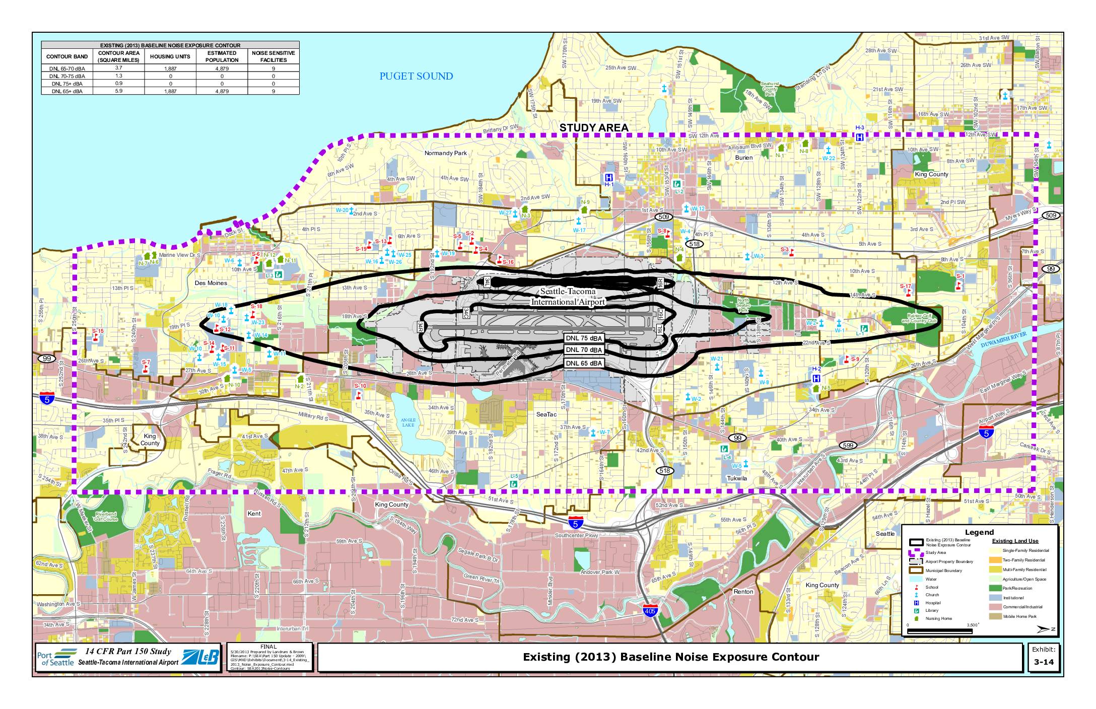
Existing (2013) baseline noise exposure contour
This exhibit from the Seattle-Tacoma International Airport 14 CFR Part 150 Study maps the existing 2013 baseline noise exposure contours around Sea-Tac Airport, showing DNL 65, 70, and 75 dBA noise zones across surrounding communities including SeaTac, Burien, Des Moines, and Tukwila. The DNL 65 dBA or greater contour covers approximately 5.9 square miles, encompassing an estimated 1,887 housing units and roughly 4,879 residents, along with 9 noise-sensitive facilities such as schools, churches, and hospitals. Notably, no housing units fall within the higher-impact DNL 70 dBA or above zones, though significant residential and commercial land uses exist within the broader 65 dBA contour area. -
 2013-04-12
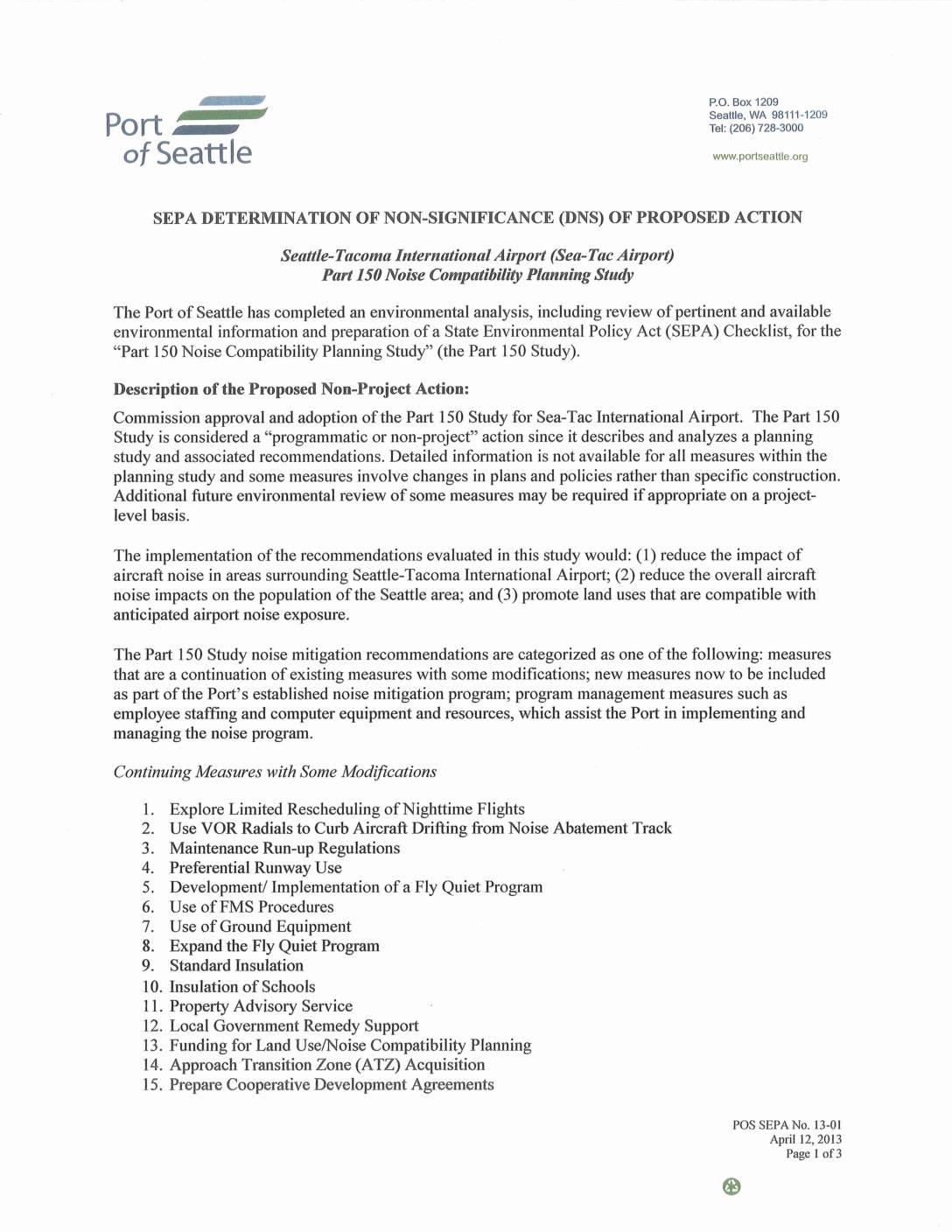
SEPA Determination of Non-Significance (DNS) of Proposed Action: Sea-Tac Airport Part 150 Noise Compatibility Planning Study
The Port of Seattle issued a State Environmental Policy Act (SEPA) Determination of Non-Significance for the Sea-Tac Airport Part 150 Noise Compatibility Planning Study, concluding the plan would not have a significant adverse impact on the environment. The study outlines 23 noise mitigation measures—including limiting nighttime flights, sound-insulating homes and schools, and constructing a Ground Run-Up Enclosure—aimed at reducing aircraft noise for communities surrounding Seattle-Tacoma International Airport. A 45-day public comment period was open through May 30, 2013, with the determination signed by Elizabeth Leavitt, Director of Aviation Planning and Environmental Programs. -
 2013-03-27
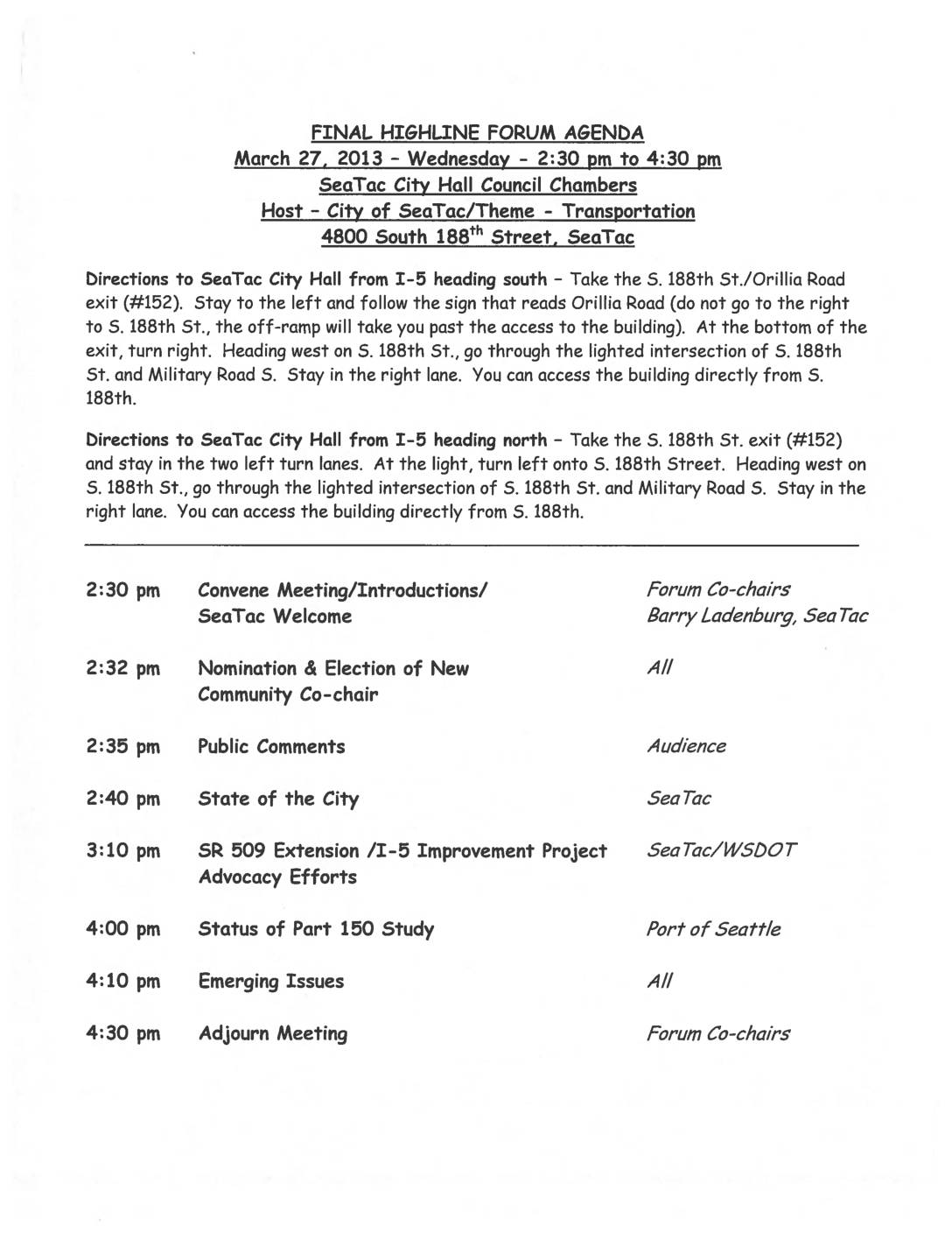
Highline Forum Agenda: March 27, 2013
The Highline Forum is a collaborative body representing Southwest King County cities, schools, and the Port of Seattle that meets to share information and work on regional initiatives. A March 27, 2013 meeting held at SeaTac City Hall focused on transportation topics, including the SR 509 Extension/I-5 Improvement Project and a status update on the Port of Seattle's Part 150 noise study, which directly relates to Sea-Tac Airport noise mitigation policy. The Forum operates by consensus and is governed by procedures that assign the Port of Seattle as the lead disseminator of all Forum-related information. -
 2013-01-22
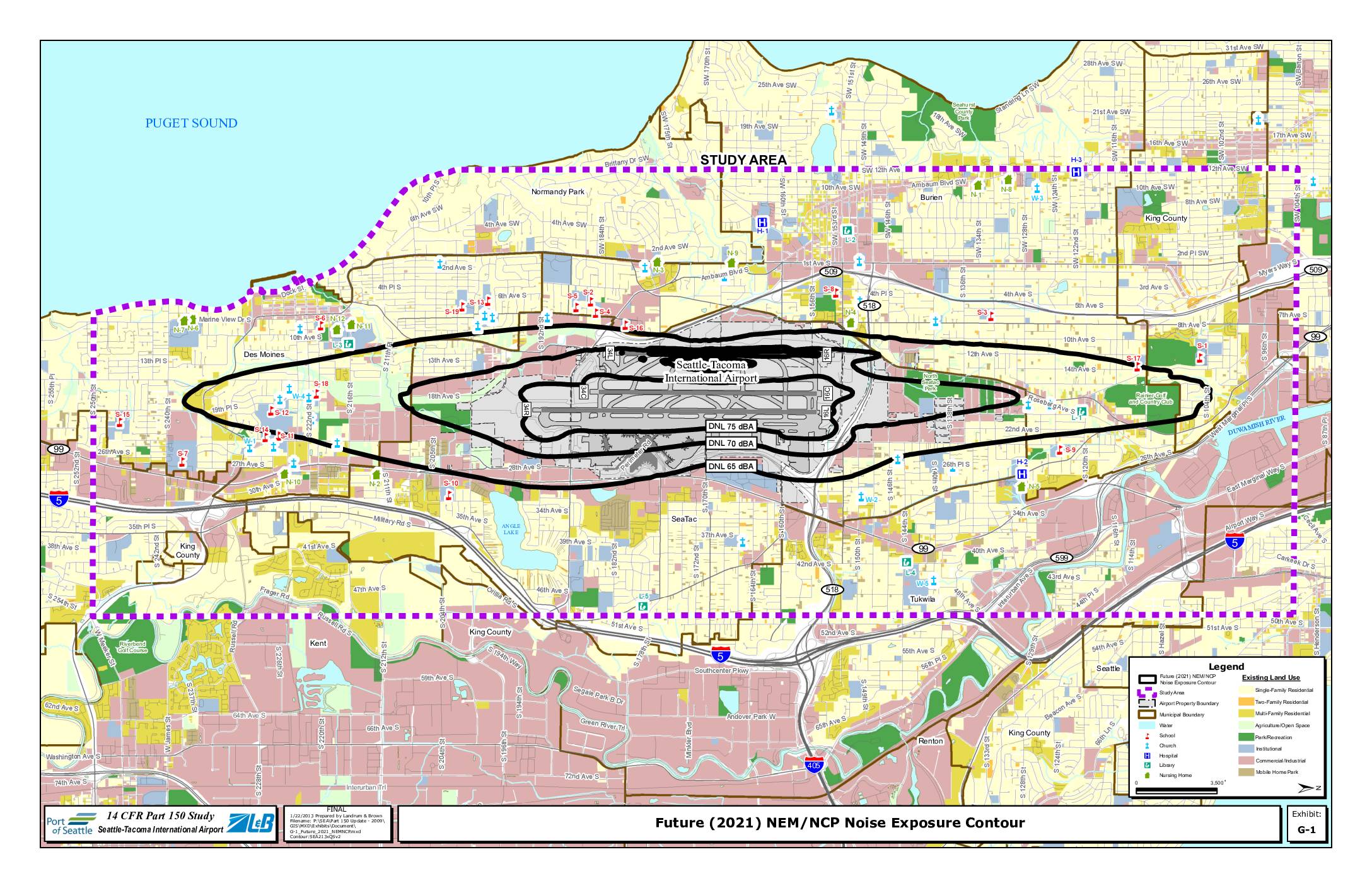
Exhibit G-1: Future (2021) NEM/NCP Noise Exposure Contour
This map, prepared by Landrum & Brown on January 22, 2013 as part of the 14 CFR Part 150 Study for Seattle-Tacoma International Airport, shows projected future (2021) noise exposure contours around Sea-Tac Airport at DNL 65, 70, and 75 dBA levels. The contours extend across surrounding communities including SeaTac, Burien, Des Moines, Tukwila, and portions of Renton and Kent, with sensitive land uses such as schools, churches, hospitals, and residential areas identified within the noise impact zones. The study was conducted to inform noise compatibility planning and policy decisions aimed at reducing aviation noise impacts on affected neighborhoods.