TagMaster Plan(53)
-
SAMP-2015-0519-BP12-PortofSeattle Page 14
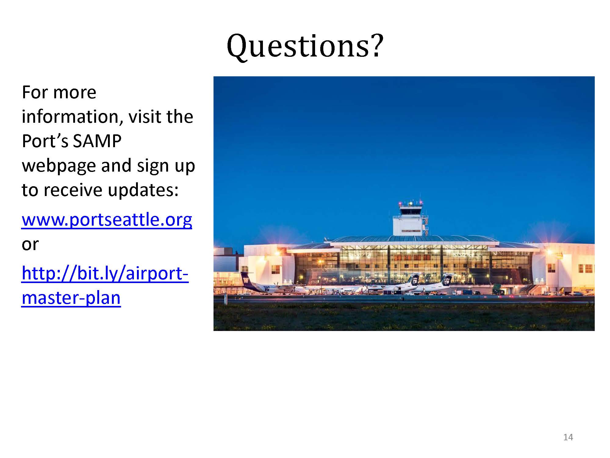
Final slide (page 14) of a Port of Seattle Sea-Tac Airport SAMP (Sustainable Airport Master Plan) presentation, directing viewers to www.portseattle.org or http://bit.ly/airport-master-plan for more information and updates. The slide includes a nighttime exterior photograph of Seattle-Tacoma International Airport terminal with aircraft at gates and the air traffic control tower visible. -
SAMP-2015-0519-BP12-PortofSeattle Page 12
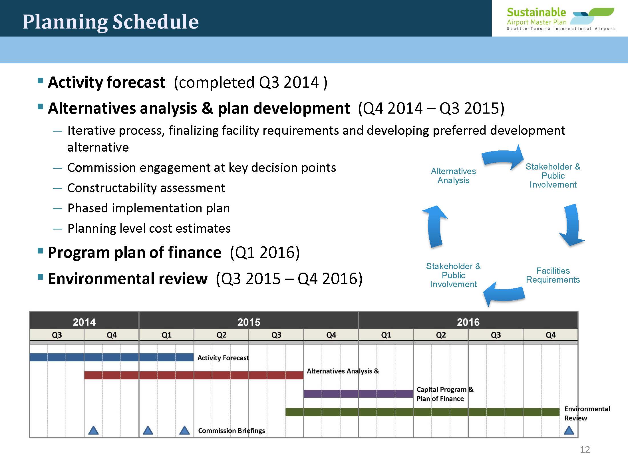
This slide from the Seattle-Tacoma International Airport Sustainable Airport Master Plan presents the planning schedule, including Activity Forecast (completed Q3 2014), Alternatives Analysis & Plan Development (Q4 2014–Q3 2015), Program Plan of Finance (Q1 2016), and Environmental Review (Q3 2015–Q4 2016). A Gantt chart at the bottom shows task timelines across 2014–2016, with Commission Briefing milestones marked. -
180620-SAMP-Presentation-Public-Meeting 14 LTP-cropped
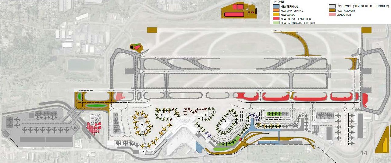
A color-coded airport master plan layout showing proposed development elements including new terminal, new main entrance, new cargo facilities, new support facilities, new hardstand/hold pad, long-range study areas, new pavement, and demolition zones. The legend distinguishes elements by color, and the drawing appears to be page 14 of a planning document, depicting a large airfield with multiple concourses and gate areas. -
 2022-07-10
Part 4: Trends and Forecasts — Chapter 4.1, Central Puget Sound Region Population
This document is Part 4 of a Master Plan study for Sea-Tac International Airport, focusing on trends and forecasts for the Central Puget Sound Region. It examines population and economic growth data to project future air traffic demand, noting that the four-county area around Seattle held over 1.9 million people in 1970—56% of Washington State's population. While the region grew rapidly through the 1950s and 1960s, the plan anticipates more modest growth in the 1970s relative to national averages. -
 2022-01-31
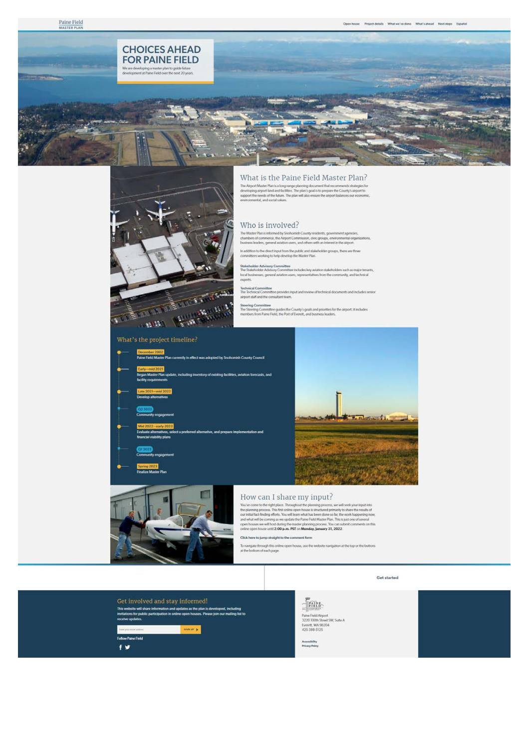
Choices Ahead for Paine Field: Master Plan Open House
Snohomish County is developing a 20-year Master Plan for Paine Field Airport near Everett, WA, driven by growing aviation demand and Sea-Tac International Airport approaching its capacity limits. The plan examines existing facilities, passenger and cargo forecasts, and development alternatives, with passenger volume projected to exceed 4 million annually by 2040. Public input is being gathered through online open houses and community engagement sessions throughout the planning process. -
 2020-10-19
City of Burien storm drainage master plan update 2020
The City of Burien, Washington's Storm Drainage Master Plan Update (2020) is a technical planning document approved by the Burien City Council on October 19, 2020, outlining the city's stormwater and drainage infrastructure management strategies. Prepared by engineering firm Otak, Inc., the plan was developed in coordination with the city's Public Works Department to guide storm drainage improvements and maintenance. While based in Burien near Sea-Tac Airport, this document focuses on local stormwater systems rather than airport noise policy. -
 2018-12-04
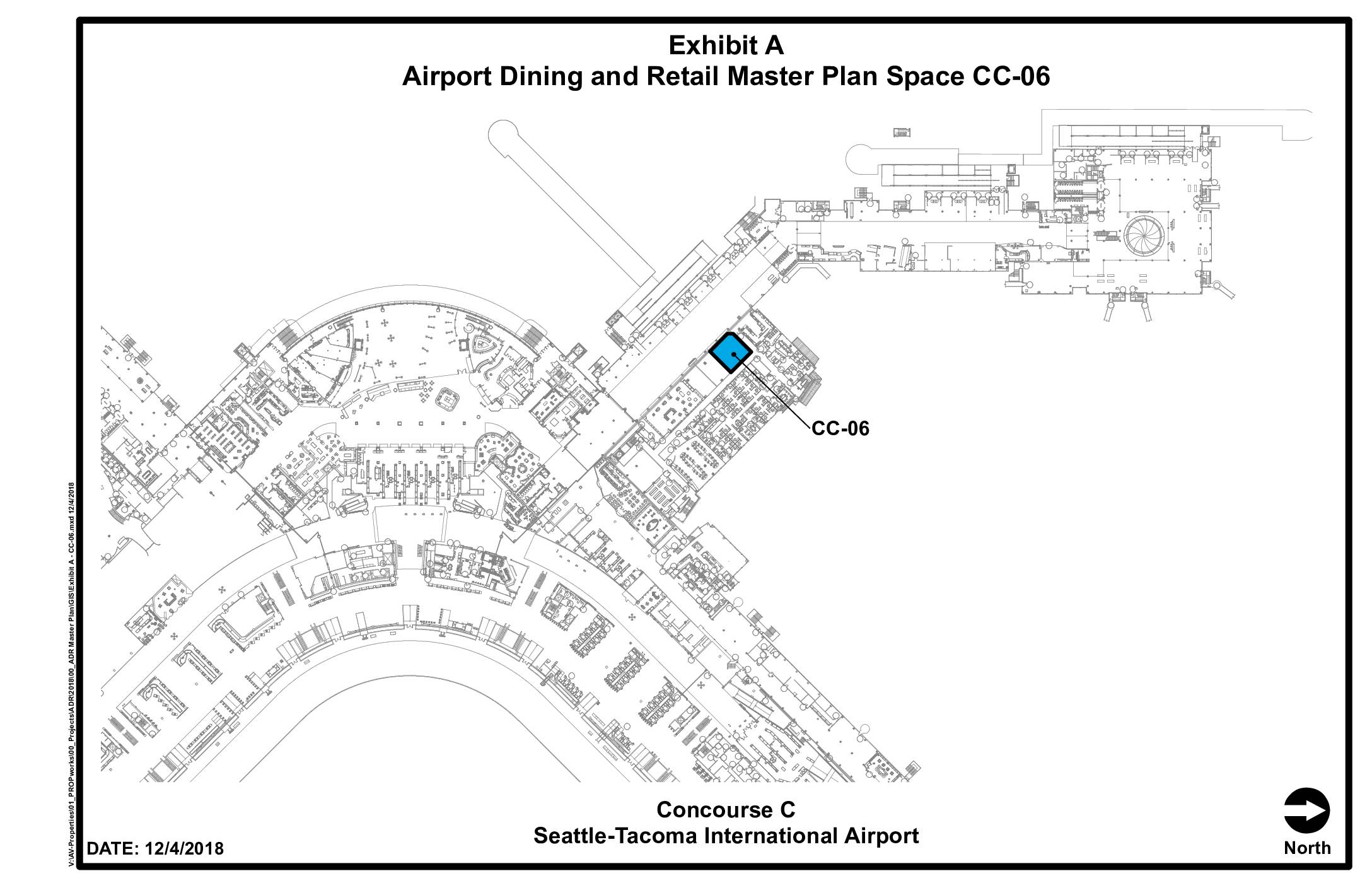
Exhibit A: Airport Dining and Retail Master Plan Space CC-06
This document is a floor plan exhibit from Seattle-Tacoma International Airport's Airport Dining and Retail Master Plan, dated December 4, 2018, identifying a specific retail or dining space designated CC-06 located in Concourse C. The highlighted space is shown on a detailed map of the concourse layout, pinpointing its position along the main concourse corridor. The exhibit was produced for planning and leasing reference purposes related to the airport's dining and retail program. -
 2018-12-04
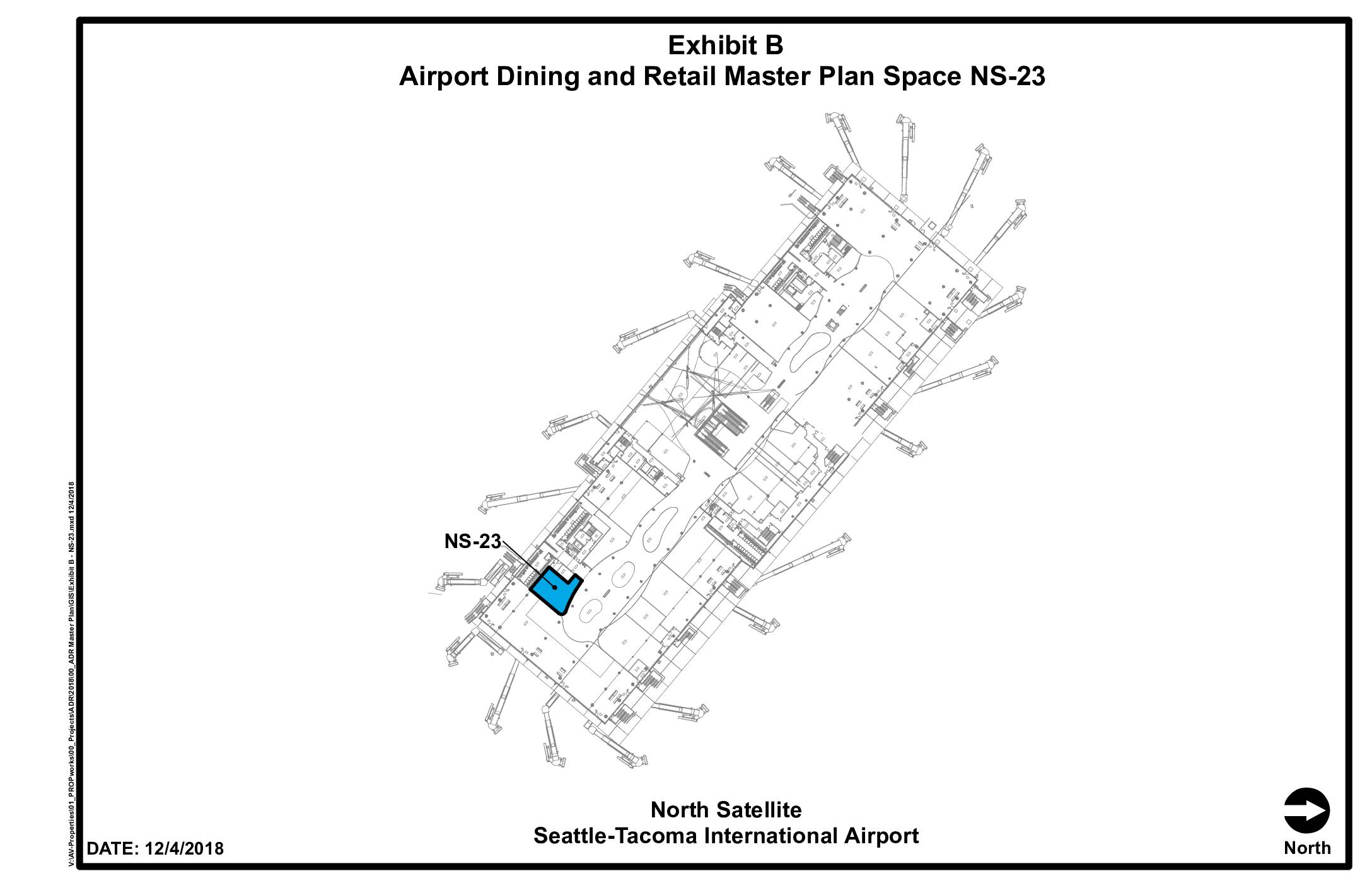
Exhibit B: Airport Dining and Retail Master Plan Space NS-23
This document is a floor plan exhibit identifying retail or dining space NS-23 located in the North Satellite terminal at Seattle-Tacoma International Airport, dated December 4, 2018. The highlighted space is part of the Airport Dining and Retail Master Plan and is shown in blue on the terminal map. It serves as a reference document for leasing or planning purposes related to commercial concession spaces within the North Satellite. -
 2015-12-15
Sea-Tac Airport Sustainability Goals and Objectives
A December 2015 presentation by Sea-Tac Airport's Director of Environmental & Planning outlines how the airport is weaving sustainability into its Master Plan across three phases: what and where it builds, how it builds, and how it operates. The plan is guided by the Port of Seattle's Century Agenda and the airport's own Strategy for a Sustainable Sea-Tac (S3), with development concepts for airfield, terminal, and landside areas being screened against sustainability-based evaluation criteria. Key planning constraints include meeting passenger demand growth without adding new runways, improving airfield efficiency through NextGen technology, and converting sustainability goals into measurable decision-making criteria. -
 2015-12-10
City of Des Moines 2016 Parks, Recreation & Senior Services Master Plan
This is the City of Des Moines, Washington 2016 Parks, Recreation & Senior Services Master Plan, adopted by the Des Moines City Council on December 10, 2015. The plan covers existing park resources, programs, and demographics, along with a needs assessment, facility development priorities, cost estimates, and funding strategies for the city's parks and recreation system. It also includes goals, policies, and implementation strategies for parks, recreation, and open space.