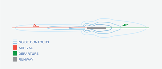
A diagram illustrating airport noise contours around a runway, with color-coded flight paths showing arrivals (red) and departures (green). The oval-shaped noise contour lines extend along both ends of the runway centerline, with greater extent on the departure end.
2026-01-06
This document outlines federal guidelines for managing land use around airports to minimize noise and safety conflicts. It distinguishes between incompatible land uses near airports—such as residential development, schools, hospitals, and churches—and compatible ones like agriculture, parks, and parking facilities. It also describes appropriate actions airport sponsors can take, including developing off-airport land use plans, enacting zoning ordinances, and working with local and regional authorities to restrict development in affected areas.
Document discussing the delineation of airport environs and identification of impact areas for planning purposes. Covers the overall study area including Highline School District and portions of Federal Way and South Central School Districts, with focus on airport vicinity planning and implementation.
2024-10-23
A planning document outlining the goals and objectives for King County International Airport/Boeing Field’s Vision 2045 plan. The document establishes seven key goals including safety, efficiency, environmental stewardship, fiscal sustainability, land management, communication, and resilience, with detailed considerations for both airport operations and community impacts.
2024-06-25
An aerial rendering depicting the SR 509 Expressway extension (Stage 1b) in SeaTac, Washington, showing planned infrastructure including a new 24th Avenue South interchange, new 34th Avenue S connection to I-5, a reconfigured S 208th Street, a toll point on SR 509, and proximity to the Sound Transit Angle Lake Station. The project corridor runs east-west connecting I-5 to existing SR 509 near Angle Lake.
2023-08-22
This document is an airport diagram of Seattle-Tacoma International Airport showing runways, taxiways, run-up areas, and terminal facilities. Handwritten annotations in red ink reference noise abatement procedures, including a note about 'General Aviation' operations and restrictions on runways, specifying limits such as '650 landings' and directions (East/West). Additional handwritten notes at the bottom outline runway use prohibitions from 10 PM to 6 AM, with exceptions for 50% power run-ups and full-power checks limited to 2 minutes.
2022-10-17
The Huntsville-Madison County Airport Authority submitted comments to the FAA in October 2022, objecting to a proposed federal policy governing land use changes on federally acquired or conveyed airport property. The authority argues the policy creates unnecessary regulatory burdens that hamper airports' ability to pursue compatible non-aeronautical developments, and calls for clearer, simpler rules — such as broader definitions of 'airport purpose' and airport-led category determinations rather than FAA approval for every land use change.
2022-10-17
Charlotte Douglas International Airport (CLT) submitted comments to the FAA in October 2022 opposing a proposed new policy on land use changes at federally acquired airport land, arguing that existing regulations already adequately govern non-aeronautical land use. CLT requested that if the policy moves forward, the FAA clarify approval timelines, lease evaluation procedures, and criteria for mixed-use land decisions. The letter emphasizes that non-aeronautical development is essential for airports to remain financially self-sustaining and to ensure compatible land use around airport property.
Section 163 of the FAA Reauthorization Act of 2018 regulates the uses of properties acquired by airport sponsors using FAA funds. These include property buyouts for noise mitigation and other non-aeronautical uses. SEC. 163. LIMITED REGULATION OF NON-FEDERALLY SPONSORED PROPERTY. (a) <> In General.--Except as provided in subsection (b), the Secretary of Transportation may not
2022-09-12
This document is the Master Plan Update for Snohomish County Airport/Paine Field, covering a comprehensive range of planning topics including existing airport conditions, aviation activity forecasts, capacity analysis, facility requirements, and a long-term development program. It outlines airfield and landside infrastructure needs, environmental considerations, and financial planning strategies for the airport's future growth. Note that this plan pertains to Paine Field in Snohomish County and does not directly address noise policy at Seattle-Tacoma International Airport.
 2026-01-06
 2024-10-23
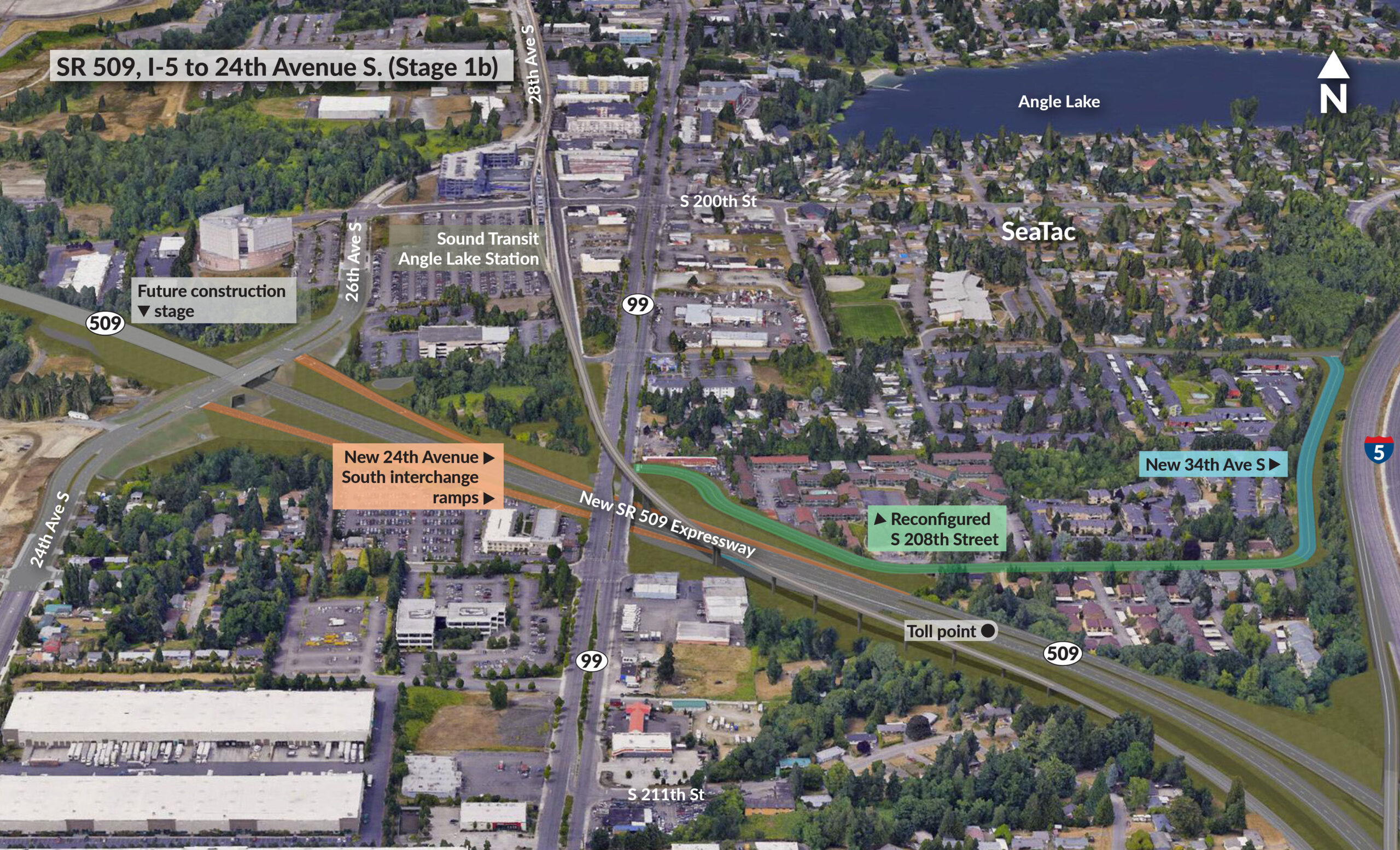 2024-06-25
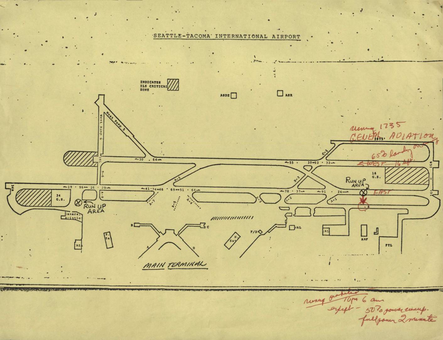 2023-08-22
 2022-10-17
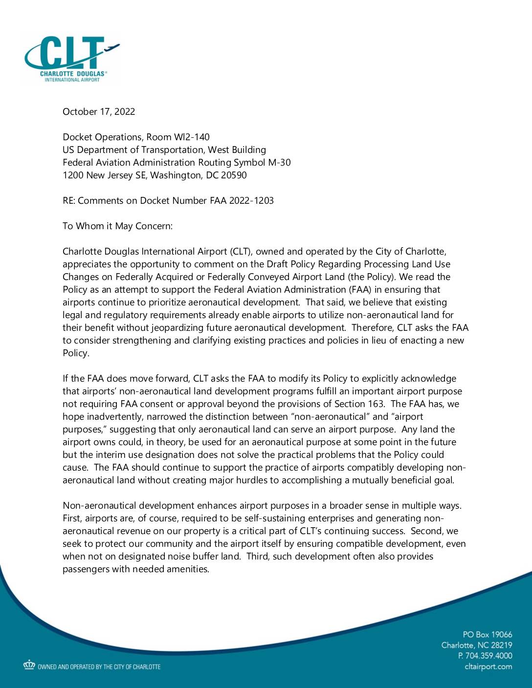 2022-10-17
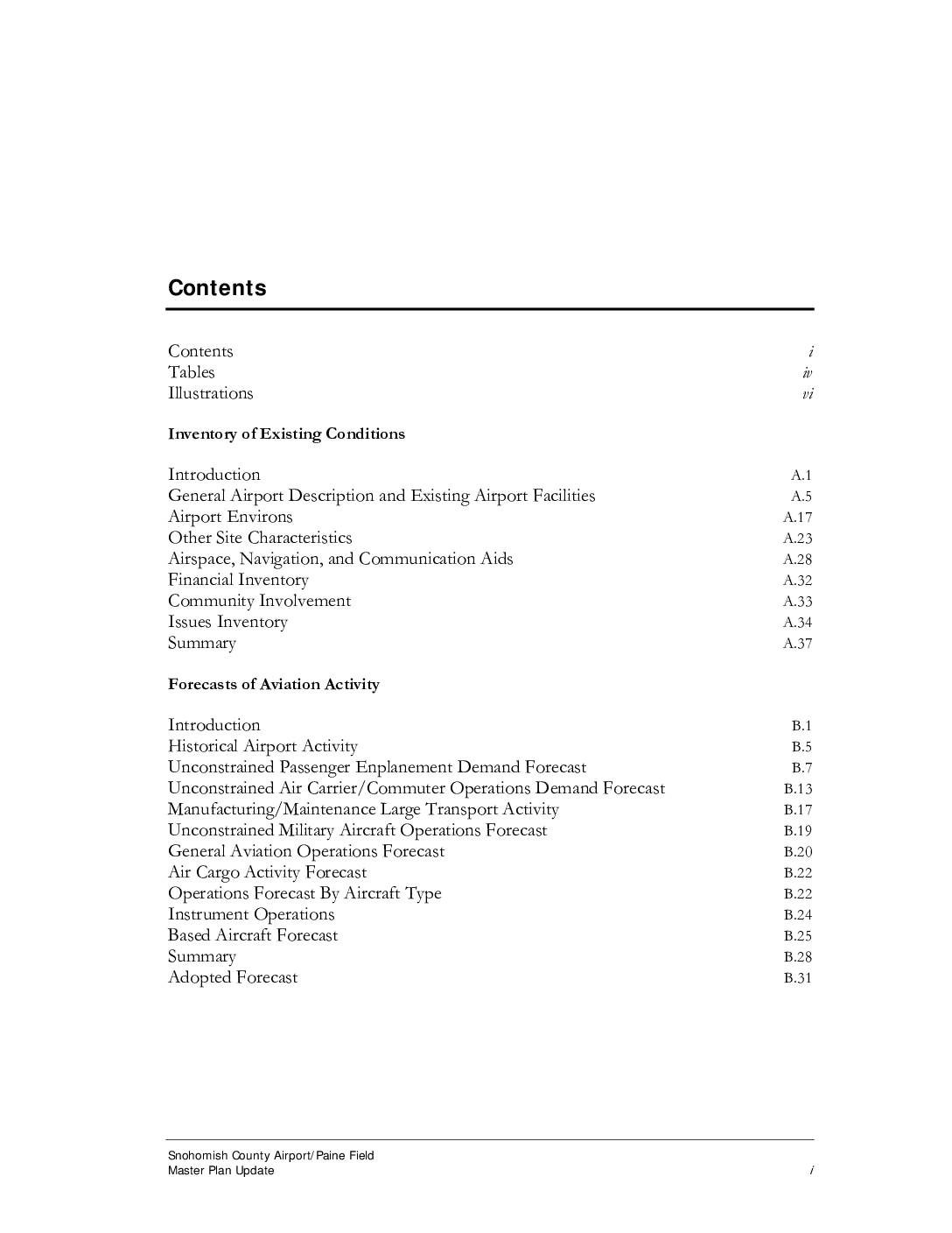 2022-09-12