TagAirport Expansion(165)
-
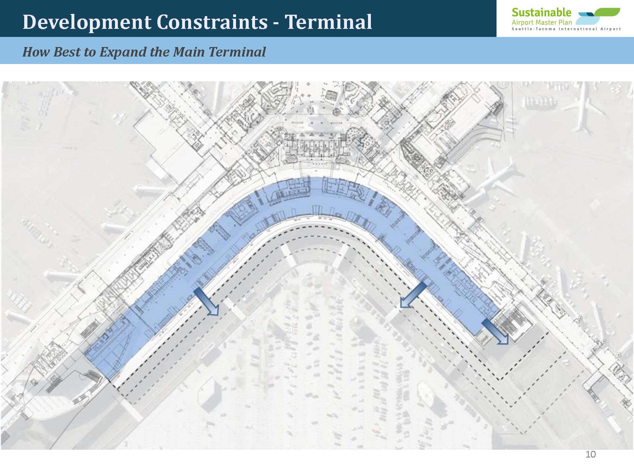
SAMP-2015-0519-BP12-PortofSeattle Page 10
Slide 10 from the Seattle-Tacoma International Airport Sustainable Airport Master Plan presentation, titled 'Development Constraints - Terminal: How Best to Expand the Main Terminal.' The aerial plan view highlights in blue the potential southward expansion zone along the curved main terminal frontage, with directional arrows indicating proposed growth directions. -
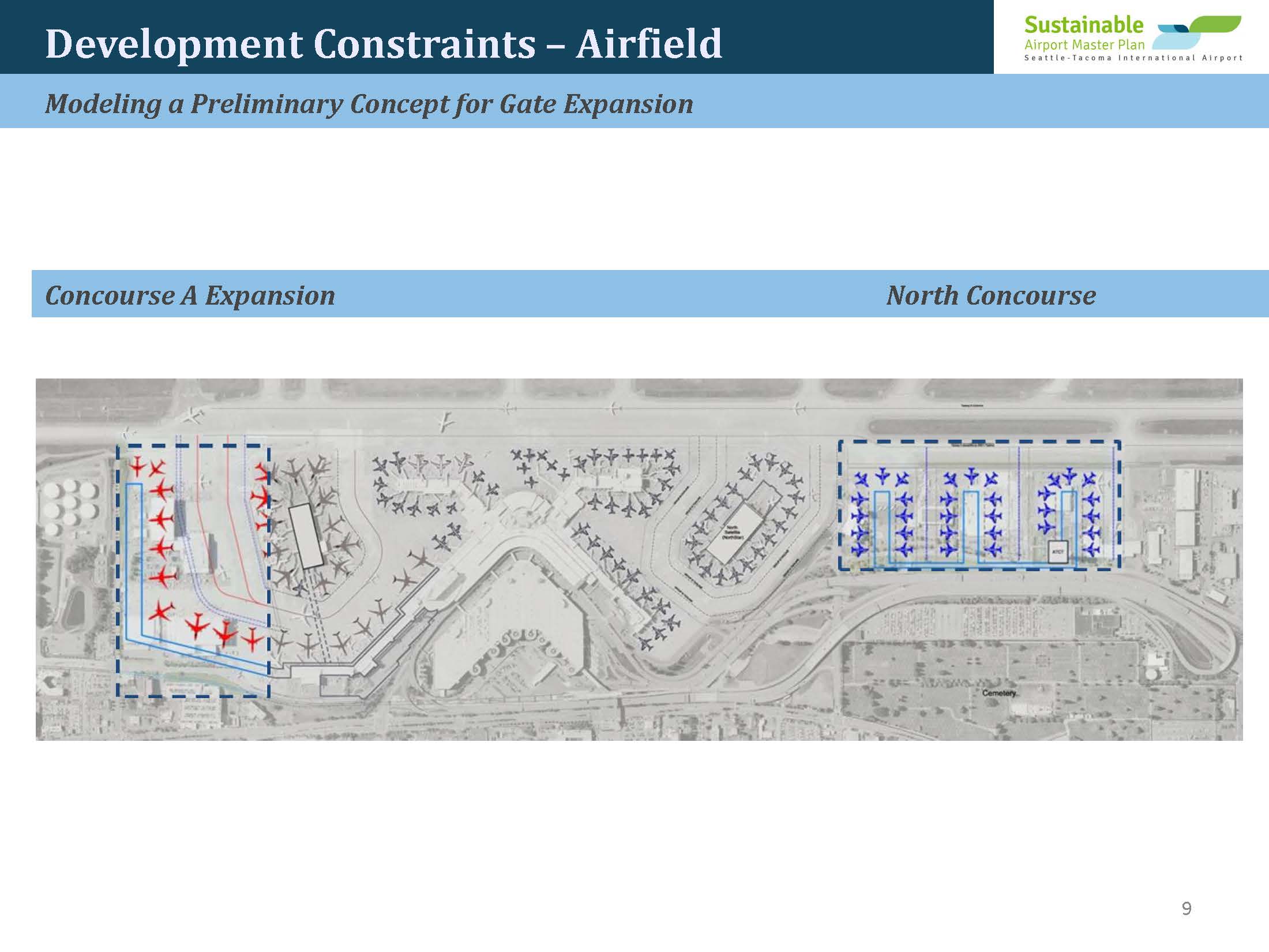
SAMP-2015-0519-BP12-PortofSeattle Page 09
Slide 9 from the Seattle-Tacoma International Airport Sustainable Airport Master Plan presentation, titled 'Development Constraints – Airfield: Modeling a Preliminary Concept for Gate Expansion.' The slide shows an aerial diagram comparing two proposed expansion areas: Concourse A Expansion (left, with red conflict markers indicating airfield constraints) and a North Concourse concept (right, shown in blue dashed outline). -
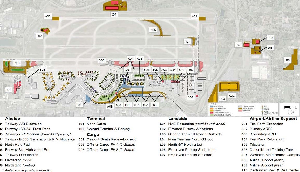
180620-SAMP NTP Presentation-Public-Meeting 16-NTP-Environmental Review-cropped
An aerial planning map of Seattle-Tacoma International Airport (Sea-Tac) showing proposed capital improvement projects categorized into Airside, Terminal, Cargo, Landside, and Airport/Airline Support elements. Projects are color-coded by type (new terminal, new pavement, new cargo, new support facilities, demolition, new hardstand/hold pad) and labeled with alphanumeric identifiers including runway extensions, taxiway relocations, new terminal gates, cargo redevelopment areas, and employee parking structures. -
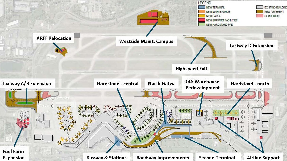
180620-SAMP-Presentation-Public-Meeting 12 NTP Major Improvements-cropped
An aerial planning map of Seattle-Tacoma International Airport showing proposed capital improvements including a Second Terminal, North Gates, Busway & Stations, Taxiway A/B and D Extensions, Westside Maintenance Campus, Fuel Farm Expansion, C4S Warehouse Redevelopment, Hardstand pads, ARFF Relocation, and Roadway Improvements. The legend distinguishes new terminal, maintenance, cargo, support facilities, hardstand pads, existing buildings, new pavement, and demolition areas. -
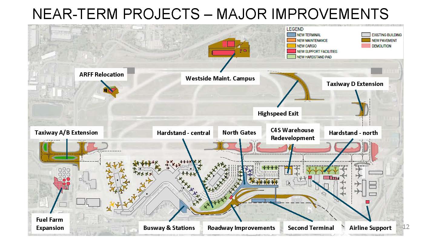
180620-SAMP-Presentation-Public-Meeting 12 NTP Major Improvements
A planning slide titled 'Near-Term Projects – Major Improvements' showing an aerial map of an airport with labeled infrastructure projects including a Second Terminal, Taxiway A/B and D Extensions, Westside Maintenance Campus, Fuel Farm Expansion, Busway & Stations, Roadway Improvements, North Gates, Hardstand areas, ARFF Relocation, Highspeed Exit, C4S Warehouse Redevelopment, and Airline Support facilities. The map uses a color-coded legend distinguishing new terminal, maintenance, cargo, support facilities, hardstand pads, existing buildings, new pavement, and demolition areas. -
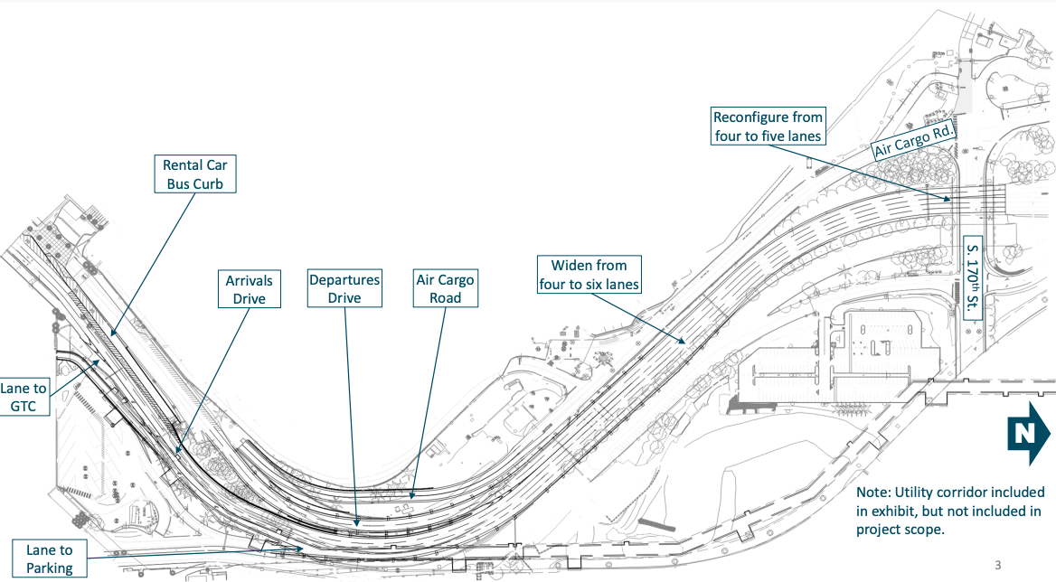
Sea-Tac Airport Roadway Reconfiguration Site Plan
An architectural/engineering site plan for Seattle-Tacoma International Airport showing proposed roadway modifications including widening Air Cargo Road from four to six lanes, reconfiguring from four to five lanes near Air Cargo Rd. and S. 170th St., and labeled features including Arrivals Drive, Departures Drive, Rental Car Bus Curb, and lanes to GTC and Parking. A note indicates the utility corridor is shown but not included in project scope. -
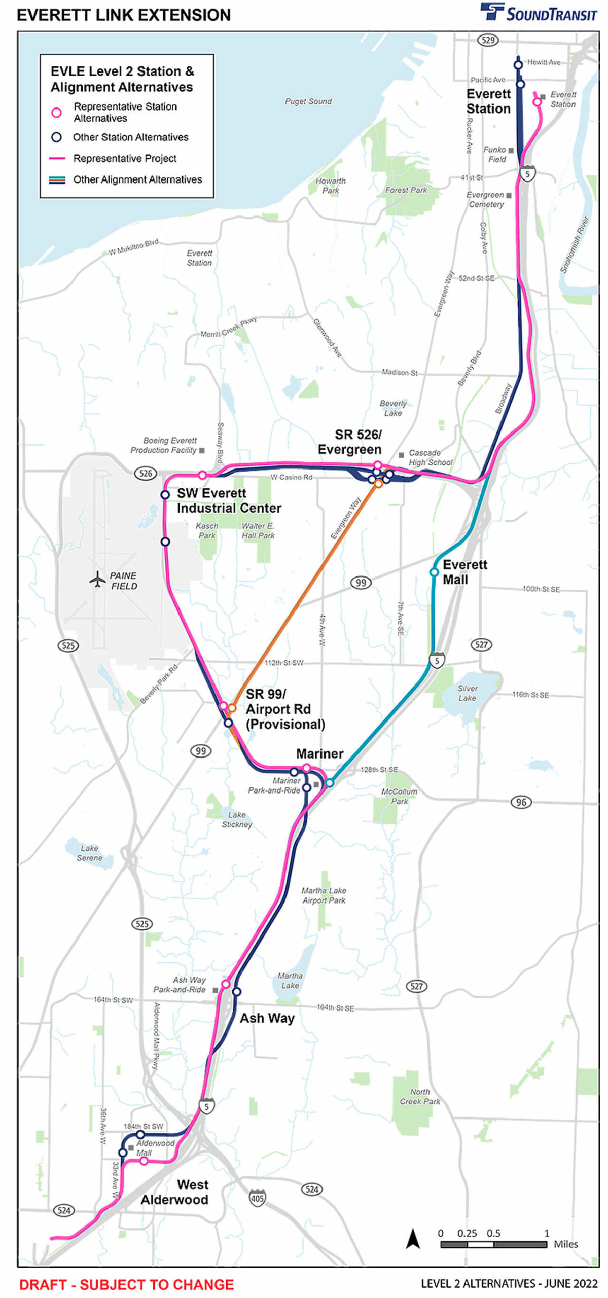 2022-06-01
Everett Link Extension – EVLE Level 2 Station & Alignment Alternatives
A draft planning map published by Sound Transit in June 2022 showing the Everett Link Extension (EVLE) Level 2 station and alignment alternatives, including the Representative Project (pink) and other alignment alternatives running between West Alderwood/Alderwood Mall in the south and Everett Station in the north, with proposed stations at Ash Way, Mariner, SR 99/Airport Rd, SW Everett Industrial Center, SR 526/Evergreen, Everett Mall, and Everett Station. Note: This map depicts the Everett Link Extension corridor and does not directly relate to Sea-Tac Airport noise policy; Paine Field is visible on the western edge of the map. -
 2022-01-19
International Arrivals Facility (IAF)
Seattle-Tacoma International Airport's new International Arrivals Facility (IAF), presented in January 2022, is a major expansion that increases the airport's international capable gates from 12 to 20 and replaces the old 87,000 sq. ft. facility with a spacious 450,000 sq. ft. building. The project also expanded baggage handling from 4 to 7 carousels using a 'Bags First' system, and supported over 10,000 construction jobs. This document provides an overview of the facility's key highlights and improvements to international passenger processing at Sea-Tac Airport. -
 2021-01-14
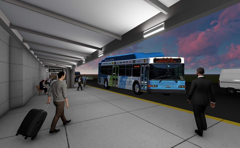
Sea-Tac Airport Arrivals Bus Canopy Expansion Rendering (January 2021)
A rendered illustration of the Seattle-Tacoma International Airport ground transportation area, showing a blue transit bus with a destination sign reading 'Seattle-Tacoma International Airport' and a 'Car Rentals' directional sign. The scene depicts passengers with luggage at a covered bus platform, consistent with a planning or noise-policy document related to Sea-Tac Airport facilities. -
 2020-01-01
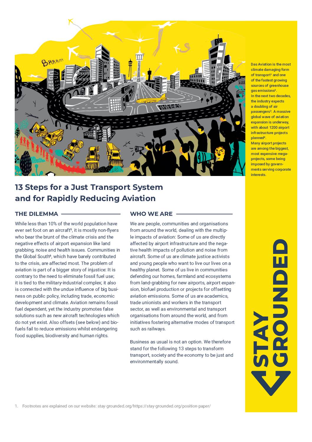
13 Steps for a Just Transport System and for Rapidly Reducing Aviation
The Stay Grounded network outlines 13 steps to reduce aviation's climate and community impacts, calling for a shift to trains and other low-carbon transport, an end to airport expansion, and the elimination of industry subsidies and tax breaks. The document highlights how airport noise, pollution, and land displacement disproportionately harm local communities and Global South populations who rarely fly. It also rejects carbon offsets and unproven technologies as false solutions, instead demanding binding emissions limits and democratic oversight of transport policy.