TagAirport Expansion(165)
-
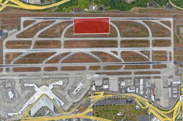
Sea-Tac Airport Third Runway Aerial Overlay
Aerial satellite view of Seattle-Tacoma International Airport (Sea-Tac) showing the runway complex and taxiway system, with a red-highlighted rectangular area marked on one of the runway sections. The Airport Expressway and terminal area are visible in the lower portion of the image. -
 2022-08-23
Victory Against All the Odds: The Story of How the Campaign to Stop a Third Runway at Heathrow Was Won
This document tells the story of how a grassroots campaign successfully stopped the expansion of Heathrow Airport, including the construction of a third runway, by taking on the aviation industry, international business, and the UK Government. Written by campaign leader John Stewart, it outlines the strategies, tactics, and coalition-building efforts that led to the victory. Though focused on Heathrow, the lessons drawn from this campaign are presented as broadly applicable to airport-related advocacy efforts worldwide. -
 2022-08-23
Victory Against All the Odds: The Story of How the Campaign to Stop a Third Runway at Heathrow Was Won
This document recounts the successful grassroots campaign that defeated plans to build a third runway at Heathrow Airport in the UK, taking on the aviation industry, international business, and the UK Government. Written by campaign leader John Stewart, it outlines the strategies, tactics, and coalition-building efforts that led to victory, offering lessons for community advocates fighting airport expansion. While focused on Heathrow, the document provides a relevant model for understanding how organized opposition to airport growth can succeed against powerful institutional forces. -
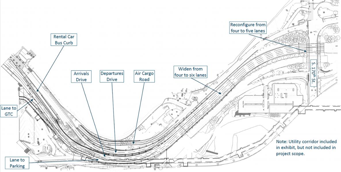
Sea-Tac Airport Landside Roadway Widening – Site Plan
Architectural/engineering plan view of Sea-Tac Airport's landside roadway system showing proposed improvements including widening a segment from four to six lanes, reconfiguring another segment from four to five lanes near S. 170th St., and labeled features including Arrivals Drive, Departures Drive, Air Cargo Road, Rental Car Bus Curb, Lane to GTC, and Lane to Parking. A note states the utility corridor is shown in the exhibit but is not included in project scope. -
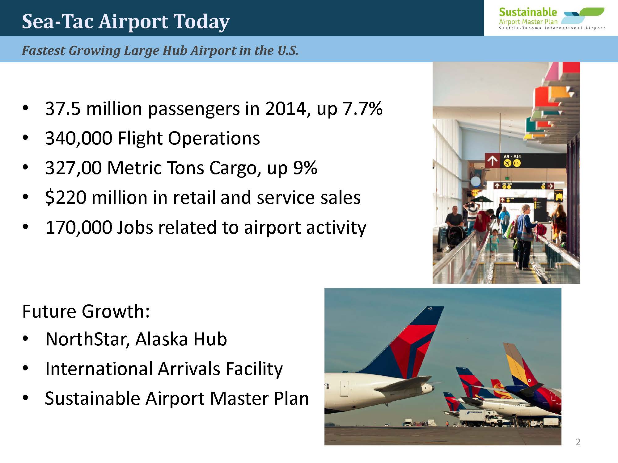
SAMP-2015-0519-BP12-PortofSeattle Page 02
Presentation slide from Seattle-Tacoma International Airport's Sustainable Airport Master Plan summarizing 2014 statistics: 37.5 million passengers (up 7.7%), 340,000 flight operations, 327,000 metric tons cargo (up 9%), $220 million in retail and service sales, and 170,000 airport-related jobs. Future growth initiatives listed include NorthStar Alaska Hub, International Arrivals Facility, and the Sustainable Airport Master Plan. Photos show the terminal interior and Delta Air Lines aircraft on the tarmac. -
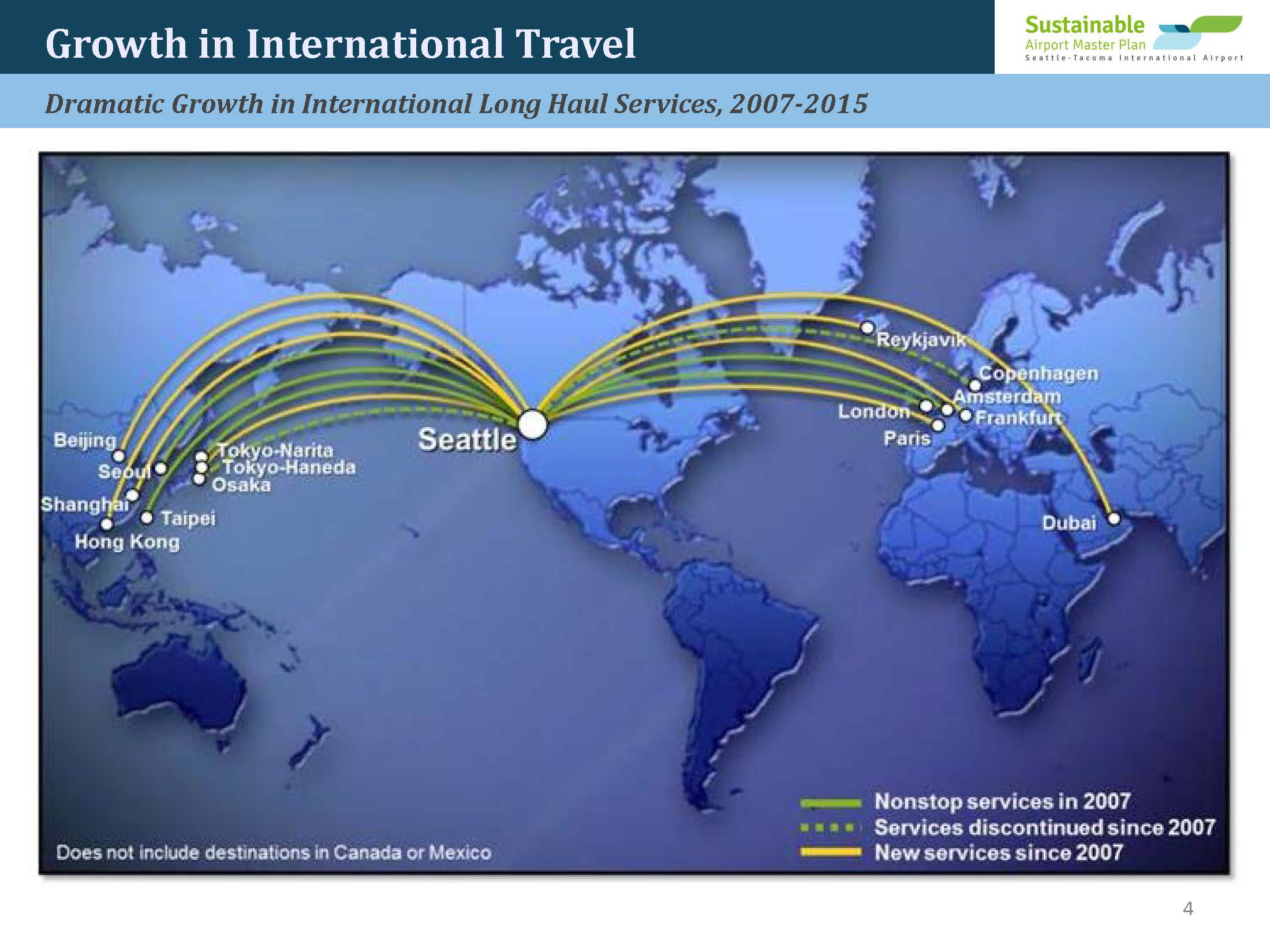
Growth in International Travel – SAMP 2015 May 19 Port of Seattle
A slide from the Seattle-Tacoma International Airport Sustainable Airport Master Plan (slide 4) showing a world route map illustrating dramatic growth in international long-haul nonstop services between 2007 and 2015. Routes are color-coded to distinguish nonstop services existing in 2007, services discontinued since 2007, and new services added since 2007, connecting Seattle to destinations including Beijing, Shanghai, Hong Kong, Tokyo, Seoul, Taipei, Osaka, London, Paris, Amsterdam, Frankfurt, Copenhagen, Reykjavik, and Dubai. -
SAMP-2015-0519-BP12-PortofSeattle Page 08
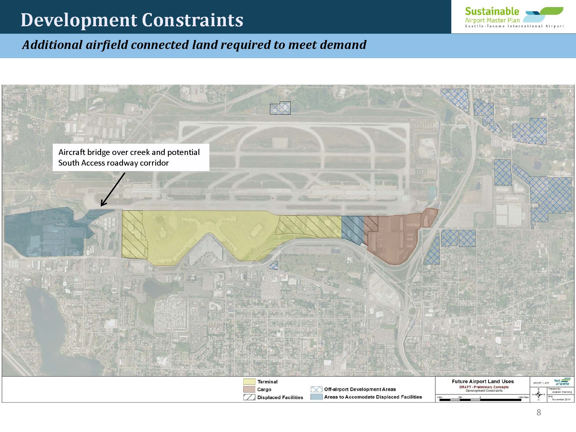
A draft slide from Seattle-Tacoma International Airport's Sustainable Airport Master Plan (November 2014) showing development constraints and future airport land uses, including proposed areas for terminal, cargo, and displaced facilities south of the existing airfield. The slide notes the need for an aircraft bridge over a creek and a potential South Access roadway corridor to connect additional airfield-adjacent land to meet future demand. -
SAMP-2015-0519-BP12-PortofSeattle Page 07
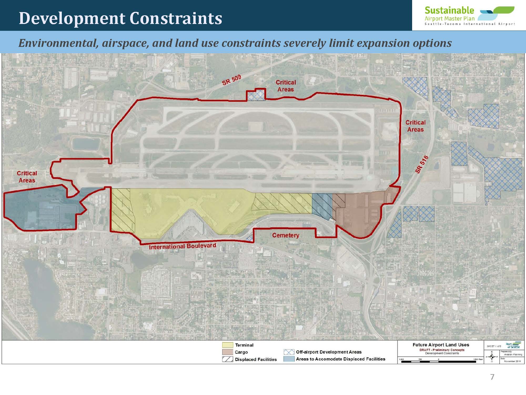
Slide 7 from the Seattle-Tacoma International Airport Sustainable Airport Master Plan (draft, November 2014) showing an aerial map of Sea-Tac Airport annotated with development constraints including Critical Areas, SR 509, SR 518, International Boulevard, and a Cemetery, along with color-coded future land use designations for Terminal, Cargo, Displaced Facilities, Off-airport Development Areas, and Areas to Accommodate Displaced Facilities. The subtitle states that environmental, airspace, and land use constraints severely limit expansion options. -
SAMP-2015-0519-BP12-PortofSeattle Page 06
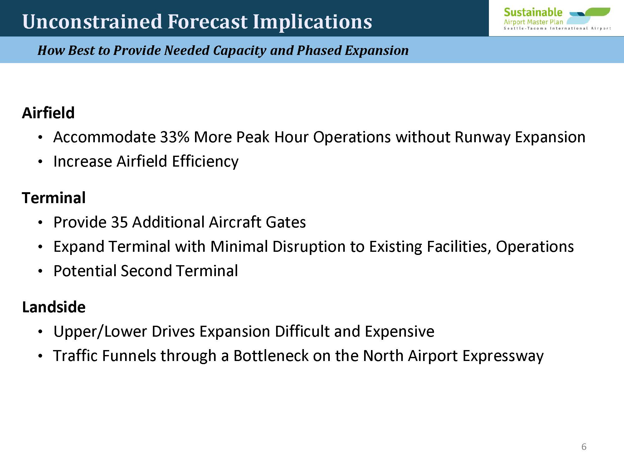
A presentation slide from the Seattle-Tacoma International Airport Sustainable Airport Master Plan, outlining capacity and phased expansion needs across three areas: Airfield (33% more peak hour operations without runway expansion), Terminal (35 additional gates, possible second terminal), and Landside (Upper/Lower Drives expansion challenges, North Airport Expressway bottleneck). -
SAMP-2015-0519-BP12-PortofSeattle Page 11
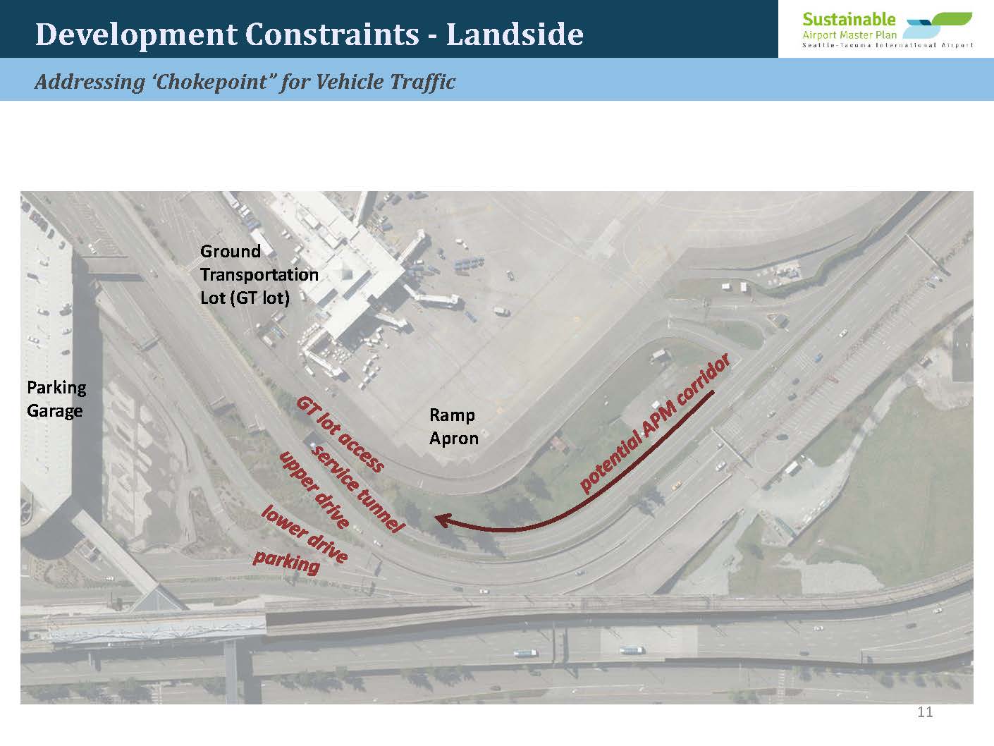
Slide 11 from Seattle-Tacoma International Airport's Sustainable Airport Master Plan presentation, showing an aerial photograph annotated with landside vehicle traffic chokepoints including the Ground Transportation Lot (GT lot), Ramp Apron, Parking Garage, service tunnel, upper and lower drives, and a potential APM (Automated People Mover) corridor.