TagWSDOT(129)
-
 2022-01-06
Commercial Aviation Coordinating Commission: Meeting Summary, January 6, 2022
The Commercial Aviation Coordinating Commission met in January 2022 to discuss potential airport expansion sites in the Washington State region, including updates on a short list of six airports being considered for additional commercial, cargo, and general aviation capacity. The Commission voted to update its decision-making charter language regarding quorums and voting procedures, and reviewed public concerns about noise and community impact, particularly around Tacoma Narrows Airport. No new greenfield airport sites were added to the list, though the Commission acknowledged that additional sites may eventually be needed to meet future aviation demand. -
 2021-12-20
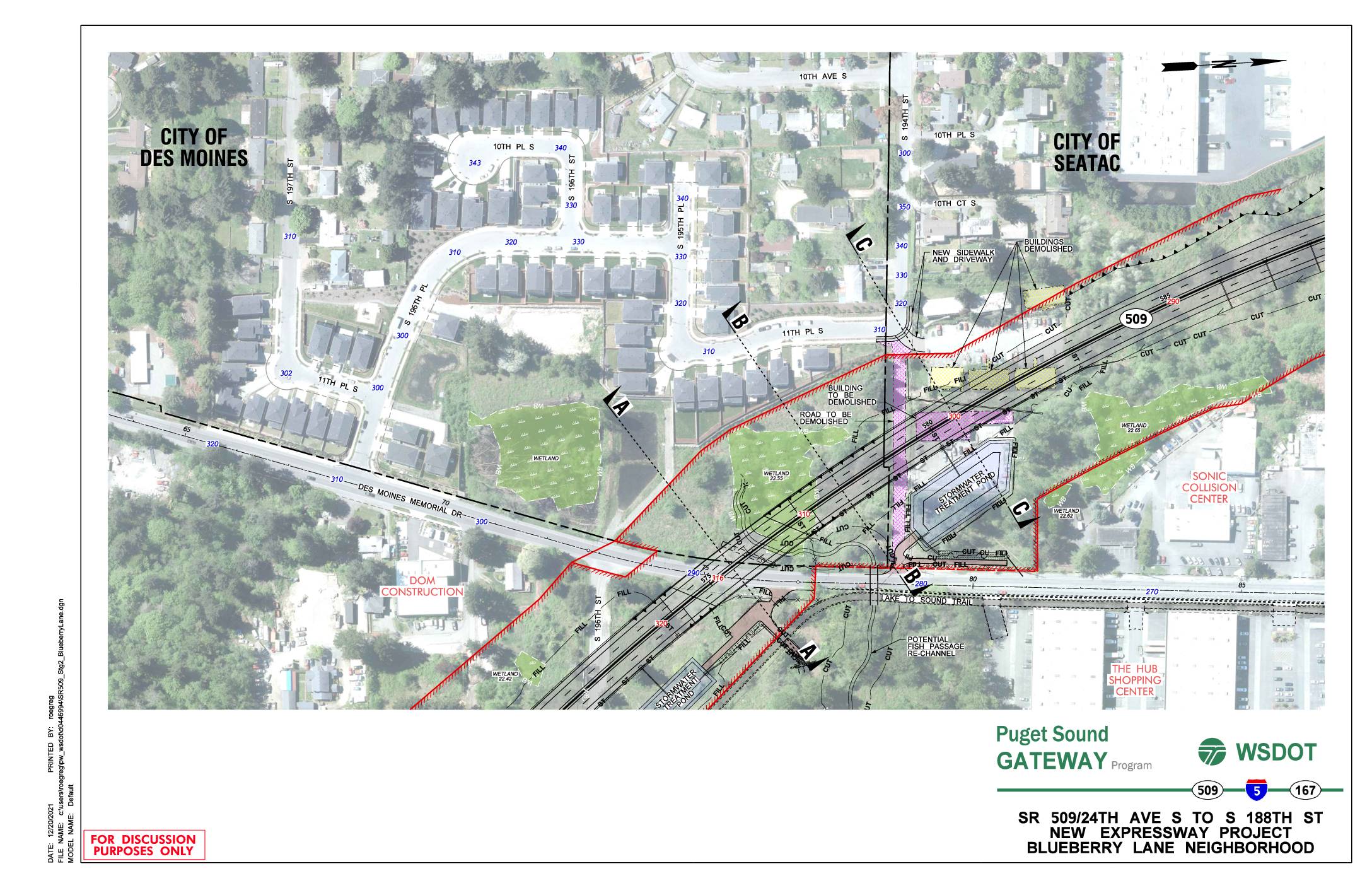
SR 509/24th Ave S to S 188th St new expressway project: Blueberry Lane neighborhood
This WSDOT Puget Sound Gateway Program document presents preliminary design plans for a new SR 509 expressway segment running from 24th Ave S to S 188th St through the Blueberry Lane neighborhood, spanning the cities of Des Moines and SeaTac. The plans show proposed roadway construction, stormwater treatment ponds, wetland areas, and several buildings and roads slated for demolition to accommodate the new highway alignment. Cross-sectional diagrams illustrate the elevation changes and right-of-way boundaries relative to existing neighborhoods, trails, and local streets. -
 2021-11-17
SR 509 Completion Project: Highline Forum presentation
A November 2021 WSDOT presentation outlines the SR 509 Completion Project, part of the broader Puget Sound Gateway Program, which aims to build new highway connections linking the region's ports and distribution centers between 2020 and 2028. The project includes several construction stages covering new expressway segments, interchange improvements at I-5/SR 516, and a Lake to Sound Trail component in the area south of Seattle near Sea-Tac Airport. -
 2021-11-04
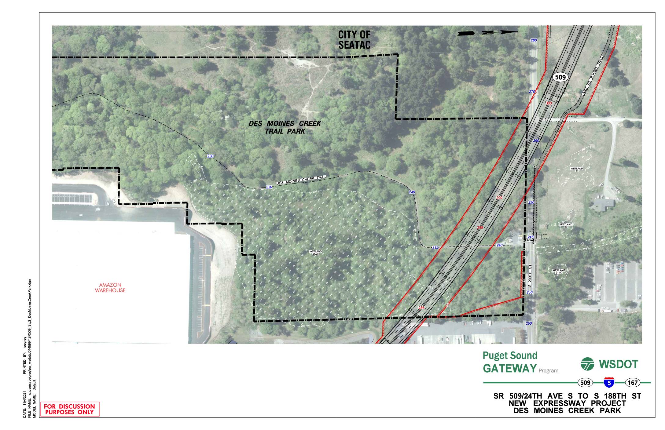
SR 509/24th Ave S to S 188th St new expressway project: Des Moines Creek Park
This WSDOT discussion document from November 2021 shows a planning map for the SR 509 Puget Sound Gateway Program's new expressway project, spanning from 24th Ave S to S 188th St near Des Moines Creek Park in the City of SeaTac. The map highlights the proposed highway alignment (shown in red) running adjacent to Des Moines Creek Trail Park, identifying wetland areas, contour elevations, and nearby features such as an Amazon warehouse and the Lake to Sound Trail. The project represents a major infrastructure expansion in the SeaTac area that would affect the Des Moines Creek Park corridor and surrounding natural resources. -
 2021-02-09
SR509 Surplus Land Purchase: Supporting Development of the Des Moines Creek West Property
In February 2021, the Port of Seattle Commission was asked to authorize the purchase of a 14.3-acre strip of former SR-509 highway right-of-way from WSDOT for approximately $3.15 million. The land, located in Des Moines, WA adjacent to the Port's Des Moines Creek West property, was intended to support development near Seattle-Tacoma International Airport. The acquisition aimed to consolidate Port-controlled land in an industrial corridor close to the airport's flight path. -
 2020-11-18
Puget Sound Gateway Program SR 509 Completion Project: Highline Forum Presentation
The Washington State Department of Transportation (WSDOT) presented the Puget Sound Gateway Program to the Highline Forum in November 2020, outlining plans to complete SR 509 in King County and SR 167 in Pierce County. The SR 509 project includes creating a new south access point to Sea-Tac Airport, improving freight connections to the ports of Seattle and Tacoma, and reducing congestion on local roads. The program also proposes tolling as a tool for sustainable congestion management. -
 2020-10-01
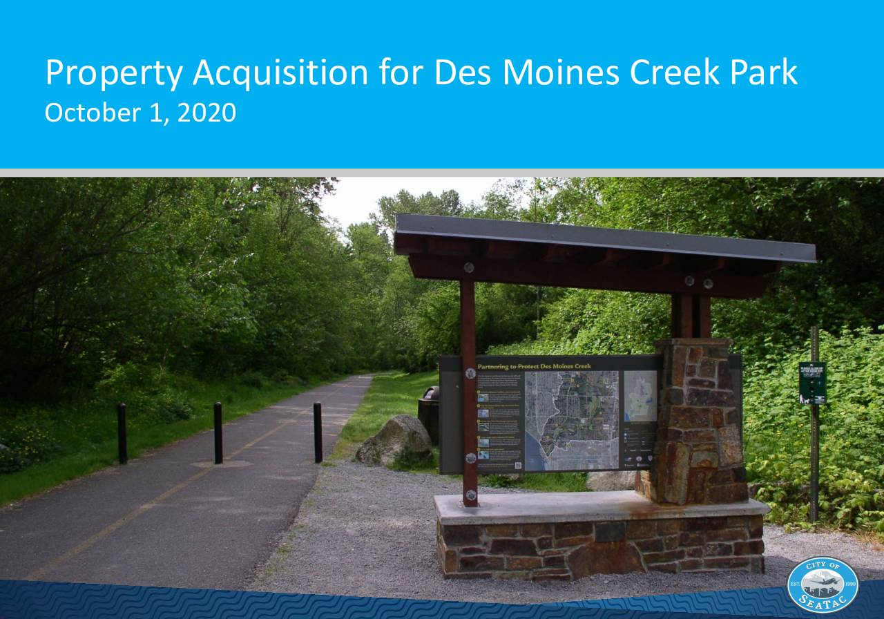
Property Acquisition for Des Moines Creek Park
The City of SeaTac has been working since 2018 to acquire approximately 8 acres of surplus forested land from the Washington State Department of Transportation (WSDOT) adjacent to Des Moines Creek Park. The acquisition aims to expand open space, improve trail access, and preserve a conservation area along one of the city's salmon-bearing streams. As of October 2020, the city had secured $2.29 million in grant funding for the purchase, with an additional $1 million under consideration in the 2021-2022 budget process. -
Commercial Aviation Coordinating Commission (Video)
Commercial Aviation Coordinating Commission Zoom meeting -
 2020-07-01
Washington Aviation Economic Impact Study: Final technical report
The Washington Aviation Economic Impact Study, published in July 2020 by the Washington State Department of Transportation (WSDOT), examines the economic contributions of airports across Washington State, including on-airport activities and off-airport visitor spending. Prepared by Kimley-Horn in partnership with EBP, WSP, and PRR, the study uses economic modeling tools such as IMPLAN to estimate jobs, output, and income generated by aviation activity statewide. The report also addresses how aviation economics changed over the study period, including the effects of COVID-19 on the industry. -
 2020-05-01
SR 518 Corridor Planning Study
The SR 518 Corridor Planning Study, published by the Washington State Department of Transportation (WSDOT) in May 2020, examines the stretch of State Route 518 running from SR 509 to Interstate 5 (milepost 0.00 to 3.42) in the Seattle area near Sea-Tac Airport. The study was conducted by WSDOT's Management of Mobility Division to evaluate transportation conditions and identify potential improvements along this key corridor. It was formally approved by WSDOT leadership in November 2019 and includes standard civil rights and accessibility notices in both English and Spanish.