TagWSDOT(129)
-
 2022-09-01
Regional high occupancy vehicle system policies
This document outlines regional policies for High Occupancy Vehicle (HOV) lanes in the central Puget Sound region, covering rules for lane operation, enforcement, and public education. It establishes that HOV lanes should be reserved 24 hours a day, seven days a week for buses, carpools, and vanpools, and calls for increased fines for violations and better use of technology to improve compliance. The policies were developed by the Regional HOV Policy Advisory Committee in 1998-1999 and are intended to reduce traffic volumes, lower vehicle emissions, and improve overall transportation efficiency. -
 2022-09-01
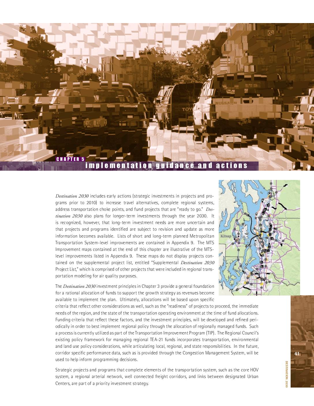
Destination 2030: Implementation guidance and actions
Destination 2030 is a long-term regional transportation plan for the greater Seattle area that outlines both short-term investments (prior to 2010) and longer-term improvements through 2030, focusing on roadway expansions, HOV lane completions, freight network connections, and reduced traffic congestion. The plan prioritizes safety, maintenance, and optimization of existing roads before pursuing new capacity projects, while also emphasizing travel alternatives and pedestrian and bicycle improvements. Fund allocations are guided by project readiness, regional need, and consistency with local growth management policies. -
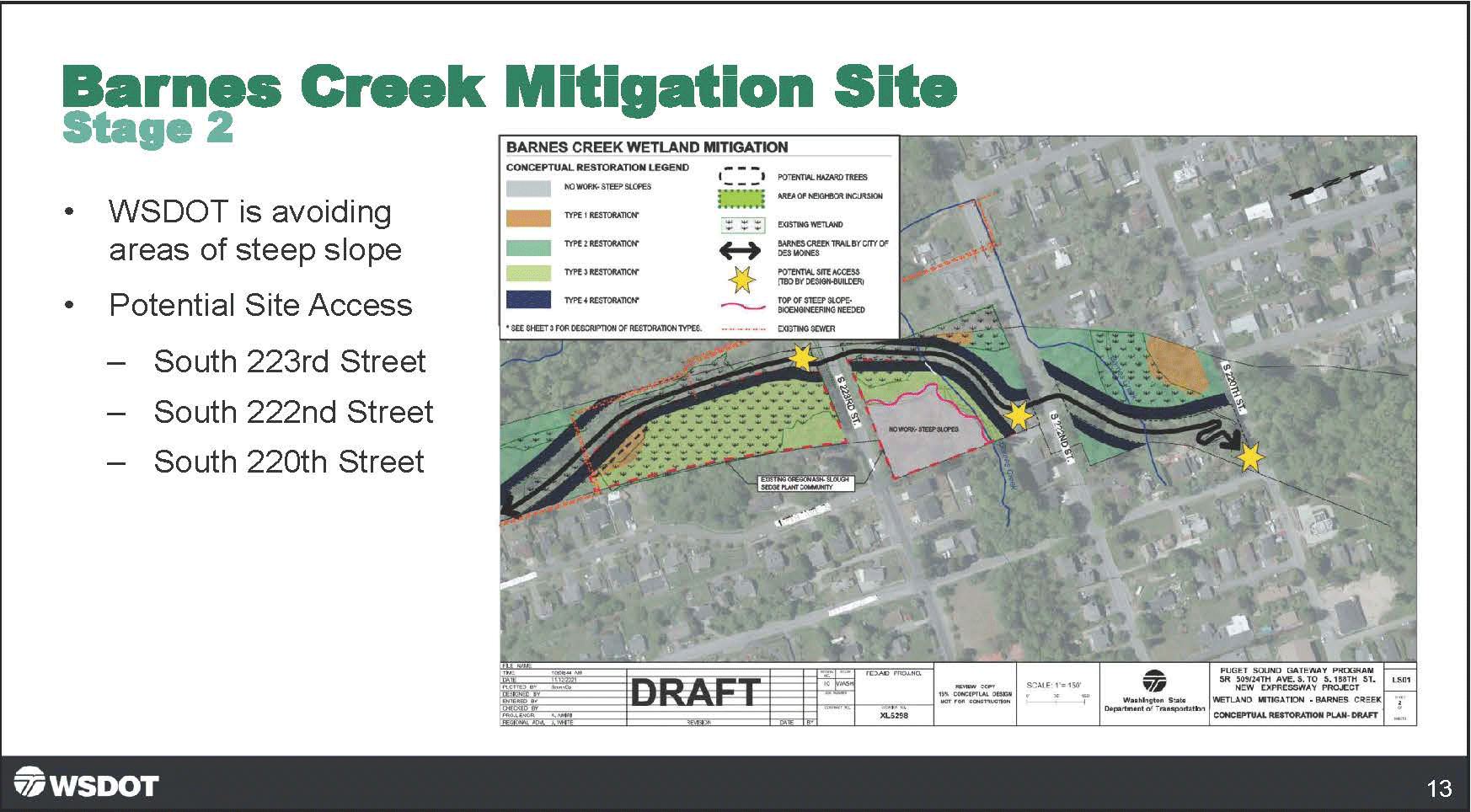
Barnes Creek Trail Mitigation Transportation Committee 09 Jun 2022 Agenda Pdf
A Washington State Department of Transportation (WSDOT) presentation slide labeled 'Barnes Creek Mitigation Site – Stage 2' showing a draft conceptual restoration plan map for Barnes Creek Wetland Mitigation, part of the Puget Sound Gateway Program SR 509/24th Ave. S. to S. 188th St. New Expressway Project. The slide notes WSDOT is avoiding steep slope areas and identifies three potential site access points at South 223rd Street, South 222nd Street, and South 220th Street. -
The Fourth Runway
We’ve begun using the term “Fourth Runway” to describe two large projects (SR-509 and the Sustainable Airport Master Plan) as one system, which they are. The two projects have always been part of a regional plan begun over fifty years ago to meet the strategic goals of the Port Of Seattle and regional planners. The construction of SR-509 will affect the communities are great deal. But starting in 2027 the projects will also increase flight operations at least 33% and cargo operations by 300%. -
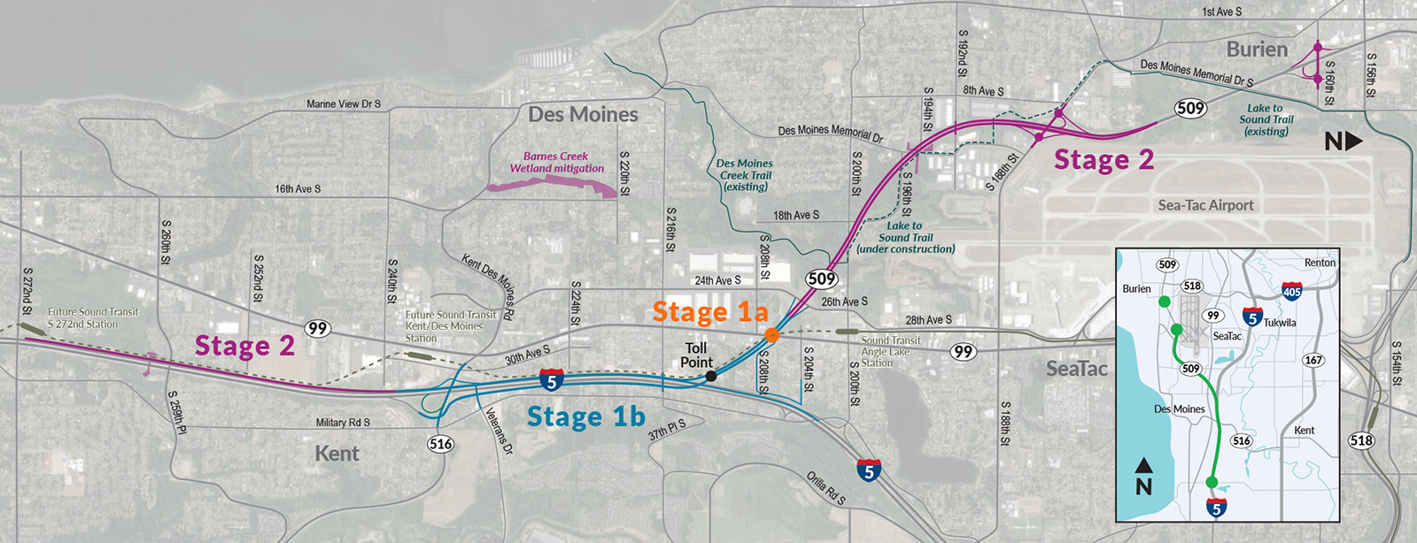
Resized-SR-509-map
This map depicts the Washington State SR-509 extension project, showing three construction stages: Stage 1a (at Toll Point near S 208th St), Stage 1b (along I-5 through Kent), and Stage 2 (connecting Burien via Des Moines Memorial Drive to the existing Lake to Sound Trail). The map also identifies future Sound Transit stations, Barnes Creek Wetland mitigation, the Des Moines Creek Trail, and the Lake to Sound Trail under construction near Sea-Tac Airport. -
 2022-03-24
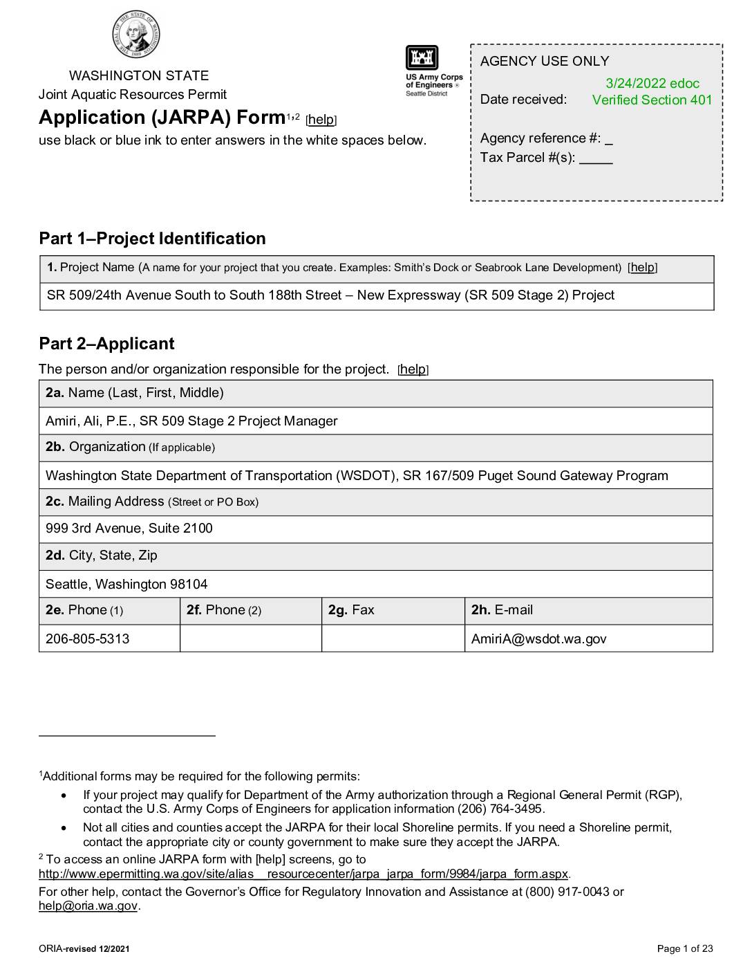
SR 509/24th Avenue South to South 188th Street – New Expressway (SR 509 Stage 2) Project JARPA
This is a Washington State Joint Aquatic Resources Permit Application (JARPA) submitted by the Washington State Department of Transportation (WSDOT) for the SR 509 Stage 2 Project, which involves constructing a new expressway between 24th Avenue South and South 188th Street in the cities of Burien, Des Moines, and SeaTac, King County. The project corridor runs through publicly owned land and spans multiple sections of townships near Sea-Tac Airport. The application was received on March 24, 2022, and covers permits related to aquatic resources affected by the highway construction. -
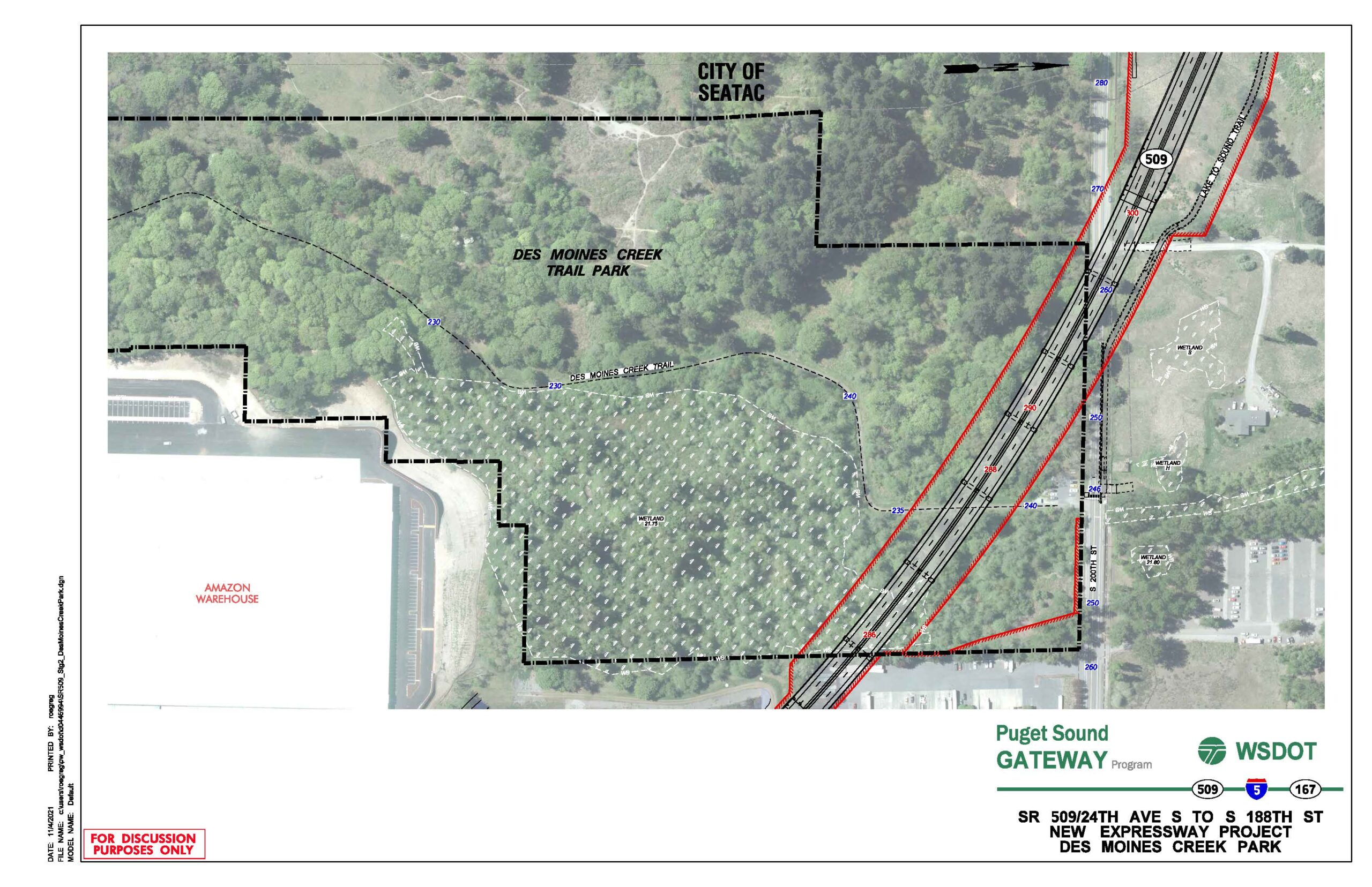
SR-509 Stage 2 Des Moines Creek Park
A WSDOT aerial planning map dated 11/6/2021 showing the proposed SR 509 New Expressway alignment (red lines) relative to Des Moines Creek Trail Park, with project boundaries (dashed black lines), wetland areas, contour elevations, and adjacent features including an Amazon Warehouse and the City of SeaTac boundary. The document is labeled 'For Discussion Purposes Only' and is part of the Puget Sound Gateway Program involving SR 509, I-5, and SR 167. -
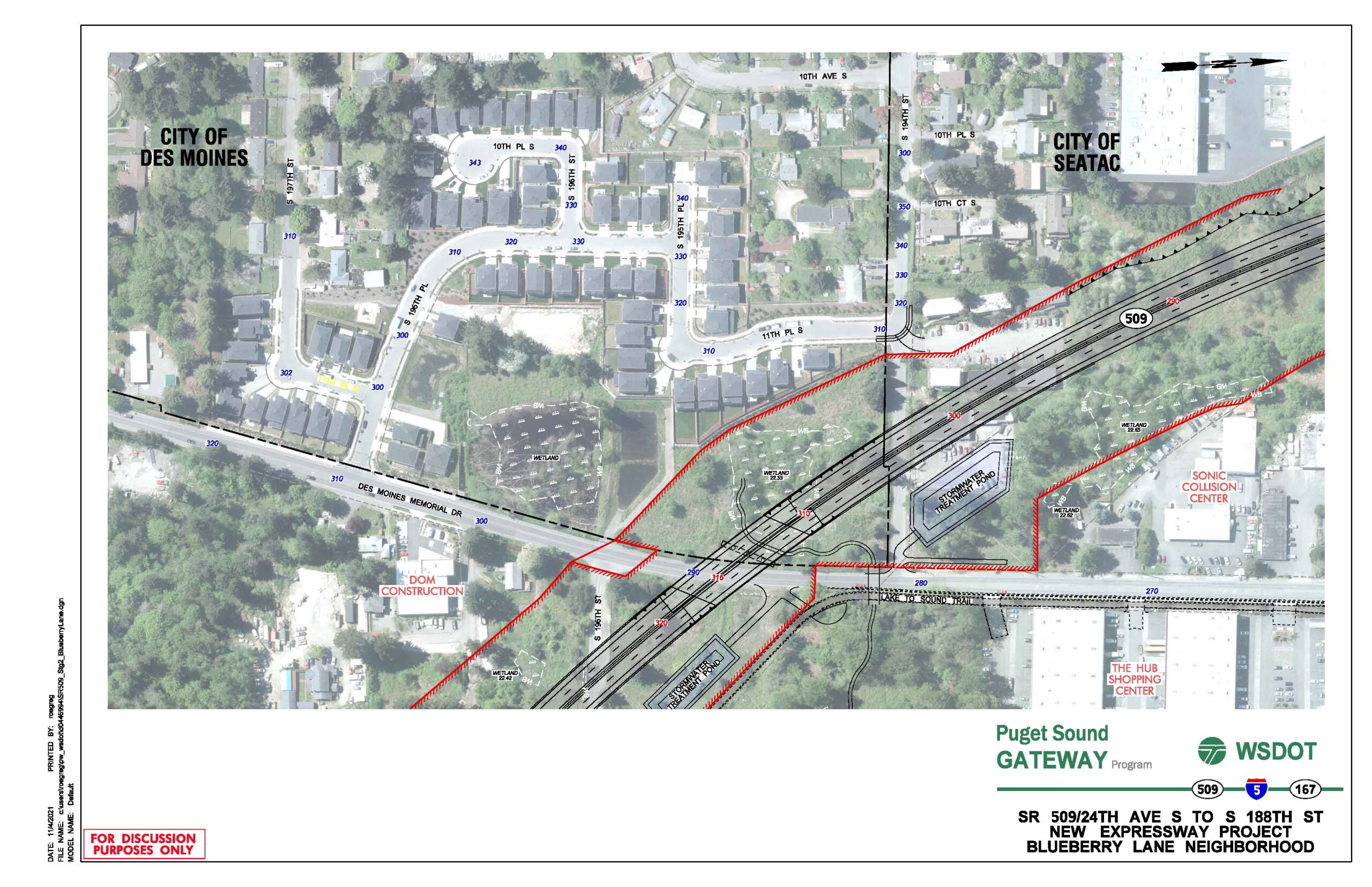
SR-509 Stage 2 BlueberryLane
A WSDOT engineering plan sheet dated 11/06/2021 showing the proposed SR 509/24th Ave S to S 188th St new expressway alignment through the Blueberry Lane neighborhood, straddling the City of Des Moines and City of SeaTac boundary. The map identifies right-of-way limits (red hatching), stormwater treatment ponds, wetlands, the Lake-to-Sound Trail, and nearby landmarks including The Hub Shopping Center and Sonic Collision Center, produced under the Puget Sound Gateway Program. -
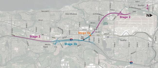
SR509 Stages Map
A project staging map shows the SR 509 extension and I-5 connector route divided into Stage 1a (toll point near Des Moines Memorial Drive), Stage 1b (along Military Road S toward Kent), and Stage 2 (extending northwest toward Burien and southeast toward Kent via SR 99). The map covers the Des Moines, SeaTac, Burien, and Kent areas of Washington State, with route numbers 99, 509, 316, and 5 visible. -
 2022-02-09
Commercial Aviation Coordinating Commission report to legislative transportation committees
The Washington State Commercial Aviation Coordinating Commission's 2022 report to the Legislature identifies six existing airports — including Paine Field, Bremerton National, and Tacoma Narrows — as candidates for expanded aviation capacity, while also exploring potential greenfield sites for a new airport. The report summarizes public input showing that a majority of respondents support building new aviation capacity despite environmental costs, and outlines the Commission's guiding principles of public benefit, economic feasibility, environmental responsibility, and social equity. The Commission's final recommendations are expected by February 15, 2023.