TagSea-Tac Communities Plan(215)
-
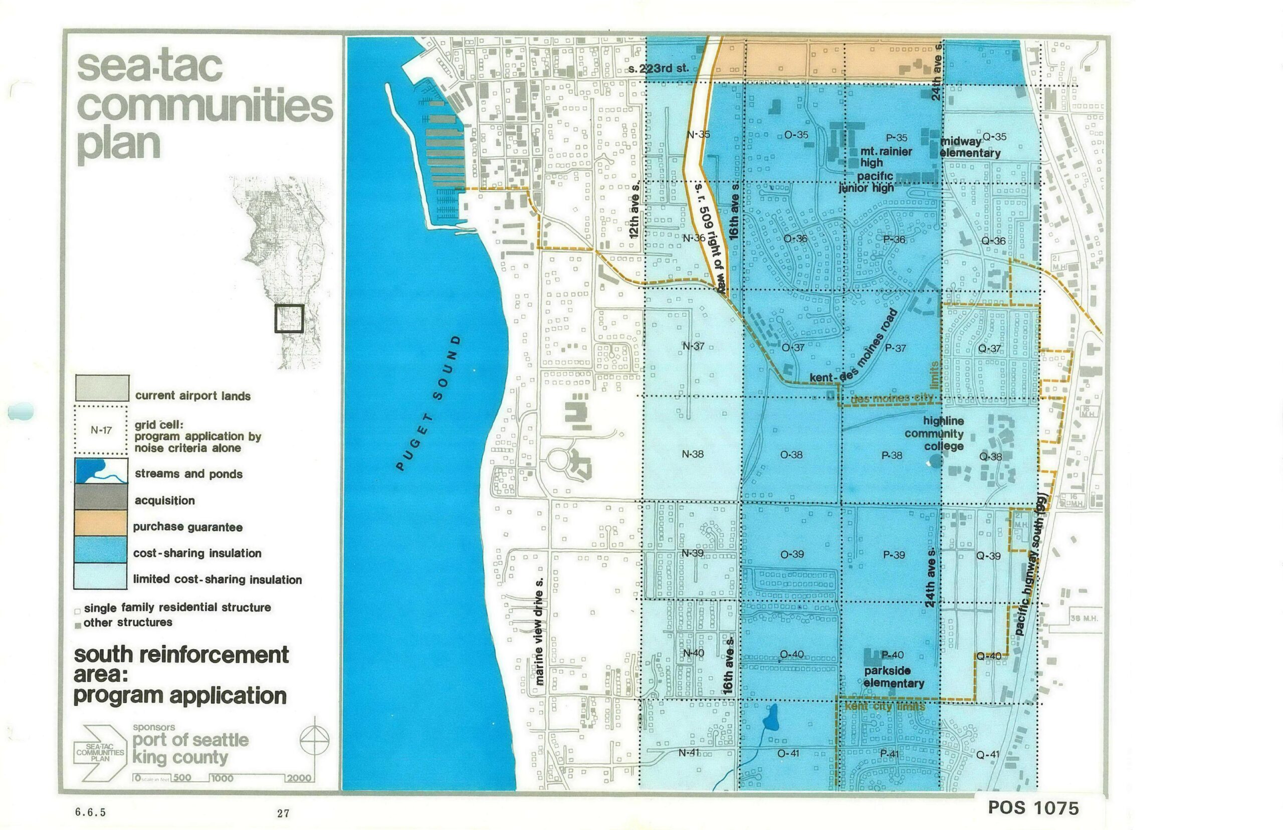
Sea-Tac Communities Plan South Reinforcement Area Program Application Map
A planning map from the Sea-Tac Communities Plan, sponsored by the Port of Seattle and King County, showing the south reinforcement area and its program applications including cost-sharing insulation, acquisition, purchase guarantee, and limited cost-sharing insulation zones. The map (document reference 6.6.5, page 27, POS 1075) covers grid cells N/O/P/Q rows 35–41 along Puget Sound, identifying landmarks such as Mt. Rainier High, Pacific Junior High, Midway Elementary, Highline Community College, and Parkside Elementary. -
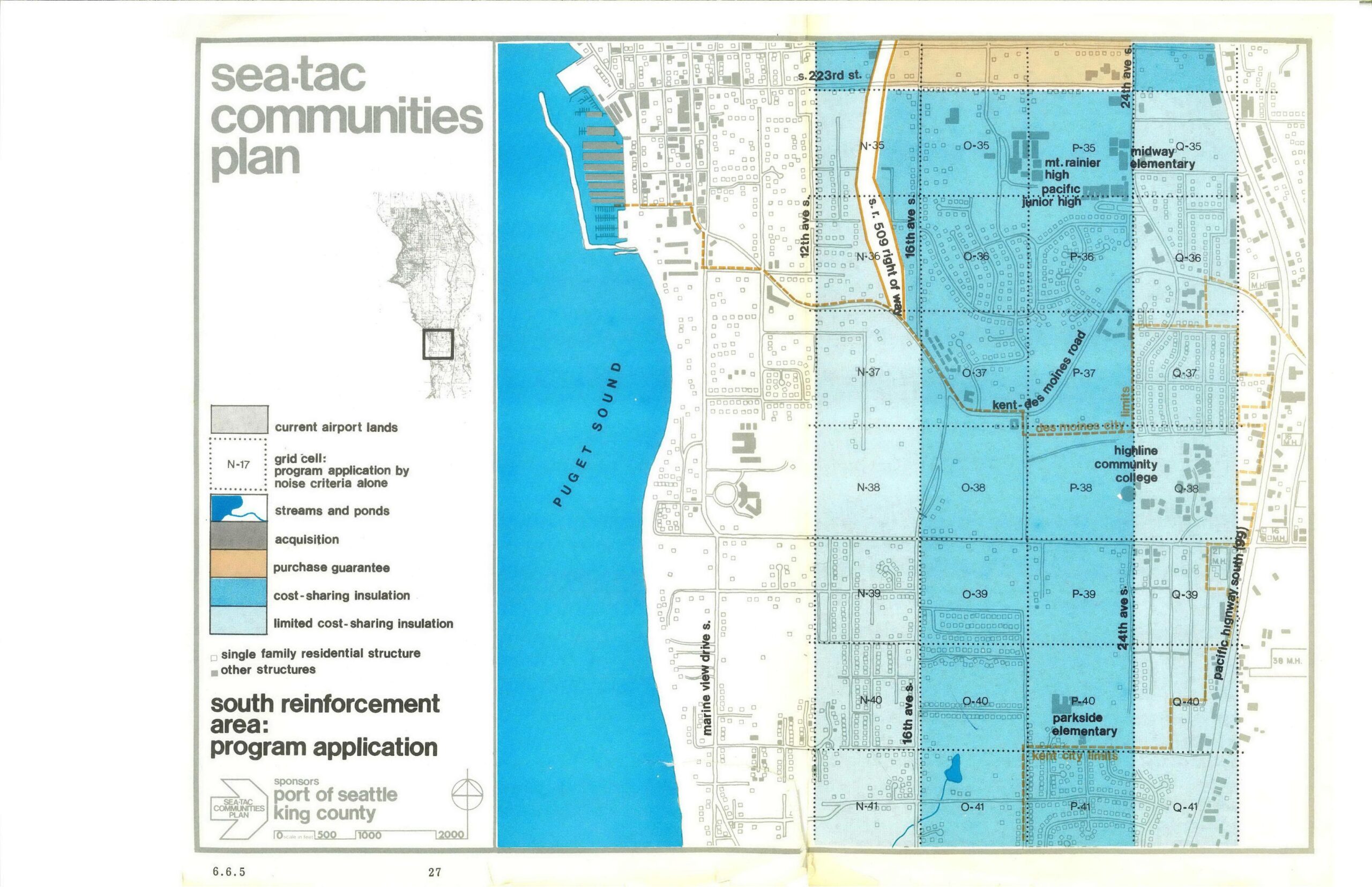
STCP South Reinforcement Area Program Application Map (Page 27)
This is page 27 (section 6.6.5) of the Sea-Tac Communities Plan, sponsored by the Port of Seattle and King County, showing the South Reinforcement Area program application map. The map depicts grid cells across the area east of Puget Sound (along Marine View Drive S., 12th, 16th, and 24th Ave S., and the Kent-Des Moines Road corridor) color-coded by noise-mitigation program type: cost-sharing insulation, limited cost-sharing insulation, purchase guarantee, and acquisition, with landmarks including Mt. Rainier High, Pacific Junior High, Midway Elementary, Highline Community College, and Parkside Elementary noted. -
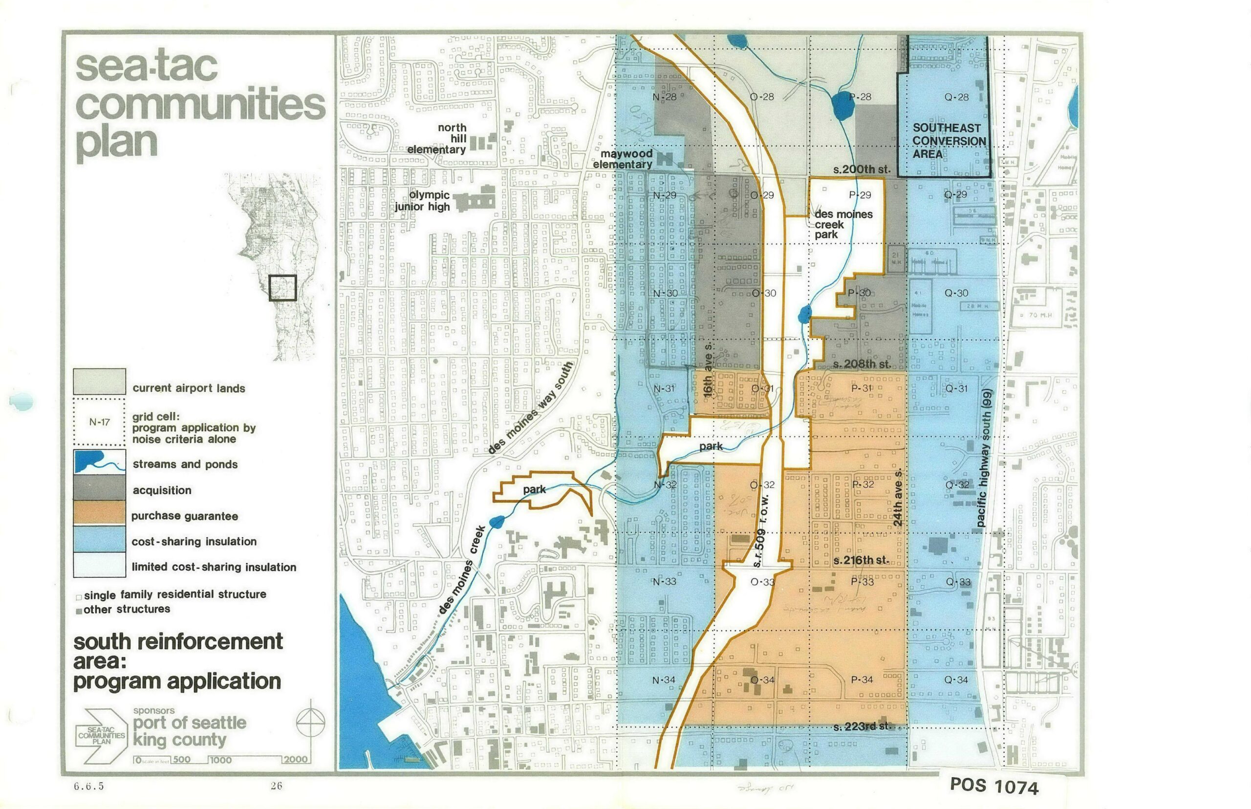
STCP South Reinforcement Area Program Application Map (Page 26)
This planning map, document number POS 1074 (sheet 6.6.5, page 26), was produced for the Sea-Tac Communities Plan and sponsored by the Port of Seattle and King County. It depicts the South Reinforcement Area program application, showing grid cells color-coded by noise-mitigation program type—including acquisition, purchase guarantee, cost-sharing insulation, and limited cost-sharing insulation—across the area roughly bounded by S. 200th St. to the north and S. 223rd St. to the south, with landmarks such as Des Moines Creek Park, Maywood Elementary, and Pacific Highway South (SR 99) labeled. -
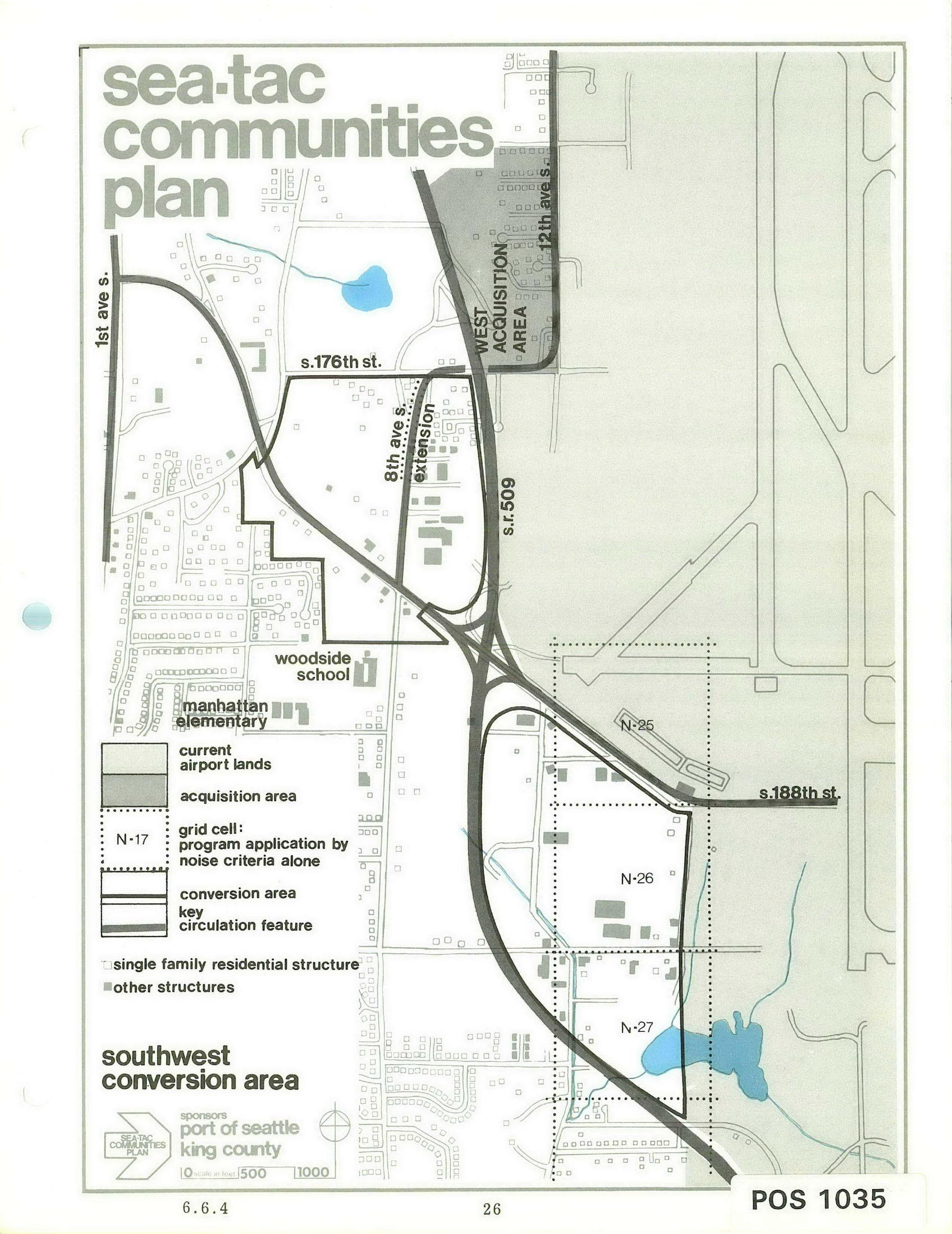
Sea-Tac Communities Plan: Southwest Conversion Area Planning Map
A planning map labeled 'Sea-Tac Communities Plan' depicting the Southwest Conversion Area near Seattle-Tacoma International Airport, showing current airport lands, acquisition areas, grid cells (N-25, N-26, N-27), key streets (S. 176th St., S. 188th St., 1st Ave S., 12th Ave S.), SR 509, the 8th Ave S. extension, and local schools (Woodside School, Manhattan Elementary). Sponsored by the Port of Seattle and King County, document reference POS 1035, page 6.6.4. -
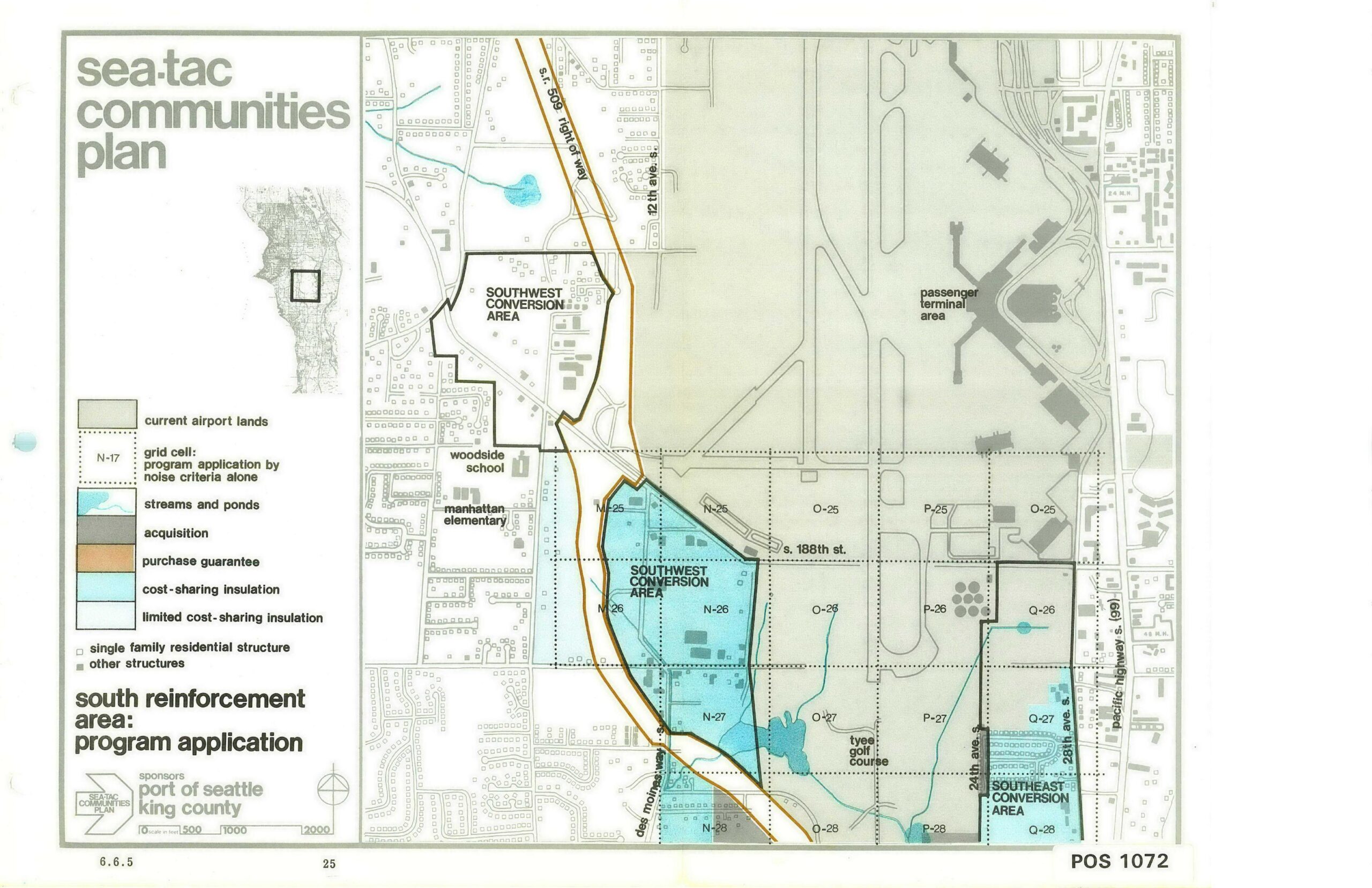
Sea-Tac Communities Plan — South Reinforcement Area Program Application Map (Page 25)
A planning map from the Sea-Tac Communities Plan, document number POS 1072 (dated 6.6.5, page 25), sponsored by the Port of Seattle and King County. The map depicts the South Reinforcement Area program application near Seattle-Tacoma International Airport, showing Southwest and Southeast Conversion Areas, grid cells by noise criteria, acquisition zones, purchase guarantee corridors, cost-sharing insulation areas, and landmarks including Woodside School, Manhattan Elementary, and Tyee Golf Course. -
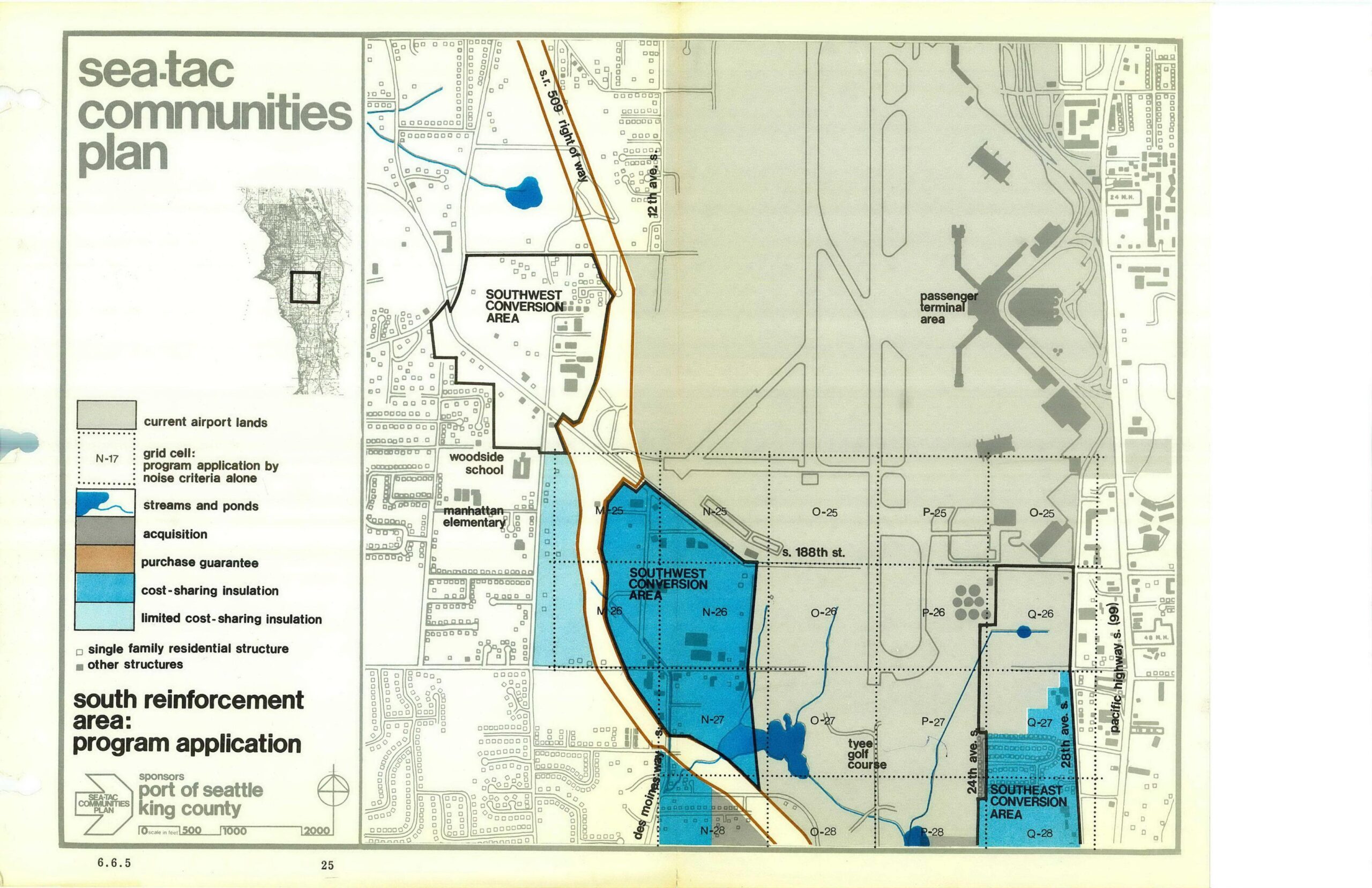
STCP South Reinforcement Area Program Map — Acquisition Zones, Insulation Areas, and Conversion Zones
This map from the Sea-Tac Communities Plan, sponsored by the Port of Seattle and King County, depicts the South Reinforcement Area program application showing acquisition zones, purchase guarantee corridors, cost-sharing insulation areas, and conversion zones (Southwest and Southeast) relative to current airport lands and surrounding neighborhoods including Woodside School and Manhattan Elementary. Grid cells, streams, ponds, and residential structures are also identified in the legend. -
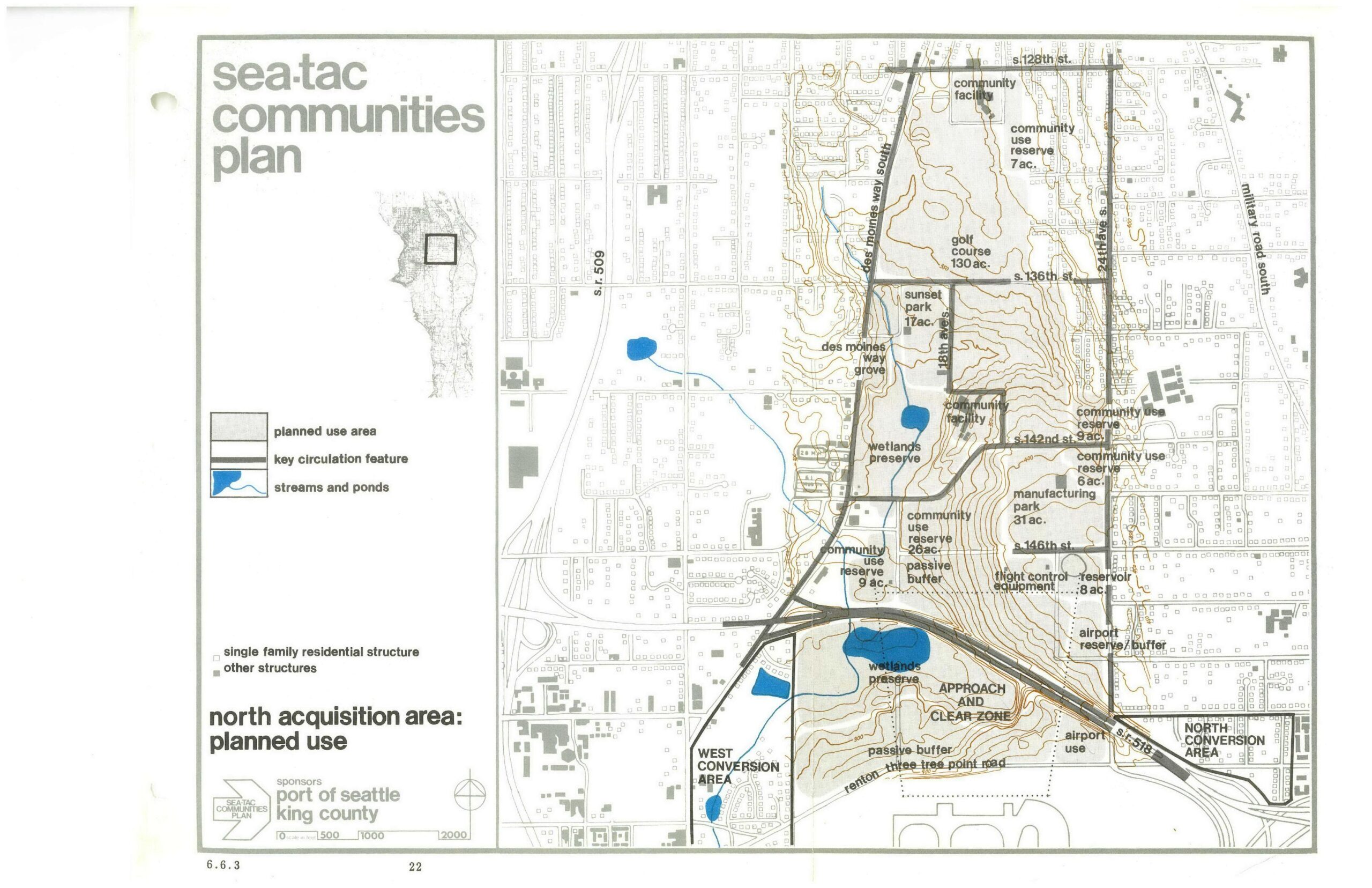
STCP North Acquisition Area Planned Use Map
A land-use planning map from the Sea-Tac Communities Plan, sponsored by the Port of Seattle and King County, showing the North Acquisition Area's planned uses including wetlands preserves, community use reserves, a golf course (130 ac.), Sunset Park (17 ac.), manufacturing park (31 ac.), passive buffers, flight control equipment area, airport reserve/buffer, and approach and clear zone designations. Key streets visible include S. 128th St., S. 136th St., S. 142nd St., S. 146th St., Des Moines Way South, 24th Ave. S., and Military Road South. -
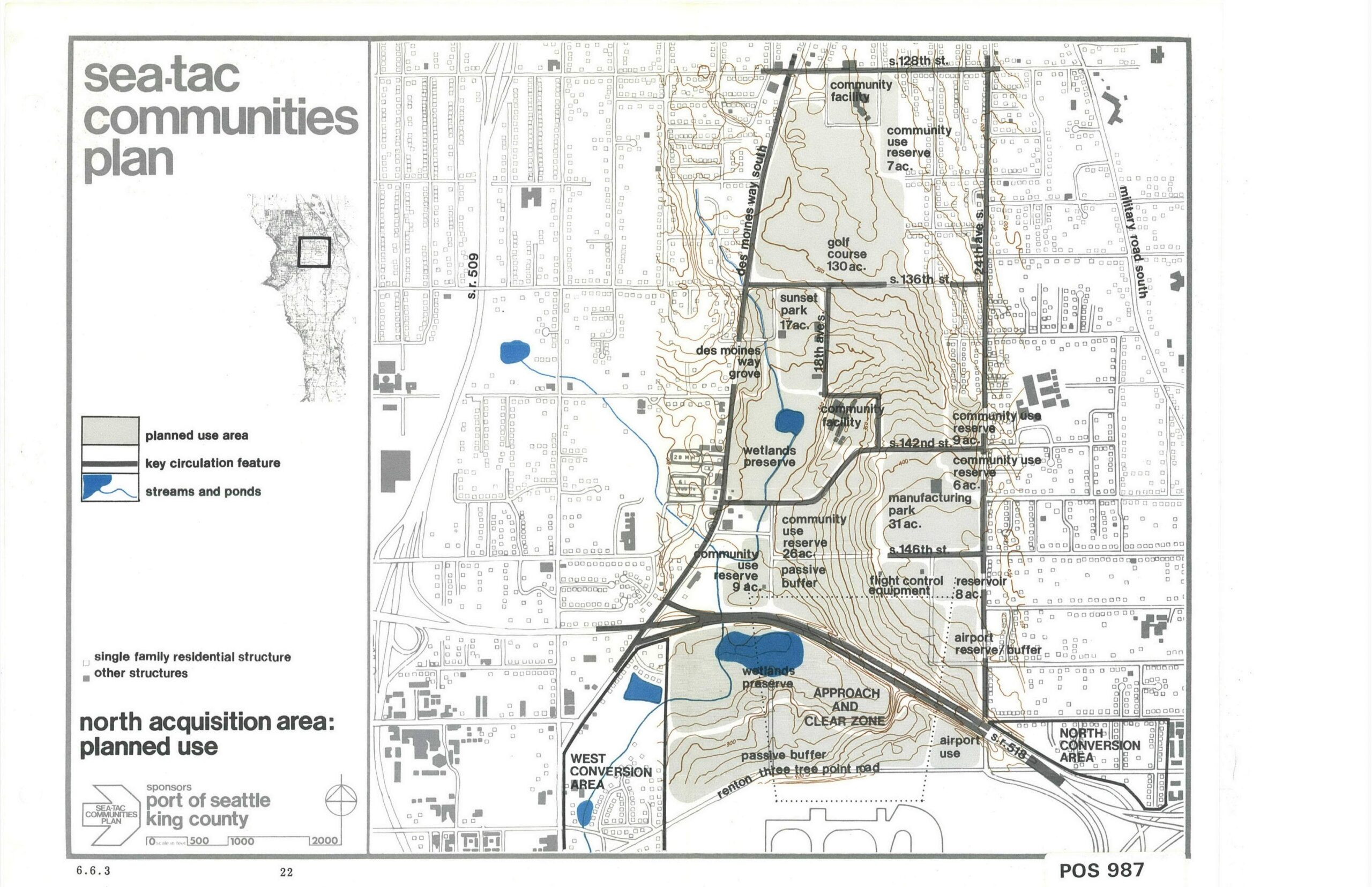
Sea-Tac Communities Plan (STCP) — North Acquisition Area Planned Land Uses, Page 22
This planning map, labeled 'POS 987' and page 22 (section 6.6.3), is from the Sea-Tac Communities Plan sponsored by the Port of Seattle and King County. It depicts the North Acquisition Area planned land uses, including wetlands preserves, community use reserves, a golf course (130 ac.), manufacturing park, airport reserve/buffer zones, and approach/clear zones around Seattle-Tacoma International Airport. -
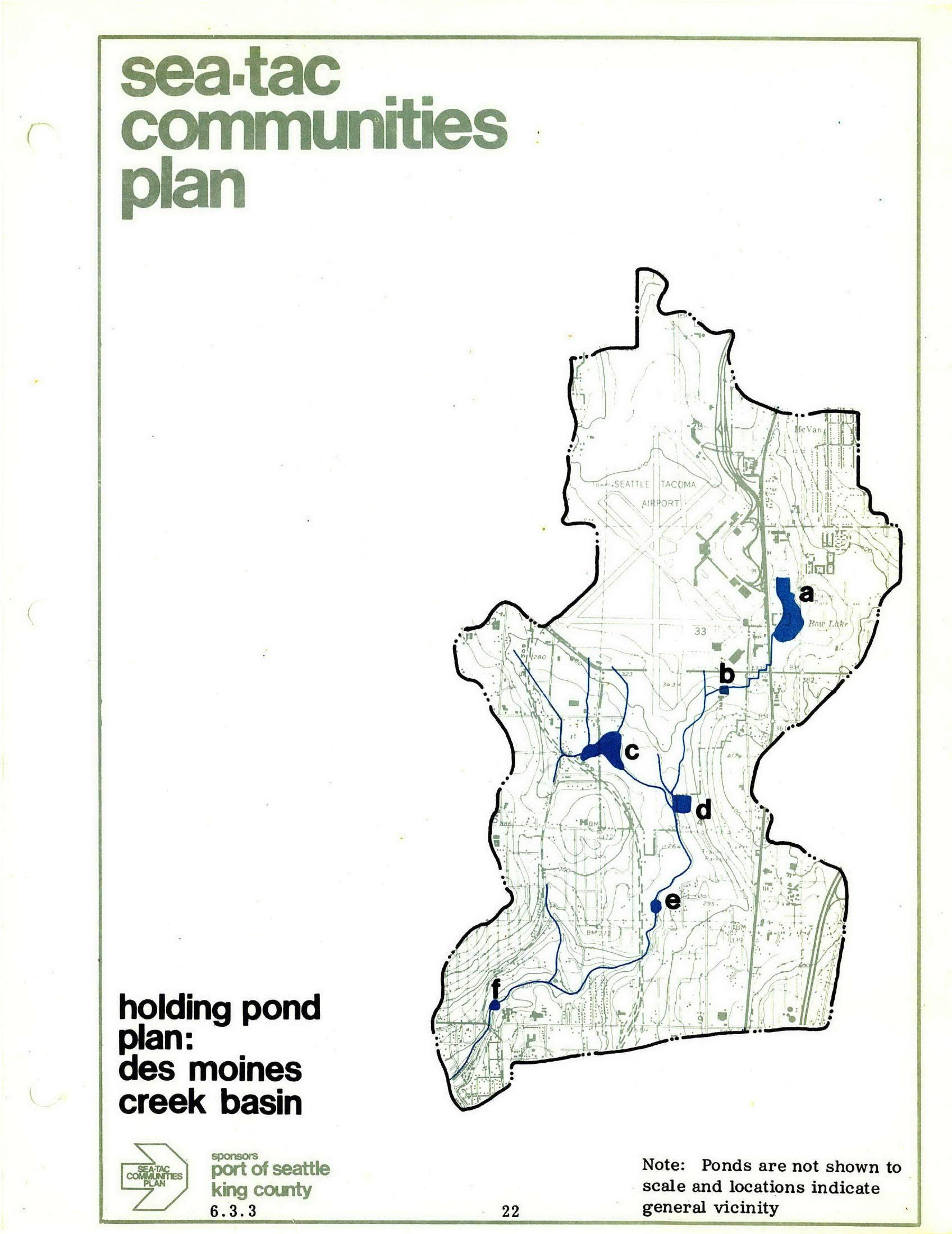
STCP Des Moines Creek Basin Holding Pond Plan
A planning map from the Sea-Tac Communities Plan, sponsored by the Port of Seattle and King County, showing the Des Moines Creek Basin holding pond locations (labeled a through f) in relation to Seattle-Tacoma Airport and surrounding areas, including Hog Lake. A note indicates ponds are not shown to scale and locations indicate general vicinity only. -
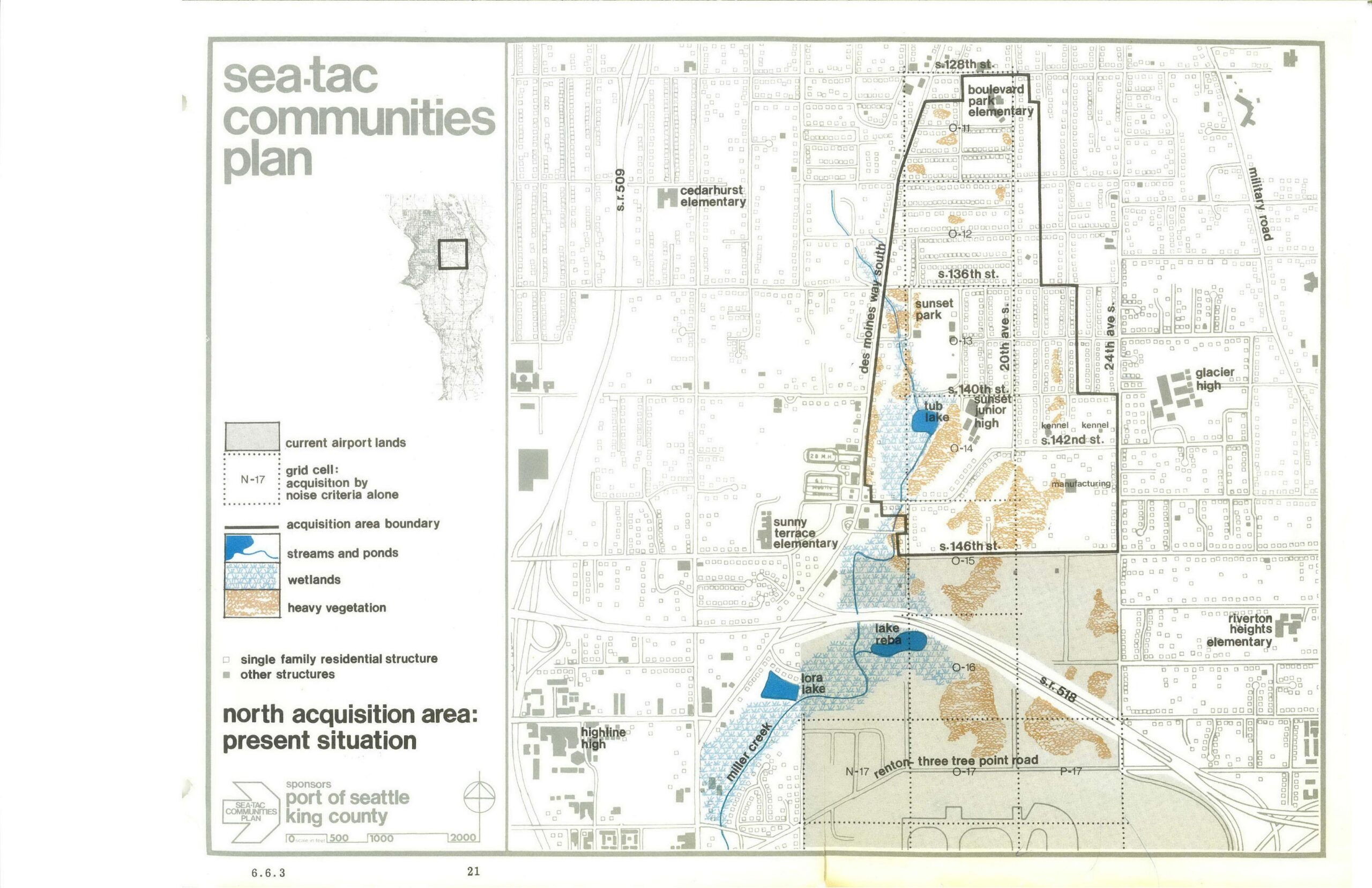
STCP North Acquisition Area Present Situation Planning Map
A planning map sponsored by the Port of Seattle and King County as part of the Sea-Tac Communities Plan, depicting the North Acquisition Area and its present situation. The map identifies schools (Boulevard Park Elementary, Cedarhurst Elementary, Sunset Junior High, Glacier High, Highline High, and others), land features (wetlands, streams, heavy vegetation), grid cells subject to acquisition by noise criteria alone, and key streets including S. 128th St., S. 136th St., S. 140th St., S. 146th St., and State Routes 509 and 518.