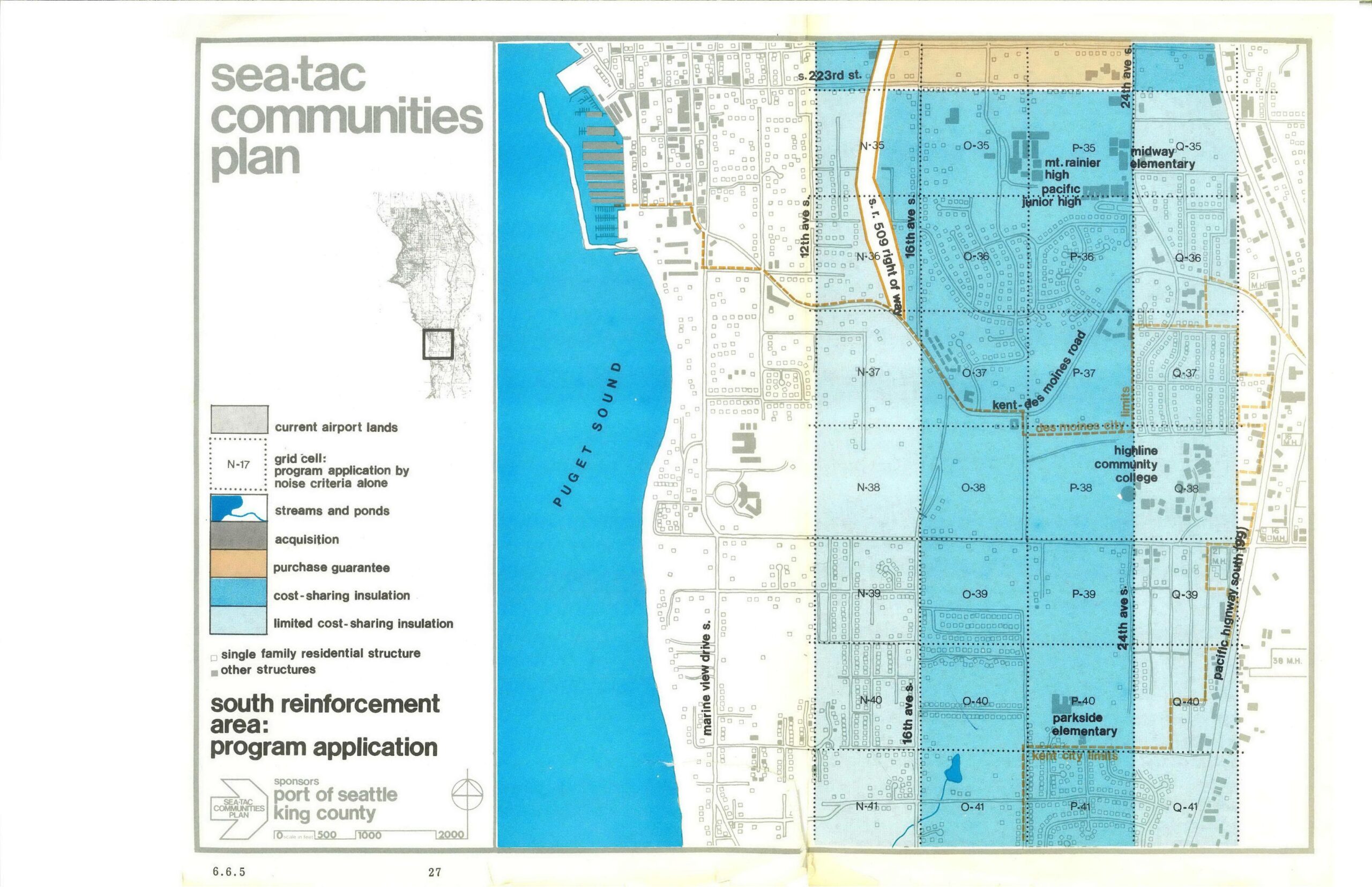
This is page 27 (section 6.6.5) of the Sea-Tac Communities Plan, sponsored by the Port of Seattle and King County, showing the South Reinforcement Area program application map. The map depicts grid cells across the area east of Puget Sound (along Marine View Drive S., 12th, 16th, and 24th Ave S., and the Kent-Des Moines Road corridor) color-coded by noise-mitigation program type: cost-sharing insulation, limited cost-sharing insulation, purchase guarantee, and acquisition, with landmarks including Mt. Rainier High, Pacific Junior High, Midway Elementary, Highline Community College, and Parkside Elementary noted.Open full document
Notes
This is page 27 (section 6.6.5) of the Sea-Tac Communities Plan, sponsored by the Port of Seattle and King County, showing the South Reinforcement Area program application map. The map depicts grid cells across the area east of Puget Sound (along Marine View Drive S., 12th, 16th, and 24th Ave S., and the Kent-Des Moines Road corridor) color-coded by noise-mitigation program type: cost-sharing insulation, limited cost-sharing insulation, purchase guarantee, and acquisition, with landmarks including Mt. Rainier High, Pacific Junior High, Midway Elementary, Highline Community College, and Parkside Elementary noted.