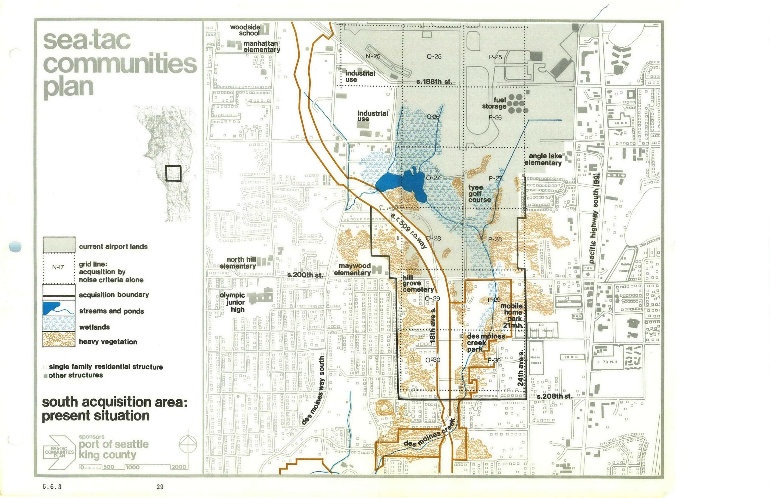
This planning map, page 29 (figure 6.6.3) of the Sea-Tac Communities Plan sponsored by the Port of Seattle and King County, depicts the south acquisition area around Seattle-Tacoma International Airport, showing current airport lands, acquisition boundaries, grid lines for noise-criteria acquisition, streams, ponds, wetlands, heavy vegetation, and key landmarks including Tyee Golf Course, Hill Grove Cemetery, Des Moines Creek Park, and several schools along Pacific Highway South and Des Moines Way South.Open full document
Notes
This planning map, page 29 (figure 6.6.3) of the Sea-Tac Communities Plan sponsored by the Port of Seattle and King County, depicts the south acquisition area around Seattle-Tacoma International Airport, showing current airport lands, acquisition boundaries, grid lines for noise-criteria acquisition, streams, ponds, wetlands, heavy vegetation, and key landmarks including Tyee Golf Course, Hill Grove Cemetery, Des Moines Creek Park, and several schools along Pacific Highway South and Des Moines Way South.