TagPort Of Seattle(2349)
-
RCW Title 29A: Elections
This Title of State law describes election procedures. For our purposes, we’re largely concerned with a path towards altering the structure and size of the Port Of Seattle’ Commission. Specifically, we’d like to see a nine-member Commission with District-based elections. -
 2019-09-25
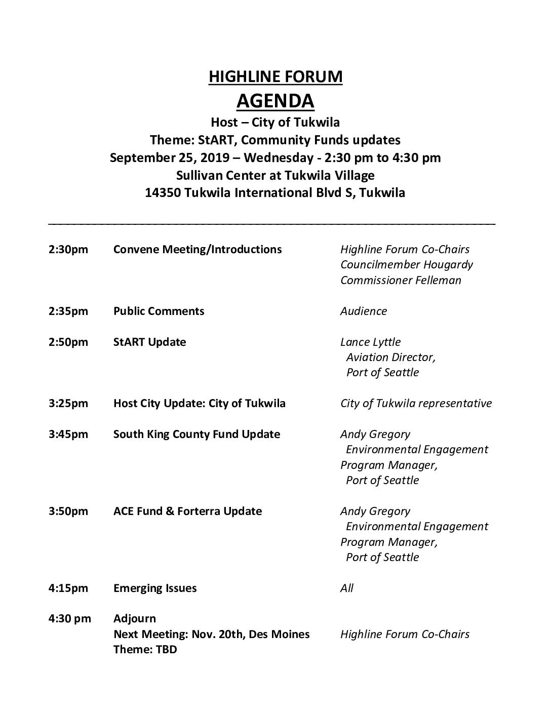
Highline Forum agenda: StART, Community Funds updates
The Highline Forum held a meeting on September 25, 2019, hosted by the City of Tukwila, focusing on StART (Sea-Tac Airport Roundtable) updates and community fund programs affecting South King County residents living near Sea-Tac Airport. Key agenda items included a StART update from Port of Seattle Aviation Director Lance Lyttle, along with updates on the South King County Fund and the ACE Fund presented by Port of Seattle Environmental Engagement Program Manager Andy Gregory. The next meeting was scheduled for November 20, 2019, at Des Moines Beach Park Dining Hall. -
EPA is right to withdraw stringent water-quality rule | Op-Ed
Bob Edwards was a Port Commissioner during the height of the 3rd Runway fight from 1999-2007. -
 2019-09-12
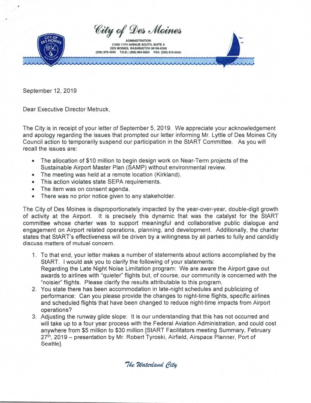
City of Des Moines response to Port Of Seattle Executive Director Metruck regarding StART Committee
In September 2019, the City of Des Moines responded to a Port of Seattle apology letter regarding the allocation of $10 million for Sustainable Airport Master Plan (SAMP) design work without prior environmental review or stakeholder notice, which had prompted Des Moines and other nearby cities to temporarily suspend participation in the Sea-Tac Stakeholder Advisory Round Table (StART). The City challenged the Port's claims of meaningful progress on noise reduction measures, requesting specific data on the Late Night Noise Limitation program, changes to nighttime flight schedules, and the status of runway glide slope adjustments. The exchange highlights ongoing tensions between Sea-Tac Airport and surrounding communities over transparency, environmental compliance, and the effectiveness of collaborative noise mitigation efforts. -
 2019-09-12
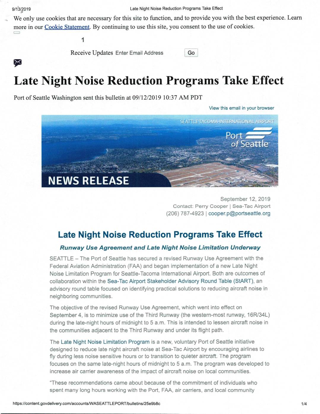
Late night noise reduction programs take effect
In September 2019, the Port of Seattle announced two new programs to reduce late-night aircraft noise at Seattle-Tacoma International Airport. A revised Runway Use Agreement with the FAA took effect on September 4, limiting use of the Third Runway (16R/34L) between midnight and 5 a.m., while a new voluntary Late Night Noise Limitation Program encourages airlines to schedule flights during less noise-sensitive hours or switch to quieter aircraft during the same period. Both initiatives stemmed from recommendations by the Sea-Tac Airport Stakeholder Advisory Round Table (StART). -
 2019-09-05
Port Of Seattle Executive Director Letter to Burien City Council on StART Suspension
In this September 5, 2019 letter, Port of Seattle Executive Director Stephen Metruck responds to the City of Burien's decision to suspend participation in the Sea-Tac Stakeholder Advisory Round Table (StART), along with similar decisions by Des Moines and Federal Way. Metruck apologizes for failing to promptly notify cities about preliminary design funding and reaffirms the Port's commitment to open communication on airport expansion and noise issues. He highlights progress made through StART—such as late-night noise limits, runway glide slope adjustments, and requests for airlines to retire louder aircraft—and pledges to work with all cities to find a constructive path forward. -
2019-09-05
Port Of Seattle Executive Director Letter to Burien City Council on StART Suspension
In this September 5, 2019 letter, Port of Seattle Executive Director Stephen Metruck responds to the City of Burien's decision to suspend participation in the Sea-Tac Stakeholder Advisory Round Table (StART), along with similar decisions by Des Moines and Federal Way. Metruck apologizes for failing to promptly notify cities about preliminary design funding and reaffirms the Port's commitment to open communication on airport expansion and noise issues. He highlights progress made through StART—such as late-night noise limits, runway glide slope adjustments, and requests for airlines to retire louder aircraft—and pledges to work with all cities to find a constructive path forward. -
 2019-08-31
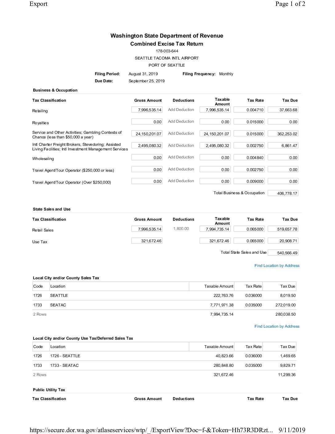
Port Of Seattle: Combined Excise Tax Return for Seattle Tacoma Intl Airport — August 2019
This document is a Washington State Combined Excise Tax Return filed by the Port of Seattle for Seattle-Tacoma International Airport, covering the period ending August 31, 2019. It details Business & Occupation taxes, state and local sales and use taxes, and public utility taxes across multiple categories, totaling $1,279,242.02 in taxes due. The return was submitted on September 11, 2019, by Bonnie McArthur and paid via ACH debit with an effective date of September 25, 2019. -
 2019-08-28
StART August 28, 2019 Meeting Recap
The Sea-Tac Stakeholder Advisory Round Table (StART) met on August 28, 2019 to discuss airport noise reduction efforts, federal policy priorities, and an overview of Part 150 noise studies. Key updates included progress on a Revised Runway Use Agreement, the launch of a Late Night Noise Limitation Program, and a new noise complaint system. The meeting also addressed the temporary suspension of three neighboring cities from StART, with airport leadership pledging improved communication and good-faith efforts to re-engage those communities.