TagPort Of Seattle(2349)
-
 2022-09-12
Functional assessment, impact and mitigation plan review to the record of decision for Seattle, Port of (1996-4-02325)
This U.S. Army Corps of Engineers document reviews the environmental impact of construction projects at Seattle-Tacoma International Airport, including the Third Runway and related Master Plan Update improvements, focusing on impacts to wetlands and waterways. The Corps conducted an independent assessment of wetland functions and evaluated whether the Port of Seattle's proposed mitigation plans adequately compensated for the destruction or alteration of aquatic resources. After finding the Port's initial December 2000 mitigation plan insufficient, the Corps worked with the Port to develop a revised plan, accepted in November 2001, that better addressed the loss of wetland functions caused by airport construction. -
 2022-09-12
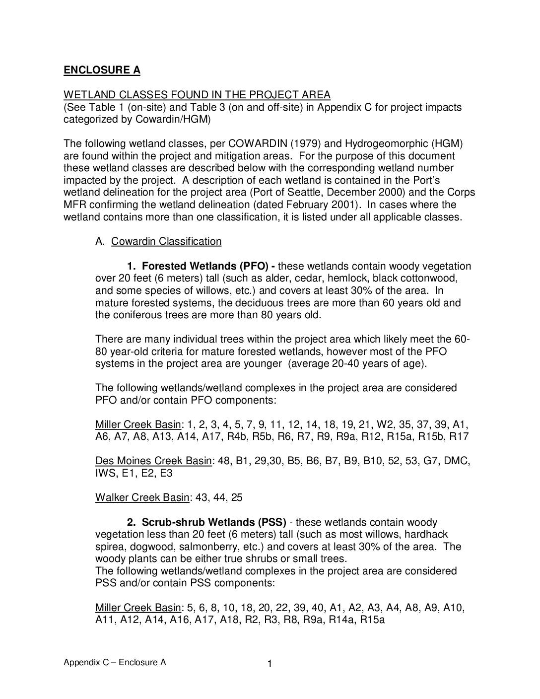
Wetland classes found in the project area
This document classifies and describes the various wetland types found within the Sea-Tac Airport project area, using both the Cowardin (1979) and Hydrogeomorphic (HGM) classification systems. It identifies forested, scrub-shrub, emergent, aquatic bed, and riverine wetlands across three drainage basins — Miller Creek, Des Moines Creek, and Walker Creek — listing the specific wetland units belonging to each category. The classifications support environmental impact assessment and mitigation planning associated with airport development activities. -
 2022-09-12
Respondent/cross-petitioner Airport Communities Coalition’s emergency motion for injunctive relief pursuant to RAP 8.3
The Airport Communities Coalition (ACC) filed an emergency motion asking the Washington Supreme Court to temporarily halt construction of a proposed third runway at Seattle-Tacoma International Airport. ACC sought to prevent the Port of Seattle from filling wetlands and the Department of Ecology from approving embankment construction while the court's decision on related appeals remained pending. The motion was prompted by reports that the Port planned to begin depositing fill material in April, before the court had issued its ruling. -
 2022-09-12
Declaration of Dyanne Sheldon in support of Respondent/Cross-Petitioner Airport Communities Coalition’s emergency motion for injunctive relief pursuant to RAP 8.3
This declaration, filed before the Washington Supreme Court, was submitted by environmental scientist Dyanne Sheldon in support of the Airport Communities Coalition's emergency request to halt any construction or environmental changes at the Sea-Tac Airport expansion project site. Sheldon, who has over 20 years of wetland ecology expertise and helped establish King County's first wetland management program, argues that the wetlands at the project site cannot be recreated or adequately compensated for if destroyed. The motion asks the Court to maintain the status quo while appeals of a Pollution Control Hearings Board order are decided. -
 2022-09-12
Declaration of Dr. Stephen L. M. Hockaday in support of respondent/cross-petitioner Airport Communities Coalition’s reply in support of its emergency motion for injunctive relief pursuant to RAP 8.3
Dr. Stephen L. M. Hockaday, a Professor Emeritus of Civil and Environmental Engineering at Cal Poly San Luis Obispo with over 25 years of airport and airspace planning experience, submitted this declaration in support of the Airport Communities Coalition's emergency motion for injunctive relief before the Washington Supreme Court. The case involves the Port of Seattle, the Pollution Control Hearings Board, and the Washington Department of Ecology in a dispute related to Sea-Tac Airport expansion. Dr. Hockaday's credentials include serving as Head of Eurocontrol's airspace and airport modelling service and managing major FAA programs at the nation's ten busiest airports. -
 2022-09-12
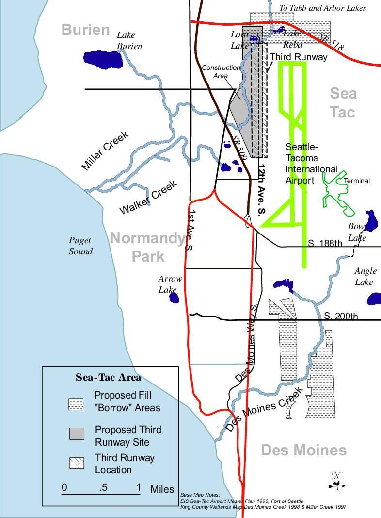
Sea-Tac area third runway construction map
This map document illustrates the planned Third Runway expansion at Seattle-Tacoma International Airport, showing the proposed runway location, construction staging area, and fill 'borrow' areas in the Sea-Tac region. The map covers surrounding communities including Burien, Normandy Park, and Des Moines, and highlights nearby waterways such as Des Moines Creek, Miller Creek, and Walker Creek that could be affected by construction. Based on the 1996 Port of Seattle EIS Sea-Tac Airport Master Plan and 1997–1998 King County Wetlands Maps, the document provides geographic context for environmental and land-use planning related to the runway project. -
 2022-09-12
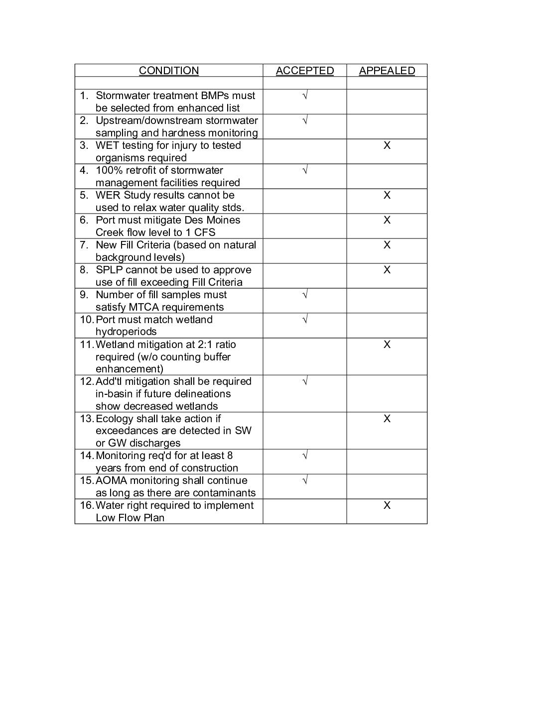
Conditions accepted and appealed summary table
This document lists 16 permit conditions related to environmental protections at what appears to be a Port development project, showing which conditions were accepted and which were appealed. Conditions covering stormwater management, wetland mitigation, fill criteria, and water quality monitoring were contested, with 8 of the 16 conditions formally appealed. Accepted conditions include stormwater sampling, wetland hydroperiod matching, and long-term contamination monitoring requirements. -
 2022-09-12
Port Of Seattle’s pre-hearing brief
The Port of Seattle filed a pre-hearing brief challenging aspects of a 2003 water pollution permit issued by Washington State's Department of Ecology for Seattle-Tacoma International Airport (Sea-Tac). The permit, considered one of the most stringent stormwater permits in the country, sets numeric water quality limits, requires extensive toxicity testing, and mandates upgrades to the airport's stormwater and wastewater management systems. The brief addresses a range of contested issues, including effluent limits, sampling requirements, and construction stormwater controls. -
 2022-09-12
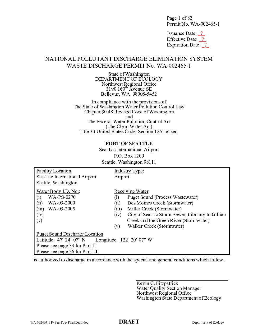
National Pollutant Discharge Elimination System waste discharge permit No. WA-002465-1
This document is a draft National Pollutant Discharge Elimination System (NPDES) waste discharge permit issued by the Washington State Department of Ecology to the Port of Seattle for Sea-Tac International Airport. It governs the discharge of treated industrial wastewater into Puget Sound and stormwater runoff into nearby waterways including Des Moines Creek, Miller Creek, and Walker Creek. The permit sets effluent limits, monitoring requirements, and reporting obligations to protect water quality in the receiving waters. -
 2022-09-01
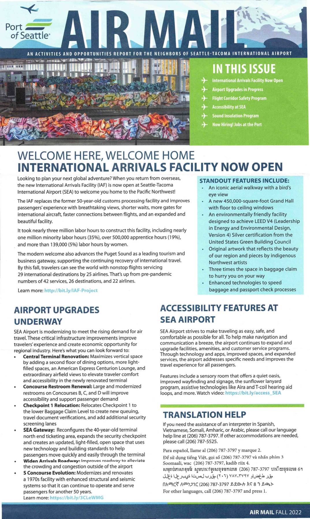
Air Mail Fall 2022: Port Of Seattle Activities and Opportunities Report
The Port of Seattle's Fall 2022 Air Mail newsletter highlights major updates at Seattle-Tacoma International Airport (SEA), including the opening of the new International Arrivals Facility, ongoing terminal modernization projects, and accessibility improvements. It also details noise mitigation efforts for neighboring communities, including a $40 million expansion of the Sound Insulation Program to cover more than 215 apartment units, with all work scheduled for completion by 2026. Additional topics include the Flight Corridor Safety Program, which removes tall trees near the airport that pose safety risks while planting native lower-height trees as replacements.