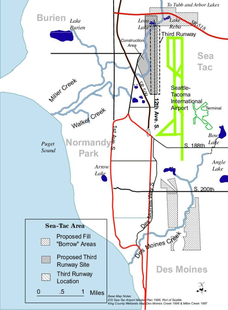
This map document illustrates the planned Third Runway expansion at Seattle-Tacoma International Airport, showing the proposed runway location, construction staging area, and fill 'borrow' areas in the Sea-Tac region. The map covers surrounding communities including Burien, Normandy Park, and Des Moines, and highlights nearby waterways such as Des Moines Creek, Miller Creek, and Walker Creek that could be affected by construction. Based on the 1996 Port of Seattle EIS Sea-Tac Airport Master Plan and 1997–1998 King County Wetlands Maps, the document provides geographic context for environmental and land-use planning related to the runway project.Open full document
Notes
A map of the Sea-Tac area showing the proposed third runway site and location at Seattle-Tacoma International Airport. The map identifies proposed fill ‘borrow’ areas, surrounding communities including Burien, Normandy Park, Des Moines, and SeaTac, as well as nearby water features such as Des Moines Creek, Miller Creek, Walker Creek, and several lakes. Base map sources are the EIS Sea-Tac Airport Master Plan 1996 (Port of Seattle) and King County Wetlands Maps from 1997-1998.