TagLora Lake(20)
-
 2003-09-01
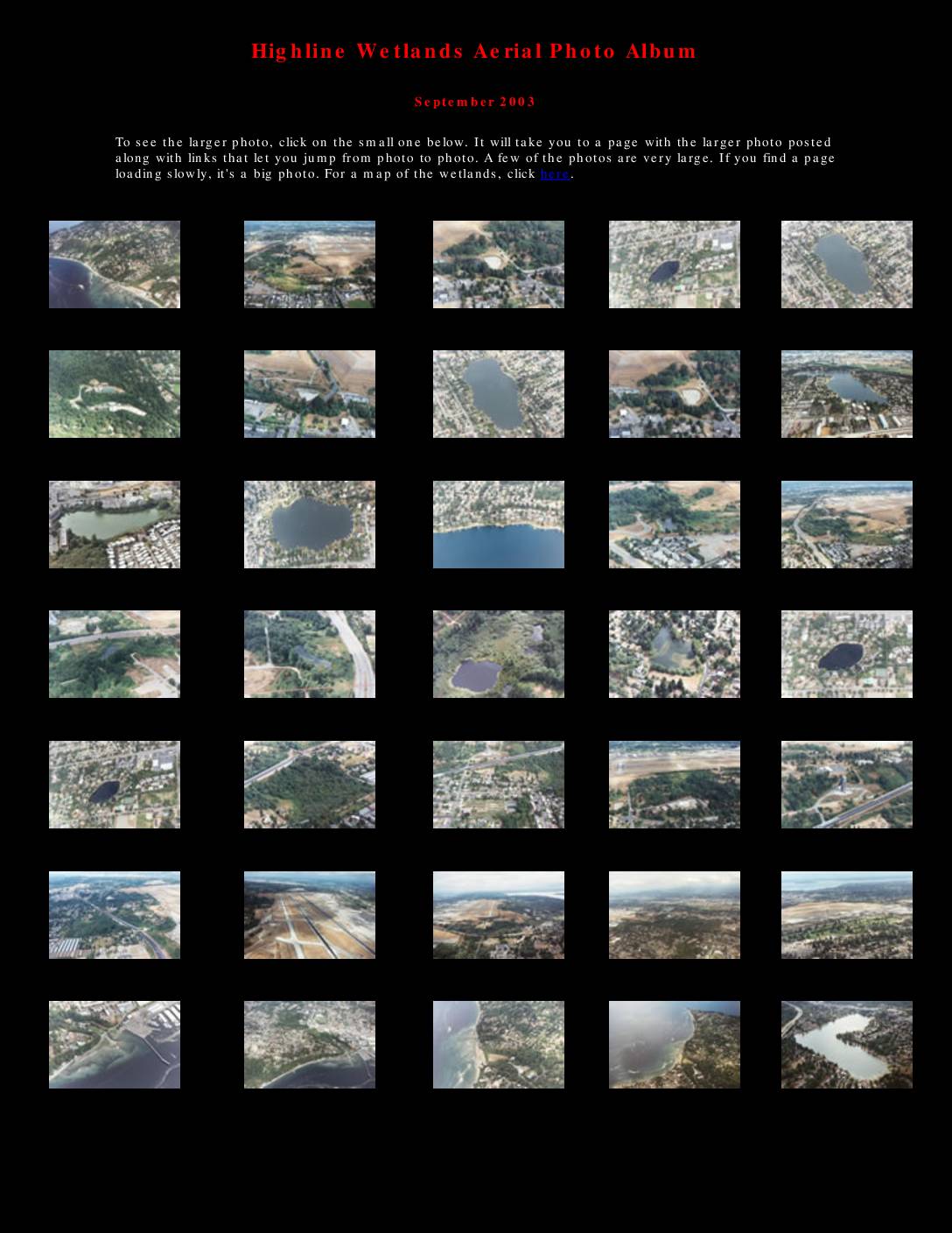
Highline Wetlands aerial photo album
The Highline Wetlands Aerial Photo Album, compiled in September 2003, presents a collection of aerial photographs documenting wetlands, lakes, and waterways in the Sea-Tac Airport area of Washington State. The album covers locations including Miller Creek, Walker Creek, Lake Burien, Angle Lake, and other water resources affected by the proposed Third Runway construction at Seattle-Tacoma International Airport. An accompanying map illustrates the runway's projected impact on local water resources, identifying proposed fill areas and the third runway site relative to surrounding communities such as Burien, Normandy Park, and Des Moines. -
 2002-10-22
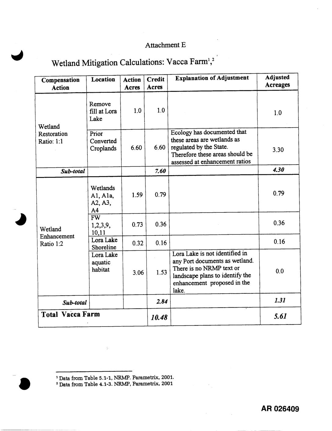
EXH AR026409: Wetland Mitigation Calculations — Vacca Farm
This document outlines wetland mitigation calculations for the Vacca Farm site, detailing compensation actions such as wetland restoration and enhancement across various locations including Lora Lake and prior converted croplands. Adjustments were made to credit acreages based on state ecology findings and documentation gaps; for example, the 6.60-acre converted cropland credit was reduced to 3.30 acres because the state identified those areas as existing wetlands requiring enhancement ratios rather than restoration ratios. In total, the site's original 10.48 credit acres were adjusted down to 5.61 acres after accounting for these regulatory and documentation considerations. -
 2002-10-22
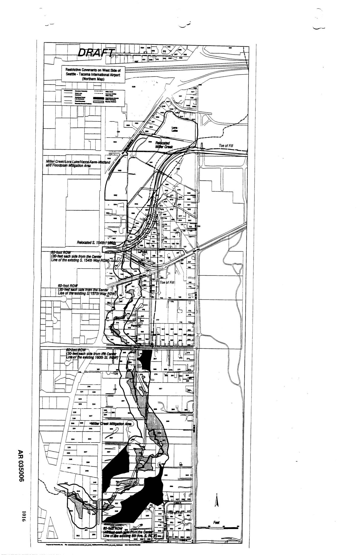
EXH AR035006: Draft Map — Restrictive Covenants on West Side of Seattle-Tacoma International Airport (Northern Map)
Draft map AR035006 showing restrictive covenants on the west side of Seattle-Tacoma International Airport (northern section). Features include Relocated Miller Creek, Lora Lake, Miller Creek/Lora Lake/Vacca Farm Wetland and Floodplain Mitigation Area, Miller Creek Mitigation Area, Toe of Fill boundaries, Relocated S. 154th Place, and multiple 60-foot ROW designations (30 feet each side from center -
 2002-10-22
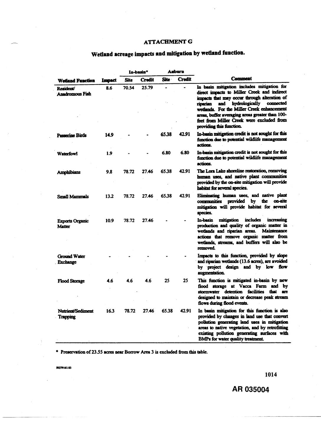
EXH AR035004: Attachment G — Wetland Acreage Impacts and Mitigation by Wetland Function
Attachment G table detailing wetland acreage impacts and mitigation credits by wetland function for in-basin and Auburn sites, related to the Sea-Tac Airport or associated project. Functions covered include Resident/Anadromous Fish (8.6 acres impacted), Passerine Birds (14.9 acres), Waterfowl (1.9 acres), Amphibians (9.8 acres), Small Mammals (13.2 acres), Exports Organic Matter (10.9 acres), Ground Water -
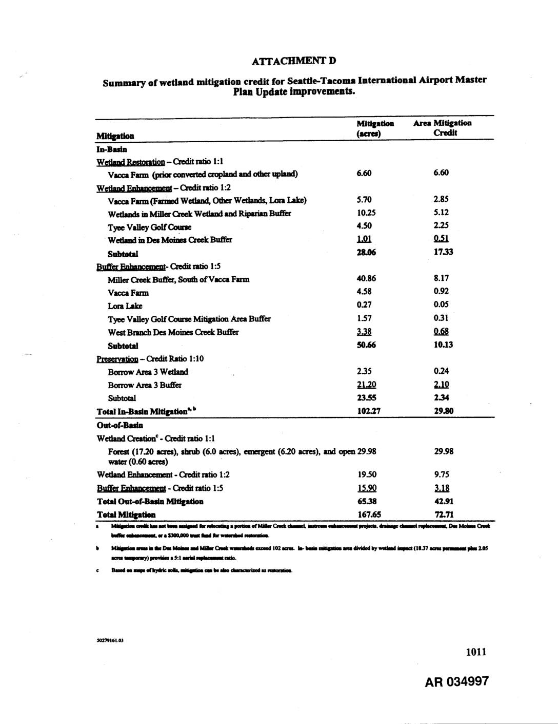 2002-10-22
EXH AR034997: Summary of Wetland Mitigation Credit for Sea-Tac Airport Master Plan Update Improvements
Attachment D table summarizing wetland mitigation credit for Seattle-Tacoma International Airport Master Plan Update improvements. Documents in-basin mitigation (102.27 acres, 29.80 credit) and out-of-basin mitigation (65.38 acres, 42.91 credit) for a total of 167.65 mitigation acres and 72.71 total credit. In-basin mitigation includes wetland restoration at Vacca Farm (credit ratio 1:1), wetland enhancement at Vacca -
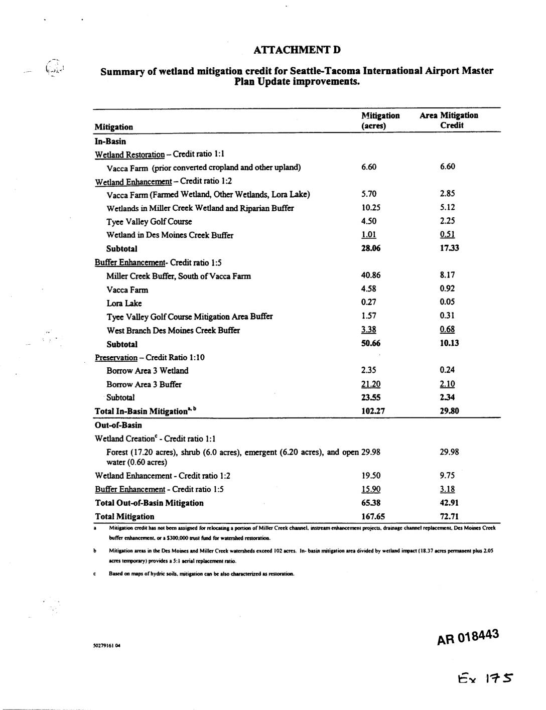 2002-10-21
Exhibit 175: Summary of Wetland Mitigation Credit for Seattle-Tacoma International Airport Master Plan Update Improvements
Exhibit 175 (AR018443) summarizes wetland mitigation credit for Sea-Tac Airport Master Plan Update improvements. Tables detail in-basin mitigation (102.27 acres, 29.80 credit) and out-of-basin mitigation (65.38 acres, 42.91 credit) for a total of 167.65 acres and 72.71 mitigation credits. Specific mitigation sites include Vacca Farm, Miller Creek Wetland and Riparian Buffer, Tyee Valley Golf Course, -
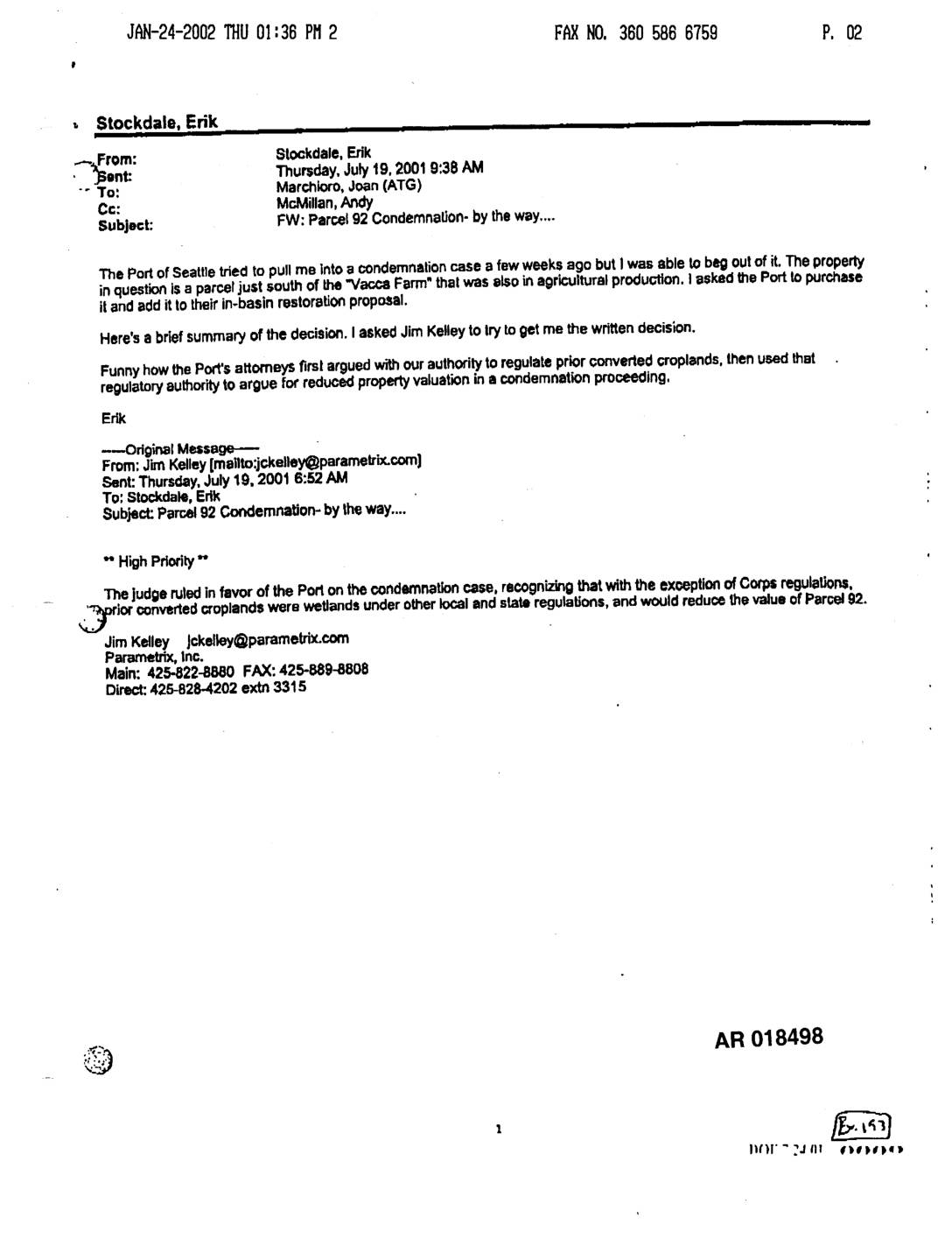 2001-07-19
EXH AR018498: Port Of Seattle Parcel 92 Condemnation — Prior Converted Croplands Wetland Ruling and Lora Lake Mitigation Credit Discussion
Email chain (AR018498–AR018499) dated July 19, 2001, from Erik Stockdale (likely Washington State Department of Ecology) to Joan Marchioro (ATG) and Andy McMillan, forwarding a message from Jim Kelley of Parametrix, Inc. The judge ruled in favor of Port Of Seattle in the Parcel 92 condemnation case, finding that prior converted croplands were wetlands under -
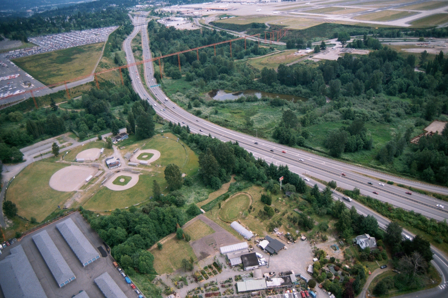 2001-06-22
Aerial View of Highway Corridor With Transmission Towers Near Sea-Tac Airport
Aerial photograph showing a multi-lane highway (likely Interstate 5 or SR-99) running through a mixed landscape of ball fields, wetland ponds, and light industrial/nursery properties. Large orange high-voltage transmission tower structures are visible crossing the highway corridor, with what appears to be an airport runway environment in the upper right background. -
 2000-09-05
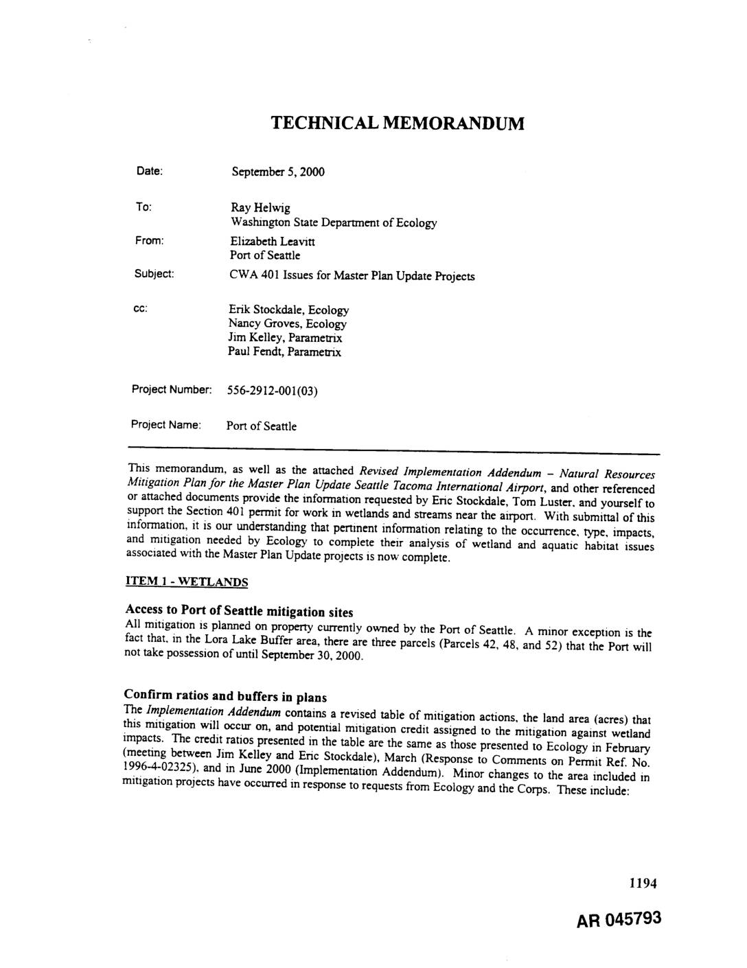
EXH AR045793: Technical Memorandum — CWA 401 Issues for Master Plan Update Projects, Port Of Seattle (Sea-Tac Airport)
Technical memorandum dated September 5, 2000 from Elizabeth Leavitt (Port Of Seattle) to Ray Helwig (Washington State Department of Ecology), cc’d to Erik Stockdale, Nancy Groves (Ecology), Jim Kelley and Paul Fendt (Parametrix), Project No. 556-2912-001(03). Addresses CWA Section 401 permit issues for Seattle-Tacoma International Airport Master Plan Update projects involving wetlands and streams. Topics -
 1998-08-19
EXH AR041760: Miller Creek Enhancement Program — Seattle-Tacoma International Airport Master Plan Update Improvements
Draft report prepared by Parametrix, Inc. for Port of Seattle regarding the Miller Creek Enhancement Program associated with Seattle-Tacoma International Airport Master Plan Update Improvements. Document AR 041760 covers Miller Creek relocation and enhancement, floodplain compensation, floodplain enhancement, Lora Lake buffer enhancement, and Miller Creek riparian buffer enhancement. Includes ecological assessment of Miller Creek (fish