TagDes Moines Creek(162)
-
 2002-10-22
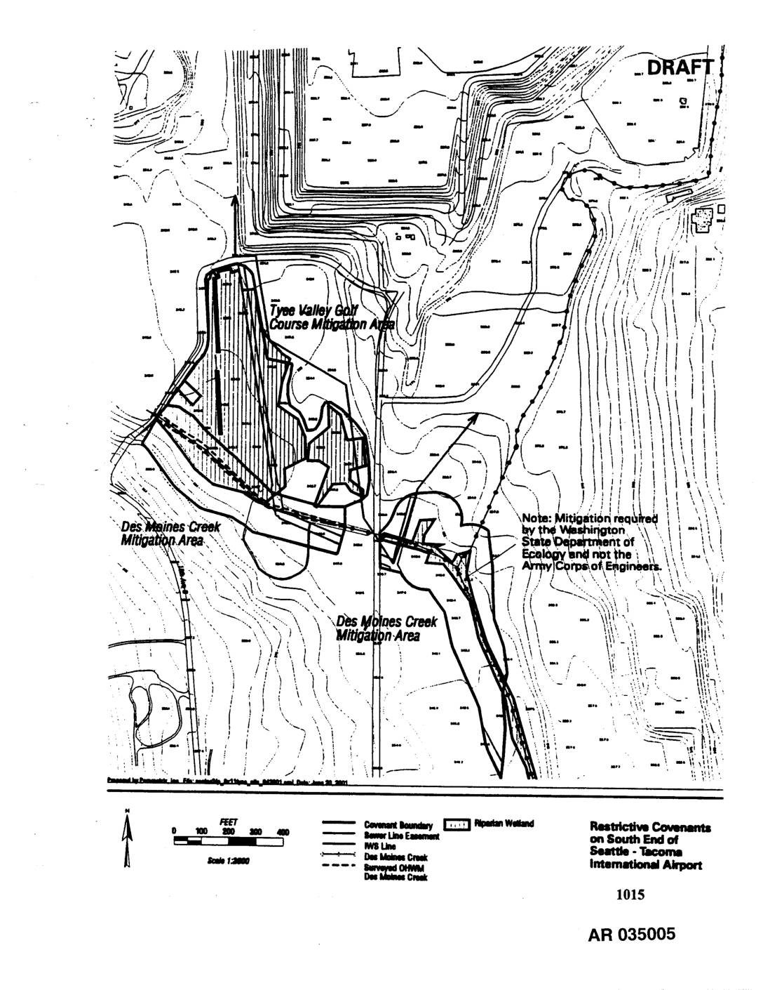
EXH AR1015: Restrictive Covenants on South End of Seattle-Tacoma International Airport — Draft Map
Draft map (AR 035005, Exhibit 1015) showing restrictive covenant boundaries, sewer line easements, IWS line, Des Moines Creek, and surveyed OHWM on the south end of Seattle-Tacoma International Airport. Identifies the Tyee Valley Golf Course Mitigation Area and Des Moines Creek Mitigation Area, with a note that mitigation was required by the Washington State Department -
 2002-10-22
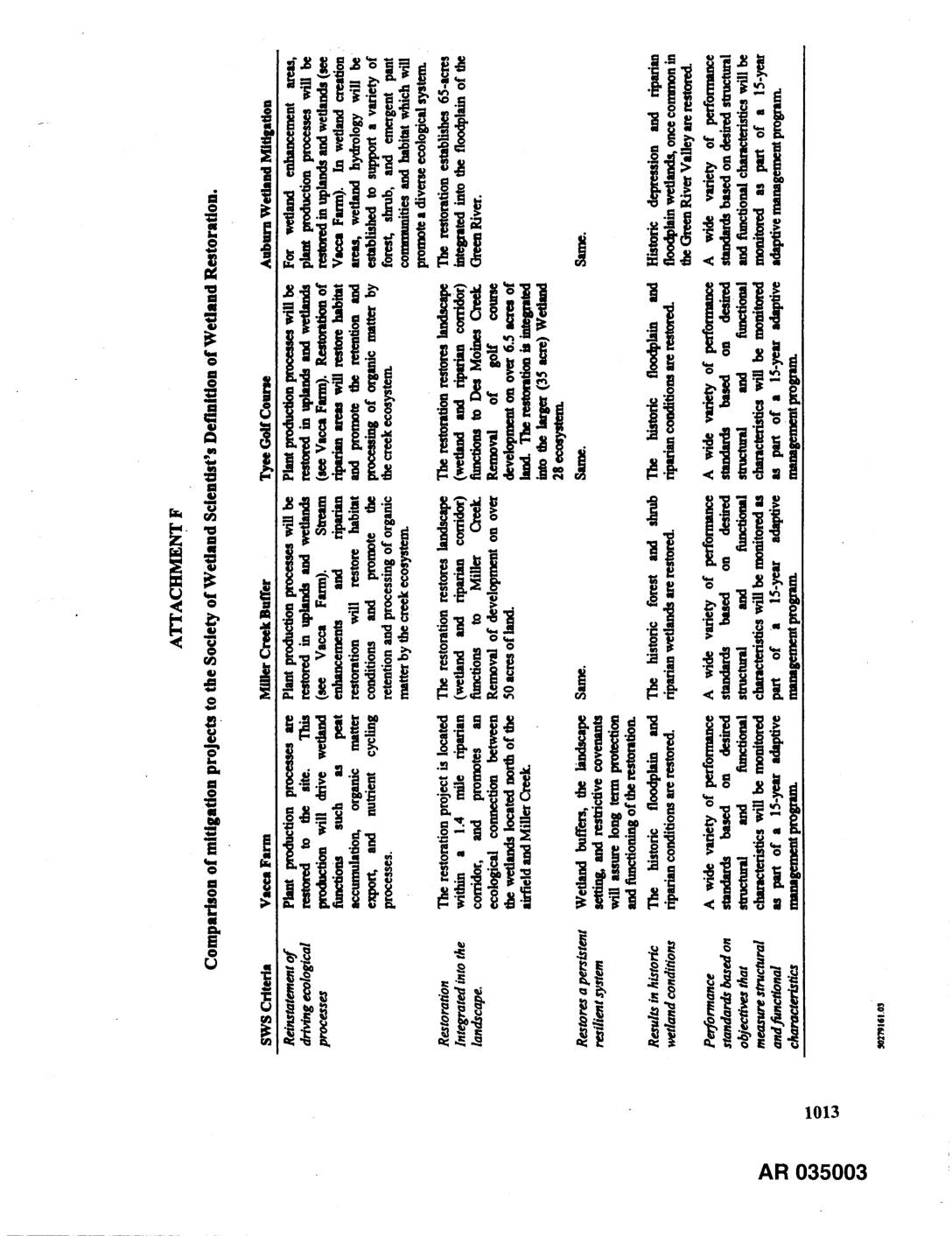
EXH AR1013: Attachment F — Comparison of Mitigation Projects to the Society of Wetland Scientist’s Definition of Wetland Restoration
AR 035003. Attachment F table comparing wetland mitigation projects — Vacca Farm, Miller Creek Buffer, Tyee Golf Course, and Auburn Wetland — against Society of Wetland Scientists (SWS) criteria including reinstatement of driving ecological processes, restoration integrated into the landscape, restores a persistent resilient system, results in historic wetland conditions, and performance standards based on -
 2002-10-22
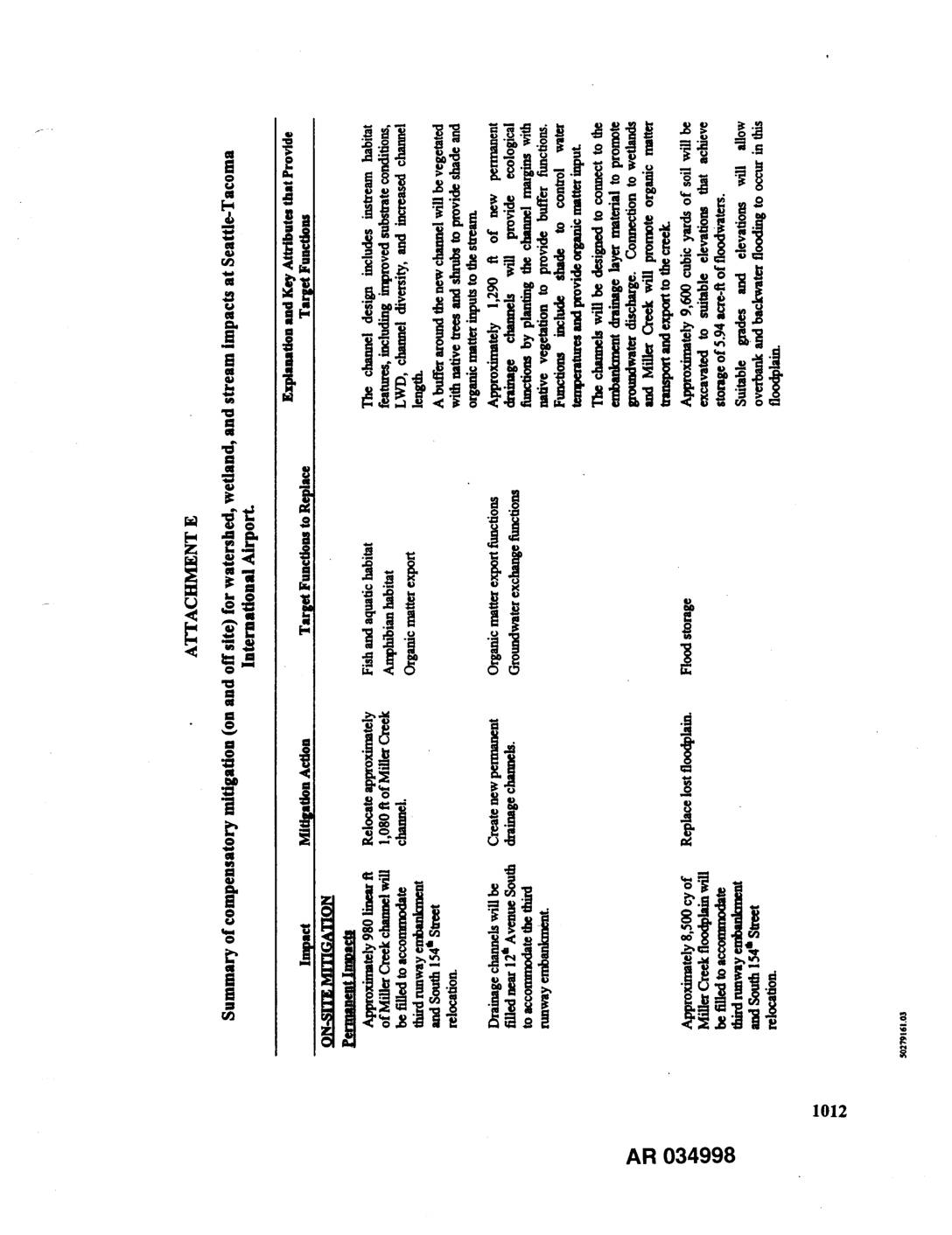
EXH AR034998: Attachment E — Summary of Compensatory Mitigation for Watershed, Wetland, and Stream Impacts at Seattle-Tacoma International Airport
Exhibit AR034998-AR035000, Attachment E: Summary table of compensatory mitigation (on-site and off-site) for watershed, wetland, and stream impacts at Seattle-Tacoma International Airport related to third runway embankment and South 154th Street relocation. Details on-site permanent impacts including filling approximately 980 linear feet of Miller Creek channel, filling 8,500 cy of Miller Creek floodplain, and filling -
 2002-10-22
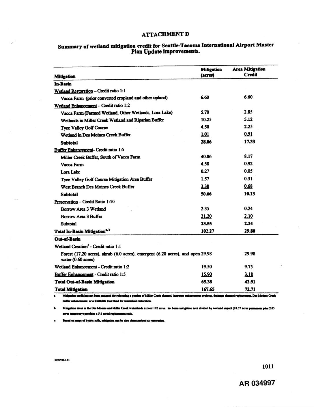
EXH AR034997: Summary of Wetland Mitigation Credit for Sea-Tac Airport Master Plan Update Improvements
Attachment D table summarizing wetland mitigation credit for Seattle-Tacoma International Airport Master Plan Update improvements. Documents in-basin mitigation (102.27 acres, 29.80 credit) and out-of-basin mitigation (65.38 acres, 42.91 credit) for a total of 167.65 mitigation acres and 72.71 total credit. In-basin mitigation includes wetland restoration at Vacca Farm (credit ratio 1:1), wetland enhancement at Vacca -
 2002-10-22
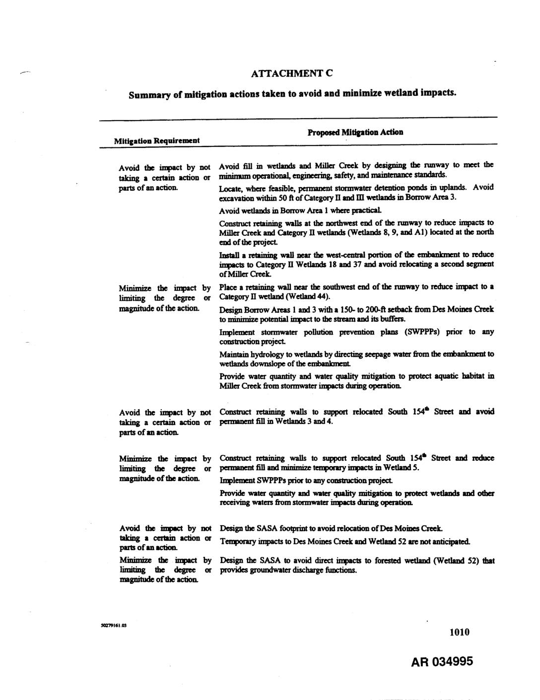
EXH AR034995: Summary of Mitigation Actions Taken to Avoid and Minimize Wetland Impacts
Attachment C summarizing proposed mitigation actions to avoid and minimize wetland impacts for a runway project at Sea-Tac Airport area. Document details mitigation requirements and actions for Miller Creek, Des Moines Creek, Category II and III wetlands (Wetlands 3, 4, 5, 8, 9, 18, 37, 44, 52, A1, and Borrow Area wetlands B1, B4–B10, B15a, -
 2002-10-22
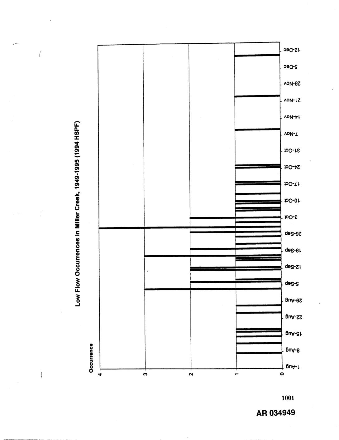
EXH AR034949: Low Flow Occurrences in Miller Creek, Des Moines Creek, and Walker Creek, 1949-1995 (1994 HSPF)
Three bar charts showing 7-day low flow occurrences modeled using 1994 HSPF (Hydrological Simulation Program Fortran) for the period 1949-1995. Charts cover Miller Creek, Des Moines Creek, and Walker Creek, displaying occurrence counts (0-4) by date ranging from summer through winter months (June through December). AR034949-AR034951. Related to stormwater hydrology and low flow analysis for -
 2002-10-21
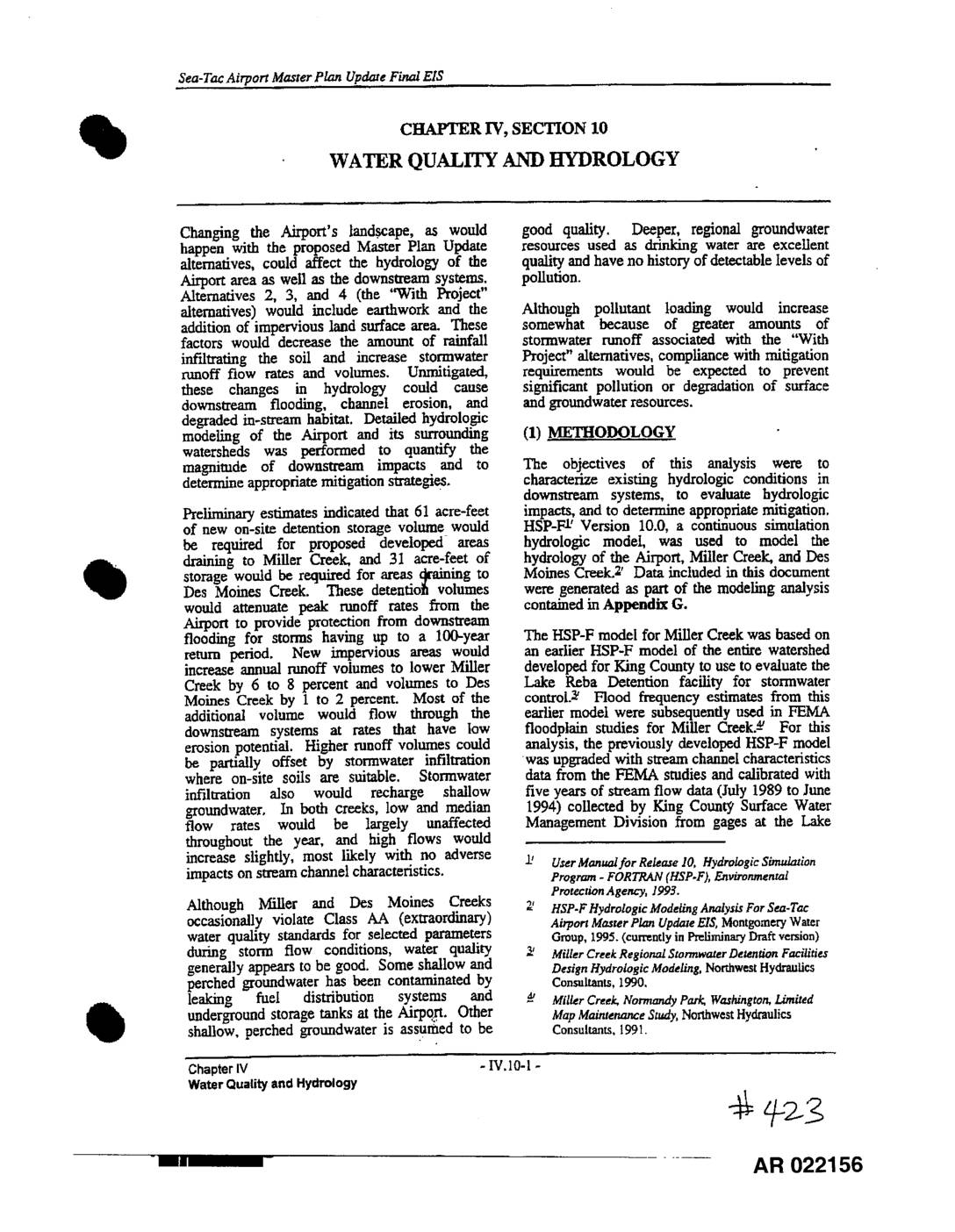
EXH 423: STIA Master Plan Update Final EIS Ch.IV §10 Water Quality & Hydrology
This section of the Sea-Tac Airport Master Plan Update Environmental Impact Statement examines how proposed airport expansion alternatives would affect water quality and hydrology in the surrounding area, particularly Miller Creek and Des Moines Creek. The analysis finds that increased impervious surfaces would raise stormwater runoff volumes and peak flow rates, potentially causing downstream flooding and erosion, but that required detention storage facilities and mitigation measures would largely prevent significant water quality degradation. Both creeks, while classified as Class AA extraordinary waters, already show some pollution from urban stormwater runoff, though deeper regional groundwater used for drinking remains unaffected. -
 2002-10-21
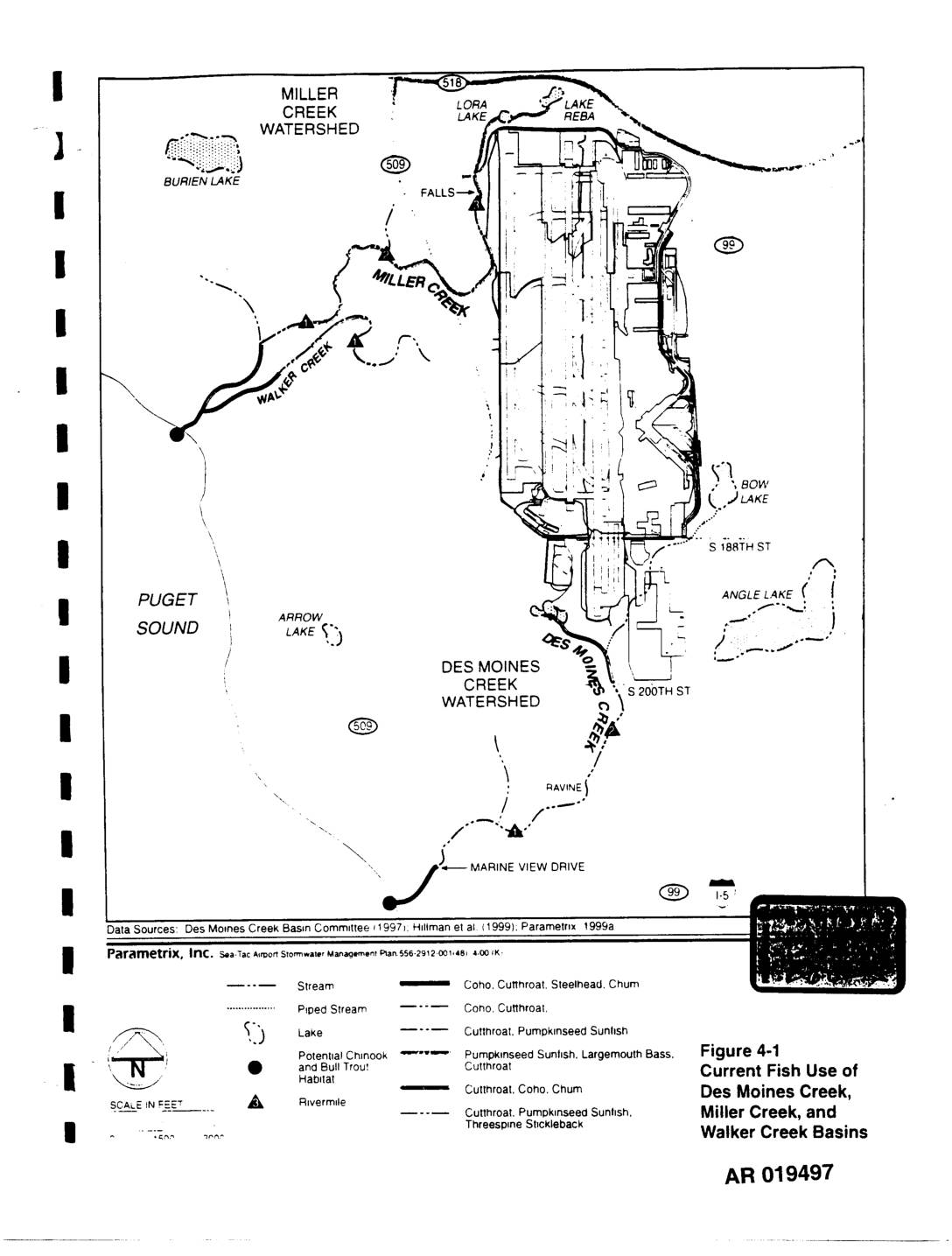
EXH AR019497: Figure 4-1 Current Fish Use Des Moines, Miller & Walker Creek Basins
This figure from the Sea-Tac Airport Stormwater Management Plan maps current fish habitat in the Des Moines Creek, Miller Creek, and Walker Creek watersheds near Sea-Tac Airport. It identifies the fish species present in various streams and lakes in the area, including Coho, Cutthroat, Steelhead, Chum, Chinook, Bull Trout, and Pumpkinseed Sunfish. The map also highlights piped stream segments and areas of potential Chinook and Bull Trout habitat within these interconnected watershed basins adjacent to Puget Sound. -
 2002-10-21
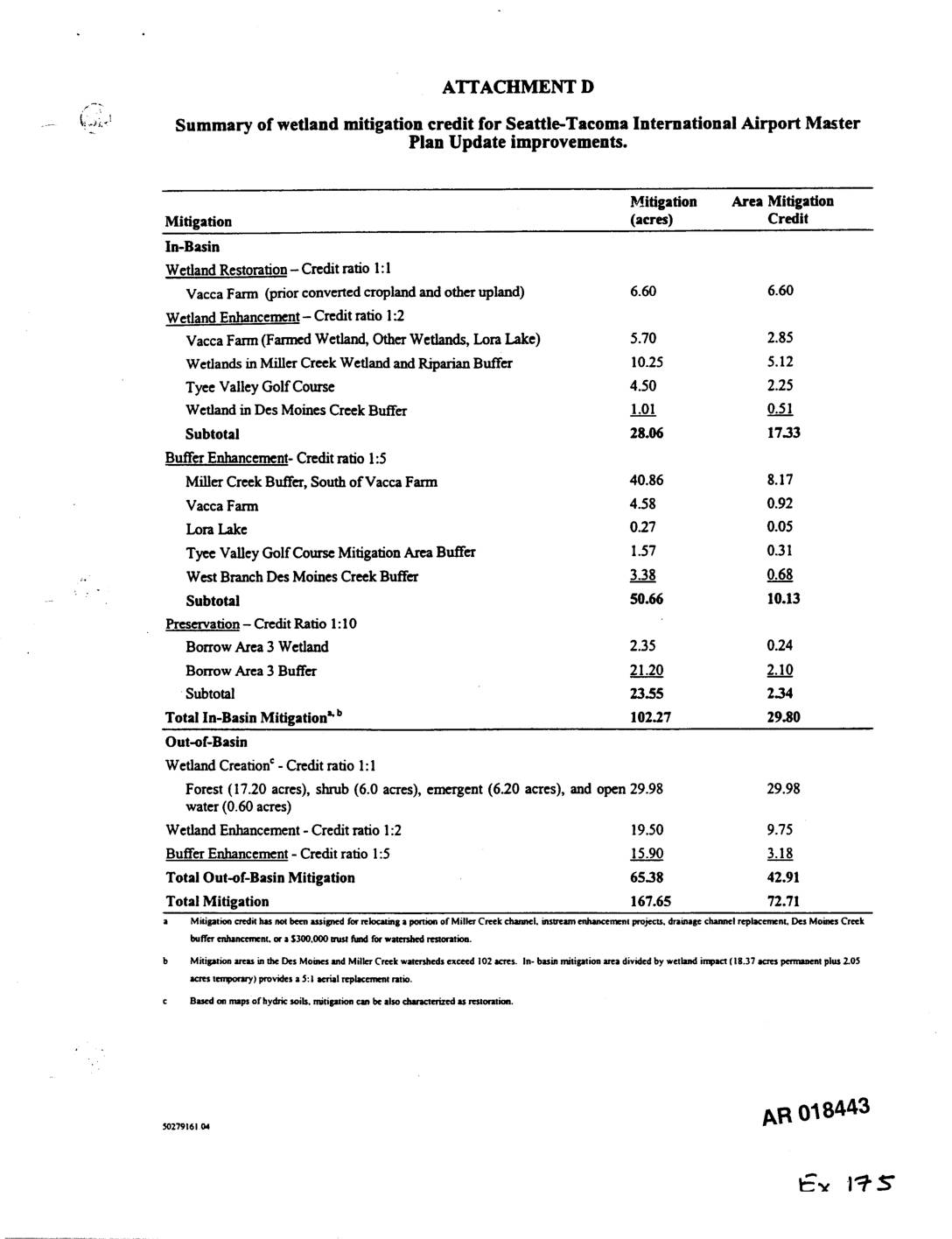
Exhibit 175: Summary of Wetland Mitigation Credit for Seattle-Tacoma International Airport Master Plan Update Improvements
Exhibit 175 (AR018443) summarizes wetland mitigation credit for Sea-Tac Airport Master Plan Update improvements. Tables detail in-basin mitigation (102.27 acres, 29.80 credit) and out-of-basin mitigation (65.38 acres, 42.91 credit) for a total of 167.65 acres and 72.71 mitigation credits. Specific mitigation sites include Vacca Farm, Miller Creek Wetland and Riparian Buffer, Tyee Valley Golf Course, -
 2002-10-21
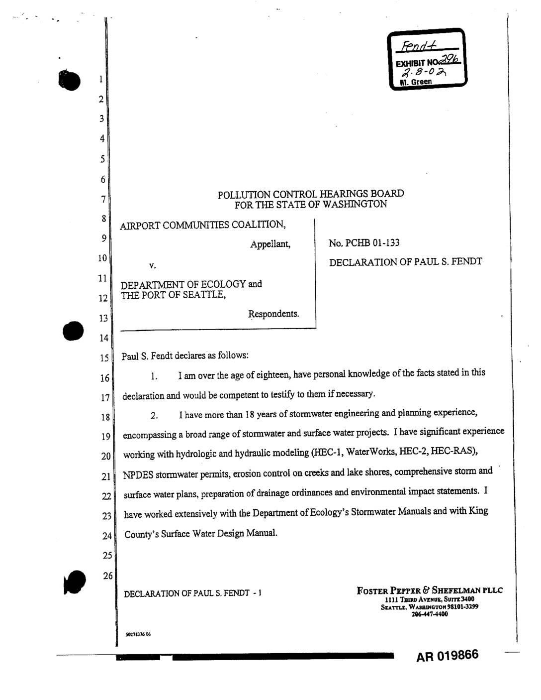
EXH 296: Declaration Paul S. Fendt — Stormwater Mgmt & Low Flow Mitigation, PCHB 01-133
This declaration by stormwater engineer Paul S. Fendt, filed in a Washington State Pollution Control Hearings Board case, explains how Sea-Tac International Airport's Master Plan Update will increase impervious surfaces and alter stormwater runoff into Miller, Walker, and Des Moines Creeks. The document outlines mitigation measures, including 344.1 acre-feet of new detention storage and controlled low-flow water releases, to offset increased peak flows and reduced summer stream flows caused by airport expansion. It provides technical background on the affected watersheds and the Port of Seattle's stormwater management strategy.