TagCity Of SeaTac(241)
-
 2022-11-16
City of SeaTac update: Highline Forum meeting
This November 2022 City of SeaTac presentation to the Highline Forum provides a snapshot of the city's key statistics, highlighting its diverse community of approximately 32,000 residents who speak more than 85 languages. The city also serves as a major regional hub, with around 6,000 hotel rooms, roughly 35,000 employees working within city boundaries, and more than 140,000 people passing through daily. -
 2022-07-28
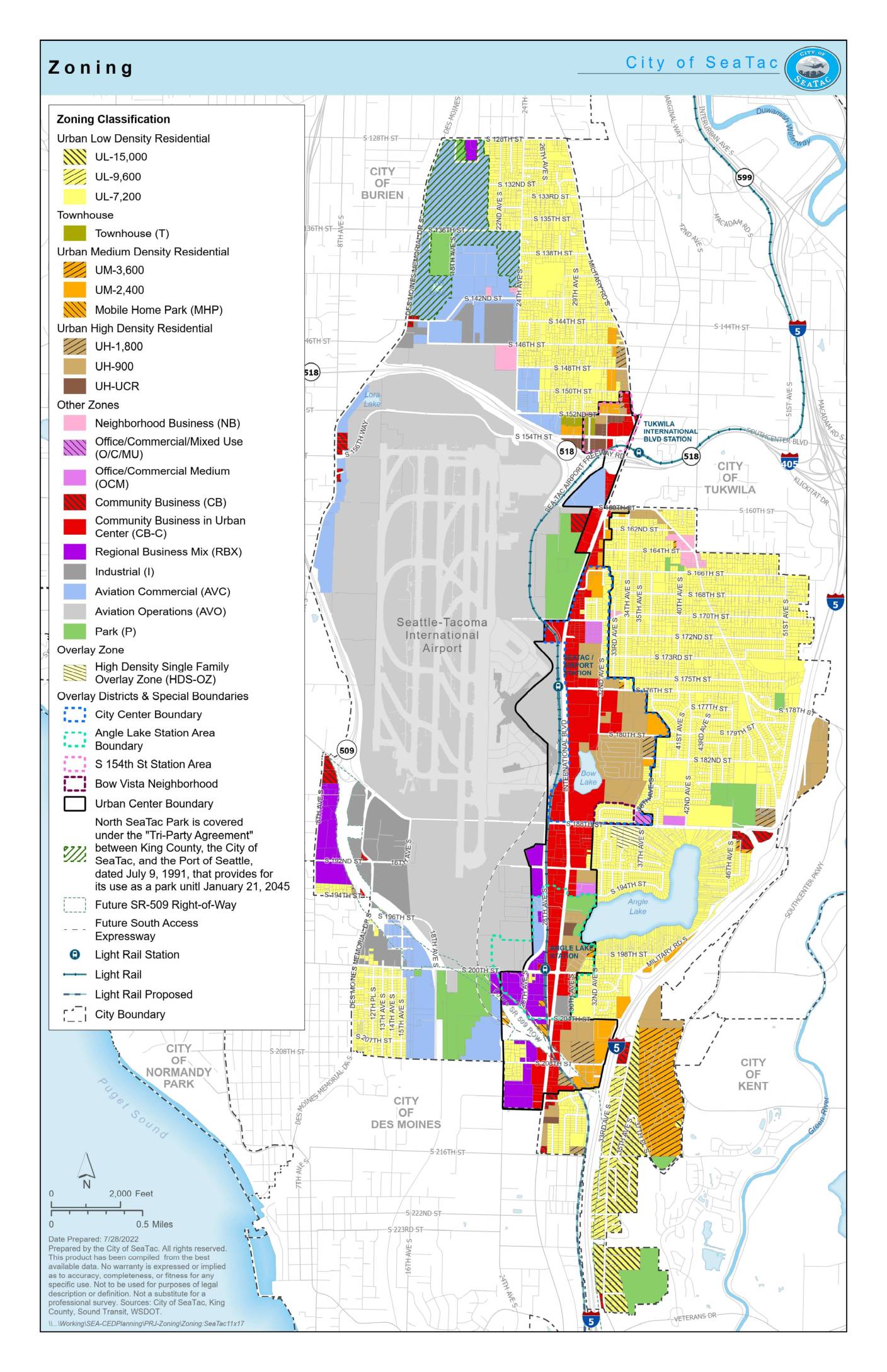
Zoning: City of SeaTac
This zoning map from the City of SeaTac (prepared July 28, 2022) shows land-use classifications throughout the city, which borders Seattle-Tacoma International Airport. The map identifies a range of residential, commercial, industrial, and aviation-related zones — including Aviation Commercial (AVC) and Aviation Operations (AVO) designations — that reflect the airport's significant influence on surrounding land use and development policy. Special overlay districts, light rail corridors, and station area boundaries are also depicted, highlighting the city's efforts to manage growth and compatibility with airport noise and operations. -
 2022-07-24
North SeaTac agreements – draft
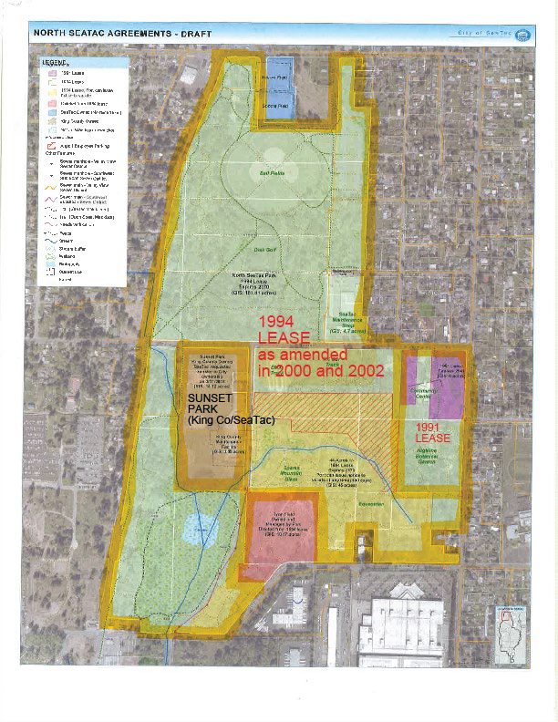
This draft map from the City of SeaTac outlines land-use agreements for North SeaTac Park, showing eight numbered zones with different lease arrangements between the Port of Seattle, King County, and the City of SeaTac. Key areas include ball fields, a soccer field, a community garden, and a Highline Botanical Garden, governed primarily by 1991 and 1994 leases expiring in 2070. Some parcels are subject to Port termination rights with 180 days' notice, reflecting the airport's ongoing influence over surrounding land use and open space management. -
sr509 earth zoom 1 (2)
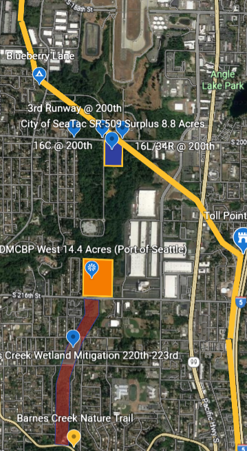
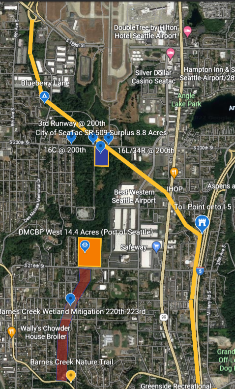
Aerial map of the Sea-Tac Airport vicinity showing labeled land parcels including '3rd Runway @ 200th – City of SeaTac SR-509 Surplus 8.8 Acres,' 'DMCBP West 14.4 Acres (Port of Seattle),' and 'Barnes Creek Wetland Mitigation 220th–223rd,' along with runway references 16C and 16L/34R at 200th Street. The map appears to be part of a Port of Seattle or City of SeaTac land use or noise-mitigation planning document. -
sr509 earth 3 (3)
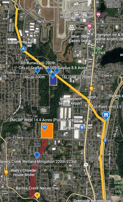
Aerial map of the Sea-Tac Airport vicinity showing labeled parcels including the 'City of SeaTac SR-509 Surplus 8.8 Acres,' 'DMCBP West 14.4 Acres (Port of Seattle),' runway designations 16C and 16L/34R at 200th Street, and Barnes Creek Wetland Mitigation area between S 220th and S 223rd. Nearby landmarks including DoubleTree by Hilton Hotel Seattle Airport, Best Western Seattle Airport, IHOP, Safeway, and I-5 toll point are also visible. -
SR-509 Stage 2
Aerial map of the Sea-Tac Airport vicinity showing labeled parcels and points of interest relevant to noise and land use policy, including the 3rd Runway at 200th Street, City of SeaTac SR-509 Surplus 8.8 Acres, DMCBP West 14.4 Acres (Port of Seattle), Barnes Creek Wetland Mitigation area at 220th-223rd, and runway designations 16C/34C and 16L/34R at 200th. Nearby landmarks including DoubleTree by Hilton Hotel Seattle Airport, Best Western Seattle Airport, Safeway, IHOP, and Angle Lake Park are also visible. -
 2022-05-25
Business retention & expansion programs possible through Port Grant Program
The City of SeaTac's Economic Development Division, in partnership with the Seattle Southside Chamber of Commerce and funded by a Port of Seattle grant, runs an annual Business Synergy Outreach Program to survey and support local businesses. Now in its fifth year (2022), the program uses survey results to guide business retention and expansion (BRE) initiatives aimed at helping SeaTac businesses grow and remain in the community. -
SR-509 Stage 2 BlueberryLane
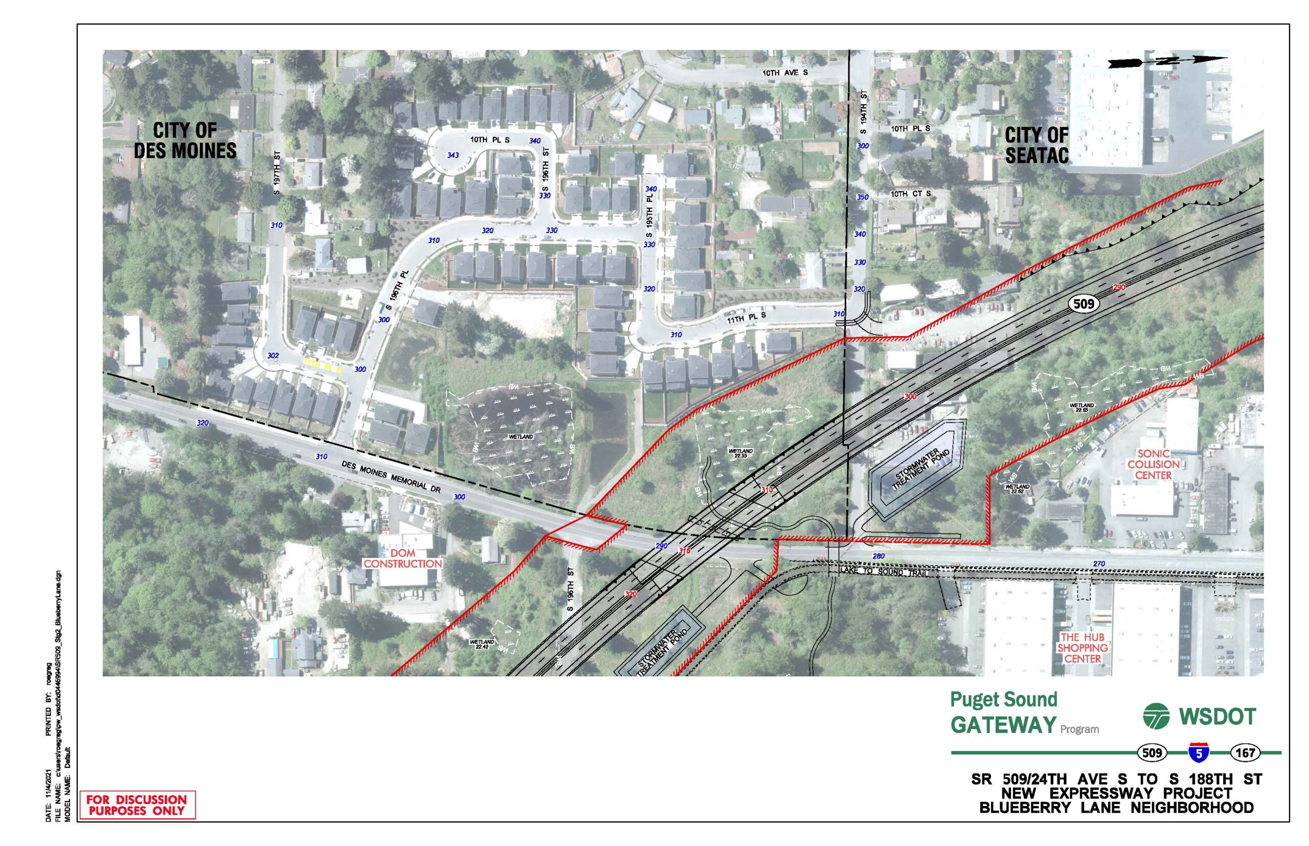
A WSDOT engineering plan sheet dated 11/06/2021 showing the proposed SR 509/24th Ave S to S 188th St new expressway alignment through the Blueberry Lane neighborhood, straddling the City of Des Moines and City of SeaTac boundary. The map identifies right-of-way limits (red hatching), stormwater treatment ponds, wetlands, the Lake-to-Sound Trail, and nearby landmarks including The Hub Shopping Center and Sonic Collision Center, produced under the Puget Sound Gateway Program. -
North SeaTac Park Lease Map
A draft aerial map produced by the City of SeaTac depicting land use agreements in the North SeaTac area, including the 1991 Lease, the 1994 Lease as amended in 2000 and 2002, and Sunset Park (King County/SeaTac). The map uses color-coded overlays and a legend to delineate lease boundaries, City-owned parcels, and facilities such as a Community Center and SeaTac Maintenance area. -
 2022-03-03
North SeaTac Park current status report
This March 2022 report to SeaTac's Parks and Recreation Committee examines the city's existing lease arrangements with the Port of Seattle for North SeaTac Park and explores the feasibility of the city taking ownership of the park. The presentation covers the background of the ownership proposal, an overview of current leases dating back to 1991 and 1994, and outlines next steps including drafting a formal resolution. The park land, currently leased from the Port, encompasses multiple areas governed by agreements that have been amended over the years.