TagAirport Expansion(165)
-
 2001-06-22
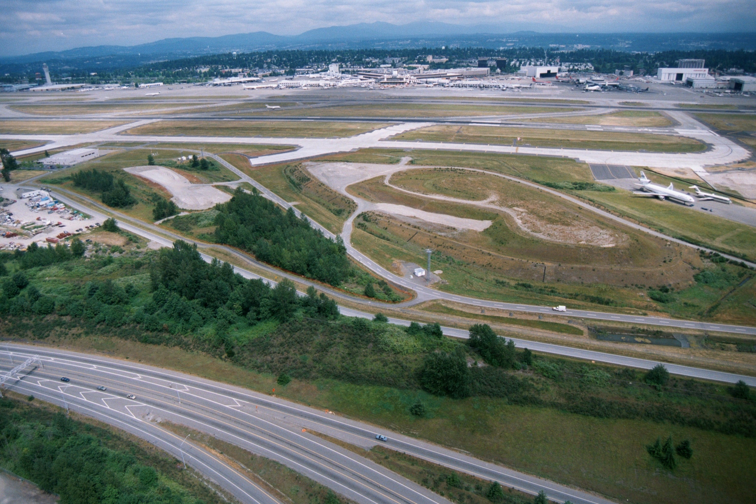
Sea-Tac Airport Aerial View Showing Runways, Terminals, and Aircraft Parking Areas
Aerial photograph showing Seattle-Tacoma International Airport's runway and taxiway complex, terminal buildings, and aircraft parking areas, with a multi-lane highway (likely Interstate 5 or SR 99) and undeveloped greenbelt land in the foreground. Two white commercial aircraft are visible on the right side of the airfield; mountains and suburban development are visible in the background. -
 2001-06-22
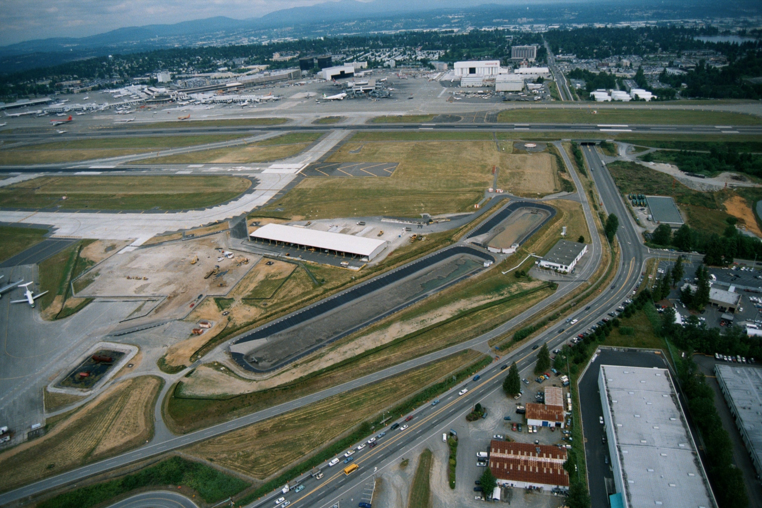
Sea-Tac Airport Aerial View Showing Terminal, Runways, and Groundside Construction
Aerial photograph showing Seattle-Tacoma International Airport with active runways, terminal gates, and what appears to be a significant ground-side construction project in the foreground, including new roadways, drainage channels, and a large facility building under development. Surrounding commercial and residential areas of the SeaTac/Burien area are visible, along with multiple aircraft at gates. -
 2001-06-22
Aerial View of Undeveloped Green Space and Pond Near Sea-Tac Airport
Aerial photograph showing a large undeveloped green space with a small pond, adjacent to a major highway interchange. Residential and commercial development is visible along the left edge, with what appears to be an airport or large industrial facility and construction cranes visible in the background. -
 2001-06-22
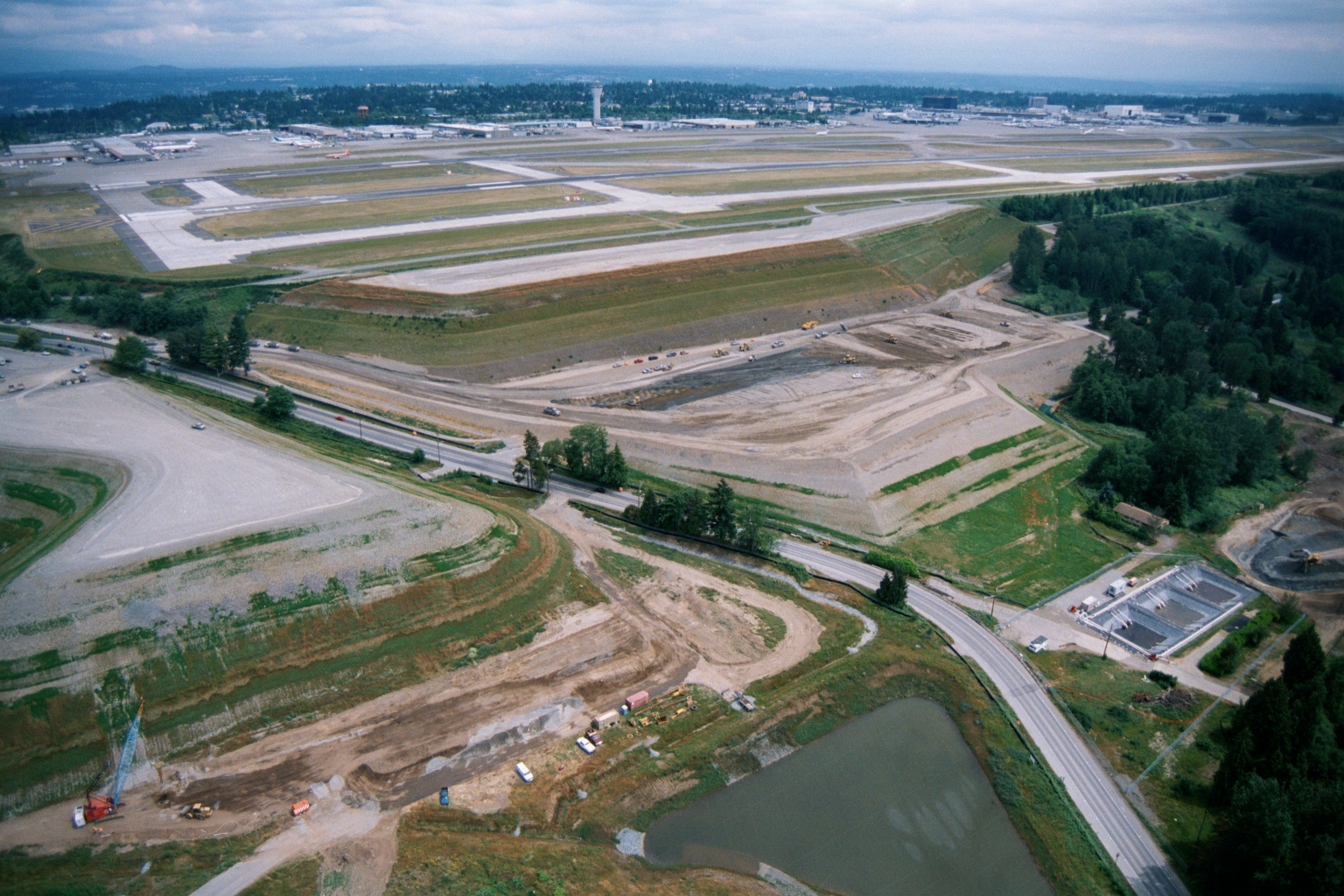
Aerial View of Construction and Earthwork Adjacent to Sea-Tac Airport Runways
Aerial photograph showing active grading and earthwork construction adjacent to a major commercial airport with multiple parallel runways visible in the background. Construction equipment, retention ponds, and a road corridor are visible in the foreground, consistent with runway or infrastructure expansion work at a Pacific Northwest airport. -
 2001-06-22
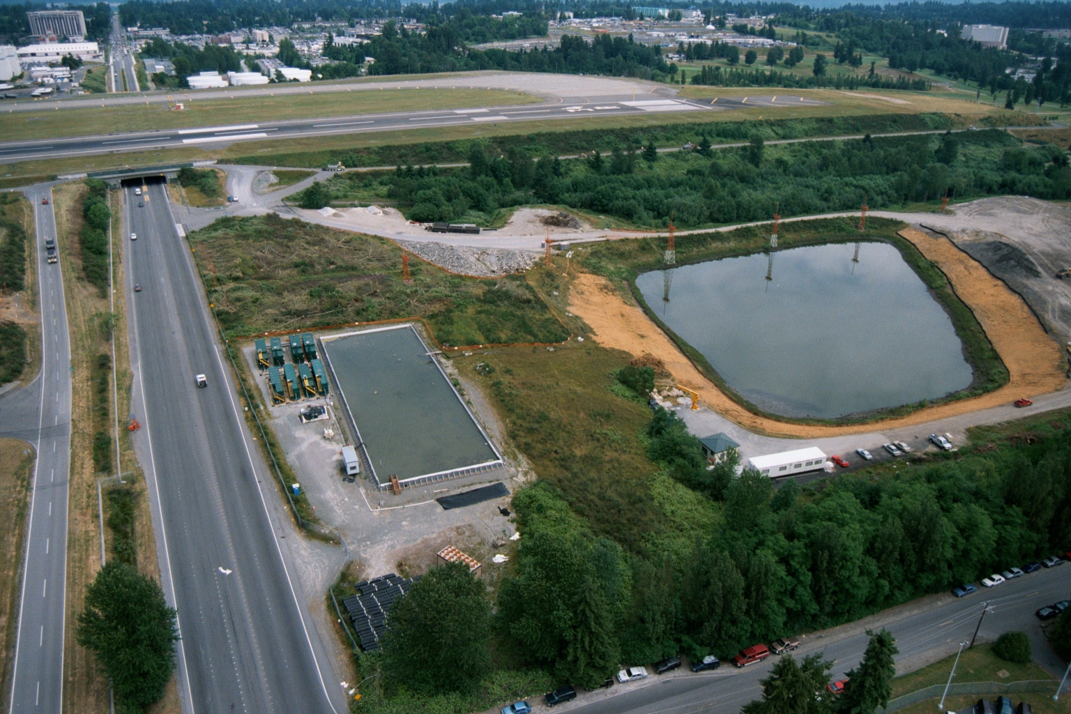
Aerial View of Highway Tunnel Underpass and Construction Near Sea-Tac Airport Runway
Aerial photograph showing a highway corridor with a tunnel underpass beneath an airport runway, alongside active construction including a retention/detention pond, a rectangular concrete structure or basin, and portable site facilities. The airport runway and surrounding developed areas are visible in the background, consistent with infrastructure work in the Sea-Tac Airport vicinity. -
 2001-06-22
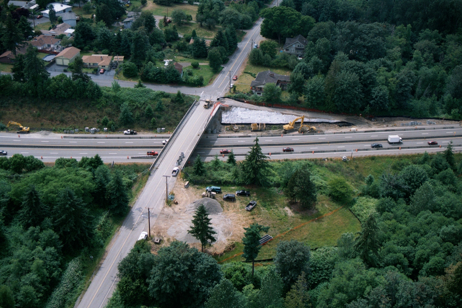
Aerial View of Highway Interchange Construction with Overpass Bridge and Excavation Equipment
Aerial photograph showing an overpass bridge crossing a multi-lane highway, with active construction visible including excavation equipment, earthwork, and staging areas on the northeast quadrant of the interchange. Surrounding area includes residential neighborhoods and dense tree cover, consistent with the Pacific Northwest region. -
 2001-06-22
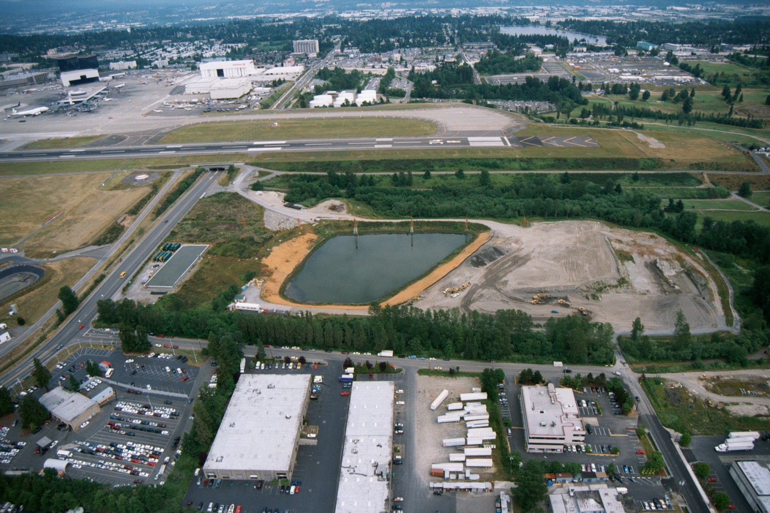
Aerial View of Sea-Tac Airport Runway System and Stormwater Pond Under Construction
Aerial photograph looking north toward Seattle-Tacoma International Airport, showing a runway and taxiway system in the mid-ground, a large retention/stormwater pond under construction in the middle distance, and commercial/industrial development in the foreground. The Boeing manufacturing facilities and Renton area are visible in the upper background, consistent with the airport's geography south of Seattle. -
 2001-01-21
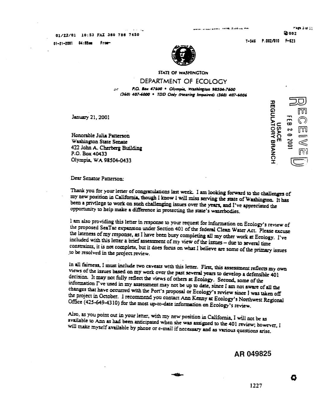
EXH AR049825: Ecology Letter to Senator Julia Patterson on Sea-Tac Airport Expansion Section 401 Water Quality Certification Review
Letter dated January 21, 2001 from Tom Luster, Washington State Department of Ecology, to Senator Julia Patterson of the Washington State Senate, responding to her request for information on Ecology’s Section 401 Clean Water Act review of the proposed SeaTac Airport expansion. Luster provides a brief assessment of key issues including antidegradation requirements, beneficial uses, -
 2000-02-25
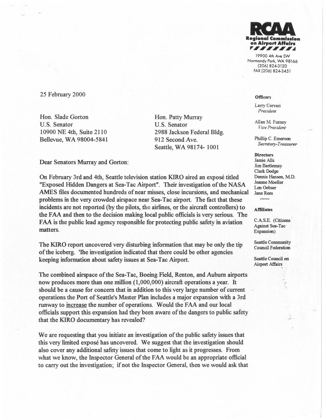
Letter to U.S. Senators Gorton and Murray Regarding Sea-Tac Airport Safety Issues
In February 2000, the Regional Commission on Airport Affairs (RCAA) wrote to U.S. Senators Patty Murray and Slade Gorton urging an investigation into aviation safety concerns at Sea-Tac Airport, following a KIRO-TV news report that revealed hundreds of unreported near-misses, runway incursions, and mechanical problems documented in NASA AMES files. The RCAA argued that these hidden dangers raised serious questions about the Port of Seattle's plans to expand the airport with a third runway. The letter also requested a moratorium on expansion-related construction permits until a full safety investigation — ideally led by the FAA Inspector General — could be completed. -
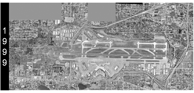 1999-01-01
Sea-Tac Airport Aerial Survey, 1999
A grayscale aerial photograph dated 1999 shows a large commercial airport with multiple parallel runways, taxiways, terminals, and surrounding suburban development. The '1999' watermark is visible on the left side of the image, indicating the year this aerial survey was conducted.