TagAirport Expansion(165)
-
 1996-07-11
Puget Sound Regional Council General Assembly Meeting Agenda, July 11, 1996
The Puget Sound Regional Council held a General Assembly Meeting on July 11, 1996, at the Seattle Center Flag Pavilion to consider a key policy action: an amendment to the Metropolitan Transportation Plan (MTP) that would include plans for Sea-Tac Airport expansion along with additional noise reduction measures. The meeting included a public comment period from 2:00–3:30 p.m., allowing community members up to three minutes each to speak, followed by assembly deliberations and a vote on the proposed amendment. This document reflects a formal regional planning effort to balance airport growth with mitigation of noise impacts on surrounding communities. -
1996-07-11
Puget Sound Regional Council General Assembly Meeting Agenda, July 11, 1996
Agenda for the Puget Sound Regional Council (PSRC) General Assembly Meeting held Thursday, July 11, 1996, 2:00–5:00 PM at the Seattle Center Flag Pavilion, Seattle, WA. Presided over by Executive Doug Sutherland. Key action item: Amendment to Metropolitan Transportation Plan (MTP) to include plans for Sea-Tac Airport expansion with additional noise reduction measures. Includes public -
 1996-06-27
Puget Sound Regional Council Executive Board Meeting Agenda — June 27, 1996
The Puget Sound Regional Council held an Executive Board meeting on June 27, 1996, at the Seattle Center Flag Pavilion, featuring a public hearing and board deliberations on regional transportation matters. A key item on the agenda was a recommendation to the General Assembly on amending the Metropolitan Transportation Plan (MTP) to incorporate plans for Sea-Tac Airport expansion accompanied by additional noise reduction measures. The meeting also addressed transportation plan certifications, transit authority system plan consistency, and routine amendments to regional transportation improvement programs. -
1996-06-27
Puget Sound Regional Council Executive Board Meeting Agenda — June 27, 1996
Agenda for the Puget Sound Regional Council (PSRC) Executive Board Meeting held June 27, 1996, at the Seattle Center Flag Pavilion, Seattle, WA. Presided over by Executive Doug Sutherland, President. Public hearing from 9:00 a.m. to 12:00 noon, followed by Executive Board deliberation. Consent agenda items include approval of minutes from April 25, 1996; vouchers -
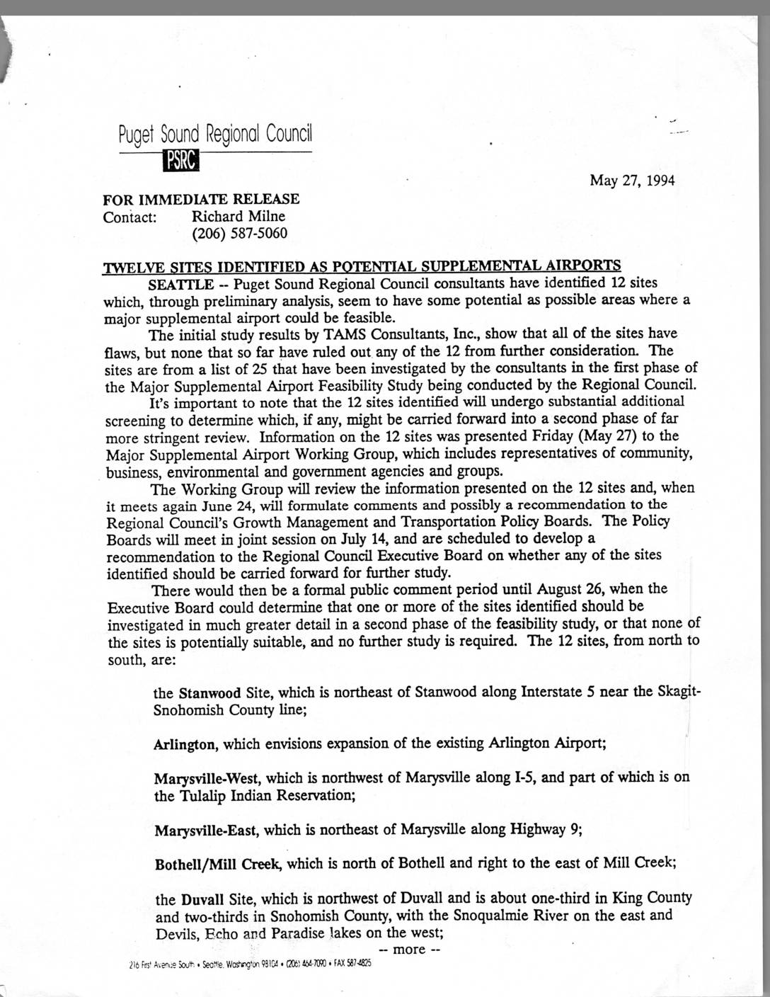 1994-05-27
Twelve Sites Identified as Potential Supplemental Airports
In May 1994, the Puget Sound Regional Council announced that consultants had identified 12 potential sites for a major supplemental airport in the central Puget Sound region, narrowed down from an initial list of 25 candidates. The sites, stretching from Stanwood in the north to the Tanwax Lake area in Pierce County in the south, were deemed to have no flaws severe enough to rule them out from further consideration. The study was part of a broader effort to determine whether a supplemental airport could relieve pressure on Sea-Tac and potentially eliminate the need for a controversial third runway. -
 1993-01-21
RCAA presentation materials on demand management, airport planning, and system alternatives
This January 1993 document from the Regional Commission on Airport Affairs (RCAA) presents materials to the Puget Sound Regional Council's Transportation Policy and Executive Board covering demand management, airport planning, and regional air capacity alternatives. The packet includes analysis of flight delays, airspace and runway capacity issues, and landside capacity concerns prepared by consultants J. Richard Aramburu and Gerald Bogan, along with alternative airport development ideas from locations such as Grays Harbor County, Toledo-Winlock, and Moses Lake. The RCAA, backed by dozens of community groups and several cities in the Sea-Tac area, sought to offer expert-driven solutions to address long-term aviation capacity needs while addressing aircraft noise concerns affecting surrounding neighborhoods. -
 1993-01-14
Regional Commission on Airport Affairs Book #1
This is Book #1 of materials compiled by the Regional Commission on Airport Affairs (RCAA), a coalition of community organizations and cities in the Puget Sound region, submitted to the Transportation Policy Board in January 1993. The packet presents expert reports on air traffic forecasting, economic impacts, noise, effects on children's education, public health, and air pollution—all focused on the proposed expansion of Seattle-Tacoma (Sea-Tac) International Airport. The RCAA argues against airport expansion on the grounds of quality of life, environmental harm, and equity for surrounding communities. -
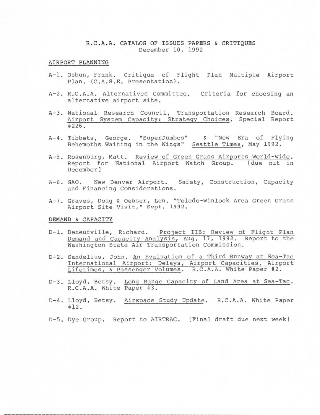 1992-12-10
R.C.A.A. catalog of issues papers & critiques
This December 1992 catalog from R.C.A.A. (Residents for Conscious Airport Activity) lists research papers, critiques, and white papers organized by topic—including airport planning, demand and capacity, economics, health, environmental impacts, and noise—all relating to Sea-Tac International Airport expansion. Key concerns addressed include aircraft noise measurement and the adequacy of the 65 Ldn noise metric, air and water pollution from airport expansion, and the evaluation of alternative airport sites. The catalog reflects community and expert opposition to Sea-Tac's third runway proposal and broader regional airport policy decisions in the Puget Sound area. -
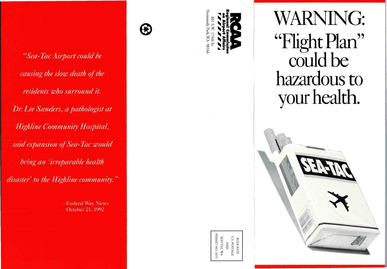 1992-10-21
WARNING: ‘Flight Plan’ could be hazardous to your health
A 1992 pamphlet published by the Regional Commission on Airport Affairs (RCAA) warns that the Port of Seattle's expansion plan for Sea-Tac Airport — including the addition of a third runway — poses serious health risks to surrounding communities. Citing studies reviewed by physicians at Highline Community Hospital, the brochure links increased airport activity to higher rates of birth defects, cardiovascular disease, mental illness, and dangerous levels of air pollutants such as carbon monoxide, benzene, and lead. The document concludes that when health and community costs are fully considered, Sea-Tac expansion may be neither financially feasible nor ethically justifiable. -
 1992-10-05
The adverse health impacts of airport expansion with particular reference to Sea-Tac International Airport
A 1992 report by physicians from the Regional Coalition on Airport Affairs details the serious health risks posed by Sea-Tac International Airport's noise and air pollution on surrounding communities. It documents links between airport noise and increased use of tranquilizers, psychiatric hospitalizations, sleep disruption, lower birth weights, and declining school test scores, while also noting that Sea-Tac generates up to 5% of all air pollution in King County. The report argues that airport expansion would significantly worsen these already measurable public health impacts on South King County residents.