TagSea-Tac Airport(1855)
-

StART Letterhead
Official header graphic for the StART (SEA Stakeholder Advisory Round Table), a noise-policy advisory body associated with Seattle-Tacoma International Airport (SEA). The banner displays the StART acronym with an airplane icon and the full name 'SEA Stakeholder Advisory Round Table' on a dark green background. -
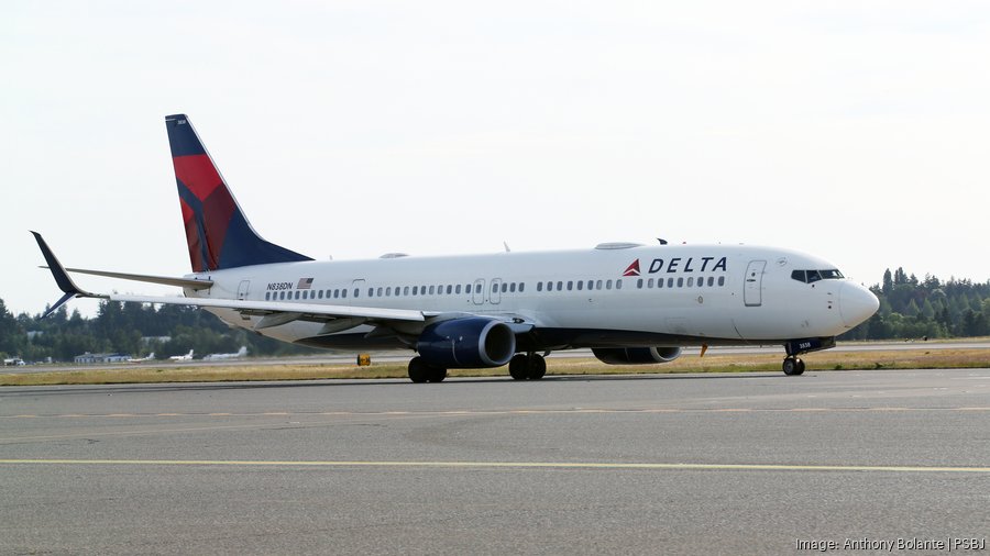
Delta Air Lines Boeing 737-900 Taxis at Sea-Tac Airport
A Delta Air Lines Boeing 737-900 bearing registration number N838DN taxis on the airfield at Sea-Tac Airport. The image is credited to photographer Anthony Bolante for the Puget Sound Business Journal (PSBJ), as noted in the watermark. -
 2024-10-31
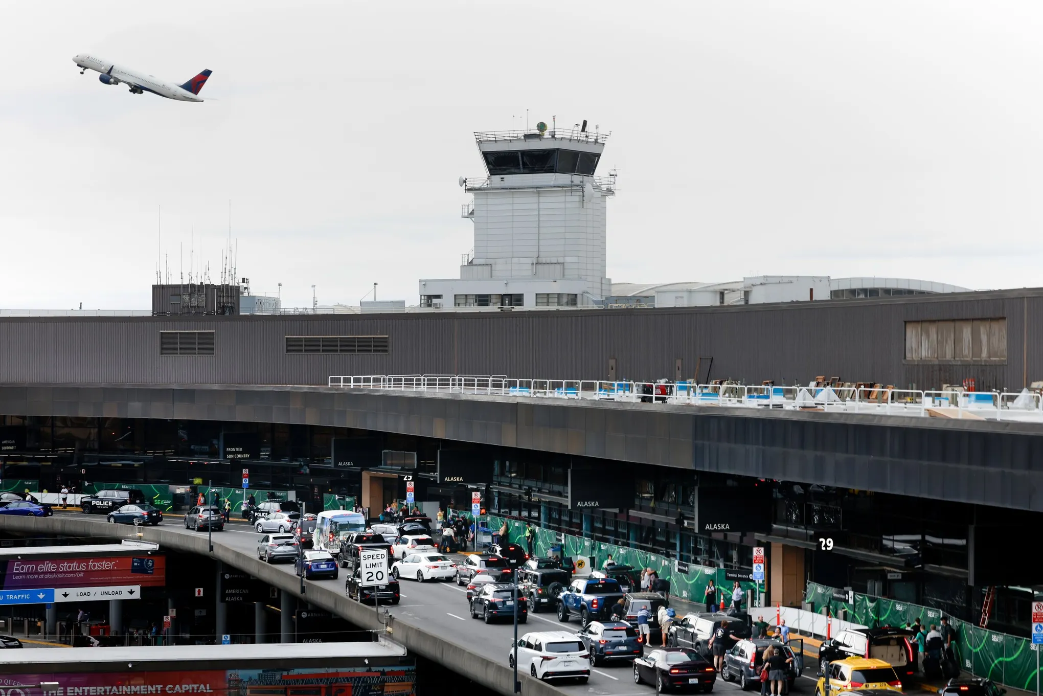
Airport Terminal with Control Tower and Aircraft Departure
A Delta Air Lines aircraft departs over the main terminal at Seattle-Tacoma International Airport (SEA-TAC), with Alaska Airlines check-in curb areas visible below. The busy departures roadway shows a posted 20 mph speed limit, with signage for Alaska, Frontier, and Sun Country airlines visible on the terminal facade. -
 2024-10-23
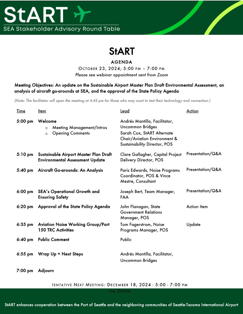
StART Meeting Agenda — October 23, 2024
Agenda for the SEA Stakeholder Advisory Round Table (StART) meeting held October 23, 2024, 5:00–7:00 pm via Zoom. Topics include an update on the Sustainable Airport Master Plan Draft Environmental Assessment, an analysis of aircraft go-arounds at SEA, and approval of the State Policy Agenda; next meeting tentatively scheduled December 18, 2024. -
 2024-10-22
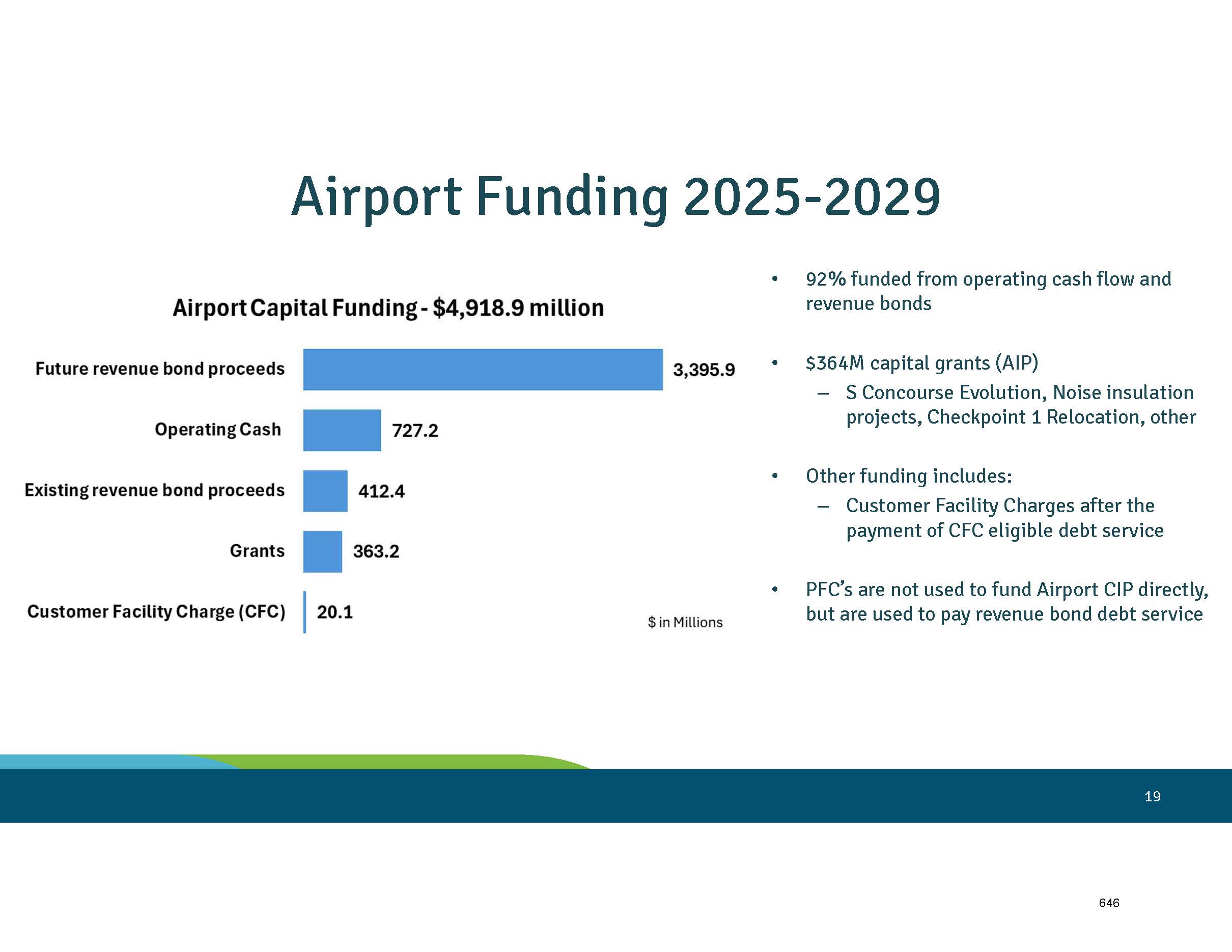
Sea-Tac Airport Capital Funding Breakdown 2025–2029 — Draft Plan of Finance (Page 21)
A presentation slide showing the Airport Capital Funding breakdown of $4,918.9 million for 2025–2029, with the largest source being Future Revenue Bond Proceeds at $3,395.9 million. The slide notes that 92% is funded from operating cash flow and revenue bonds, with $364M in capital grants (AIP) allocated to projects including S Concourse Evolution, Noise Insulation projects, and Checkpoint 1 Relocation. -
 2024-10-22
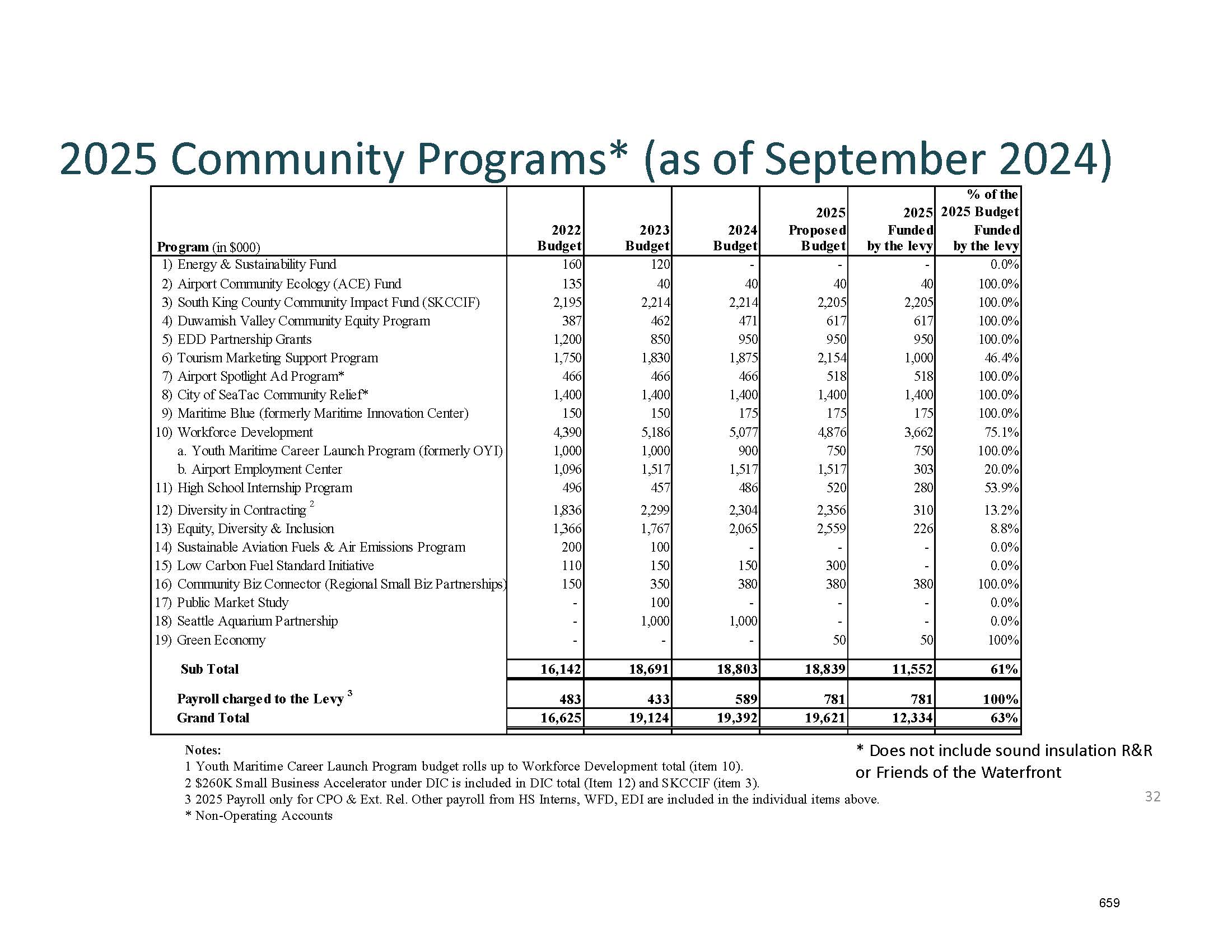
Port Of Seattle 2025 Community Programs Budget Table — Draft Plan of Finance Property Tax Levy (Page 34)
A budget table from the Port of Seattle presenting 2025 Community Programs funding as of September 2024, showing 19 line-item programs with budgets from 2022–2025. The Grand Total proposed 2025 budget is $19,621,000, with $12,334,000 (63%) funded by the levy; programs include the South King County Community Impact Fund, Duwamish Valley Community Equity Program, Workforce Development, and others related to Sea-Tac Airport operations. -
 2024-10-22
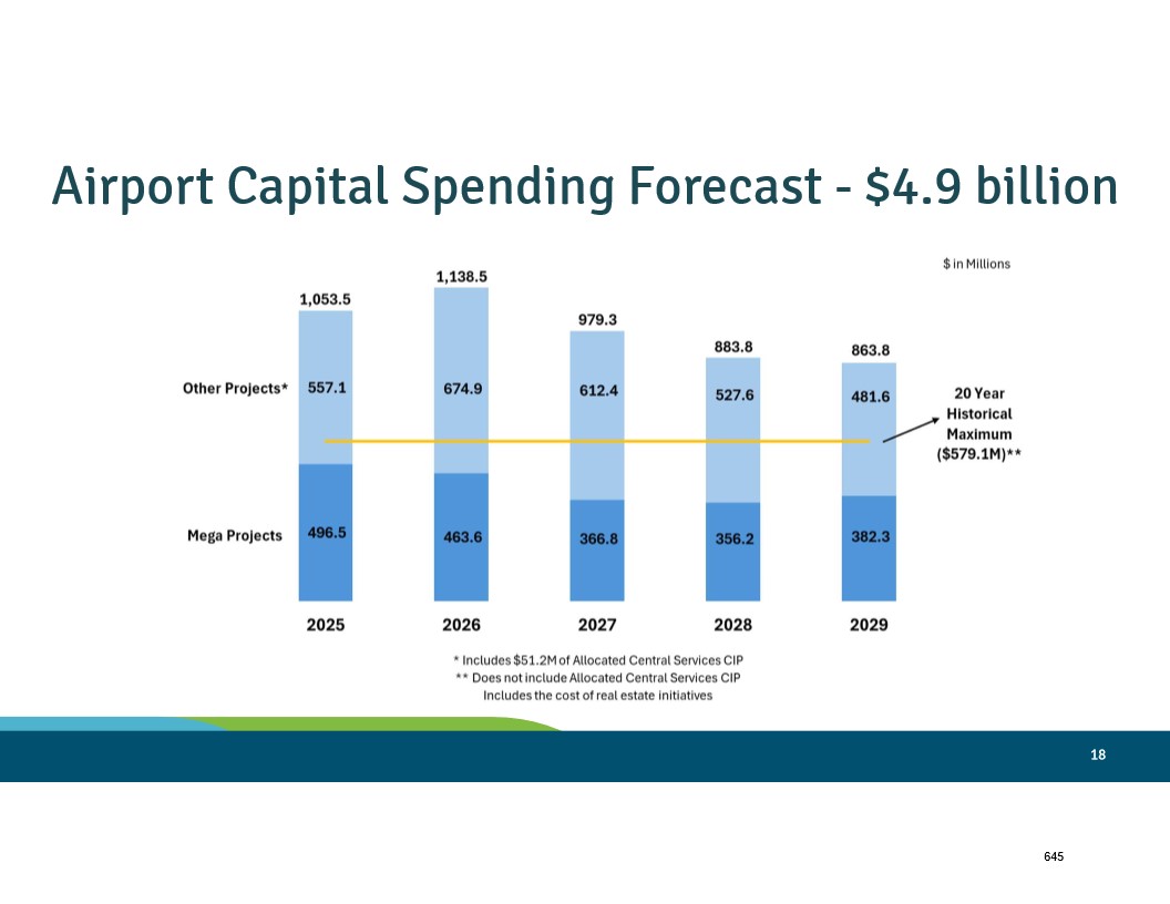
Sea-Tac Airport Capital Spending Projections 2025–2029 — Slide 20 (Draft Plan of Finance, October 2024)
A bar chart from a Sea-Tac Airport presentation (slide 18) projects $4.9 billion in airport capital spending from 2025 through 2029, broken down annually into Mega Projects and Other Projects. Annual totals range from $863.8M (2029) to $1,138.5M (2026), with a reference line marking the 20-year historical maximum of $579.1M. -
 2024-10-22
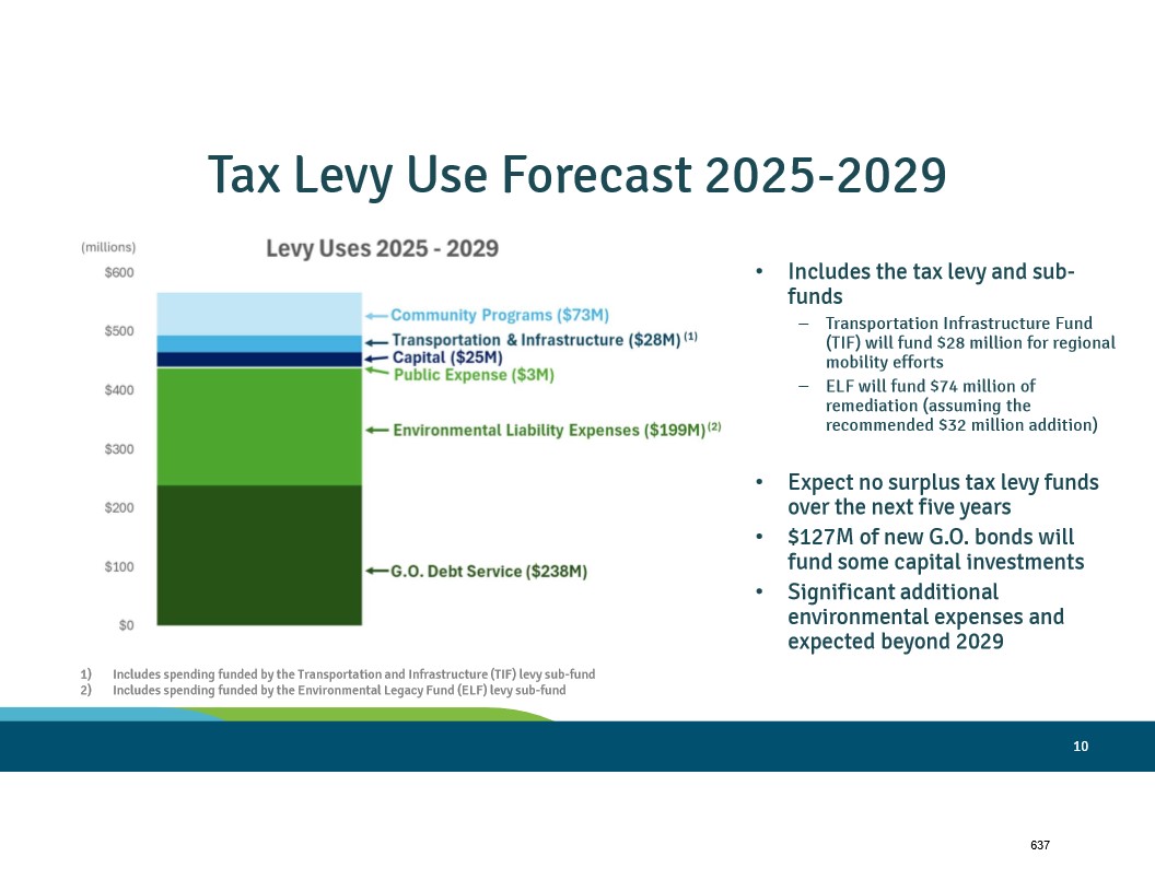
Tax Levy Use Forecast 2025–2029 — Slide 12 (Port Of Sea-Tac Draft Plan of Finance, October 2024)
A presentation slide titled 'Tax Levy Use Forecast 2025-2029' showing a stacked bar chart of levy uses totaling approximately $565M, broken down into G.O. Debt Service ($238M), Environmental Liability Expenses ($199M), Public Expense ($3M), Capital ($25M), Transportation & Infrastructure ($28M), and Community Programs ($73M). Key notes indicate no surplus tax levy funds are expected over five years, $127M in new G.O. bonds will fund capital investments, and significant additional environmental expenses are anticipated beyond 2029. -
 2024-10-21
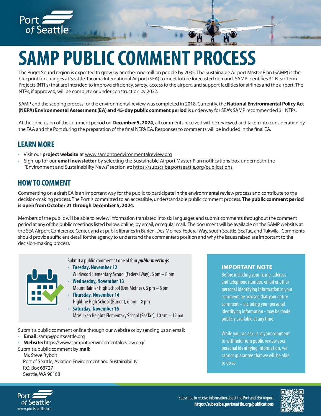
SAMP Public Comment Process: Factsheet
The Port of Seattle is seeking public comments on a proposed environmental review of 31 Near-Term Projects at Seattle-Tacoma International Airport (SEA), designed to improve efficiency, safety, and access as the Puget Sound region prepares for one million additional residents by 2035. The public comment period runs from October 21 through December 5, 2024, with four in-person meetings scheduled across Federal Way, Des Moines, Burien, and SeaTac. Comments can be submitted online, by email at samp@portseattle.org, by mail, or in person, and will be considered by the FAA and Port of Seattle in finalizing the National Environmental Policy Act (NEPA) Environmental Assessment. -

Larry Cripe and Quiet Skies Puget Sound Fight the Flight panel
A panel of approximately six speakers sit at a table before an audience at a 'Fight the Flight' community meeting, an organized effort opposing Sea-Tac Airport flight path or expansion issues. A moderator stands at left addressing the crowd, with the 'Fight the Flight' logo prominently projected on the screen behind the panel.