TagNorth Sea-Tac Park(157)
-
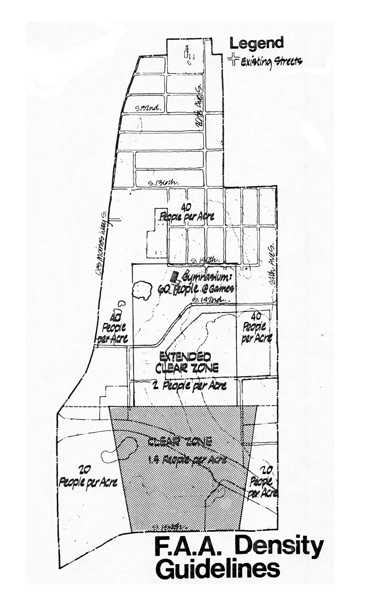
NTSP FAA Density Guidelines
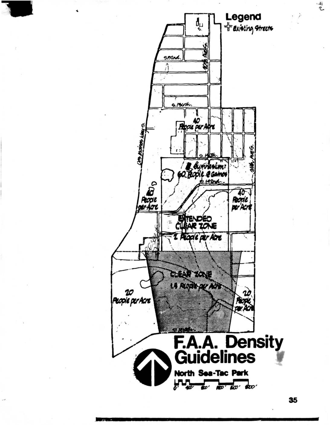
A planning map showing FAA density guidelines for the area near Sea-Tac Airport, delineating zones including a Clear Zone (1.5 people per acre), Extended Clear Zone (2 people per acre), and surrounding areas rated at 20–40 people per acre. The map references streets including S. 132nd, S. 140th, S. 142nd, Des Moines Way S., 20th Ave S., and 24th Ave S., and notes a Gymnasium with 60 people at Gaines. -
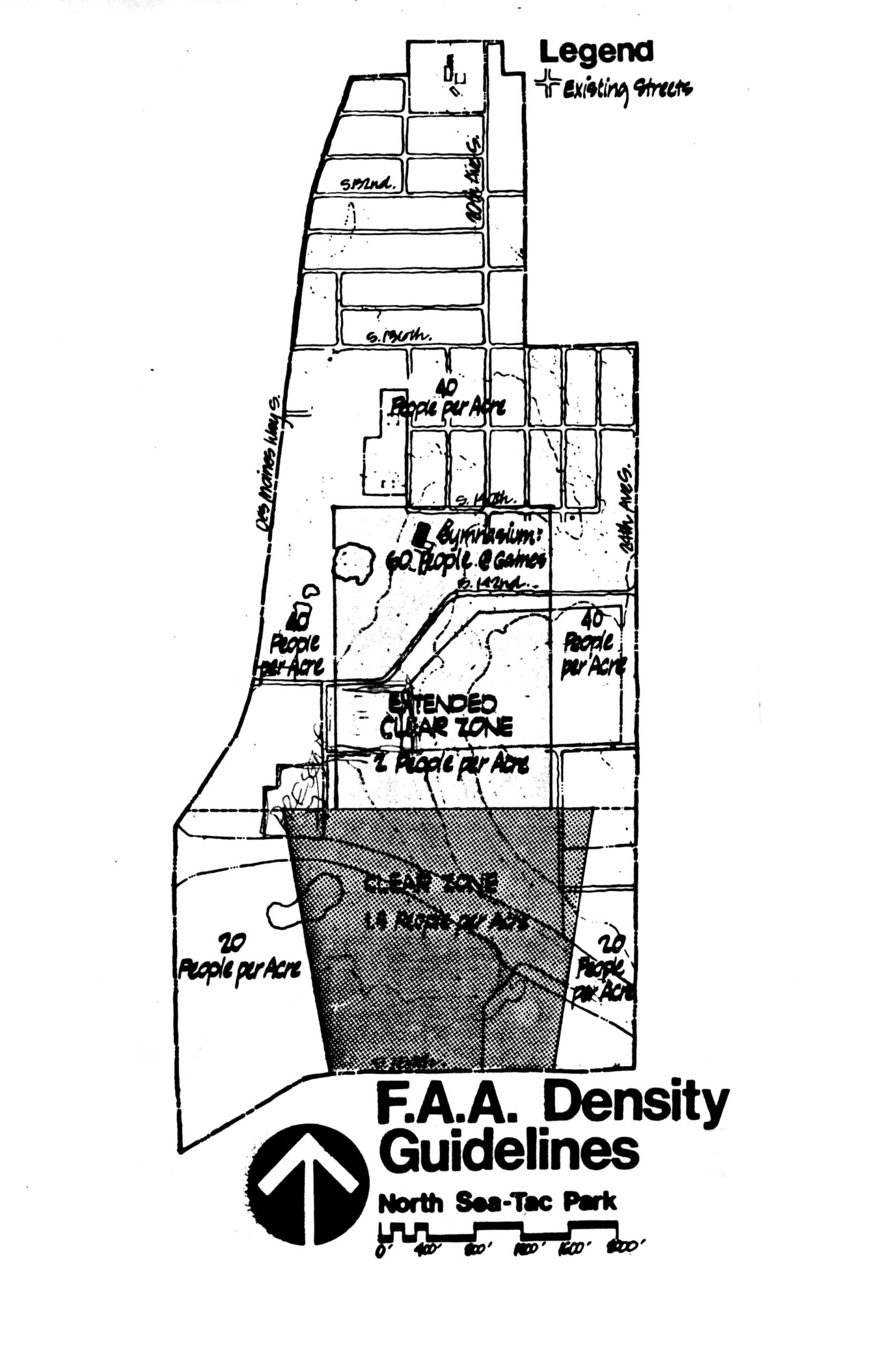
faa density guidelines np pg 35
A planning map titled 'F.A.A. Density Guidelines – North Sea-Tac Park' showing population density zones near Sea-Tac Airport, including a shaded Clear Zone (1.5 people per acre), an Extended Clear Zone (2 people per acre), and surrounding areas zoned at 20 and 40 people per acre. The map also notes a gymnasium with 60 people at games, and references existing streets including Des Moines Way S and several numbered avenues and streets. -
 2022-12-25
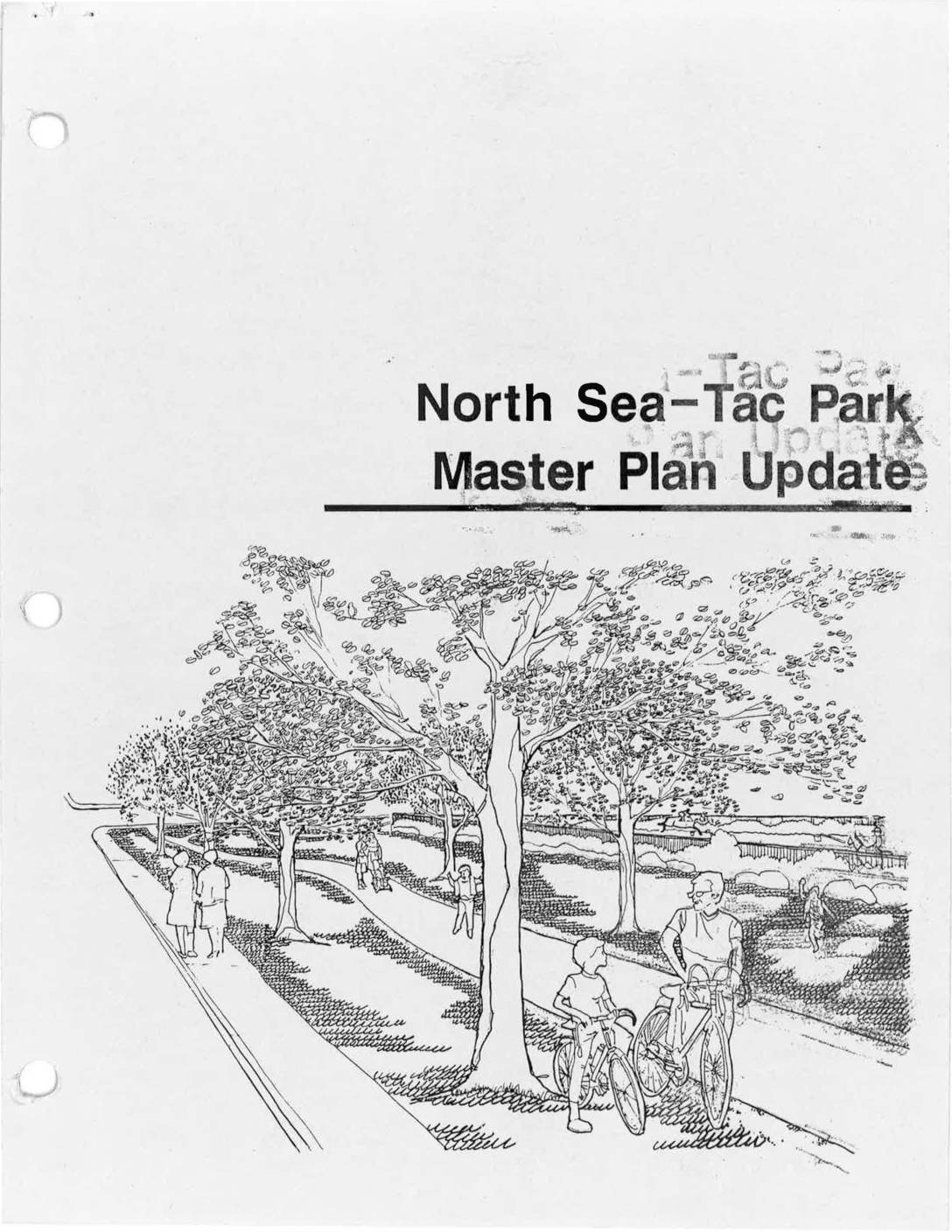
North Sea-Tac Park master plan update
The North Sea-Tac Park Master Plan Update is a joint planning document produced by King County and the Port of Seattle, prepared by Triangle Associates/Jones & Jones. It outlines recommended updates to the master plan for North Sea-Tac Park, including a phased development program and alternative implementation strategies. The plan reflects a collaborative effort to guide the park's future development in the area surrounding Seattle-Tacoma International Airport. -
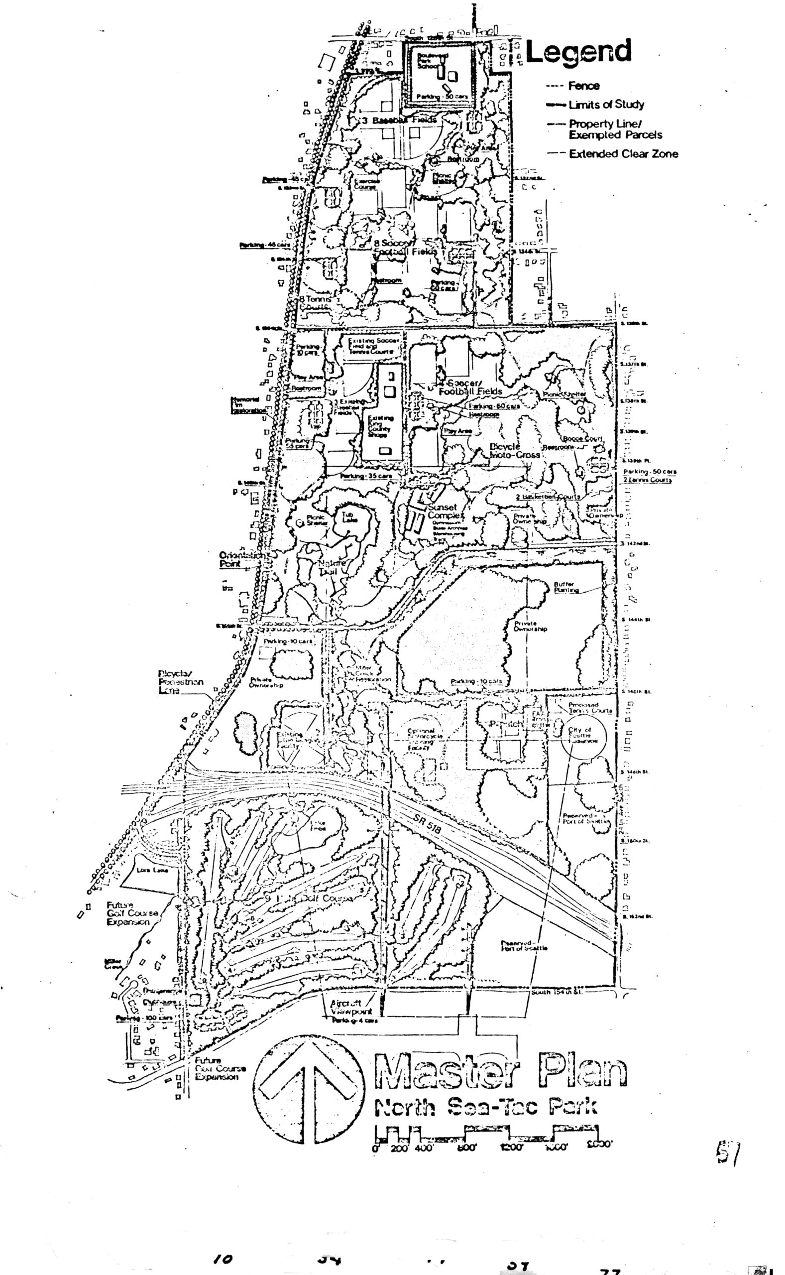
North Sea-Tac Park Master Plan (v51) hi-res
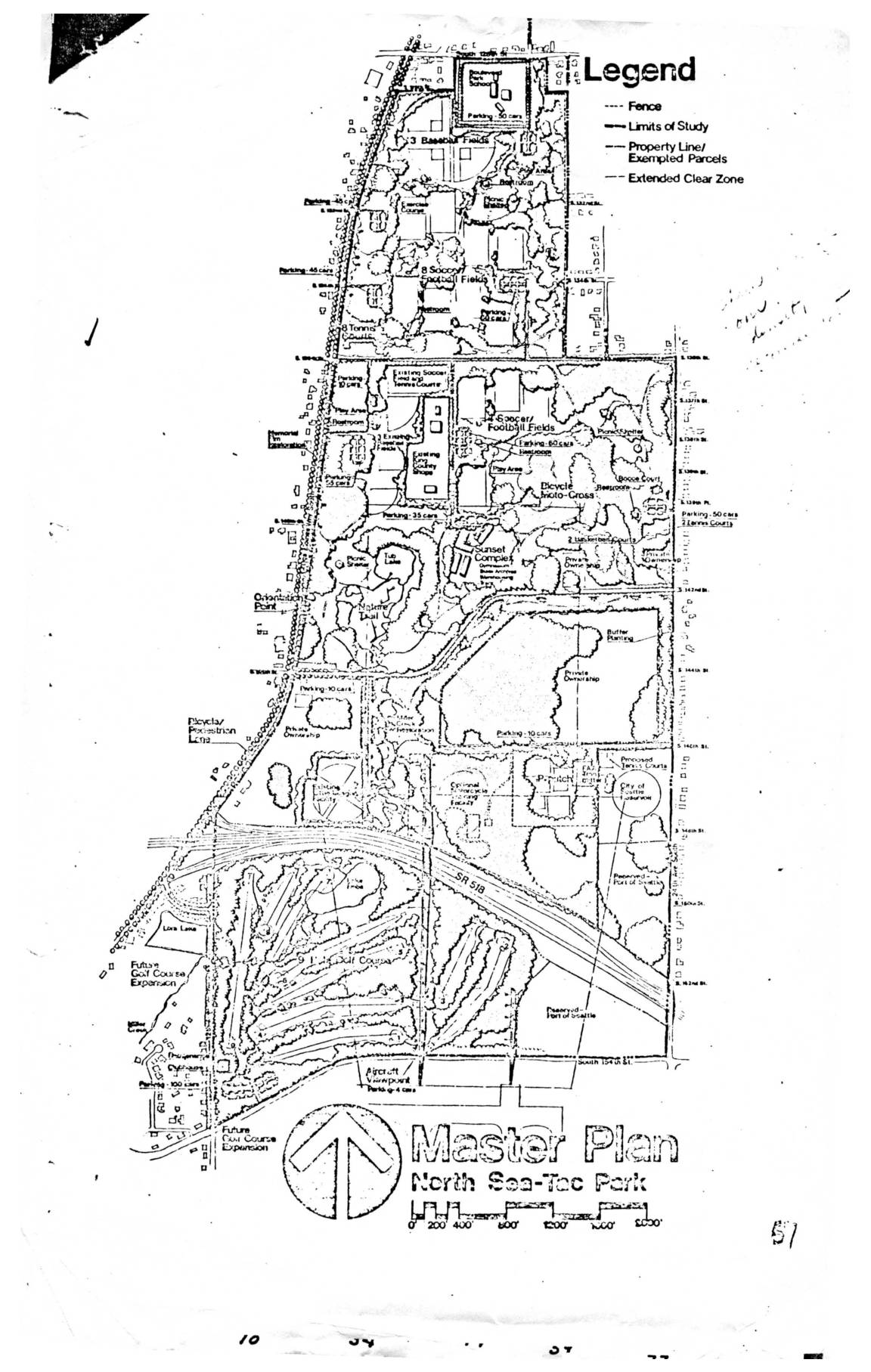
A master plan map of North Sea-Tac Park showing proposed recreational facilities including baseball fields, soccer/football fields, tennis courts, a golf course, bicycle/motocross area, Sunset Complex, and an Aircraft Viewpoint. The map includes a legend distinguishing fences, limits of study, property lines/exempted parcels, and extended clear zones, with SR 518 bisecting the lower portion of the park. -
 2022-08-27
Greater Highline Community Parks Board: Purpose, Plan for Park Development, and History of North Sea-Tac Park
The Greater Highline Community Parks Board was organized in early 1981 to represent the local community in developing the North Sea-Tac Park, a project arising from the Port of Seattle's acquisition of land severely impacted by airplane noise from Sea-Tac Airport. The development plan included steps such as securing a master lease with the Port of Seattle, organizing sports and recreation programs, cleaning up and improving the site, and potentially taking over Sunset School for community use. Key milestones between 1980 and 1981 included a $30,000 master plan study, approvals from both the Port of Seattle Commission and King County, and a bid by the Parks Board on all Sunset School buildings contingent on obtaining the master lease. -
 2022-08-27
F.A.A. density guidelines: North Sea-Tac Park
This map illustrates the F.A.A. density guidelines for the North Sea-Tac Park area, showing recommended population limits per acre across different airport safety zones. The Clear Zone nearest the runway allows the fewest people (approximately 1.5 per acre), while the Extended Clear Zone permits around 2 people per acre, and surrounding residential areas are guided toward densities of 20 to 40 people per acre. A gymnasium is specifically noted at 60 people during games, reflecting how land use intensity is regulated based on proximity to airport flight paths. -
 2022-08-27
Master plan North Sea-Tac Park
This document presents the Master Plan for North Sea-Tac Park, showing a detailed map of proposed and existing recreational facilities including baseball fields, soccer and football fields, tennis courts, a golf course, bicycle/motocross areas, and a Sunset Complex. The plan identifies property boundaries, fencing, limits of study, and extended clear zones relevant to nearby Seattle-Tacoma International Airport operations. It reflects land-use planning efforts to balance public park amenities with airport noise and safety constraints in the surrounding community. -
A Report On Land Use at Sea-Tac Airport by Joe Sims
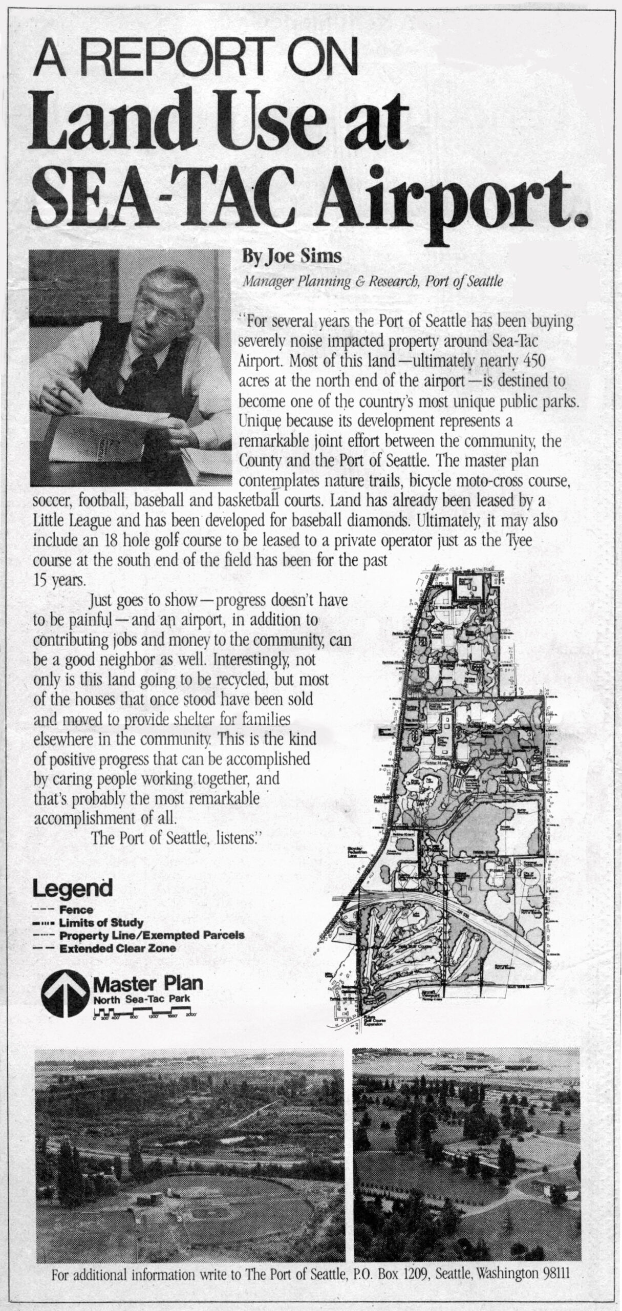
A report authored by Joe Sims, Manager of Planning & Research for the Port of Seattle, describing the Port's purchase of noise-impacted properties around Sea-Tac Airport and plans to develop nearly 450 acres at the north end of the airport into North Sea-Tac Park, including nature trails, sports courts, baseball diamonds, and a possible 18-hole golf course. The article includes a master plan map of North Sea-Tac Park and two aerial photographs of the developing park grounds. -
LETTER: Citizens reply to Port of Seattle’s response regarding North SeaTac Park
Dear Editor, An August 9 Letter to the Editor, “Port of Seattle responds – ‘Airport programs create habitat, strengthen native species,’” outlined ways in which the Port protects natural habitat and green spaces. The author also stated that the Port is not considering development within North SeaTac Park. The Port has invested significantly in environmental -
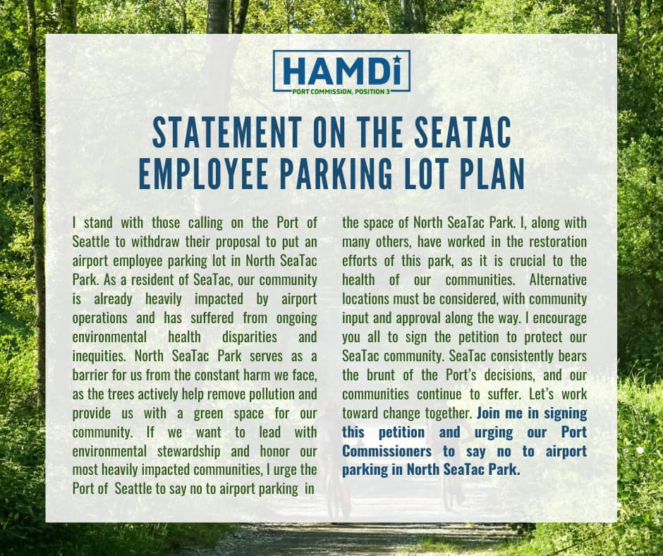
Hamdi Campaign Statement Opposing NSTP Employee Parking Lot
A campaign statement from Hamdi, candidate for Port Commission Position 3, opposing the Port of Seattle's proposal to build an airport employee parking lot in North SeaTac Park. The statement cites environmental health disparities in the SeaTac community, highlights the park's role in reducing pollution, and calls on supporters to sign a petition urging Port Commissioners to reject the plan.