TagLand Use(230)
-
 1974-02-13
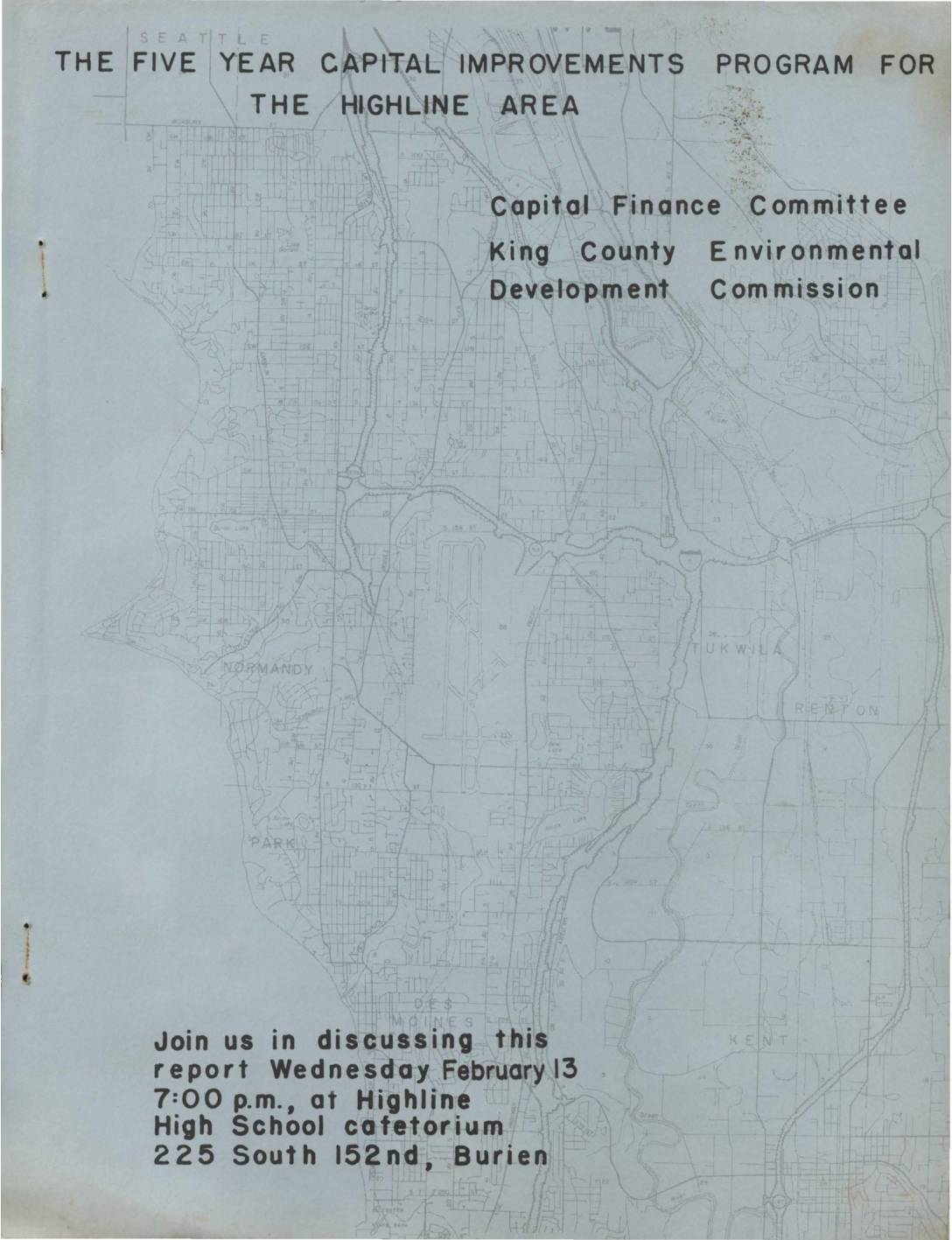
Five Year Capital Improvements Program for the Highline Area
This 1974 report by the King County Environmental Development Commission outlines capital improvement projects tentatively scheduled for the Highline Area — a community near present-day Sea-Tac Airport — covering the years 1974 through 1979. Prepared to encourage public input before financial and legislative commitments were finalized, it invited residents to review and discuss planned development projects at a public meeting held at Highline High School in Burien on February 13, 1974. -
1974-02-13
Five Year Capital Improvements Program for the Highline Area
Report prepared by the Capital Finance Committee of the King County Environmental Development Commission (E.D.C.) covering the Five Year Capital Improvements Program for the Highline Area, covering projects tentatively scheduled for acquisition and/or construction from 1974 through 1979. The E.D.C. was a 134-member citizens advisory group with an 18-member commission and 9 functional committees. Public -
 1973-04-20
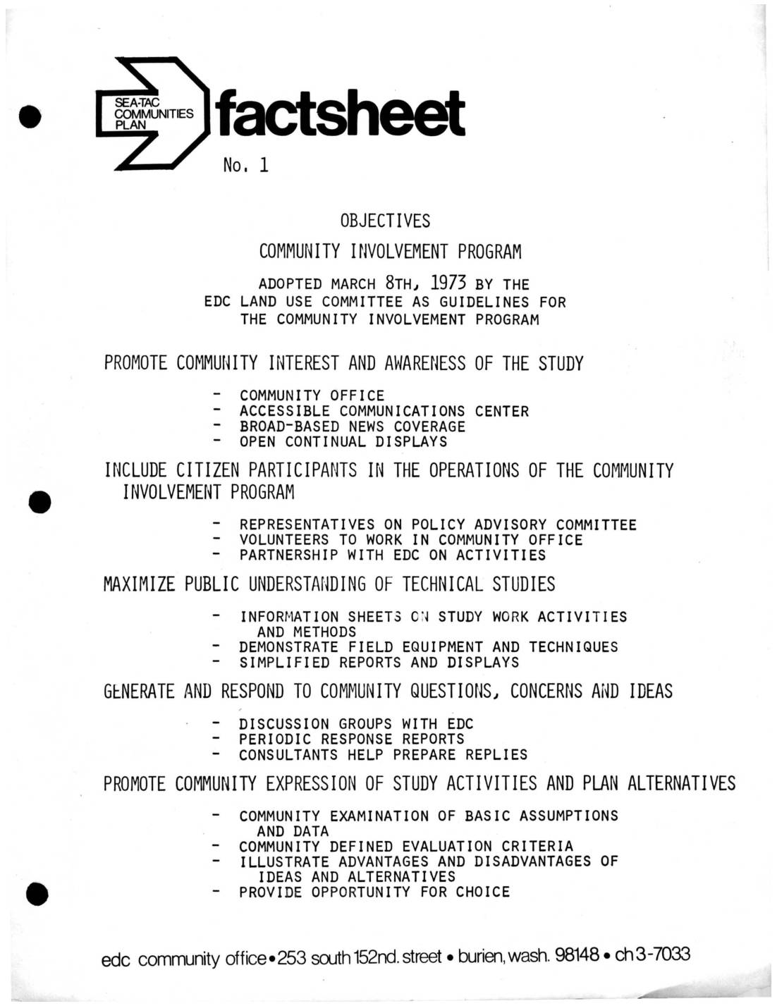
Sea-Tac Communities Plan Fact Sheets: Community Involvement Program Objectives, Environmental Development Commission, and Technical Advisory Committee
These fact sheets from 1973 outline the structure and goals of the Sea-Tac Communities Plan, a planning study focused on Sea-Tac International Airport and surrounding areas. The Community Involvement Program aimed to engage local residents through a community office, public displays, and citizen representation on advisory committees. Technical oversight was provided by the Technical Advisory Committee (TAC), which brought together representatives from local, state, and federal agencies—including the FAA, EPA, Boeing, and area school districts—to coordinate planning efforts and review recommendations. -
1973-04-20
Sea-Tac Communities Plan Fact Sheets: Community Involvement Program Objectives, Environmental Development Commission, and Technical Advisory Committee
Three fact sheets (Nos. 1–3) from the Sea-Tac Communities Plan (STCP), published by the EDC Community Office at 253 South 152nd Street, Burien, WA 98148. Fact Sheet No. 1 outlines the objectives of the Community Involvement Program, adopted March 8, 1973 by the EDC Land Use Committee, covering community office operations, citizen participation, public understanding -
 1972-04-21
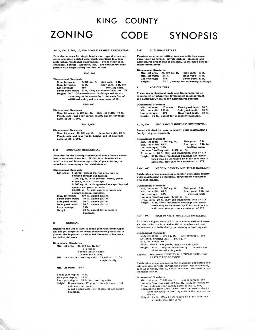
King County Zoning Code Synopsis
This 1972 King County Zoning Code Synopsis outlines dimensional standards and land-use purposes for all zoning classifications in King County, Washington, ranging from single-family residential zones (RS-7,200 through RS-15,000) to agricultural, commercial, and industrial designations. Each zone specifies minimum lot sizes, yard setbacks, lot coverage limits, and building height restrictions. The document provides the regulatory framework that governed land development in the King County area, including communities near Sea-Tac Airport, during the early 1970s. -
1972-04-21
King County Zoning Code Synopsis
King County Zoning Code Synopsis dated April 21, 1972, summarizing dimensional standards for all zoning classifications including single family residential (RS-7,200, RS-9,600, RS-15,000), Suburban Residential (S-R), Suburban Estate (S-E), Agricultural (A), General (G), duplex/multi-family residential (RD-3,600, RM-2,400, RM-1,800, RM-900), neighborhood and community business (B-N, B-C), general commercial (C-G), light and heavy manufacturing (M-L, M-H), Manufacturing -
 1969-02-08
Sea-Tac International Airport: Part 3 — Boeing Bust to Deregulation
The Port of Seattle built Seattle-Tacoma International Airport during World War II to relieve pressure on existing airports such as Seattle’s Boeing Field. Following the war, Sea-Tac quickly established itself as the region’s aviation hub, but it had to undertake major improvements to accommodate newer jet aircraft and steadily increasing numbers of passengers. During the -
 1968-02-01
APA – Planning The Airport Environment
This 1968 report by the American Society of Planning Officials examines the major planning challenges posed by airports, particularly in light of rapid growth in air transportation and the introduction of new jet aircraft. It summarizes methods and tools planners can use to achieve environments compatible with airport operations, viewing airports as transportation facilities, nuisances, -
 1968-02-01
Planning the airport environment
This 1968 report by the American Society of Planning Officials examines the major planning challenges posed by airports, particularly in light of rapid growth in air transportation and the introduction of new jet aircraft. It summarizes methods and tools planners can use to achieve environments compatible with airport operations, viewing airports as transportation facilities, nuisances, -
Seattle Times 1966 Airport Expansion Becomes Routine (map)
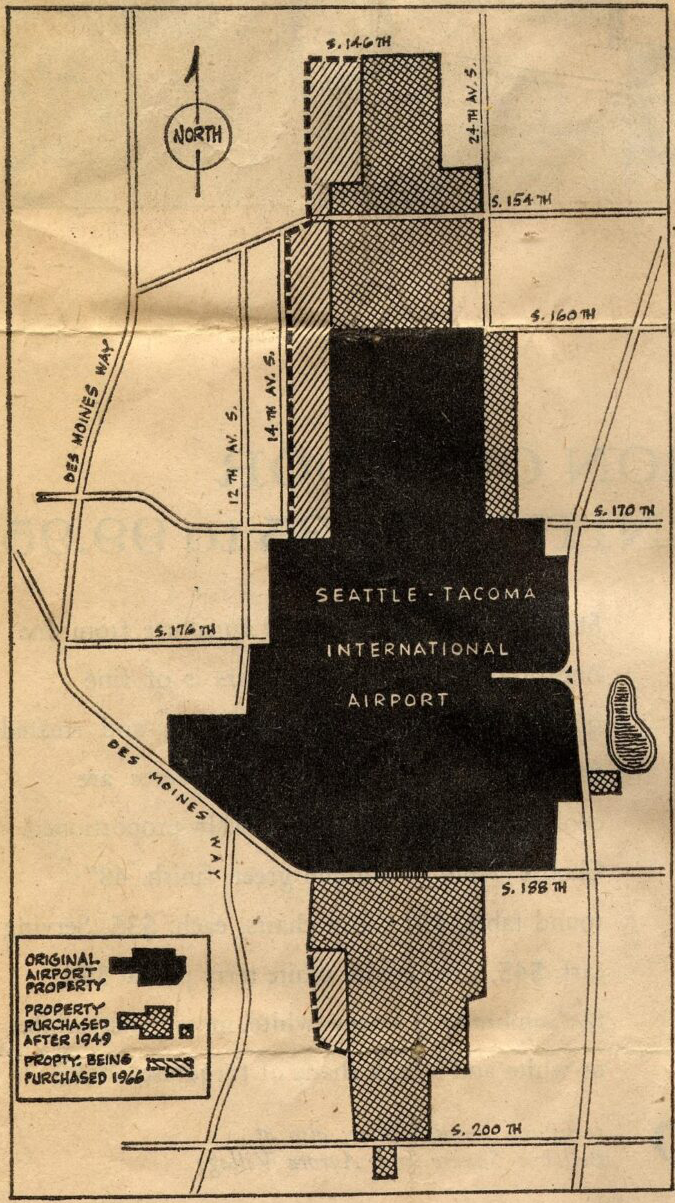
A map showing the land boundaries of Seattle-Tacoma International Airport, distinguishing between original airport property (solid black), property purchased after 1949 (crosshatch pattern), and property being purchased in 1966 (diagonal hatch pattern). The map shows surrounding streets including Des Moines Way, S. 146th through S. 200th Streets, and avenues including 12th, 14th, and 24th Ave S.