TagPort Of Seattle(2342)
-
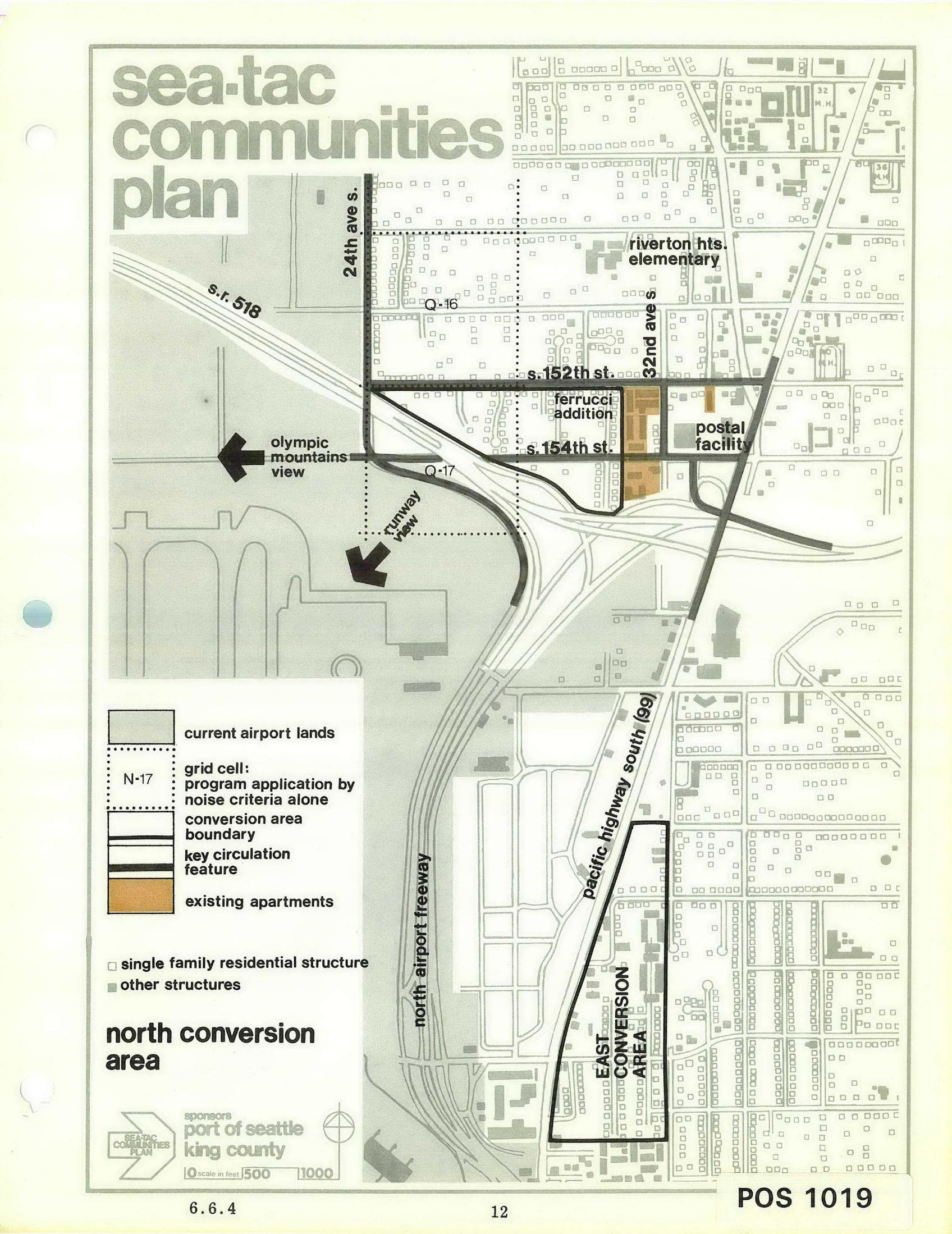
Sea-Tac Communities Plan — North Conversion Area Planning Map
A planning map labeled 'Sea-Tac Communities Plan' showing the North Conversion Area near Seattle-Tacoma Airport, identifying key features including S.R. 518, S. 152nd and S. 154th Streets, 24th and 32nd Avenues S., Riverton Heights Elementary, a postal facility, Ferrucci Addition, grid cells Q-16 and Q-17, Olympic Mountains view corridor, runway view corridor, and the East Conversion Area along Pacific Highway South (99). Sponsored by the Port of Seattle and King County, document reference POS 1019, page 6.6.4. -
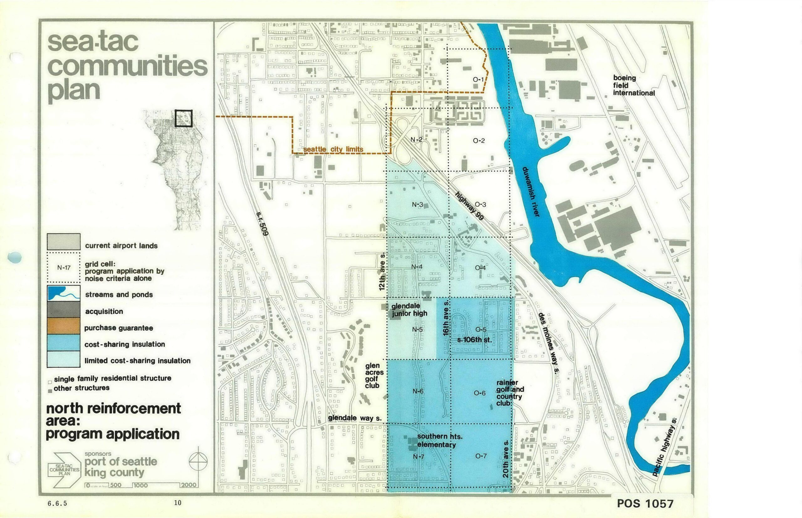
Sea-Tac Communities Plan North Reinforcement Area Program Map (POS 1057, Sheet 6.6.5, Page 10)
This planning map (document number POS 1057, sheet 6.6.5, page 10) from the Sea-Tac Communities Plan depicts the North Reinforcement Area program application, showing grid cells N-1 through N-7 and O-1 through O-7 near Seattle-Tacoma International Airport. Sponsored by the Port of Seattle and King County, the map identifies land-use categories including current airport lands, acquisition zones, purchase guarantee areas, cost-sharing insulation areas, and limited cost-sharing insulation areas, with landmarks such as Boeing Field International, the Duwamish River, Glendale Junior High, Southern Heights Elementary, and Rainier Golf and Country Club. -
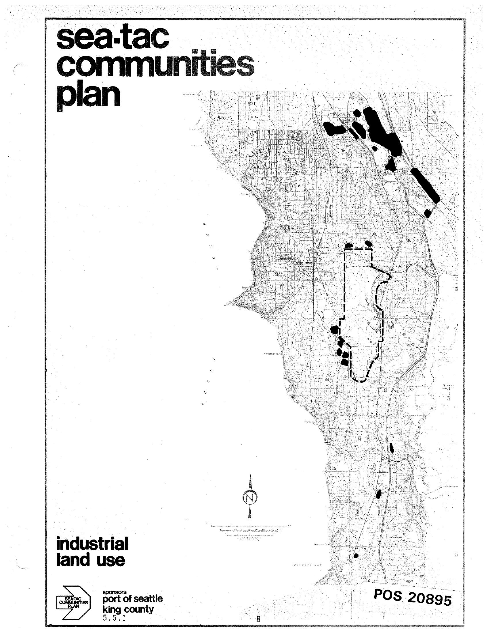
Sea-Tac Communities Plan Industrial Land Use Map
A planning document titled 'Sea-Tac Communities Plan' showing an industrial land use map of the Sea-Tac area, sponsored by the Port of Seattle and King County (document reference 5.5.1). The map highlights industrial land use zones in black, with a dashed boundary indicating a specific study or airport area, and is catalogued as POS 20895. -
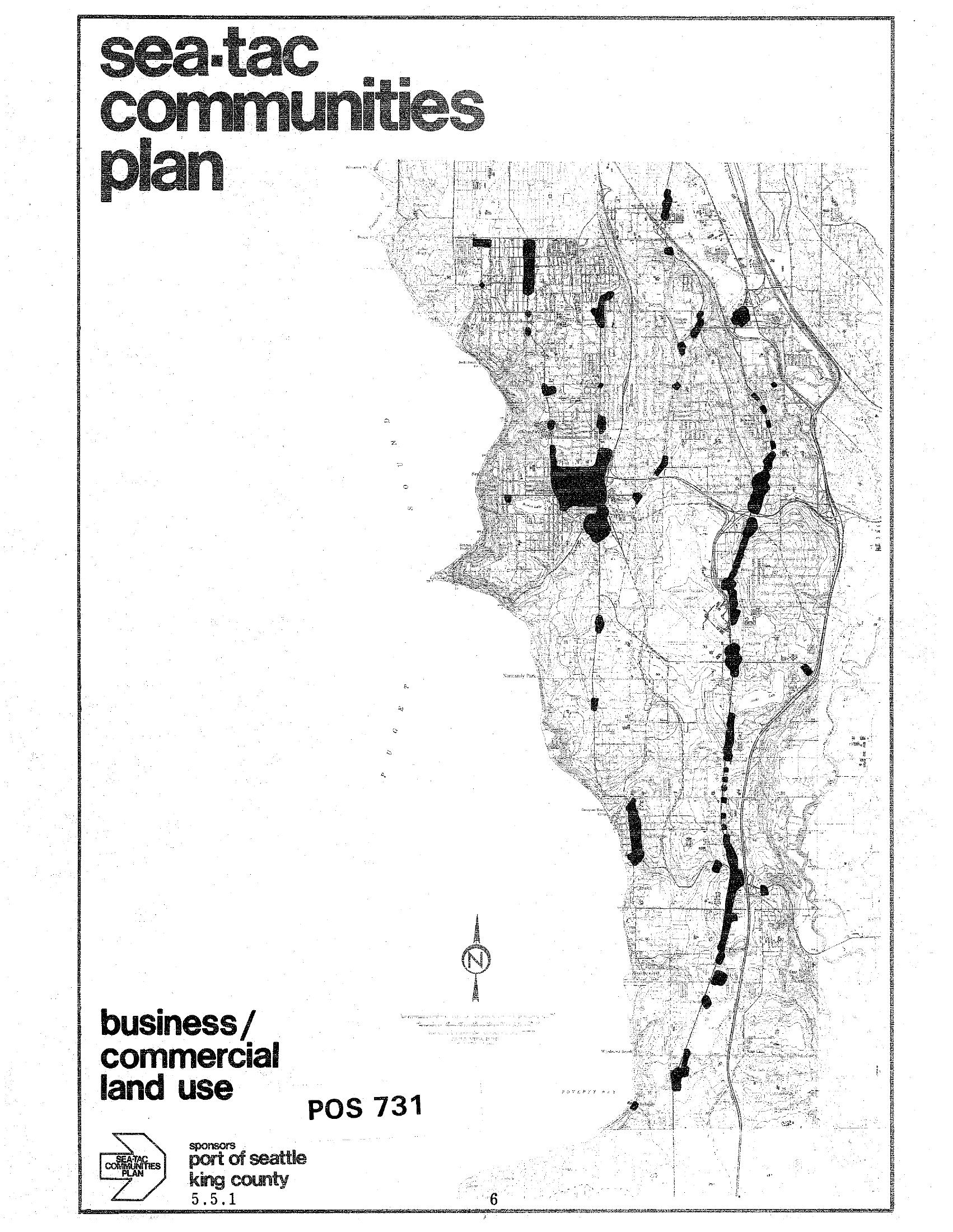
Sea-Tac Communities Plan — Business/Commercial Land Use Map (POS 731, Section 5.5.1)
Cover page of the Sea-Tac Communities Plan document titled 'Business/Commercial Land Use,' reference number POS 731, section 5.5.1. The plan was sponsored by the Port of Seattle and King County, and features a black-and-white map depicting commercial land use zones in the Sea-Tac area. -
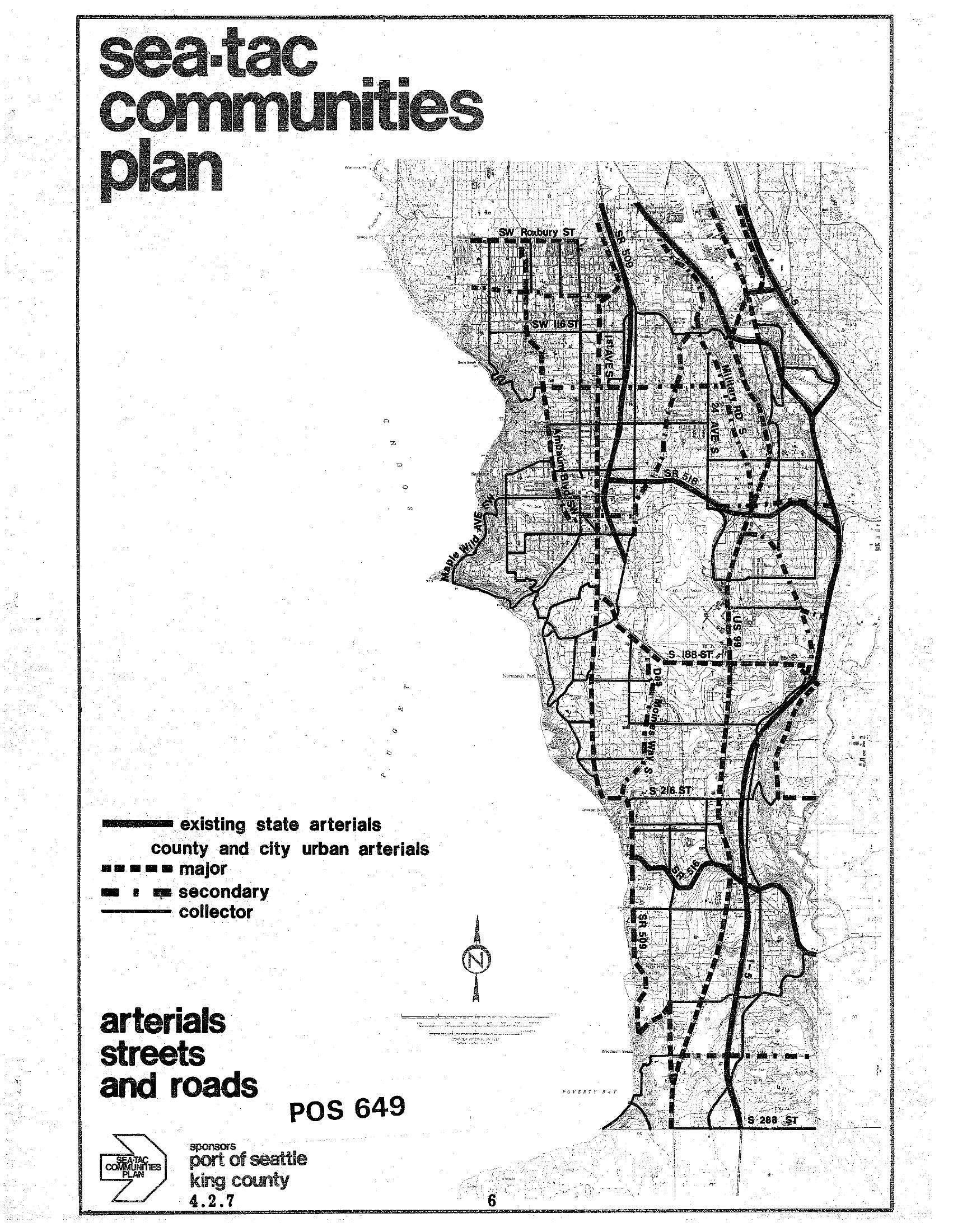
Sea-Tac Communities Plan Map 4.2.7 — Arterials, Streets, and Roads
A planning map labeled 'Sea-Tac Communities Plan' showing arterials, streets, and roads in the Sea-Tac area, document number POS 649, map sheet 4.2.7. The map identifies existing state arterials, county and city urban arterials (major, secondary, and collector), with visible street labels including SW Roxbury St, S 188th St, S 216th St, S 288th St, SR 518, SR 509, and US 99; sponsored by the Port of Seattle and King County. -
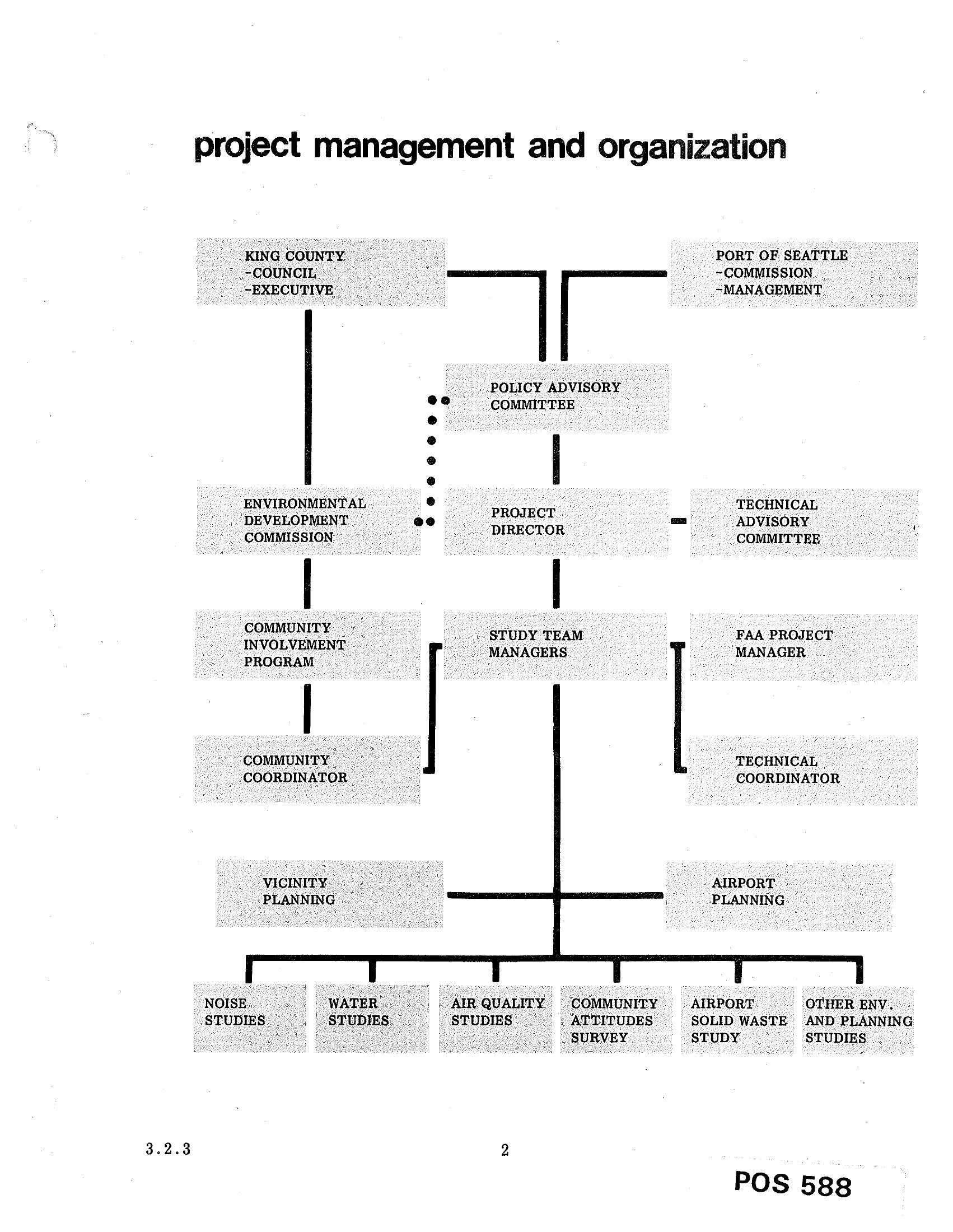
Sea-Tac Airport Environmental Study Project Management and Organization Chart
An organizational chart titled 'project management and organization' showing the hierarchy for a Sea-Tac Airport environmental study, with King County (Council/Executive) and Port of Seattle (Commission/Management) at the top, flowing through a Policy Advisory Committee and Project Director, down to Study Team Managers, and ending with study areas including Noise Studies, Water Studies, Air Quality Studies, Community Attitudes Survey, Airport Solid Waste Study, and Other Environmental and Planning Studies. Document is labeled POS 588, page 3.2.3. -
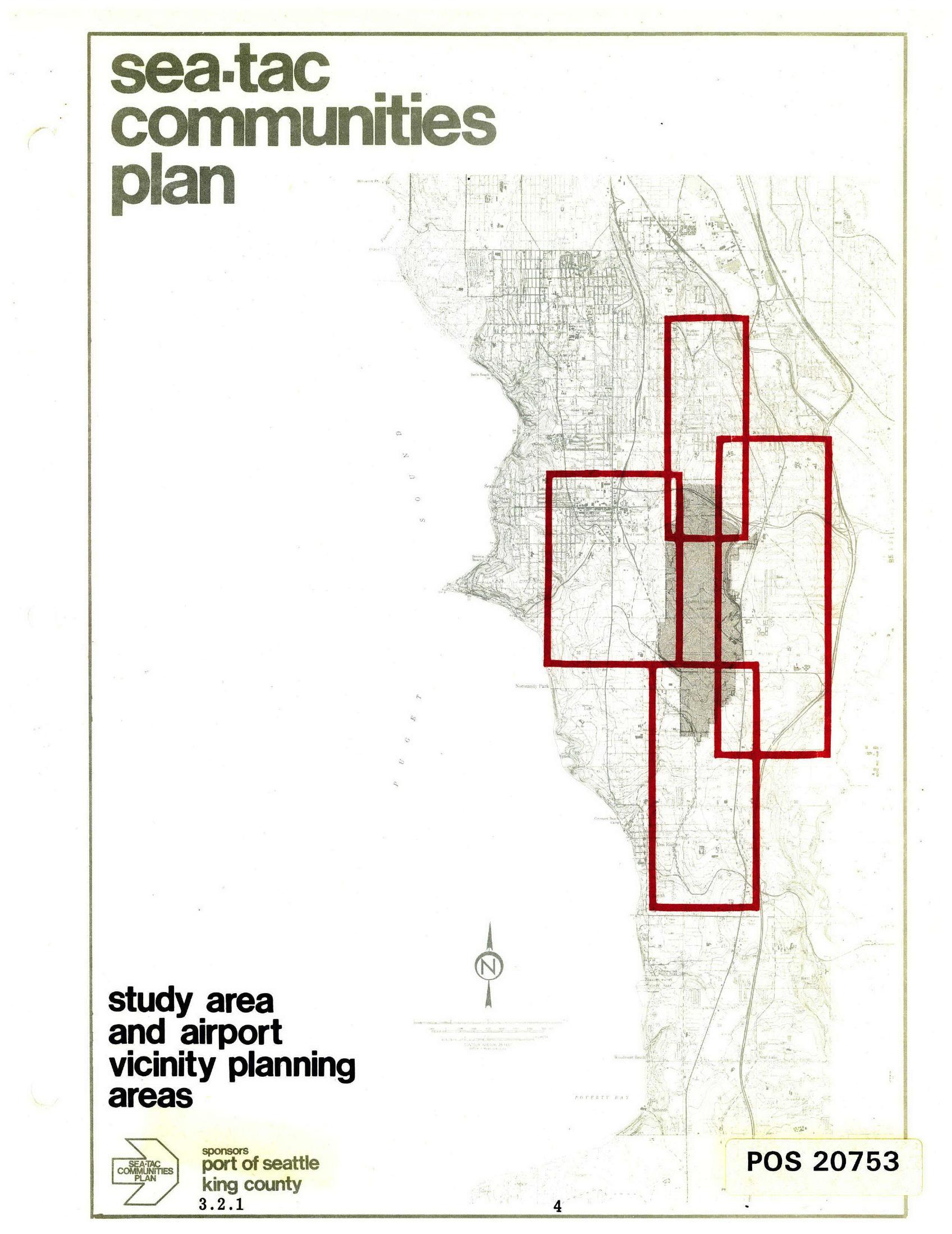
Sea-Tac Communities Plan Study Area and Airport Vicinity Planning Areas Map
Cover page of the Sea-Tac Communities Plan document (map sheet 3.2.1, page 4), jointly sponsored by the Port of Seattle and King County, showing a topographic base map of the Sea-Tac area with red-outlined rectangles delineating the study area and airport vicinity planning zones around Seattle-Tacoma International Airport. The document is catalogued as POS 20753. -
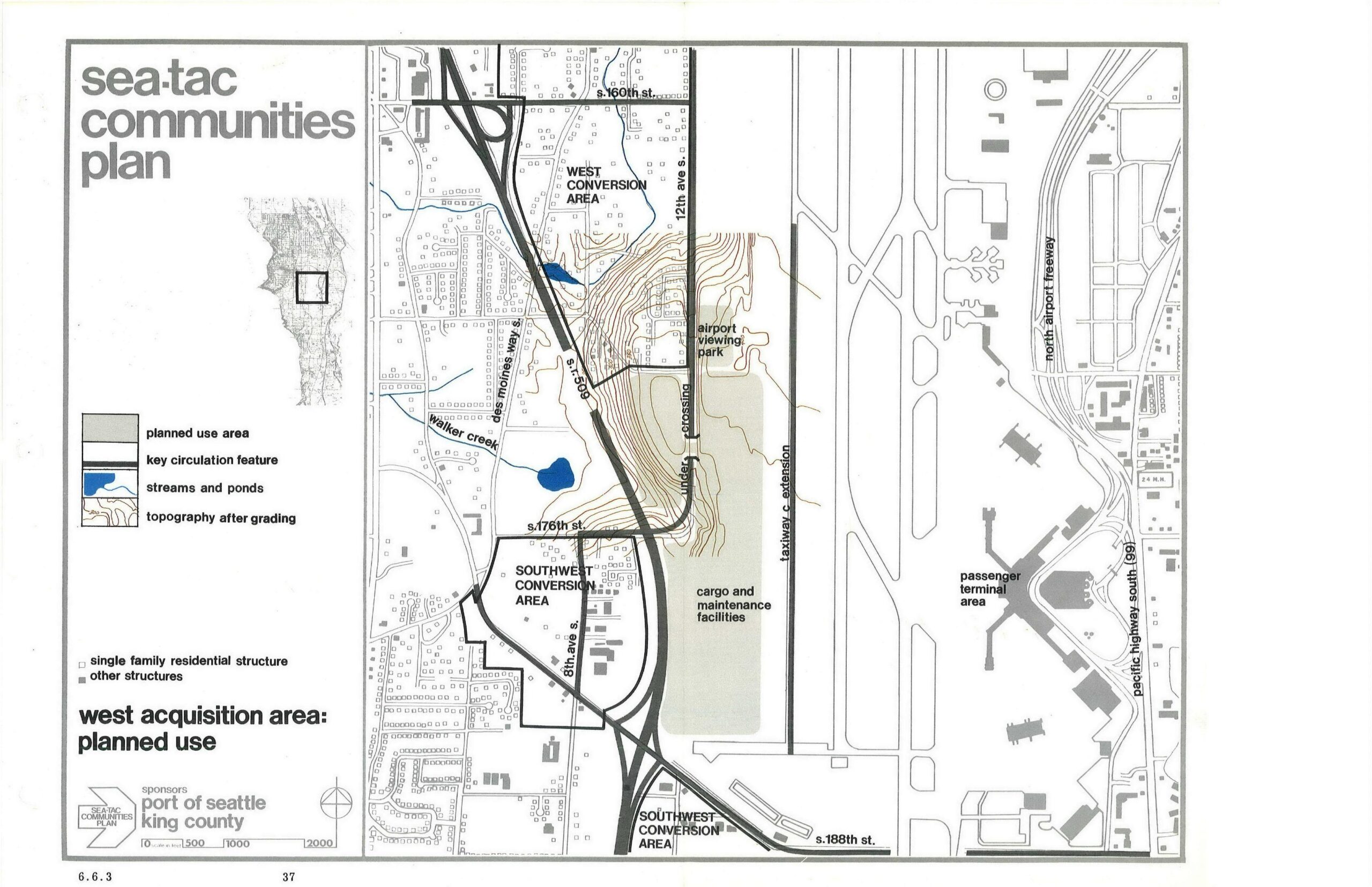
Sea-Tac Communities Plan West Acquisition Area Planned Land Use Map
This planning map, sponsored by the Port of Seattle and King County, depicts the West Acquisition Area planned land uses near Seattle-Tacoma International Airport, showing the West Conversion Area, Southwest Conversion Area, cargo and maintenance facilities, airport viewing park, taxiway C extension, and key circulation features including SR-509 and Des Moines Way S. The map is labeled as page 37, section 6.6.3 of the Sea-Tac Communities Plan. -
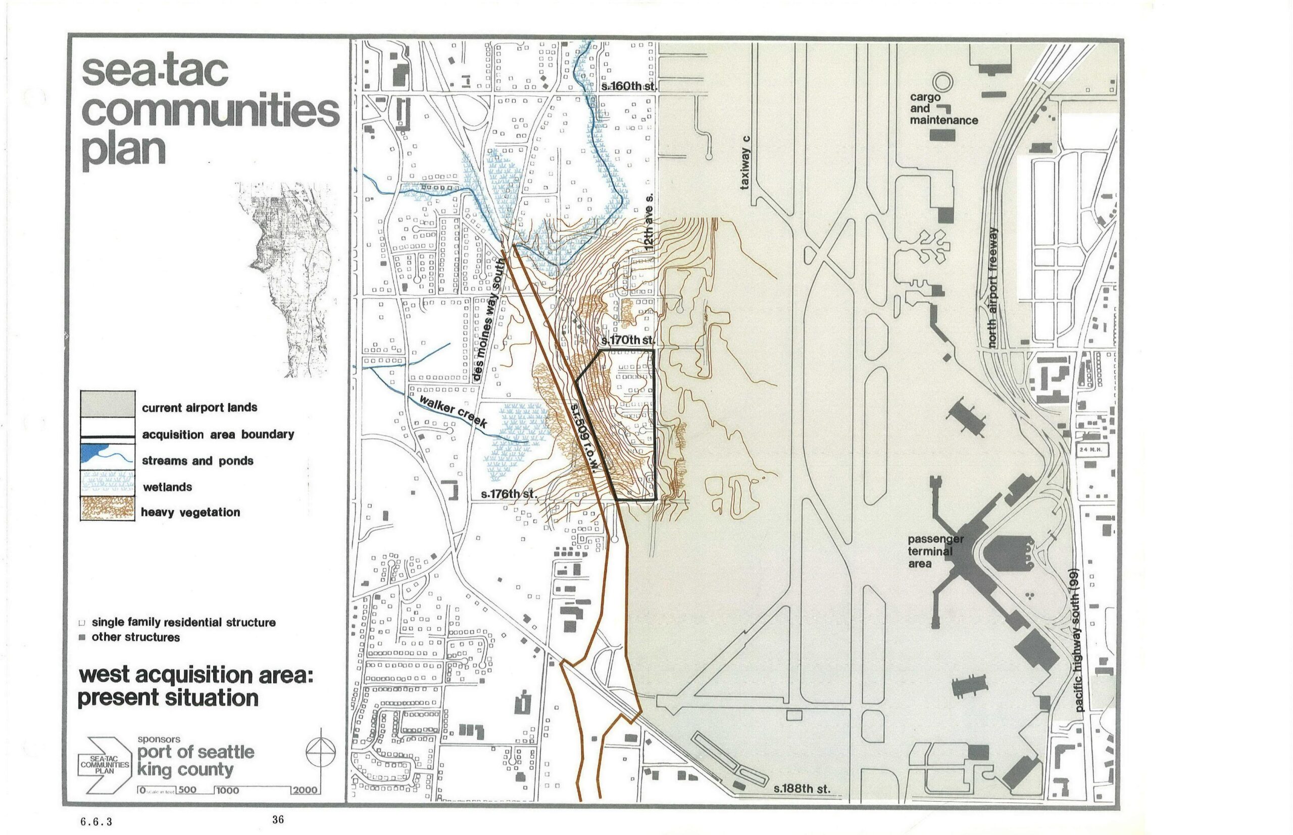
Sea-Tac Airport West Acquisition Area Present Situation Planning Map
This planning map, sponsored by the Port of Seattle and King County, depicts the West Acquisition Area adjacent to Seattle-Tacoma International Airport, showing current airport lands, acquisition area boundaries, streams, wetlands, heavy vegetation, and residential structures. Key features labeled include Walker Creek, Des Moines Way South, 12th Ave S, S. 170th St, S. 176th St, S. 188th St, Taxiway C, the North Airport Freeway, the Passenger Terminal Area, and the Cargo and Maintenance area. -
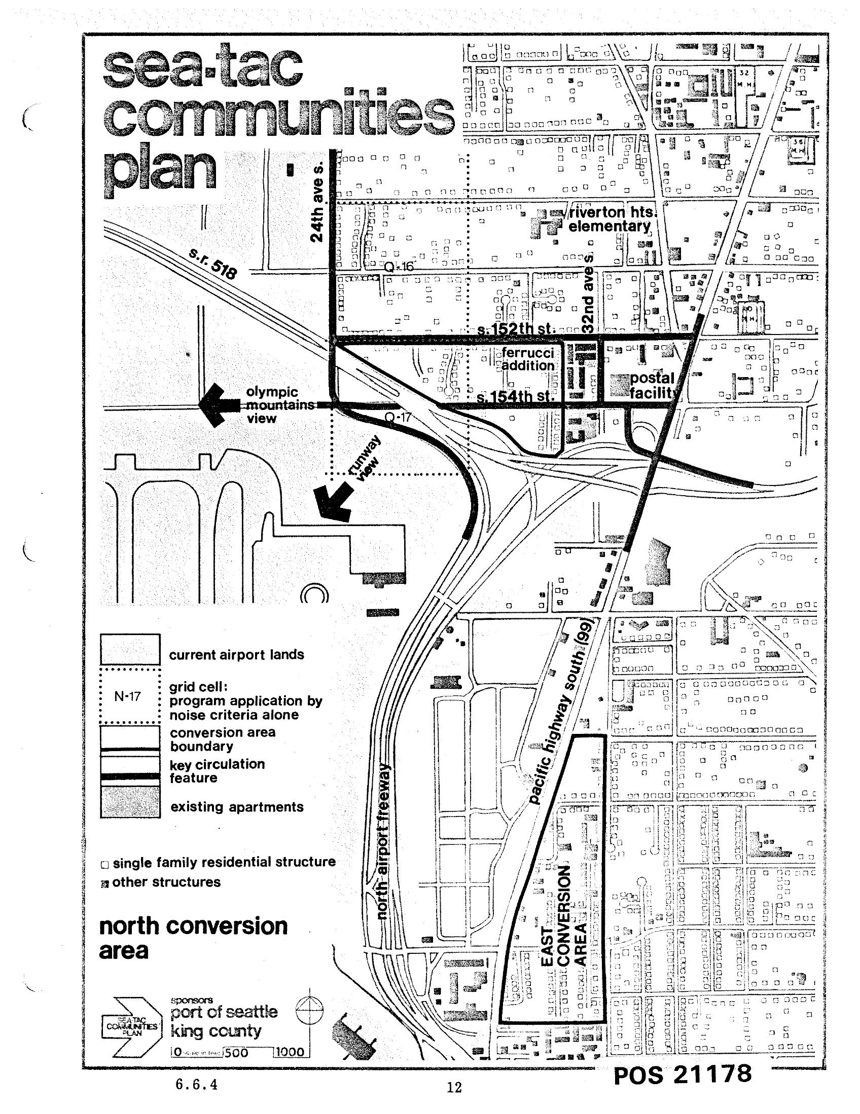
Sea-Tac Communities Plan Chapter 6 Page 12 — North Conversion Area Map
This is page 12 (document reference 6.6.4, POS 21178) of the Sea-Tac Communities Plan, co-sponsored by the Port of Seattle and King County. The map depicts the North Conversion Area near Seattle-Tacoma International Airport, showing current airport lands, grid cells subject to noise-criteria program application, conversion area boundaries, key circulation features, the Ferrucci Addition, a postal facility, Riverton Heights Elementary, S. 152nd and S. 154th Streets, 24th Ave S., 32nd Ave S., Pacific Highway South (SR 99), the North Airport Freeway, and SR 518.