TagNoise Exposure Update(27)
-
 2013-10-23
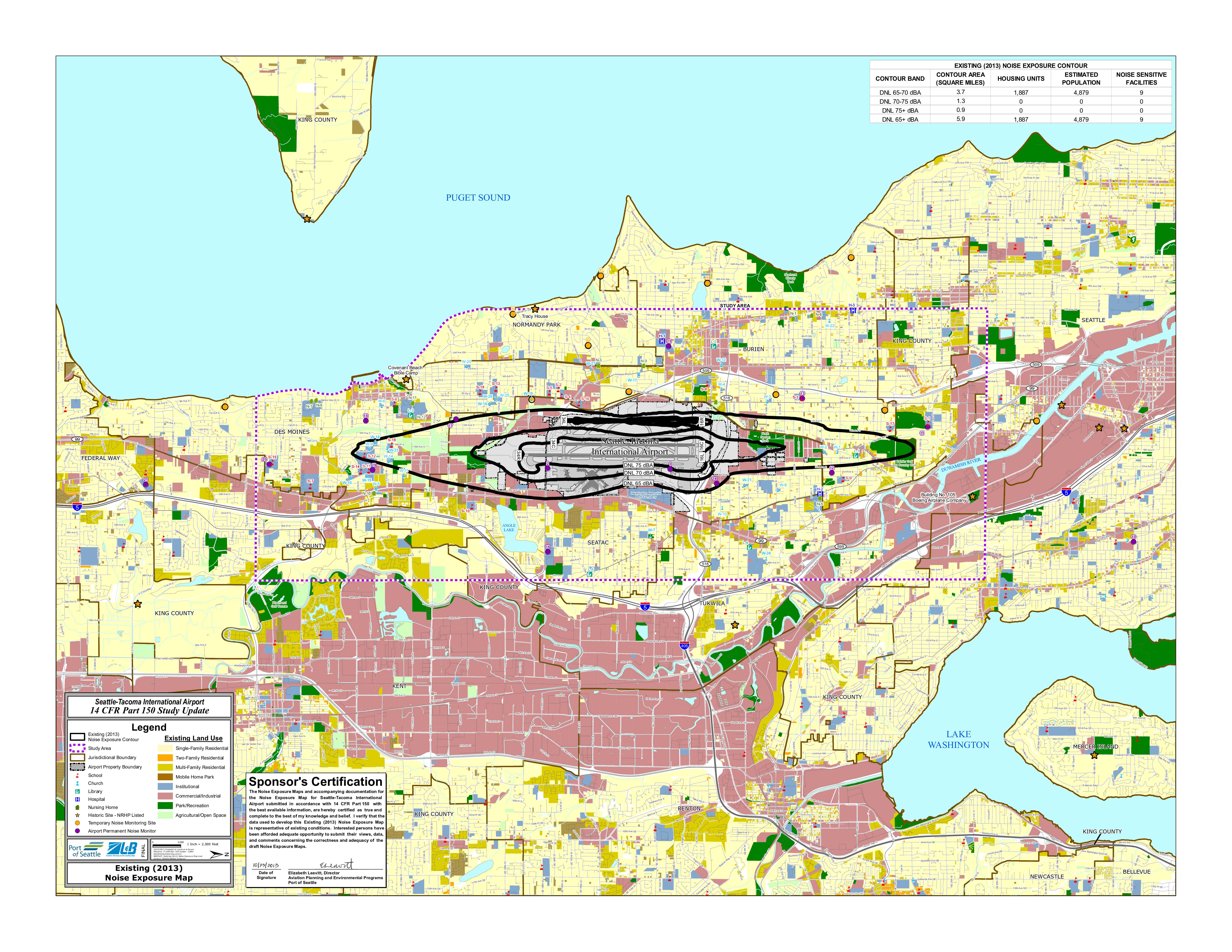
Existing (2013) Noise Exposure Map: Seattle-Tacoma International Airport 14 CFR Part 150 Study Update
This is the Existing (2013) Noise Exposure Map for Seattle-Tacoma International Airport, prepared as part of a 14 CFR Part 150 Study Update by Landrum & Brown for the Port of Seattle. The map shows aircraft noise contours around Sea-Tac, indicating that the DNL 65 dBA or greater noise zone covers approximately 5.9 square miles and affects an estimated 1,887 housing units and 4,879 residents, along with 9 noise-sensitive facilities such as schools and churches. The map was certified by Port of Seattle Aviation Planning Director Elizabeth Leavitt as accurately representing existing noise conditions based on the best available data. -
 2013-10-23
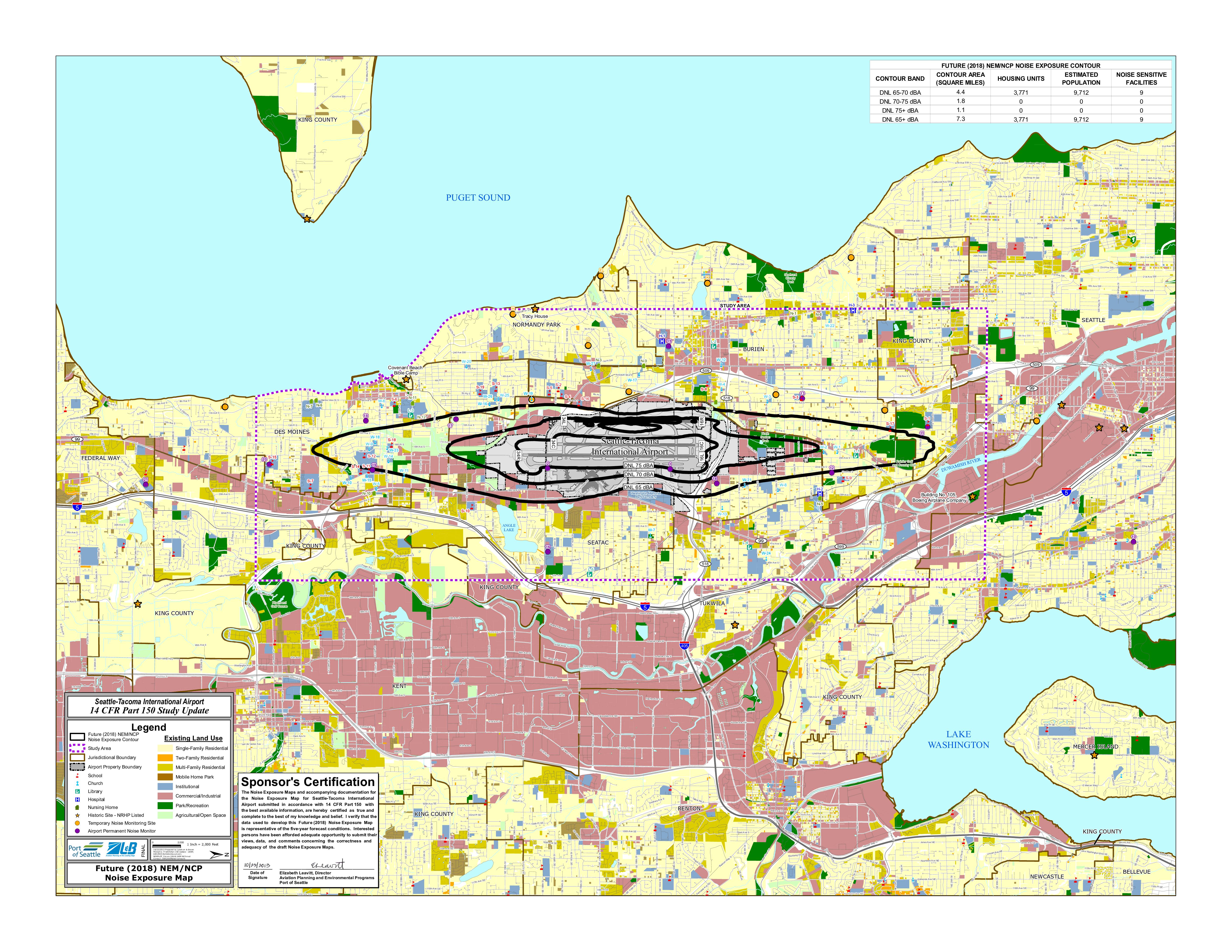
Future (2018) NEM/NCP Noise Exposure Map: Seattle-Tacoma International Airport 14 CFR Part 150 Study Update
This map, prepared by Landrum & Brown for the Port of Seattle's 14 CFR Part 150 Study Update, shows projected aircraft noise exposure around Seattle-Tacoma International Airport for the year 2018. It illustrates three noise contour zones (DNL 65, 70, and 75 dBA), with the total area above DNL 65 dBA covering approximately 7.3 square miles and affecting an estimated 3,771 housing units and 9,712 residents. The map also identifies noise-sensitive land uses such as schools, churches, hospitals, and libraries within the affected area, and was certified by the Port of Seattle's Director of Aviation Planning and Environmental Programs. -
 2013-10-01
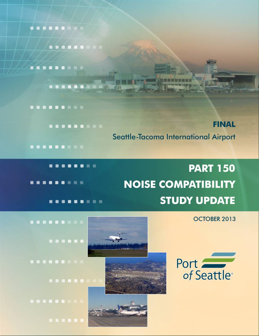
Seattle-Tacoma International Airport 14 CFR Part 150 Noise Compatibility Study Update
This October 2013 final report, prepared by Landrum & Brown for the Port of Seattle, updates the noise exposure maps and noise compatibility program for Seattle-Tacoma International Airport under federal regulations (14 CFR Part 150). It assesses the impact of aircraft noise on surrounding communities and outlines strategies to reduce noise-related conflicts between the airport and neighboring land uses. The study serves as a key planning document guiding Port of Seattle noise mitigation policies at Sea-Tac Airport. -
 2012-09-26
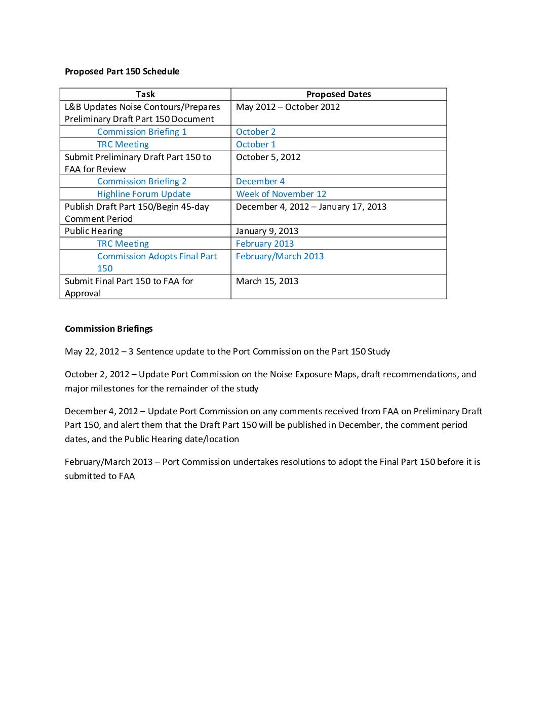
Proposed Part 150 Schedule
This document outlines the proposed schedule for Sea-Tac Airport's Part 150 Noise Compatibility Study, running from May 2012 through March 2013. Key milestones include submitting a preliminary draft to the FAA in October 2012, a public comment period and hearing in January 2013, and final submission to the FAA by March 15, 2013. The schedule also details four Port Commission briefings at which officials would be updated on noise exposure maps, FAA feedback, and the formal adoption of the final Part 150 document. -
 2003-09-01
Snohomish County Airport/Paine Field FAR Part 150 noise exposure maps update
This September 2003 report presents an update to the FAR Part 150 Noise Exposure Maps for Snohomish County Airport (Paine Field) near Everett, Washington, prepared by Barnard Dunkelberg & Company. It covers airport inventory, aircraft operations forecasts, and the development of noise contours to map areas affected by aircraft noise. The study was conducted with input from a Study Advisory Committee and involved formal public consultation processes. -
 1993-01-01
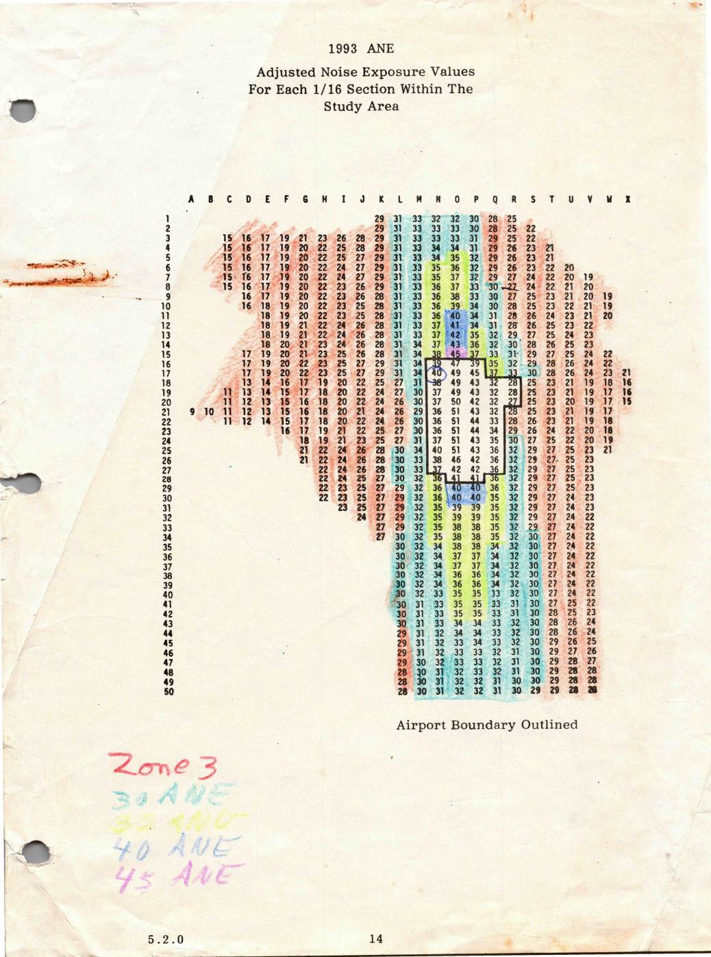
1993 ANE: Adjusted Noise Exposure Values for Each 1/16 Section Within the Study Area
This 1993 document presents Adjusted Noise Exposure (ANE) values for each 1/16 section within the Sea-Tac Airport study area, displayed as a grid referenced by row numbers (1–50) and column letters (A–X). The values represent measured noise levels across the surrounding region, with higher readings concentrated near the airport boundary and lower values toward the outer edges of the study area. Handwritten annotations indicate noise zone classifications at 30, 33, 40, and 45 ANE thresholds, which were used to define noise impact zones for land use planning purposes. -
 1982-06-01
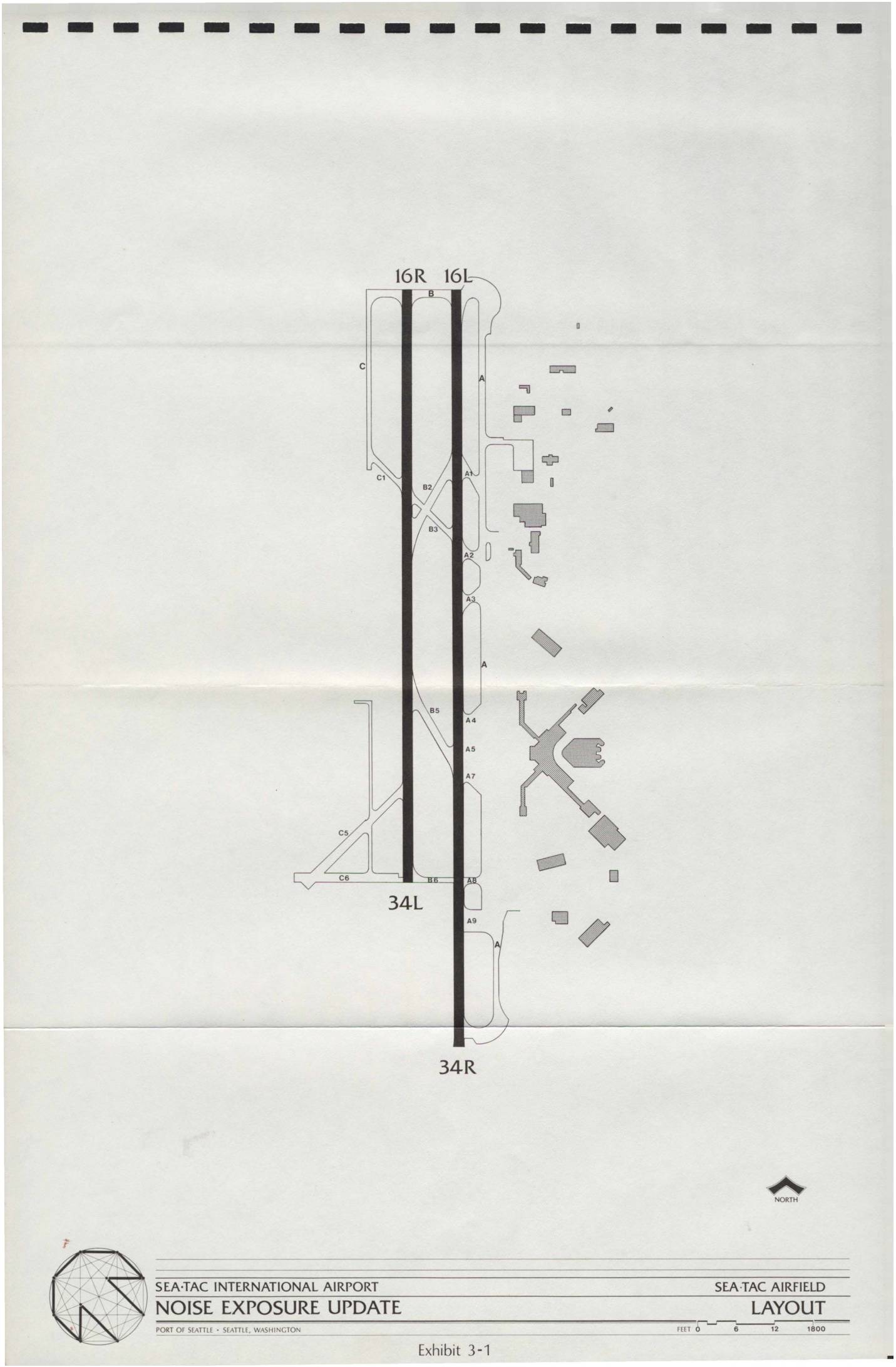
Sea-Tac International Airport Noise Exposure Update: Sea-Tac Airfield Layout and Flight Tracks
This document presents the Sea-Tac International Airport Noise Exposure Update prepared for the Port of Seattle, including a detailed airfield layout showing the two parallel runways (16R/16L and 34R/34L) and associated taxiways. It also includes flight track maps for both South Flow and North Flow operations, illustrating arrival and departure routes used by aircraft over the surrounding communities. The exhibits provide a geographic overview of how flight paths extend across the Seattle metropolitan area, informing noise exposure assessments for airport planning and policy purposes. -
 1982-01-21
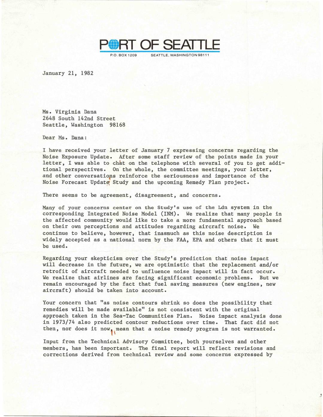
Letter from Clifford C. Muller to Virginia Dana Regarding Noise Exposure Update
In this January 1982 letter, Port of Seattle Planning Director Clifford C. Muller responds to community member Virginia Dana's concerns about the Sea-Tac Airport Noise Exposure Update Study. He addresses skepticism over the Ldn noise measurement system, defends the study's prediction that noise impact will decrease as airlines adopt quieter aircraft, and reassures Dana that shrinking noise contours do not eliminate eligibility for noise remedy programs. Muller acknowledges that the Technical Advisory Committee's input has been valuable and indicates that the upcoming Remedy Plan project will be the primary venue for addressing ongoing community concerns. -
 1982-01-07
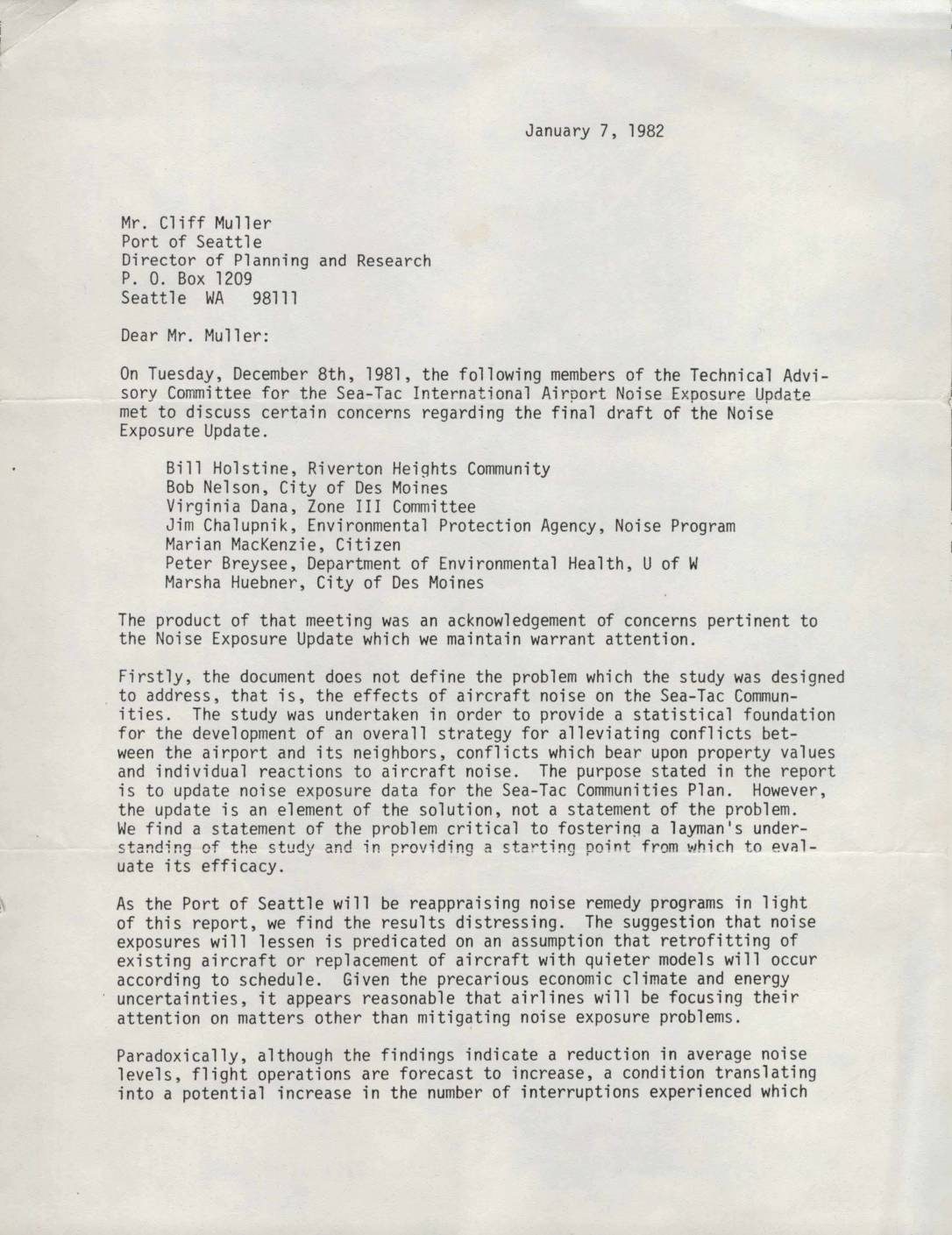
Letter to Cliff Muller, Port Of Seattle, from Technical Advisory Committee Re: Sea-Tac Noise Exposure Update Concerns
In January 1982, members of the Technical Advisory Committee for the Sea-Tac International Airport Noise Exposure Update wrote to the Port of Seattle's Director of Planning and Research to raise concerns about the final draft of the noise study. The letter argues that the report fails to clearly define the problem of aircraft noise impacts on surrounding communities, relies on optimistic assumptions about airlines adopting quieter aircraft, and uses an average noise level methodology that does not capture how residents actually experience flight disruptions. The committee also expressed frustration that their technical input and unanswered questions were largely ignored, despite their role being cited in the report as evidence of public participation. -
 1981-12-29
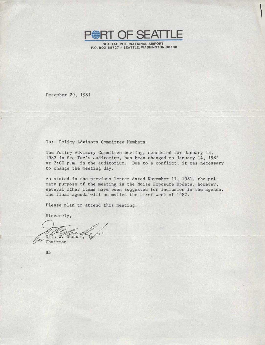
Policy Advisory Committee meeting date change notice
A December 29, 1981 letter from Port of Seattle Chairman Oris W. Dunham, Jr. notifies Policy Advisory Committee members that their upcoming meeting has been rescheduled from January 13 to January 14, 1982 at 2:00 p.m. in Sea-Tac's auditorium due to a scheduling conflict. The primary focus of the meeting remains the Noise Exposure Update, with additional agenda items also planned for discussion. Members were advised that the final agenda would be mailed during the first week of 1982.