TagNoise Mitigation(218)
-
 2022-08-27
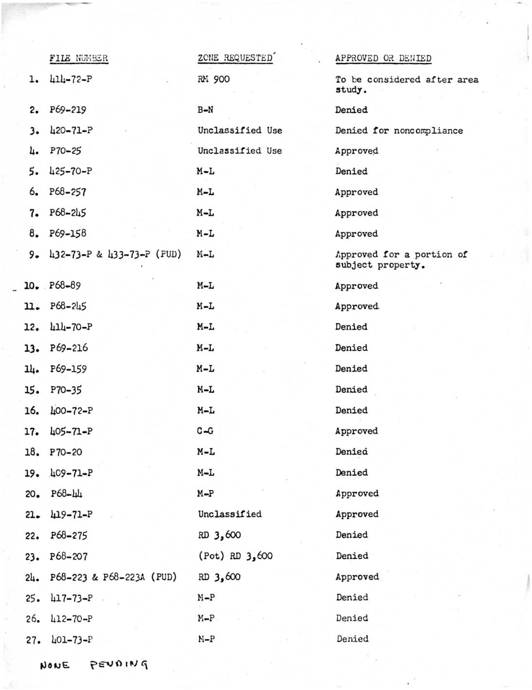
King County Zoning File Status for NIP
This document lists 27 zoning petition files submitted to a planning authority, detailing the zone classification requested and whether each petition was approved or denied. Requests span a variety of zone types including residential (RD 3,600, RM 900), light manufacturing (M-L), industrial (M-1), commercial (C-G), and others, with the majority of petitions ultimately denied. A note at the bottom indicates that none of the cases were pending at the time of the record. -
 2022-08-24
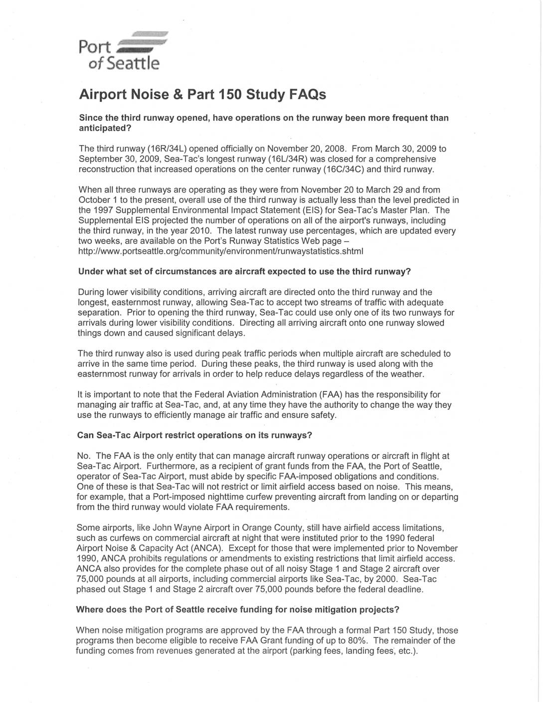
Airport Noise & Part 150 Study FAQs
This FAQ document from the Port of Seattle addresses common questions about noise management at Seattle-Tacoma International Airport, including how and when the third runway is used, why the Port cannot impose noise-based restrictions on runway operations, and what types of noise mitigation projects qualify for FAA funding. It outlines the history of the Port's noise reduction efforts, such as home acquisitions, insulation programs, and the Fly Quiet Incentive Program, and explains the goals of the Part 150 Noise Study process. The document also highlights the economic importance of Sea-Tac to the Puget Sound region while acknowledging the challenges of reducing noise in a densely populated area around a major international airport. -
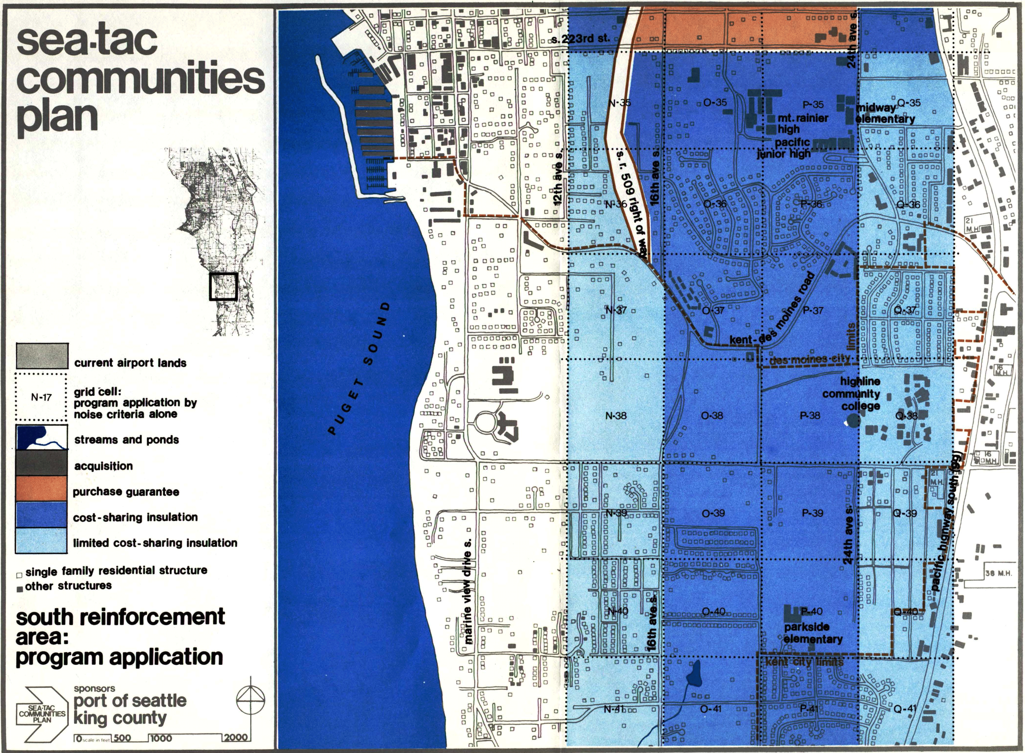
STCP-6.6.5-27-south
A planning map from the Sea-Tac Communities Plan, sponsored by the Port of Seattle and King County, showing the South Reinforcement Area program application with color-coded zones indicating acquisition, purchase guarantee, cost-sharing insulation, and limited cost-sharing insulation relative to airport noise contours. The map covers the area around S. 223rd Street south to Kent city limits, bounded by Puget Sound to the west and Pacific Highway South (SR-99) to the east, with landmarks including Mt. Rainier High School, Highline Community College, and Parkside Elementary labeled. -
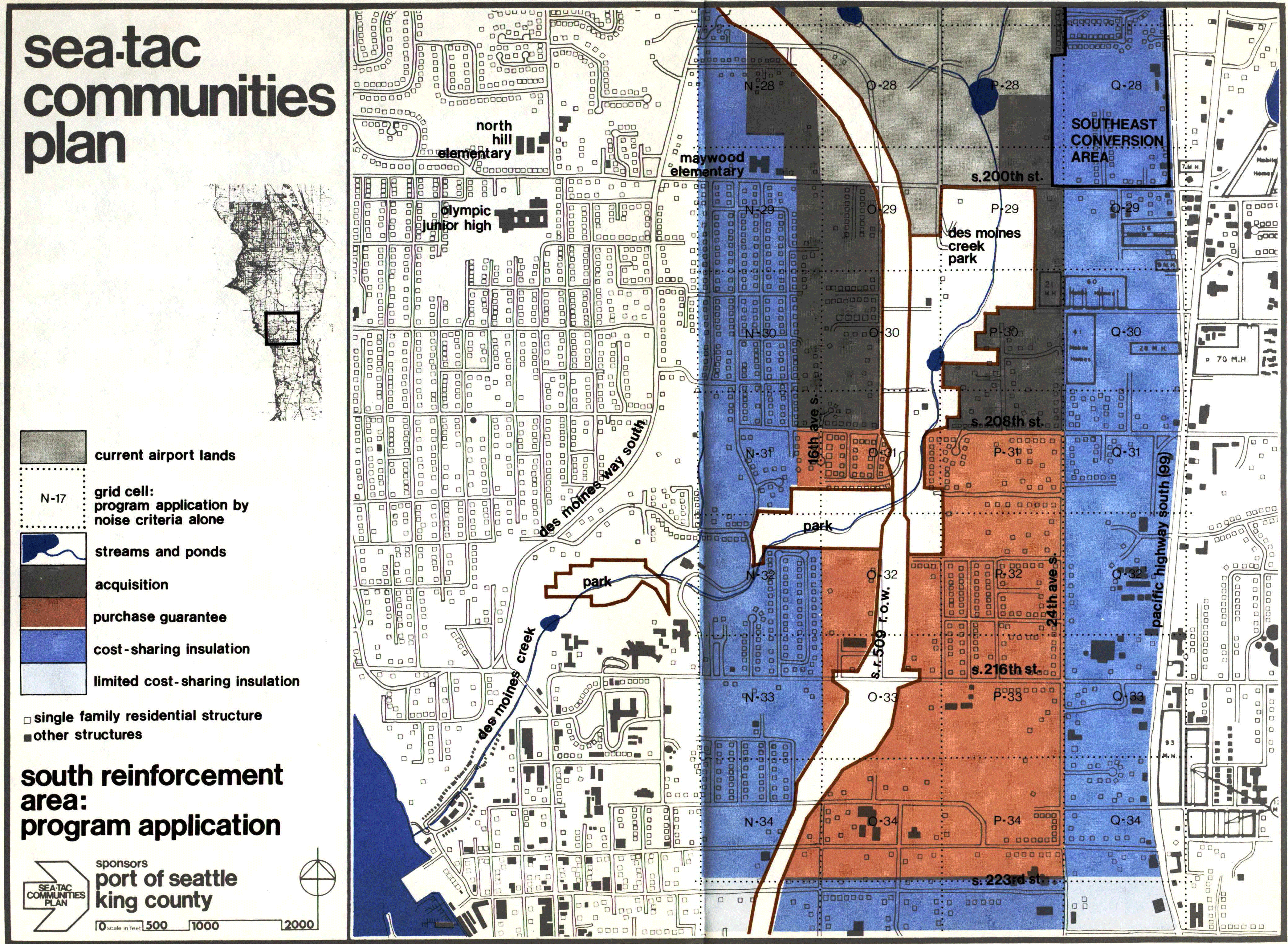
STCP-6.6.5-26-south
A planning map from the Sea-Tac Communities Plan, sponsored by the Port of Seattle and King County, showing the South Reinforcement Area program application. The map uses color coding to designate zones for acquisition, purchase guarantee, cost-sharing insulation, and limited cost-sharing insulation in the area bounded roughly by S. 200th St. to the north and S. 223rd St. to the south, including grid cells along 16th Ave. S., 24th Ave. S., and Pacific Highway South (SR-99), with a Southeast Conversion Area noted in the upper right. -
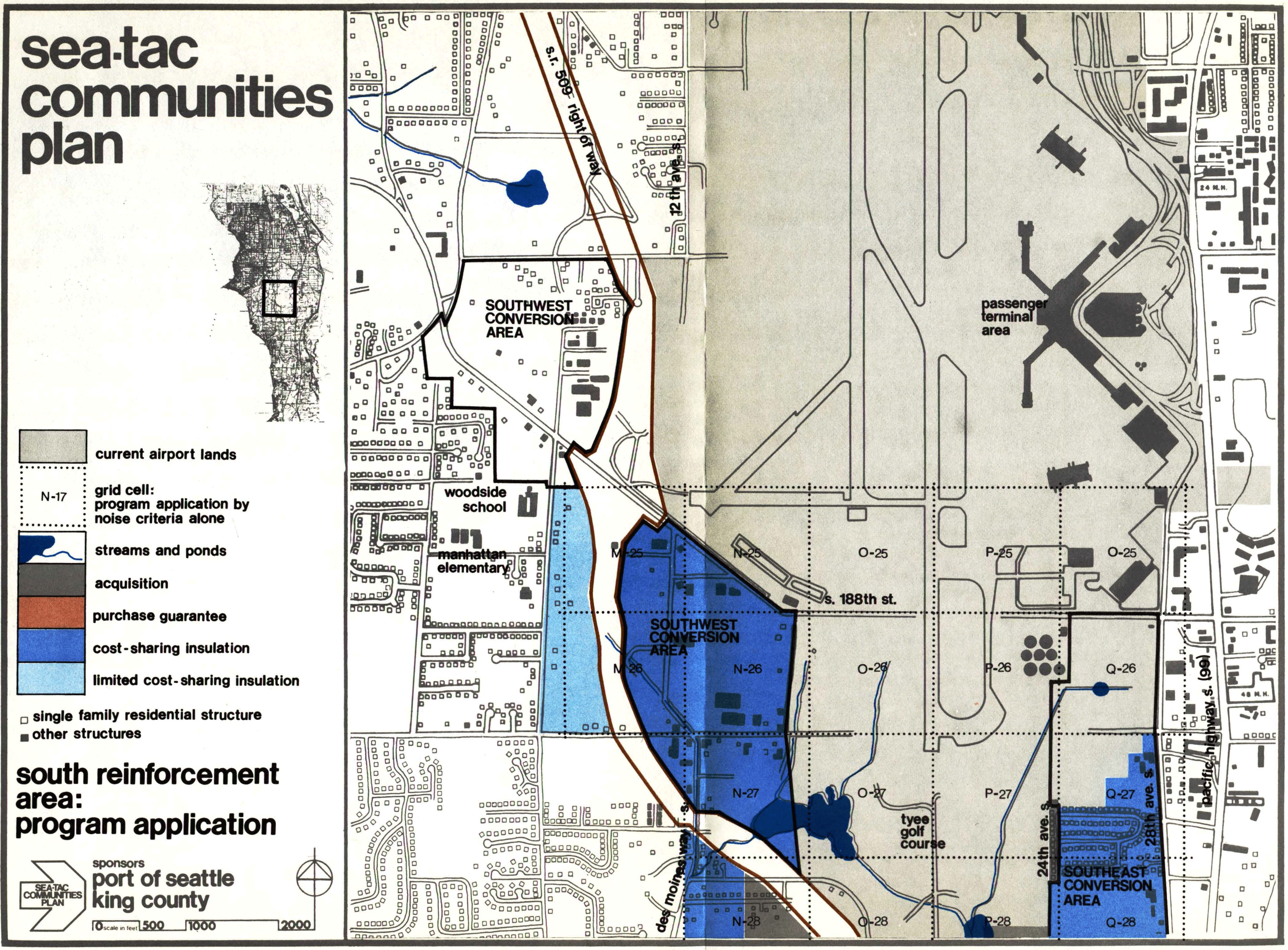
STCP-6.6.5-25-south
A planning map produced under the Sea-Tac Communities Plan, sponsored by the Port of Seattle and King County, depicting the South Reinforcement Area program application near Seattle-Tacoma International Airport. The map identifies land-use zones including the Southwest Conversion Area, Southeast Conversion Area, and color-coded program interventions such as acquisition, purchase guarantee, cost-sharing insulation, and limited cost-sharing insulation, with grid cells referenced by noise criteria (e.g., N-25 through Q-28) and landmarks including Woodside School, Manhattan Elementary, and Tyee Golf Course. -
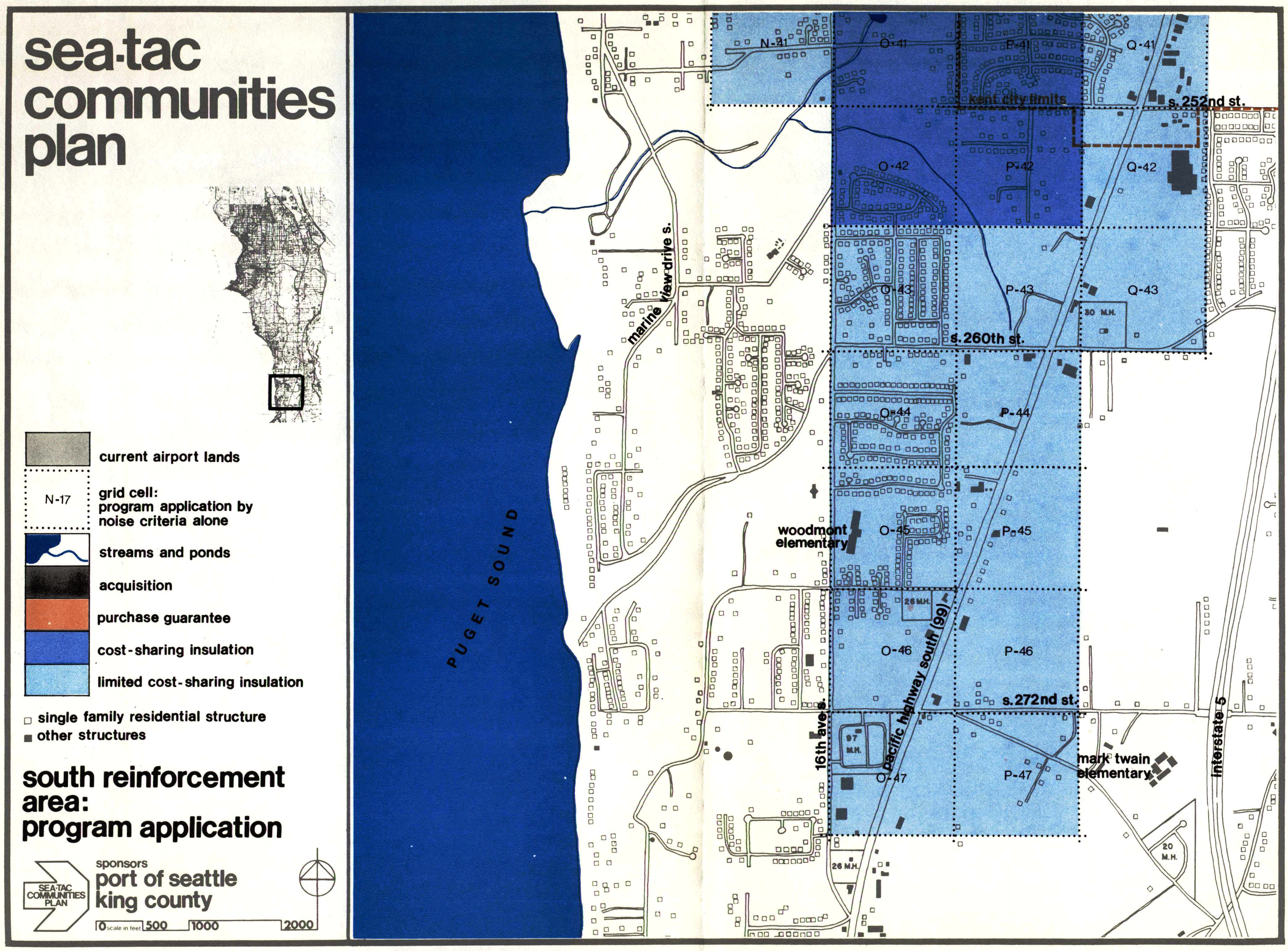
STCP-6.6.5-28-south
A planning map from the Sea-Tac Communities Plan, sponsored by the Port of Seattle and King County, showing the South Reinforcement Area program application. The map uses color-coded grid cells (labeled N-41 through P-47) to designate zones for acquisition, purchase guarantee, cost-sharing insulation, and limited cost-sharing insulation relative to airport noise impacts, covering the area between approximately S. 252nd St. and S. 272nd St. along Puget Sound, including landmarks such as Woodmont Elementary and Mark Twain Elementary schools. -
seatac communities plan cover-smudged
Cover of the 'Sea-Tac Communities Plan,' a planning document jointly produced by the Port of Seattle and King County. The hot-pink cover features bold black typography and a stylized geometric logo, likely related to noise mitigation or land-use planning around Seattle-Tacoma International Airport. -
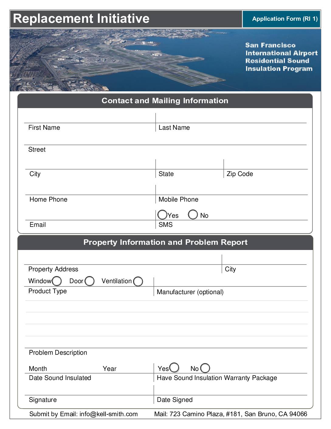 2022-06-08
Replacement Initiative Application Form (RI-1): San Francisco International Airport Residential Sound Insulation Program
The San Francisco International Airport (SFO) Replacement Noise Insulation Initiative offers free repair or replacement of failed acoustical improvements—such as windows, doors, and ventilation systems—for eligible residential properties previously treated under SFO's Noise Insulation Program. To qualify, a property must fall within the 65-decibel CNEL noise contour on the SFO Noise Exposure Map, and failures caused by neglect or improper maintenance are not covered. Homeowners can apply by submitting the RI-1 application form via email or mail to C. Kell-Smith & Associates, Inc. -
 2022-05-30
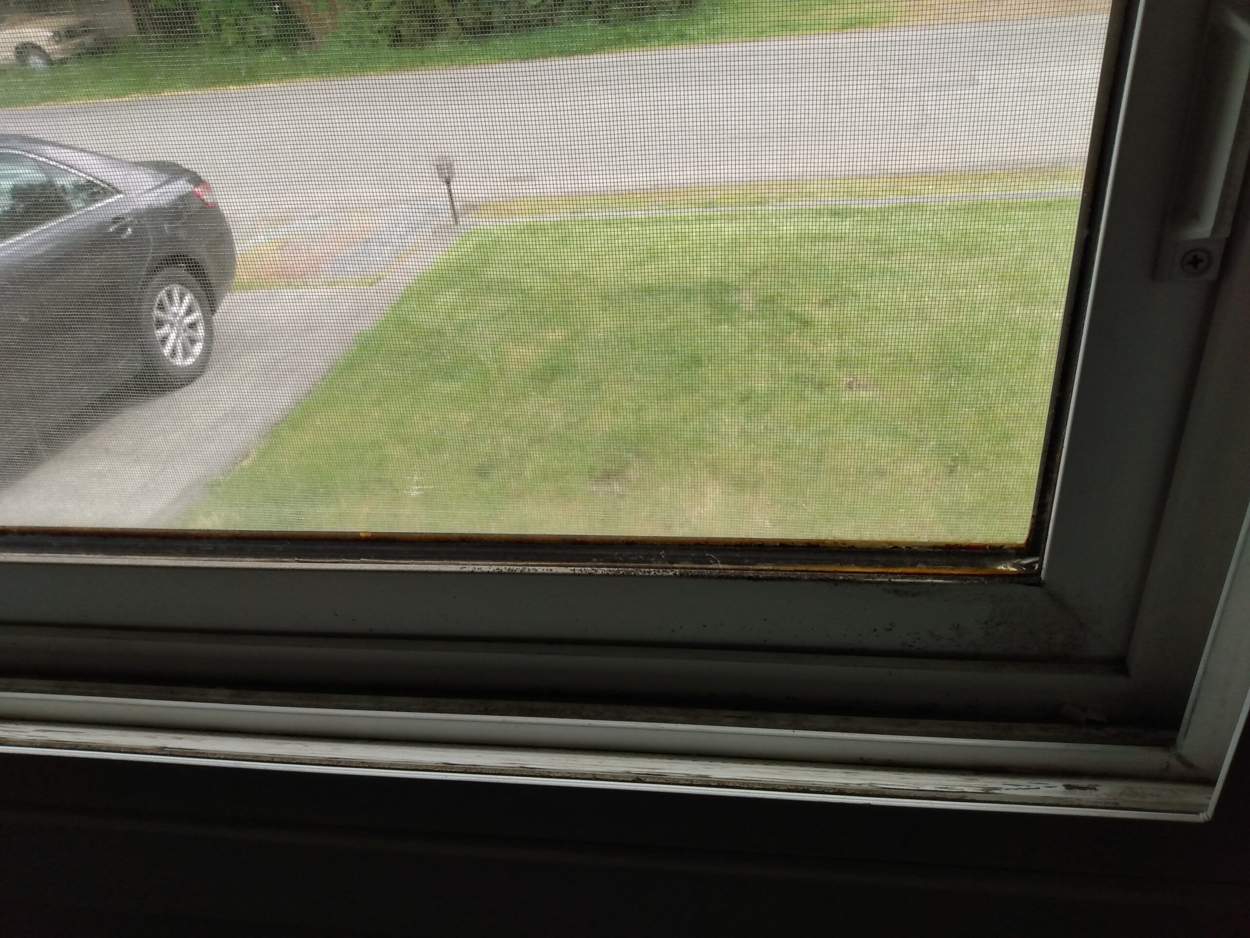
Port Package Program Photo — May 2022
-
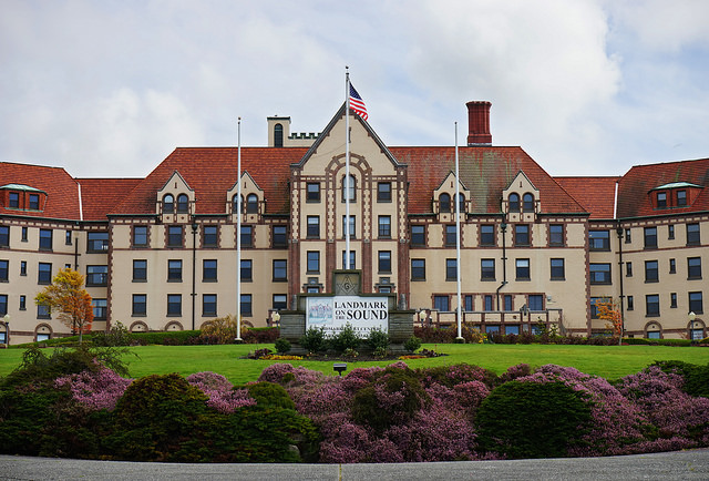
Masonic Home of Des Moines, Washington (Now Landmark on the Sound)
The image shows the Landmark on the Sound facility, a large historic building with red tile roofs, an American flag, and a clearly visible sign reading 'Landmark on Sound.' This property is located near Renton, Washington, in the Sea-Tac Airport noise impact area and has been associated with discussions about airport noise mitigation and land use planning.