TagACC(1548)
-
 2002-10-22
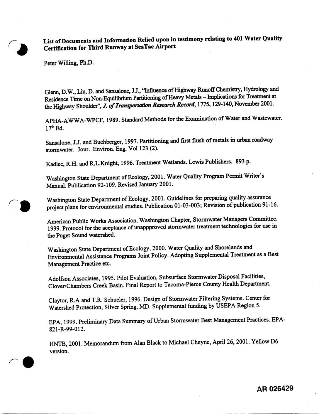
Exhibit 713: List of Documents and Information Relied Upon in Testimony Relating to 401 Water Quality Certification for Third Runway at Sea-Tac Airport
Reference list compiled by Peter Willing, Ph.D., of documents relied upon in testimony regarding the 401 Water Quality Certification for the Third Runway at Sea-Tac Airport. Sources cited include studies on highway runoff chemistry, heavy metals partitioning, urban stormwater BMPs, treatment wetlands, NPDES permits, and Port of Seattle annual stormwater monitoring reports (1998–2001). Key references -
 2002-10-22
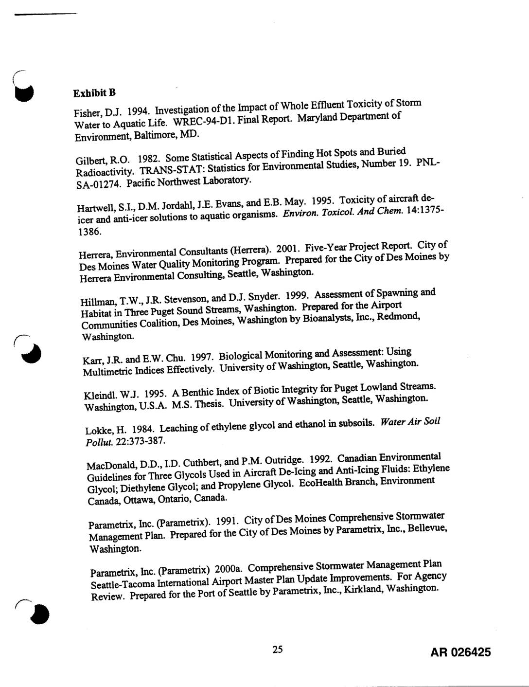
EXH 711: Bibliography — Stormwater & Aquatic Environmental References, STIA EIS
This document is a reference bibliography (Exhibit B) listing scientific and regulatory sources related to environmental monitoring at Seattle-Tacoma International Airport. It includes studies on stormwater quality, aircraft de-icing and anti-icing fluid toxicity, aquatic habitat assessment, and sediment guidelines, drawn from sources such as the Port of Seattle, Parametrix Inc., and various environmental agencies. The references support environmental compliance reporting under the airport's NPDES stormwater permit. -
 2002-10-22
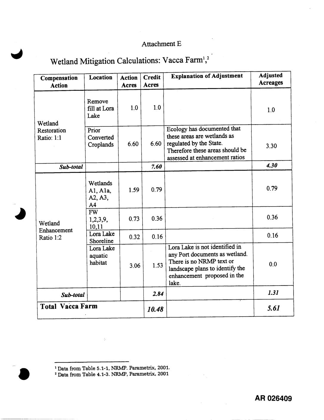
EXH AR026409: Wetland Mitigation Calculations — Vacca Farm
This document outlines wetland mitigation calculations for the Vacca Farm site, detailing compensation actions such as wetland restoration and enhancement across various locations including Lora Lake and prior converted croplands. Adjustments were made to credit acreages based on state ecology findings and documentation gaps; for example, the 6.60-acre converted cropland credit was reduced to 3.30 acres because the state identified those areas as existing wetlands requiring enhancement ratios rather than restoration ratios. In total, the site's original 10.48 credit acres were adjusted down to 5.61 acres after accounting for these regulatory and documentation considerations. -
 2002-10-22
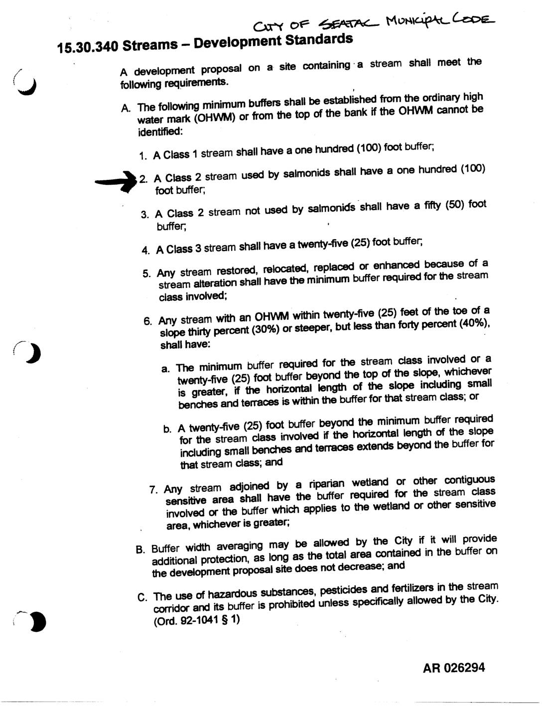
Exhibit 701: Streams — Development Standards (Sea-Tac Municipal Code 15.30.340 and King County Code 21A.24.360)
City of SeaTac Municipal Code section 15.30.340 and King County Code section 21A.24.360 establishing stream development standards and minimum buffer requirements from the ordinary high water mark (OHWM). Specifies buffers for Class 1 streams (100 feet), Class 2 streams used by salmonids (100 feet), Class 2 streams not used by salmonids (50 feet), and Class -
 2002-10-22
Exhibit 696: Missing Document Notice
Exhibit 696 placeholder page indicating the document was not present at time of scanning. Administrative record reference AR 026131.01. No substantive content available; document absent from scanning batch. -
 2002-10-22
Exhibit 691 Was Not Present At Time Of Scanning
This document is a placeholder page indicating that Exhibit 691 was not available at the time of document scanning. It is associated with administrative record reference AR 025988.01. No substantive content is present. -
 2002-10-22
EXH AR025787: 30% Submittal – Third Runway Embankment Construction Phase 4
This document is a 30% design submittal prepared by HNTB Corporation for the Third Runway Embankment Construction Phase 4 project at Seattle-Tacoma International Airport. It is an oversized engineering exhibit, submitted without a date, representing an early-stage design milestone in the ongoing construction of the airport's third runway. The submittal is part of the administrative record (AR 025787) related to the runway expansion project. -
 2002-10-22
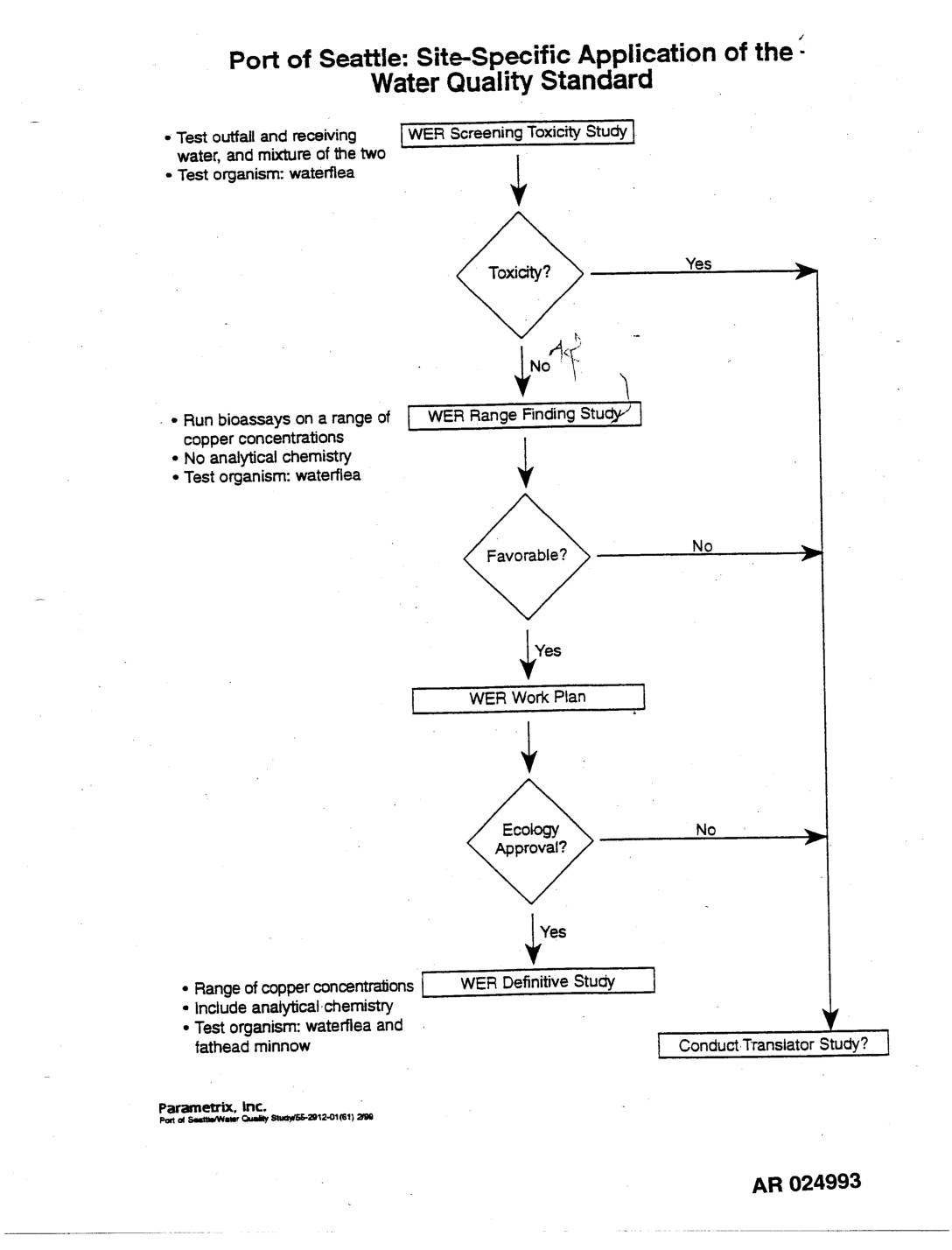
EXH AR024993: Site-Specific Water Quality Standard WER Study Process Flowchart
This document outlines the Port of Seattle's step-by-step process for applying water quality standards at a specific site, focusing on copper toxicity testing in local waterways. The flowchart guides researchers through a series of studies — including screening, range-finding, and definitive toxicity tests using waterfleas and fathead minnows — to determine whether copper levels in outfall and receiving waters pose environmental risks. Depending on test results and regulatory approval from the Washington State Department of Ecology, the process may lead to a Water Effect Ratio (WER) study or a Translator Study. -
 2002-10-22
Exhibit 2238: Placeholder — Not Present at Time of Scanning
Exhibit 2238, Administrative Record AR 034933.01, was not present at the time of scanning. No substantive content available; placeholder page only. Document is part of the administrative record indexed as AR 034933.01. -
 2002-10-22
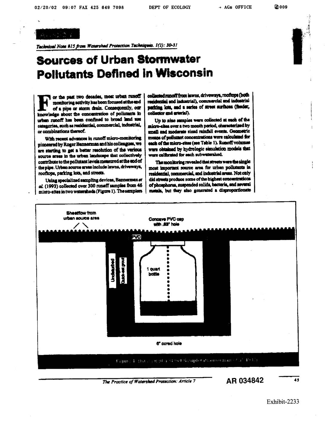
Exhibit 2233: Sources of Urban Stormwater Pollutants Defined in Wisconsin
Technical Note #15 from Watershed Protection Techniques, I(1):30-31, covering sources of urban stormwater pollutants as defined in Wisconsin. Based on Bannerman, R., D. Owens, R. Dodds, and N. Hornewer (1993) study published in Water Science & Technology (28):3-5, pp. 241-259. Over 300 runoff samples collected from 46 micro-sites in two watersheds. Documents pollutant concentrations of