TagSustainable Airport Master Plan(233)
-
 2019-03-19
Sea-Tac Airport Capital Development Update
A presentation by Port of Seattle staff to the Washington State Transportation Commission providing an update on Sea-Tac Airport capital development projects. The presentation covers regional economic growth driving airport demand and includes discussion of the Sustainable Airport Master Plan near-term projects and environmental review processes. -
 2019-02-12
Seattle-Tacoma International Airport Sustainable Airport Master Plan near-term projects environmental review scoping report
The Port of Seattle and the Federal Aviation Administration (FAA) conducted a public scoping process in 2018 to gather input on the environmental impacts of near-term construction projects planned at Seattle-Tacoma International Airport (Sea-Tac) as part of the Sustainable Airport Master Plan (SAMP). The 60-day scoping period, which ran from July 30 to September 28, 2018, invited comments from the public and agencies through meetings, mailings, and an online open house advertised in five languages. This report summarizes the scoping process, public feedback received, and outlines next steps for the full environmental review under both federal (NEPA) and state (SEPA) environmental policy laws. -
 2019-02-12
Seattle-Tacoma International Airport Sustainable Airport Master Plan near-term projects environmental review scoping report
This February 2019 Scoping Report documents the public and agency input process for the environmental review of Seattle-Tacoma International Airport's near-term construction projects, planned for completion by 2027 under the Sustainable Airport Master Plan (SAMP). The Port of Seattle and the FAA conducted a 60-day public scoping period from July 30 to September 28, 2018, gathering community concerns about potential environmental impacts through meetings, mailings, and online outreach in five languages. The report compiles scoping comments, meeting materials, and agency responses to inform the forthcoming environmental review under both federal (NEPA) and state (SEPA) law. -
 2019-02-12
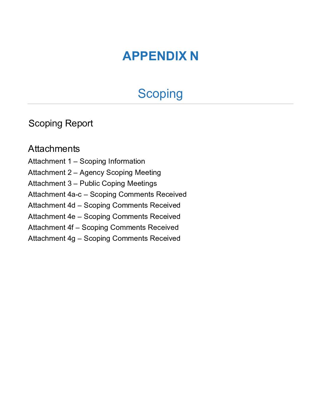
Appendix N: SAMP Near-Term Projects DEIS Scoping Report
This Scoping Report, published February 12, 2019, documents the public and agency scoping process conducted by the Port of Seattle for the Seattle-Tacoma International Airport Sustainable Airport Master Plan (SAMP) Near-Term Projects Environmental Review. It summarizes scoping meetings held with agencies and the public, common themes raised by commenters, and organizes the written comments received during the scoping period. The report serves as the foundation for determining which environmental topics—including noise impacts—will be analyzed in the subsequent environmental review. -
 2019-01-01
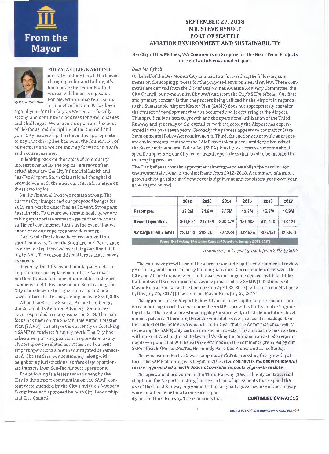
From the Mayor: City finances and Sea-Tac Airport update
In this Winter 2019 edition of Des Moines City Currents, Mayor Matt Pina outlines the city's strong opposition to Sea-Tac Airport's expansion plans, arguing that rapid growth between 2012 and 2017—including surging passenger numbers, aircraft operations, and air cargo—has already caused disproportionate noise, health, and environmental impacts on surrounding communities. The city formally called on the Port of Seattle to conduct a comprehensive environmental review under Washington State's SEPA laws before approving any further capacity-building projects, and specifically demanded that issues such as nighttime flight noise, fuel dumping, ultra-fine particle emissions, and Third Runway usage be included in the scoping process. Members of the city's Aviation Advisory Committee also voiced concerns about the health toll on residents, outdated federal standards, and the need for alternatives such as a second regional airport. -
 2018-09-26
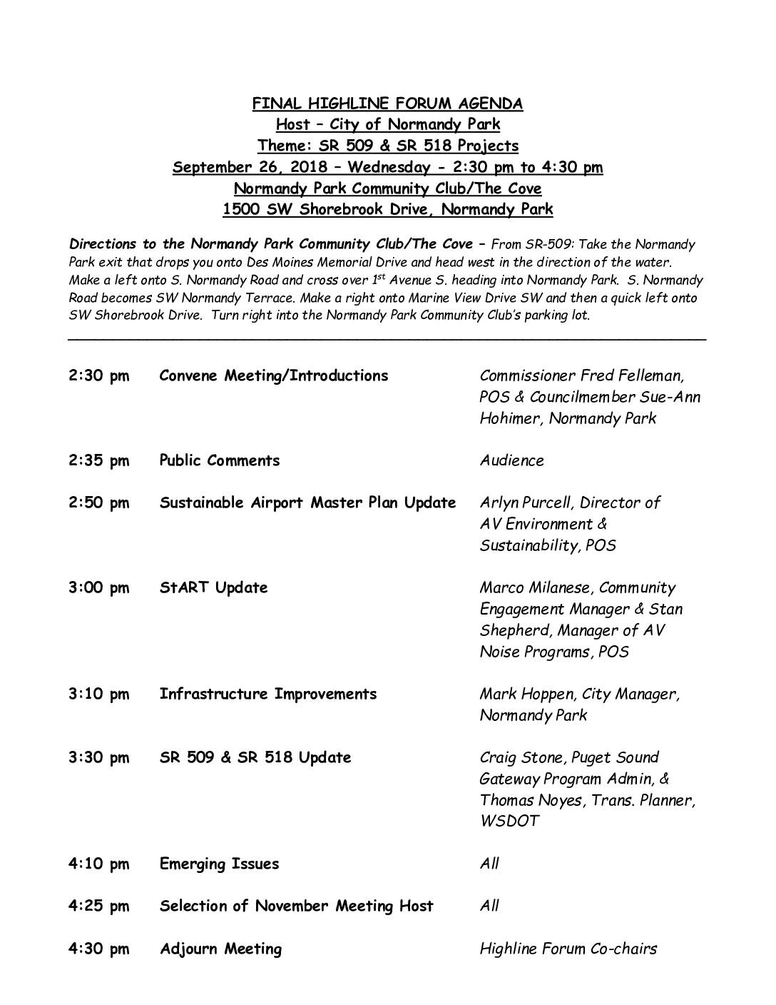
Final Highline Forum agenda: SR 509 & SR 518 projects
The Highline Forum held its September 26, 2018 meeting in Normandy Park, focusing on SR 509 and SR 518 transportation projects alongside Seattle-Tacoma International Airport-related topics. The agenda included updates on the Sustainable Airport Master Plan, the StART (Sea-Tac Airport Roundtable) community engagement program, and airport noise programs, presented by Port of Seattle officials. Infrastructure improvements in Normandy Park and a WSDOT briefing on regional highway gateway projects were also on the agenda. -
2018-09-11
Port Of Seattle Video: SAMP Explanation from Landrum & Brown
Communications Manager Perry Cooper interviews Rob Allen, Executive VP of Landrum & Brown, the consultants hired to prepare the Environmental Impact Statement (EIS). -
 2018-09-10
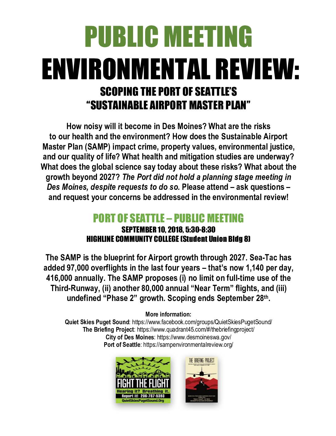
Public meeting: Environmental review scoping the Port Of Seattle’s “Sustainable Airport Master Plan”
A public meeting was held on September 10, 2018, at Highline Community College to allow Des Moines residents to weigh in on the Port of Seattle's Sustainable Airport Master Plan (SAMP), which outlines Sea-Tac Airport's growth strategy through 2027. The plan proposes removing limits on Third Runway use and adding 80,000 more annual flights on top of the existing 416,000, raising community concerns about noise, health risks, property values, and environmental justice. Residents were urged to attend and submit comments before the scoping period closed on September 28, 2018. -
 2018-09-01
City of Burien Billing Backup for City Shares of Lockridge Grindal Nauen Invoices for Sea-Tac Airport SAMP Review
This document details billing records from Lockridge Grindal Nauen P.L.L.P., a law firm hired jointly by the cities of Burien, Des Moines, Normandy Park, and SeaTac to review the Sea-Tac Airport Sustainable Airport Master Plan (SAMP). Under an Interlocal Agreement executed March 6, 2018, the cities shared a $175,000 contract based on per-capita funding rates, with the first invoice (covering July 23–September 25, 2018) totaling $62,685.58. The billing backup includes itemized legal services such as research, teleconferences, document review, and SAMP analysis performed by firm attorneys. -
 2018-09-01
City of Burien Billing Backup for City Shares of Lockridge Grindal Nauen Invoices for Sea-Tac Airport SAMP Review
This document details billing records from Lockridge Grindal Nauen P.L.L.P., a law firm hired jointly by the cities of Burien, Des Moines, Normandy Park, and SeaTac to review the Sea-Tac Airport Sustainable Airport Master Plan (SAMP). Under an Interlocal Agreement executed March 6, 2018, the cities shared a $175,000 contract based on per-capita funding rates, with the first invoice (covering July 23–September 25, 2018) totaling $62,685.58. The billing backup includes itemized legal services such as research, teleconferences, document review, and SAMP analysis performed by firm attorneys.