TagSea-Tac Airport(1855)
-
 2025-04-22
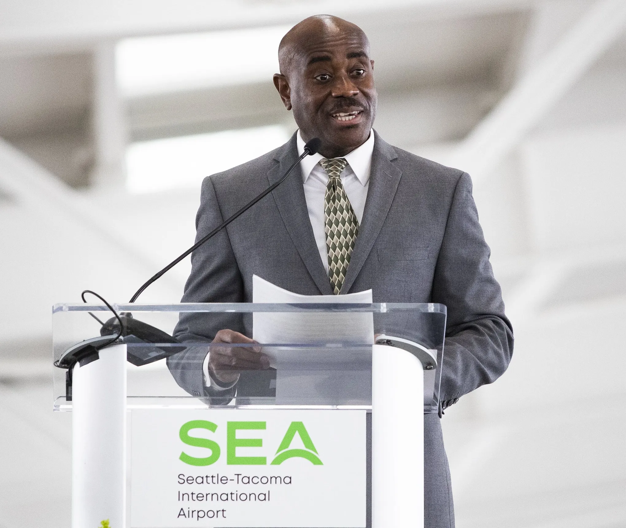
Lance Lyttle SEA Seattle-Tacoma International Airport Press Conference
A man in a gray suit and patterned tie speaks at a clear podium bearing the SEA (Seattle-Tacoma International Airport) logo. The setting appears to be an official airport event or press conference. -
 2025-04-22
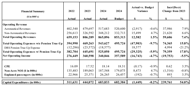
Port Of Seattle Commission: Sea-Tac Airport Aviation Budget Summary 2022–2024
A financial summary table comparing actual operating revenues and expenses for an airport across 2022, 2023, and 2024, including budget variance and year-over-year changes. Metrics include aeronautical and non-aeronautical revenues, operating expenses with and without pension true-up, CPE, Non-Aero NOI, enplaned passengers, and capital expenditures. -
 2025-04-22
Port Of Seattle Aviation Division 2024 Q4 Financial Performance Report — Title Slide (Page 291)
Title slide for the Port of Seattle Aviation Division's 2024 Q4 Financial Performance Report, bearing the Port of Seattle logo. This document appears on page 291 of a 373-page compiled report. -
 2025-04-22
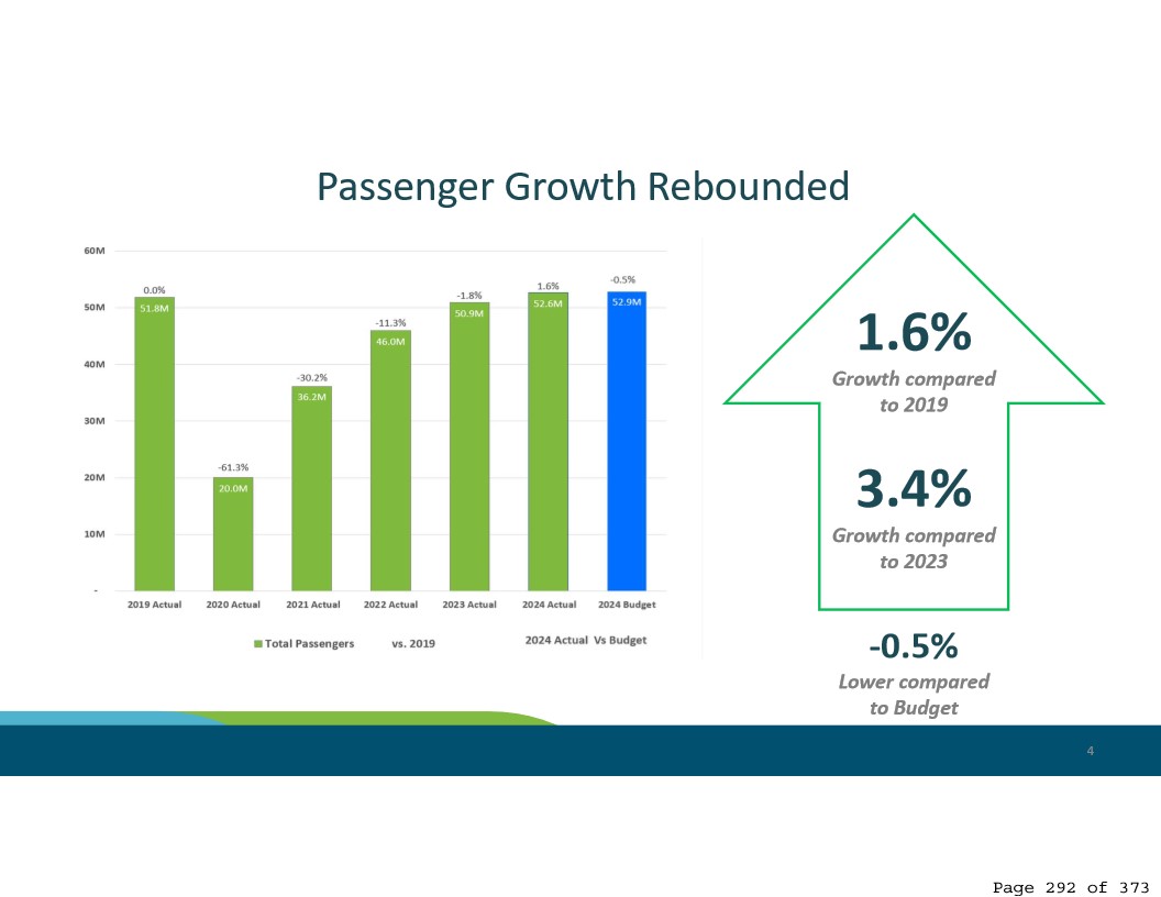
Sea-Tac Airport Passenger Growth Rebounded — 2024 Actuals vs. Budget (Page 292)
A presentation slide titled 'Passenger Growth Rebounded' showing total passenger figures from 2019 through 2024 for what is identified as Sea-Tac Airport (page 292 of 373). The 2024 actual passenger count was 52.6M, representing 1.6% growth compared to 2019 and 3.4% growth compared to 2023, but 0.5% below the 2024 budget of 52.9M. -
 2025-04-22
Port Of Seattle Commission regular meeting agenda, April 22, 2025
This document is the agenda for the Port of Seattle Regular Commission Meeting held on April 22, 2025, covering routine administrative business such as approval of meeting minutes, claims and obligations totaling hundreds of millions of dollars, and authorization for lease agreements with airport dining and retail tenants affected by capital construction projects. The meeting was held both in person at Seattle-Tacoma International Airport and virtually via Microsoft Teams. No specific noise policy items appear on this agenda. -
 2025-04-22
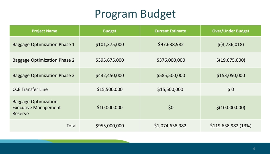
Port Commission: Baggage Optimization Budget
A budget table showing five line items related to Baggage Optimization phases and a CCE Transfer Line, with a total budget of $955,000,000 against a current estimate of $1,074,638,982, resulting in a 13% over-budget variance of $119,638,982. The largest overage is Baggage Optimization Phase 3, which exceeds its budget by $153,050,000. -
 2025-04-08
Port Of Seattle Commission regular meeting agenda, April 8, 2025
The Port of Seattle Commission held a Regular Meeting on April 8, 2025, covering airport facility projects including dining and retail renovations and a new shared-use lounge (Club SEA) at Seattle-Tacoma International Airport, as well as fire suppression system upgrades in the Satellite Transit System tunnels. The agenda also included approval of an Economic Development Partnership Program with King County cities and routine administrative items such as meeting minutes and travel approvals. No noise policy items were listed on this meeting's agenda. -
 2025-04-08
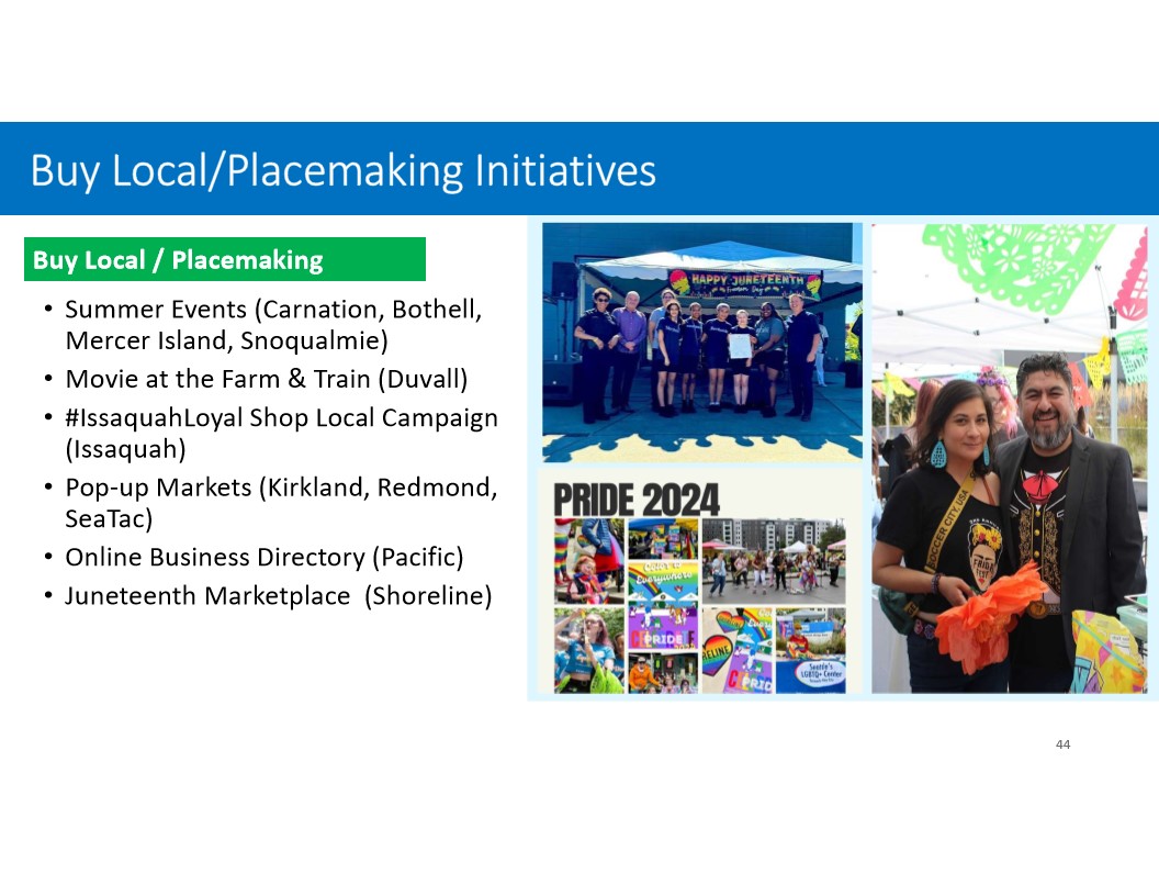
Buy Local/Placemaking Initiatives — Economic Development Partnership Program Presentation, Slide 44 (April 8, 2025)
A presentation slide titled 'Buy Local/Placemaking Initiatives' lists community economic development programs across King County cities including Carnation, Bothell, Mercer Island, Snoqualmie, Duvall, Issaquah, Kirkland, Redmond, SeaTac, Pacific, and Shoreline. Photos show a Happy Juneteenth event, Pride 2024 imagery, and what appears to be a cultural marketplace event with attendees in festive attire. -
 2025-04-03
Port of Seattle Providing Notice to Individuals Affected by Fall 2024 Cyberattack
The Port of Seattle (the “Port”) announced today notification letters are being mailed to individuals whose data was impacted in the August 2024 cyberattack on the Port, including Seattle-Tacoma International Airport (SEA) and maritime facilities. The threat actors accessed and downloaded some personal information from previously used Port systems for employee, contractor, and parking data. -
 2025-03-26
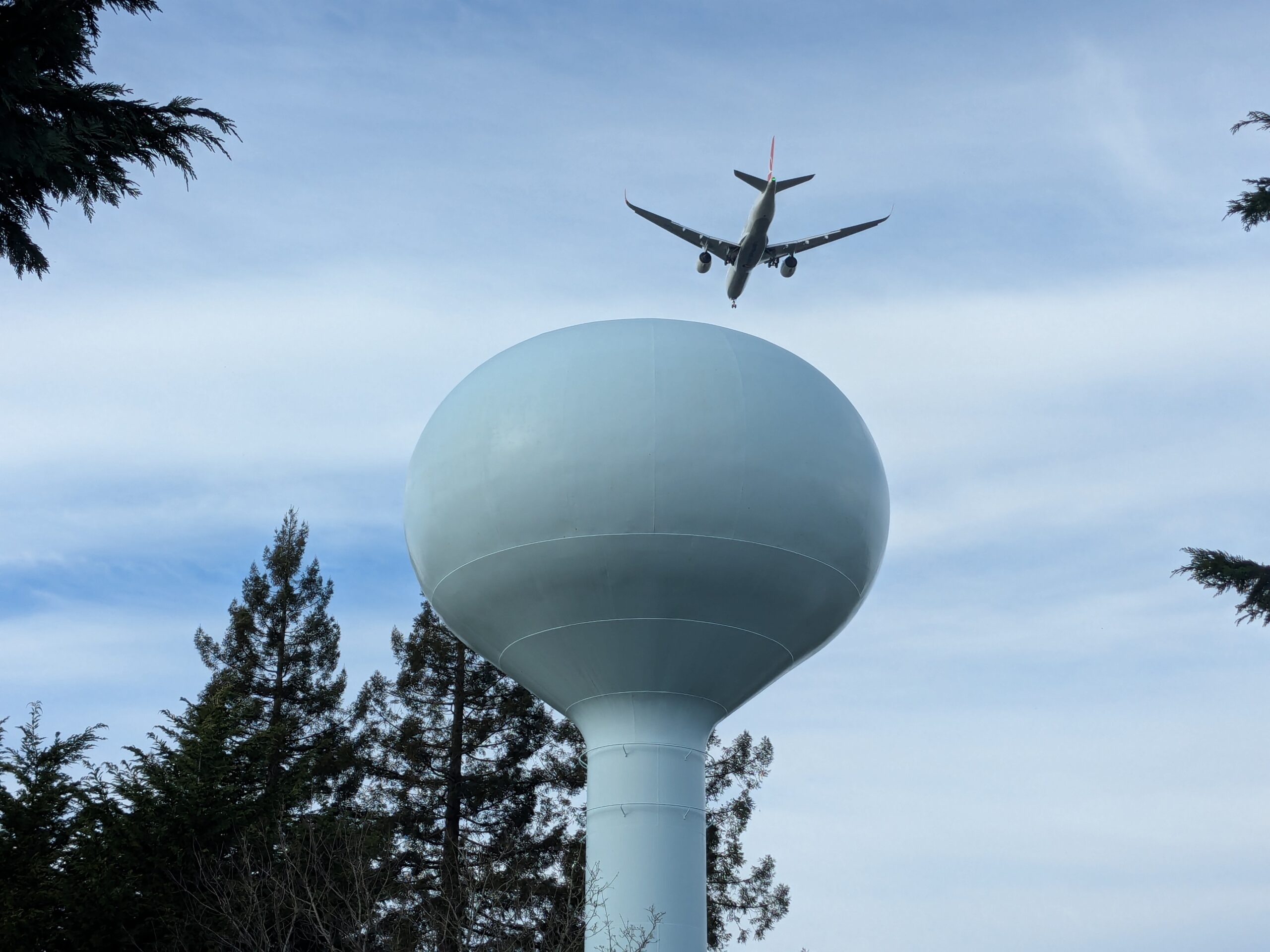
Commercial Jet On Approach Over Water Tower Near Sea-Tac Airport
A twin-engine commercial passenger aircraft, landing gear deployed and on final approach, is photographed from below passing over a spherical municipal water tower surrounded by evergreen trees. No visible text, logos, or markings are discernible to identify the airline, aircraft registration, or specific location, though the flight path and setting are consistent with communities near a major airport.