TagMap(38)
-
 2026-02-19 23:43
When Federal environmental maps go dark
The benefits and consequences for airport communities In January 2025, the Trump administration began removing content from federal websites following Executive Order 14151. The order directed all government agencies to terminate DEI and environmental justice–related programs. These include environmental justice and climate mapping using a nationally consistent dataset for evaluating the socioeconomic impacts of airports. -
2026-02-17 01:22
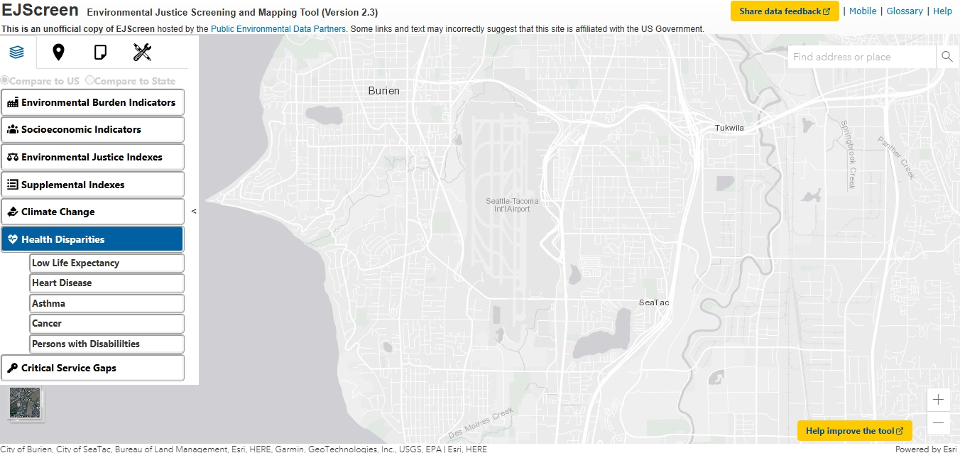
EJScreen Environmental Justice Screening and Mapping Tool (Version 2.3)
This is an 1unofficial copy of EJScreen hosted by the Public Environmental Data Partners. Some links and text may incorrectly suggest that this site is affiliated with the US Government. The EJScreen Tool was an EPA web application taken down in January of 2025 as part of Executive Order 14151. It was described as “an -
 2025-09-23 20:11
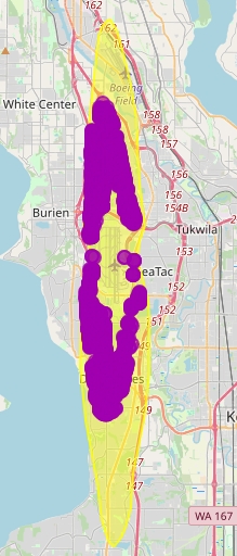
Sea-Tac Airport Noise Contour Map
Map of Seattle/Burien/SeaTac/Des Moines area showing DNL aircraft noise contour footprint around Sea-Tac. -
 2025-09-02 21:38
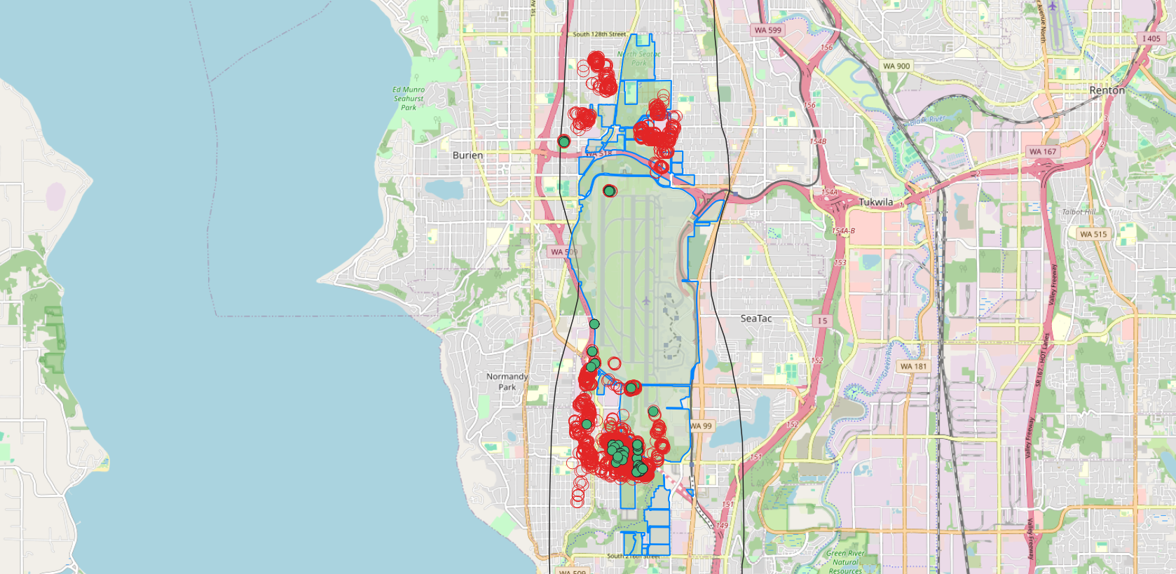
Port Properties and Trees mapped
Properties, trees and the environment around the airport As the icon indicates, this is a beta project, one of a series of visual representations on community impacts. This indicates Port-owned properties around the airport, most purchased with FAA grants. It also displays the status of trees that are subject to removal and/or replacement via the -
 2025-06-10 14:50
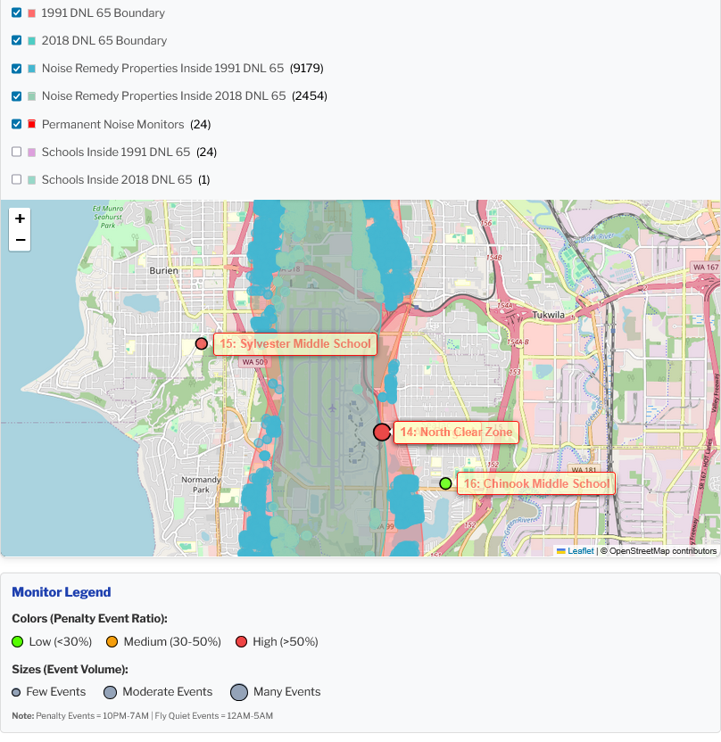
Noise Events mapped
Visualizing flights over the 24 Permanent Noise Monitors As the icon indicates, this is a beta project. Click on it to see the disclaimer. This is the second in a series of visual representations of community impacts. Stay tuned. There will be many use cases for this map, but for now, one we find interesting -
2025-06-01 15:06
Port Packages mapped
Structures with Port of Seattle avigation easements Background When the Port of Seattle conducted their initial Part 150 Study in 1985, there were at least 11,000 structures inside the eligible boundary area. Since then, it has conducted four more, including the current one. Since then, the boundary, and the structures included within those boundaries, have -
 2024-12-10 13:19
Midway Creek Restoration Project – Aerial Phase Map
Aerial map showing multi-phase creek restoration near Des Moines/SeaTac, construction phases labeled 2007–2012. -
 2024-10-17 00:33
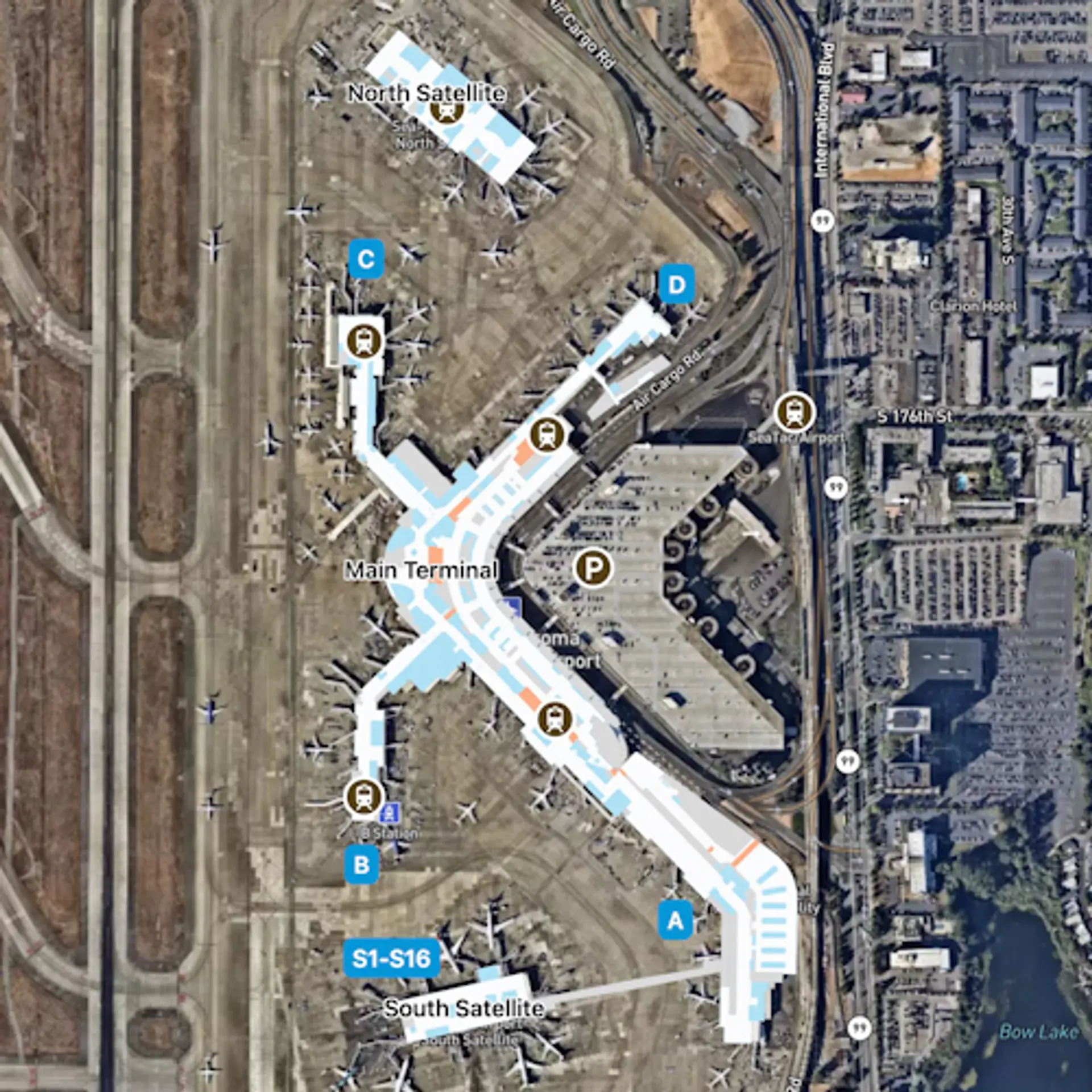
Seattle-Tacoma-SEA-Overview Map
-
 2024-04-05 01:41
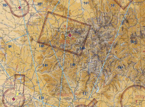
Deciphering the FAA’s wildly complex aviation maps
Among all of the visual information published by the U.S. government, there may be no product with a higher information density than the Federal Aviation Administration’s (FAA) aviation maps. Intended for pilots, the FAA publishes free detailed maps of the entire U.S. airspace, and detailed maps of airports and their surroundings and updates them frequently. The density -
 2023-08-14 00:00
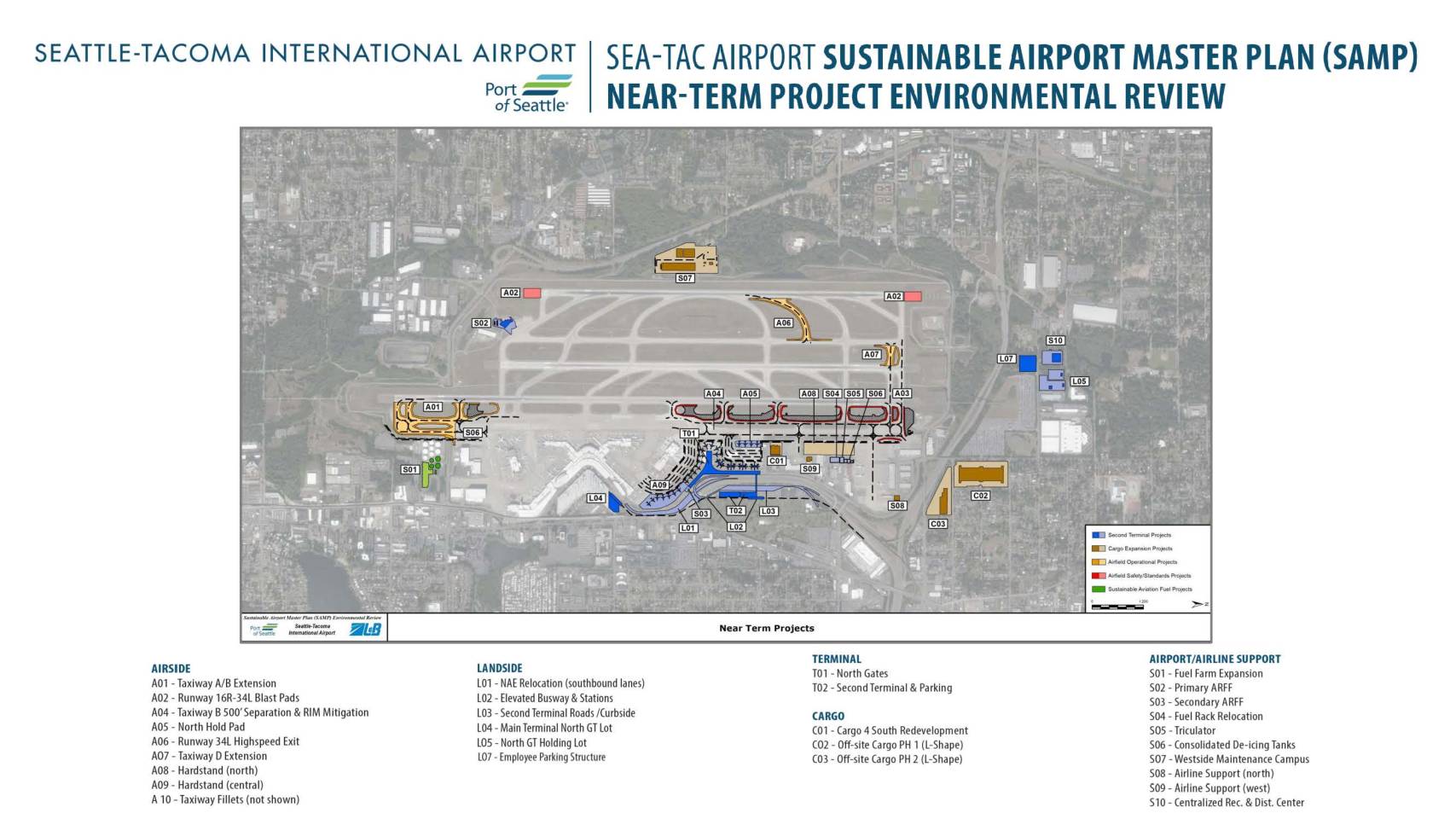
August 14, 2023 SAMP NTP Map