TagDes Moines(304)
-
 1978-10-12
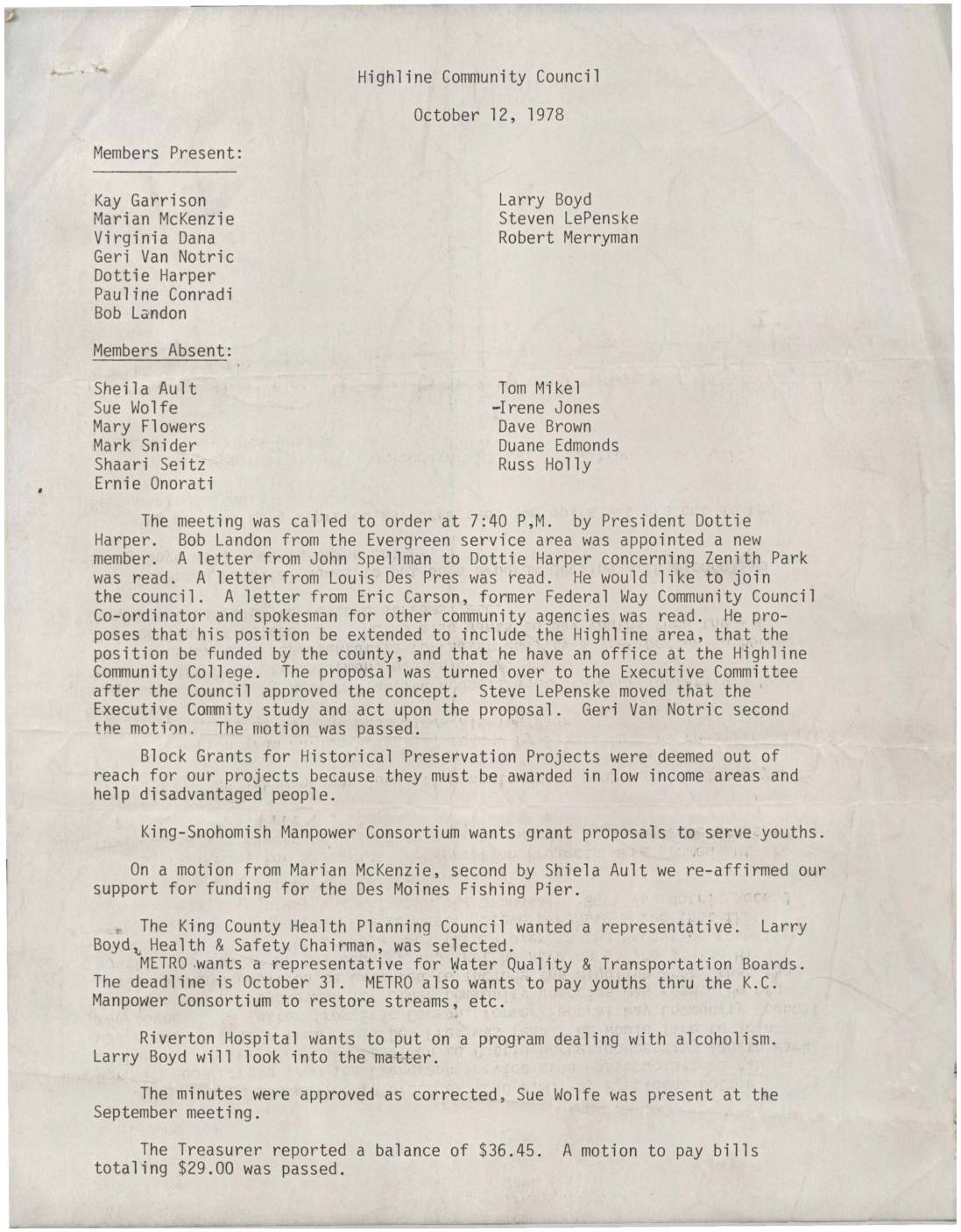
Highline Community Council Minutes, October 12, 1978
Minutes from the Highline Community Council meeting held on October 12, 1978, covering new member appointments, correspondence regarding Zenith Park, and proposals for community coordination and funding. The council discussed topics including block grants for historical preservation, youth employment through the King-Snohomish Manpower Consortium, and representation on regional boards such as the King County Health Planning Council and METRO's Water Quality and Transportation Boards. Financial business included approval of bills totaling $29.00 against a treasury balance of $36.45. -
 1976-06-16
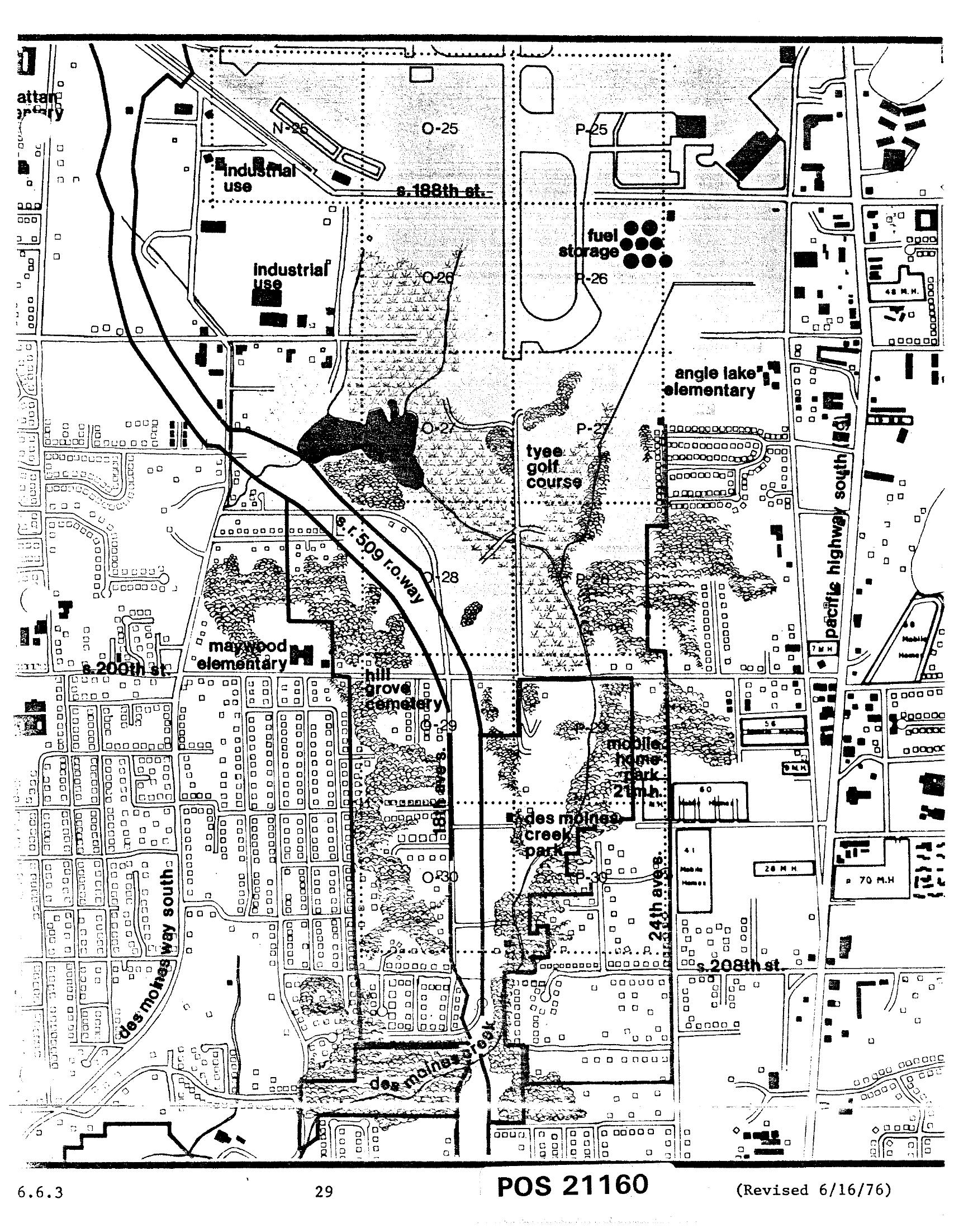
Sea-Tac Comprehensive Plan Land Use Zoning Map — Des Moines Area, Chapter 6, Page 29 (June 1976)
This is document POS 21160, revised June 16, 1976, a detailed land use map (page 29, section 6.6.3) showing the area surrounding Seattle-Tacoma International Airport. Visible features include industrial use zones, fuel storage areas, Tyee Golf Course, Angle Lake Elementary, Maywood Elementary, Hill Grove Cemetery, Des Moines Creek Park, a mobile home park, S. 188th St., S. 200th St., S. 208th St., Pacific Highway South, Des Moines Way South, and the S.R. 509 right-of-way corridor. -
 1974-01-01
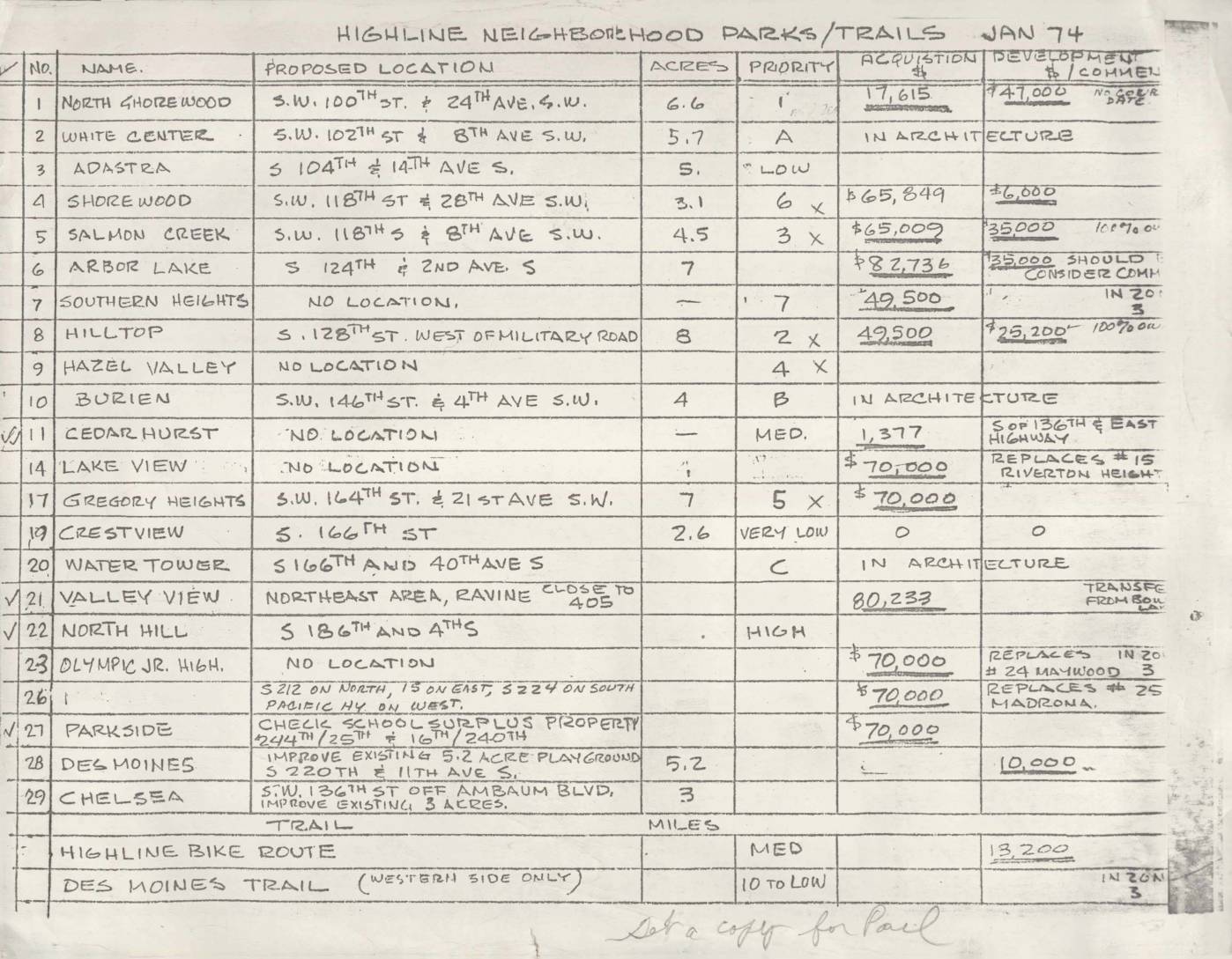
Highline Neighborhood Parks/Trails, January 1974
Handwritten planning table listing Highline neighborhood parks and trails as of January 1974, including proposed locations, acreage, priority, acquisition costs, and development costs. Sites listed include North Shorewood (S.W. 100th St & 24th Ave S.W., 6.6 acres, $17,615 acquisition), White Center (S.W. 102nd St & 8th Ave S.W., 5.7 acres), Adastra (S 104th & 14th -
1974-01-01
Highline Neighborhood Parks/Trails, January 1974
This January 1974 planning document lists proposed Highline neighborhood parks and trails, detailing 29 potential park sites with their proposed locations, acreage, acquisition costs, and development priorities. Sites such as North Shorewood, Salmon Creek, Arbor Lake, and Parkside are evaluated, with acquisition costs ranging from zero to over $82,000 and development funding noted in varying stages. The document also references a Highline Bike Route and Des Moines Trail, reflecting mid-1970s green space planning efforts in the communities surrounding the Sea-Tac Airport area.