TagSouth King County(24)
-
 1996-10-21
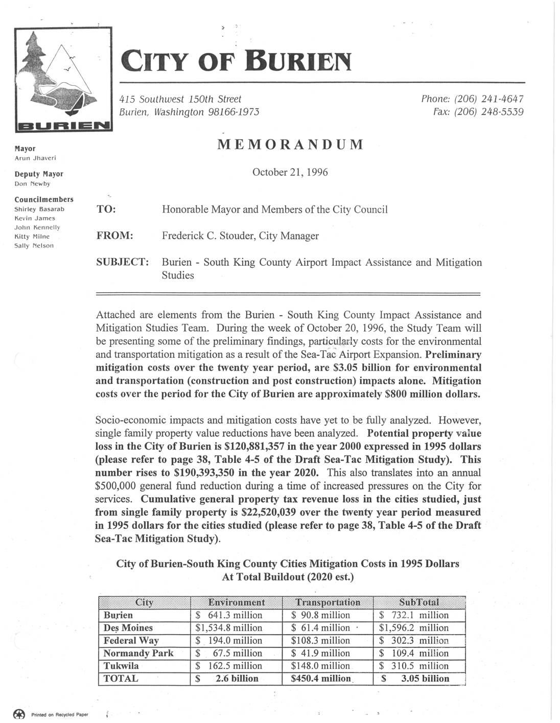
City of Burien Memorandum: South King County Airport Impact Assistance and Mitigation Studies
A 1996 City of Burien memorandum outlines preliminary findings from a regional study on the socio-economic and environmental impacts of Sea-Tac Airport's proposed expansion and third runway. Estimated mitigation costs for five South King County cities totaled $3.05 billion over twenty years, with Burien alone facing roughly $800 million in costs and over $190 million in single-family property value losses by 2020. The study argues that because the airport's benefits are spread across the broader Puget Sound region while its costs—including noise, traffic, and a reduced tax base—fall disproportionately on a handful of nearby communities, targeted mitigation funding is both an equity issue and a necessity. -
 1987-12-09
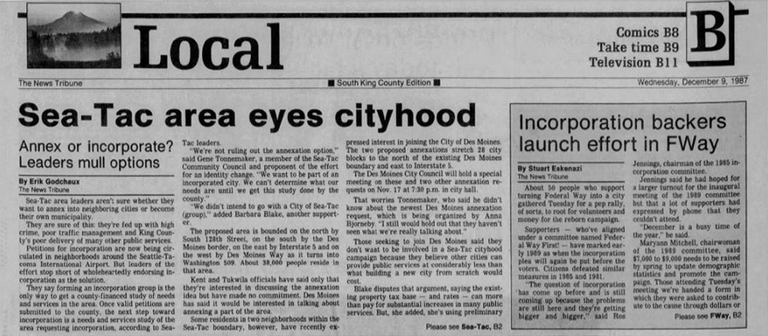
Sea-Tac area eyes cityhood
The News Tribune's Local section (South King County Edition), dated Wednesday, December 9, 1987, features two stories: 'Sea-Tac area eyes cityhood,' reporting on Sea-Tac area leaders debating annexation versus incorporation as a new city, and 'Incorporation backers launch effort in FWay,' covering approximately 50 supporters of turning Federal Way into a city gathering for a pep rally to revive the 1989 incorporation campaign. -
 1970-01-01
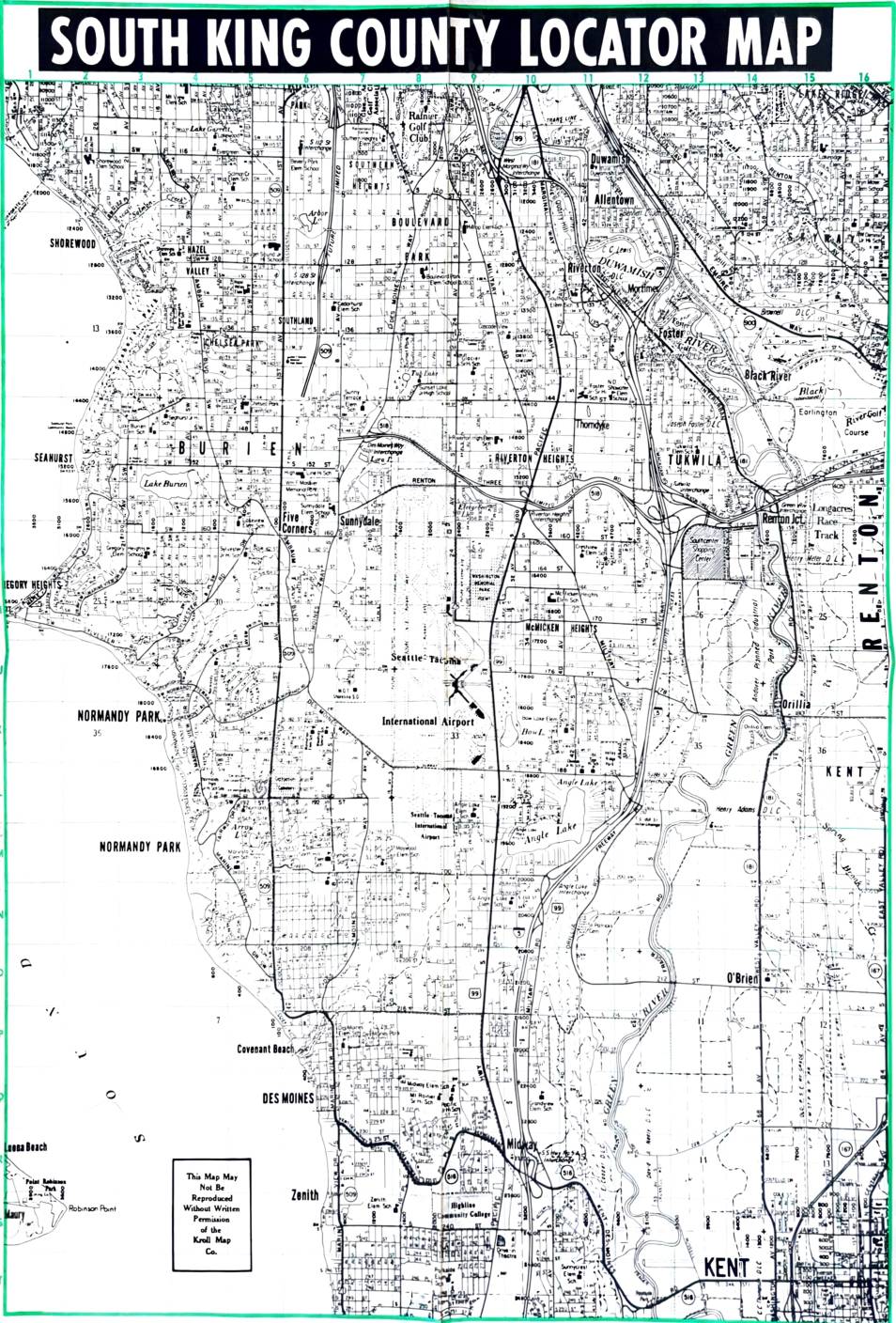
South King County Locator Map
This South King County Locator Map, produced by the Kroll Map Co., provides a detailed street-level view of communities surrounding the Seattle-Tacoma International Airport, including Burien, Des Moines, Normandy Park, Tukwila, Renton, and Kent. The map shows the airport's central position within the region and the dense residential neighborhoods directly affected by its flight paths. It is a key reference document for understanding the geographic scope of communities subject to Sea-Tac Airport noise impacts and related land-use policy decisions. -
 1970-01-01
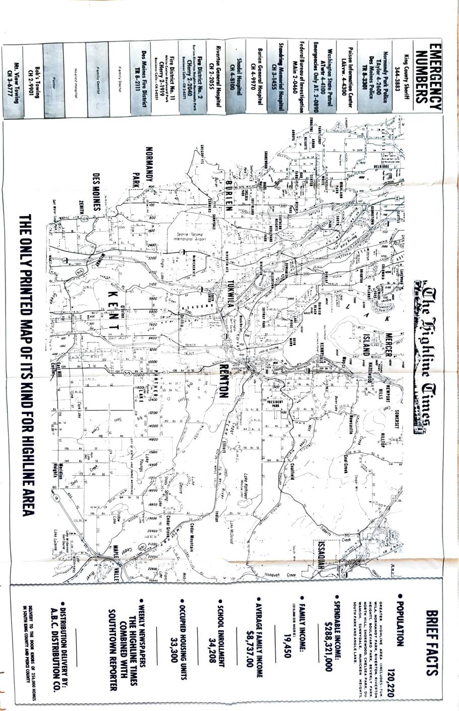
The Highline Times: South King County map with brief facts
This document is a community map and fact sheet published by The Highline Times, a weekly newspaper serving the Greater Highline area of South King County, Washington, which includes communities such as Tukwila, Normandy Park, Burien, Renton, and surrounding neighborhoods. It provides demographic and economic statistics for the region, including a population of 120,220, an average family income of $8,737, and 33,300 occupied housing units. The map also lists local emergency phone numbers for agencies such as the King County Sheriff, local hospitals, and fire districts, and notes that the newspaper was distributed to 256,000 homes in South King County and Pierce County.