TagNoise Mitigation(218)
-
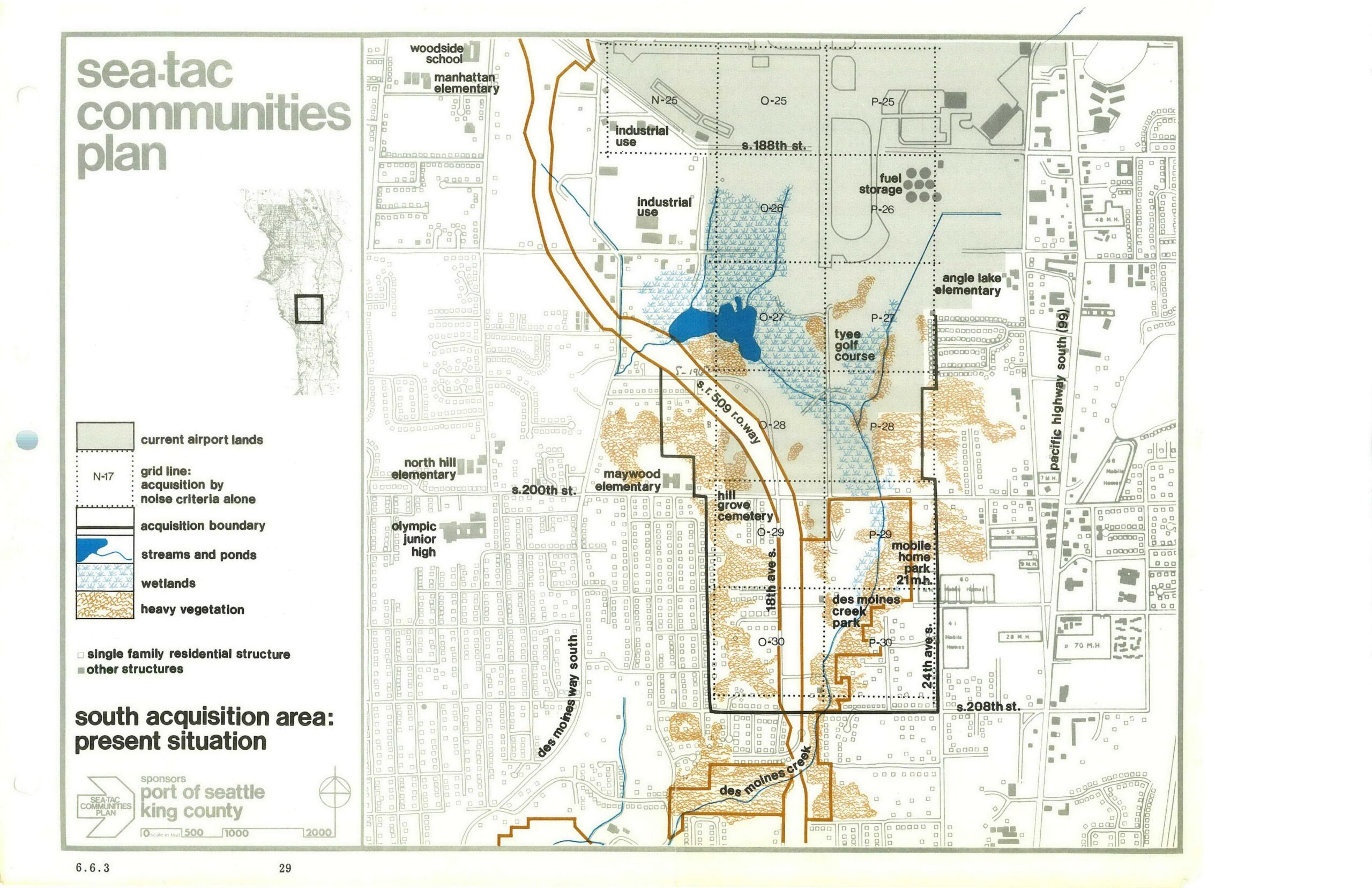
STCP South Acquisition Area Present Situation Map (Page 29)
This planning map, page 29 (figure 6.6.3) of the Sea-Tac Communities Plan sponsored by the Port of Seattle and King County, depicts the south acquisition area around Seattle-Tacoma International Airport, showing current airport lands, acquisition boundaries, grid lines for noise-criteria acquisition, streams, ponds, wetlands, heavy vegetation, and key landmarks including Tyee Golf Course, Hill Grove Cemetery, Des Moines Creek Park, and several schools along Pacific Highway South and Des Moines Way South. -
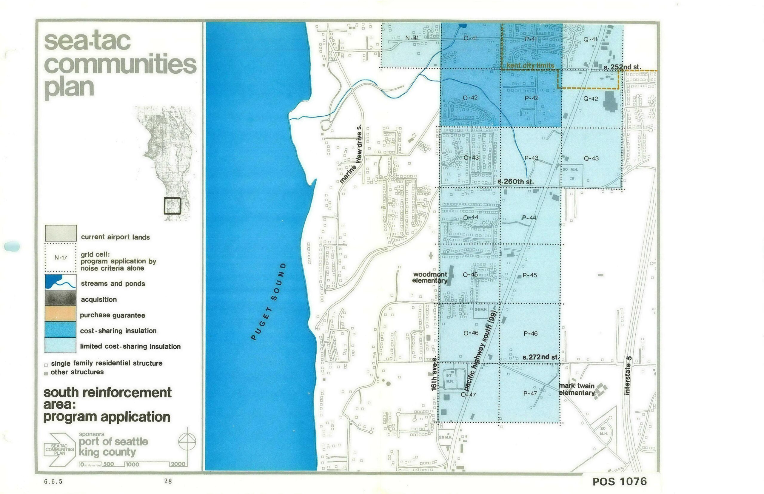
Sea-Tac Communities Plan – South Reinforcement Area Program Application Map (Page 28)
This map, labeled 'Sea-Tac Communities Plan – South Reinforcement Area: Program Application' (document reference POS 1076, page 28, section 6.6.5), was sponsored by the Port of Seattle and King County. It depicts grid cells O-41 through Q-47 in the area west of Interstate 5 and east of Puget Sound, color-coded to show noise-mitigation program designations including cost-sharing insulation, limited cost-sharing insulation, acquisition, and purchase guarantee zones, with landmarks including Woodmont Elementary, Mark Twain Elementary, Pacific Highway South (SR 99), and S. 252nd through S. 272nd Streets. -
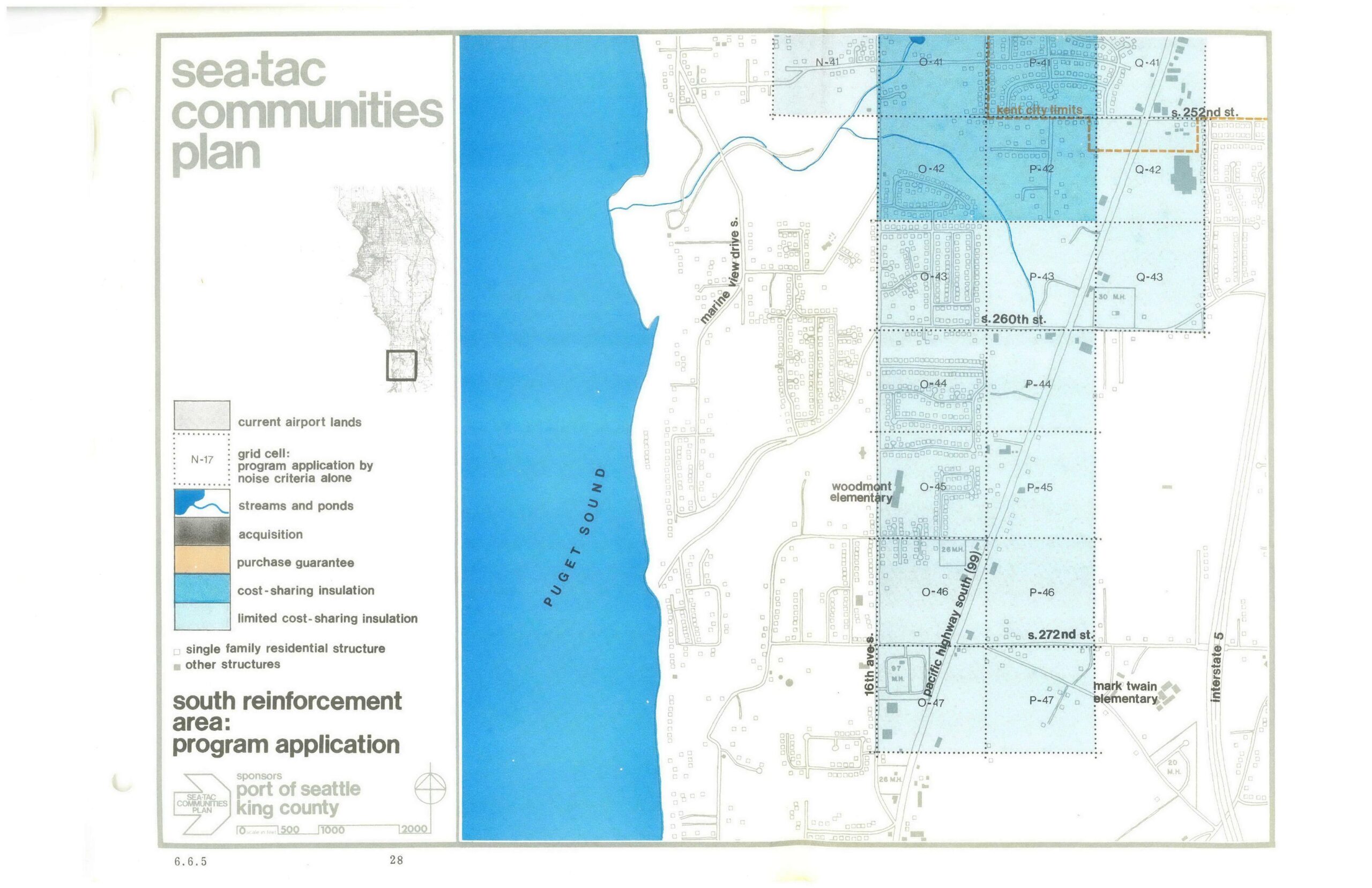
STCP South Reinforcement Area Program Application Map
A planning map from the Sea-Tac Communities Plan, sponsored by the Port of Seattle and King County, showing the South Reinforcement Area's program application for noise mitigation. The map depicts grid cells in the area bounded roughly by S. 252nd St. to S. 272nd St. and Marine View Drive S. to Interstate 5, color-coded to indicate acquisition, purchase guarantee, cost-sharing insulation, and limited cost-sharing insulation zones, with landmarks including Woodmont Elementary, Mark Twain Elementary, and the Kent City Limits noted. -
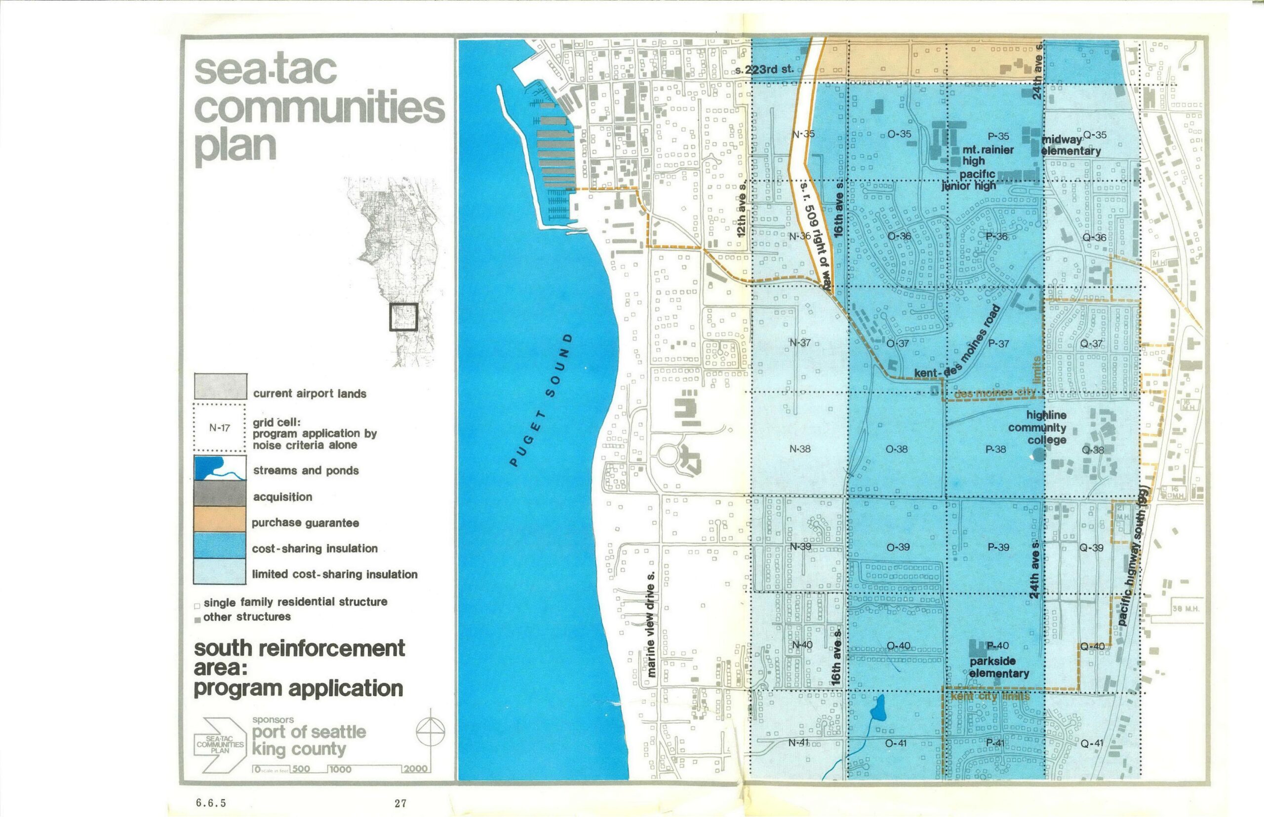
STCP South Reinforcement Area Program Application Map (Page 27)
This is page 27 (section 6.6.5) of the Sea-Tac Communities Plan, sponsored by the Port of Seattle and King County, showing the South Reinforcement Area program application map. The map depicts grid cells across the area east of Puget Sound (along Marine View Drive S., 12th, 16th, and 24th Ave S., and the Kent-Des Moines Road corridor) color-coded by noise-mitigation program type: cost-sharing insulation, limited cost-sharing insulation, purchase guarantee, and acquisition, with landmarks including Mt. Rainier High, Pacific Junior High, Midway Elementary, Highline Community College, and Parkside Elementary noted. -
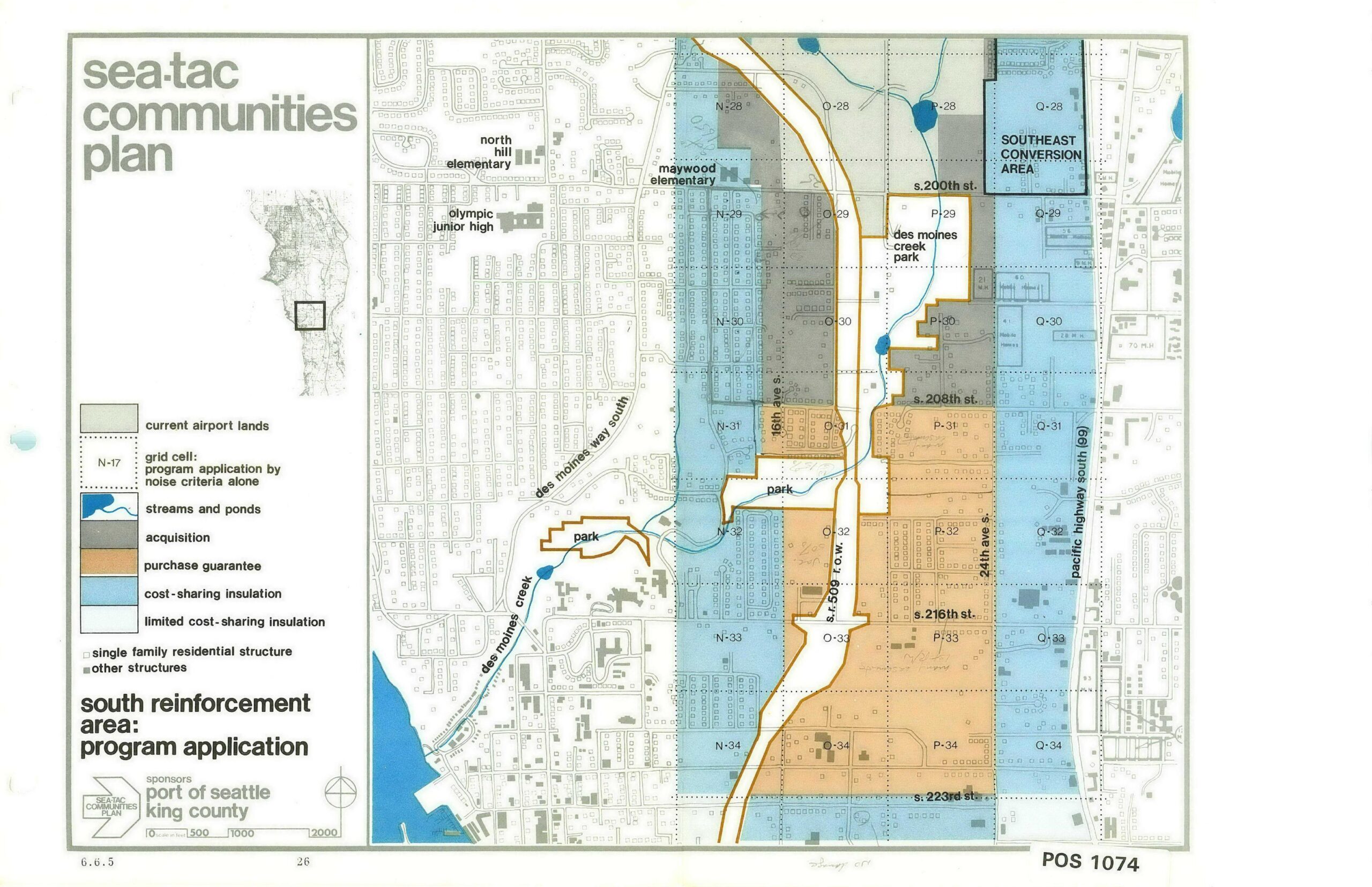
STCP South Reinforcement Area Program Application Map (Page 26)
This planning map, document number POS 1074 (sheet 6.6.5, page 26), was produced for the Sea-Tac Communities Plan and sponsored by the Port of Seattle and King County. It depicts the South Reinforcement Area program application, showing grid cells color-coded by noise-mitigation program type—including acquisition, purchase guarantee, cost-sharing insulation, and limited cost-sharing insulation—across the area roughly bounded by S. 200th St. to the north and S. 223rd St. to the south, with landmarks such as Des Moines Creek Park, Maywood Elementary, and Pacific Highway South (SR 99) labeled. -
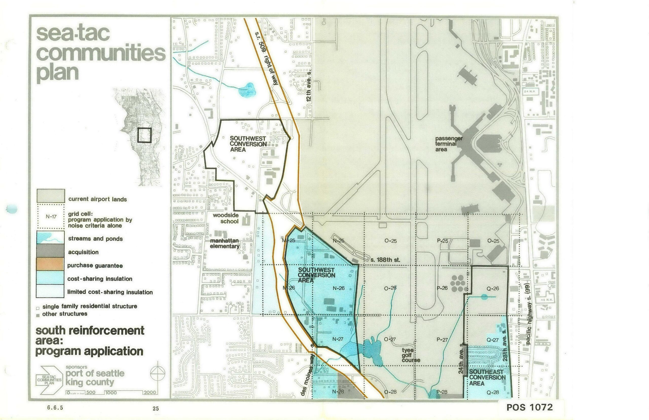
Sea-Tac Communities Plan — South Reinforcement Area Program Application Map (Page 25)
A planning map from the Sea-Tac Communities Plan, document number POS 1072 (dated 6.6.5, page 25), sponsored by the Port of Seattle and King County. The map depicts the South Reinforcement Area program application near Seattle-Tacoma International Airport, showing Southwest and Southeast Conversion Areas, grid cells by noise criteria, acquisition zones, purchase guarantee corridors, cost-sharing insulation areas, and landmarks including Woodside School, Manhattan Elementary, and Tyee Golf Course. -
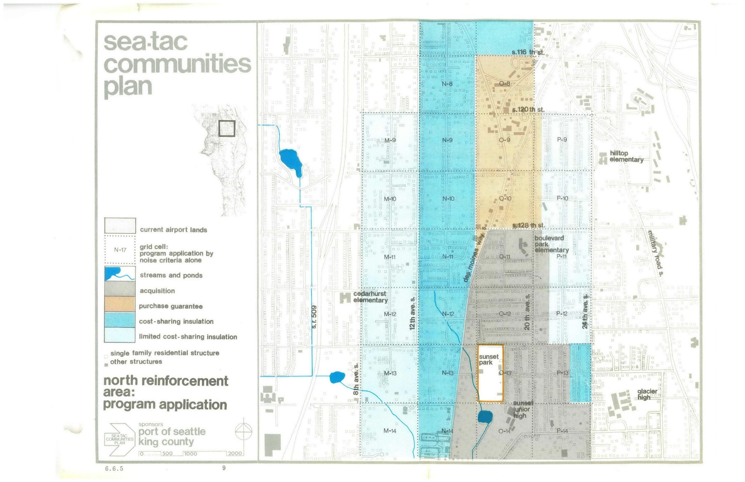
STCP North Reinforcement Area Noise Mitigation Map — Sea-Tac Communities Plan
This map from the Sea-Tac Communities Plan, sponsored by the Port of Seattle and King County, depicts the North Reinforcement Area program application showing grid cells color-coded by noise mitigation category—including acquisition, purchase guarantee, cost-sharing insulation, and limited cost-sharing insulation zones. Landmarks visible include Cedarhurst Elementary, Boulevard Park Elementary, Hilltop Elementary, Sunset Park, Sunset Junior High, and Glacier High, with major streets including S. 116th St., S. 120th St., S. 128th St., and Des Moines Way S. -
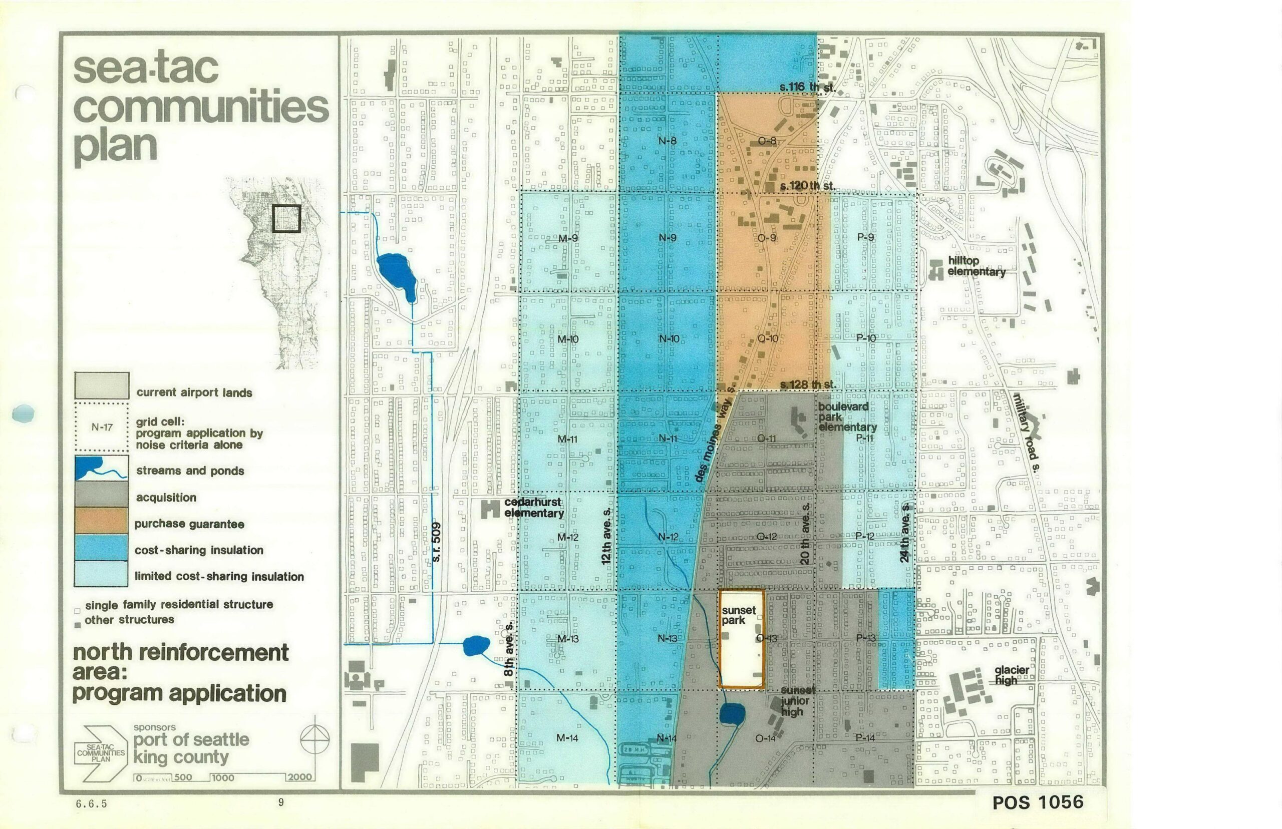
STCP North Reinforcement Area Program Application Map (Page 9)
This planning map, document number POS 1056 (page 9, section 6.6.5), was produced under the Sea-Tac Communities Plan sponsored by the Port of Seattle and King County. It depicts the North Reinforcement Area program application, showing grid cells classified by noise-mitigation programs—including acquisition, purchase guarantee, cost-sharing insulation, and limited cost-sharing insulation—across neighborhoods near Seattle-Tacoma International Airport, with landmarks such as Cedarhurst Elementary, Boulevard Park Elementary, Hilltop Elementary, Glacier High, and Sunset Junior High identified. -
STCP North Reinforcement Area Program Application Map — Sea-Tac Communities Plan
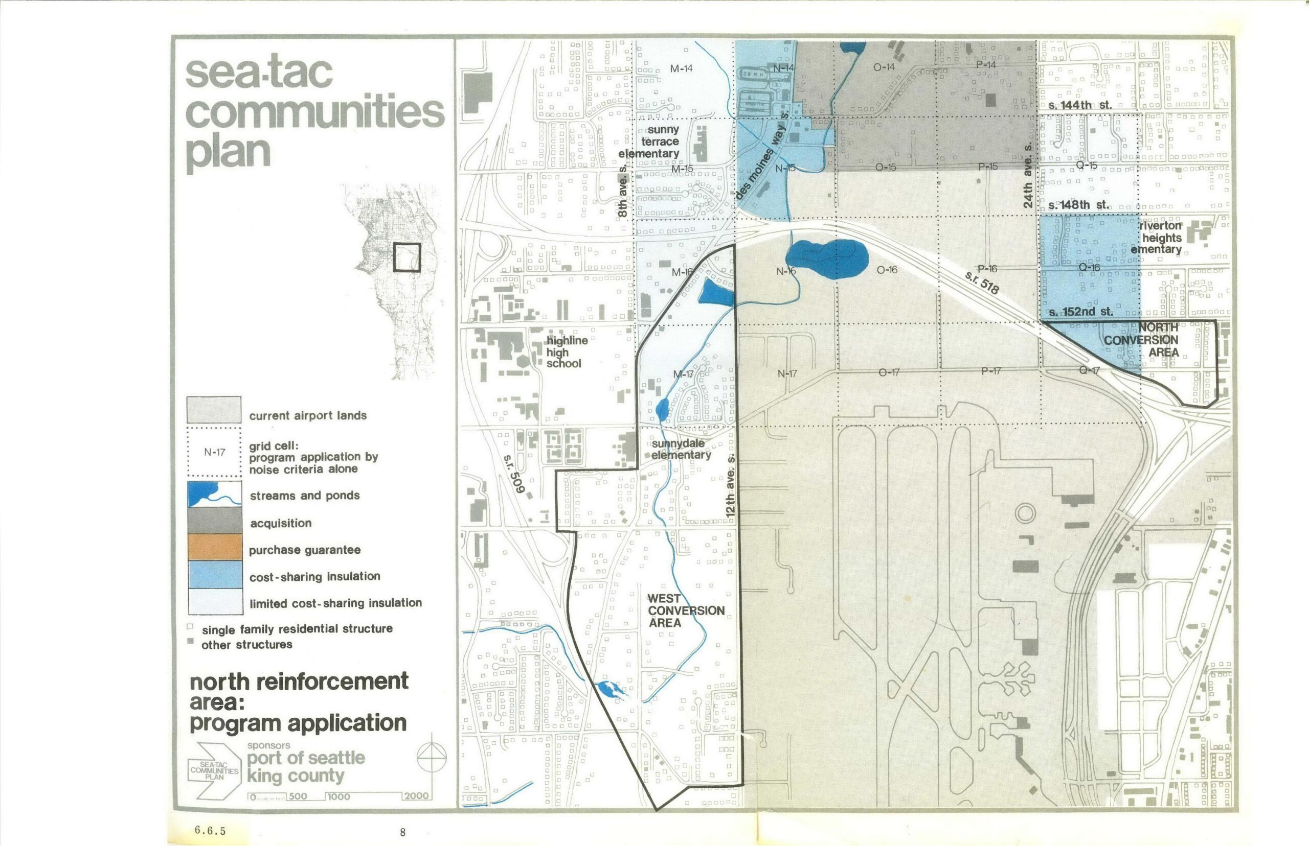
A planning map (page 8, document section 6.6.5) from the Sea-Tac Communities Plan, sponsored by the Port of Seattle and King County, depicting the North Reinforcement Area program application around Seattle-Tacoma International Airport. The map shows land-use categories including current airport lands, acquisition zones, cost-sharing insulation areas, conversion areas (West and North), streams and ponds, and nearby landmarks such as Highline High School, Sunny Terrace Elementary, Sunnydale Elementary, and Riverton Heights Elementary, with a grid cell reference system and scale bar. -
Sea-Tac Communities Plan Chapter 6 — South Reinforcement Area Program Application Map
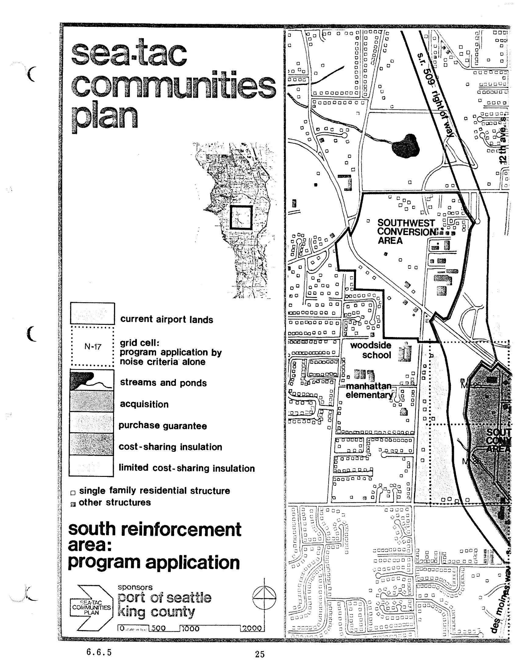
A planning map from the Sea-Tac Communities Plan, sponsored by the Port of Seattle and King County, depicting the South Reinforcement Area program application including the Southwest Conversion Area, Woodside School, and Manhattan Elementary. The legend identifies land-use and noise-mitigation categories including current airport lands, acquisition zones, purchase guarantee areas, cost-sharing insulation, and grid cells defined by noise criteria (e.g., N-17).