TagConstruction(153)
-
 2001-09-01
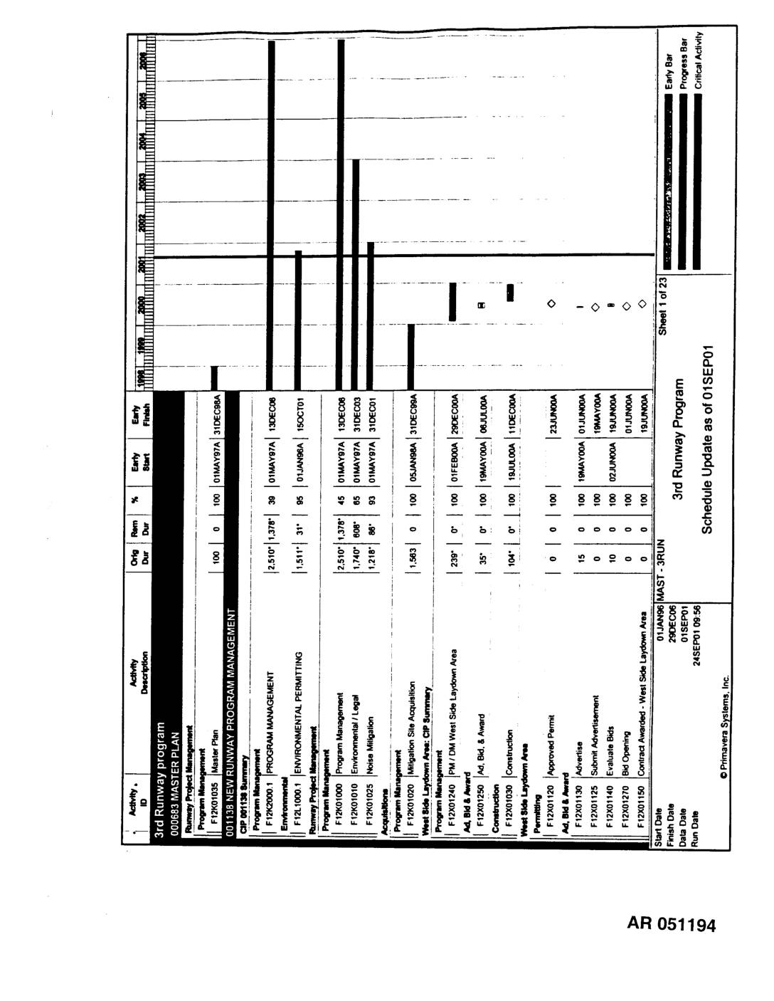
EXH AR051194: 3rd Runway Program Master Plan Schedule Update as of 01SEP01
Administrative Record AR051194 — Primavera Systems schedule document for the 3rd Runway Program (000683 Master Plan) at Sea-Tac Airport, updated as of 01SEP01. Covers Program Management, Environmental Permitting, West Side Laydown Area CIP, Auburn Wetlands Fill & Mitigation – Grading, and Safety Areas 16R/16L. Activities include site acquisition, noise mitigation, DOE 401 permit, environmental permitting, -
 2001-08-15
EXH AR051053: Final Draft Conceptual Borrow Material Development and Reclamation Plan, Borrow Areas 3 and 4, Sea-Tac Airport
Hart Crowser prepared this Final Draft Conceptual Borrow Material Development and Reclamation Plan for Borrow Areas 3 and 4 at Sea-Tac International Airport, City of SeaTac, Washington, for the Port Of Seattle, dated August 15, 2001 (project number 4978-65). The plan covers site preparation, excavation practices, reclamation, revegetation, weed control, stormwater management, and wetland protection -
 2001-08-01
EXH AR1278: Sand and Gravel Stormwater Pollution Prevention Plan — Third Runway Project Borrow Areas 3 and 4, Seattle-Tacoma International Airport
Sand and Gravel Stormwater Pollution Prevention Plan (SWPPP) prepared by Parametrix, Inc. for Port of Seattle, covering Borrow Areas 3 and 4 of the Third Runway Project at Seattle-Tacoma International Airport. Prepared August 2001, approved by Michael Feldman, Director of Aviation Facilities, Port of Seattle. Document checked by Paul Fendt, P.E. and prepared by Julie -
 2001-07-24
EXH AR050691: Installation and Verification Results, Work Area 2 Stone Column Test Areas, Third Runway Embankment Phase 4, Sea-Tac, Washington
Hart Crowser report (project 4978-44) prepared for HNTB documenting installation and verification results for Work Area 2 stone column test areas at the Third Runway Embankment Phase 4, SeaTac, Washington. Authored by Barry S. Chen, Ph.D., P.E. (Senior Associate Geotechnical Engineer) and John P. Laplante (Senior Staff Geotechnical Engineer). Report covers four test areas with -
 2001-07-01
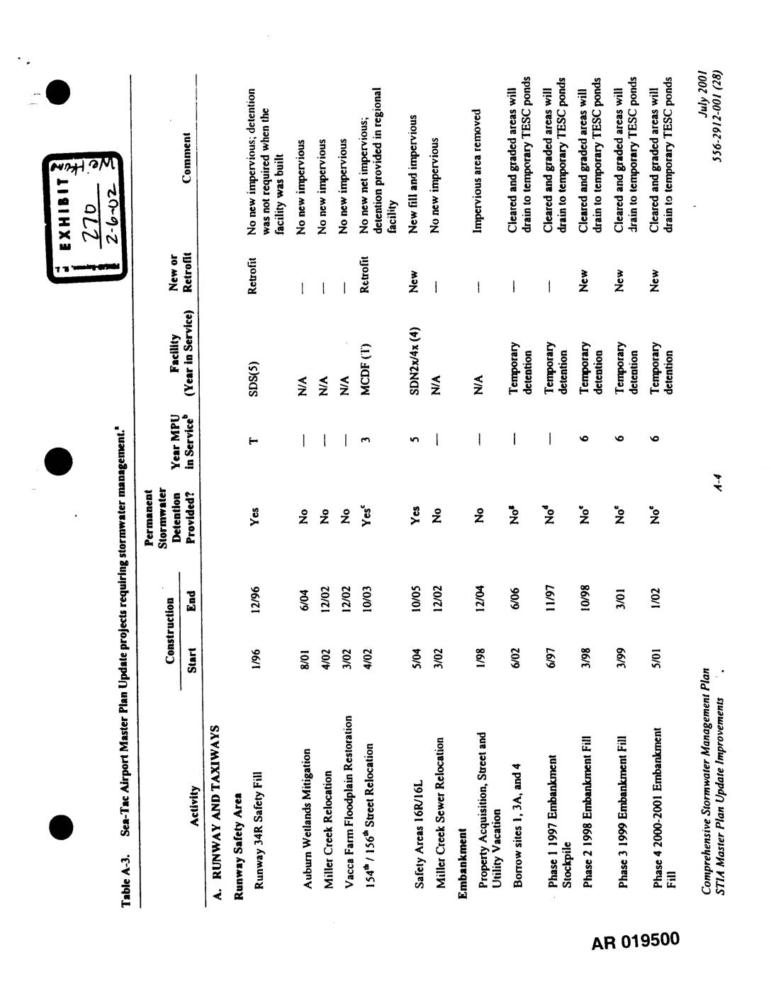
EXH 270: STIA Master Plan Update — Table A-3, Projects Requiring Stormwater Management
This document is Table A-3 from the Sea-Tac Airport Master Plan Update, outlining construction projects that require stormwater management. It details activities such as runway safety improvements, taxiway construction, terminal expansions, and embankment work, noting for each whether permanent stormwater detention was provided, the construction timeline, and the type of drainage facility used. Projects are categorized as either new or retrofit stormwater installations, with comments describing impervious surface impacts and drainage routing to temporary or permanent detention facilities. -
 2001-06-28
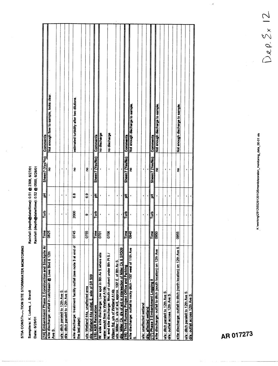
EXH AR017273: STIA Construction Site Stormwater Monitoring Report, 6/28/01
STIA construction site stormwater monitoring log dated 6/28/2001, samplers K. Ludwa and J. Brandt. Documents field observations for Phase 3 Embankment Construction, ASR Relocation, and Third Runway Project Office and Parking areas near Lowe Blvd & 12th Ave S, 8th Ave S, Miller Creek, SR509, Wilson Rd, and 12th Ave S. Records pH, turbidity, sheen -
 2001-06-28
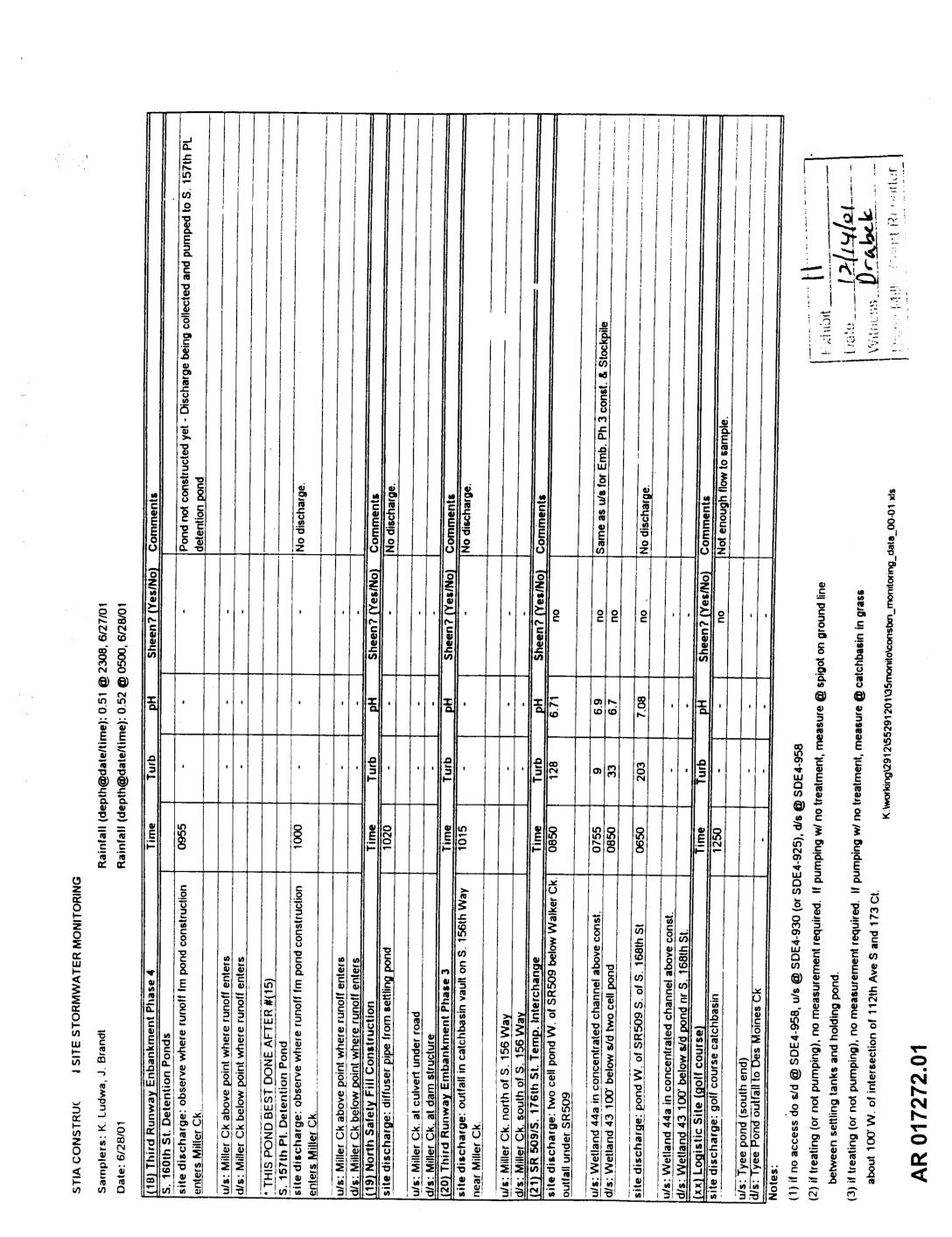
EXH AR017272: STIA Construction Site Stormwater Monitoring Report
STIA construction site stormwater monitoring report dated 6/28/01, sampled by K. Ludwa and J. Brandt. Documents monitoring of multiple construction sites including Third Runway Embankment Phase 4, S. 160th St. Detention Ponds, S. 157th Pl. Detention Pond, North Safety Fill Construction, Third Runway Embankment Phase 3, North Runway Embankment Phase 3, Wetland 44a, Lonistic Site -
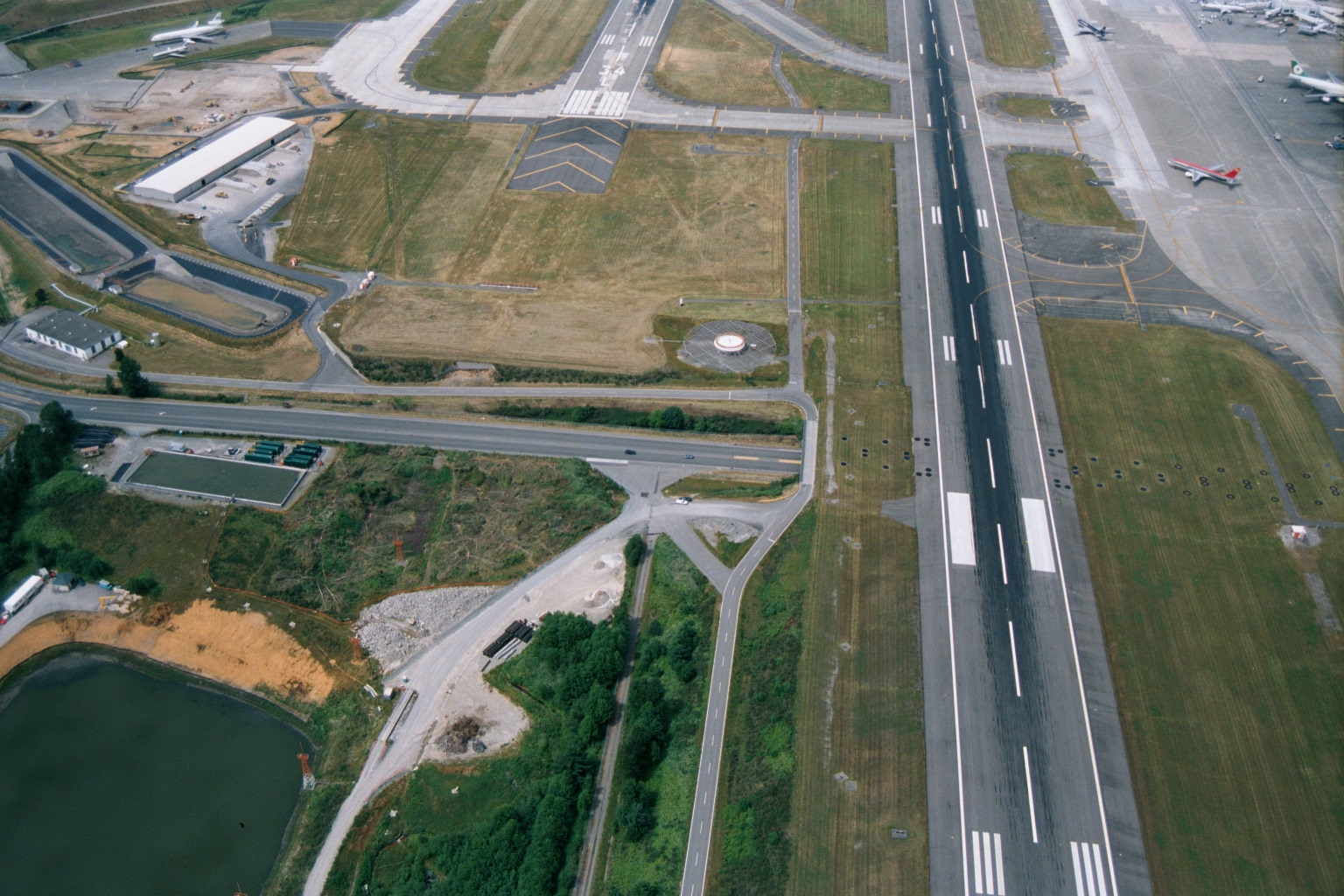
Sea-Tac Airport Runway and Taxiway Aerial View with Construction Activity
Aerial photograph showing a major airport runway with standard white threshold and centerline markings, parallel taxiways, and what appear to be commercial aircraft parked at gates visible in the upper right. Construction activity and a retention pond are visible in the lower left, suggesting active infrastructure development or expansion work. -
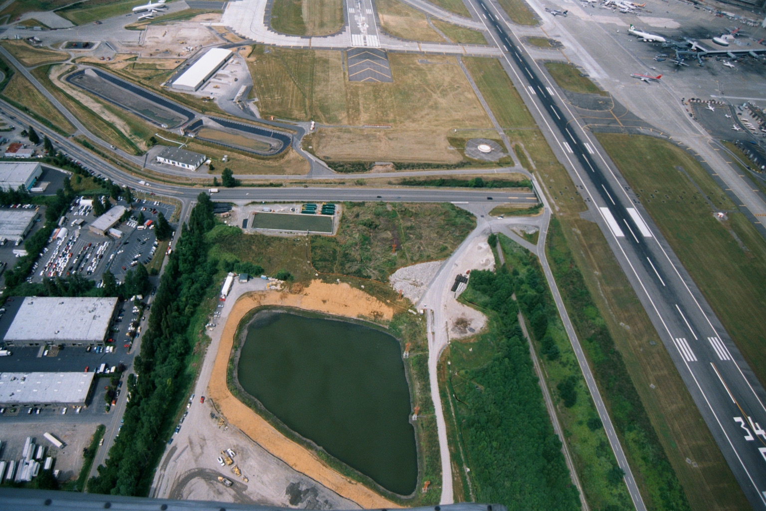
Sea-Tac Airport Aerial View With Runway 34 Threshold and Stormwater Retention Pond Under Construction
Aerial photograph showing Seattle-Tacoma International Airport infrastructure, including a runway threshold marked '34' visible in the lower right, active aircraft at gates on the right side, and a large stormwater retention pond under construction in the foreground with exposed sandy soil. The image likely documents environmental mitigation or drainage infrastructure development adjacent to airport operations. -
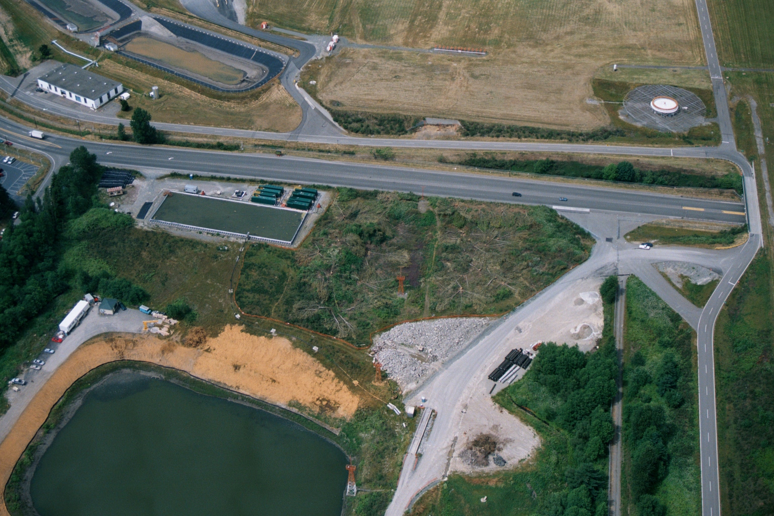
Aerial View of Highway Intersection With Construction Activity and Retention Pond Near Airport Facilities
Aerial photograph showing a highway intersection with construction or land-clearing activity, a retention pond, green containment structures, and what appears to be industrial or airport-related facilities. No visible text, logos, or date information is present in the image.