TagAirport(185)
-
 2025-09-15
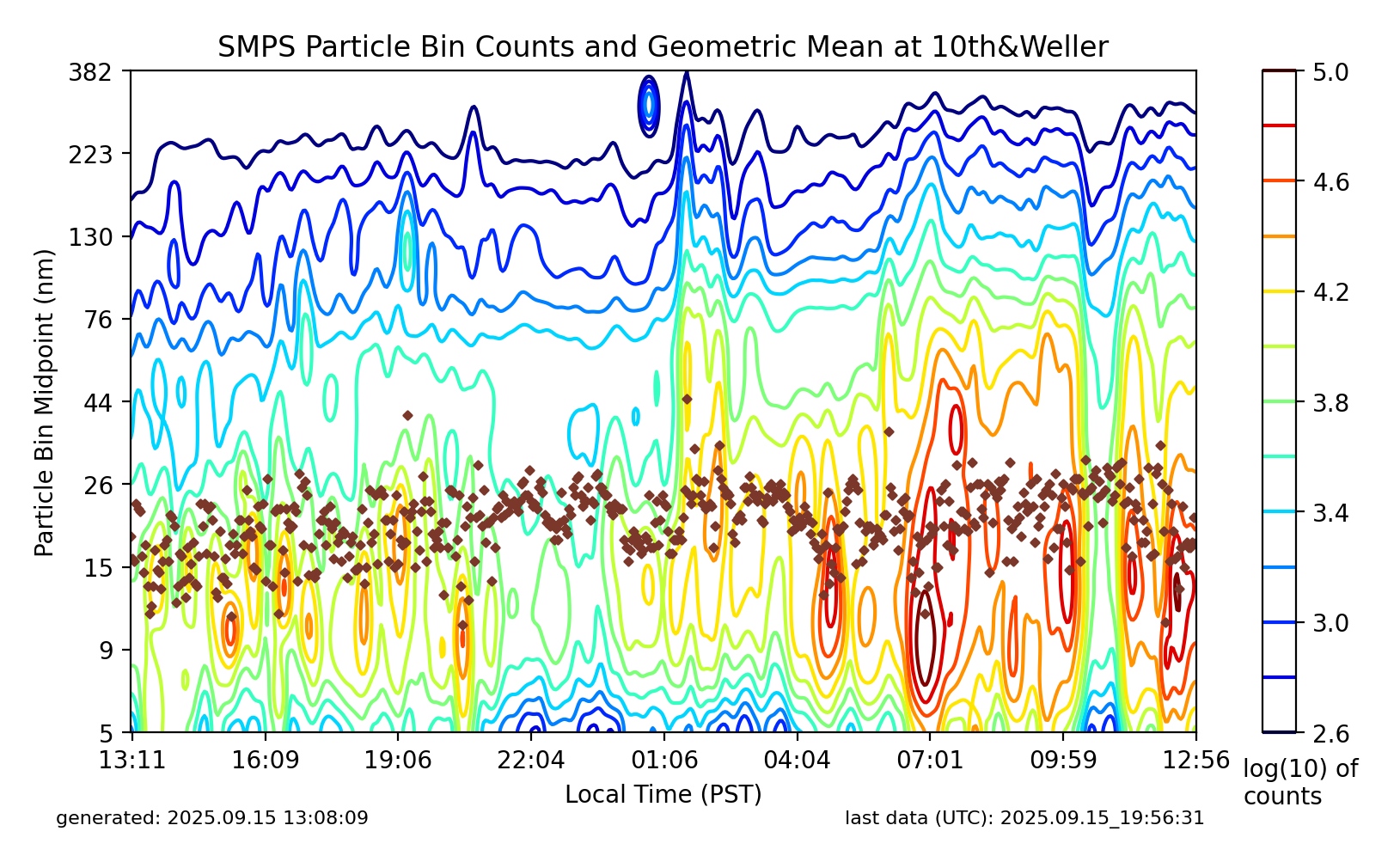
SMPS Particle Bin Counts and Geometric Mean at 10th&Weller
This plot shows Scanning Mobility Particle Sizer (SMPS) aerosol particle size distribution data (5–382 nm) collected at the 10th & Weller monitoring site, generated on 2025-09-15 at 13:08:09 PST with last UTC data timestamp of 2025-09-15 19:56:31. The contour plot displays log(10) particle counts over local PST time from approximately 13:11 on September 14 through 12:56 on September 15, with brown diamond markers indicating the geometric mean particle diameter over time. -
 2025-08-16
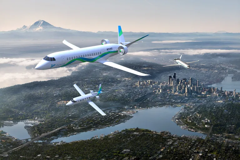
Aircraft Flying Over Seattle Metropolitan Area
A rendered illustration showing Zunum Aero hybrid-electric aircraft (registration N713TZ visible on fuselage) flying over the Seattle metro area, with Lake Washington, downtown Seattle skyline, and Mount Rainier visible in the background. Three aircraft of varying sizes are depicted, consistent with Zunum Aero's regional electric aviation concept promotional materials. -
2025-08-08
Stone LLP | Complete List of FAA Grant Assurances
Complete List Of FAA Grant Assurances Complied by the Airport & Aviation Attorneys at STONE LLP Grant Assurances Applicable To Airports and Airport Sponsors As of the writing of this webpage, the FAA mandates a total of 39 grant assurances and these apply to each airport’s performance of its grant agreement with the federal government -
 2025-06-13
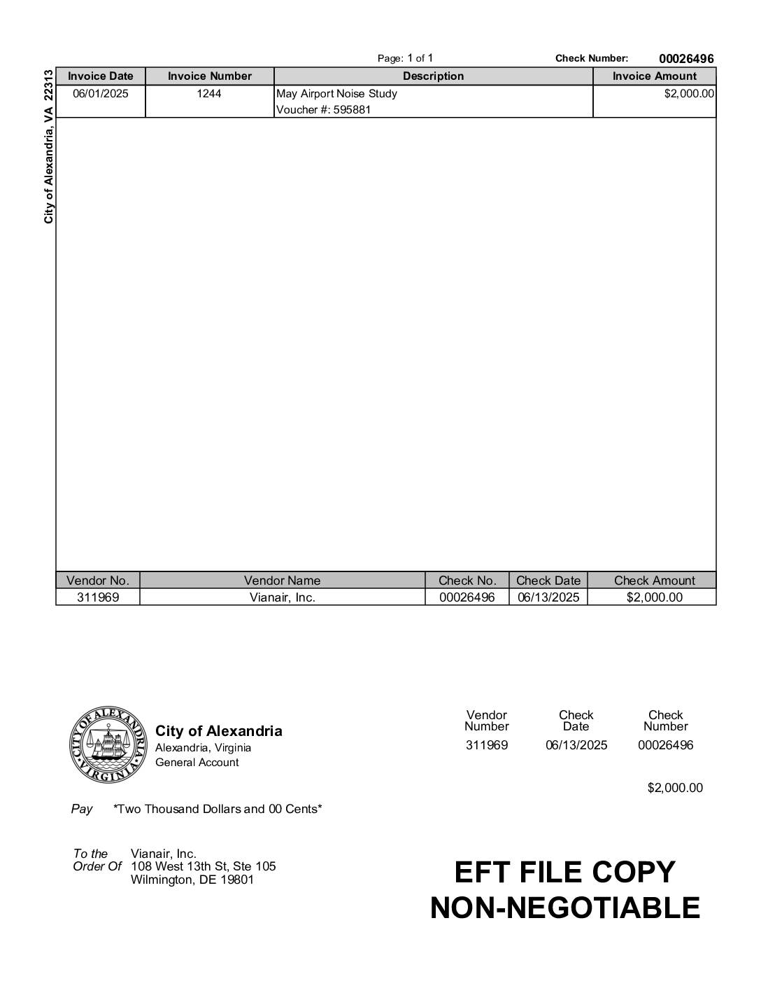
City of Alexandria EFT payment to Vianair, Inc. for May airport noise study
The City of Alexandria, Virginia issued a $2,000 electronic payment (Check No. 00026496, dated June 13, 2025) to Vianair, Inc., a firm based in Wilmington, Delaware, for services related to a May Airport Noise Study. The invoice, numbered 1244 and dated June 1, 2025, was processed under Voucher No. 595881 through Alexandria's General Account. Vianair, Inc. was engaged to conduct airport noise analysis on behalf of the city, reflecting ongoing municipal efforts to monitor and address aircraft noise impacts. -
2025-06-13
City of Alexandria EFT payment to Vianair, Inc. for May airport noise study
The City of Alexandria, Virginia issued a $2,000 electronic payment (Check No. 00026496, dated June 13, 2025) to Vianair, Inc., a firm based in Wilmington, Delaware, for services related to a May Airport Noise Study. The invoice, numbered 1244 and dated June 1, 2025, was processed under Voucher No. 595881 through Alexandria's General Account. Vianair, Inc. was engaged to conduct airport noise analysis on behalf of the city, reflecting ongoing municipal efforts to monitor and address aircraft noise impacts. -
 2025-06-07
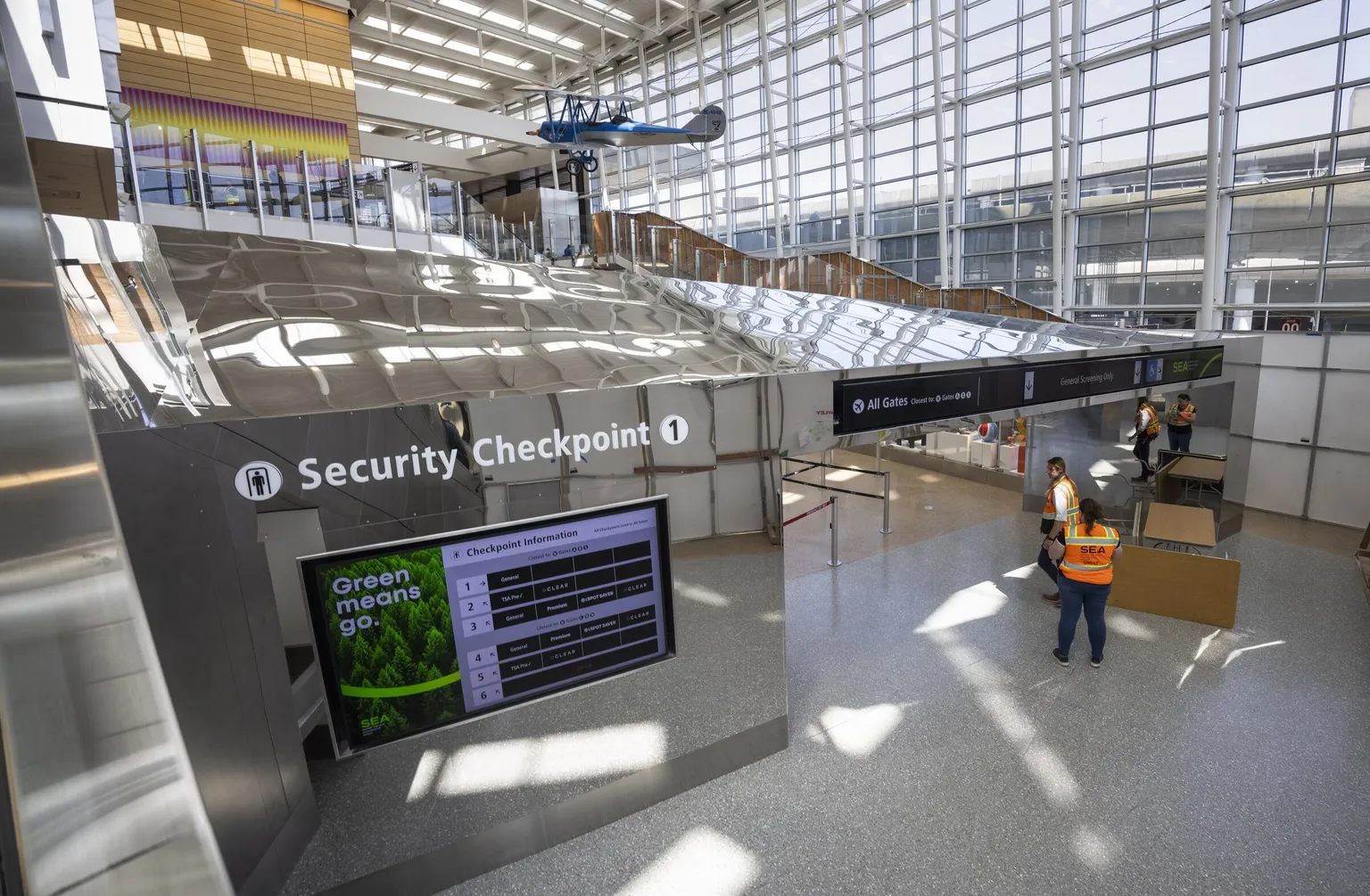
Security Checkpoint 1 at SEA Airport
Interior view of Security Checkpoint 1 at Seattle-Tacoma International Airport (SEA), showing a digital display board with checkpoint lane information and a 'Green means go.' message. Airport staff in orange SEA-branded vests are visible near the checkpoint entrance, with a historic blue biplane suspended from the ceiling in the background. -
 2025-05-17
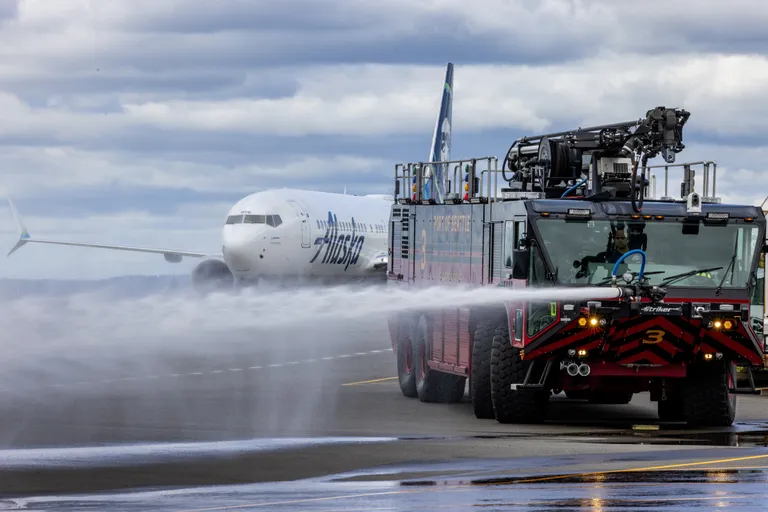
Airport Fire Truck De-icing Aircraft Operations
An Alaska Airlines Boeing 737 receives a water cannon salute on the tarmac at Seattle-Tacoma International Airport, performed by a Port of Seattle Airport Rescue and Firefighting (ARFF) Striker truck (Unit 3). Water cannon salutes are traditionally performed to commemorate special flights or aircraft retirements. -
 2025-05-17
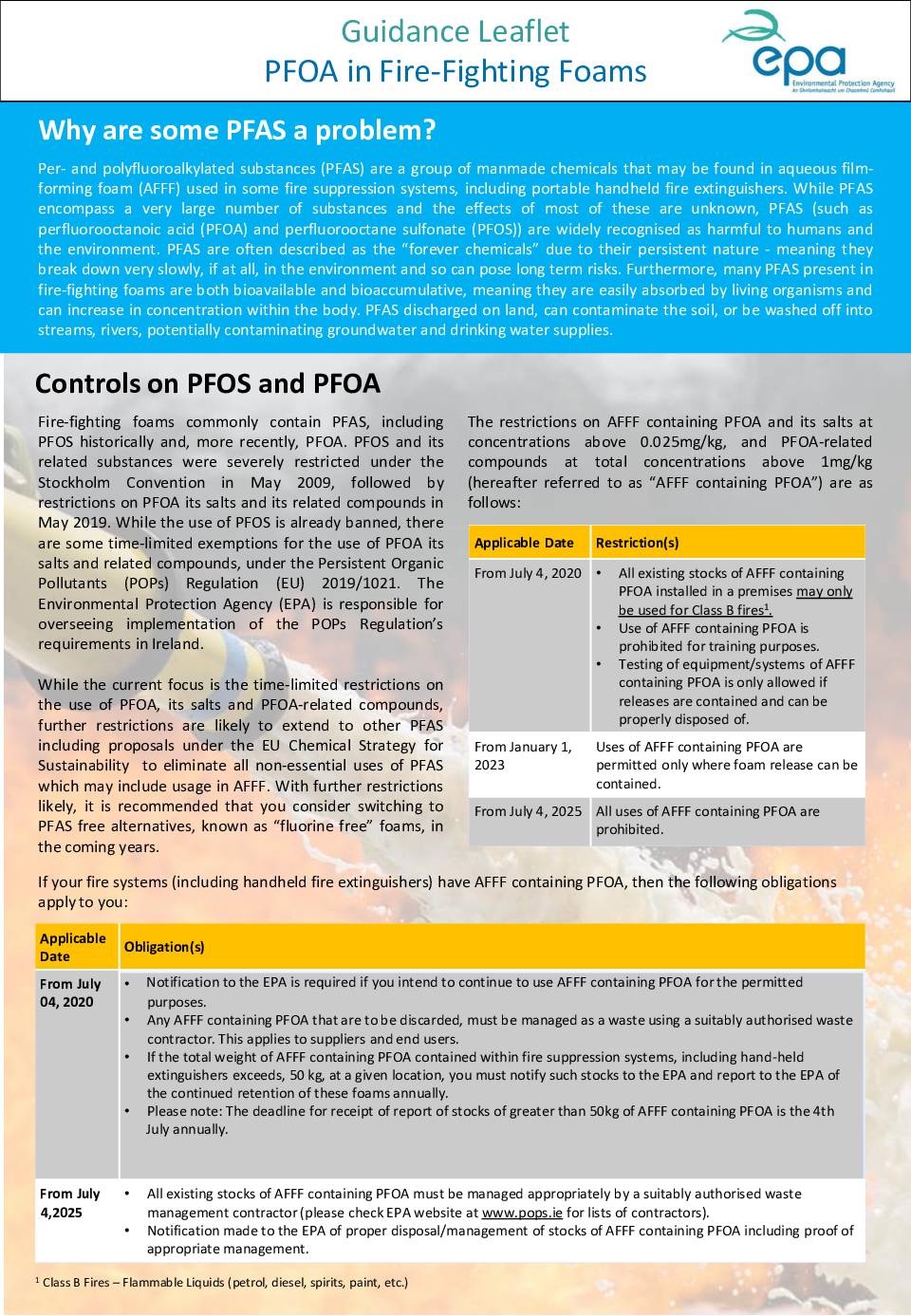
PFOA in Fire-Fighting Foams
EPA guidance leaflet explaining the problems with PFAS chemicals in fire-fighting foams, including PFOA and PFOS, which are harmful persistent chemicals. Details restrictions and controls on PFOA-containing AFFF (Aqueous Film Forming Foam) with timeline from 2020-2025 for phasing out use. -
 2025-04-07
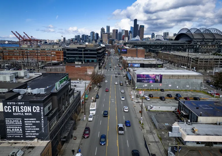
Seattle Skyline and Stadium District Aerial View
Aerial view looking north along 1st Avenue South in Seattle's SoDo neighborhood, with the C.C. Filson Co. building (Est. 1897, 1741 1st Ave S) visible at lower left and T-Mobile Park (Seattle Mariners stadium) visible at right. The downtown Seattle skyline and Puget Sound port cranes are visible in the background. -
 2025-04-07
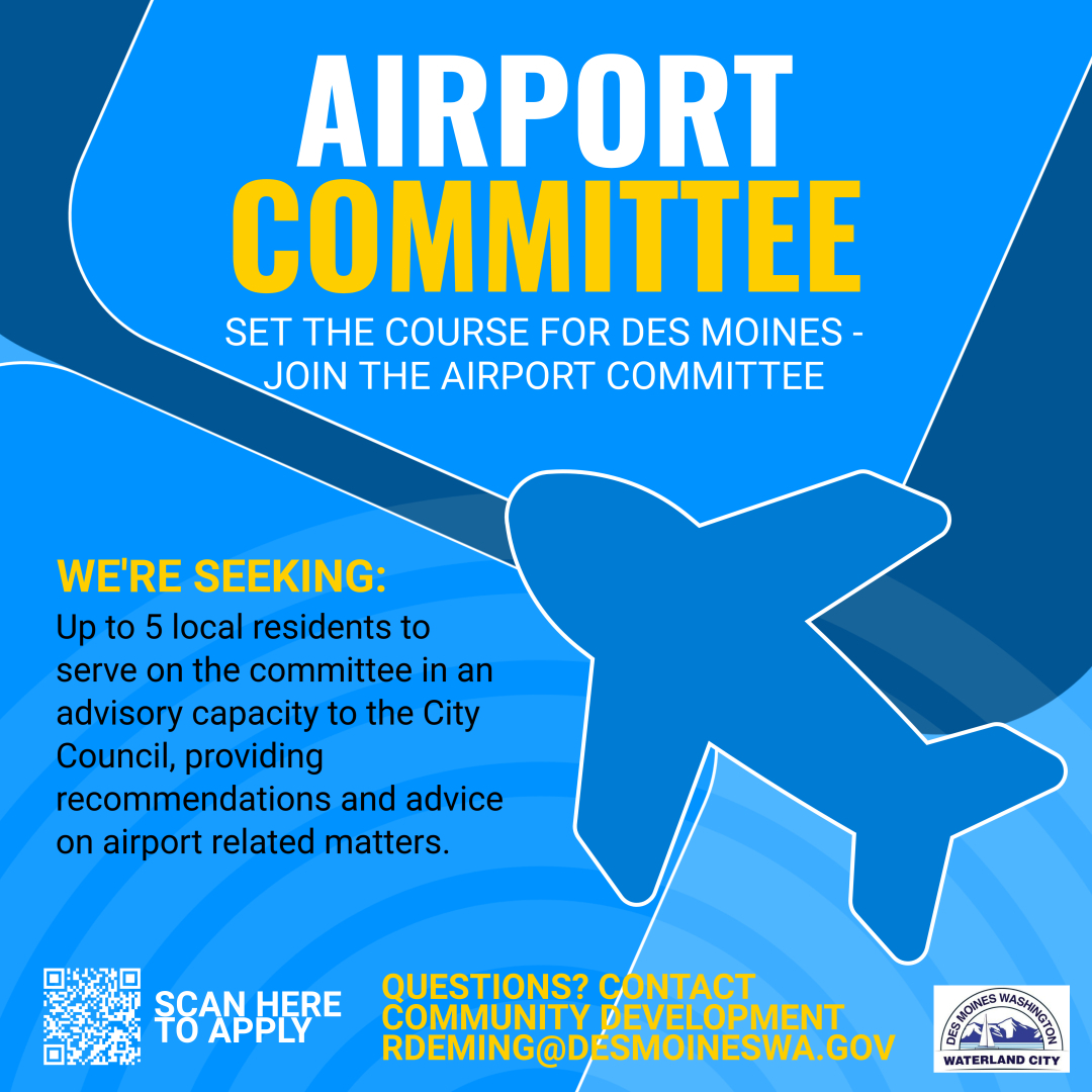
Airport Committee – Set the Course for Des Moines
The City of Des Moines, Washington (Waterland City) is recruiting up to 5 local residents to serve on its Airport Committee in an advisory capacity to the City Council, providing recommendations on airport-related matters. Applicants are directed to scan a QR code to apply or contact Community Development at rdeming@desmoineswa.gov with questions.