TagSea-Tac Airport(285)
-
Port Of Seattle Initial Section 404 Application Fill Material Third Runway Master Plan Update 12-18-1996 Barbara Hinkle
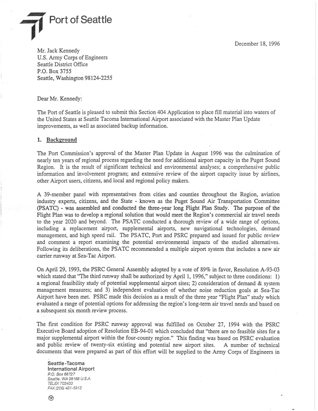
The Port of Seattle is pleased to submit this Section 404 Application to place fill material into waters of the United States at Seattle Tacoma International Airport associated with the Master Plan Update improvements, as well as associated backup information. 1. Background The Port Commission's approval of the Master Plan Update in August 1996 was the culmination of nearly ten years of regional process regarding the need for additional airport capacity in the Puget Sound Region. It is the result of significant technical and environmental analyses; a comprehensive public information and involvement program; and extensive review of the airport capacity issue by airlines, other Airport users, citizens, and local and regional policy makers. A 39-member panel with representatives from cities and counties throughout the Region, aviatiOn industry experts, citizens, and the State - known as the Puget Sound Air Transportation Committee (PSATC) - was assembled and conducted the three-year long Flight Plan Study. The purpose of the Flight Plan was to develop a regional solution that would meet the Region's commerCial air travel needs to the year 2020 and beyond. The PSA TC conducted a thorough review of a wide range of options, including a replacement airport, supplemental airports, new navigational technologies, demand management, and high speed rail. The PSATC, Port and PSRC prepared and issued for public review and comment a report examining the potential environmental impacts of the studied alternatives. Following its deliberations, the PSATC recommended a multiple airport system that includes a new air carrier runway at… -
404 Permit Maury Island Barging And Pier Comments Relevant To Sea-Tac Third Fill Dirt Ab Mx 2616n 20220823 171938
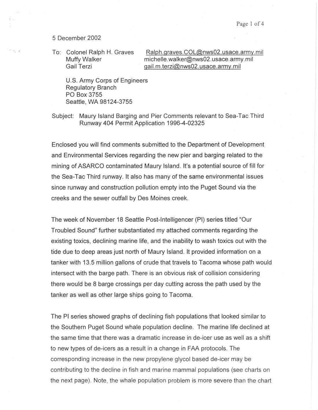
Subject: Maury Island Barging and Pier Comments relevant to Sea-Tac Third Runway 404 Permit Application 1996-4-02325 Enclosed you will find comments submitted to the Department of Development and Environmental Services regarding the new pier and barging related to the mining of ASARCO contaminated Maury Island. It's a potential source of fill for the Sea-Tac Third runway. It also has many of the same environmental issues since runway and construction pollution empty into the Puget Sound via the creeks and the sewer outfall by Des Moines creek. The week of November 18 Seattle Post-lntelligencer (PI) series titled "Our Troubled Sound" further substantiated my attached comments regarding the existing taxies, declining marine life, and the inability to wash taxies out with the tide due to deep areas just north of Maury Island. It provided information on a tanker with 13.5 million gallons of crude that travels to Tacoma whose path would intersect with the barge path. There is an obvious risk of collision considering there would be 8 barge crossings per day cutting across the path used by the tanker as well as other large ships going to Tacoma. The PI series showed graphs of declining fish populations that looked similar to the Southern Puget Sound whale population decline. The marine life declined at the same time that there was a dramatic increase in de-icer use as well as a shift to new types of de-icers as a result in a change in FAA protocols. The corresponding increase in the new propylene… -
Port of Seattle Blueprint (Winter 2010)
A Port of Seattle publication about construction progress at Sea-Tac Airport -
Miller Creek Relocation Plan – Parametri X – December 1996 Mx 2616n 20220823 173908
FOR THE PROPOSED MASTER PLAN UPDATE IlVIPROVEMENTS AT SEATTLE-TACOMA INTERNATIONAL AIRPORT Prepared for LANDRUM & BROWN Seattle-Tacoma International Airport Project Consultant's Office MT Room 6434 Seattle, Washington 98158 Prepared by PARAl"IETRIX, INC. 5808 Lake Washington Blvd. N.E. Kirkland, Washington 98033 December 1996 ' ' l l - l ' I_ n r·: ' .. J D n I . p L1 [~ ,_ l TABLE OF CONTENTS 1. INTRODUCTION . . .... . ...... .... ................... . . 1-1 2. ECOLOGICAL ASSESSMENT OF PROJECT SITE . . . . . . . . . . . . . . . . . 2-1 2.1 STREAM CLASSIFICATION .. . . .. .. . .. . ... . ...... . . 2-1 2.2 PRIMARY USES/FUNCTION IN THE WATERSHED .... . .... 2-1 2.3 EXISTING FISH HABITAT .. . . ... . .. .. . . .......... . 2-2 2.4 HYDROLOGY . . . . . . . . . . . . . . . . . . . . . . . . . . . . . . . . . . 2-3 2.5 CHANNEL CONFIGURATION . . . . . . . . . . . . . . . . . . . . . . . 2-4 2.6 FLOODPLAIN .. . . . . . . . ....... . .. . . .... . ..... ... 2-5 2.7 EXISTING RIPARIAN VEGETATION ....... . . . . . . .. . ... 2-5 3. CONSTRUCTION IMPACTS FROM CREEK… -
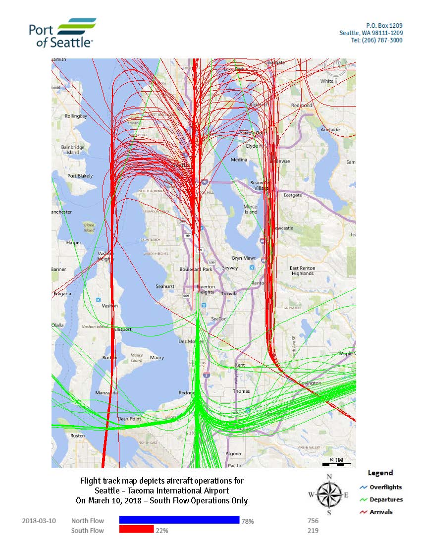
Sea-Tac Daily Flight Track – 2018-03-10, South Flow
Port of Seattle daily flight track map for Sea-Tac Airport, March 10, 2018, south flow operations. Part of Port of Seattle case 18-120 Daily FTM series, March 2018. -
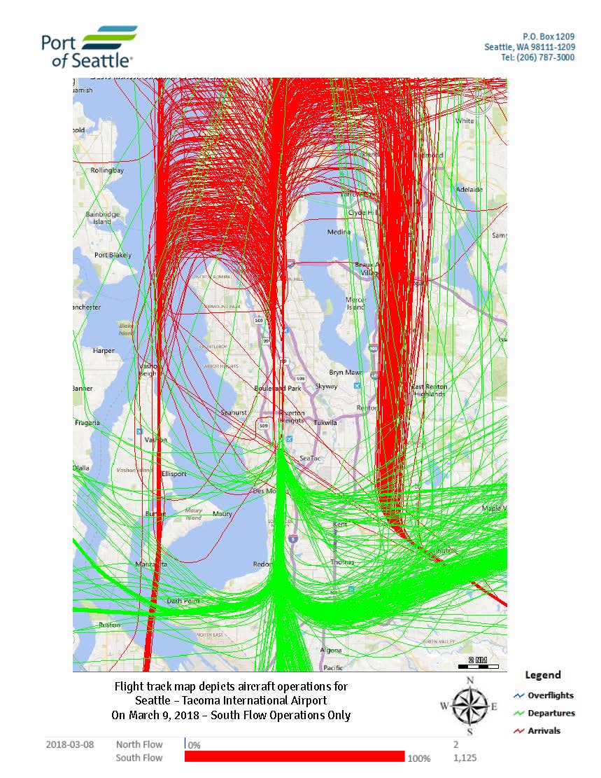
Sea-Tac Daily Flight Track – 2018-03-09, South Flow
Port of Seattle daily flight track map for Sea-Tac Airport, March 9, 2018, south flow operations. Part of Port of Seattle case 18-120 Daily FTM series, March 2018. -
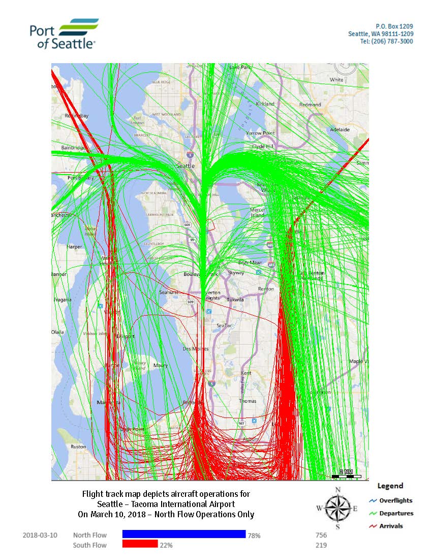
Sea-Tac Daily Flight Track – 2018-03-10, North Flow
Port of Seattle daily flight track map for Sea-Tac Airport, March 10, 2018, north flow operations. Part of Port of Seattle case 18-120 Daily FTM series, March 2018. -
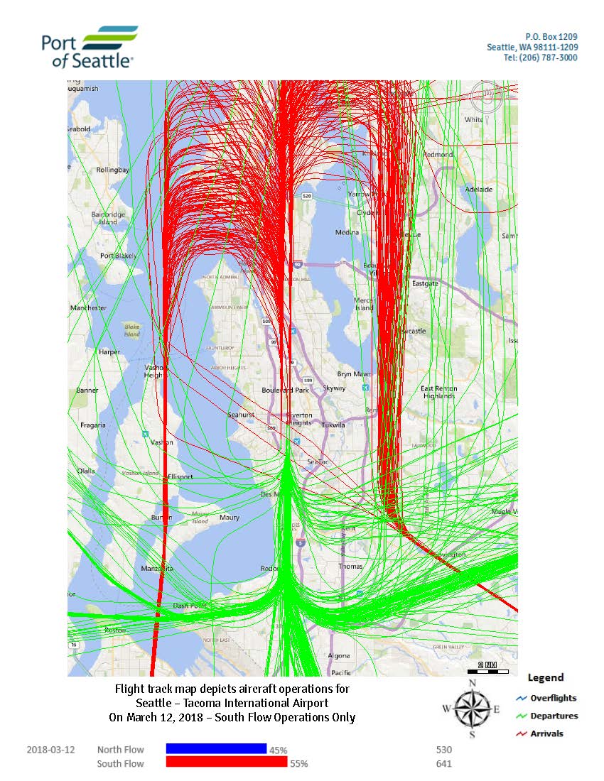
Sea-Tac Daily Flight Track – 2018-03-12, South Flow
Port of Seattle daily flight track map for Sea-Tac Airport, March 12, 2018, south flow operations. Part of Port of Seattle case 18-120 Daily FTM series, March 2018. -
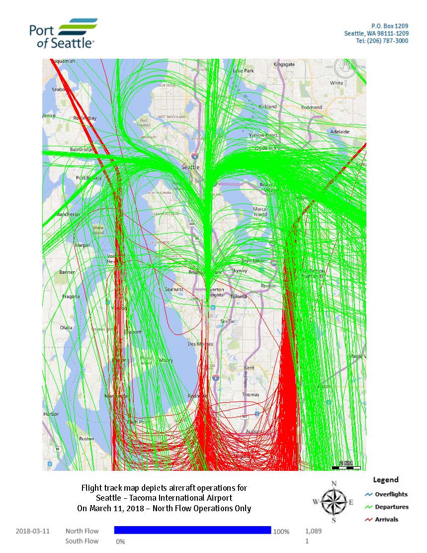
Sea-Tac Daily Flight Track – 2018-03-11, North Flow
Port of Seattle daily flight track map for Sea-Tac Airport, March 11, 2018, north flow operations. Part of Port of Seattle case 18-120 Daily FTM series, March 2018. -
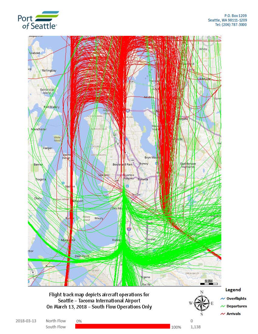
Sea-Tac Daily Flight Track – 2018-03-13, South Flow
Port of Seattle daily flight track map for Sea-Tac Airport, March 13, 2018, south flow operations. Part of Port of Seattle case 18-120 Daily FTM series, March 2018.