Appendix K SEPA Environmental Justice Disparities Map page 124

Appendix k children8217s environmental health and safety risks socioeconomics and environmental justice NEPA final ea and SEPA page 124

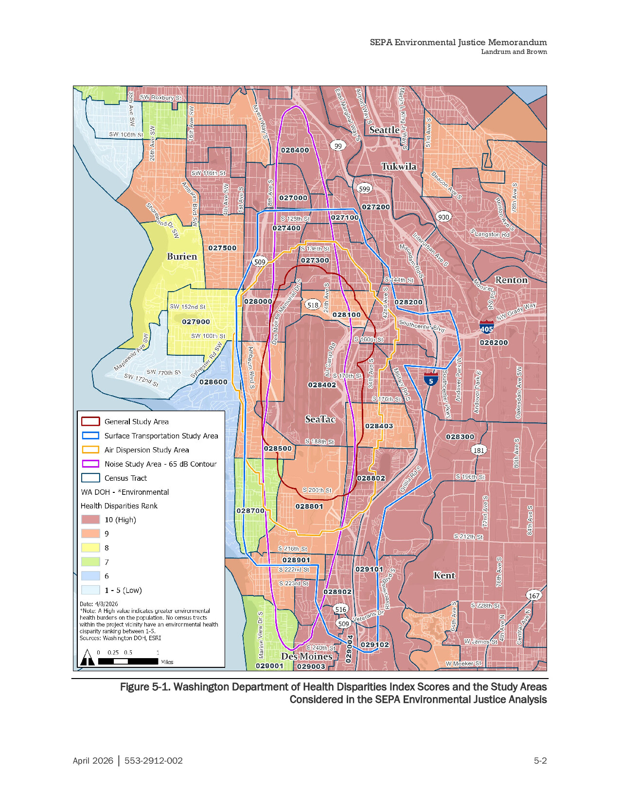
Figure 5-1 from a SEPA Environmental Justice Memorandum prepared by Landrum and Brown (document no. 553-2912-002, dated April 2026) maps Washington Department of Health Environmental Health Disparities Index scores across census tracts in the Sea-Tac Airport vicinity, including Seattle, Tukwila, Burien, SeaTac, Renton, Kent, and Des Moines. The map delineates four overlapping study areas—General Study Area, Surface Transportation Study Area, Air Dispersion Study Area, and Noise Study Area (65 dB contour)—over a background showing health disparity rankings ranging from 1–5 (Low) to 10 (High), with most tracts in the project vicinity ranked 9–10.

Notes

Appendix K of the Sustainable Airport Master Plan (SAMP) Final NEPA Environmental Assessment and SEPA documentation, covering children’s environmental health and safety risks under Executive Order 13045, socioeconomic conditions, and environmental justice analysis for the GSA (Ground Side Area) at Sea-Tac Airport. Includes Table 3-33 showing 23.3% of GSA block group population is under age 18 per 2021 American Community Survey data, identifies two schools within the GSA (Puget Sound Skills Center and Choice Academy), no licensed childcare facilities, and no medical facilities. Also references the Northwest Seaport Alliance, Port of Tacoma, and Port Of Seattle Economic Impact Analysis and a SEPA Environmental Justice Memorandum. King County comparisons included.

V V