TagFlight Tracks(67)
-
 1998-06-01
Port Of Seattle Sea-Tac Propeller Aircraft Flight Track Patterns
This Port of Seattle document explains flight track plots for propeller aircraft at Seattle-Tacoma International Airport, showing the ground paths of arrivals and departures during daytime hours (6 a.m. to 10 p.m.) for both north and south traffic flows. Aircraft flight paths vary due to pilot technique, weather, and air traffic control, meaning planes assigned the same route will not follow identical tracks. On average, Sea-Tac experiences south flow conditions 65% of the year and north flow 35%, with propeller aircraft kept on separate tracks from faster jet aircraft. -
 1998-06-01
Port Of Seattle Sea-Tac Jet Aircraft Flight Track Patterns: North Flow and South Flow, Summer 1998
This Port of Seattle document explains flight track plots for Seattle-Tacoma International Airport, which map the ground paths of jet aircraft arrivals and departures during daytime hours (6am–10pm). It describes how wind conditions determine whether aircraft fly in a north or south flow pattern, with south flow occurring about 65% of the year. The document also notes that even aircraft following identical routes will not fly the exact same path, due to variations in pilot technique, weather, air traffic control, and aircraft performance. -
 1993-03-31
Port Of Seattle Sea-Tac Airport: Flight Track Plot Sample – Turbojets
This Port of Seattle document explains flight track plots for Seattle-Tacoma International Airport, which are overhead graphic illustrations showing the ground paths of arriving and departing jet aircraft over a 24-hour period, separated into daytime and nighttime operations for both north and south traffic flows. The data is sourced from the FAA's Automated Radar Terminal System (ARTS). Notably, the document emphasizes that even aircraft following identical routes will not fly the exact same path, as factors like pilot technique, air traffic control, weather, and aircraft performance cause flight corridors to widen with increasing distance from the airport. -
 1991-03-31
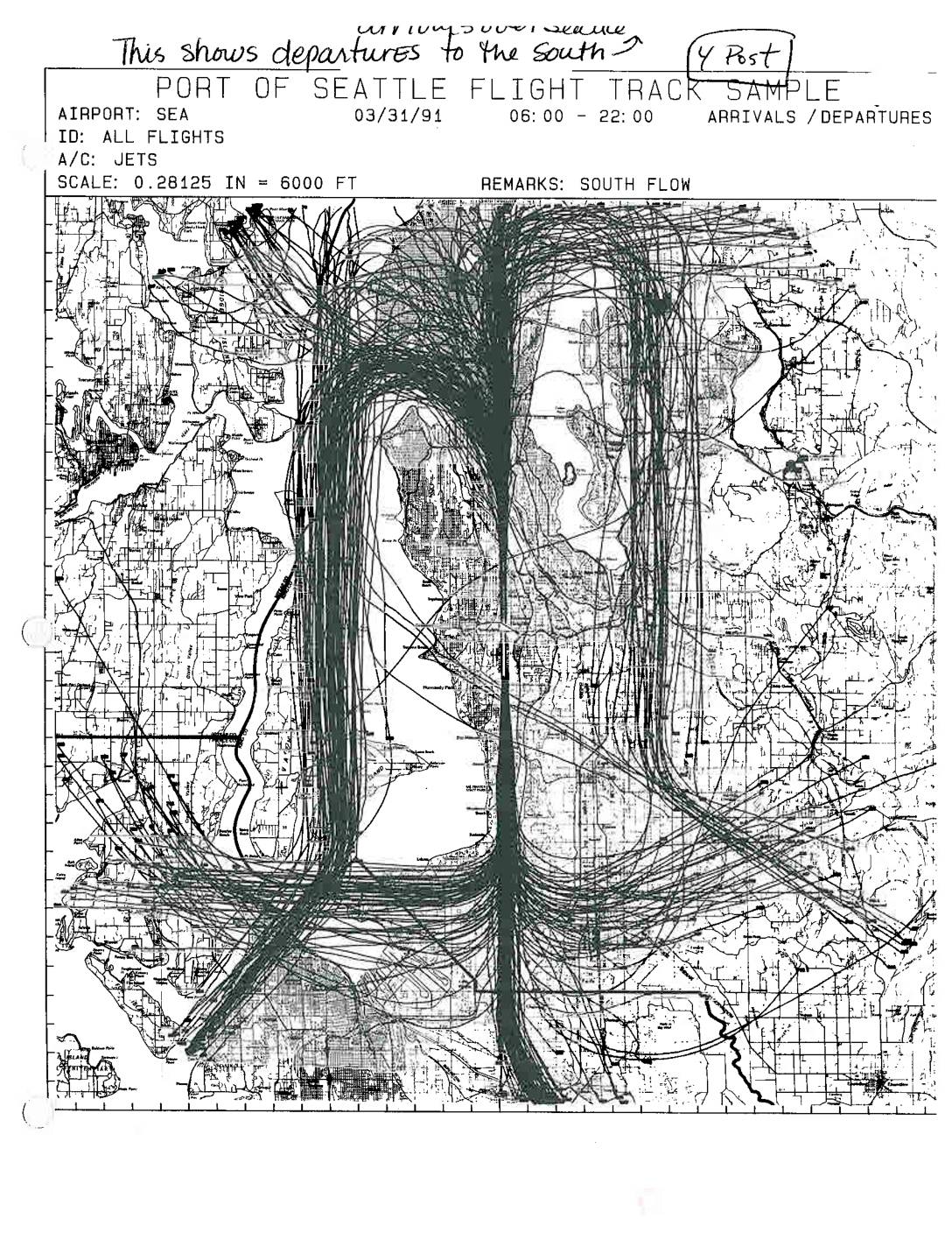
Port Of Seattle Flight Track Sample: South Flow Arrivals/Departures — Pre- and Post-Four Post Plan Comparison Maps
These two Port of Seattle Flight Track Sample maps compare jet aircraft arrival and departure patterns at Seattle-Tacoma International Airport (SEA) under south flow conditions, one from March 22, 1989 (pre-4 Post) and one from March 31, 1991 (4 Post). Both charts plot all jet flight tracks between approximately 4:30–24:00 and 6:00–22:00 respectively, showing how flight paths over the Seattle region shifted between the two periods. The maps are annotated to highlight southbound departures and arrivals over Seattle, serving as visual evidence for noise impact analysis related to airport runway and procedure policy changes. -
1991-03-31
Port Of Seattle Flight Track Sample: South Flow Arrivals/Departures — Pre- and Post-Four Post Plan Comparison Maps
Two Port Of Seattle flight track sample maps showing jet arrivals and departures at Seattle-Tacoma International Airport (SEA) under south flow conditions. Page 1 dated 03/31/91 (06:00–22:00), labeled ‘4 Post’ — showing departures to the south with flight tracks visible over Seattle and surrounding areas. Page 2 dated 03/22/89 (04:30–24:00), labeled ‘Pre-4 Post’ — showing -
 1990-03-31
Final Package of Mediated Noise Abatement Actions for Seattle-Tacoma International Airport, Agreed to by the Mediation Committee, March 31, 1990
This 1990 document outlines a comprehensive package of noise abatement actions for Seattle-Tacoma International Airport, agreed upon by a Mediation Committee on March 31, 1990. It covers measures such as nighttime flight restrictions, soundproofing programs for nearby homes and public buildings, improved flight corridors, and a new noise management monitoring system. According to the technical consultant involved, full implementation of these agreements could reduce noise levels by approximately 50% for communities surrounding the airport. -
 1982-06-01
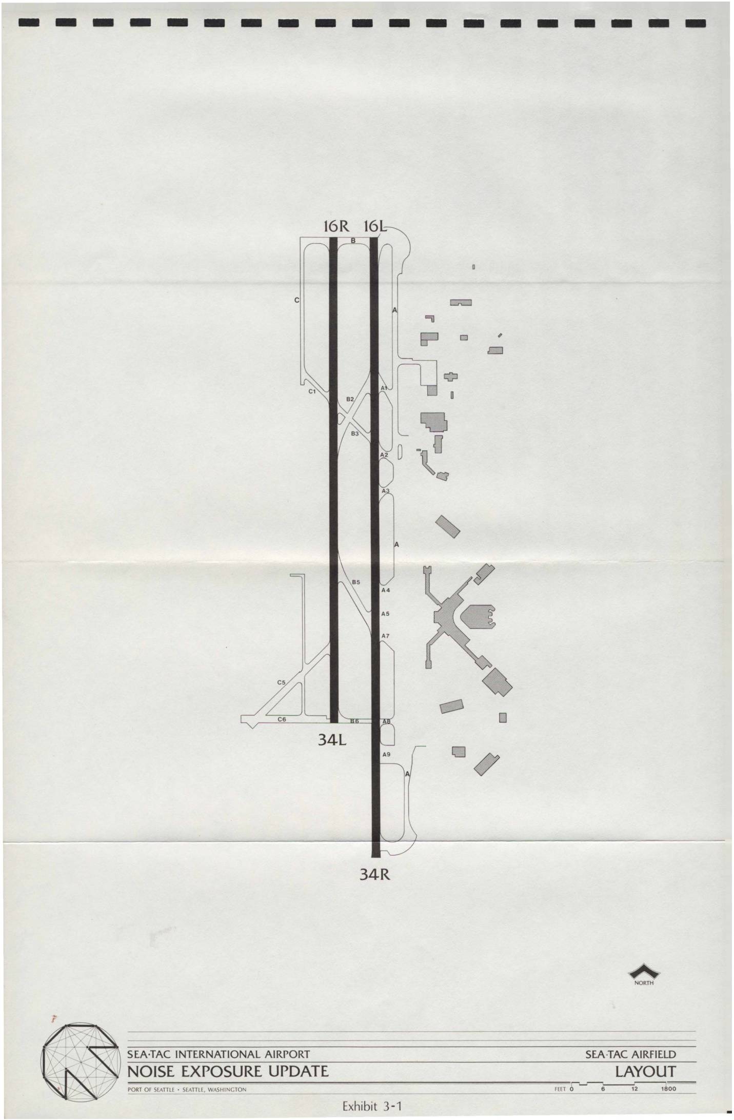
Sea-Tac International Airport Noise Exposure Update: Sea-Tac Airfield Layout and Flight Tracks
This document presents the Sea-Tac International Airport Noise Exposure Update prepared for the Port of Seattle, including a detailed airfield layout showing the two parallel runways (16R/16L and 34R/34L) and associated taxiways. It also includes flight track maps for both South Flow and North Flow operations, illustrating arrival and departure routes used by aircraft over the surrounding communities. The exhibits provide a geographic overview of how flight paths extend across the Seattle metropolitan area, informing noise exposure assessments for airport planning and policy purposes.