Notes
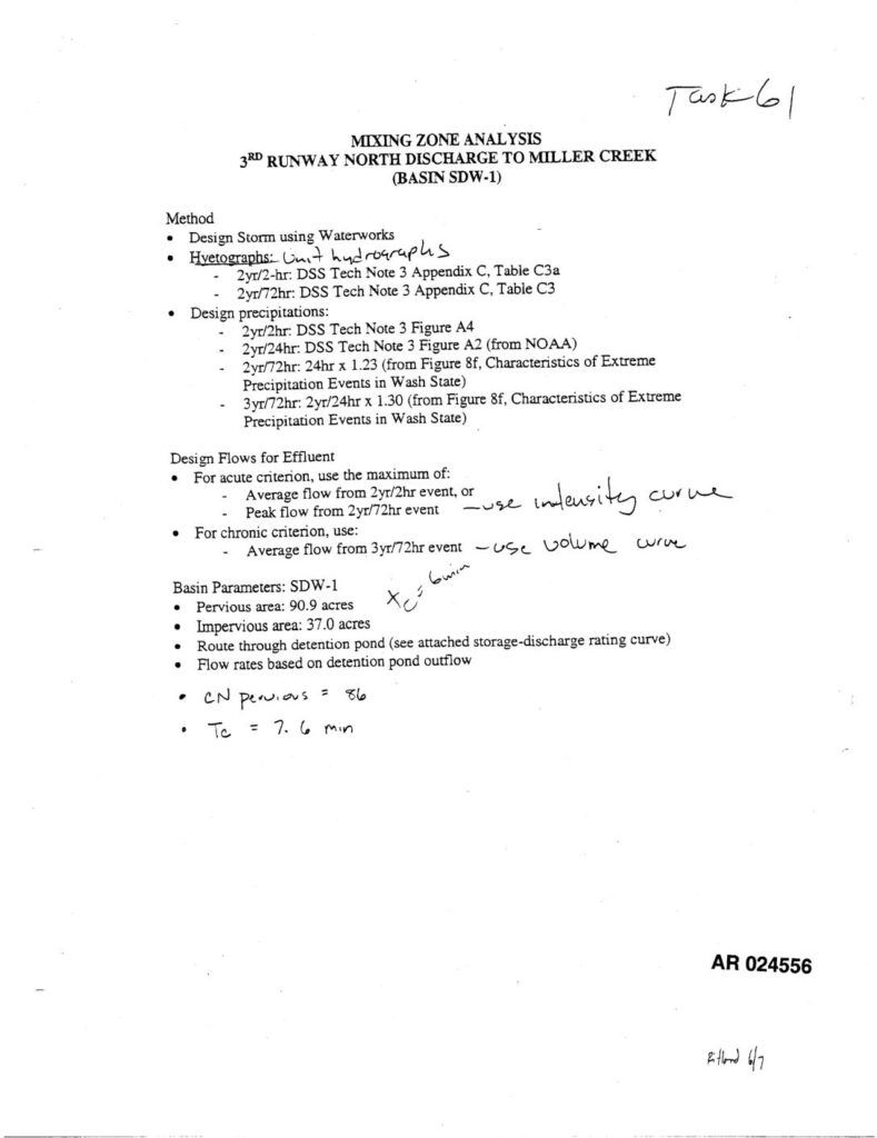
Mixing zone analysis for the 3rd Runway North discharge to Miller Creek, Basin SDW-1, using Waterworks design storm modeling. Documents hyetograph and design precipitation methodology referencing DSS Tech Note 3 (Figures A2, A4, Appendix C Tables C3/C3a) and Washington State Characteristics of Extreme Precipitation Events (Figure 8f). Design flows calculated for acute criterion (maximum of average flow from 2yr/2hr event or peak flow from 2yr/72hr event) and chronic criterion (average flow from 3yr/72hr event). Basin SDW-1 parameters: pervious area 90.9 acres, impervious area 37.0 acres, CN pervious = 86, Tc = 7.6 min, routed through detention pond. Includes FTABLE 47 storage-discharge rating curve for SDW-1 Miller Creek Level 2, with depth, area, volume (up to 14.28 acre-ft), and outflow (up to 42.79 cfs) values. Volume conversion noted as V × 2,323,200 / 53.33. AR numbers 024556–024558.